Yr Eifl (The Rivals) - Thursday 11 April 2019
Route
Porth-y-Nant Upper Car Park - Nant Gwrtheyrn - Porth-y-Nant - Penrhyn Glas - Porth-y-Nant Upper Car Park - Bwlch yr Eifl - Garn Ganol - Tre’r Ceiri - Porth-y-Nant Upper Car Park
Parking
Porth-y-Nant Upper Car Park (Free) - Grid Reference SH 3531 4401 (nearest postcode LL53 6NU)
Mileage
8.4 miles
Terrain
Easy to follow mountain paths with some road walking along quiet lanes.
Weather
Mild & overcast with some sunny spells
Time Taken
5hrs 50mins
Total Ascent
2004ft (611m)
Map
OS Explorer 254 - Lleyn Peninsula East
Walkers
Dave, Angie, Fudge & Howie
|
GPX File
|
| ||
If the above GPX file fails to download or presents itself as an XML file once downloaded then please feel free to contact me and I will send you the GPX file via e-mail.
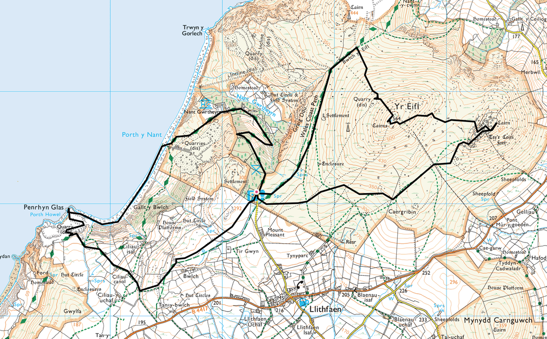
Route Map
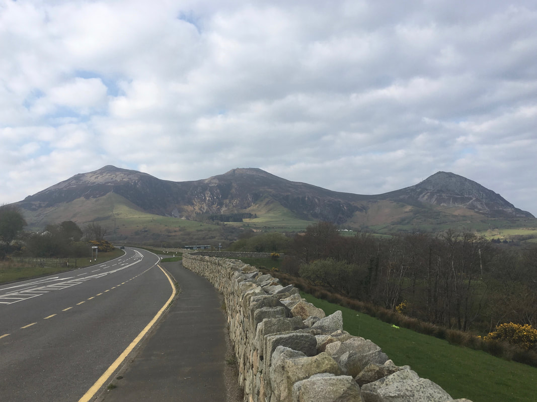
Looking to Yr Eifl from the A499.
Yr Eifl is collectively the 3 hills seen here - to the left is Tre’r Ceiri, centre is the highest Garn Ganol and to the right is Garn Fôr. We would be climbing Tre'r Ceiri & Garn Ganol today.
Yr Eifl is collectively the 3 hills seen here - to the left is Tre’r Ceiri, centre is the highest Garn Ganol and to the right is Garn Fôr. We would be climbing Tre'r Ceiri & Garn Ganol today.
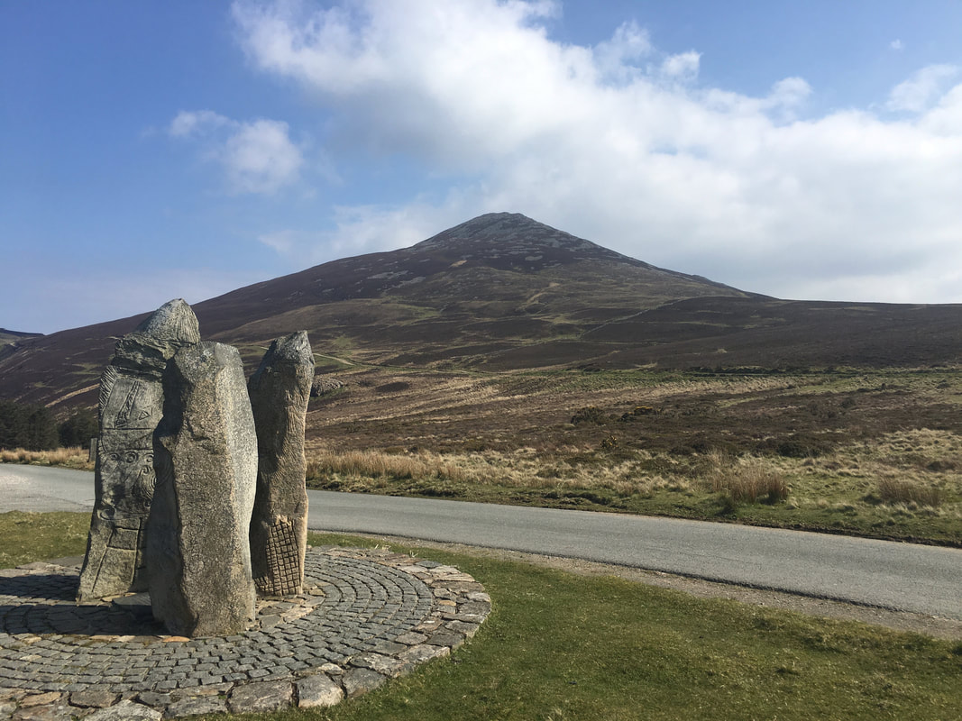
Looking to Garn Ganol from the start of the walk at the Car Park at the top of Nant Gwrtheyrn.
The sculpted stones form a memorial to the miners who worked the quarries above the valley.
The sculpted stones form a memorial to the miners who worked the quarries above the valley.
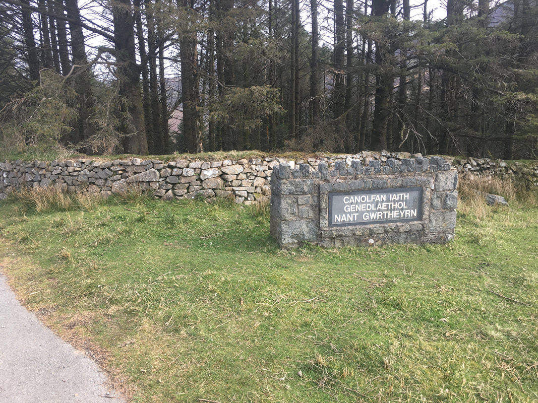
Near the Car Park is a sign at the entrance to Nant Gwrtheyrn
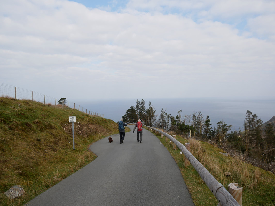
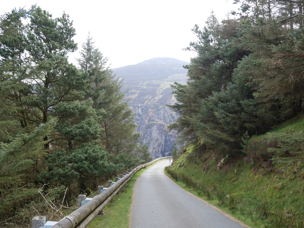
The route heads along the access road to Nant Gwrtheyrn. The road heads downhill very steeply, yet is quiet with very little traffic.
Looking down on Nant Gwrtheyrn from the access road.
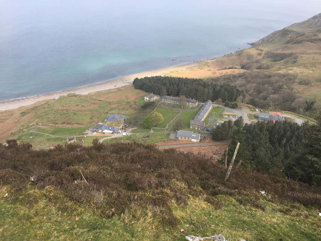
Nant Gwrtheyrn is now a Welsh Language and Heritage Centre. It is sometimes referred to as 'the Nant' and is named after the valley where it is located. The centre is built within the structures of the former quarrying village Porth y Nant, which was abandoned midway through WWII when quarrying ceased.
Nant Gwrtheyrn is now a Welsh Language and Heritage Centre. It is sometimes referred to as 'the Nant' and is named after the valley where it is located. The centre is built within the structures of the former quarrying village Porth y Nant, which was abandoned midway through WWII when quarrying ceased.
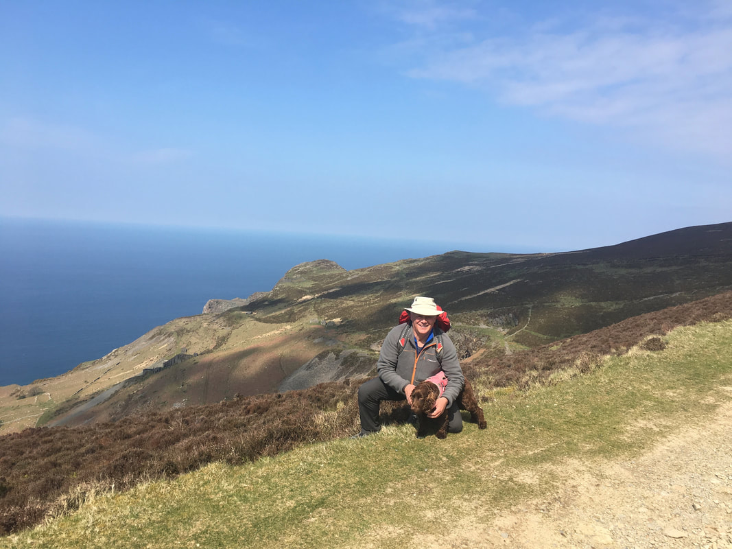
We always enjoy walking with the best thing to come out of Mold since Rhys Ifans & The Mold "Gold Cape".
Howie is also known as "The Crow" because of his innate ability to turn a glorious weather forecast into pissing rain should you ever go walking with him. Luckily he was having an off day today.
Howie is also known as "The Crow" because of his innate ability to turn a glorious weather forecast into pissing rain should you ever go walking with him. Luckily he was having an off day today.
Looking over to the quarry levels which serve as a reminder as to the areas past.
We continue to head steeply down to Nant Gwrtheyrn
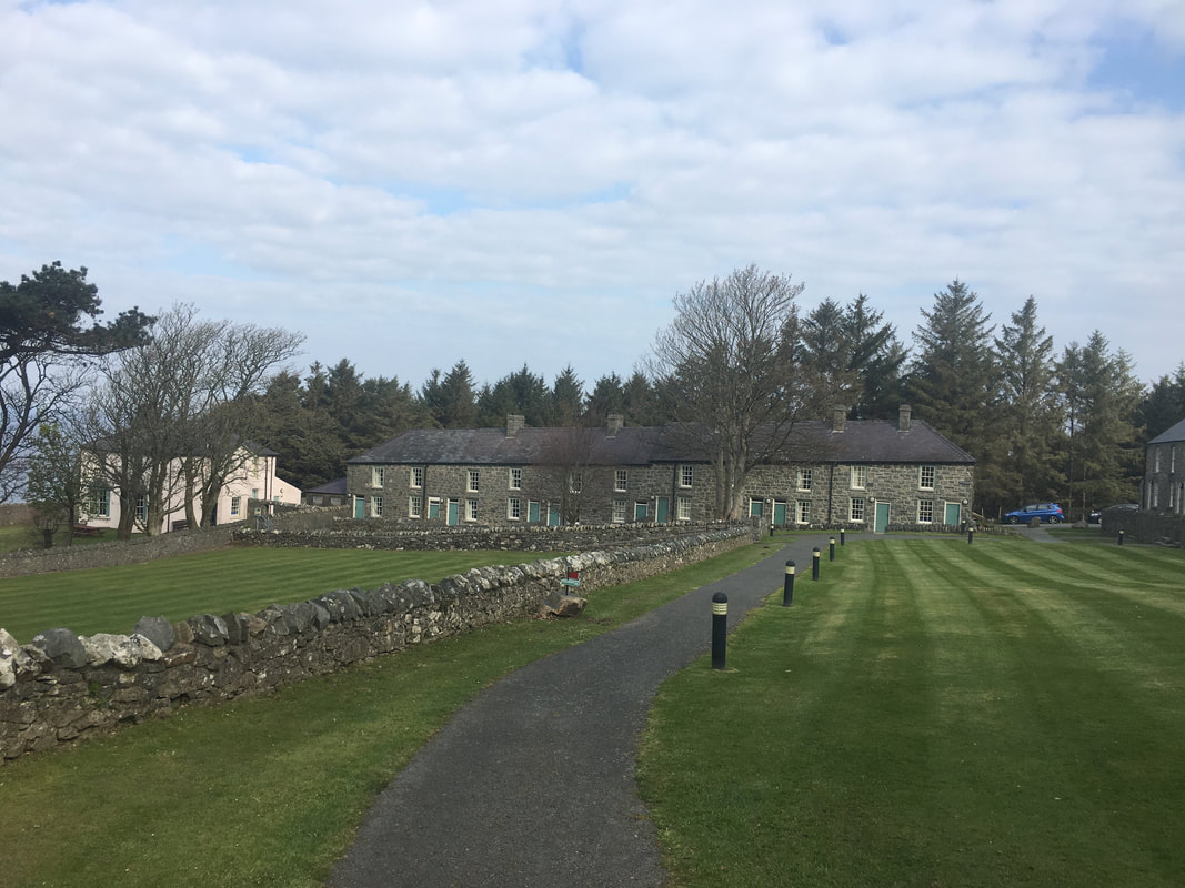
The former village of Porth y Nant which now houses the Welsh Language and Heritage Centre
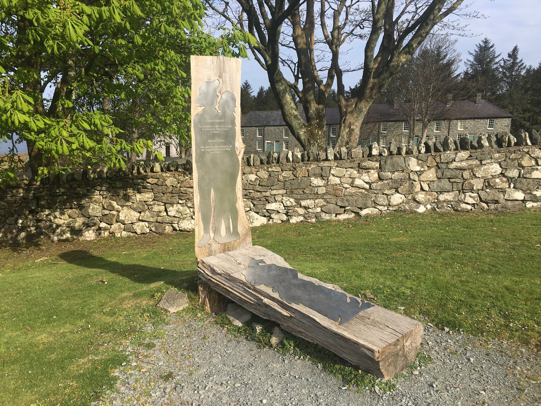
The memorial to Rhys & Meinir at Porth y Nant
The secluded Nant is the setting for one of Wales’ most tragic love stories. Both Rhys and Meinir grew up in the Nant, and it was not long until their childhood friendship blossomed into love, and they decided to get married. The young couple’s favourite spot was under an old oak tree, on the lower slopes of Yr Eifl. A date was set for their wedding and preparations began. The bride would run and hide on the morning of her wedding and when the big day arrived, everybody gathered in Clynnog Church, except for Meinir who headed for the hills. Playing their part, Rhys’ friends searched high and low for Meinir, but to no avail. On discovering his bride was missing, Rhys returned to the Nant and frantically searched for Meinir’s hiding place. Fraught with worry, Rhys spent months searching for his sweetheart, and slowly lost his mind. Then one stormy night, while out wondering the heath, Rhys took shelter beneath his favourite oak tree. As he cowered beneath the tree, a bolt of lightning struck the trunk, splitting it in half. To Rhys’ disbelief the splintered tree revealed a skeleton wearing a wedding dress. Overcome by emotion, poor Rhys collapsed and died beside his beloved bride.
The secluded Nant is the setting for one of Wales’ most tragic love stories. Both Rhys and Meinir grew up in the Nant, and it was not long until their childhood friendship blossomed into love, and they decided to get married. The young couple’s favourite spot was under an old oak tree, on the lower slopes of Yr Eifl. A date was set for their wedding and preparations began. The bride would run and hide on the morning of her wedding and when the big day arrived, everybody gathered in Clynnog Church, except for Meinir who headed for the hills. Playing their part, Rhys’ friends searched high and low for Meinir, but to no avail. On discovering his bride was missing, Rhys returned to the Nant and frantically searched for Meinir’s hiding place. Fraught with worry, Rhys spent months searching for his sweetheart, and slowly lost his mind. Then one stormy night, while out wondering the heath, Rhys took shelter beneath his favourite oak tree. As he cowered beneath the tree, a bolt of lightning struck the trunk, splitting it in half. To Rhys’ disbelief the splintered tree revealed a skeleton wearing a wedding dress. Overcome by emotion, poor Rhys collapsed and died beside his beloved bride.
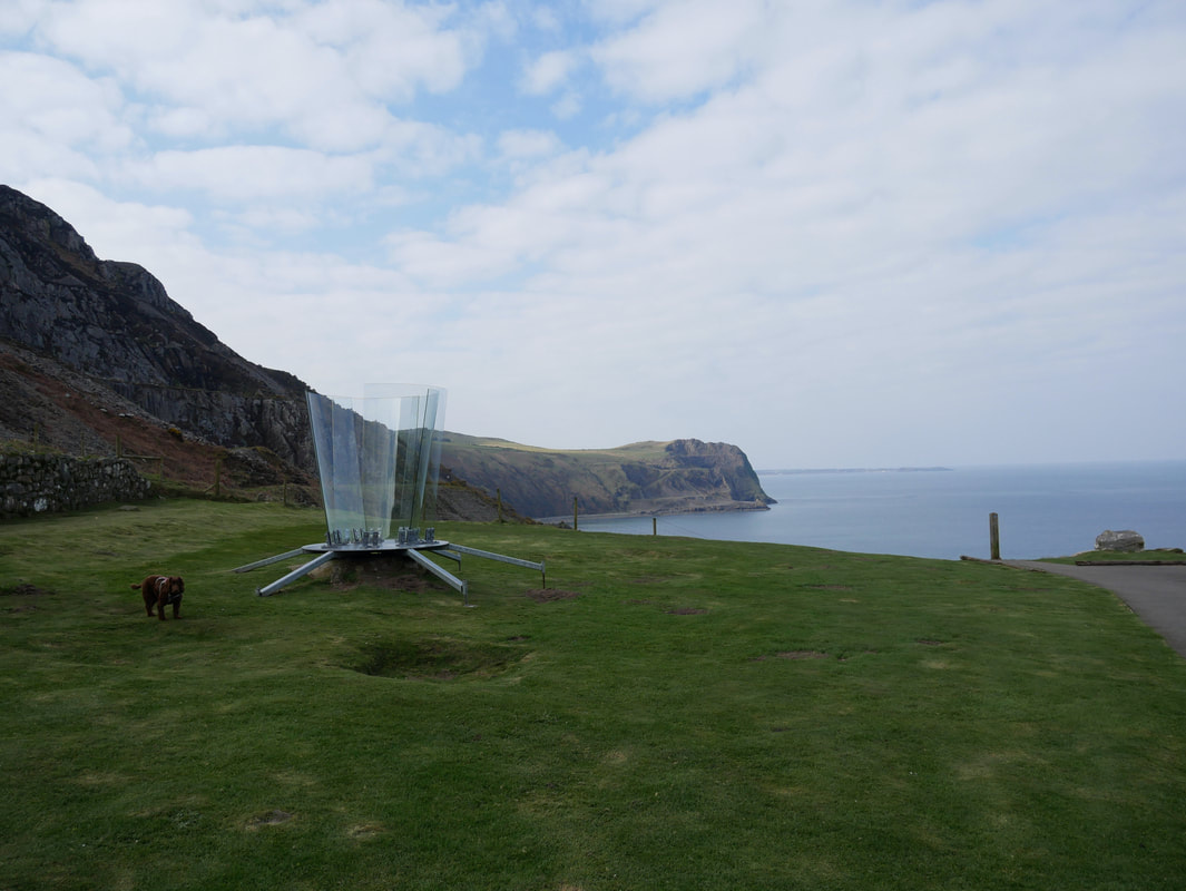
Tu Hwnt at Nant Gwrtheyrn
The sculpture was created by the artists Awst & Walther for a special art project at Barclodiad y Gawres, Anglesey in June 2014. Their aim was to create a moment of focus in order to reflect on the relationship between individuals and the landscape, drawing our limited perspective visual attention to us. Within the statue there is room for one person to stand – sheltered from the wind, and the glass like analytical lens in front of our eyes. I don't think Fudge though much of it to be honest.
The sculpture was created by the artists Awst & Walther for a special art project at Barclodiad y Gawres, Anglesey in June 2014. Their aim was to create a moment of focus in order to reflect on the relationship between individuals and the landscape, drawing our limited perspective visual attention to us. Within the statue there is room for one person to stand – sheltered from the wind, and the glass like analytical lens in front of our eyes. I don't think Fudge though much of it to be honest.
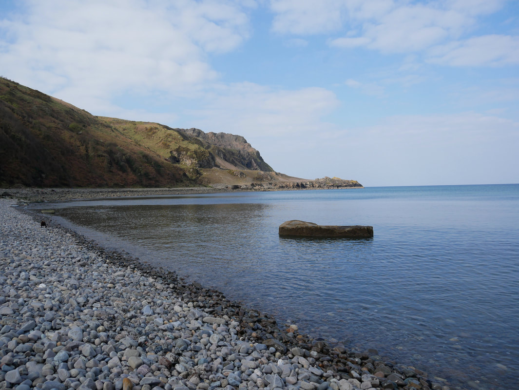
Heading along the beach to the disused quarry at Penrhyn Glas
The disused quarry at Penrhyn Glas - it was pretty desolate here
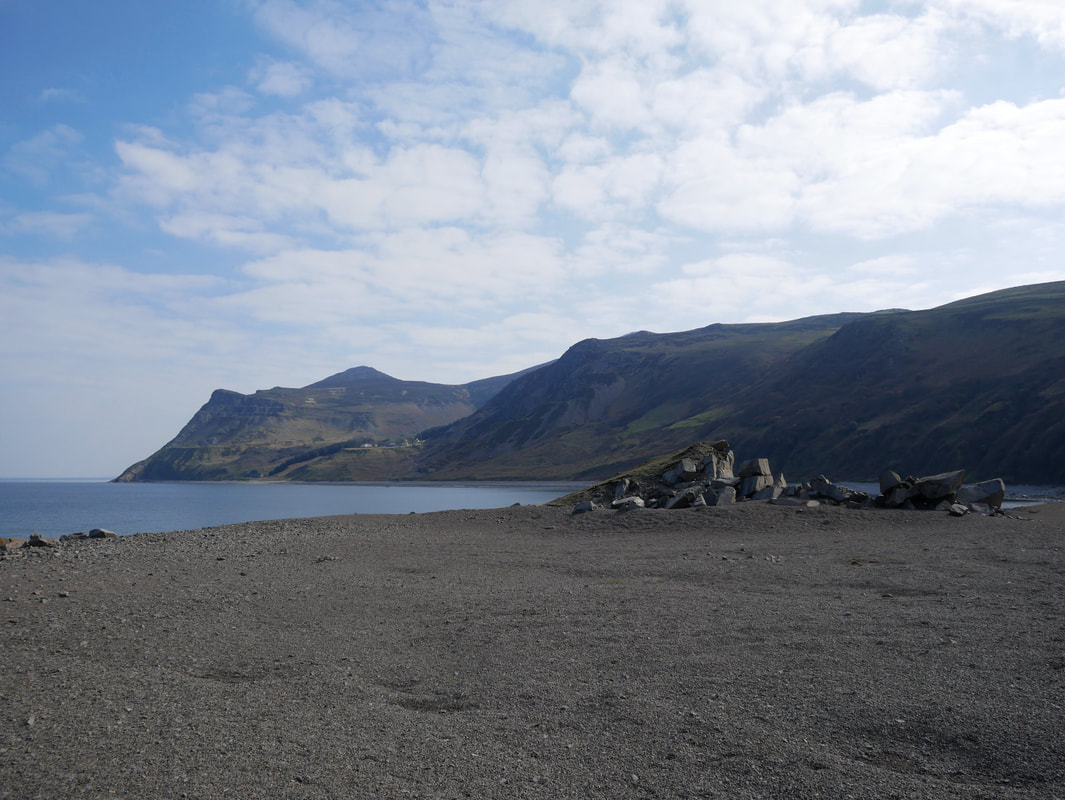
Looking back to Yr Eifl from Penryhn Glas
Whilst there has been no active quarrying here since the early 1940s, the landscape still carries the scars of that period
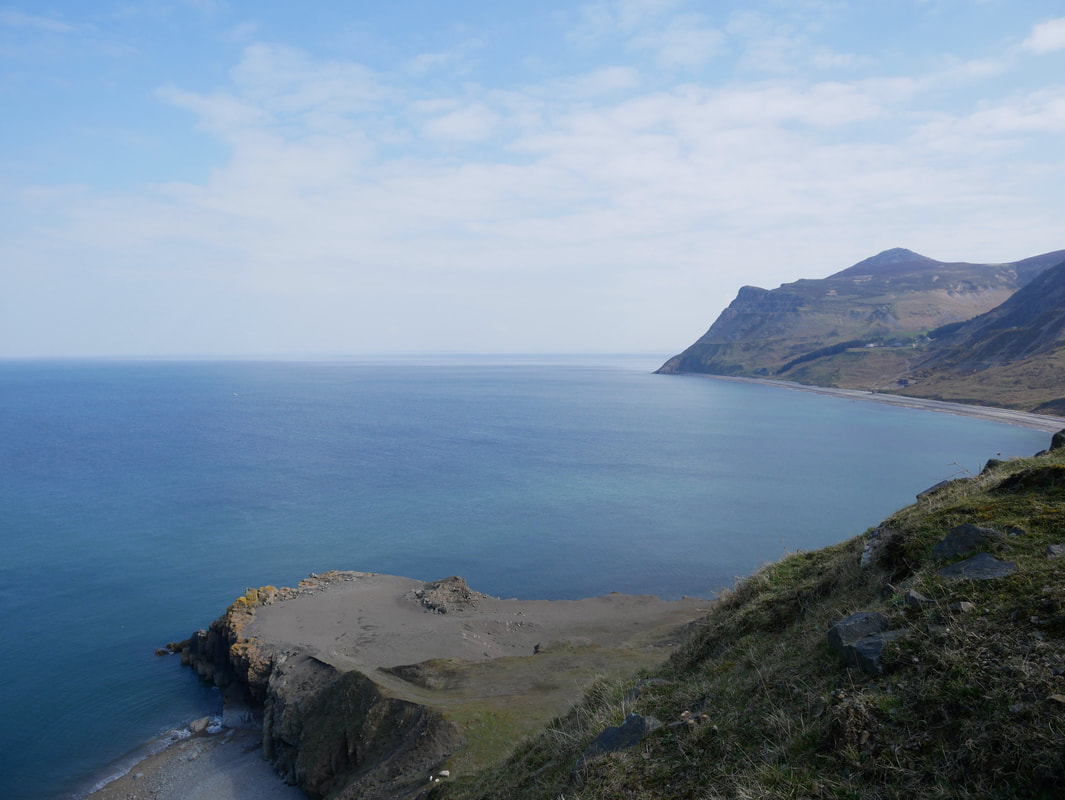
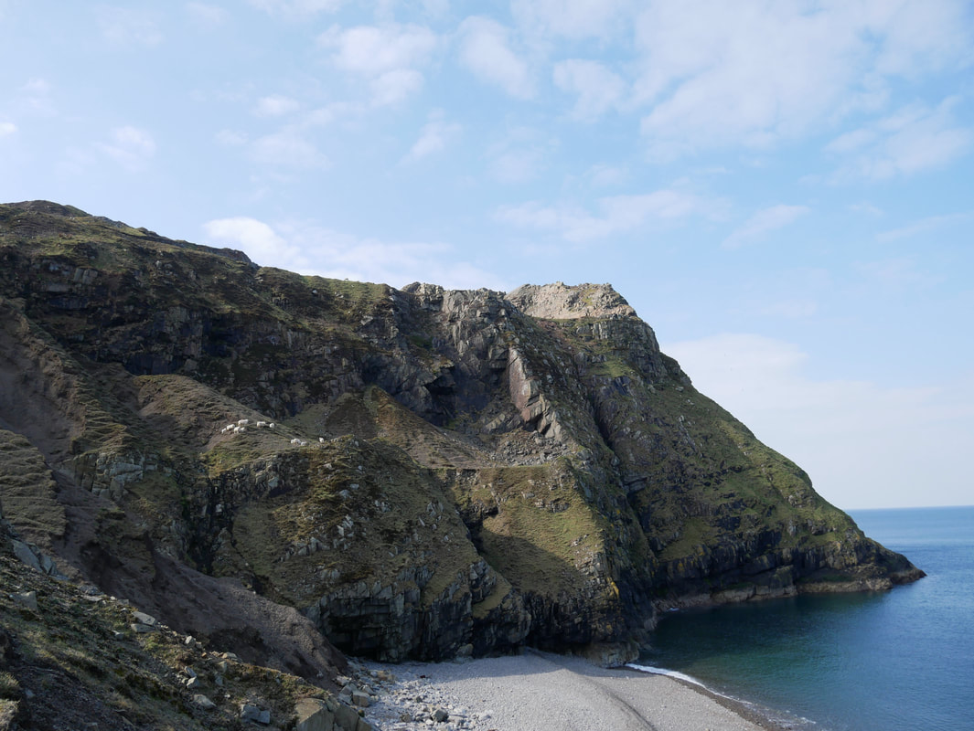
From the promontory of Penrhyn Glas we headed up to the top of the headland via a steep, rocky path.
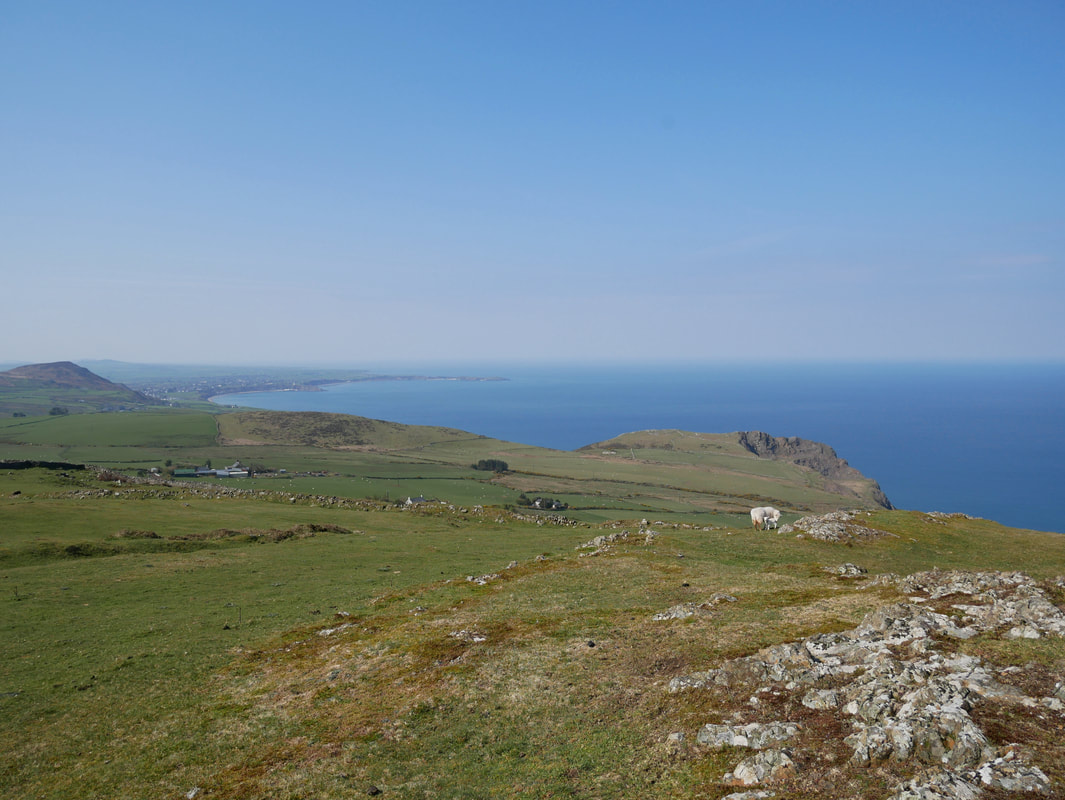
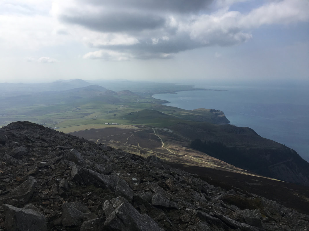
From the top of the headland is a glorious view down the coast to Porth Dinllaen and Morfa Nefyn
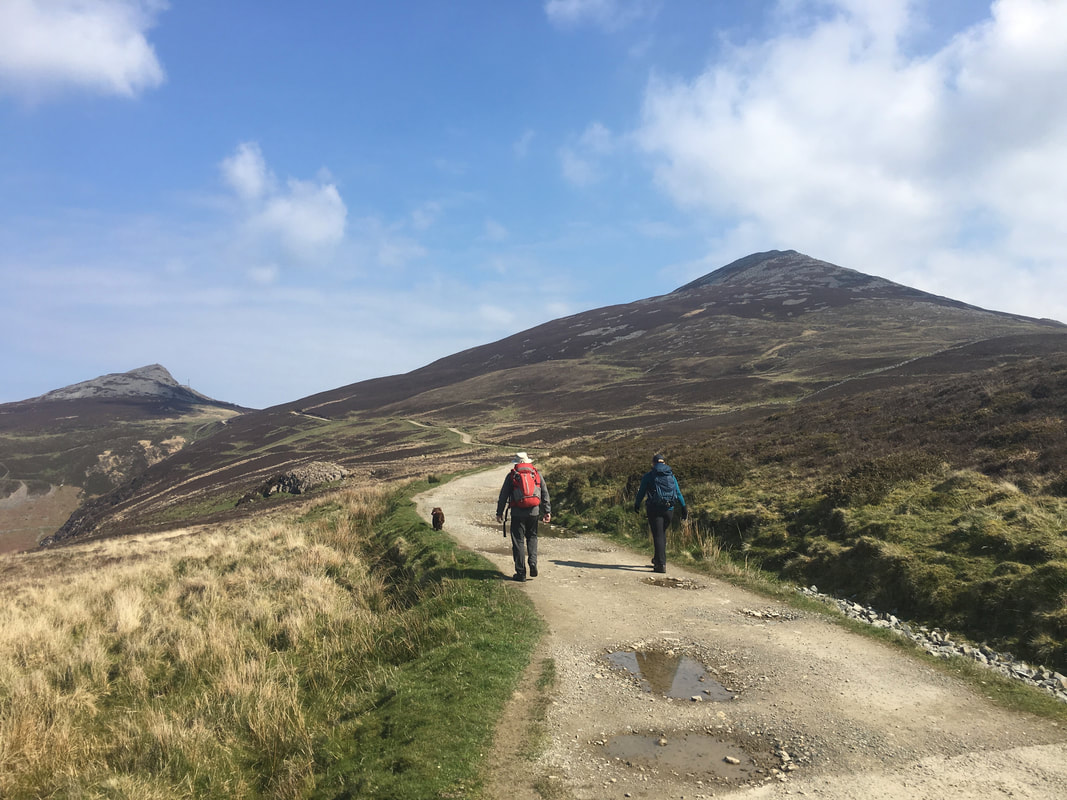
The route today was a classic "figure of 8" walk therefore arriving back at the Car Park we crossed the road to head up to Garn Ganol which is to the right.
Another view of Nant Gwrtheyrn from the track to Garn Ganol. The steep descent down the road can be seen to the left.
Howie & Fudge - I think our pooch has a bit of a soft spot for The Crow
Garn Fôr (The Sea Cairn).
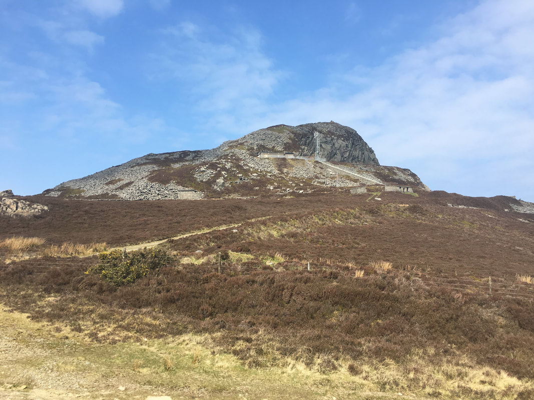
The hill is also known as Mynydd y Gwaith and houses a Microwave Relay Station which can be seen here.
The hill is also known as Mynydd y Gwaith and houses a Microwave Relay Station which can be seen here.
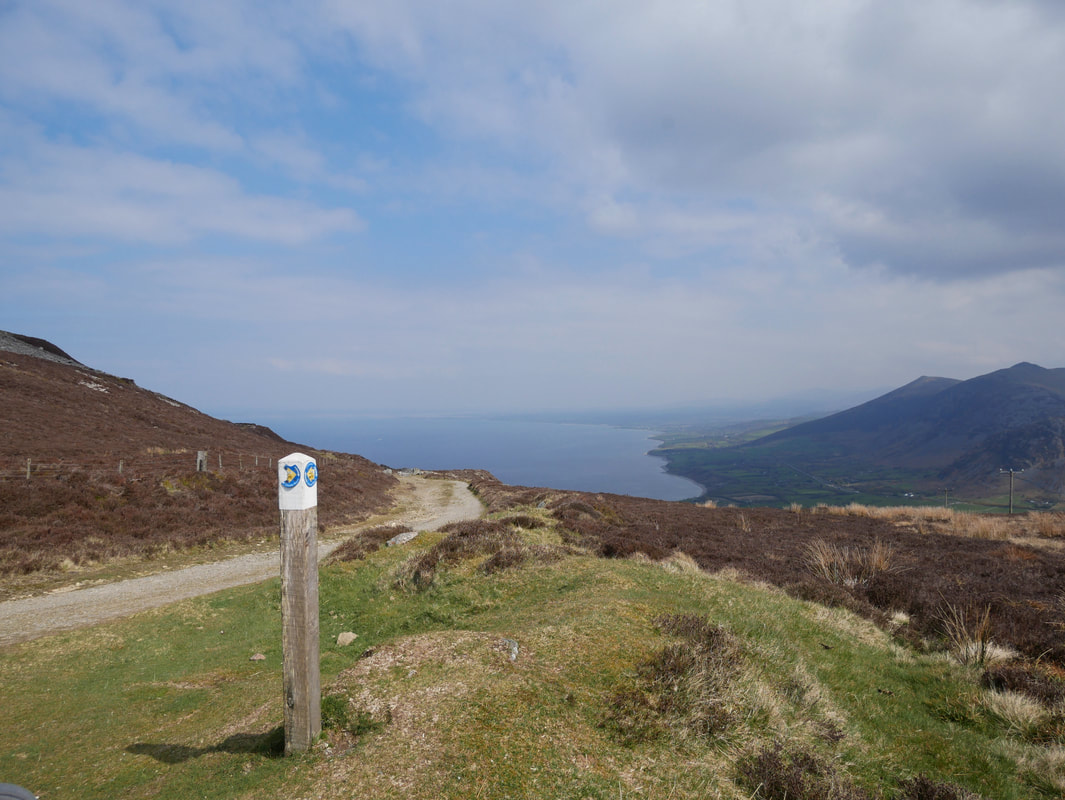
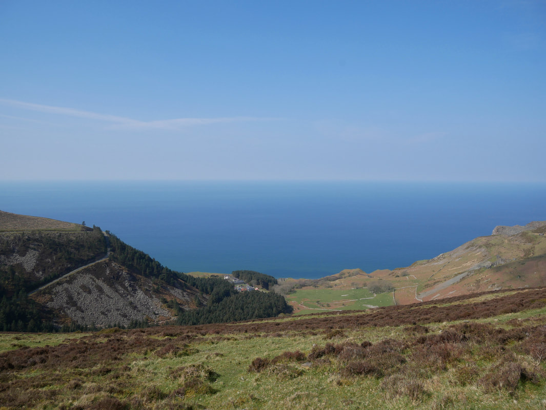
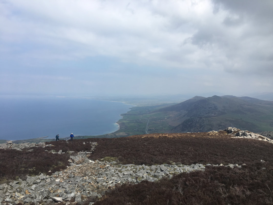
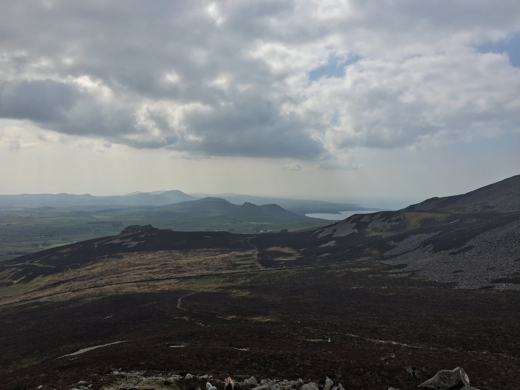
Looking down the coast towards Trefor from Bwlch yr Eifl (Pass of the Fork) with the hills of Gyrn Ddu & Gyrn Goch to the right.
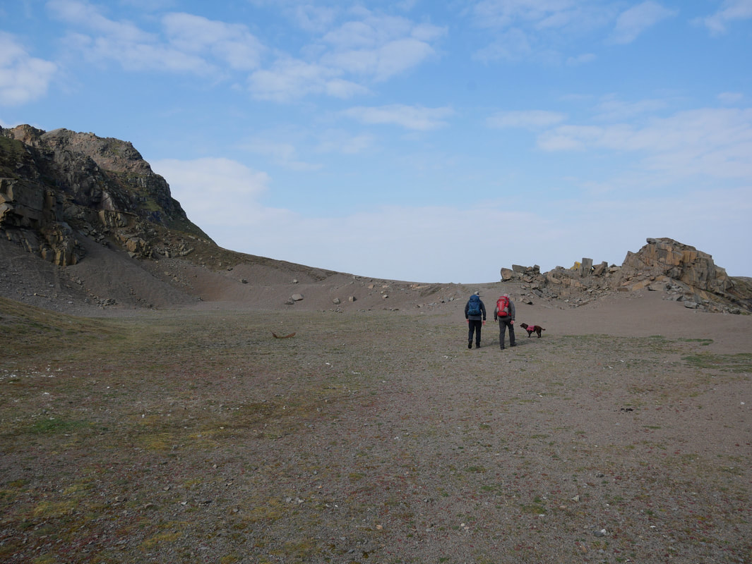
We left the track at this path junction where the terrain became more rocky (our path is to the right, out of shot).
We left the track at this path junction where the terrain became more rocky (our path is to the right, out of shot).
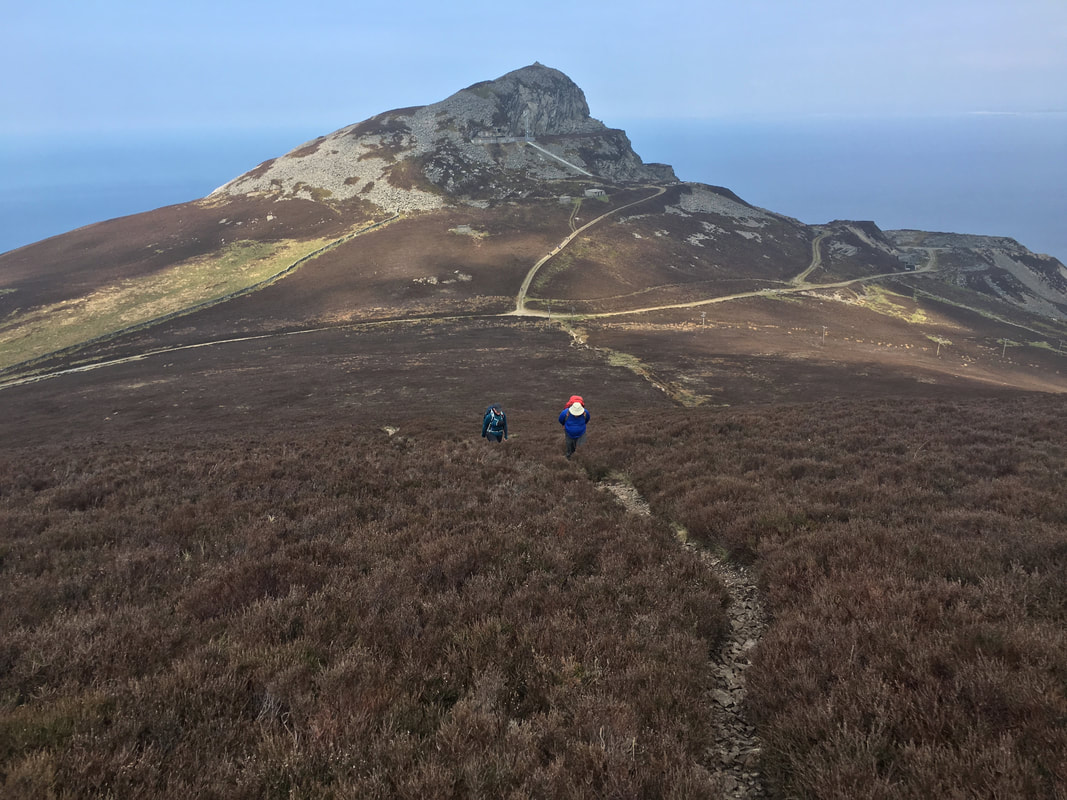
Ascending Garn Ganol looking to Garn Fôr and Bwlch yr Eifl
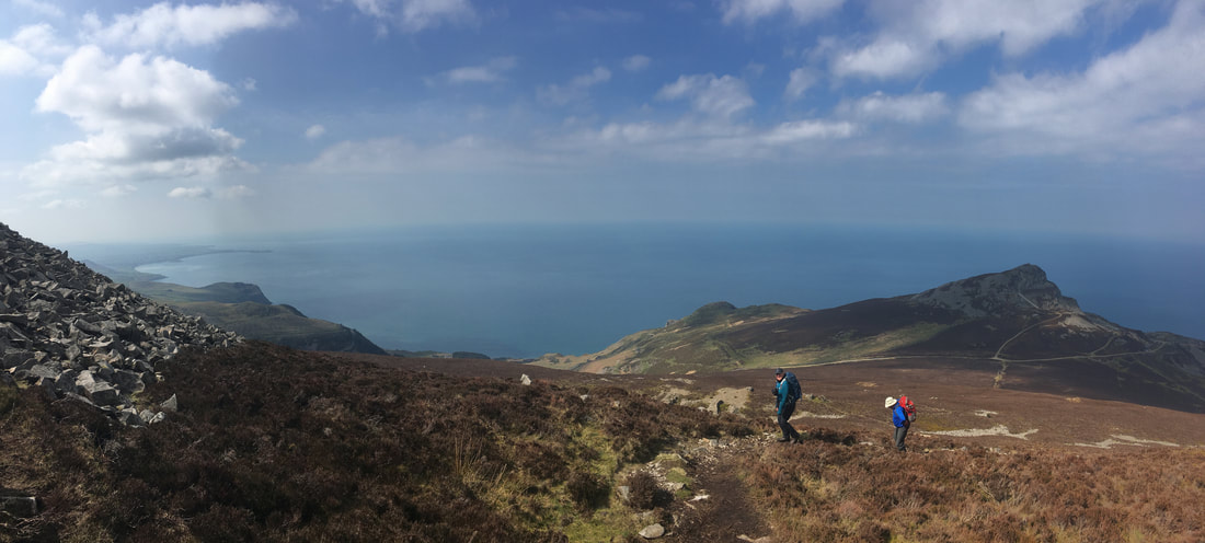
The path became a bit wider as we neared the summit of Garn Ganol
However whilst the path became wider it did become rockier therefore care needed to be taken near the summit.
What a view though!
What a view though!
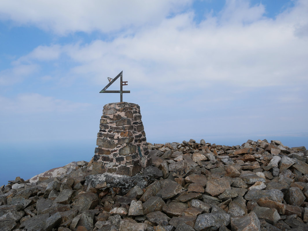
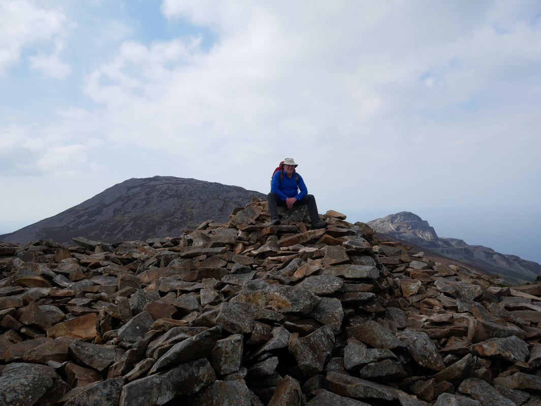
The summit of Garn Ganol (The Centre Cairn)
After quite a bit of research I think I have managed to find out the story behind the unusual adornment on top of the Trig Point. Initial investigations revealed that the figures formed part of the local postcode but a quick check revealed this to be wide of the mark. Apparently the figure was made by a local Blacksmith to celebrate the love for his partner - their initials with a number 4 meaning "A for H".
After quite a bit of research I think I have managed to find out the story behind the unusual adornment on top of the Trig Point. Initial investigations revealed that the figures formed part of the local postcode but a quick check revealed this to be wide of the mark. Apparently the figure was made by a local Blacksmith to celebrate the love for his partner - their initials with a number 4 meaning "A for H".
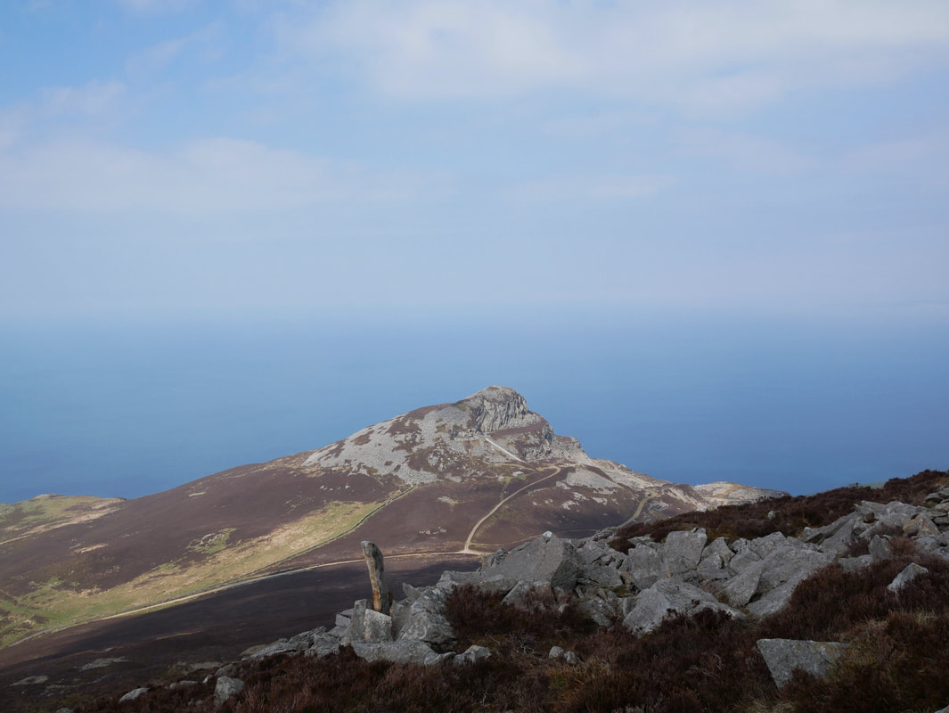
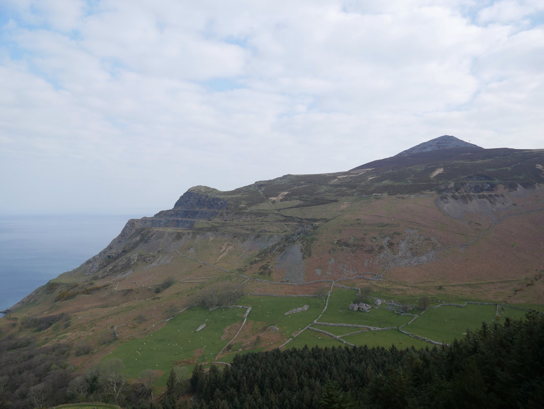
Garn Fôr from the summit of Garn Ganol
From Garn Ganol we could see the entire route of todays walk stretching out below us
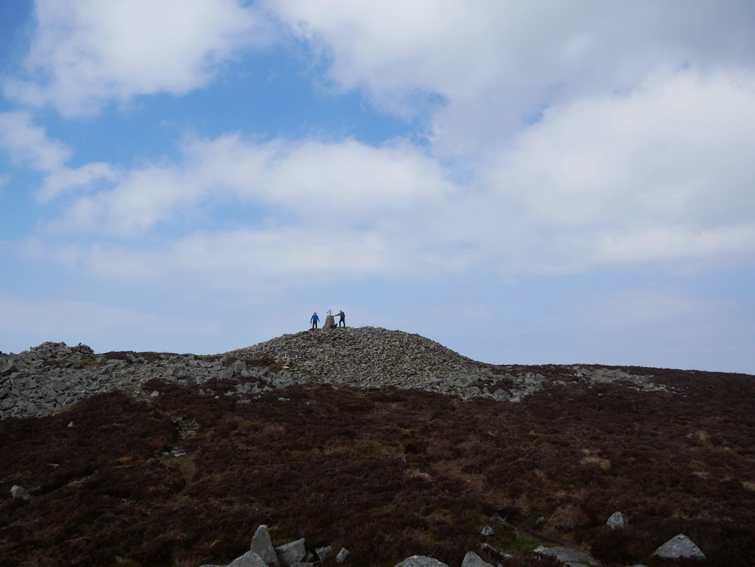
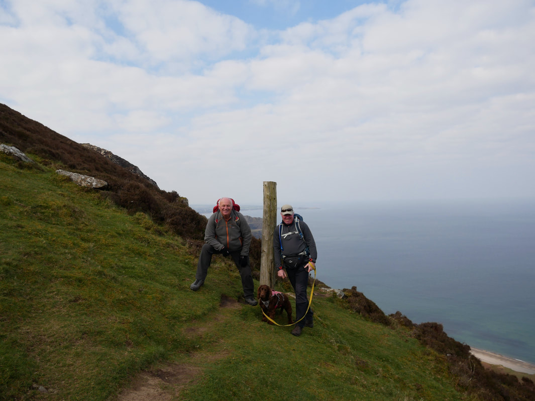
With Howie on the summit of Garn Ganol
Tre’r Ceiri – ‘Town of the Giants’.
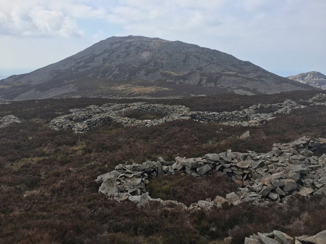
This is regarded as one of the best examples of a prehistoric hillfort in Europe with the outer walls clearly visible.
This is regarded as one of the best examples of a prehistoric hillfort in Europe with the outer walls clearly visible.
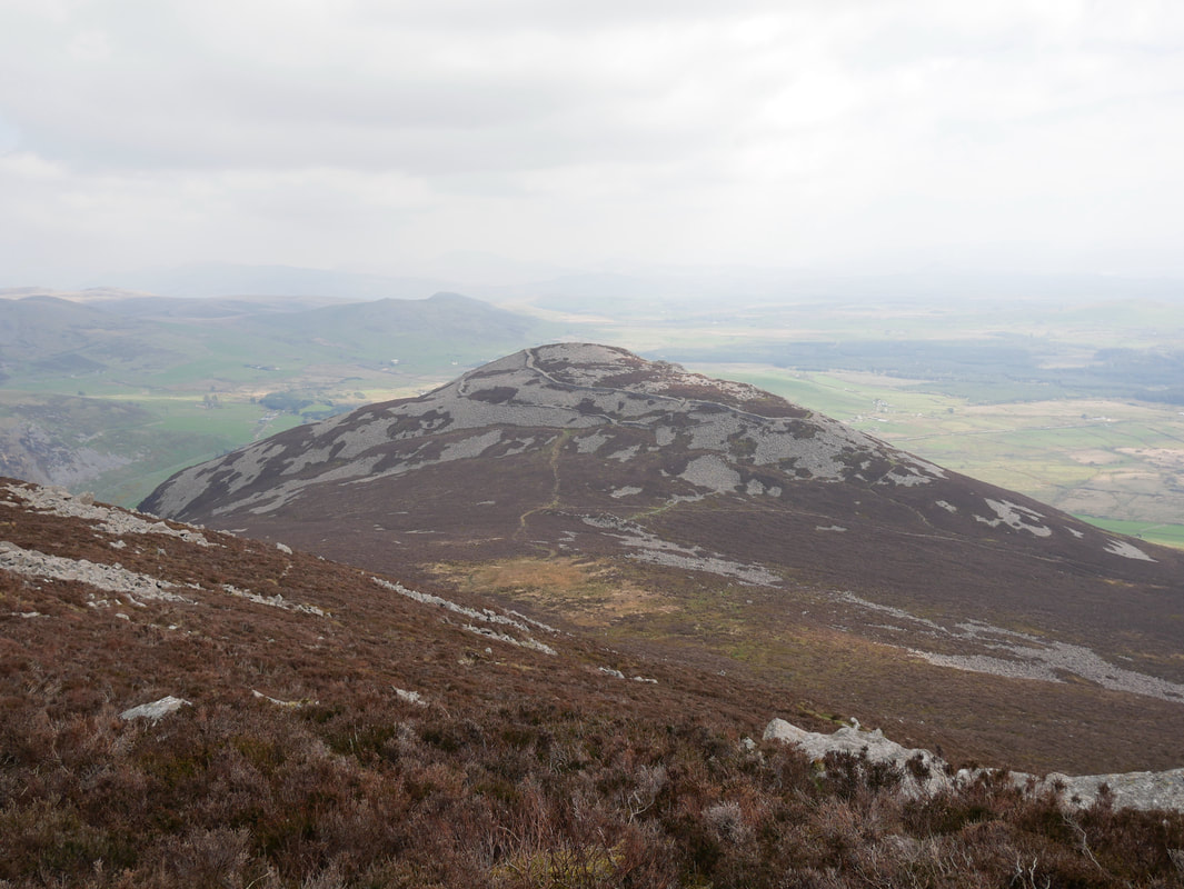
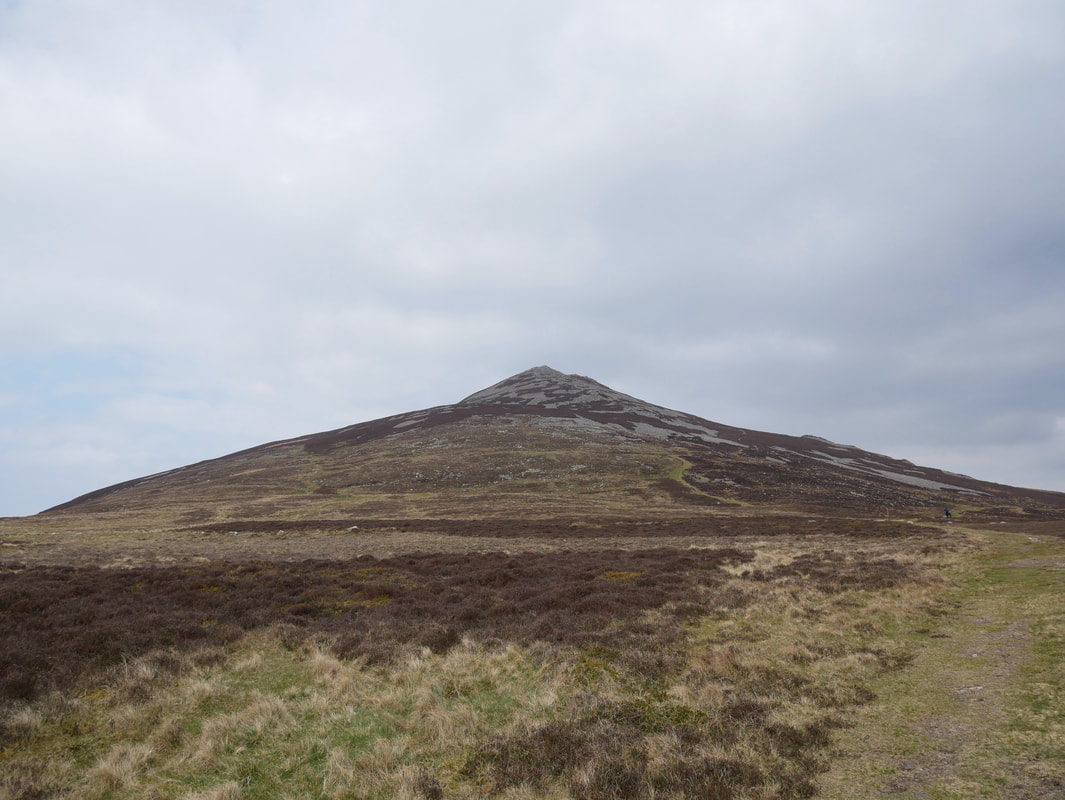
Looking to Garn Ganol from the lower slopes of Tre'r Ceiri
Tre'r Ceiri is one of the most spectacular ancient monuments in Wales. The settlement is surrounded by stone walls that are largely intact, and which reach up to 4 metres (13 ft) in some places. Within the walls are ruins of about 150 stone houses, some of which are seen here which would have had turf roofs. During Roman times, it may have housed up to 400 people. Historian John Davies suggests that because the settlement is so far above sea level, the huts served as habitations for summer shepherds who also had winter dwellings in the lowlands.
Tre'r Ceiri is one of the most spectacular ancient monuments in Wales. The settlement is surrounded by stone walls that are largely intact, and which reach up to 4 metres (13 ft) in some places. Within the walls are ruins of about 150 stone houses, some of which are seen here which would have had turf roofs. During Roman times, it may have housed up to 400 people. Historian John Davies suggests that because the settlement is so far above sea level, the huts served as habitations for summer shepherds who also had winter dwellings in the lowlands.
Howie on the summit of Tre'r Ceiri
From Tre'r Ceiri the return to the Car Park was on a very pleasant path. The rocky outcrop of Caergribin is to the left.
A final look back at Tre'r Ceiri from near the Car Park