Fairfield Horseshoe - Tuesday 14 January 2022
Route
Ambleside - Nook End Farm - Low Sweden Bridge - High Brock Crags - Low Pike - High Pike - Dove Crag - Hart Crag - Link Hause - Scrubby Crag - Fairfield - Great Rigg - Heron Pike North Top (Rydal Fell) - Heron Pike - Lord's Crag - Nab Scar - Rydal Hall - Rydal Park - Ambleside
Parking
Plenty of parking in Ambleside. We parked at Rydal Road Car Park (charge) - the postcode is LA22 9AY.
Mileage
12.7 miles
Terrain
The Fairfield Horseshoe is an extremely popular route therefore the terrain is well trodden with well established mountain paths. However, the summit of Fairfield is extremely confusing in mist therefore it is vitally important that people attempting this walk are proficient at navigating in reduced visibility.
Weather
Low cloud up to 2200 feet however just after High Pike we had a temperature inversion which remained until the descent to Heron Pike from Great Rigg.
Time Taken
8hrs 15mins
Total Ascent
3339ft (1018m)
Wainwrights
8
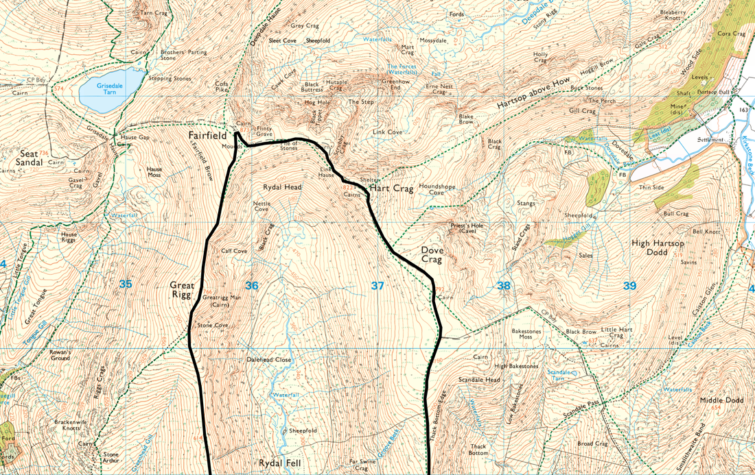
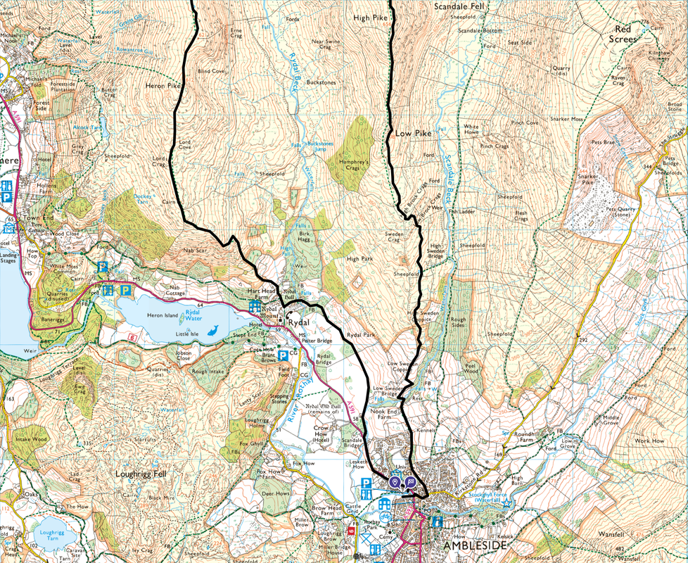
Map
OL5 - The English Lakes - North Eastern Area
OL7 - The English Lakes - South Eastern Area
Walkers
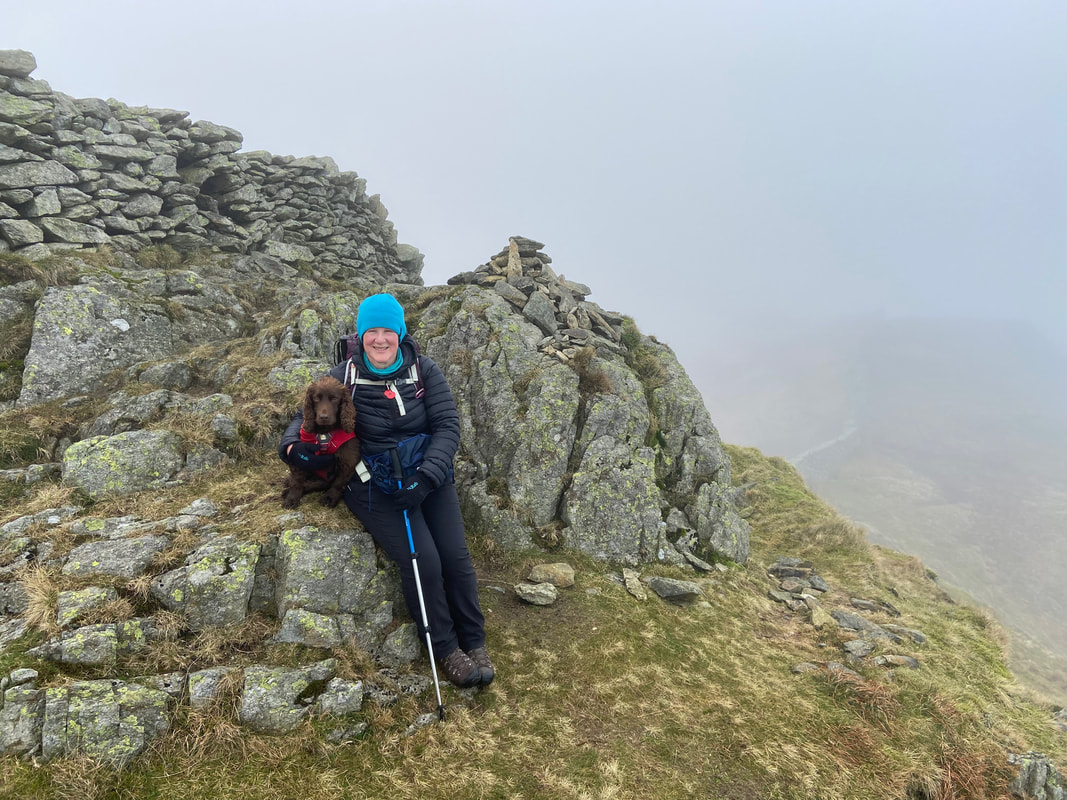
Dave, Angie & Fudge
Ambleside - Nook End Farm - Low Sweden Bridge - High Brock Crags - Low Pike - High Pike - Dove Crag - Hart Crag - Link Hause - Scrubby Crag - Fairfield - Great Rigg - Heron Pike North Top (Rydal Fell) - Heron Pike - Lord's Crag - Nab Scar - Rydal Hall - Rydal Park - Ambleside
Parking
Plenty of parking in Ambleside. We parked at Rydal Road Car Park (charge) - the postcode is LA22 9AY.
Mileage
12.7 miles
Terrain
The Fairfield Horseshoe is an extremely popular route therefore the terrain is well trodden with well established mountain paths. However, the summit of Fairfield is extremely confusing in mist therefore it is vitally important that people attempting this walk are proficient at navigating in reduced visibility.
Weather
Low cloud up to 2200 feet however just after High Pike we had a temperature inversion which remained until the descent to Heron Pike from Great Rigg.
Time Taken
8hrs 15mins
Total Ascent
3339ft (1018m)
Wainwrights
8
Map
OL5 - The English Lakes - North Eastern Area
OL7 - The English Lakes - South Eastern Area
Walkers
Dave, Angie & Fudge
|
GPX File
|
| ||
If the above GPX file fails to download or presents itself as an XML file once downloaded then please feel free to contact me and I will send you the GPX file via e-mail.
Route Map
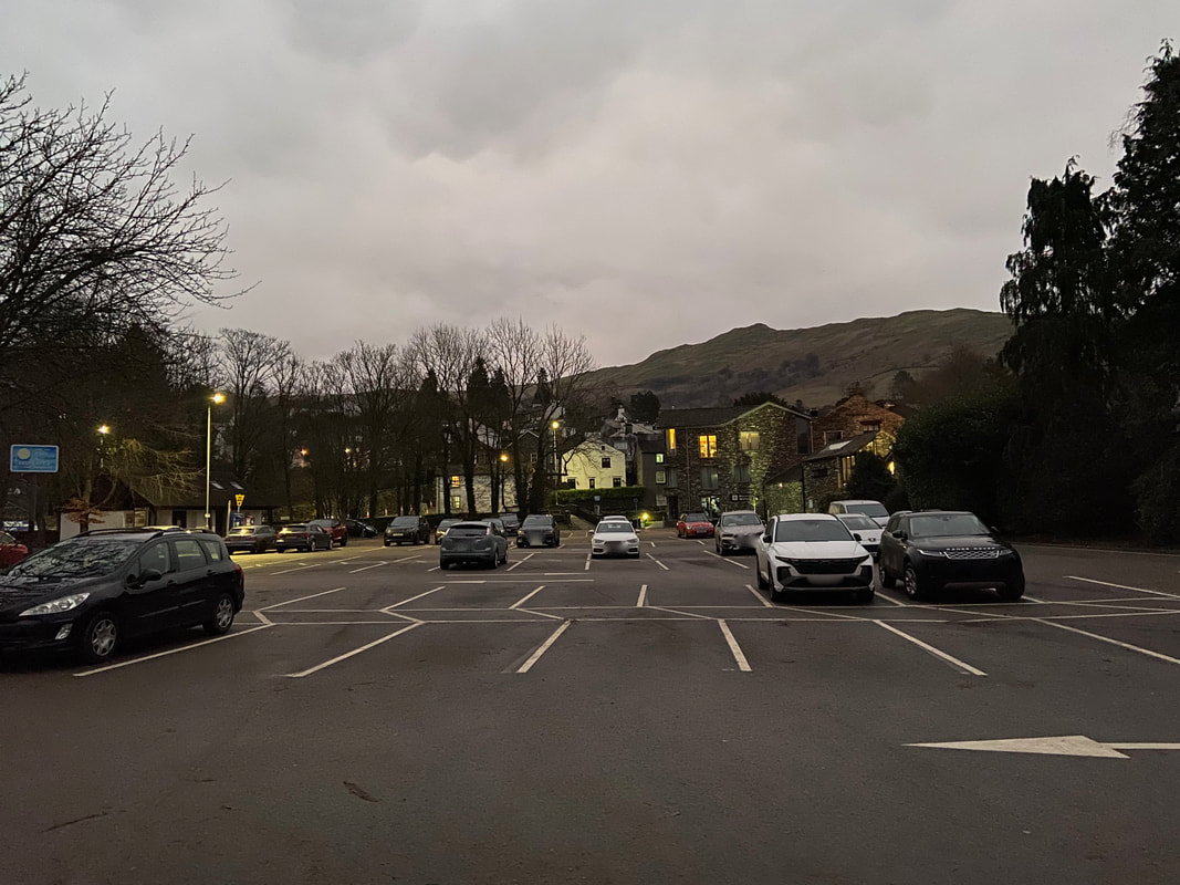
We started the walk from the Rydal Road Car Park in Ambleside which is at the northern end of the town on the A591
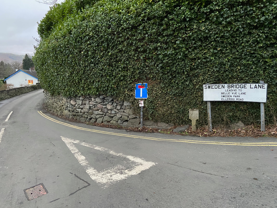
Due to roadworks on the lower part of Nook Lane we headed up Sweden Bridge Lane...................
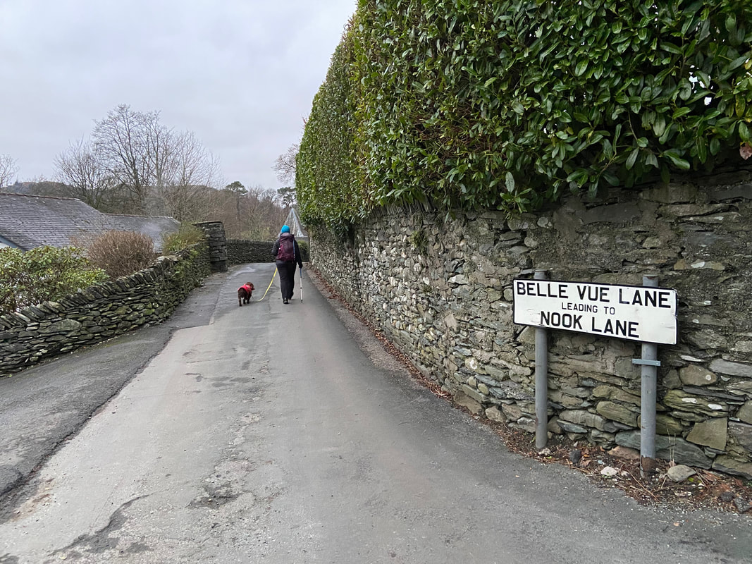
....... and joined Nook Lane via Belle Vue Lane
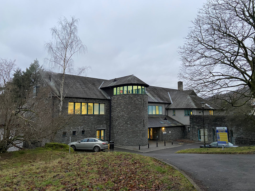
The Charlotte Mason Building in Ambleside. Up until 2007 it was St Martin's College but is now part of the University of Cumbria.
Charlotte Mason was a Victorian educational pioneer and reformer who believed that education should involve the whole child not just the mind. In 1892 she founded a college in Ambleside to develop modern methods of teacher training and also wrote what remains as the definitive work on home schooling.
Charlotte Mason was a Victorian educational pioneer and reformer who believed that education should involve the whole child not just the mind. In 1892 she founded a college in Ambleside to develop modern methods of teacher training and also wrote what remains as the definitive work on home schooling.
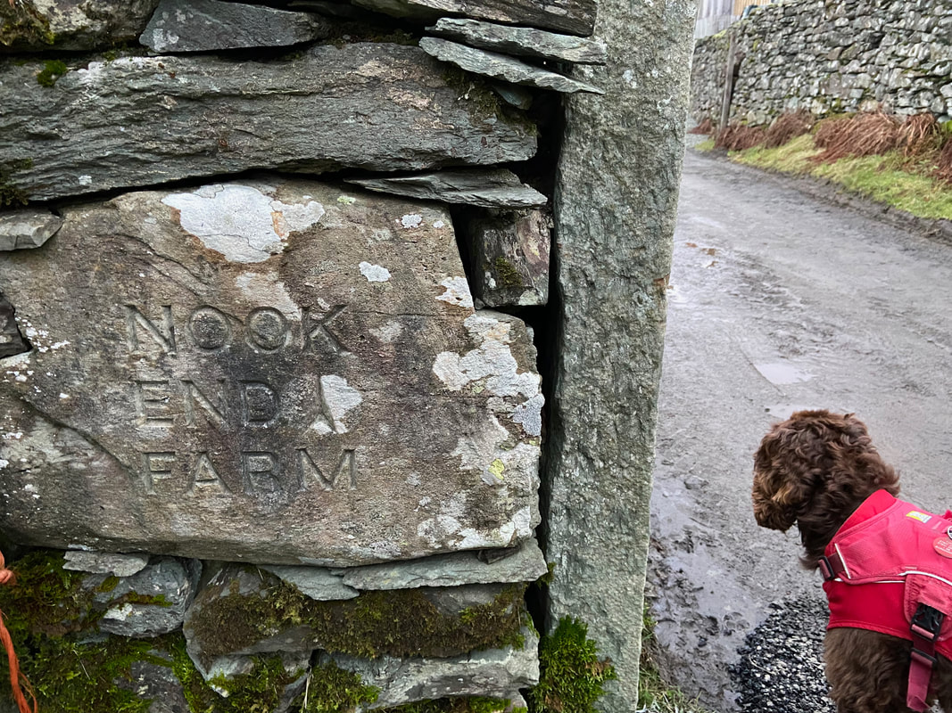
At the end of Nook Lane the route passes through Nook End Farm
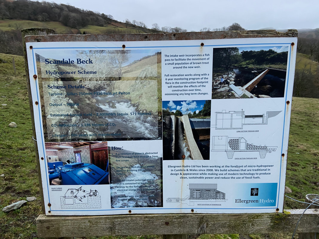
The shape of things to come? I'm seeing more and more of these small Hydropower Schemes popping up - the latest one here at Scandale Beck.
Sweden Crag ahead as we head through Scandale. The route continues to the gate ahead then heads to the left along the lower flank of the crag.
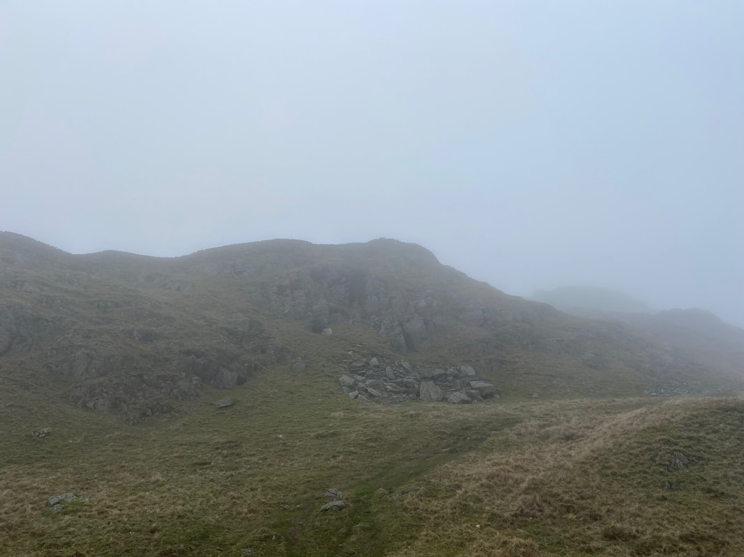
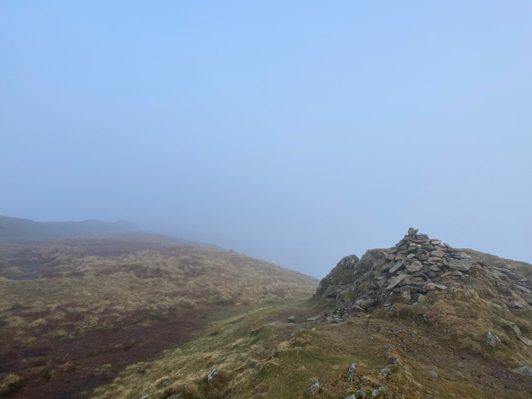
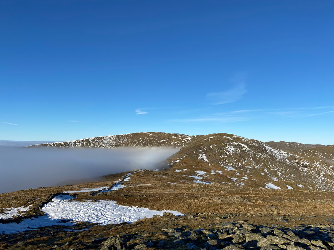
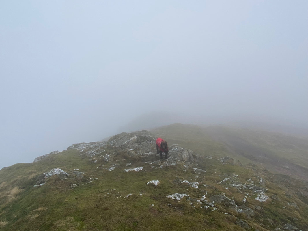
At the northern end of Sweden Crag we reach Low Brock Crags. At this point we entered low cloud and wondered if we were in for a "no viz day".
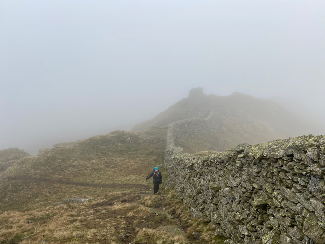
Reaching the wall between High & Low Brock Crags. The wall would now serve as a useful handrail as we would follow it all the way to Hart Crag some 3 miles away to the north.
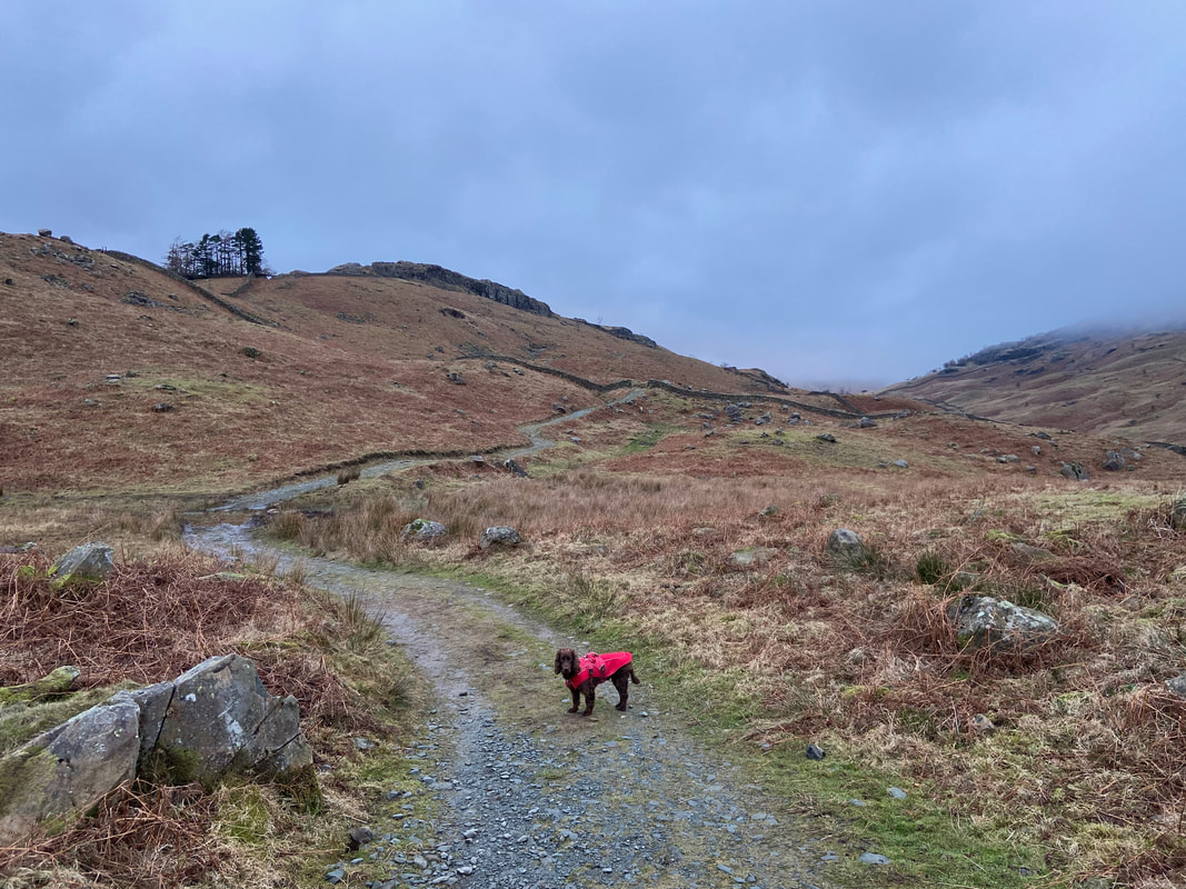
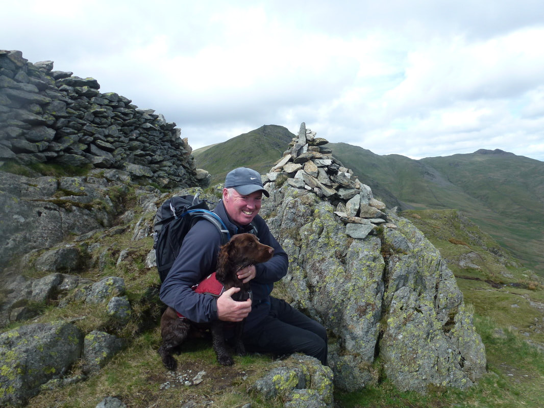
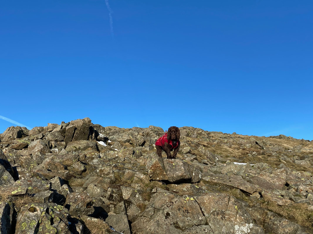
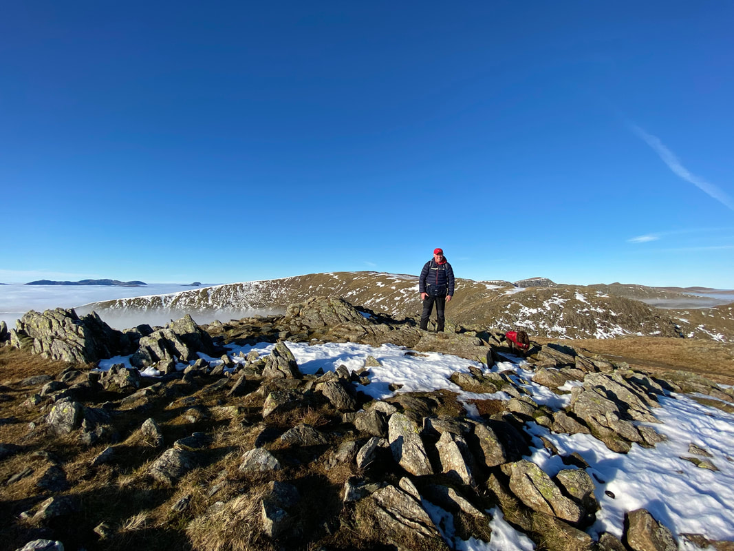
The summit of Low Pike - the first of today's 8 Wainwright tops
|
|
|
2014
|
2022
|
Low Pike 8 years apart. I don't think Fudge has changed a lot in the intervening period since these photos were taken - still doesn't like the camera much

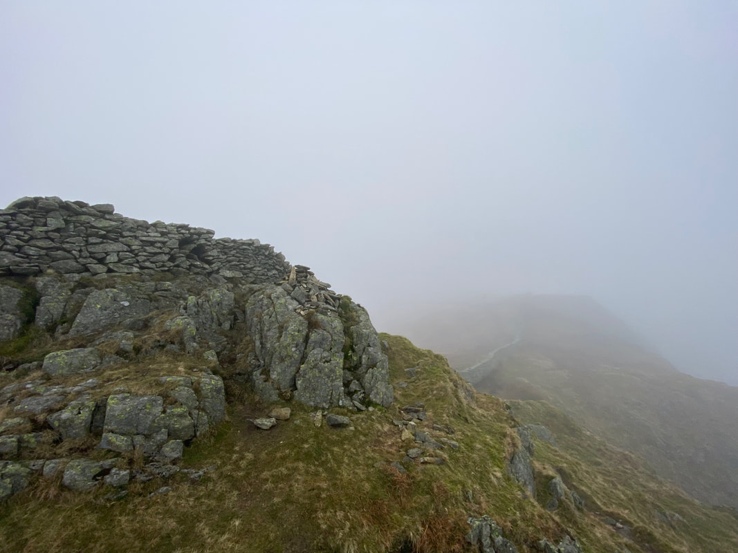
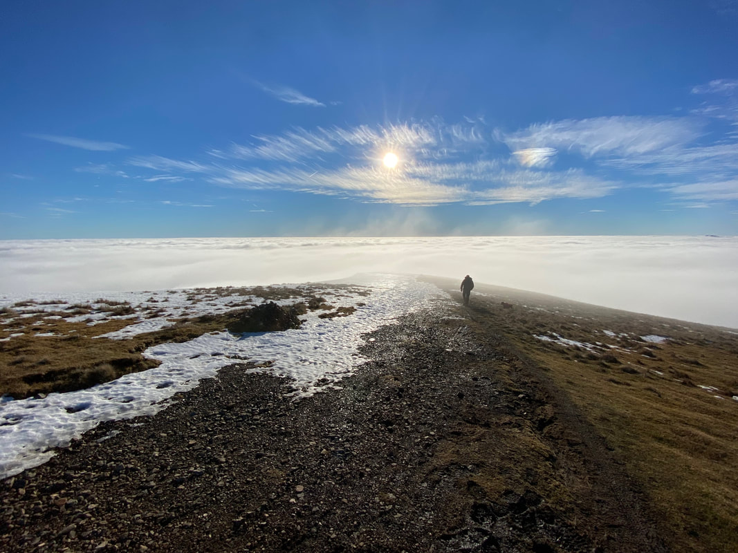
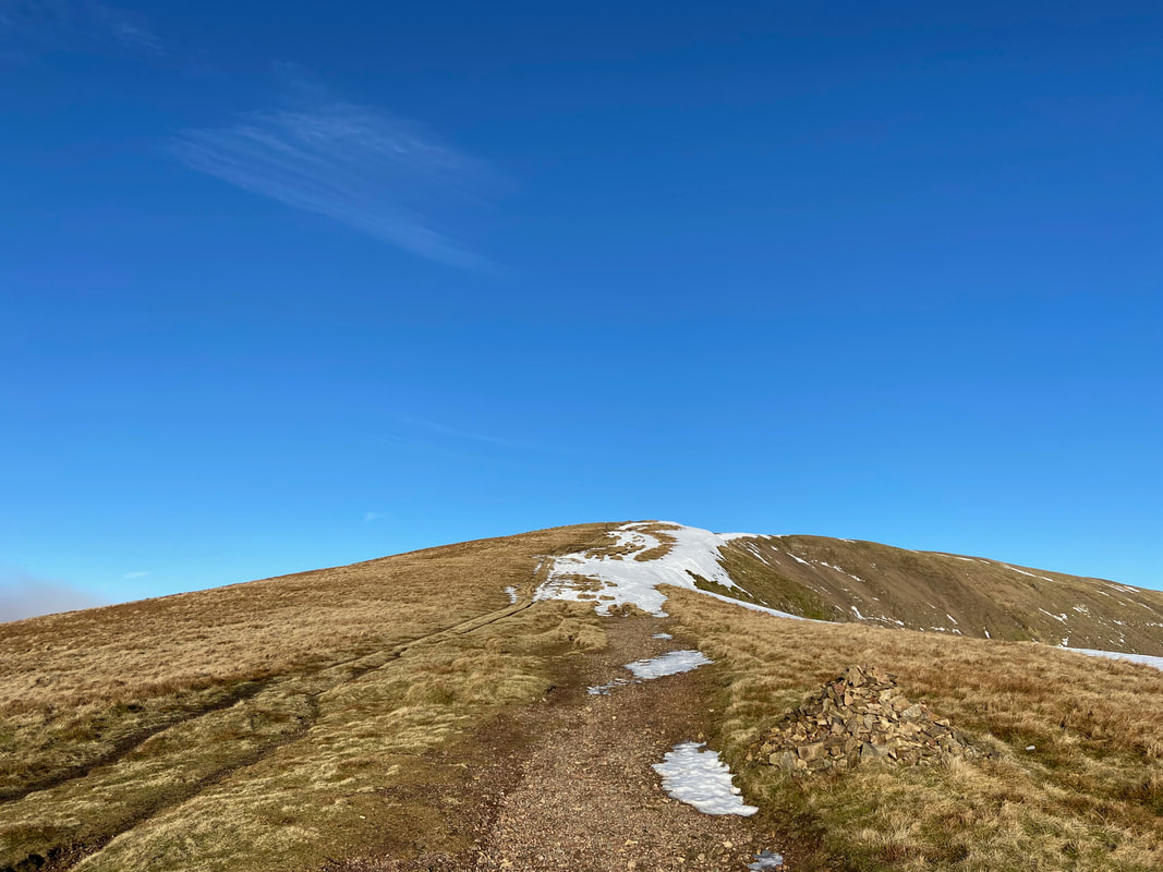
Heading for High Pike through the clag
The summit of High Pike. It was at this point the cloud started to thin and we had the feeling we would be in for something special.
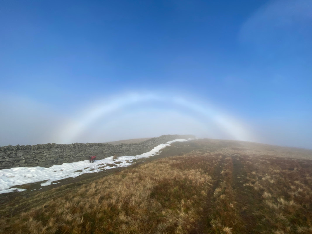
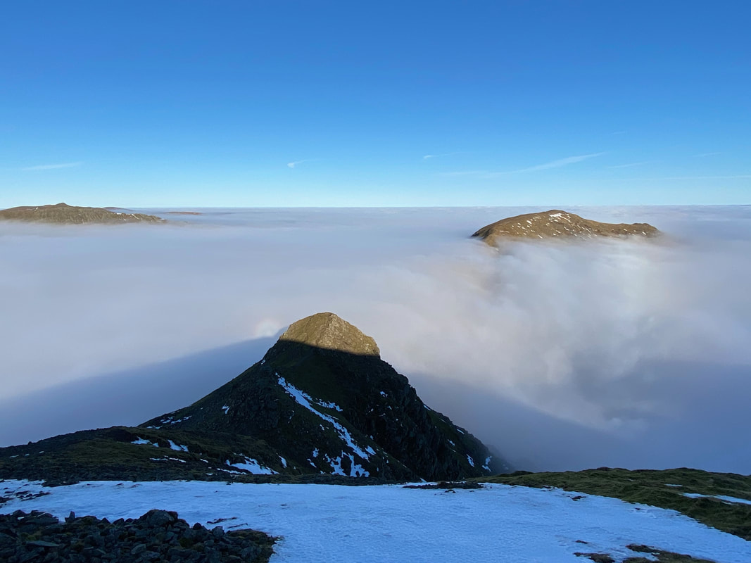
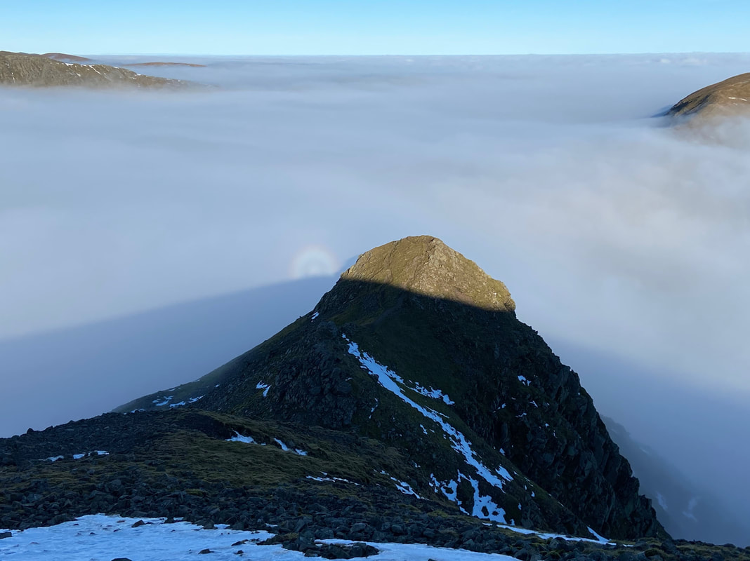
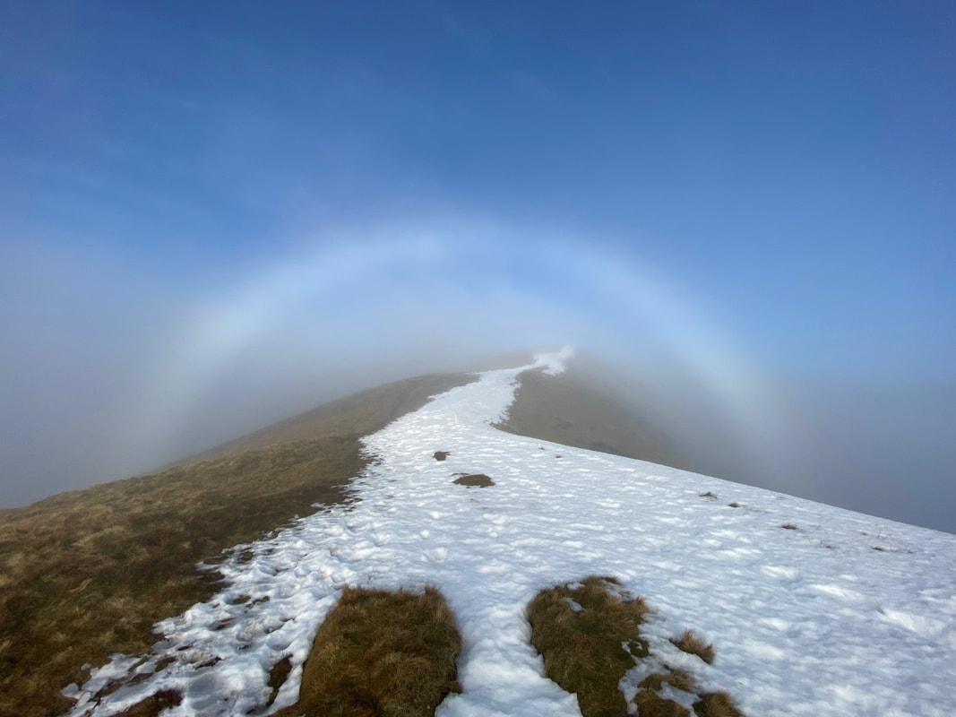
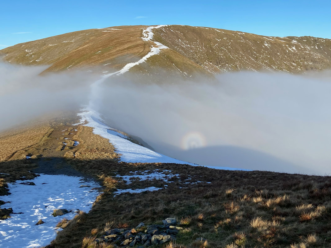
Out of the cloud and BOOM - a Fogbow!!
Despite our extensive walking programme over many years this was the first time we had experienced a Fogbow. For those that are unaware, a Fogbow is similar in some respects to a traditional rainbow forming from sunlight interacting with water droplets contained in fog, mist or cloud rather than interacting with raindrops as it does in a classical rainbow. These water droplets are much smaller than raindrops, nearly always less than 0.1 mm in diameter. These tiny droplets cause the light to undergo different physical processes, most notably diffraction, which leads to fogbows appearing to be devoid of colour. It is for this reason that fogbows are sometimes known as white rainbows. (Source - Met Office)
Fudge meanwhile laughs in the face of Fogbows and instead arses about in the snow.
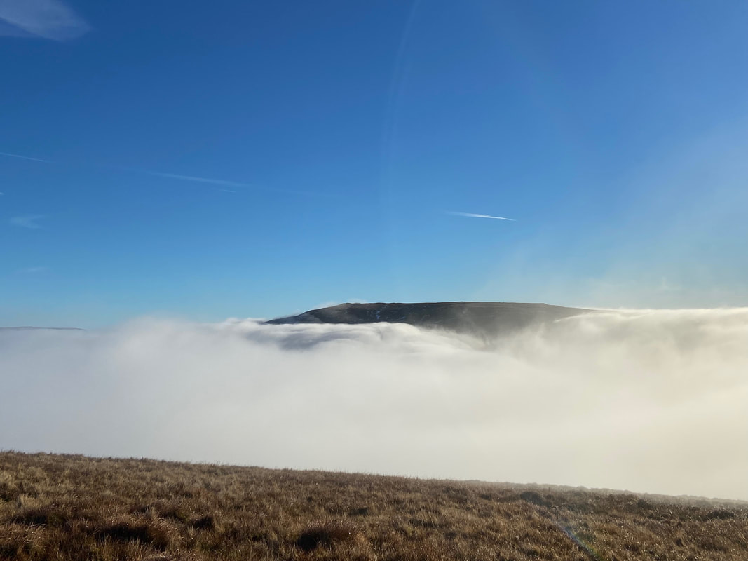
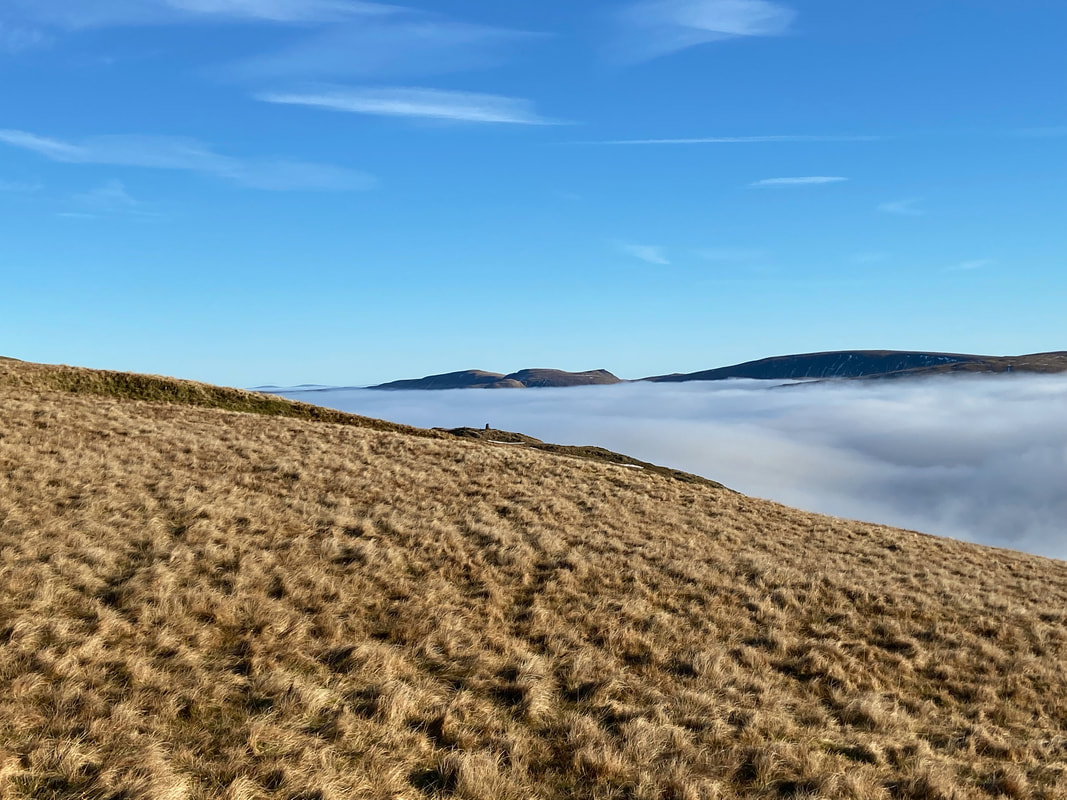
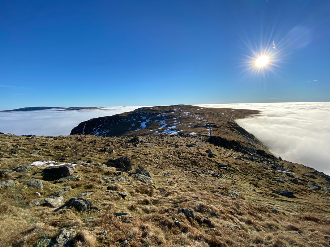
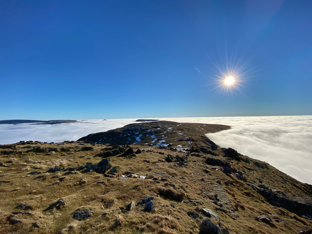
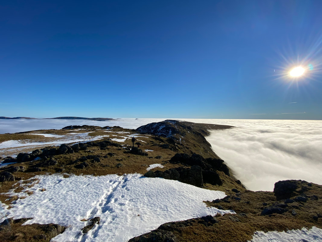
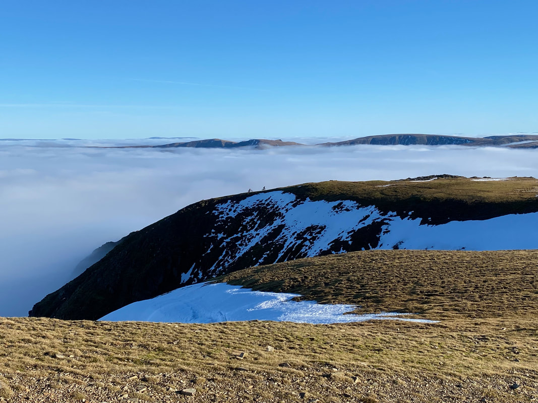
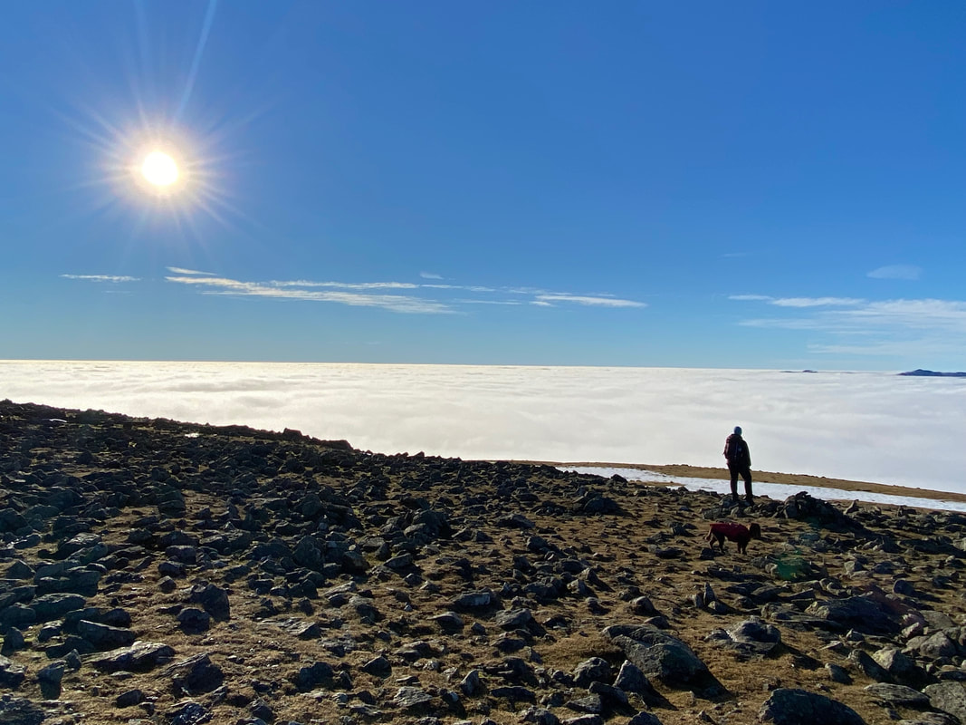
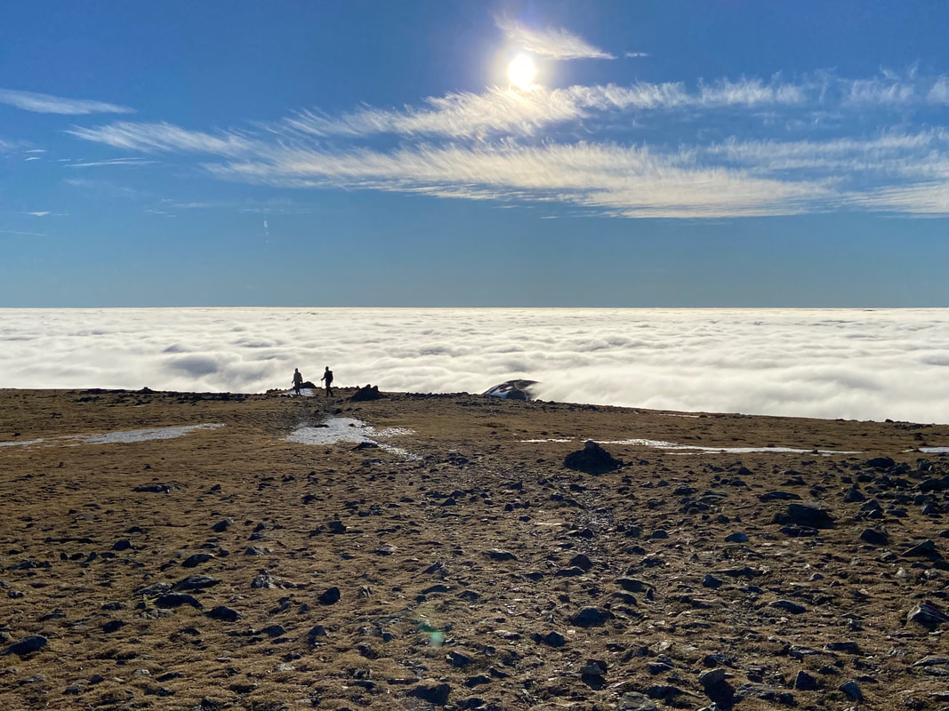
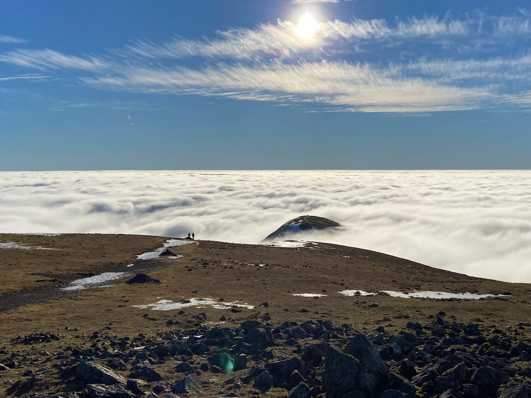
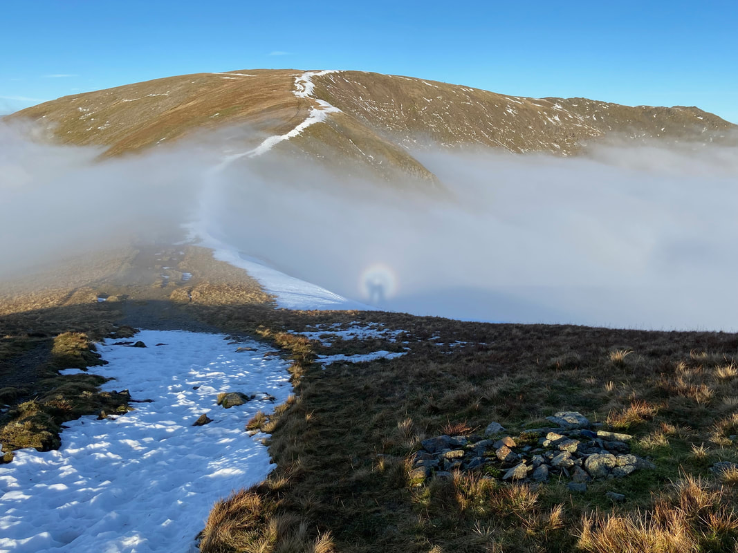
Red Screes appearing out of the cloud to the east. It was at this point we knew we were in for a very special day as we emerged fully from the low cloud. We had experienced a couple of temperature inversions before but nothing on this scale.
A temperature inversion is where temperature increases with height. The lowest part of our atmosphere is the troposphere, which can extend to heights of 16 km and is where most of the weather happens. It is also a section of the atmosphere where the temperature typically gets lower the higher up you go, for example, when you climb a mountain it is often colder at the top. However, sometimes a small layer can form where the temperature increases with height. This layer is called an inversion. This often happens in areas of high pressure, where the air high up sinks towards the ground. As it falls, it dries out and warms up. This warm layer of air can act as a lid and trap cooler air near the surface (this is because warm air is more buoyant than cold air, and so it will tend to 'float' above the colder air, trapping it). This gives us the inversion, because if you were now to climb the mountain it would get warmer as you got to the top. This is inverted compared to what you would normally expect, hence the term 'inversion'. Inversions are most common in winter when mist and fog become trapped in the cooler air low down, but inversions can happen all year round. (Source - Met Office)
A temperature inversion is where temperature increases with height. The lowest part of our atmosphere is the troposphere, which can extend to heights of 16 km and is where most of the weather happens. It is also a section of the atmosphere where the temperature typically gets lower the higher up you go, for example, when you climb a mountain it is often colder at the top. However, sometimes a small layer can form where the temperature increases with height. This layer is called an inversion. This often happens in areas of high pressure, where the air high up sinks towards the ground. As it falls, it dries out and warms up. This warm layer of air can act as a lid and trap cooler air near the surface (this is because warm air is more buoyant than cold air, and so it will tend to 'float' above the colder air, trapping it). This gives us the inversion, because if you were now to climb the mountain it would get warmer as you got to the top. This is inverted compared to what you would normally expect, hence the term 'inversion'. Inversions are most common in winter when mist and fog become trapped in the cooler air low down, but inversions can happen all year round. (Source - Met Office)
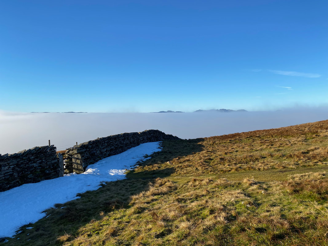
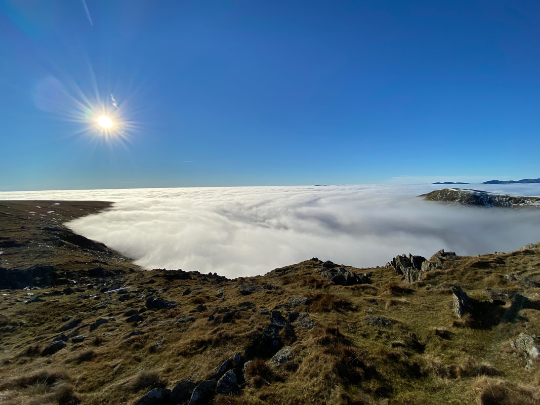
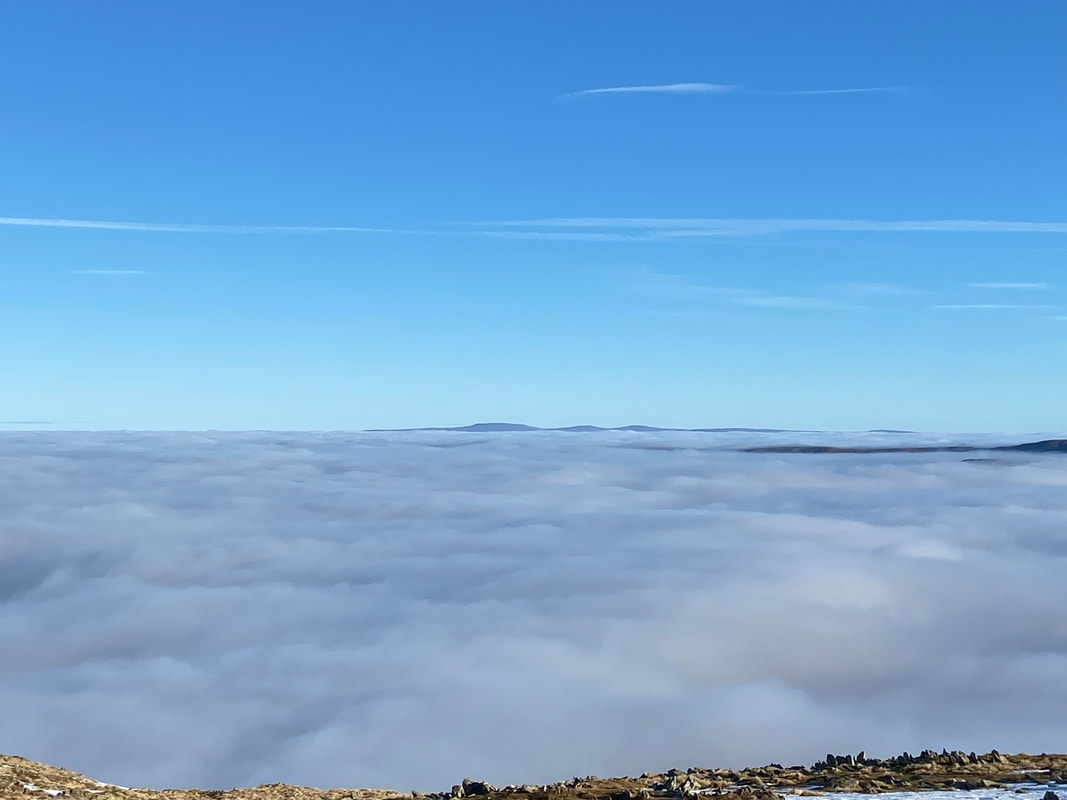
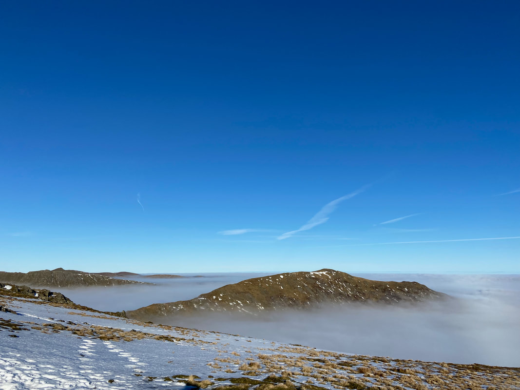
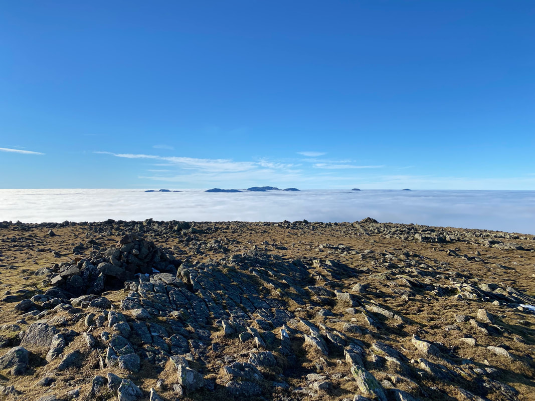
Looking over a sea of cloud to the Coniston Fells on the left then moving right to Crinkle Crags, Bowfell & The Scafells
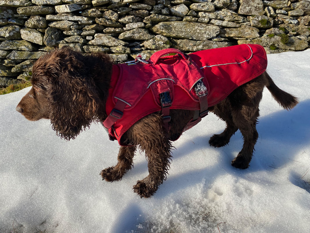
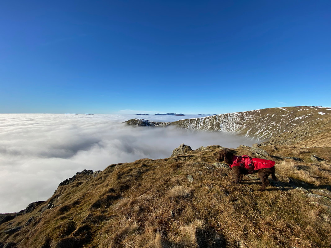
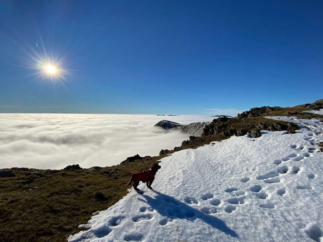
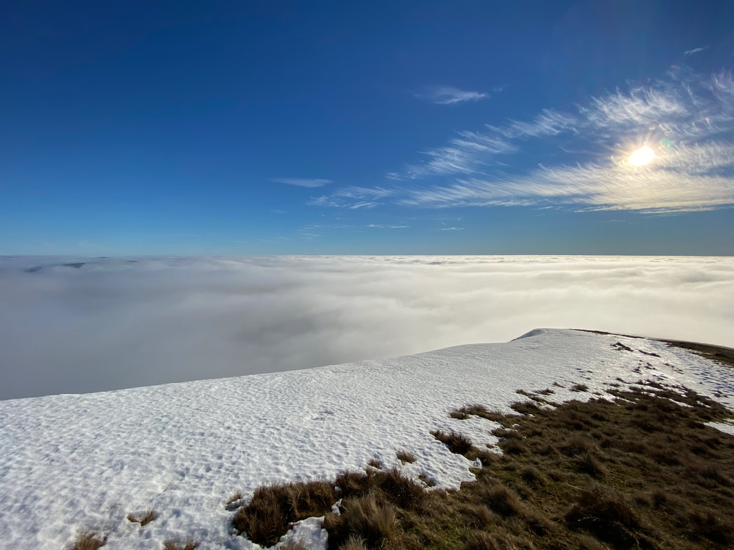
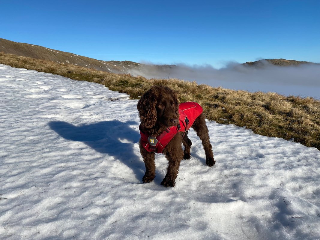
As can be seen, Fudge was loving the snow
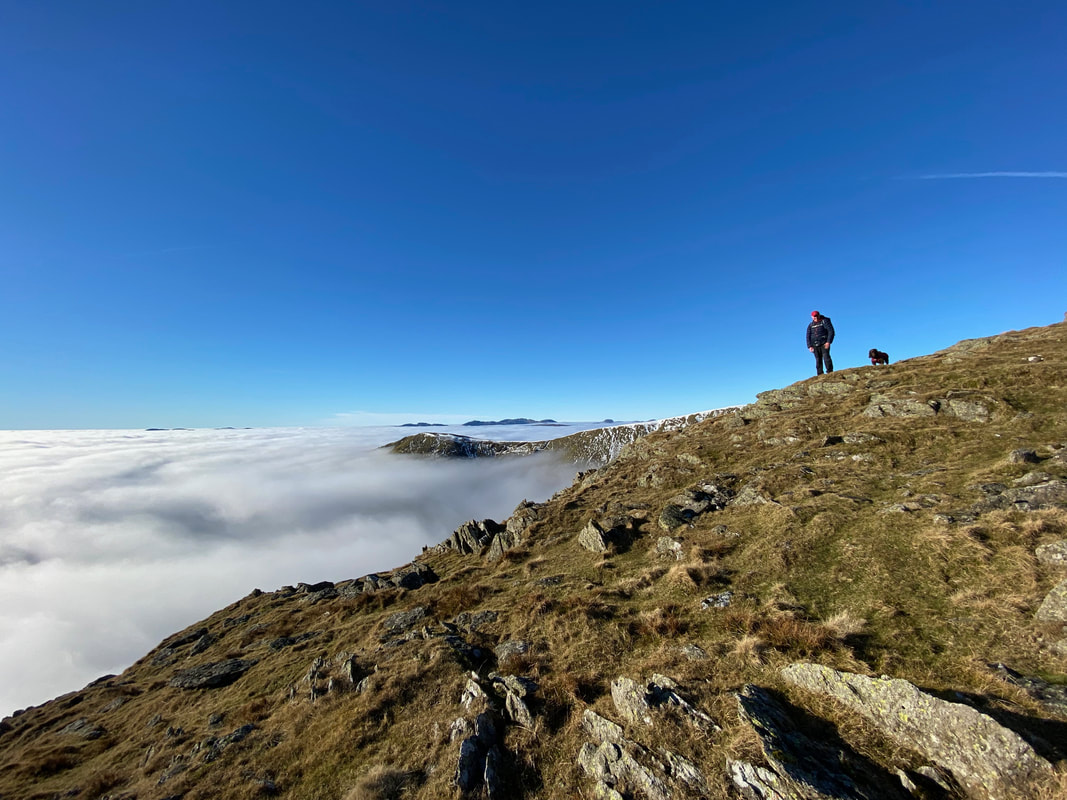
Looking back to our route of ascent with Red Screes to the left
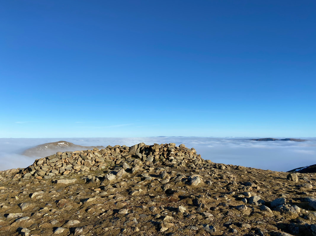
The cairn on High Bakestones with High Raise, The Knott, Rampsgill Head & Kidsty Pike to the left with High Street to the right
A glorious panorama - just wow! (click Play to view)
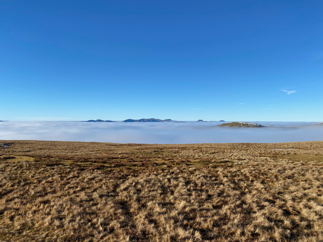
A closer view of Crinkle Crags, Bowfell and the Scafells with Great Gable & Pillar to the right. The fell in the foreground is Great Rigg.
Another glorious panorama as we head to Dove Crag (click Play to view)
Another look back to our route of ascent from High Pike
The summit of Dove Crag
The view from Dove Crag (click Play to view)
From Dove Crag we now headed for Hart Crag, still following the wall. In the distance is Fairfield.
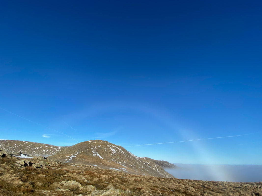
Why have only one Fogbow when you can have two!
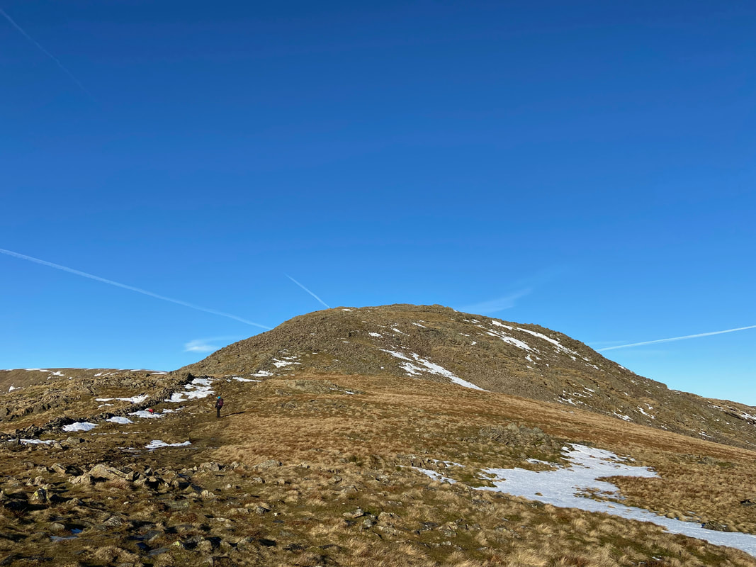
Heading along to Hart Crag via the ridge at the top of Houndscope Cove
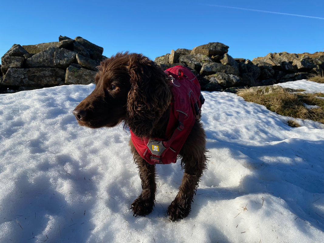
Not much snow on the ground and most of it was up against the wall - Fudge never ventured far from it.
The ascent of Hart Crag involves some mild scrambling
Looking back to Dove Crag from the ascent of Hart Crag
It doesn't get much better than this to be honest
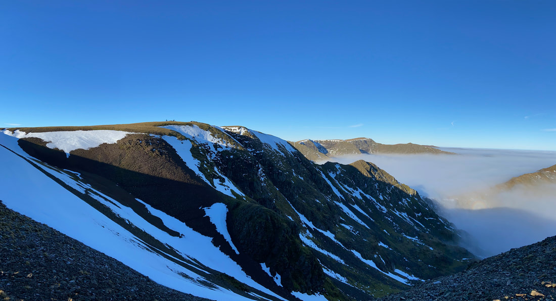
Rydal Head under cloud with Great Rigg to the right
Another glorious view back to Dove Crag
Meanwhile Fudge was wondering what all the fuss was about
Zooming in over the M6 to The Pennines looking to Cross Fell, Little Dun Fell & Great Dun Fell
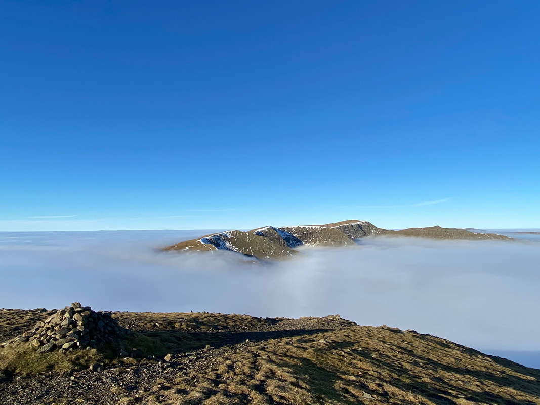
The summit of Hart Crag with Fairfield behind and Scrubby Crag to the right
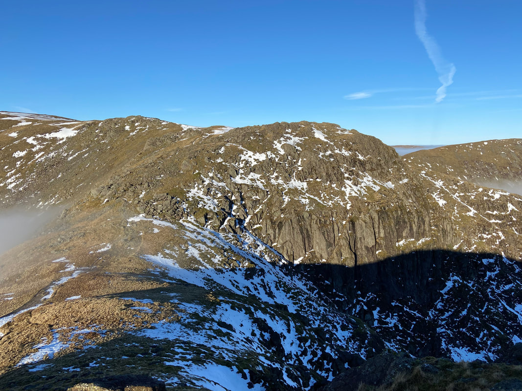
Looking into Link Cove with Link Hause, Scrubby Crag & Fairfield ahead.
Hart Crag from the ascent of Scrubby Crag at Link Hause
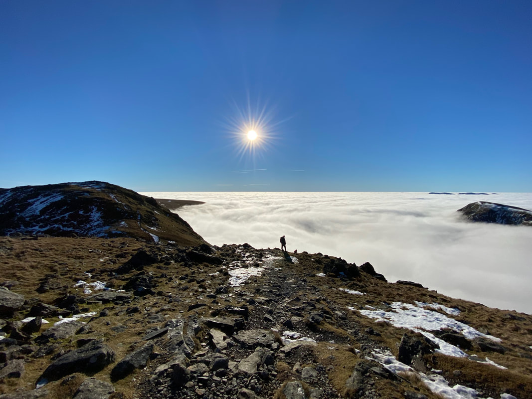
Got to be one of my favourite photos - with Fudge looking into an abyss of cloud
St Sunday Crag from the approach to Fairfield
The day just got better & better - such a privilege to witness these conditions
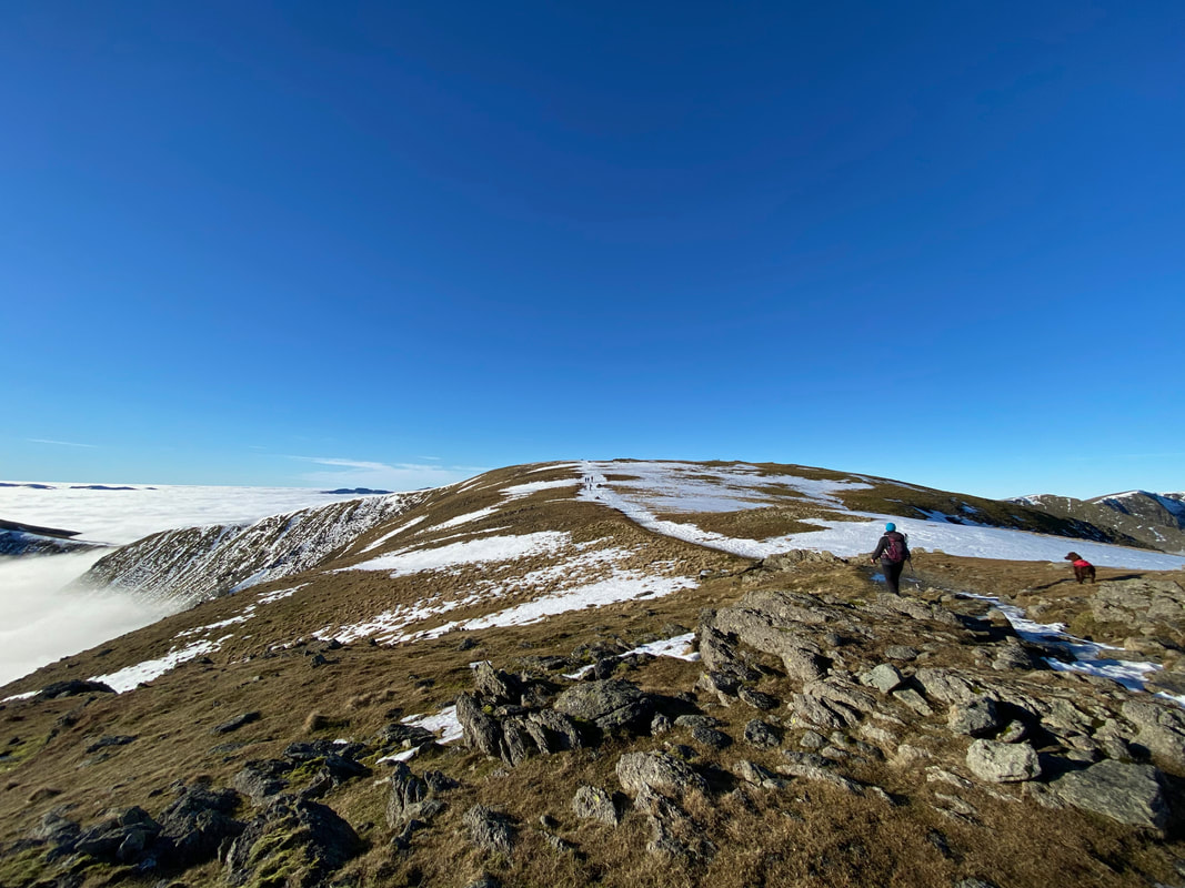
Looking back to Hart Crag as we make our approach over easy ground to Fairfield
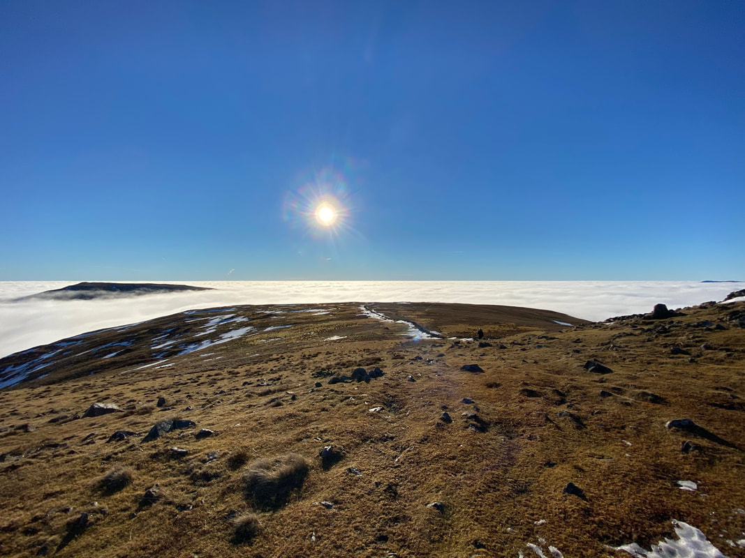
The final few hundred yards to Fairfield's summit
Fairfield, Cofa Pike & Deepdale Hause
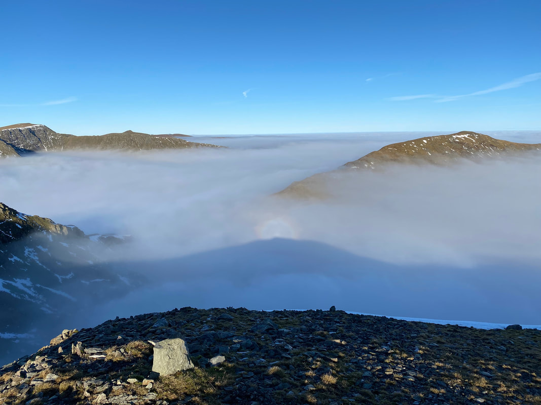
The first of quite a few Brocken Spectres we were lucky enough to witness today. Striding Edge and Helvellyn are to the left with St Sunday Crag to the right.
Named after the German mountain on which it was first noted, a Brocken Spectre is a large shadow of an observer cast onto cloud or mist. When an observer stands on a hill which is partially enveloped in mist and in such a position that their shadow is thrown on to the mist, they may get the illusion that the shadow is a person seen dimly through the mist. The illusion is that this person or 'spectre' is gigantic and at a considerable distance away from them. The sun shining behind the observer projects their shadow through the mist, while the magnification of the shadow is an optical illusion which makes the shadow on nearby clouds seem at the same distance at faraway landmarks seen through the cloud. Similarly, the shadow falls upon water droplets of varying distance which distorts perception and can make the shadow appear to move as the clouds vary and shift. This all combines to make the rather disorienting effect of a giant shadow moving in the distance. The term 'Brocken Spectre' was coined in 1780 by Johann Silberschlag, a German pastor and natural scientist who frequented the Harz mountains. The term has been popularly used throughout literature, mentioned in works by Samuel Taylor Coleridge, Charles Dickens and Lewis Carroll amongst others. (Source - Met Office)
Named after the German mountain on which it was first noted, a Brocken Spectre is a large shadow of an observer cast onto cloud or mist. When an observer stands on a hill which is partially enveloped in mist and in such a position that their shadow is thrown on to the mist, they may get the illusion that the shadow is a person seen dimly through the mist. The illusion is that this person or 'spectre' is gigantic and at a considerable distance away from them. The sun shining behind the observer projects their shadow through the mist, while the magnification of the shadow is an optical illusion which makes the shadow on nearby clouds seem at the same distance at faraway landmarks seen through the cloud. Similarly, the shadow falls upon water droplets of varying distance which distorts perception and can make the shadow appear to move as the clouds vary and shift. This all combines to make the rather disorienting effect of a giant shadow moving in the distance. The term 'Brocken Spectre' was coined in 1780 by Johann Silberschlag, a German pastor and natural scientist who frequented the Harz mountains. The term has been popularly used throughout literature, mentioned in works by Samuel Taylor Coleridge, Charles Dickens and Lewis Carroll amongst others. (Source - Met Office)
Cyclists in the distance ascending the slope on Scrubby Crag
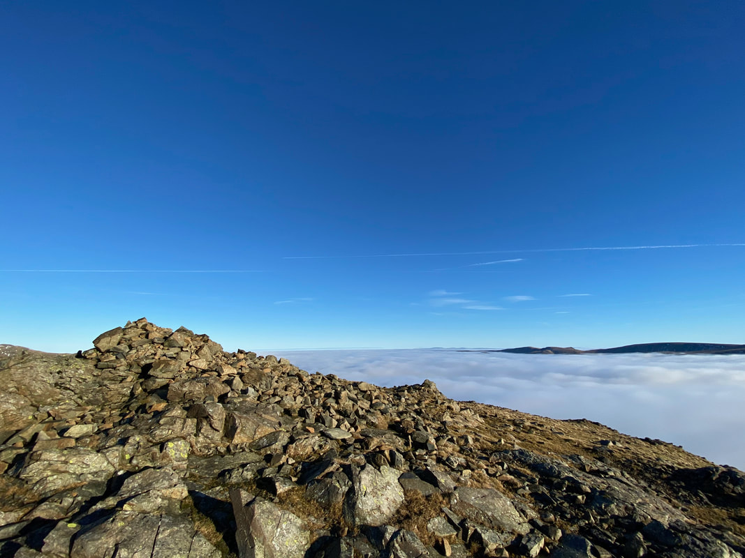
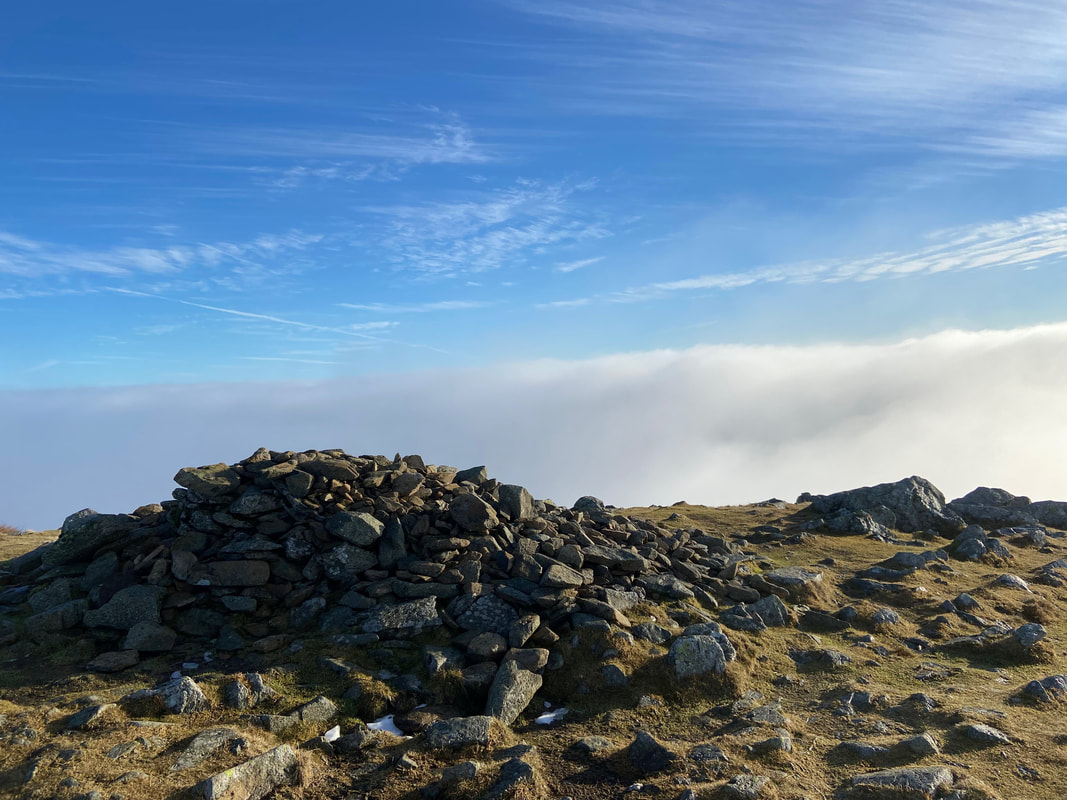
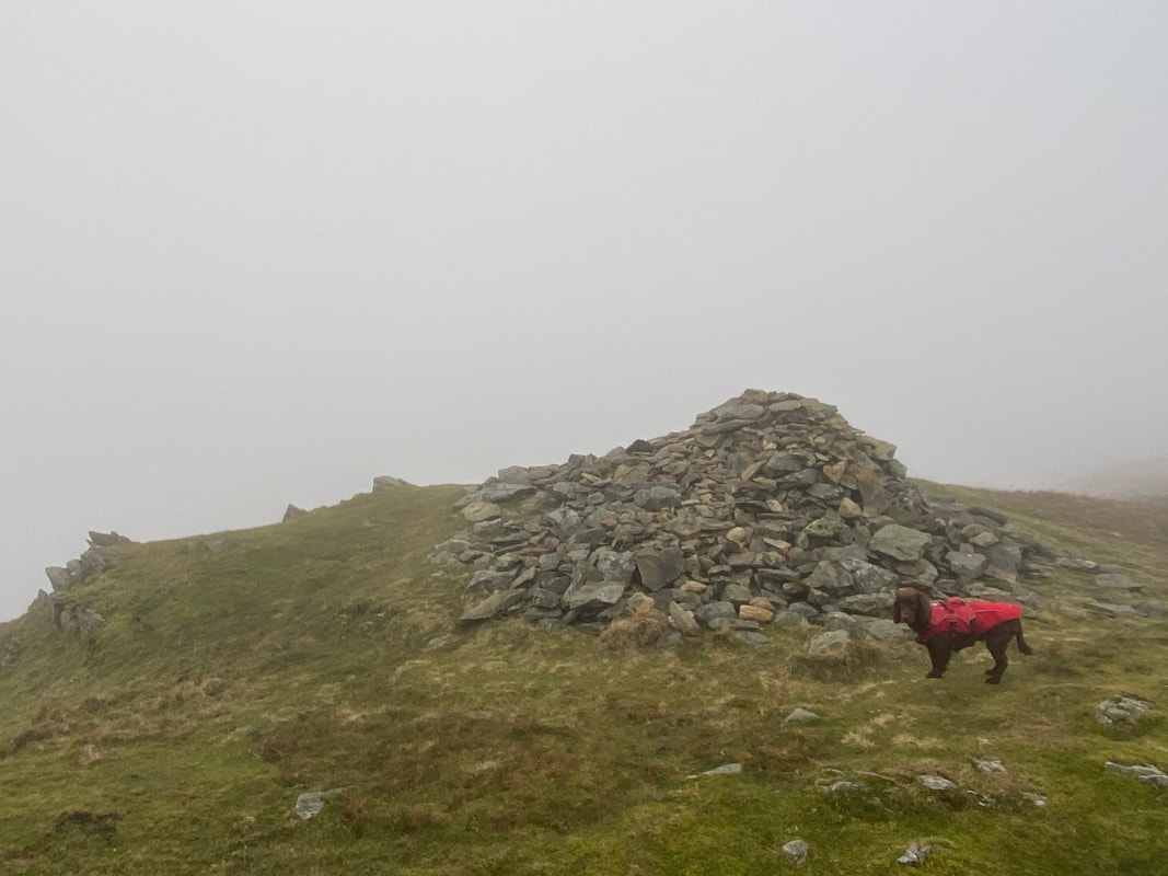
There are several cairns & shelters that adorn the summit plateau on Fairfield - this cairn and the one in the distance mark the route down to Hause Gap & Grisedale Tarn.
The view from the summit of Fairfield (click Play to view)
The Helvellyn Range across the head of the Grisedale Valley - Dollywagon Pike, Nethermost Pike, High Crag, Helvellyn, Striding Edge & Catstycam
Cofa Pike & St Sunday Crag from Fairfield - oh, and another Brocken Spectre
Zooming in on the Brocken Spectre & Cofa Pike
This was one of those days when we did not want to descend off the mountain
The summit of Fairfield
Lunch on the summit of Fairfield (click Play to view)
Two walkers heading off to Great Rigg - we would shortly follow
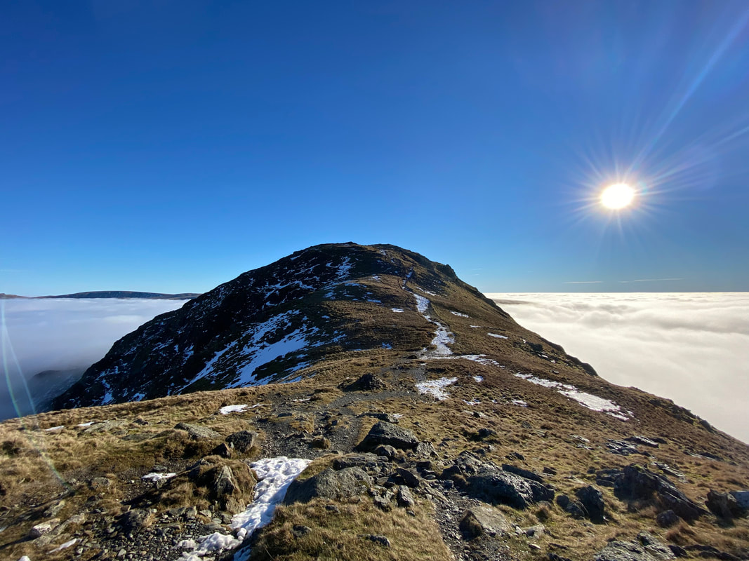
Great Rigg ahead
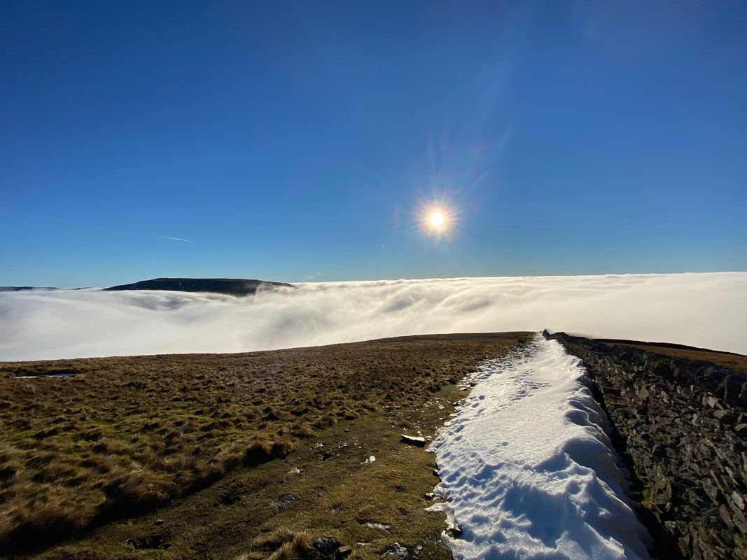
Wispy cloud over Great Rigg as we continue our descent
Just nothing out there but cloud
Snow time like the present for a good old arse about eh Fudge?
Looking back to Fairfield from near Great Rigg
Just like that the third Fogbow of the day appeared - if we hadn't looked back we would have missed it.
Not wanting to be left out, Fudge got into the act and had his own Doggy Brocken Spectre .................
....... as did Angie & I
The summit of Great Rigg
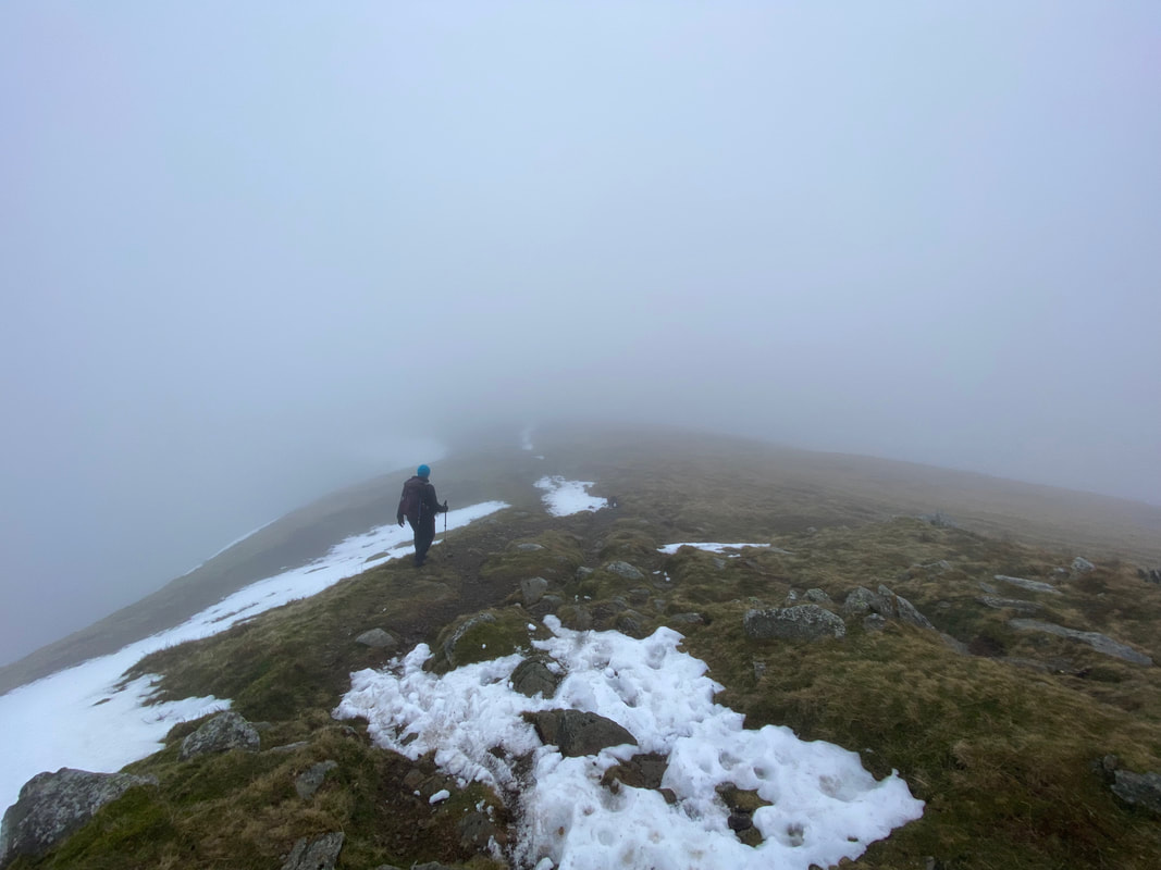
Heading into the cloud as we descend to Heron Pike North Top. From now on in there would only be pictures of the remaining summits as there was literally nothing else to see.
The summit of Heron Pike North Top (Rydal Fell)
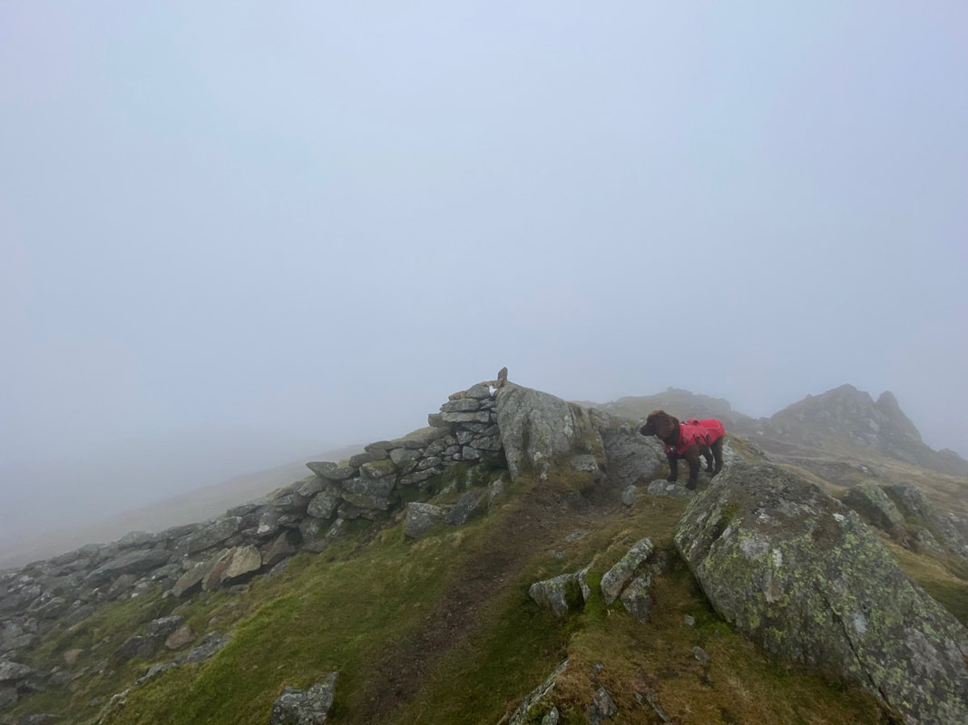
The summit of Heron Pike
The summit of Nab Scar
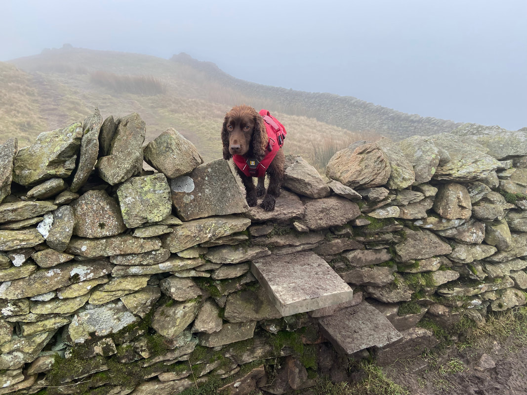
Who's a clever boy then?

Rydal Water below. The larger of the two islands is Heron Island and the smaller one is Little Isle.
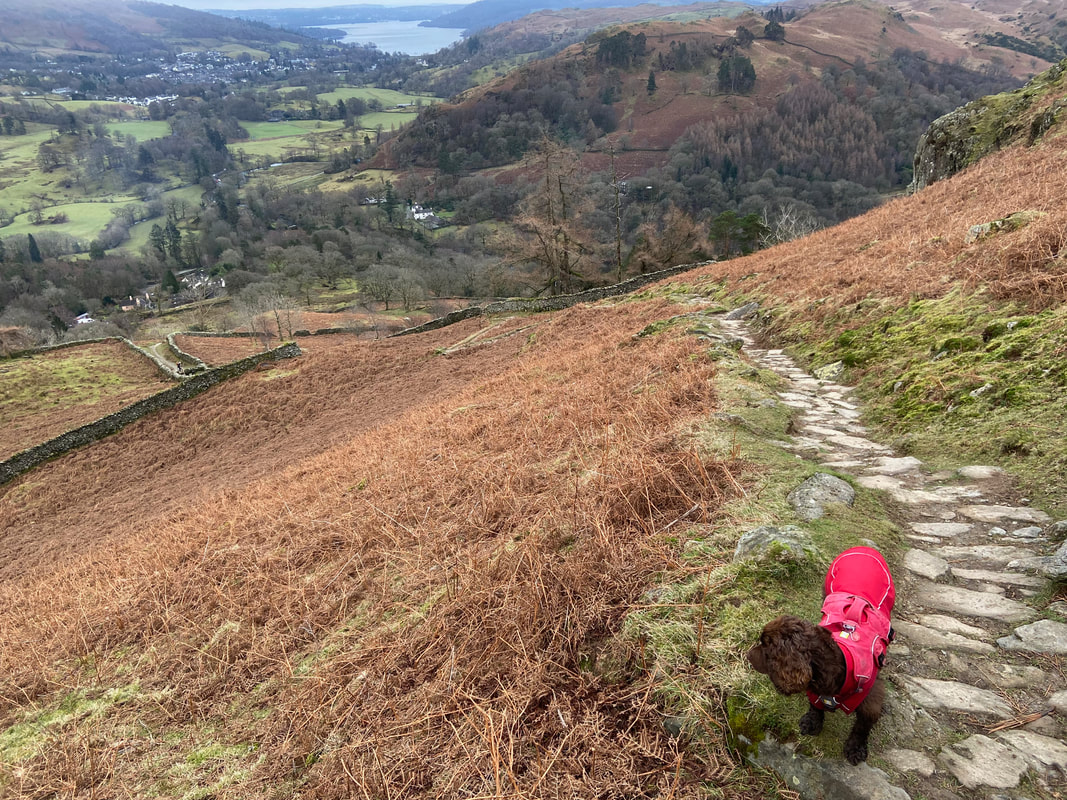
Be prepared - the descent from Nab Scar to the valley floor is extremely steep and goes on a bit!
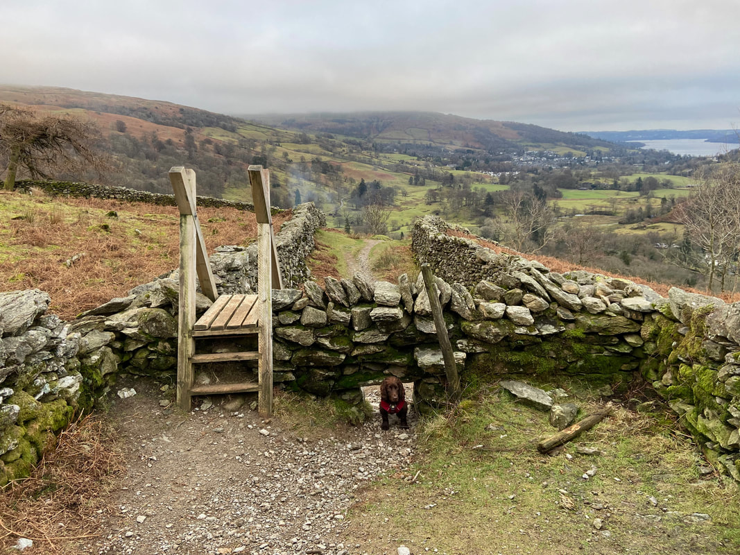
It is almost as if he is saying - "I'd like to see you two get through this"
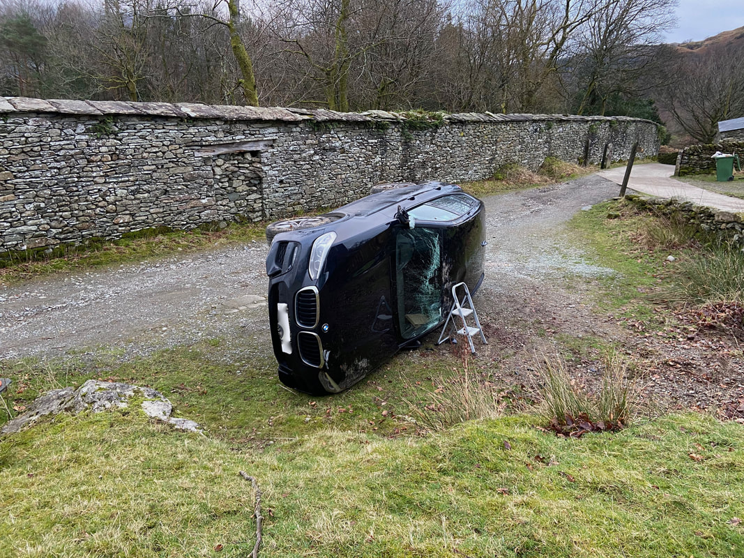
Whoops!
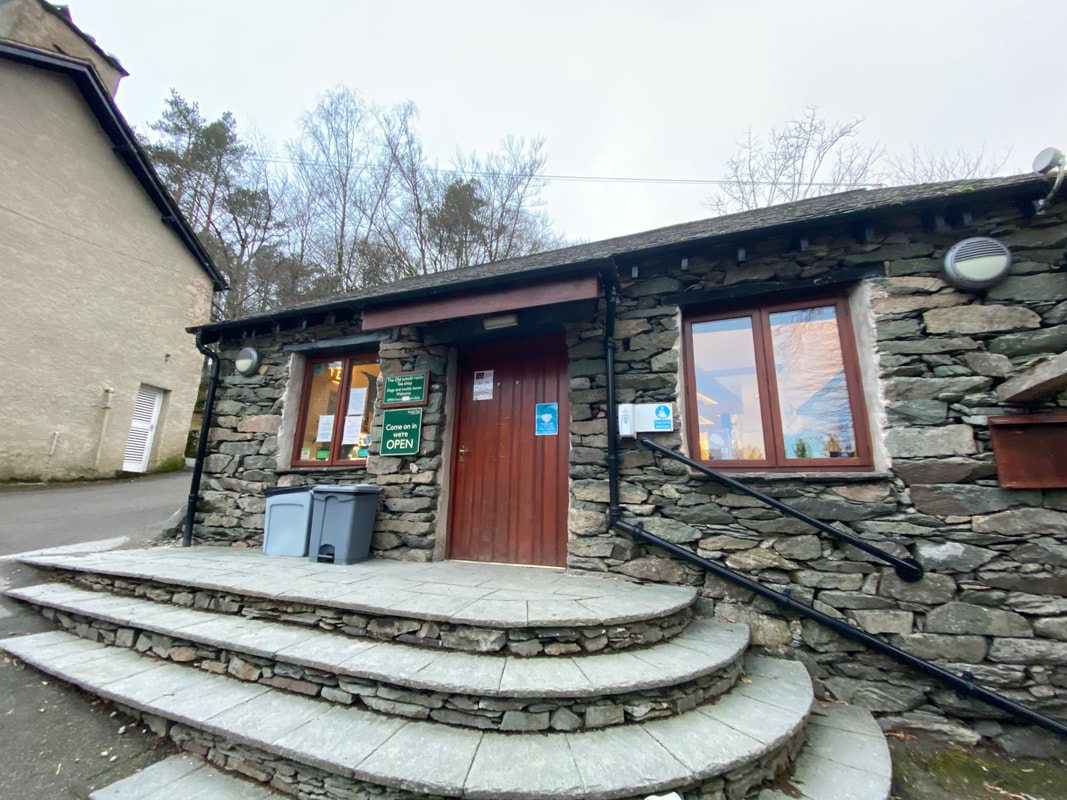
The Old School Room Tea Shop at Rydal Hall - whilst the Hot Chocolate was good, it was unfortunately a tad pricey.
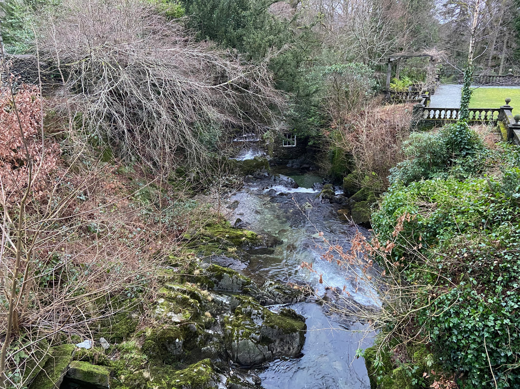
The Grot & Waterfall at Rydal Hall.
The Grot is a Grade II listed building built in 1688 to provide a window to frame and enjoy the view of the lower Rydal Beck Waterfall. The building was restored & repaired between 2005 & 2007 thanks to The Friends of the Lake District and other organisations.
The Grot is a Grade II listed building built in 1688 to provide a window to frame and enjoy the view of the lower Rydal Beck Waterfall. The building was restored & repaired between 2005 & 2007 thanks to The Friends of the Lake District and other organisations.
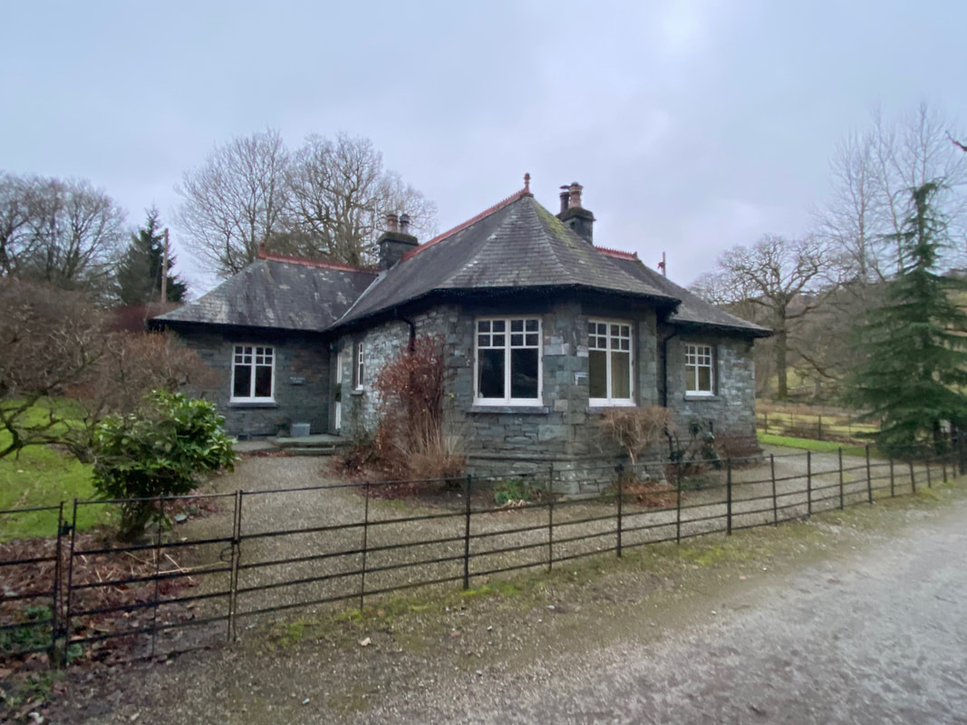
Park Gates Lodge which is at the exit from Rydal Park. The lodge is situated on the A591 just outside Ambleside and used to be a very sought after holiday let but is now a private residence. To return to Ambleside exit the lodge gates, cross the road and turn left.
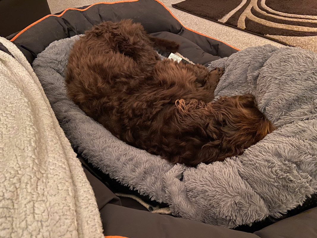
Another good day for the Fellwalking Fudgemeister