Glyder Fach - Tuesday 9 April 2019
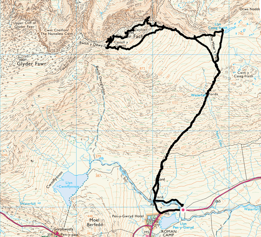
Route
Pen-y-Gwryd - The Miner's Track - Cantilever Stone - Glyder Fach - Castell y Gwynt - The Miner's Track - Pen-y-Gwryd
Parking
Verge Parking on the A498 about a quarter of a mile east of the Pen-y-Gwryd Hotel which is on the junction of the A498 & A4086 (Pay & Display). There is parking available on both sides of the road. The Grid Ref is SH664560 and the nearest postcode is LL55 4NT.
Mileage
7 miles
Terrain
Well trodden mountain paths with some bouldery sections up on The Glyders. To attain the summit of Glyder Fach requires some scrambling over large boulders.
Weather
Mostly overcast however we did get some sunny periods in the latter stages of the walk on the Glyder ridge. The visibility was generally good.
Time Taken
5hrs 45mins
Total Ascent
2368ft (722m)
Map
OL17 - Snowdon & The Conwy Valley
Walkers
Dave, Angie & Fudge
|
GPX File
|
| ||
If the above GPX file fails to download or presents itself as an XML file once downloaded then please feel free to contact me and I will send you the GPX file via e-mail.
Route Map
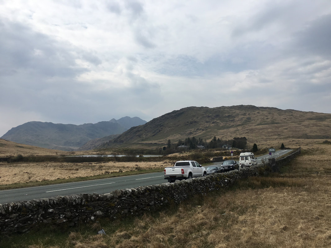
Looks a bit glum today as we leave the parking area near The Pen y Gwryd Hotel.
Moel Berfedd sits above the hotel with Y Lliwedd & Gallt y Wenallt to the left
Moel Berfedd sits above the hotel with Y Lliwedd & Gallt y Wenallt to the left
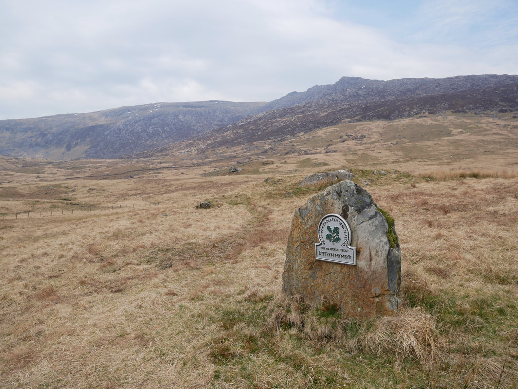
The National Trust sign of Dyffryn Mymbyr.
The valley stretches right along the A498 from Pen y Gwryd in the west to Capel Curig in the east.
The valley stretches right along the A498 from Pen y Gwryd in the west to Capel Curig in the east.
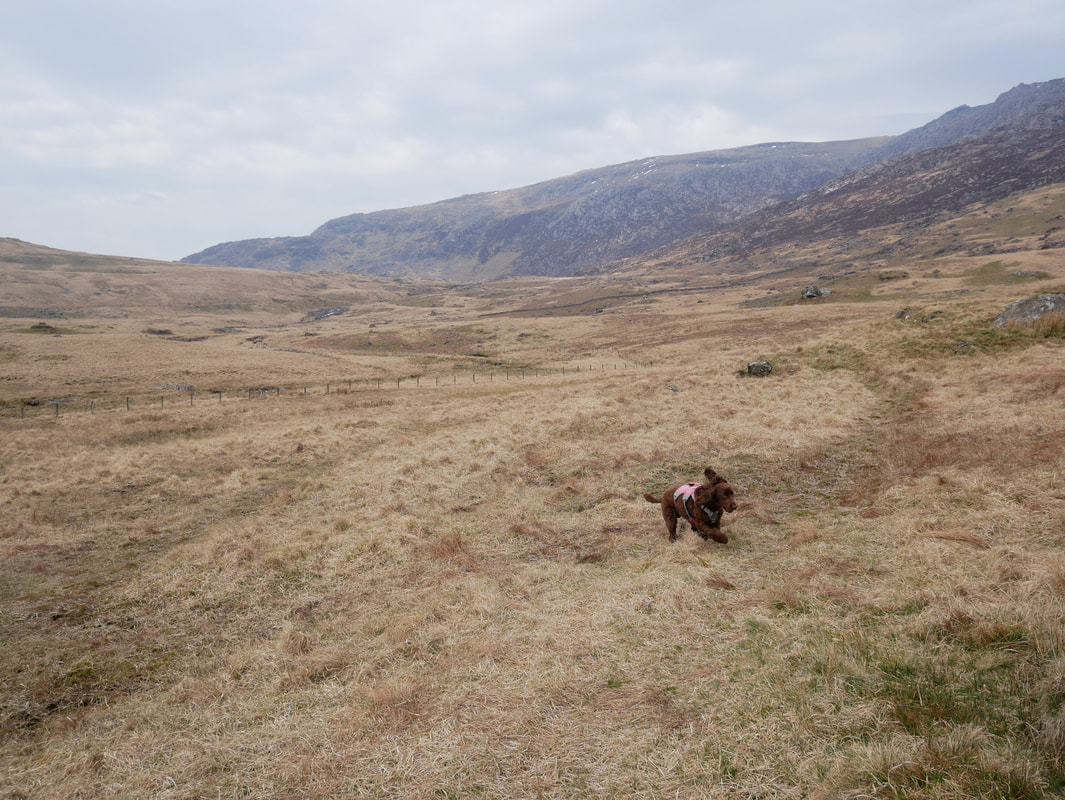
With the weather a bit ropey this morning we held off until early afternoon in order to start the walk today.
As can be seen here, Fudge was keen to crack on & mess about having spent the morning cooped up in the Caravan
As can be seen here, Fudge was keen to crack on & mess about having spent the morning cooped up in the Caravan
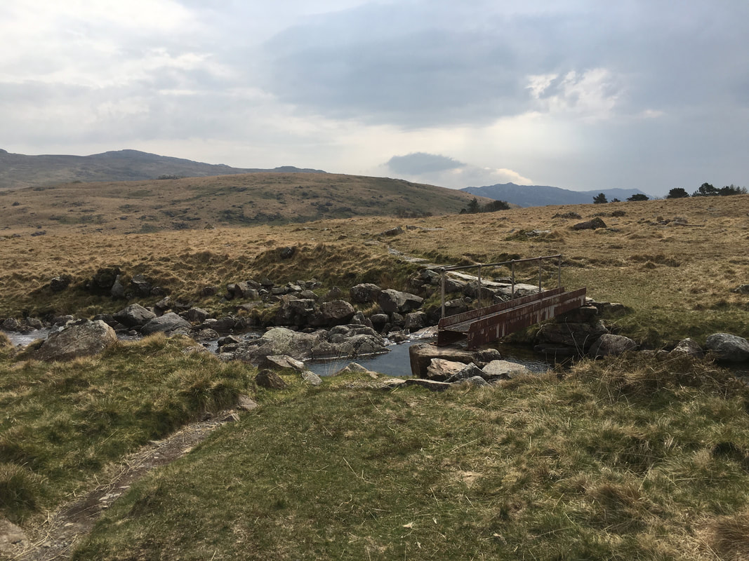
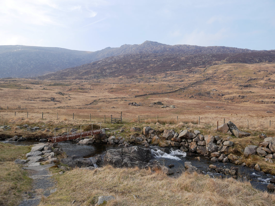
A small metal footbridge crosses the Nant Gwryd as we head out to join The Miner's Track
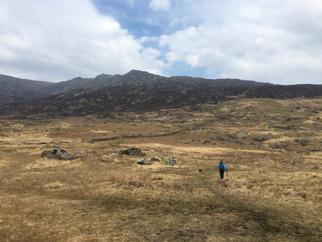
The rugged slopes of Glyder Fach are ahead as we begin the climb up The Miner's Track
As height is gained the full extent of the Snowdon range is revealed - left to right are Galt y Wenallt, Y Lliwedd, Snowdon, Crib Goch & Garnedd Ugain.
Llyn Pen y Gwryd is the left with Llyn Gwynant peeking out in the far distance. The Llyn to the right is Cwmffynnon.
Llyn Pen y Gwryd is the left with Llyn Gwynant peeking out in the far distance. The Llyn to the right is Cwmffynnon.
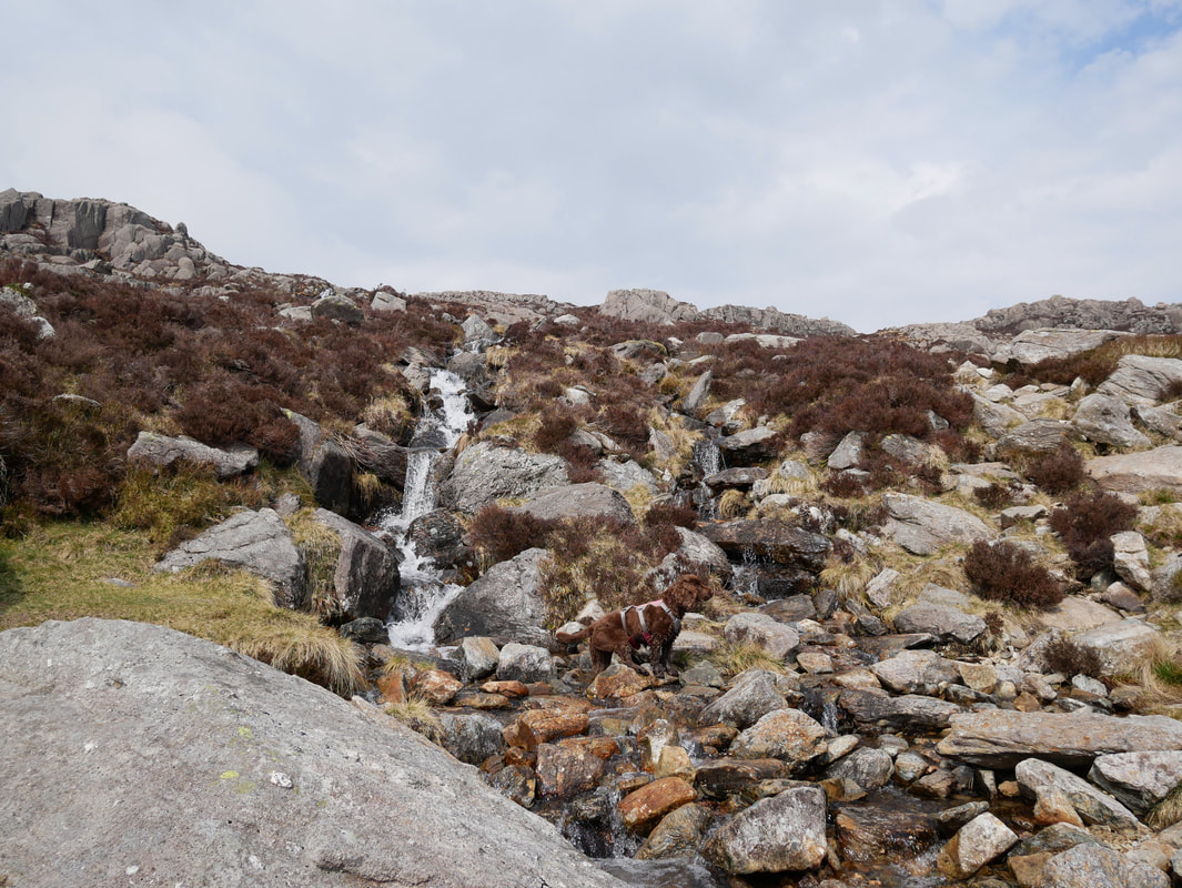
As the path gained in height we passed lots of small cascading waterfalls which Fudge loved
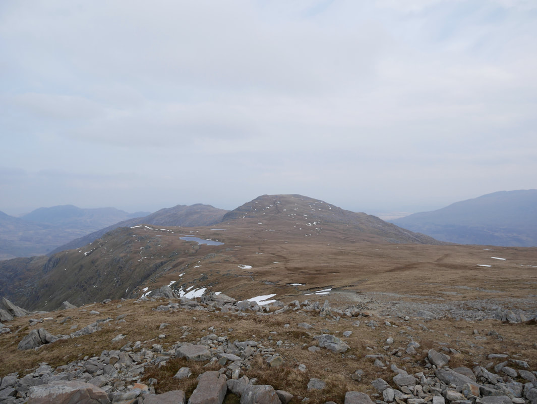
Moel Siabod
With the steepness relenting we reached the rocky crags of Cwm y Caseg-Fraith
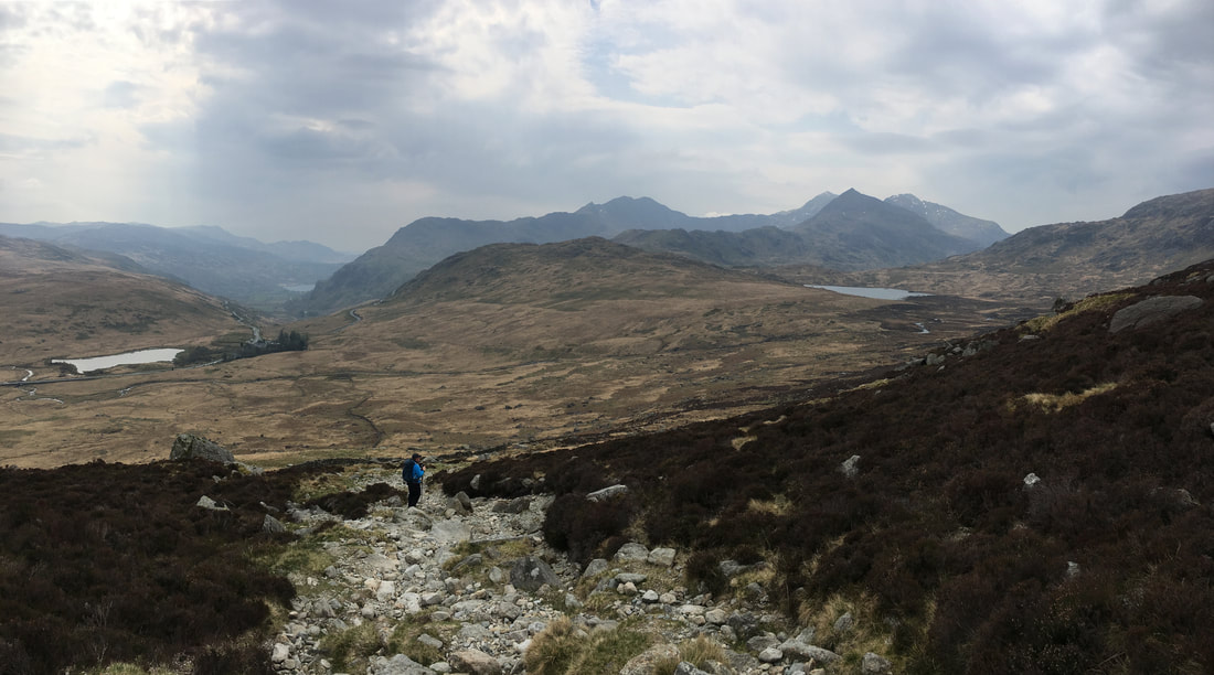
The crossroads of paths at the top of The Miner's Track.
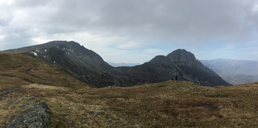
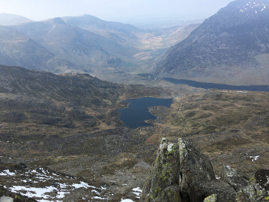
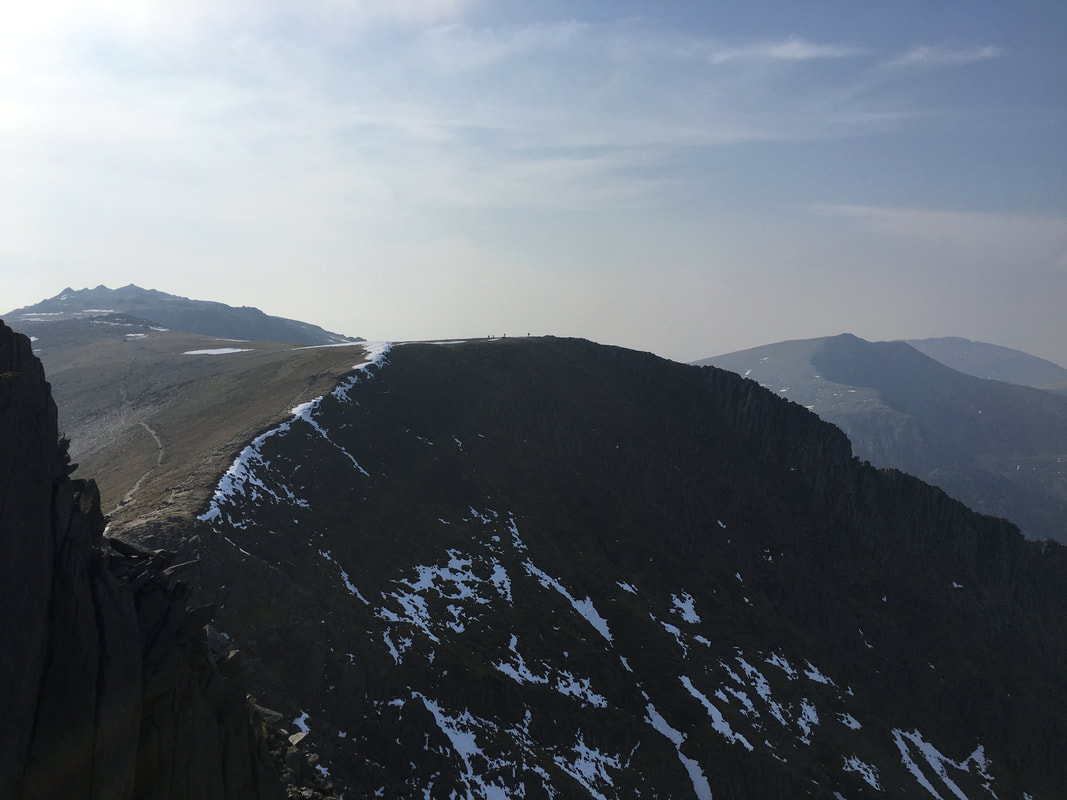
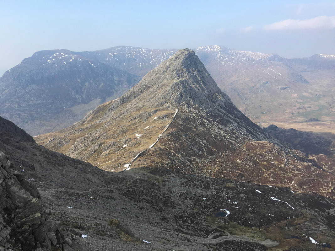
We would be heading left here to Glyder Fach which can be seen ahead with the serrated edge of Bristly Ridge to its right. In the centre of shot is Bwlch Tryfan with Tryfan itself to the right. At the very back right are the mountains of The Carneddau.
We would be heading left here to Glyder Fach which can be seen ahead with the serrated edge of Bristly Ridge to its right. In the centre of shot is Bwlch Tryfan with Tryfan itself to the right. At the very back right are the mountains of The Carneddau.
Beginning the gradual ascent of Glyder Fach looking back to our outward route which is to the right.
The body of water to the left is Llyn Caseg-fraith with Y Foel Goch centre. In the far distance is Gallt yr Ogof.
The body of water to the left is Llyn Caseg-fraith with Y Foel Goch centre. In the far distance is Gallt yr Ogof.
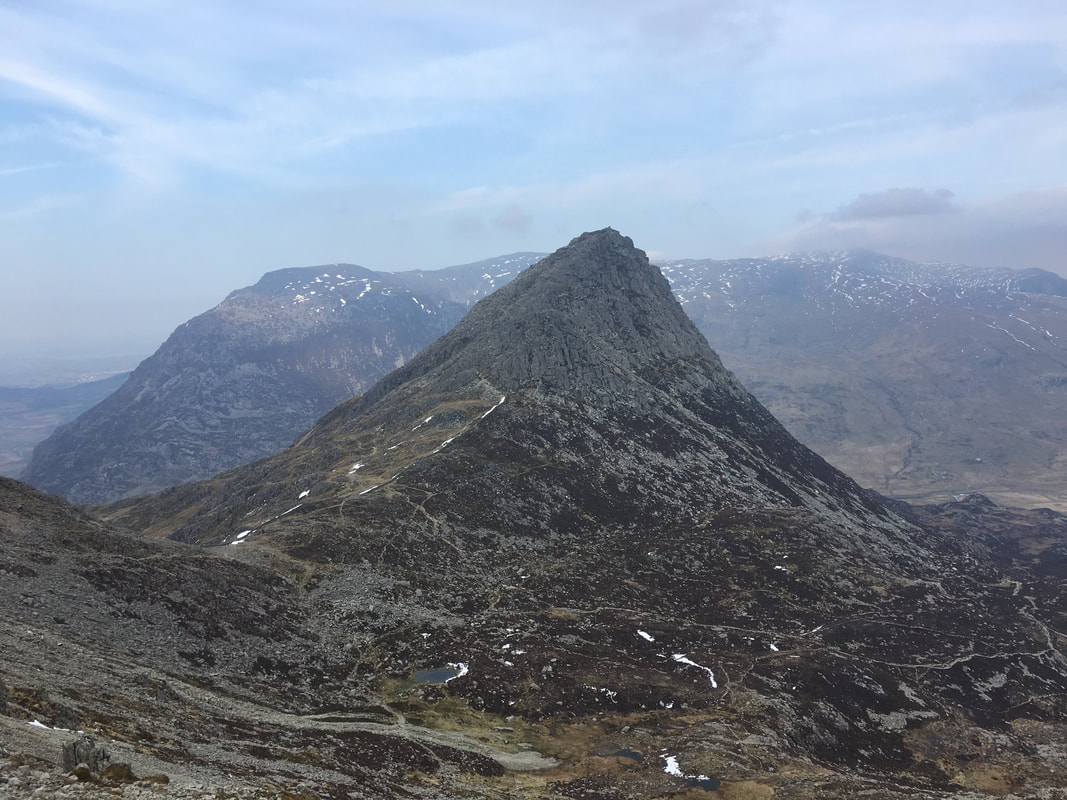
One of my favourite mountains to climb - the majestic Tryfan
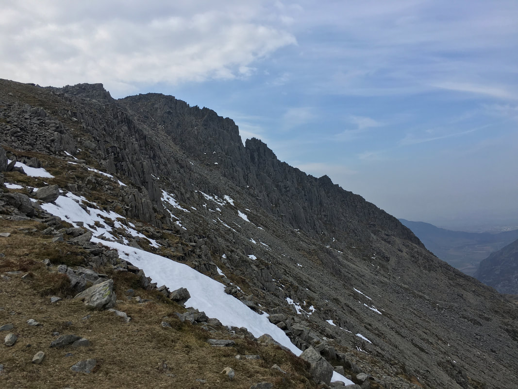
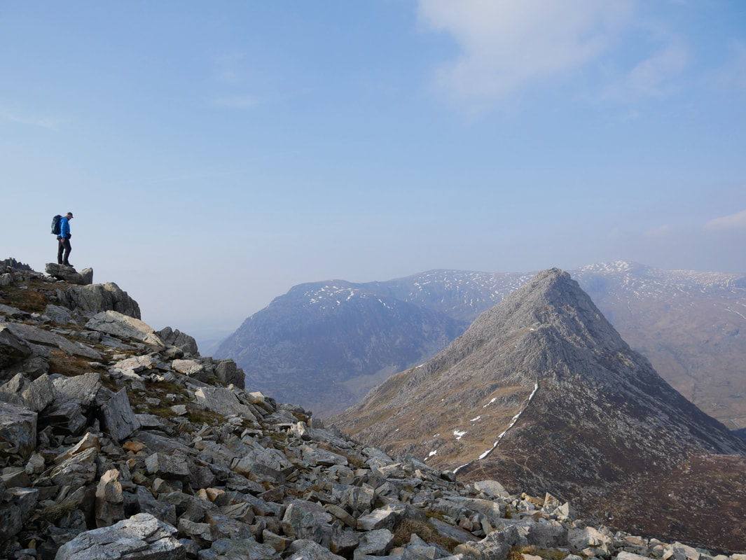
A closer look at Bristly Ridge

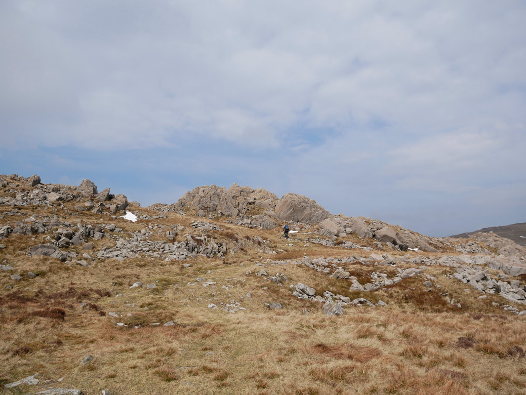
As height is gained the terrain to Glyder Fach becomes quite bouldery
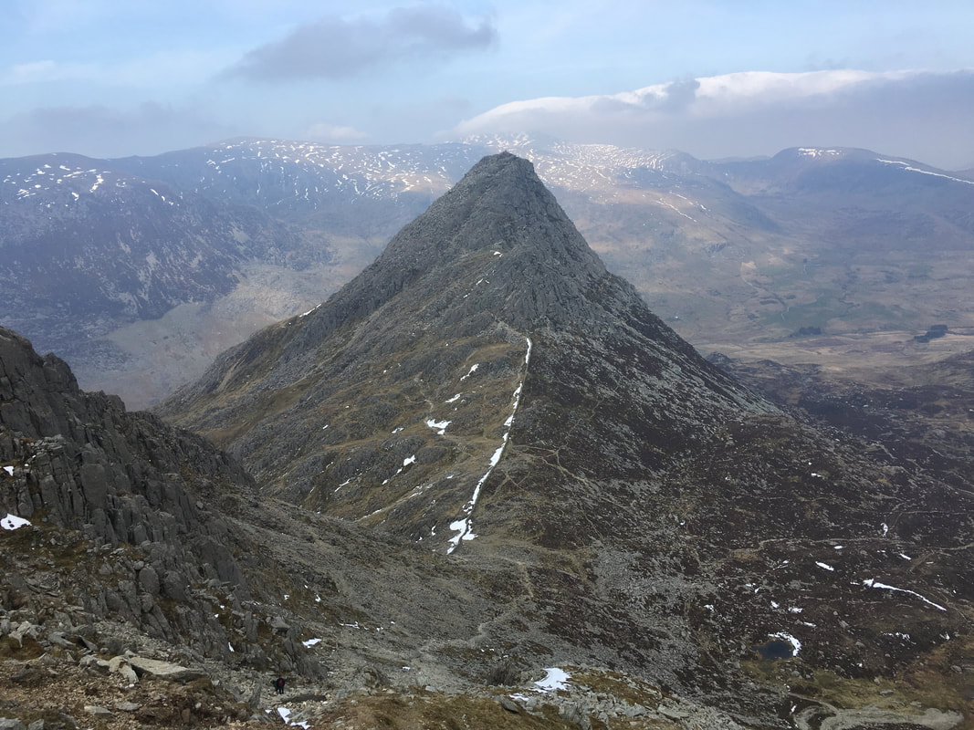
Another look over to Tryfan with Bwlch Tryfan below and the Bristly Ridge ascent to the left
At the top of Bristly Ridge
Looking down the A5 to the valley of Nant Ffrancon leading to Bethesda.
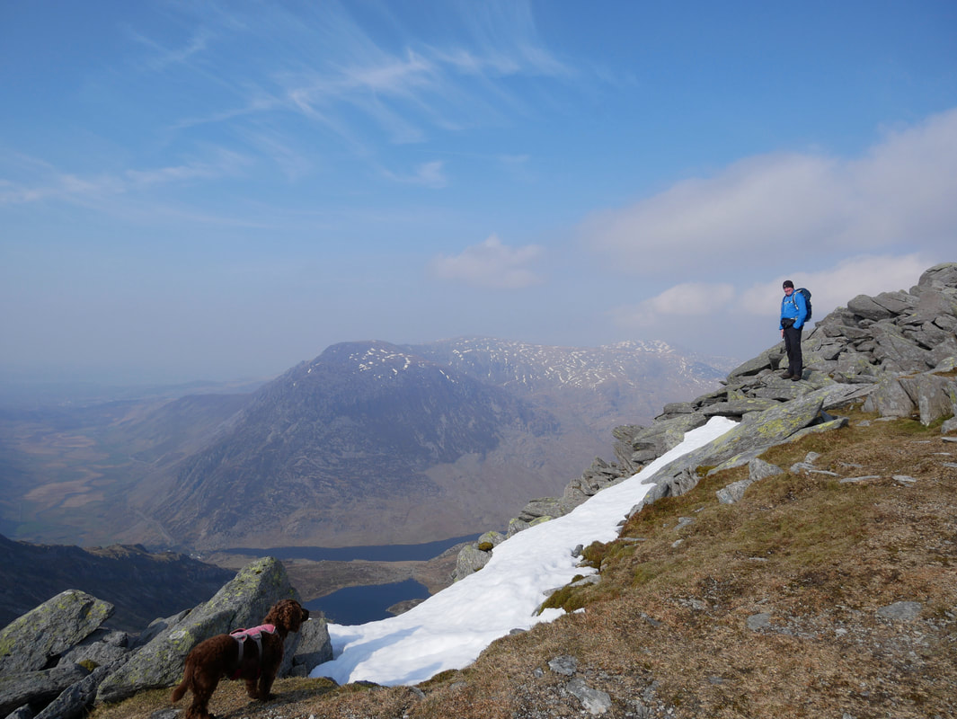
Llyn Bochlwyd is ahead with Llyn Ogwen to the right. To the left are Foel-goch, Mynydd Perfedd & Carnedd y Filiast
Llyn Bochlwyd is ahead with Llyn Ogwen to the right. To the left are Foel-goch, Mynydd Perfedd & Carnedd y Filiast
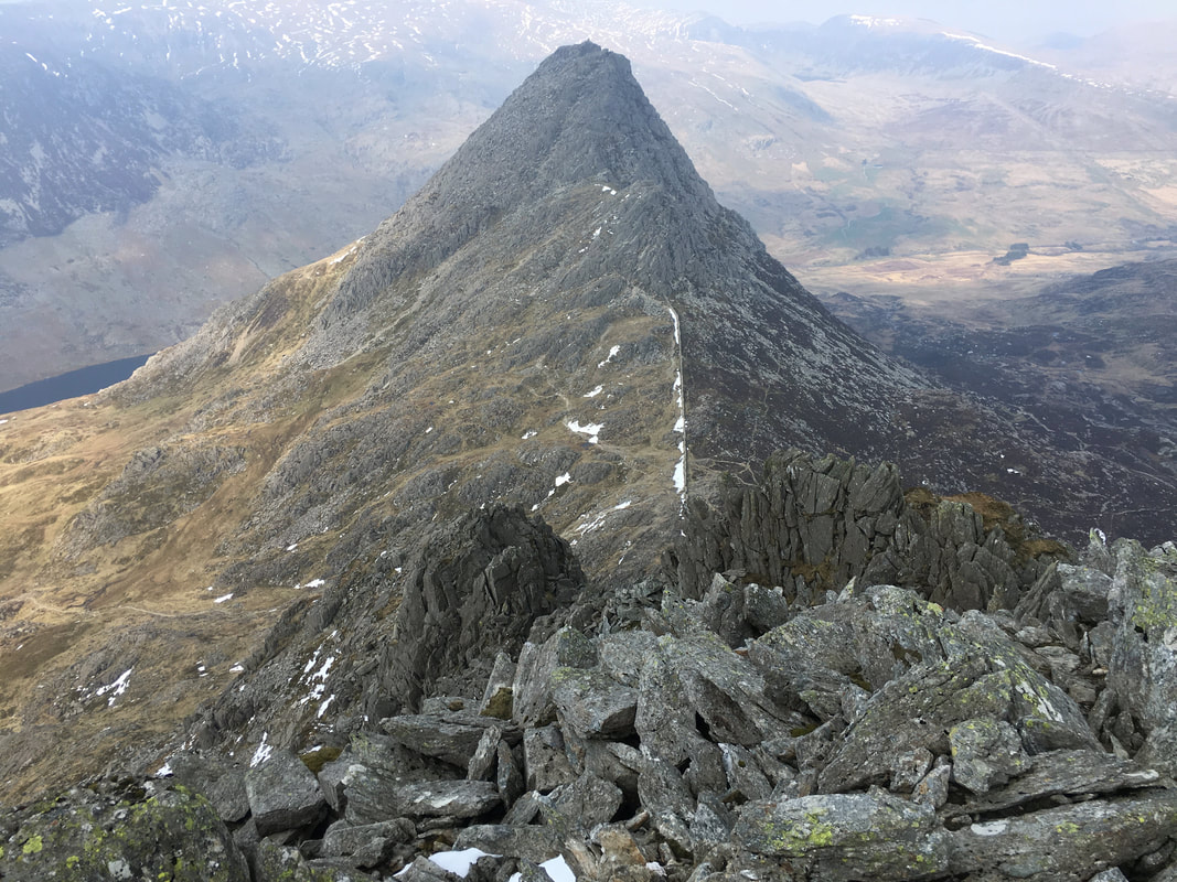
Looking down Bristly Ridge to Tryfan
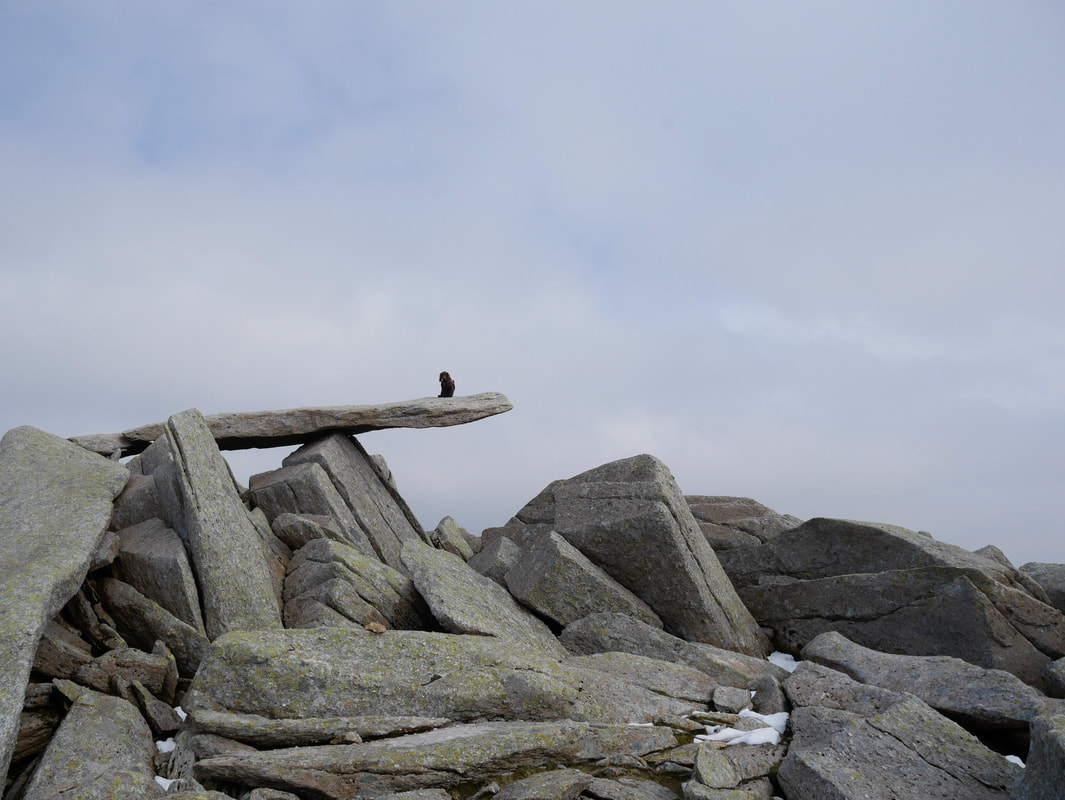
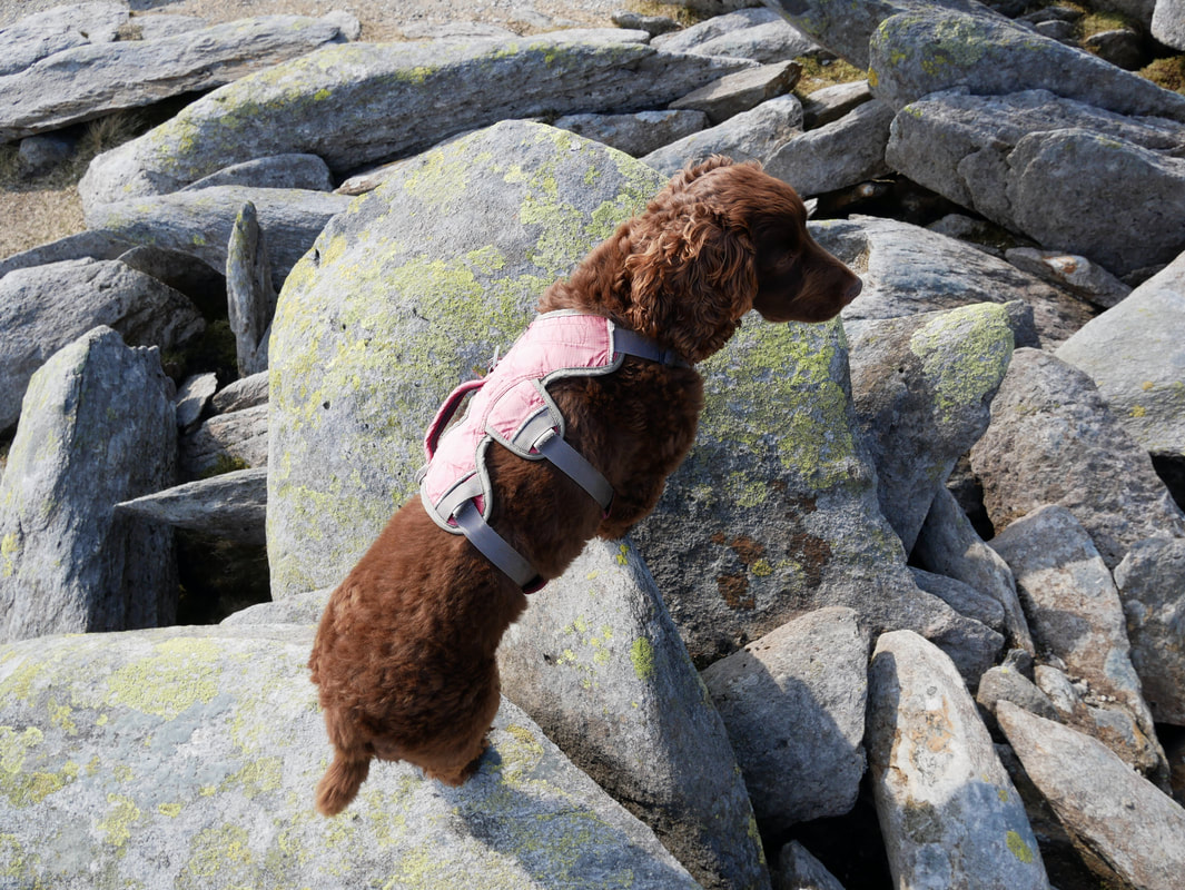
Fudge on the Cantilever Stone near then summit of Glyder Fach
The Cantilever Stone can be found at Grid Reference SH657583 although once on the summit plateau you cannot really miss it to be honest.
The Cantilever Stone (& Castell y Gwynt) featured in Walt Disney's 1981 film "Dragonslayer"
The Cantilever Stone can be found at Grid Reference SH657583 although once on the summit plateau you cannot really miss it to be honest.
The Cantilever Stone (& Castell y Gwynt) featured in Walt Disney's 1981 film "Dragonslayer"
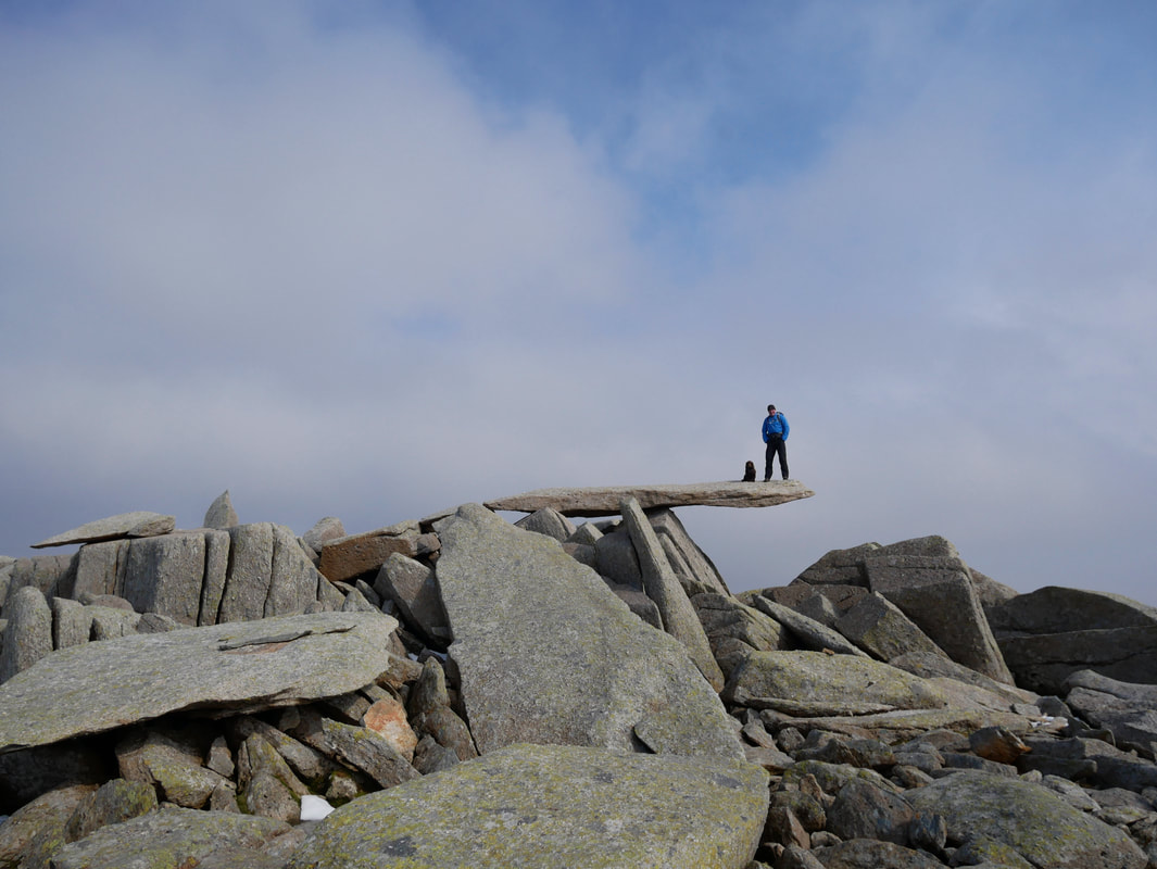
With Fudge on The Cantilever Stone - there is no truth in the rumour that the stone "wobbled" when I joined Fudge up there!!
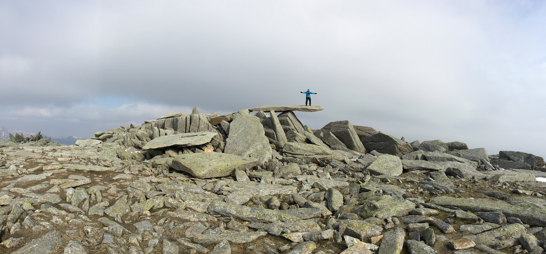
A panorama of Angie on The Cantilever Stone
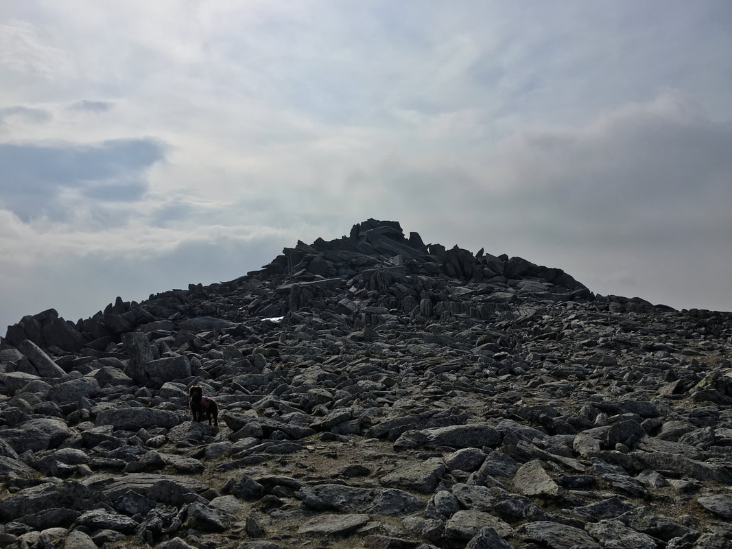
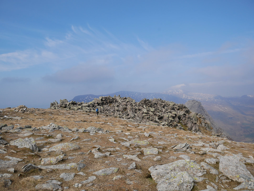
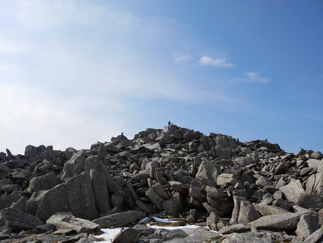
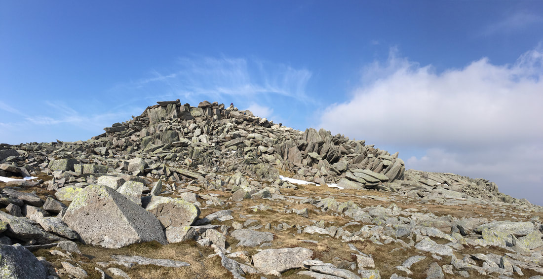
The approach to Glyder Fach's extremely rocky summit
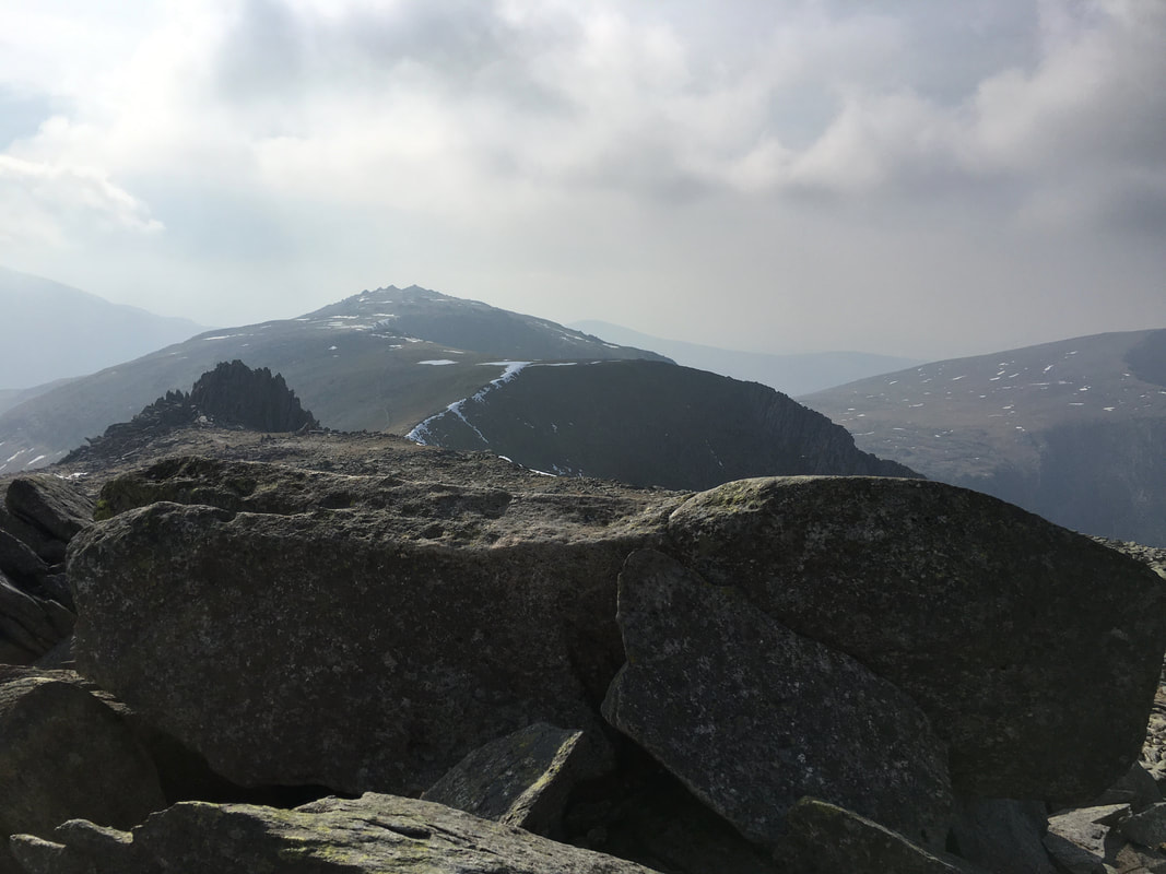
The summit of Glyder Fach looking to the shattered rocks of Castell y Gwynt and Glyder Fawr.
The slopes of Y Garn can be seen to the right.
The slopes of Y Garn can be seen to the right.
With Fudge on the summit of Glyder Fach - 3261ft above sea level
Another view of the summit of Glyder Fach
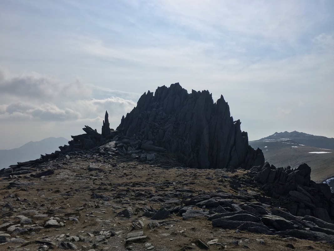
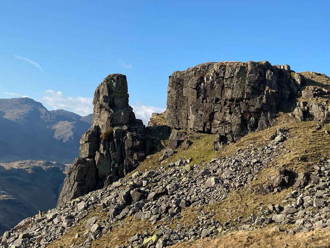
Castell y Gwynt (Castle in the Wind)
These shards of shattered rock are an amazing sight and are just a few yards from the summit of Glyder Fach
These shards of shattered rock are an amazing sight and are just a few yards from the summit of Glyder Fach
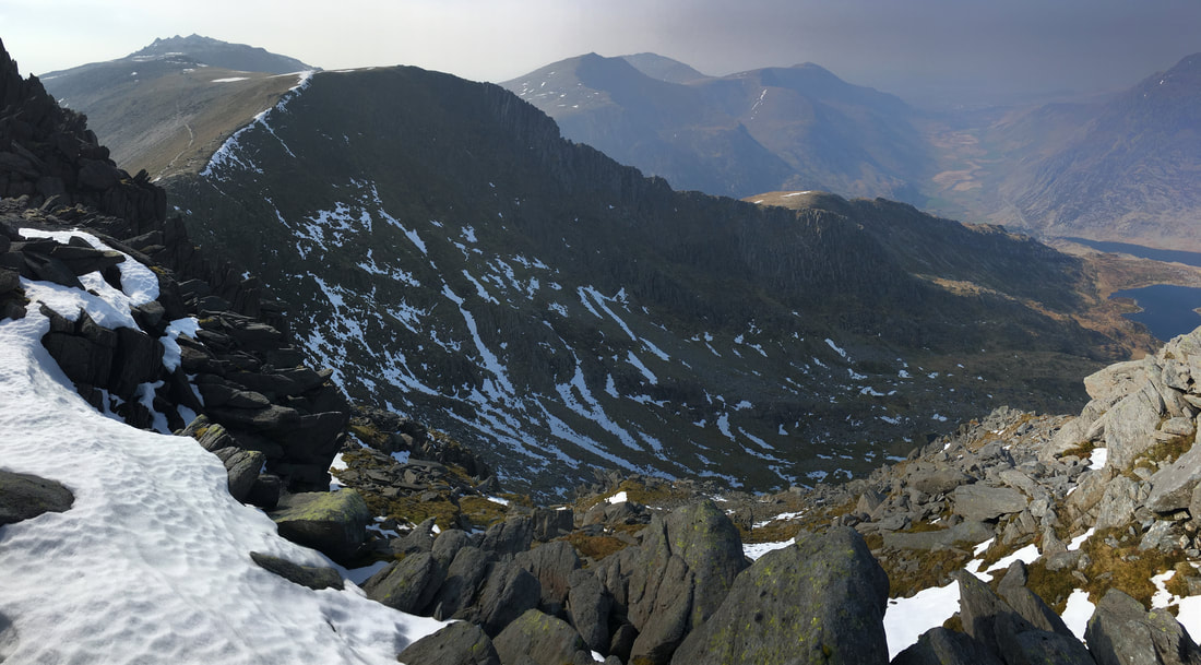
Looking into Cwm Bochlwyd with Y Gribin ridge and Glyder Fawr to the left
Looking to Pen yr Ole Wen and The Carneddau across Llyn Ogwen
The Crag Rat was having a great day out today
Ants on the top of the Y Gribin ridge
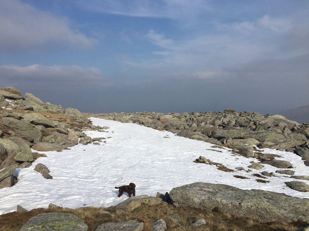
Fudge had been itching to arse about in the snow all day.
This was the first of the white stuff we had come across that was safe enough for him to play in.
This was the first of the white stuff we had come across that was safe enough for him to play in.
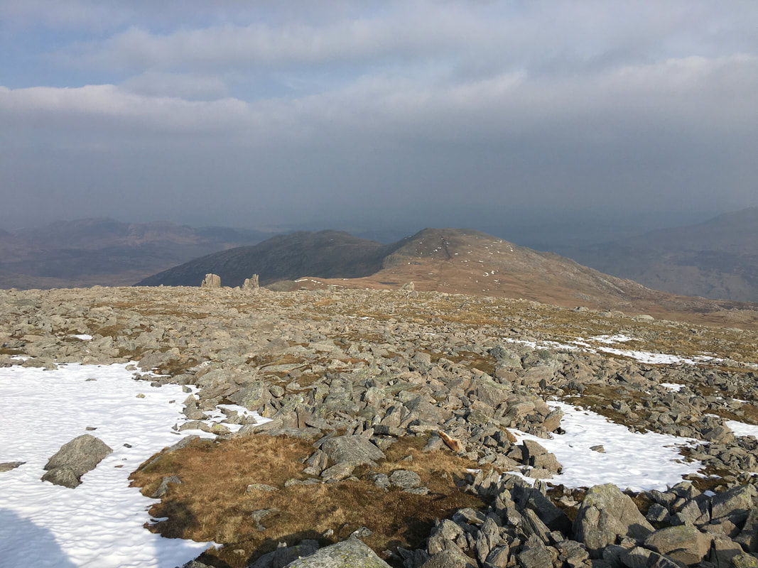
From Castell y Gwynt we headed around to the south of Glyder Fach to rejoin our outward route
It was a bit brighter on our way back therefore could not help taking another picture of the mighty Tryfan
It doesn't get much better than this
Heading back on The Miners Track towards the crags of Cwm y Caseg-Fraith
Crossing the iron footbridge once more on our way back after a cracking day out
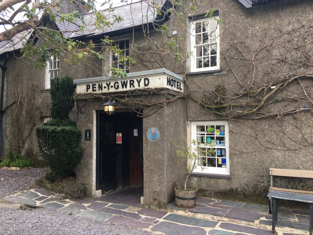
Before we left for Llanrwst we popped into the Pen y Gwryd Hotel for a swift half - we had never been in here before.
To me the place is an acquired taste and a trifle odd but served its purpose. It has an interesting interior - mainly because of its history when it was used as a training base for the 1953 Everest Expedition. The hotel contains a lot of memorabilia in the various rooms.
To me the place is an acquired taste and a trifle odd but served its purpose. It has an interesting interior - mainly because of its history when it was used as a training base for the 1953 Everest Expedition. The hotel contains a lot of memorabilia in the various rooms.
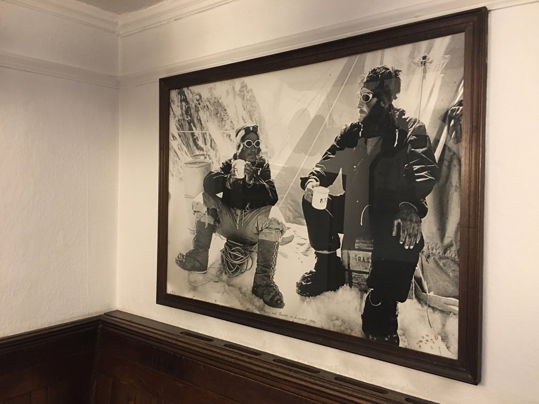
A fascinating picture in the Main Bar of the Pen y Gwryd Hotel - Edmund Hillary & Tenzing Norgay during the 1953 first ascent of Everest