The Cleveland Way & Tabular Hills - 6 to 22 June 2018
The Cleveland Way
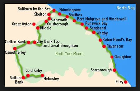
Established as a National Trail in 1969, The Cleveland Way essentially wraps itself around most of the North York Moors National Park. At 109 miles it may not be classed as a true test of stamina but it is both an interesting and a beautiful path. Starting in Helmsley on the south western edge of the National Park, it passes through two very distinct types of landscape. Firstly it traverses classic moorland scenery, through forests and along escarpments giving the walker panoramic views over the Cleveland Hills and the rest of the National Park. The other half of the route, from Saltburn-by-the-Sea to Filey, follows a dramatic coastline and runs along the top of some of the highest sea cliffs in the country.
The Tabular Hills
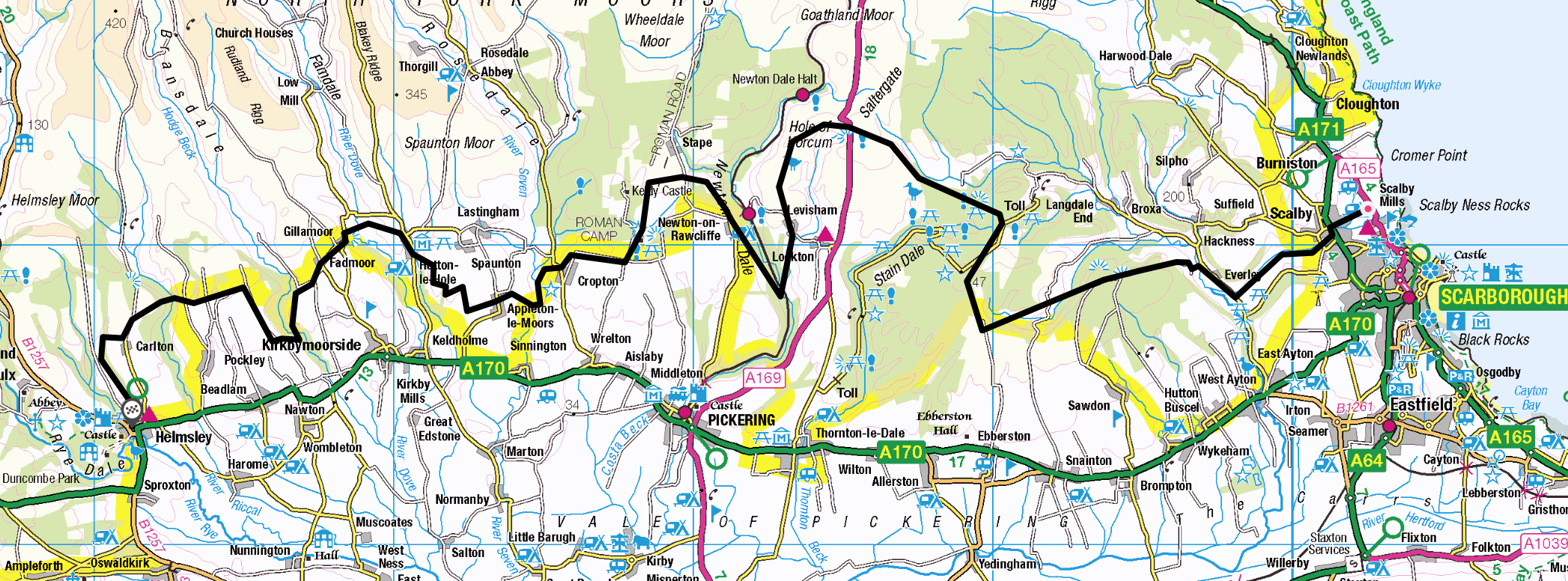
In order to link the completion of the Cleveland Way at Filey and return us safely to our car near Helmsley, we decided to add on the Tabular Hills walk. The route stretches along the southern part of the North York Moors National Park and the name is derived from the land rising from south to north and is cut by a series of dales that leave 'tabular' or 'table like' uplands between them. The idea to link the start of the walk at Scalby Mills just north of Scarborough back to Helmsley originated in 1974 and was first walked the following year. It provides the 'missing link' to enable a full circuit of the National Park to be undertaken but more importantly is recognised as a regional trail therefore ensuring its upkeep by the North York Moors National Park Authority.
(Links to each individual day are below however just click on "Itinerary" to start the story of the walk)

