Grasmoor, Crag Hill, Sail & Outerside - Thursday 8 December 2022
Route
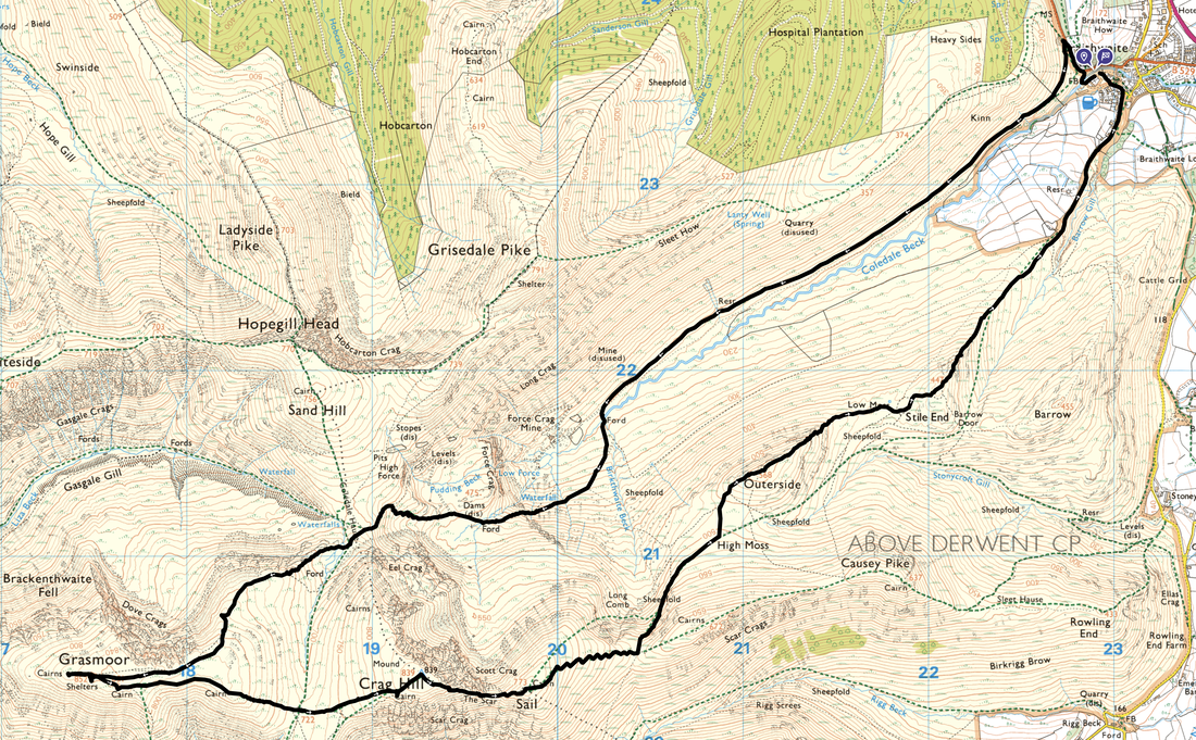
Braithwaite - Force Crag Mine Road - Force Crag Mine - Coledale Hause - Dove Crags - Grasmoor - Crag Hill - The Scar - Sail - High Moss - Outerside - Low Moss - Stile End - Braithwaite
Parking
Plenty of options for parking in Braithwaite. We parked to the left of Braithwaite Chapel (Grid Ref NY 229236, nearest postcode CA12 5TL) just a few hundred yards from The Coledale Inn. Please park sensibly in the parking area to the left of the church in the designated section and not on grass verges.
Mileage
10.1 miles
Terrain
Good mountain paths & access tracks
Weather
Mixed conditions - extremely cold and icy with snow on Grasmoor's summit plateau. Sunny in the morning turning overcast in the afternoon.
Time Taken
6hrs 20mins
Total Ascent
3300ft (1005m)
Wainwrights
4
Map
OL4 - The English Lakes (North Western Area)
Walkers
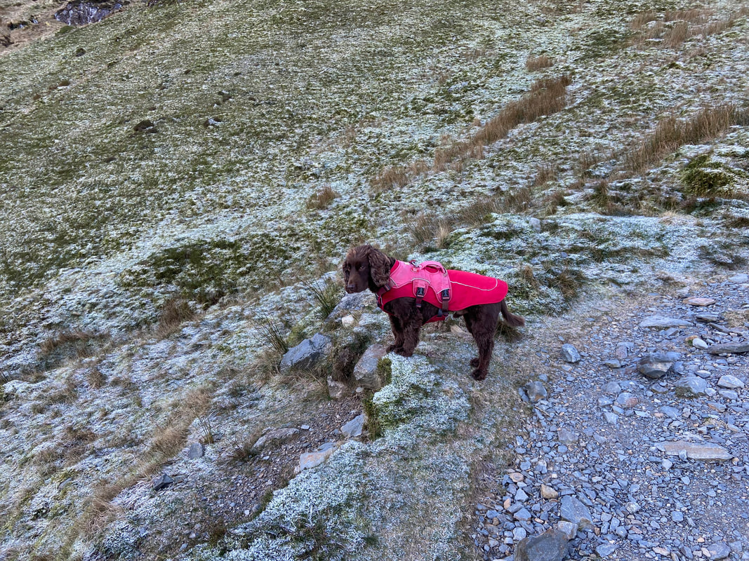
Dave, Angie & Fudge with Nicky Oliver
Braithwaite - Force Crag Mine Road - Force Crag Mine - Coledale Hause - Dove Crags - Grasmoor - Crag Hill - The Scar - Sail - High Moss - Outerside - Low Moss - Stile End - Braithwaite
Parking
Plenty of options for parking in Braithwaite. We parked to the left of Braithwaite Chapel (Grid Ref NY 229236, nearest postcode CA12 5TL) just a few hundred yards from The Coledale Inn. Please park sensibly in the parking area to the left of the church in the designated section and not on grass verges.
Mileage
10.1 miles
Terrain
Good mountain paths & access tracks
Weather
Mixed conditions - extremely cold and icy with snow on Grasmoor's summit plateau. Sunny in the morning turning overcast in the afternoon.
Time Taken
6hrs 20mins
Total Ascent
3300ft (1005m)
Wainwrights
4
Map
OL4 - The English Lakes (North Western Area)
Walkers
Dave, Angie & Fudge with Nicky Oliver
|
GPX File
|
| ||
If the above GPX file fails to download or presents itself as an XML file once downloaded then please feel free to contact me and I will send you the GPX file via e-mail.
Route Map
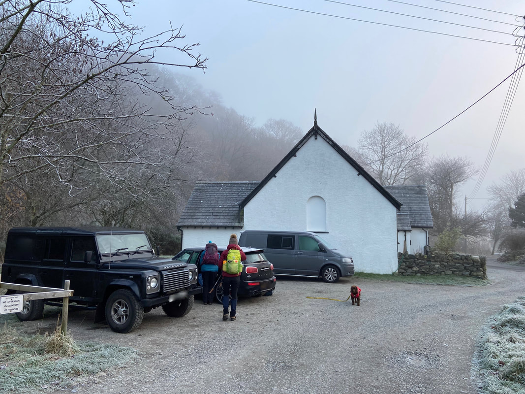
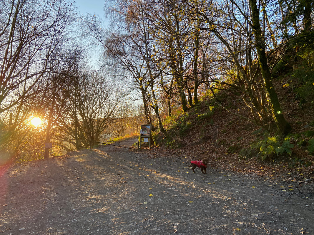
The parking area next to the Old Methodist Chapel in Braithwaite. In 2017 the Orthodox Church of St Bega, St Mungo and St Herbert purchased the chapel. Fudge gives me his "why is that prat taking a photograph of a Car Park" look.
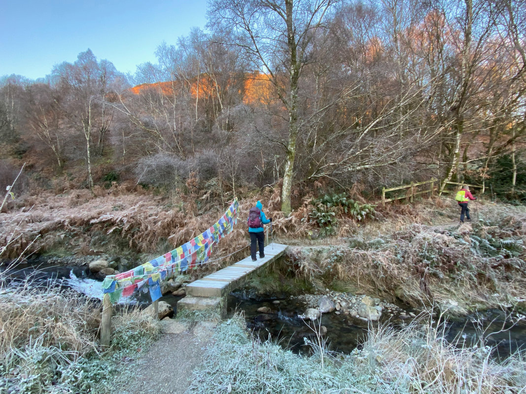
A short distance south west from the Car Park the route crosses a bridge over Coledale Beck
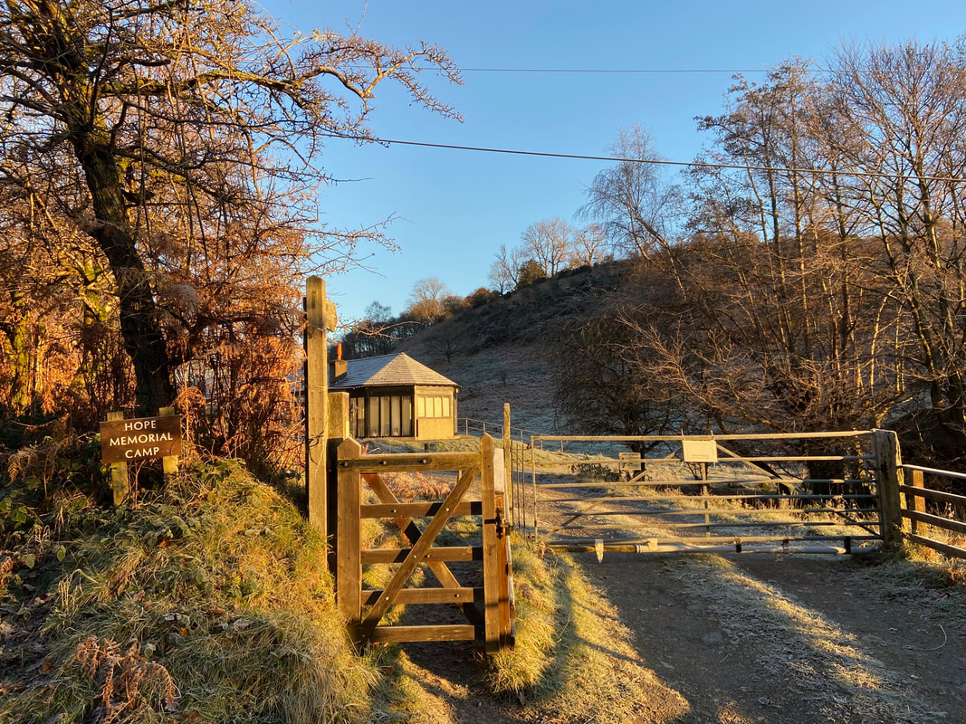
From the bridge over Coledale Beck the path leads to the B5292 and heads uphill along the road. Just before leaving the B5292 on the right hand side of the road is the Hope Memorial Camp, a residential centre used throughout the year by youth groups from all over the country. The camp was the brain-child of Mr A H Hope, Headmaster of The Roan School, Greenwich (now The John Roan School) from 1916 to 1930. In 1923, with his own money, Hope bought forty acres of land to the north-west of the village and built four huts on it, to provide his South London grammar school boys with 'an opportunity of seeing mountains and lakes and of having the valuable experience of camping and living at close quarters with others.' With the aid of The Roan Foundation, the original green and white painted wooden structures were replaced in 1989 by more substantial ones using modern building materials.
Just past the Hope Memorial Camp the route leaves the B5292 on the left hand side to head through a small Car Park to join the Force Crag Mine Road which is reached through the gate ahead.
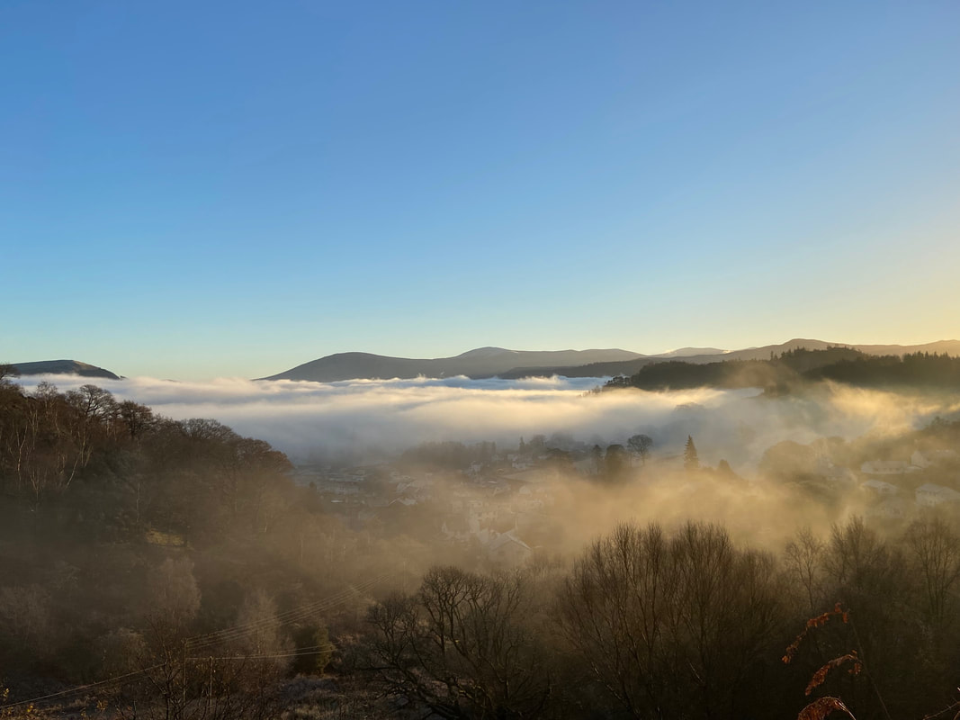
Once on the Mine Road we were treated to a temperature inversion.
A temperature inversion is where temperature increases with height. The lowest part of our atmosphere is the troposphere, which can extend to heights of 16 km and is where most of the weather happens. It is also a section of the atmosphere where the temperature typically gets lower the higher up you go, for example, when you climb a mountain it is often colder at the top. However, sometimes a small layer can form where the temperature increases with height. This layer is called an inversion. This often happens in areas of high pressure, where the air high up sinks towards the ground. As it falls, it dries out and warms up. This warm layer of air can act as a lid and trap cooler air near the surface (this is because warm air is more buoyant than cold air, and so it will tend to 'float' above the colder air, trapping it). This gives us the inversion, because if you were now to climb the mountain it would get warmer as you got to the top. This is inverted compared to what you would normally expect, hence the term 'inversion'. Inversions are most common in winter when mist and fog become trapped in the cooler air low down, but inversions can happen all year round. (Source - Met Office)
A temperature inversion is where temperature increases with height. The lowest part of our atmosphere is the troposphere, which can extend to heights of 16 km and is where most of the weather happens. It is also a section of the atmosphere where the temperature typically gets lower the higher up you go, for example, when you climb a mountain it is often colder at the top. However, sometimes a small layer can form where the temperature increases with height. This layer is called an inversion. This often happens in areas of high pressure, where the air high up sinks towards the ground. As it falls, it dries out and warms up. This warm layer of air can act as a lid and trap cooler air near the surface (this is because warm air is more buoyant than cold air, and so it will tend to 'float' above the colder air, trapping it). This gives us the inversion, because if you were now to climb the mountain it would get warmer as you got to the top. This is inverted compared to what you would normally expect, hence the term 'inversion'. Inversions are most common in winter when mist and fog become trapped in the cooler air low down, but inversions can happen all year round. (Source - Met Office)
The inversion in the valley was a real bonus
It must have been interesting driving along the A66 in all that fog.
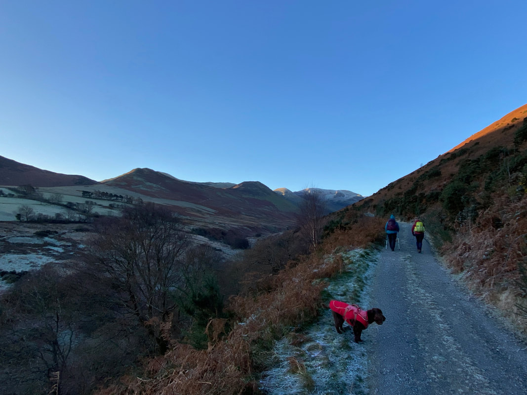
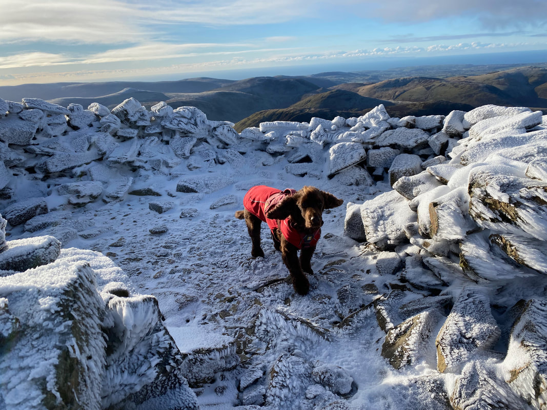
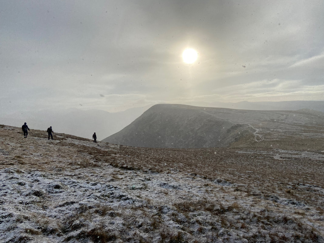
The girls lead the way along the Mine Road as Fudge waits for me - it's like he doesn't trust their navigation or something??
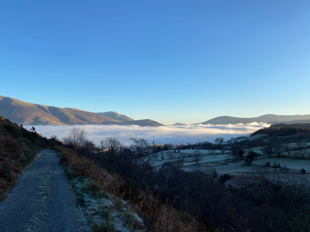
A last look at the inversion with the Skiddaw range over to the left and Blencathra distant
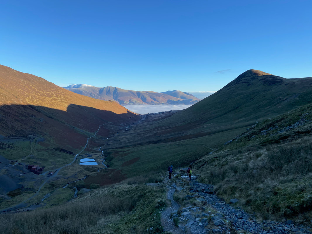
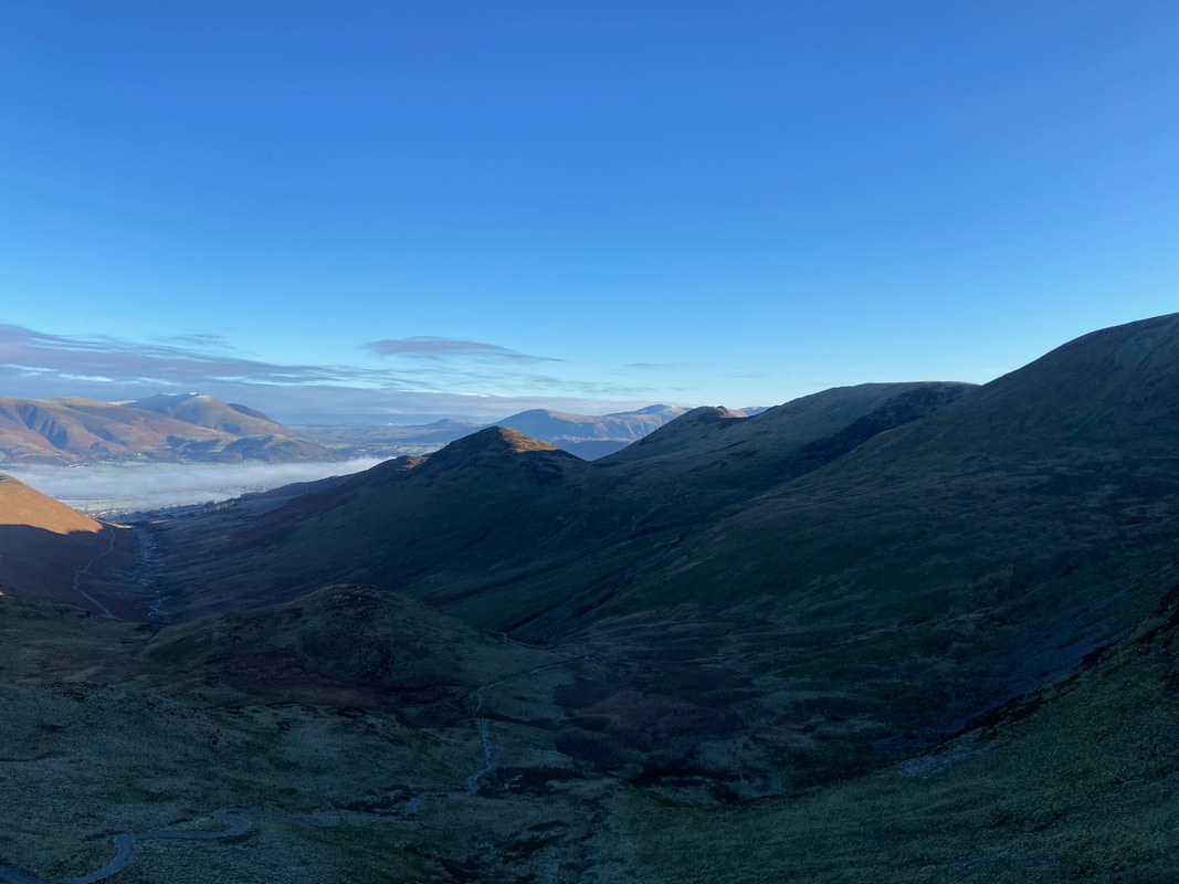
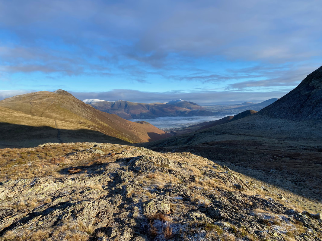
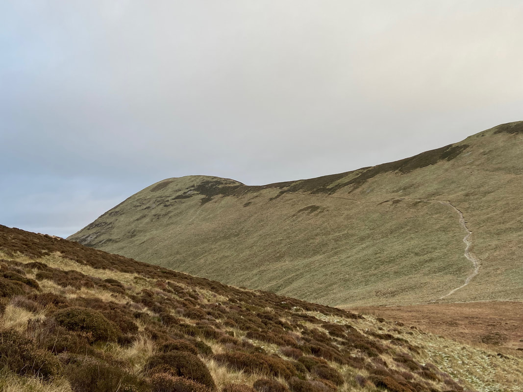
Coledale Beck below with Outerside rising above it - Sail, Crag Hill & Eel Crag provide the backdrop.
Nearing the end of the Mine Road the path forks with our route heading to the left to cross over Coledale Beck via a ford
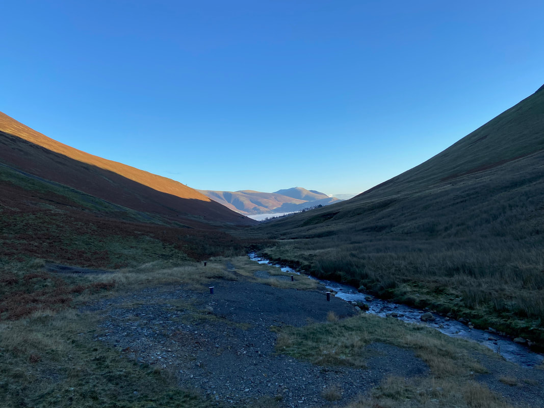
Looking down Coledale from the beck crossing point
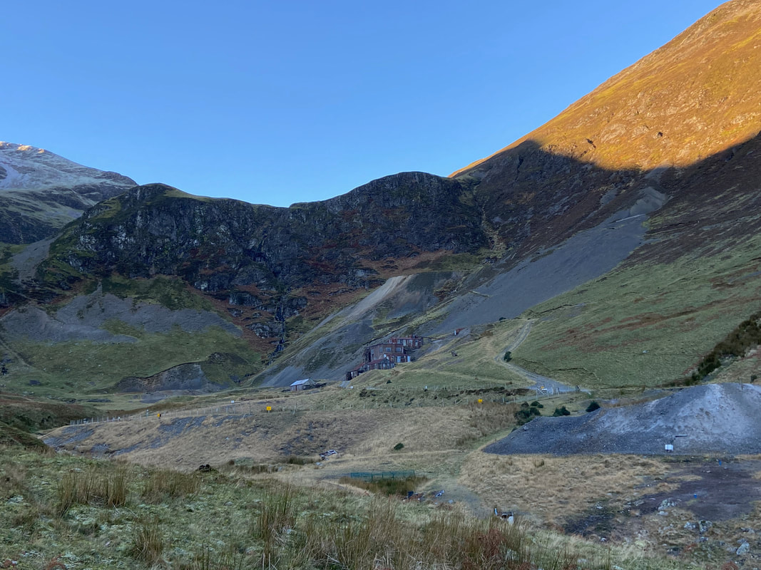
Force Crag Mine with Force Crag behind the buildings
Force Crag Mine was the last working metal mine in the Lake District, prior to its final abandonment in 1991. The site was mined for lead from 1839 until 1865, and for zinc and barytes from 1867. The job of the mill to the right was to separate these minerals from each other, and from any other minerals and the country rock. It is a Scheduled Ancient Monument, and a geological SSSI (site of special scientific interest). The mine occupies a spectacular location at the head of the Coledale Valley. The mill buildings were built in 1908-9 and redesigned in 1939-40. The mill contains the ore-refining machinery that was in use during the 1980s. It is the only former mineral mining site in the country that has retained its processing equipment in something approaching complete order. The National Trust now owns the site and access to the processing mill buildings and machinery was restored in 2004. Visitors can discover what was mined and follow the processing of the minerals through the mill plant.
Force Crag Mine was the last working metal mine in the Lake District, prior to its final abandonment in 1991. The site was mined for lead from 1839 until 1865, and for zinc and barytes from 1867. The job of the mill to the right was to separate these minerals from each other, and from any other minerals and the country rock. It is a Scheduled Ancient Monument, and a geological SSSI (site of special scientific interest). The mine occupies a spectacular location at the head of the Coledale Valley. The mill buildings were built in 1908-9 and redesigned in 1939-40. The mill contains the ore-refining machinery that was in use during the 1980s. It is the only former mineral mining site in the country that has retained its processing equipment in something approaching complete order. The National Trust now owns the site and access to the processing mill buildings and machinery was restored in 2004. Visitors can discover what was mined and follow the processing of the minerals through the mill plant.
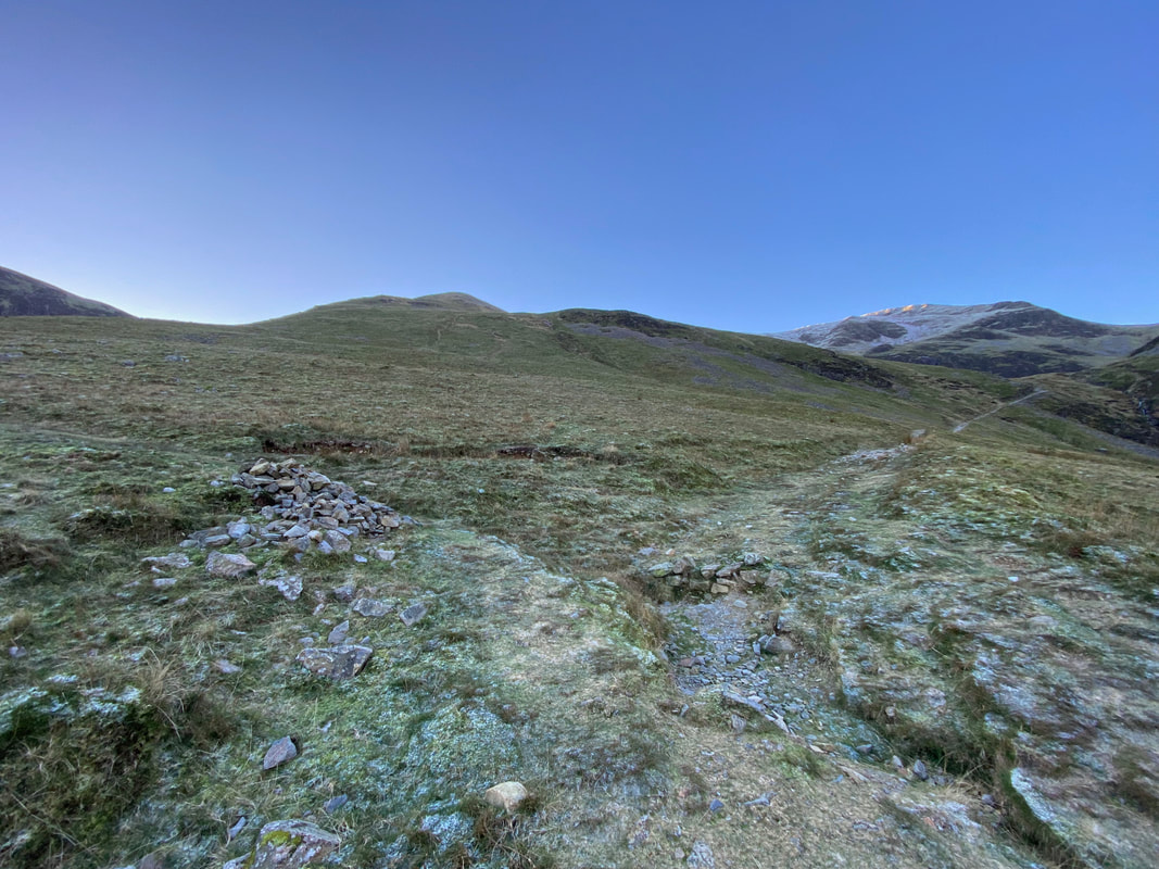
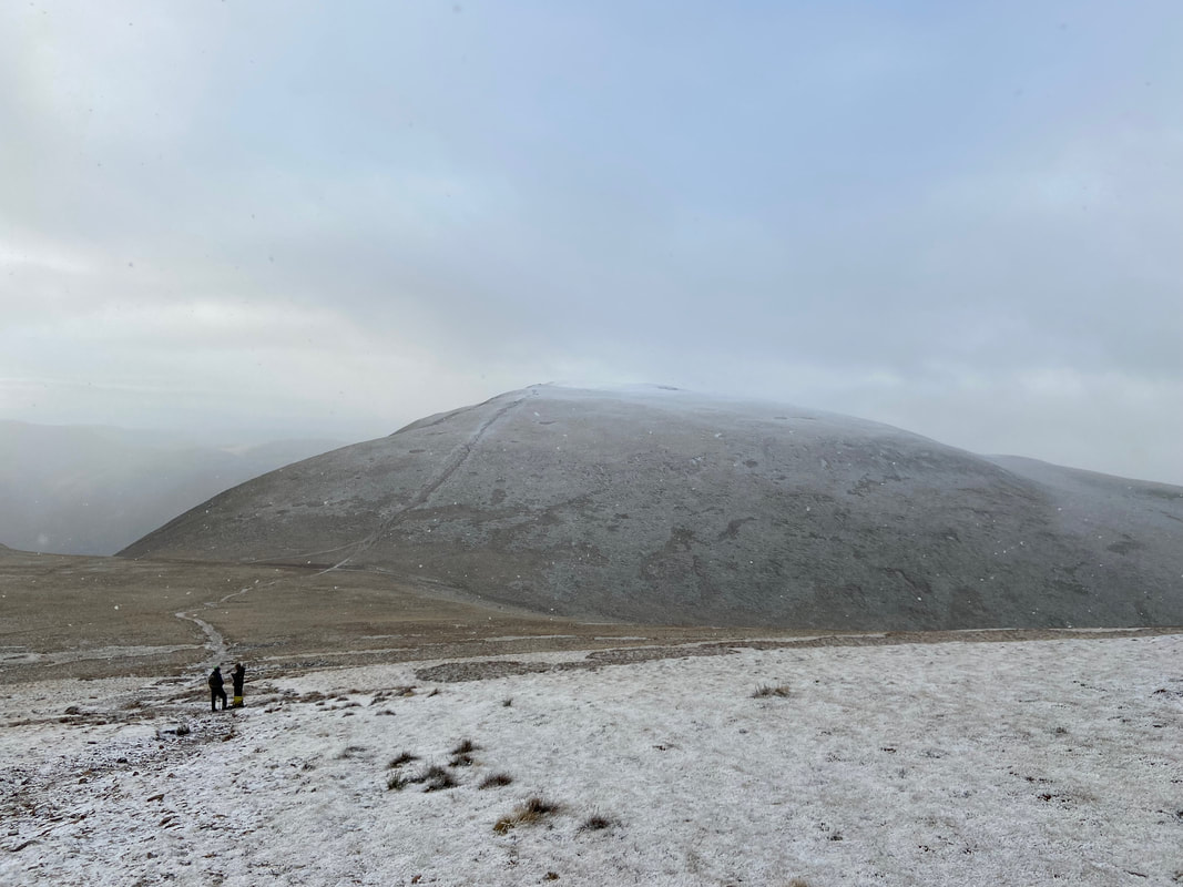
At a large cairn the path forks with the route to Coledale Hause (our route) heading to the right. The path to the left leads to High Moss for onward routes to Outerside and Sail.
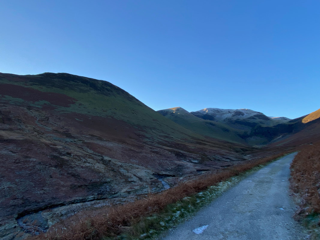
Force Crag with Coledale Hause to the rear
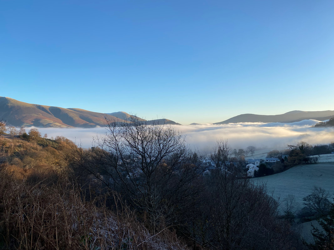
On the path to Coledale Hause looking back down Coledale with Force Crag Mine and the road over to the left. Outerside is over to the right with the valley below Skiddaw still in low cloud.
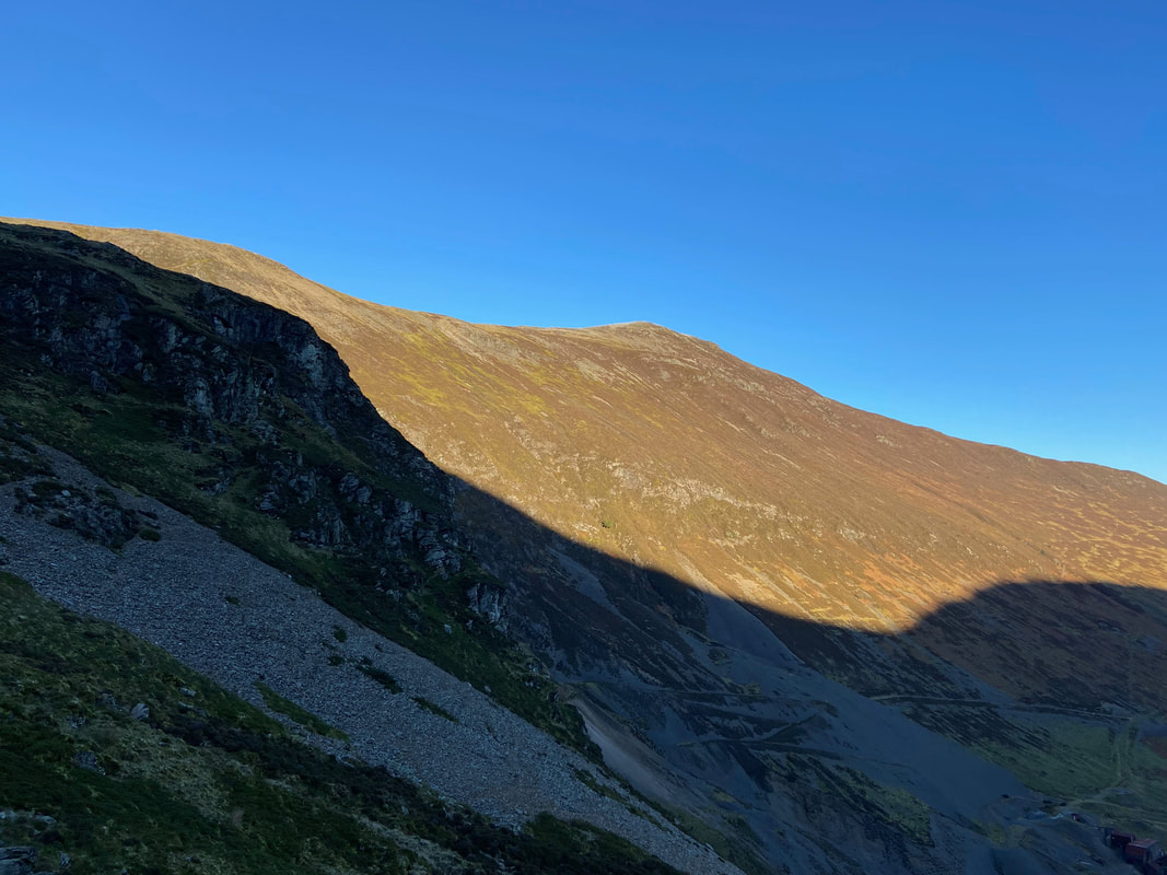
Grisedale Pike above Force Crag Mine
It was a bit nippy today!
The eyes have it as Fudge stares in indignation that I dare take yet another photo of him
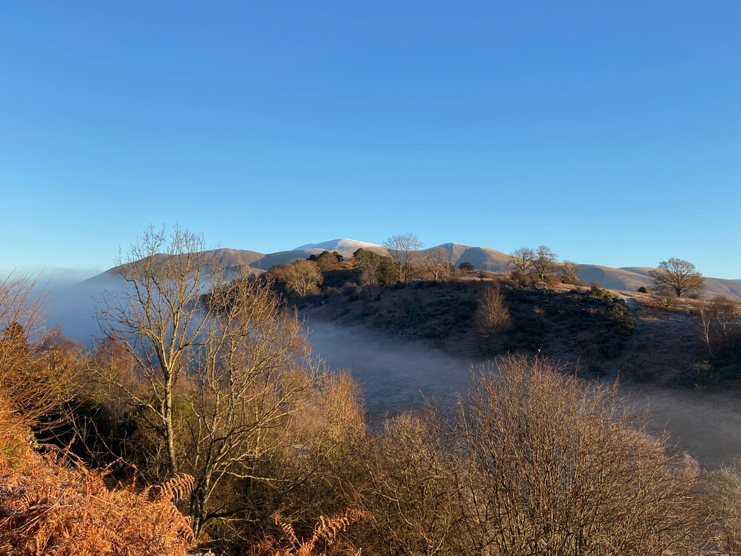
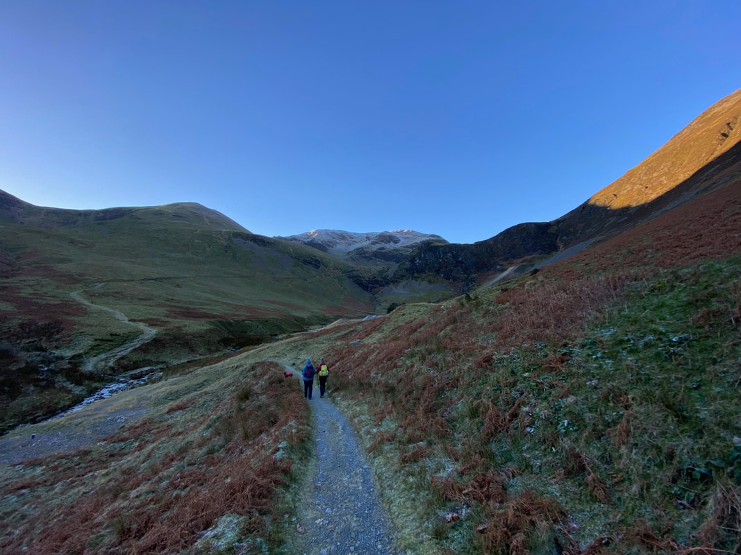
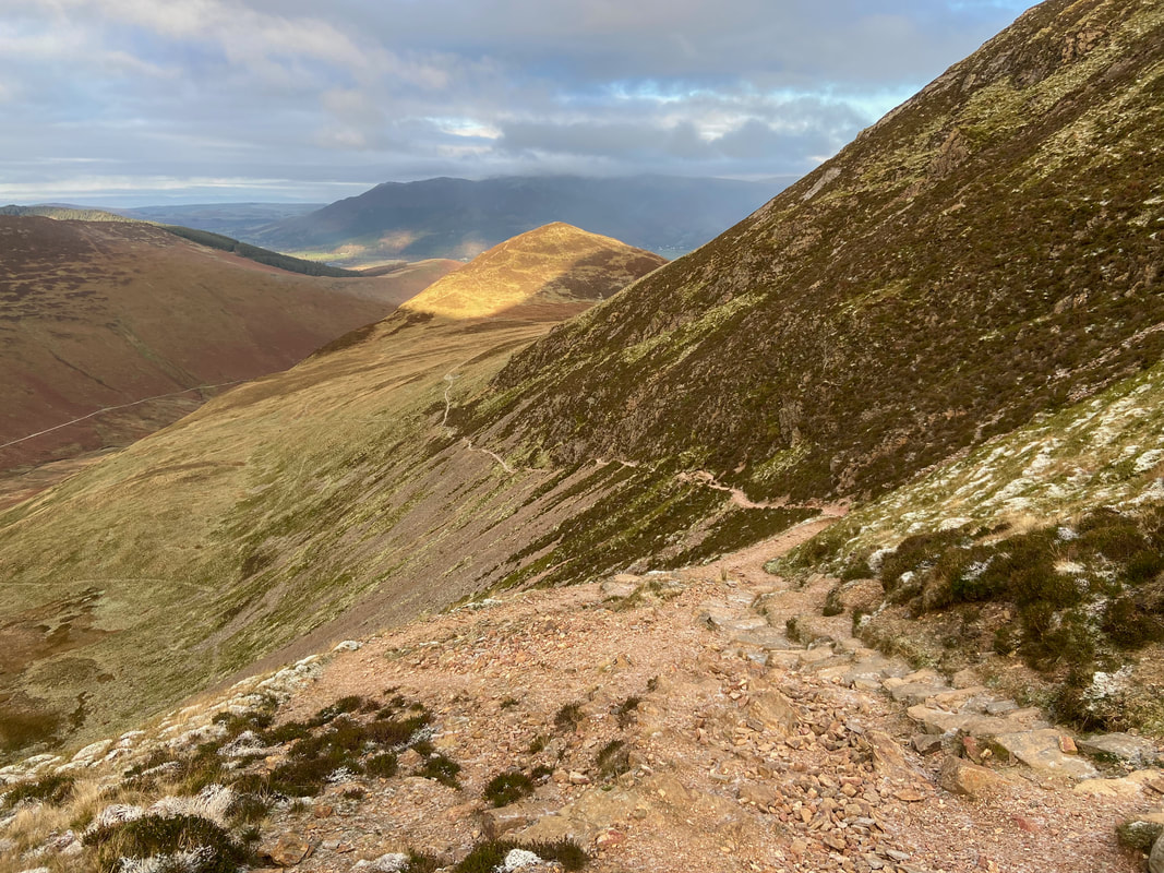
Nearing Coledale Hause as we look back down our route of ascent to Barrow, Stile End & Outerside
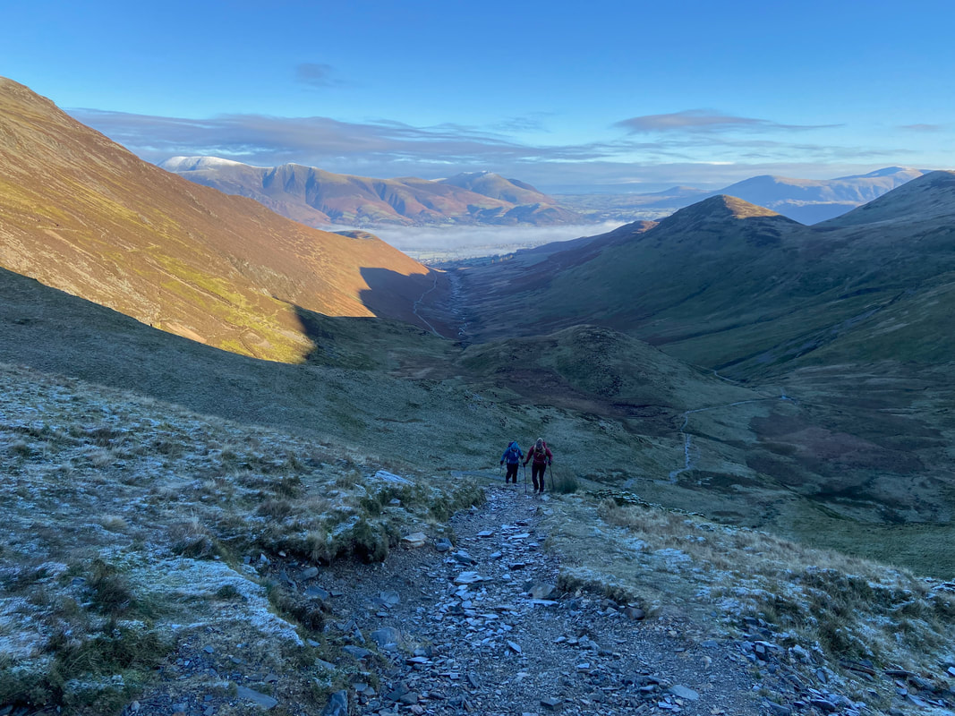
What a fantastic view and better still there was nobody else here
Coledale Hause looking to Sand Hill with the ridge to Whiteside over to the left
A cairn marks the point where the path to Grasmoor leaves Coledale Hause. We would be heading up the ridge to the right.
Grisedale Pike, Skiddaw & Blencathra from the ridge path
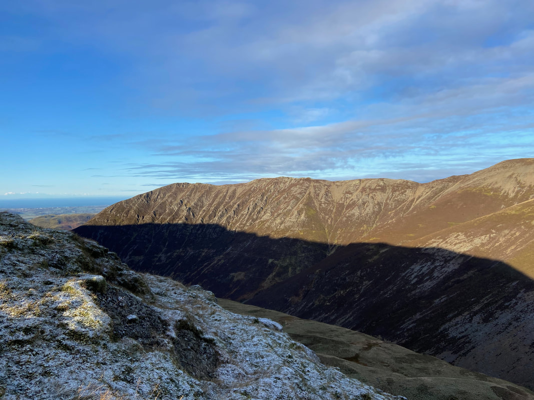
Looking over Gasgale Gill to one of the finest ridge walks in Lakeland - the ridge to Whiteside from Hopegill Head
Hopegill Head, Sand Hill, Coledale Hause & Grisedale Pike
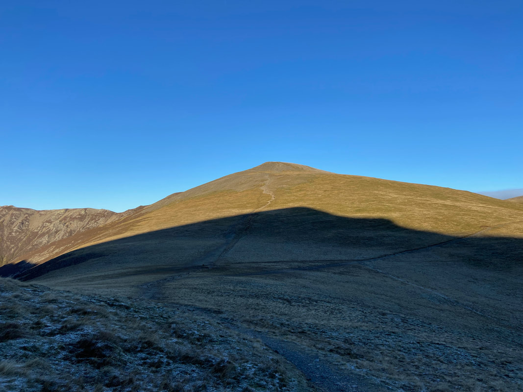
Crag Hill
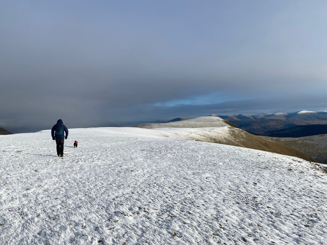
With the climb up the ridge behind us, we now enjoyed a gentler gradient - Grasmoor's summit plateau is ahead
Grisedale Pike, Coledale, Skiddaw & Blencathra from the top of the ridge
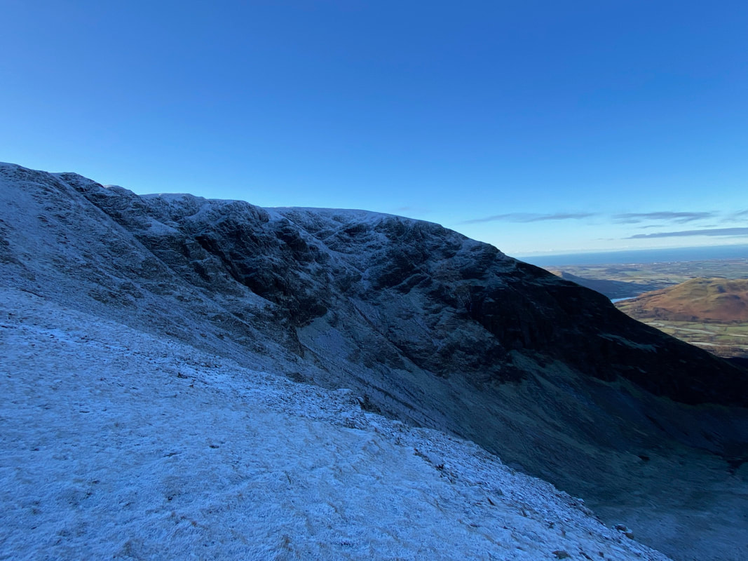
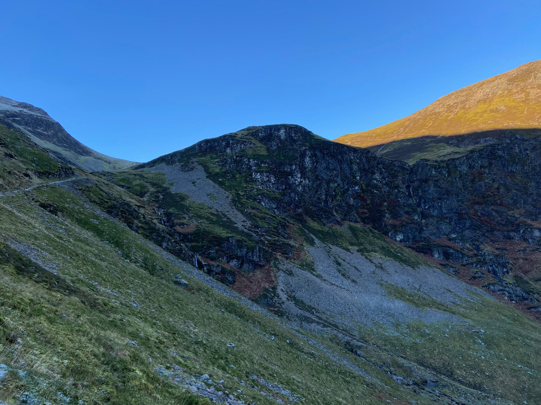
Dove Crags on Grasmoor
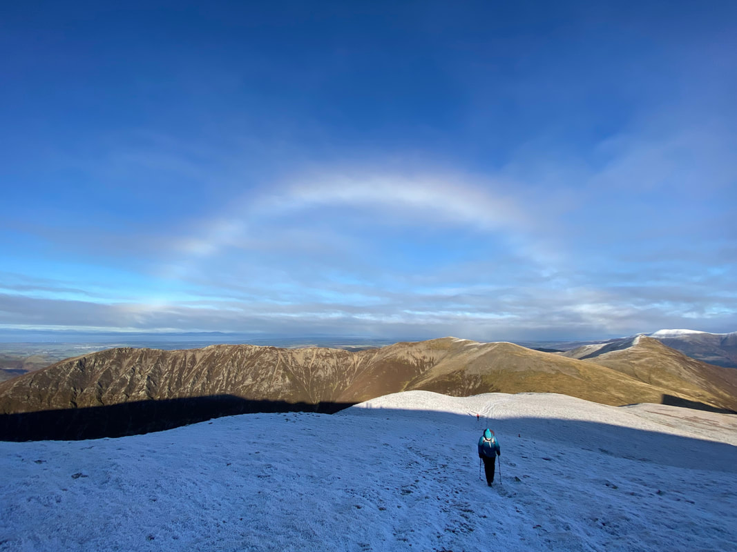
As if the day couldn't get any better we were treated to a Fogbow as we neared Grasmoor's summit
For those that are unaware, a Fogbow is similar in some respects to a traditional rainbow forming from sunlight interacting with water droplets contained in fog, mist or cloud rather than interacting with raindrops as it does in a classical rainbow. These water droplets are much smaller than raindrops, nearly always less than 0.1 mm in diameter. These tiny droplets cause the light to undergo different physical processes, most notably diffraction, which leads to fogbows appearing to be devoid of colour. It is for this reason that fogbows are sometimes known as white rainbows. (Source - Met Office)
For those that are unaware, a Fogbow is similar in some respects to a traditional rainbow forming from sunlight interacting with water droplets contained in fog, mist or cloud rather than interacting with raindrops as it does in a classical rainbow. These water droplets are much smaller than raindrops, nearly always less than 0.1 mm in diameter. These tiny droplets cause the light to undergo different physical processes, most notably diffraction, which leads to fogbows appearing to be devoid of colour. It is for this reason that fogbows are sometimes known as white rainbows. (Source - Met Office)
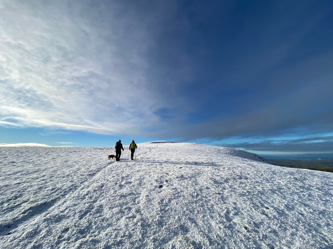
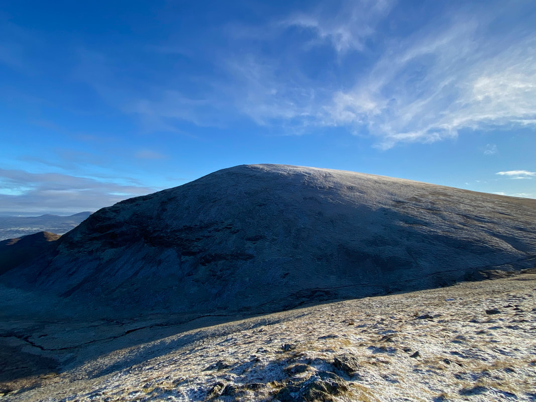
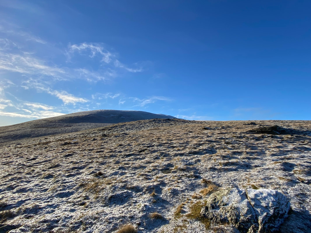
A dusting of snow on the ground as we approach Grasmoor's summit
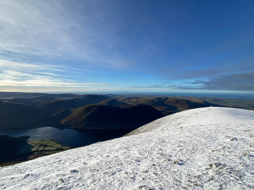
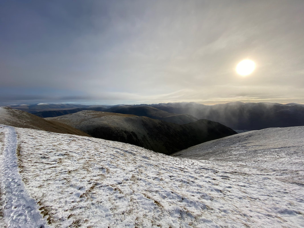
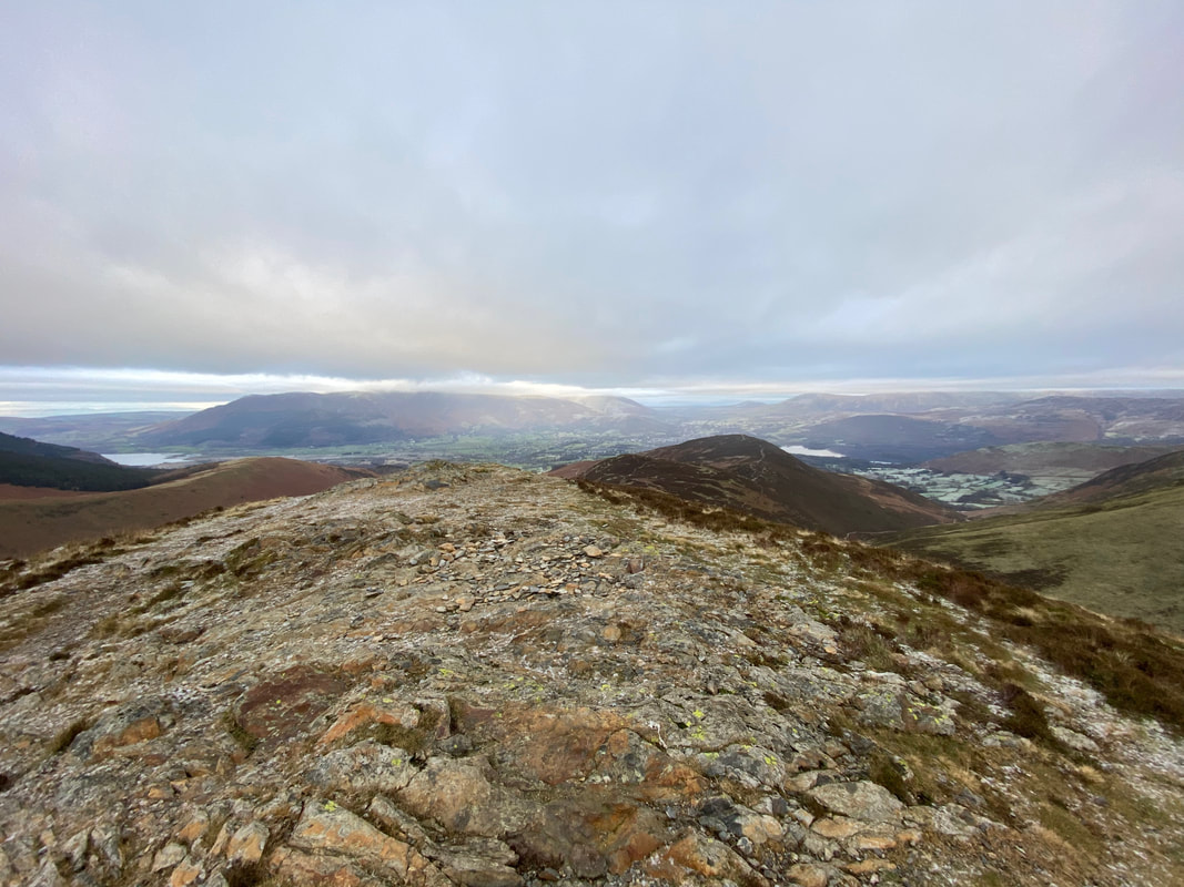
Looking to Grasmoor's western cairn from the summit. The body of water is Crummock with Mellbreak to the rear.
Looking over to the southern end of Crummock Water towards the Scafells
The large wind shelter that marks the summit of Grasmoor
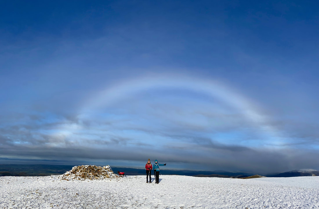
The Fogbow stays with us as the ladies pose on Grasmoor's summit. Fudge meanwhile has more important priorities and inspects the shelter for scraps of food.
Nothing left in here Guv!
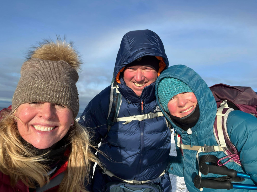
A summit selfie on Grasmoor
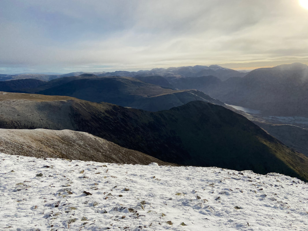
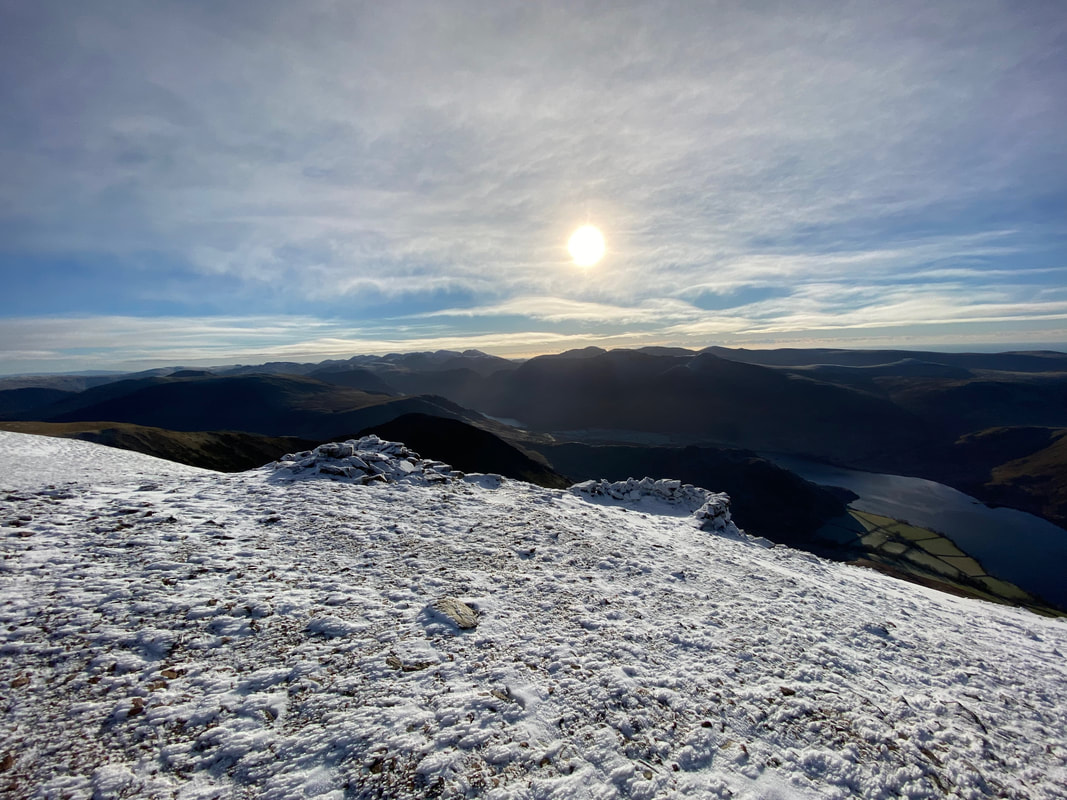
Layers & layers of fells
From Grasmoor's summit the route heads east along the extensive summit plateau
Looking to Wandope, Thirdgill Head Man & Whiteless Pike
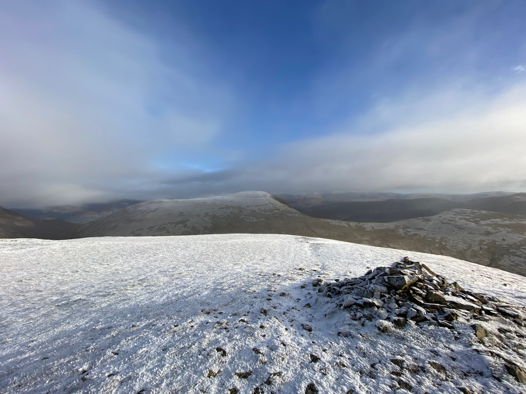
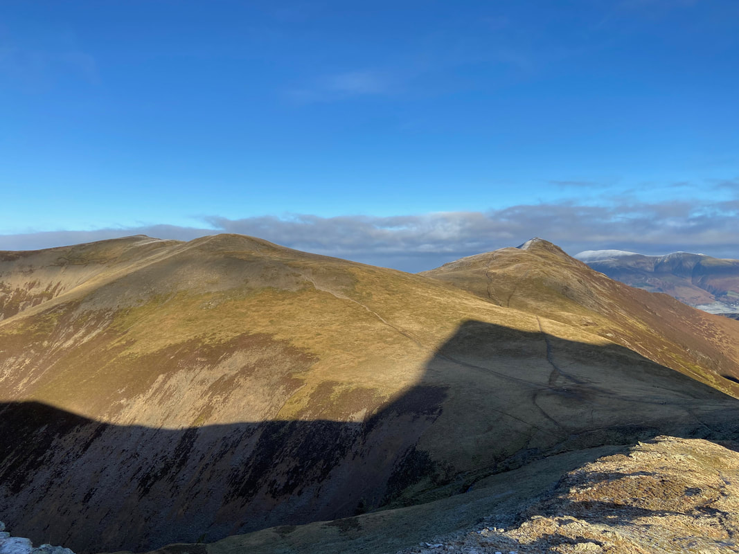
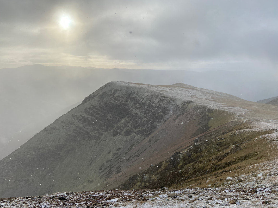
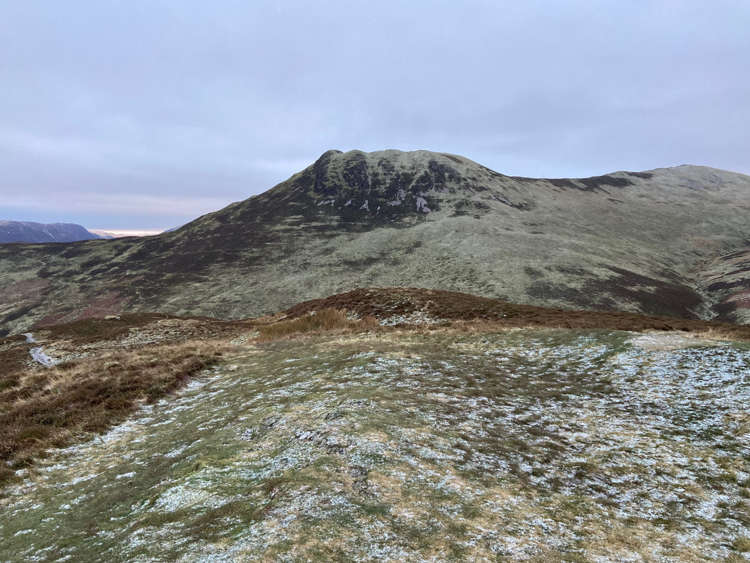
Crag Hill ahead now as we arrive at Grasmoor's eastern cairn
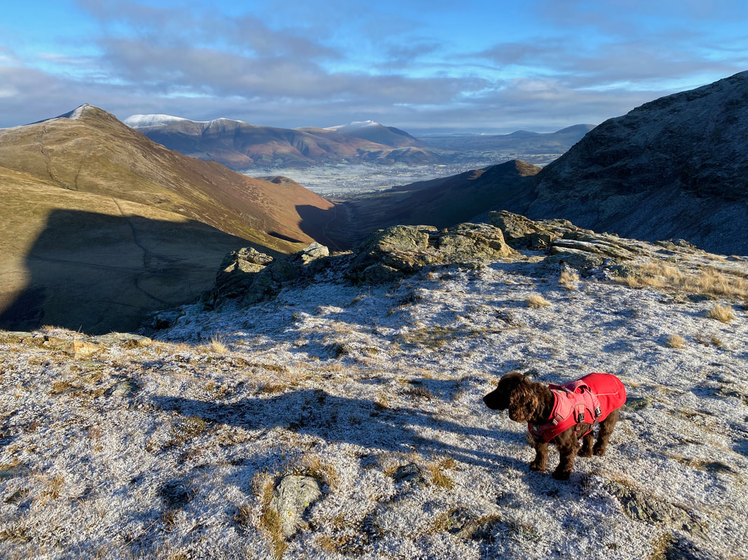
The col between Grasmoor & Crag Hill - the weather was just about to turn and a snow shower was inbound. It was here that Angie returned to Braithwaite via Coledale Hause and Force Crag Mine.
Looking to Wandope from the ascent of Crag Hill
Looking back to the col between Crag Hill & Grasmoor. Heading left leads to Wandope & Thirdgill Head Man whilst the path to the right is to Coledale Hause and onward to Braithwaite or Buttermere.
Wandope across Addacomb Hole
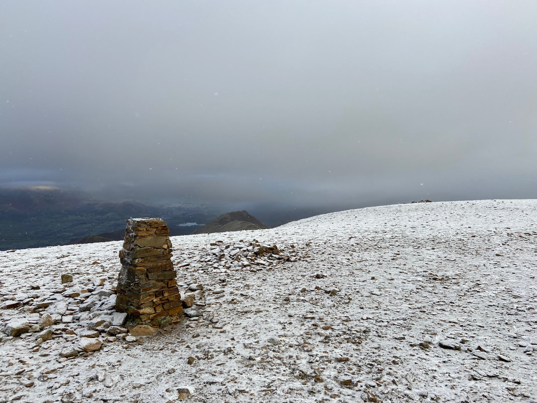
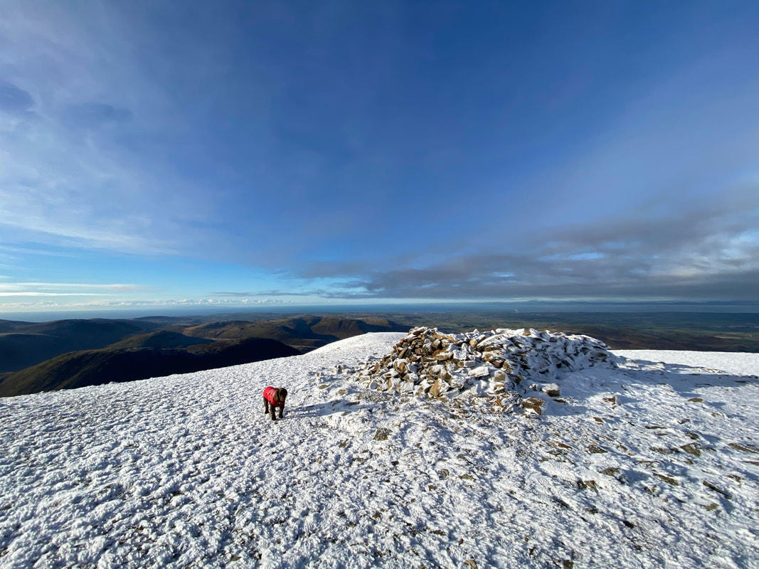
The now thankfully repaired Trig Point on the summit of Crag Hill
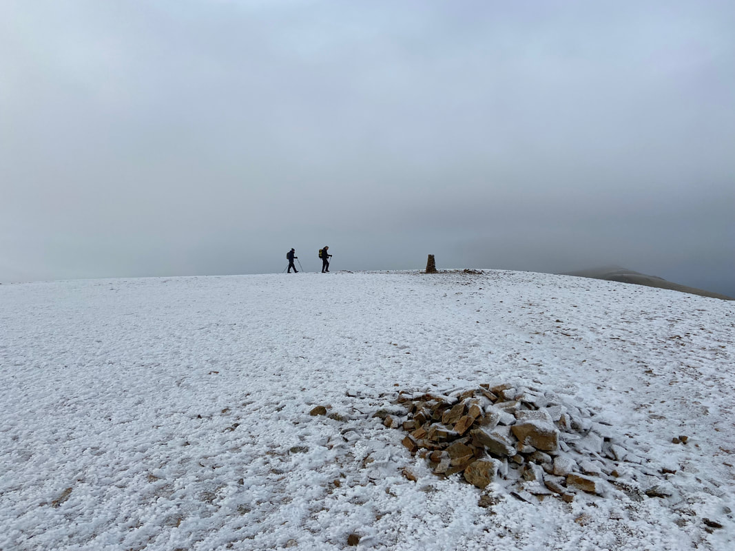
A short distance from the Trig Point is the summit of Crag Hill

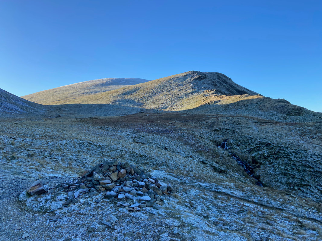
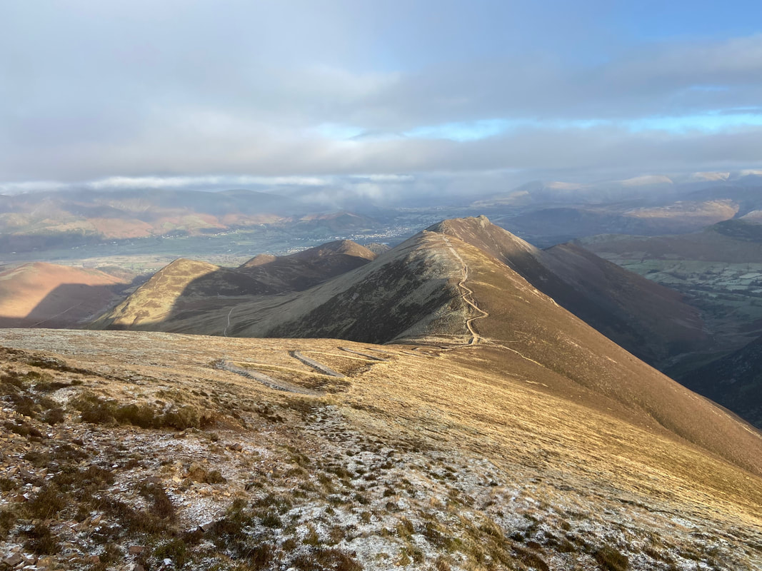
From Crag Hill the route drops to The Scar which is the connecting Ridge to Sail with Scar Crags & Causey Pike distant
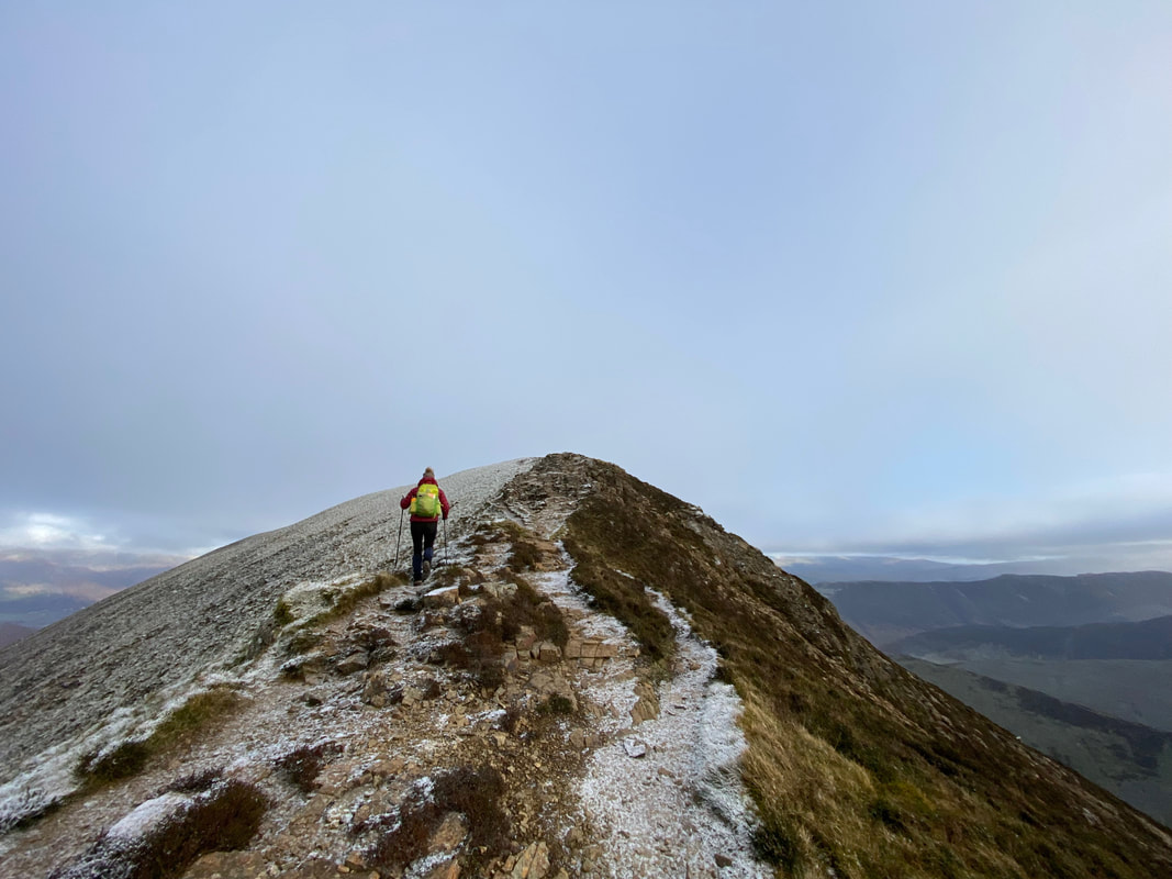
The approach to Sail
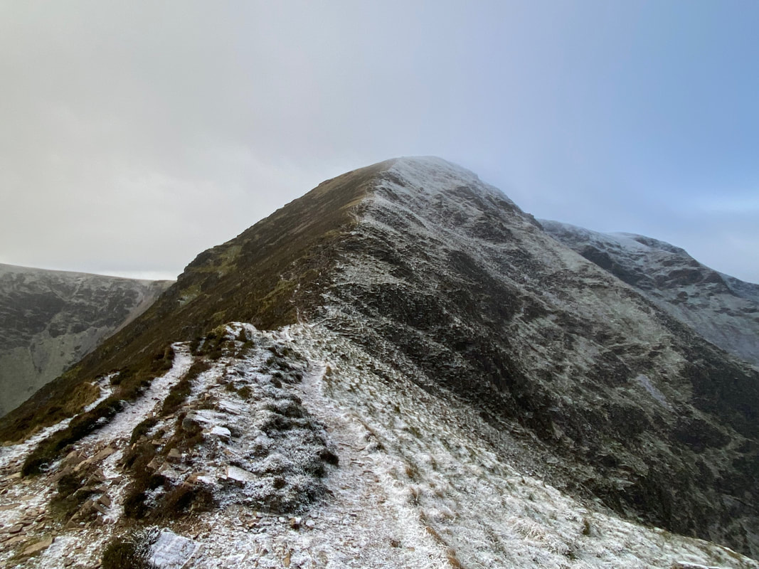
Looking back along The Scar to Crag Hill
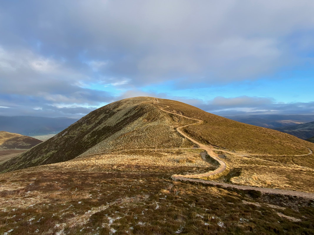
The summit of Sail
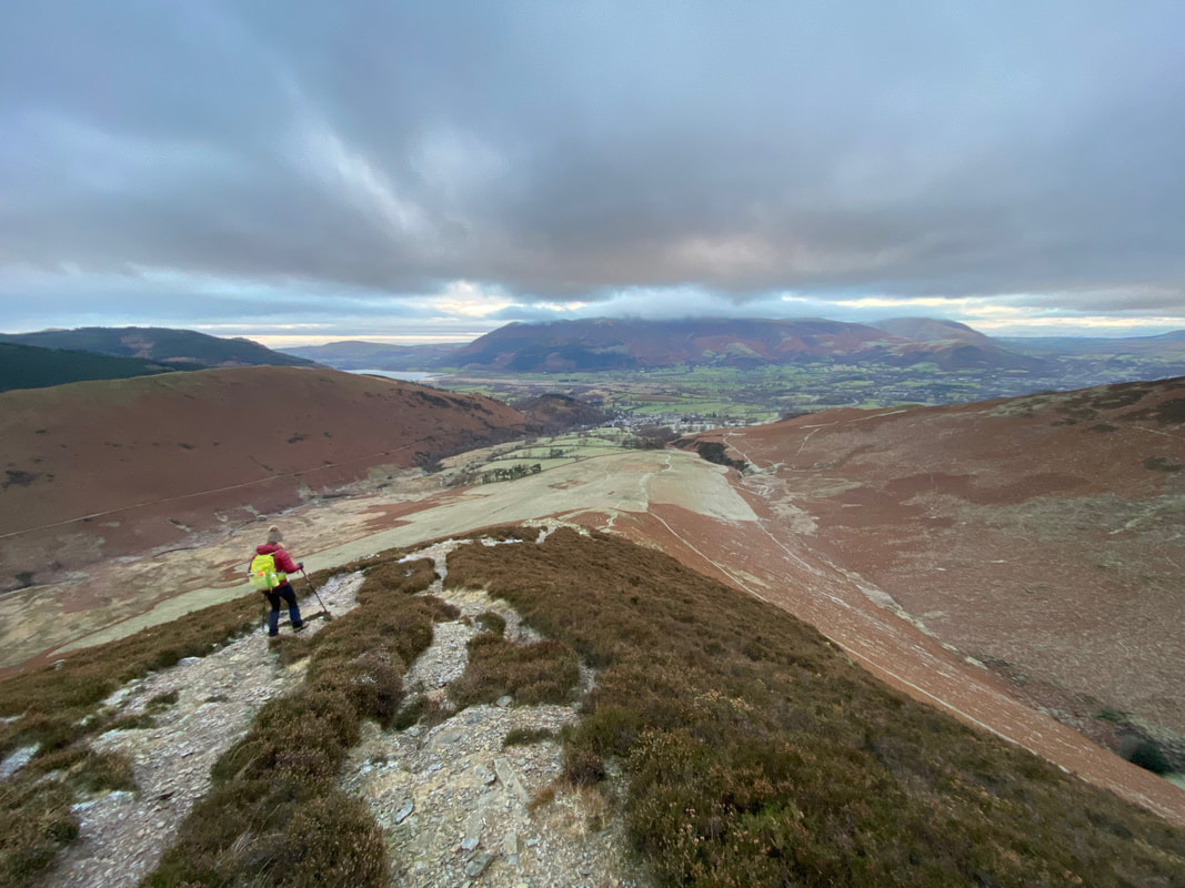
Leaving Sail the weather picked up a bit as we made our way down the notorious zig zag path to the Sail Pass. The path to Scar Crags can be seen making its way up from the pass with Causey Pike beyond.
Approaching the col at the Sail Pass with Scar Crags beyond. Once down at the col we would be taking the path to the left which heads to High Moss & Outerside. The path to the right leads down to the valley below Ard Crags.
Outerside now in view as we head down the path on the flanks of Scar Crags
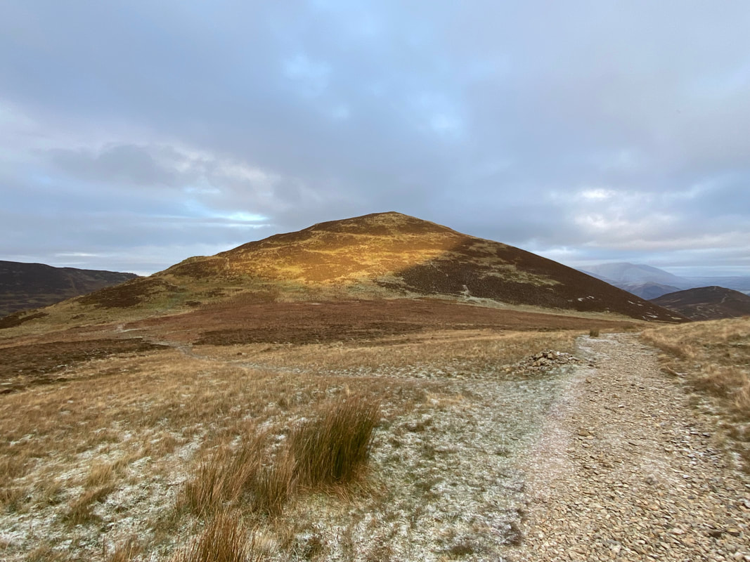
Outerside ahead over High Moss
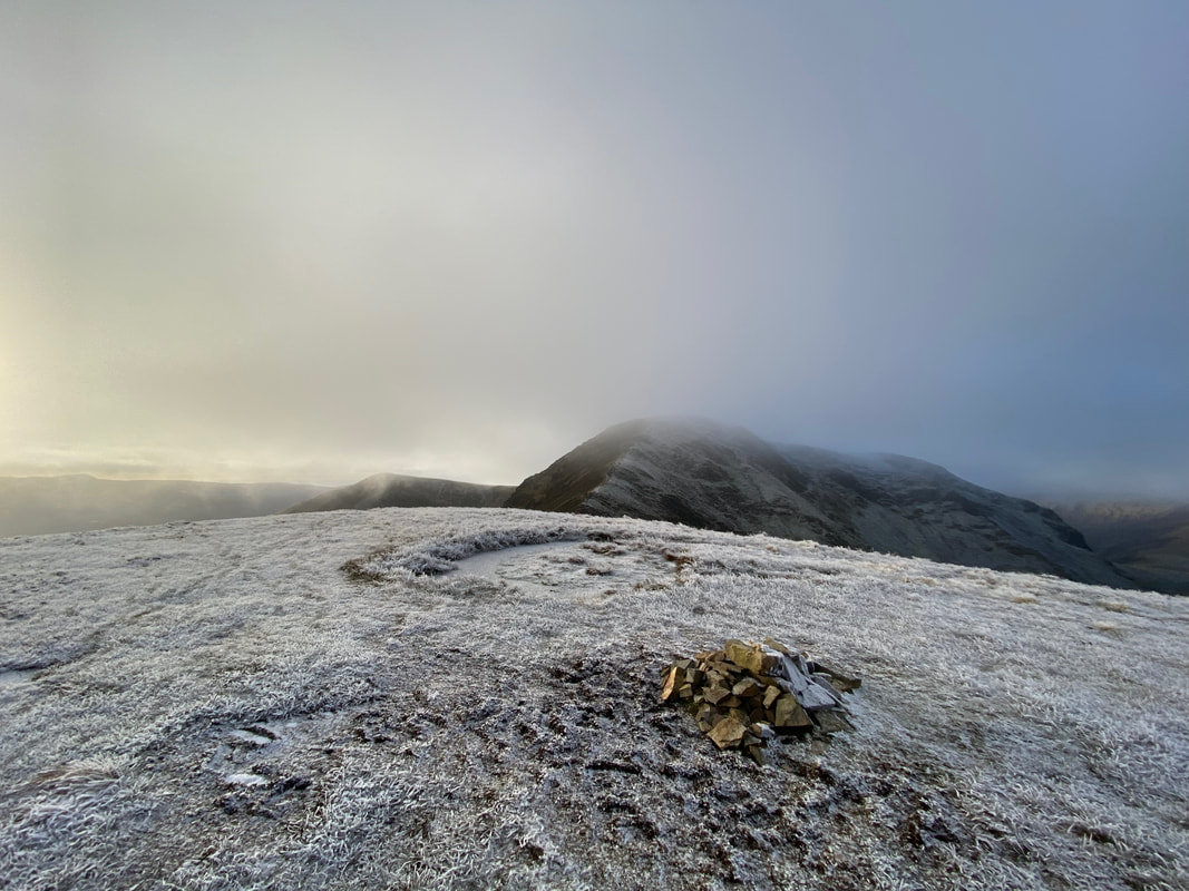
Causey Pike over High Moss.
For those wishing to add in Scar Crags and Causey Pike simply head up from the Sail Pass and continue along the ridge. Once at the summit of Causey Pike then simply retrace your steps to the col between the summit & Scar Crags then descend to High Moss via this path.
For those wishing to add in Scar Crags and Causey Pike simply head up from the Sail Pass and continue along the ridge. Once at the summit of Causey Pike then simply retrace your steps to the col between the summit & Scar Crags then descend to High Moss via this path.
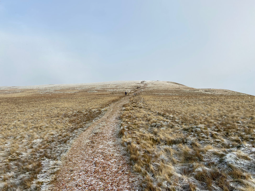
The summit of Outerside
Causey Pike from Stile End
Braithwaite now in view as we make our way back to the start from Stile End