High Spy & Maiden Moor - Thursday 2 December 2021
Route
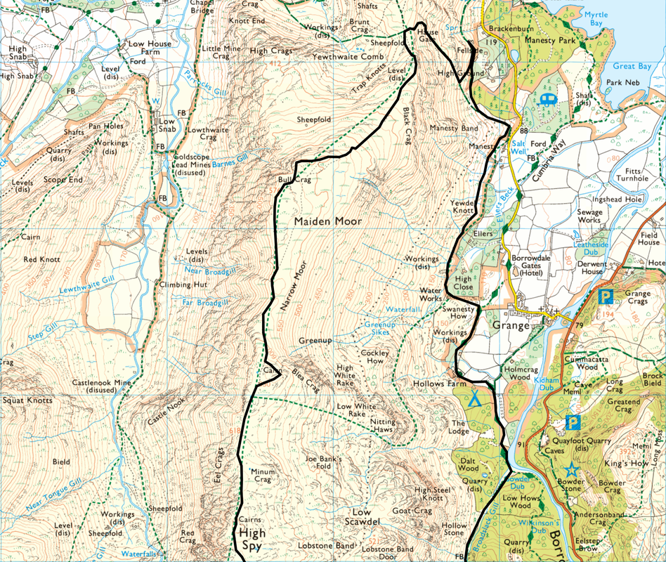
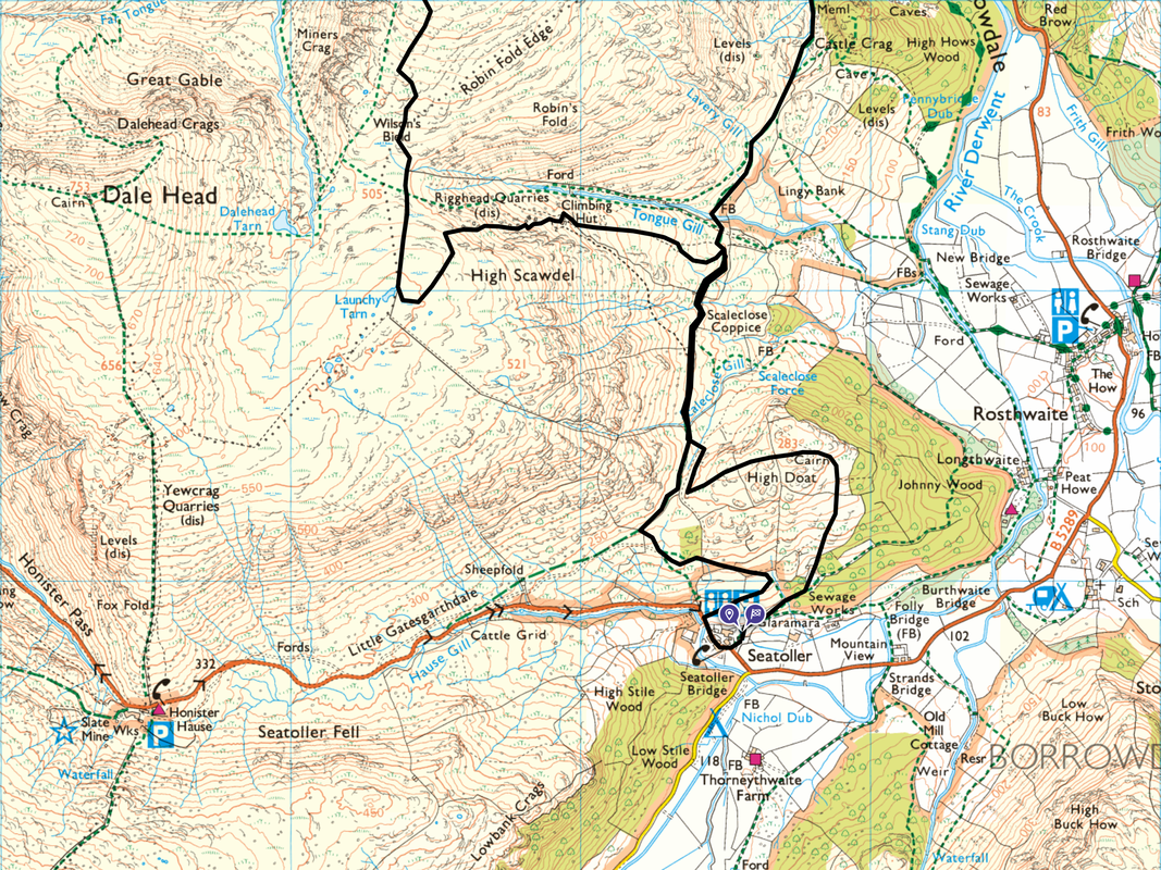
Seatoller - High Doat - Rigghead Quarries - Launchy Tarn - High Scawdel - Wilson's Bield - High Spy - High Spy North Top - Narrow Moor - Maiden Moor - Bull Crag - Hause Gate - High Ground - Fellside - Manesty - Hollows Farm - Gowder Dub - Seatoller
Parking
The National Trust Car Park in Seatoller (Free for NT Members, charges for non members) - Grid Reference is NY 245 138. The nearest postcode is CA12 5XN.
Mileage
11.2 miles
Terrain
Good mountain paths throughout apart from the transit to Launchy Tarn from the top of Rigghead Quarries which is pathless.
Weather
Bitterly cold with sunshine in the morning becoming overcast in the afternoon. The visibility was very good.
Time Taken
6hrs 50mins
Total Ascent
3100ft (945m)
Wainwrights
2
Map
OL4- The English Lakes - North Western Area
Walkers
Dave, Angie & Fudge
|
GPX File
|
| ||
If the above GPX file fails to download or presents itself as an XML file once downloaded then please feel free to contact me and I will send you the GPX file via e-mail.
Route Map
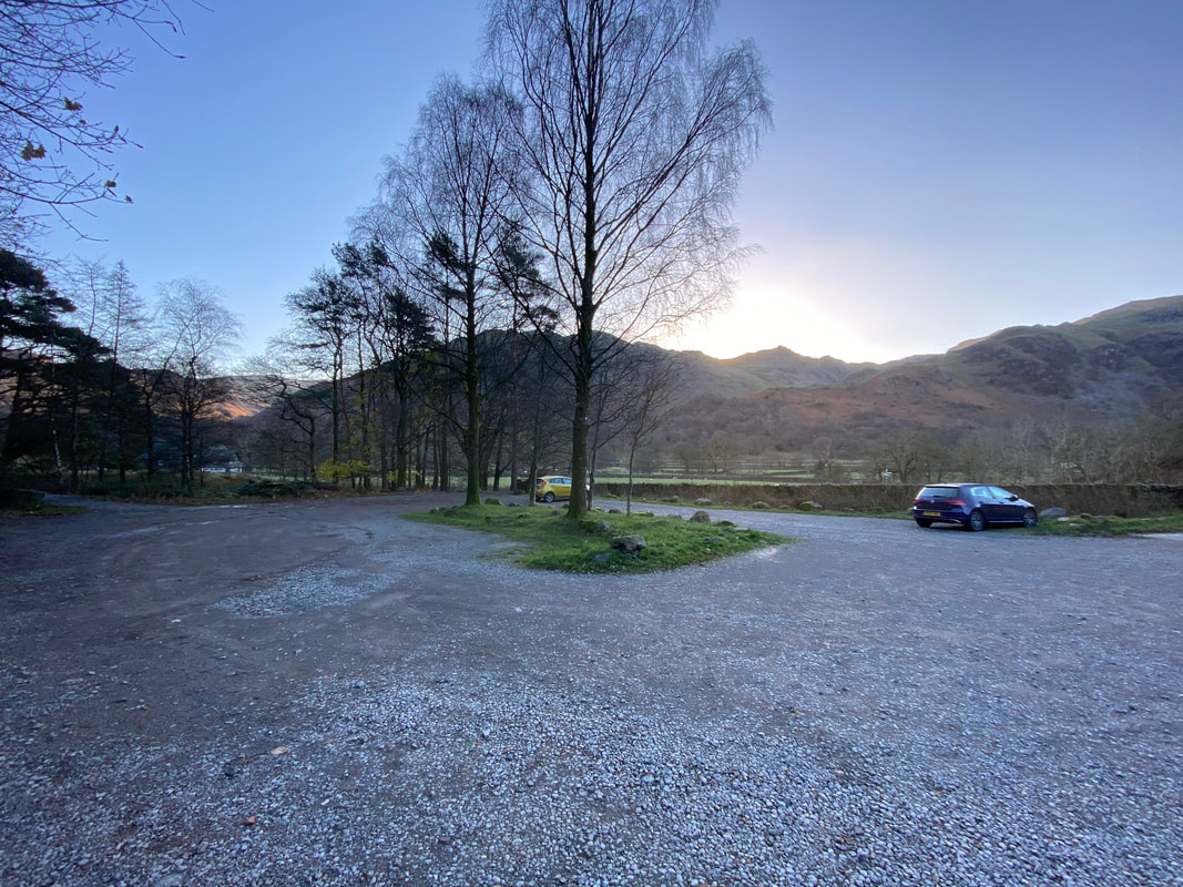
The National Trust Car Park in Seatoller. We were here very early hence the few cars parked hereabouts.
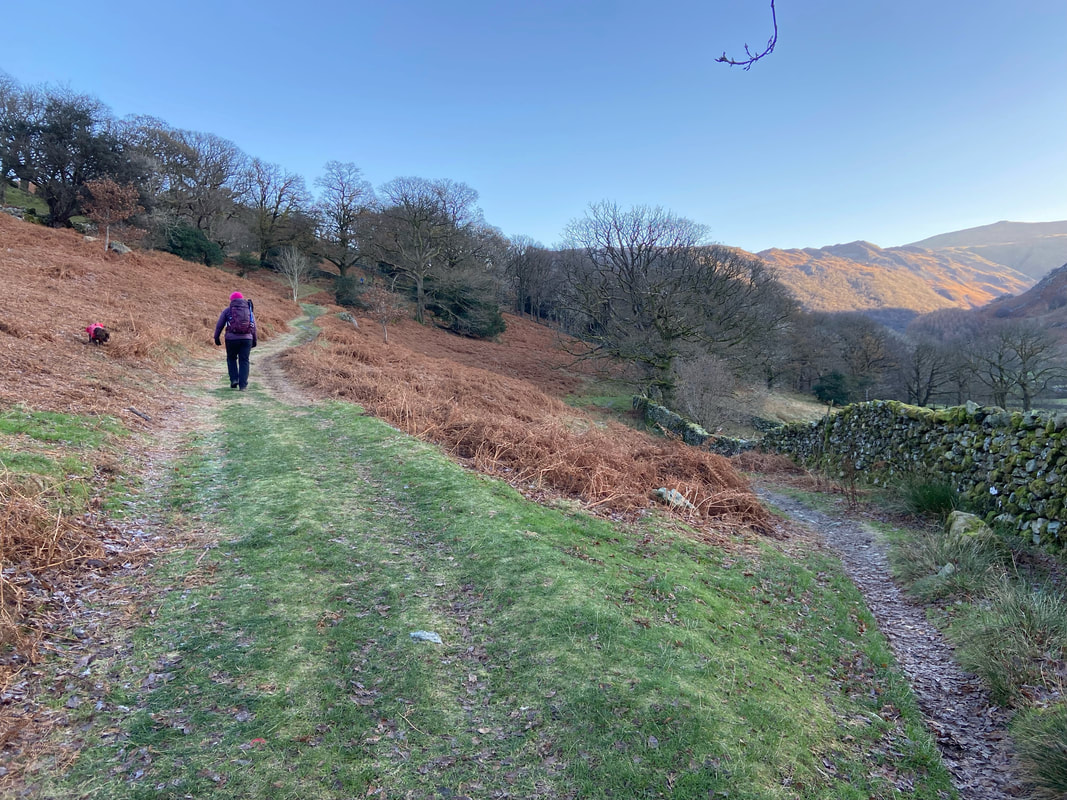
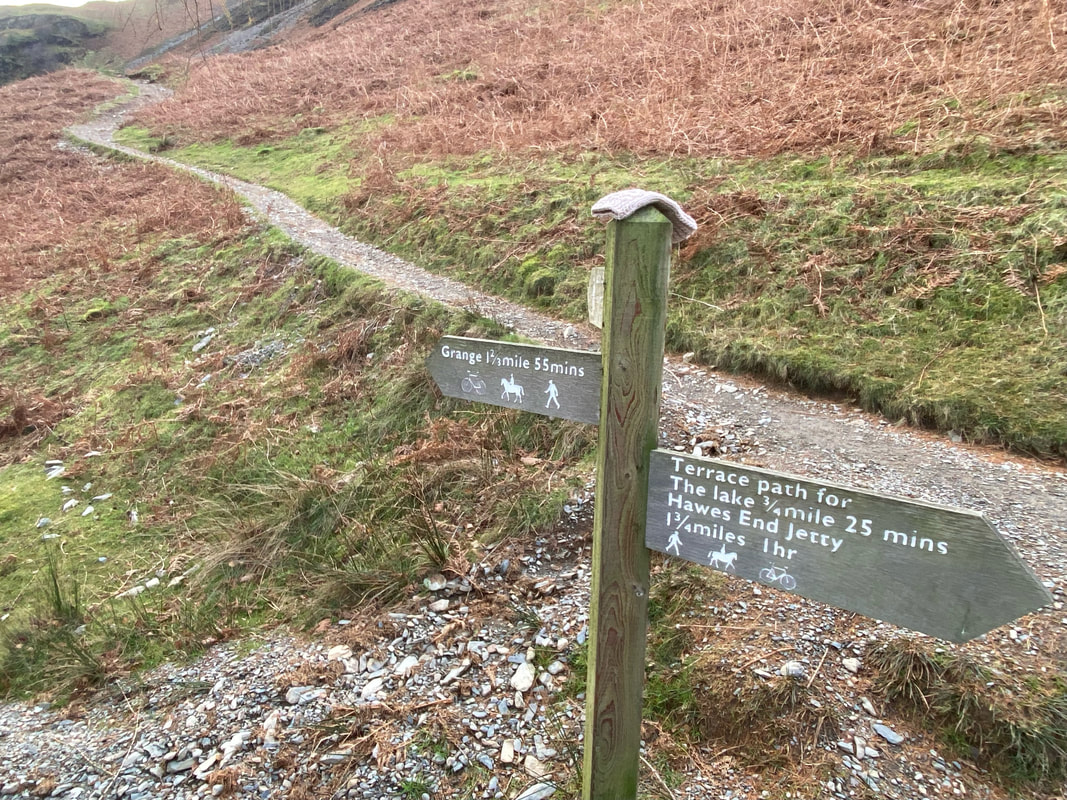
Leaving Seatoller we headed out the far end of the Car Park on the Coast to Coast path leaving it at this path junction. We took the path to High Doat which is to the left - the Coast to Coast path heads right through Johnny Wood.
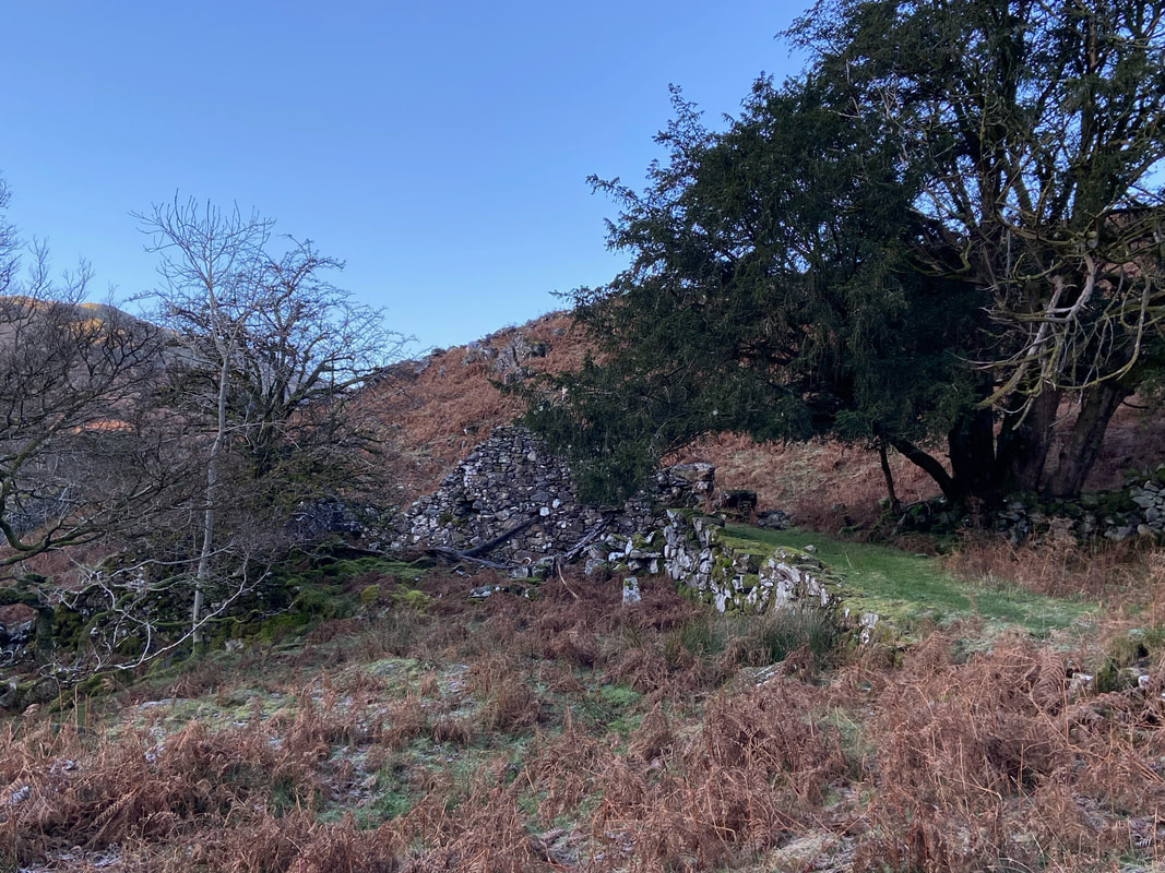
Overgrown, dilapidated and hidden away off path to the left is a stone structure. It was a 17th century bank barn, with a shippen (cattle shed) below. In the 19th century it was converted into two shippens below, and a hay barn above. This explains the well-built ramps on the right leading to the structure.
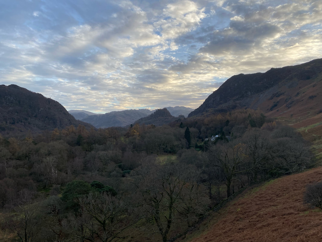
Looking back to the head of Borrowdale from the path to High Doat
The sun comes up over Rosthwaite Fell, Thornythwaite Fell & Glaramara
The "Jaws of Borrowdale" from near High Doat. The slopes of Low Scawdel are to the left with Castle Crag in the centre foreground - the Skiddaw Range is far distant with Blencathra peeping up over King's How on Grange Fell to the right.
The summit of High Doat looking to High Scawdel
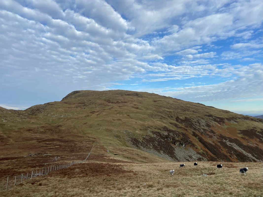
Fudge on High Doat
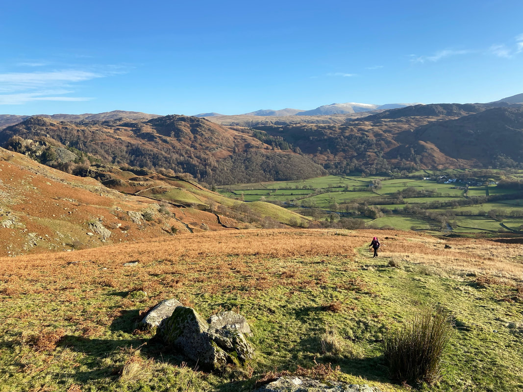
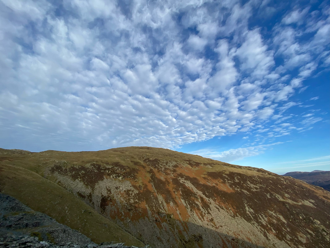
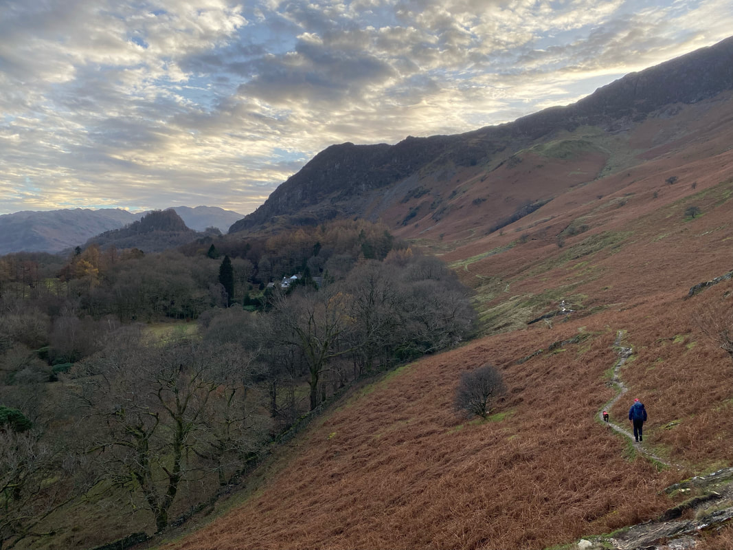
For a fell with such a modest height, High Doat has some amazing views
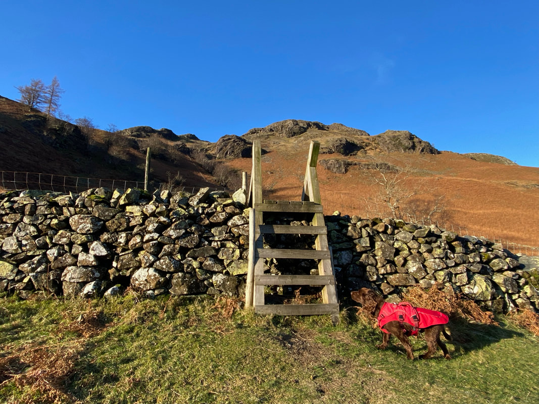
Dropping down from High Doat a ladder stile is reached. Climbing the stile, we then turned right and headed north along the bridleway between Seatoller & Grange. Fudge meanwhile practices his staring & levitation technique.
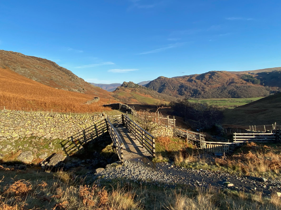
The footbridge over Scaleclose Gill looking to Castle Crag
Castle Crag and the Grange Fell tops of King's How & Brund Fell
Approximately 100 yards before Tongue Gill is a path heading up the fellside towards Rigghead Quarries
Looking back down the path to the Grange to Seatoller bridleway
After an intiial steep section the gradient eases as we continue the ascent to Rigghead Quarries
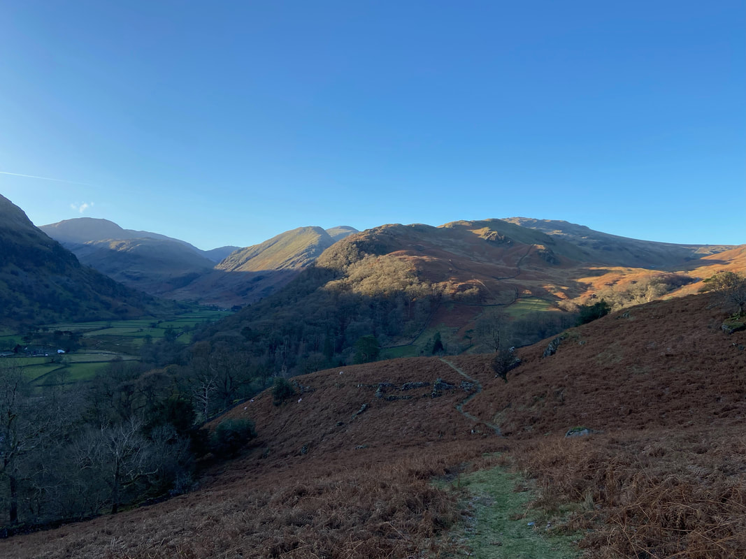
As height is gained the views over to the east really open up with Raise, White Side & Helvellyn now in view
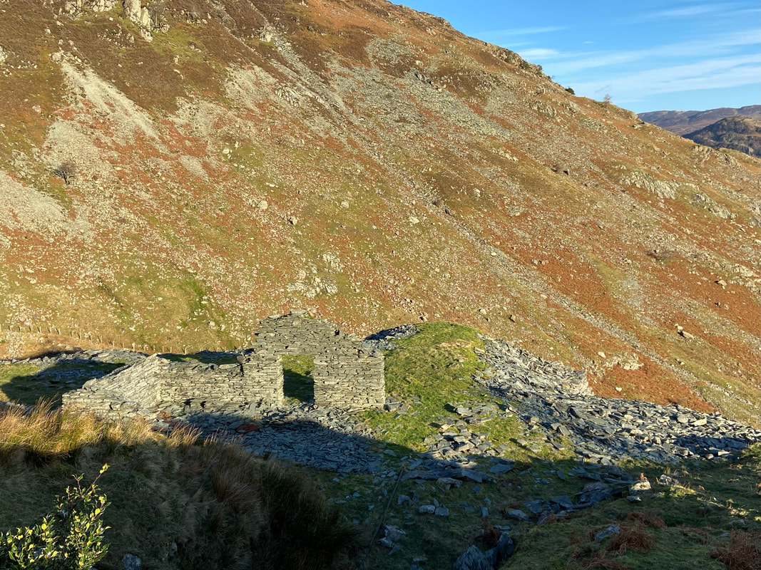
Just above Tongue Gill the ruined buildings of Rigghead's lower quarry emerge. The quarry was worked from the mid 1700s to the 1940s, mostly under the control of a local family.
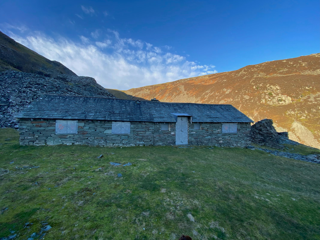
The shuttered climbing hut at Rigghead Quarry. Despite extensive research I was unable to ascertain who uses the hut therefore it is more than likely privately owned and not utilised by a climbing club as such.
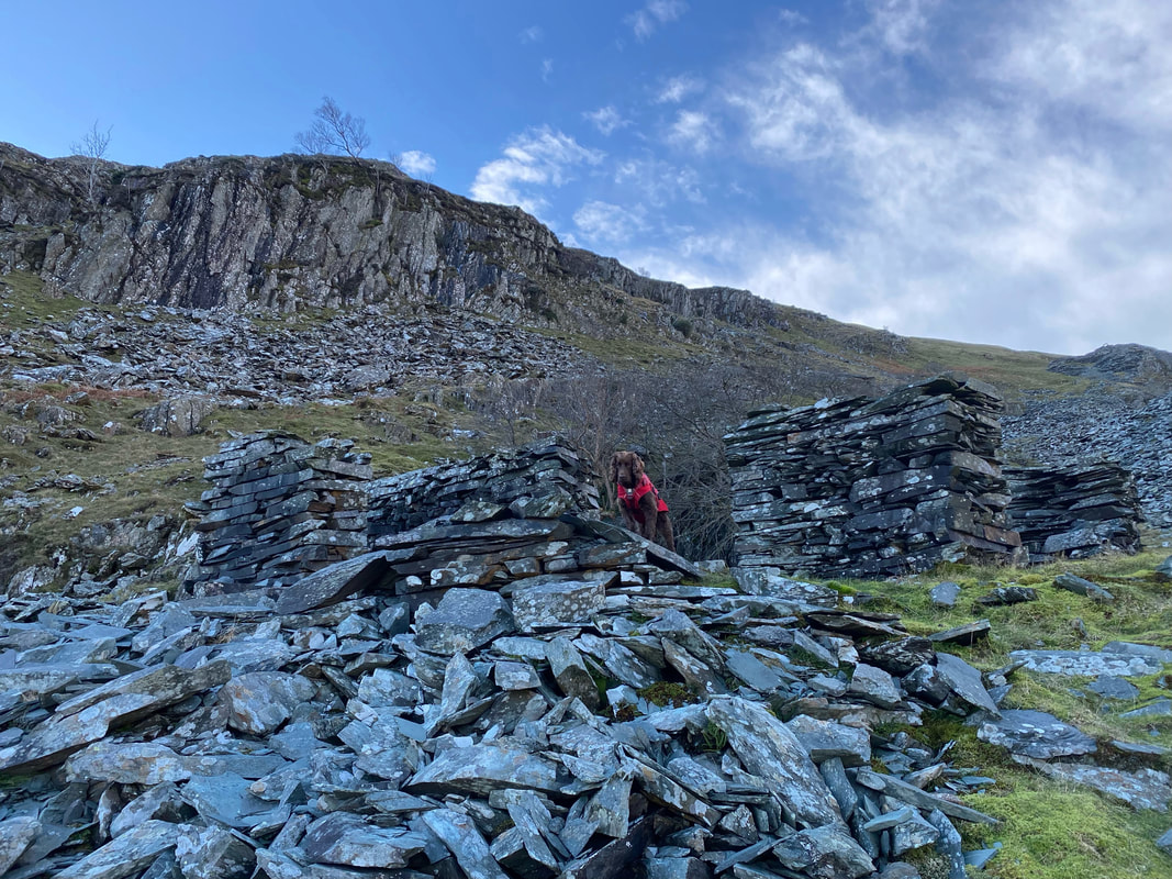
There are greenish Kimberley slate waste piles everywhere as Fudge peers out from one of the ruined quarry buildings.
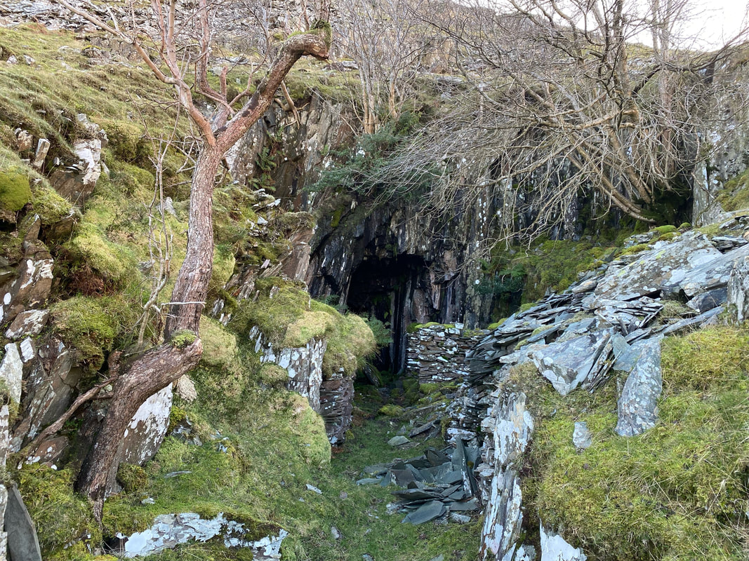
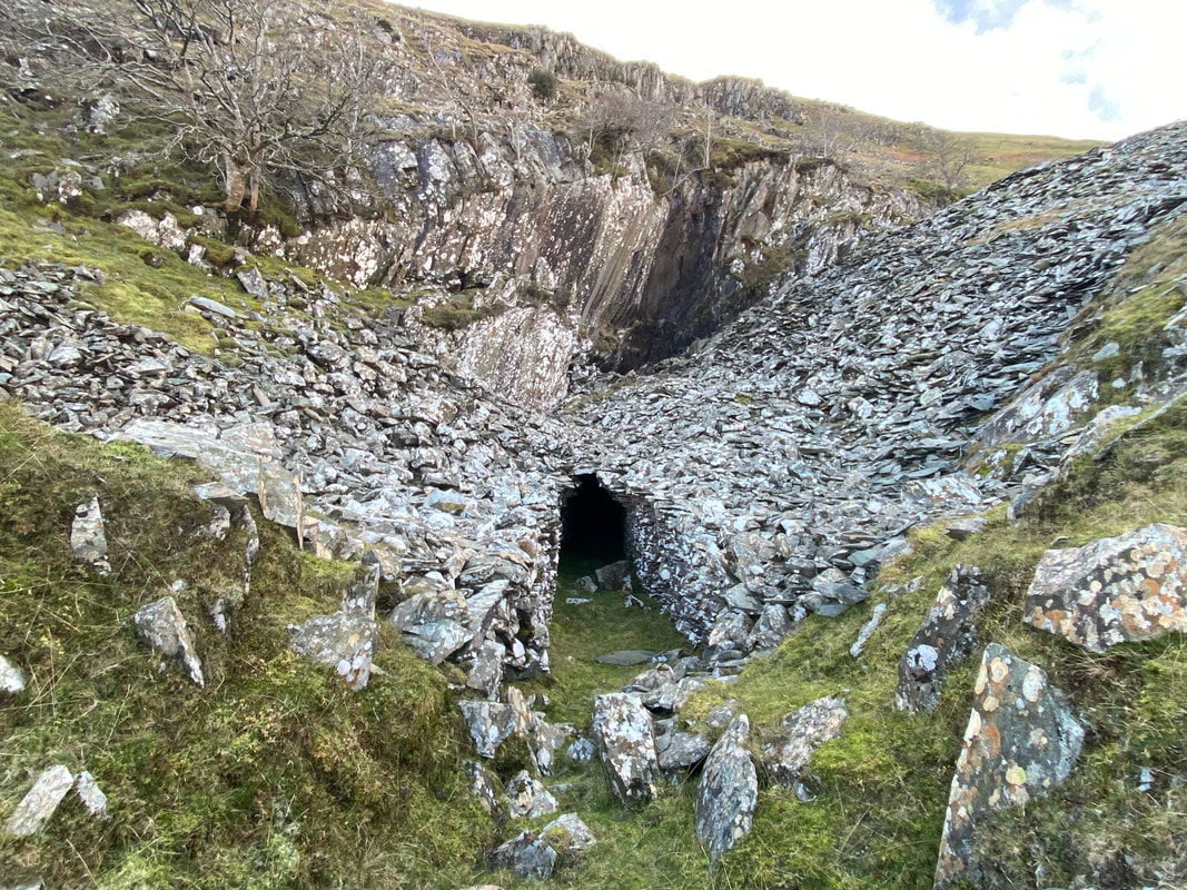
One of Rigghead Quarry's many mine adits dotted all over the fellside. An adit (from Latin aditus meaning entrance) is the access point to an underground mine which is horizontal or nearly horizontal, by which the mine can be entered, drained of water, ventilated, and minerals extracted at the lowest convenient level.
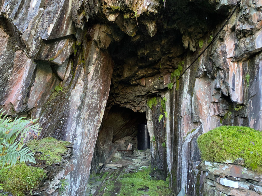
Peering a little bit further in revealed a large gas like canister which we left well alone. If you are ever up this way then please refrain from entering the adits as they are unstable and can catch out people who are not equipped or experienced.
Looking down to the climbing hut as the route starts to steepen markedly as we climb over a slate path towards the middle quarry
More mine adits as we continue to climb
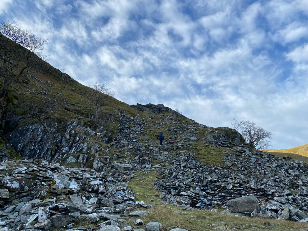
The upper quarry now in sight as the gradient remains steep - this was hard going but really enjoyable
Looking back down our route of ascent as we continue to climb
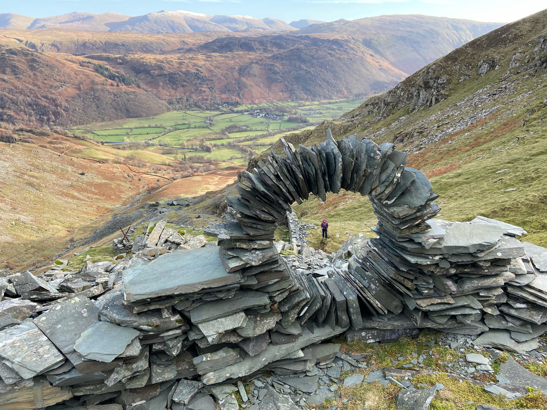
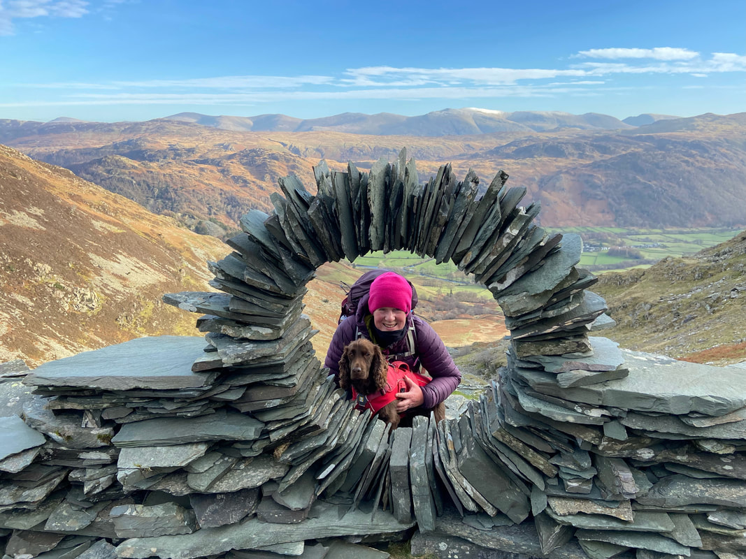
A slate artwork at the top of the quarry. These sculptures are by a rock artist dubbed "The Borrowdale Banksy" and there are several similar rings in various parts of the Lake District, notably on Castle Crag & near Warnscale Bothy although some have now collapsed. Little is known about the artist however he or she is clearly skilled in slate sculpture or dry stone walling.
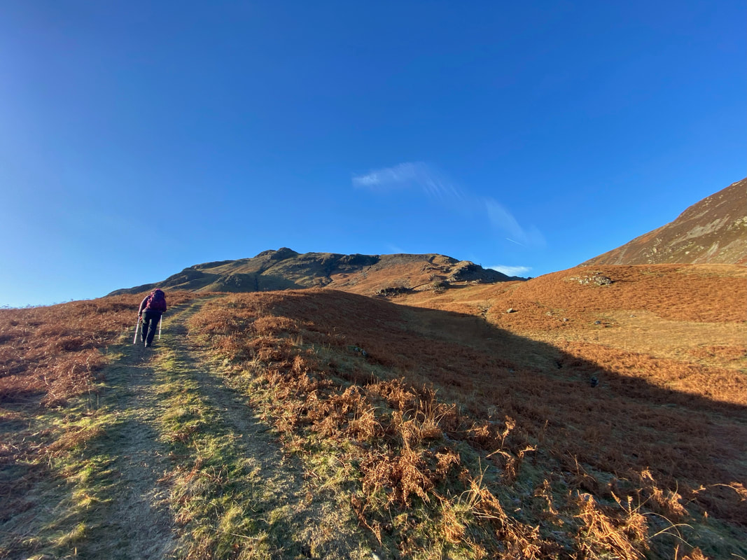
Robin Fold Edge on High Spy
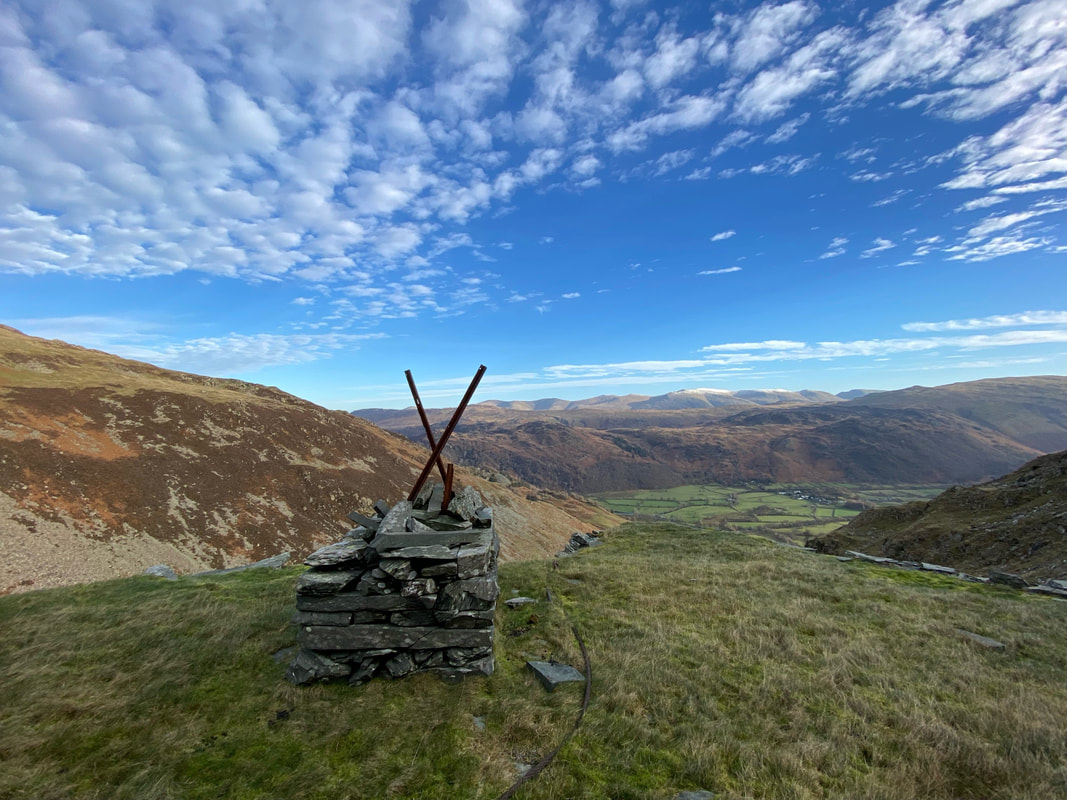
Part of the aerial ropeway used to transport the slate down to ground level
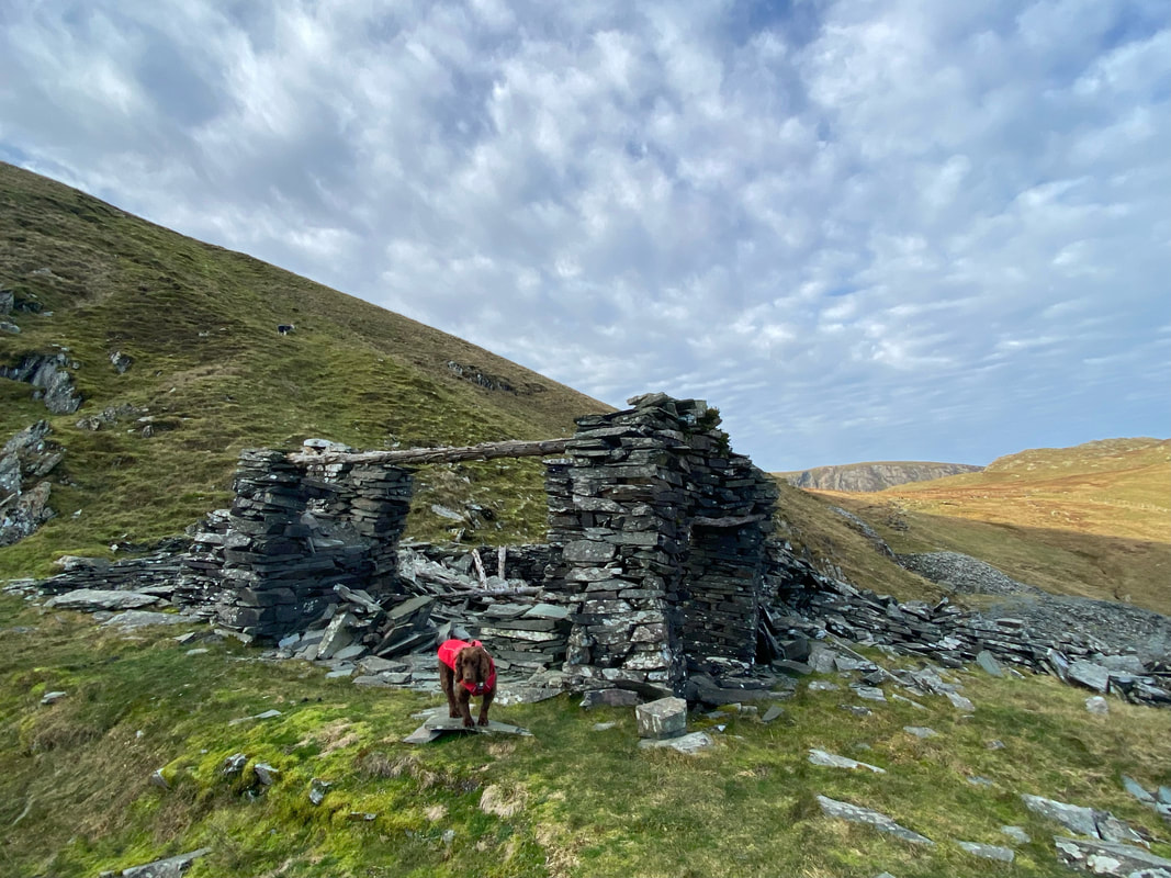
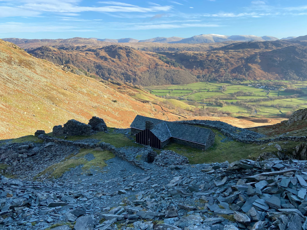
It will be nice when they get the roof on eh Fudge?
Angie & Fudge in the frame and what a view behind them too
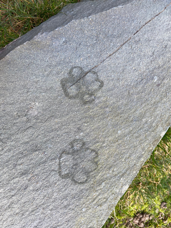
Fudge prints his sweaty wet paw marks on the slate as we prepare to leave the quarry
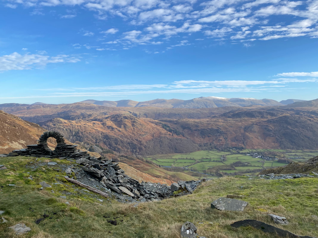
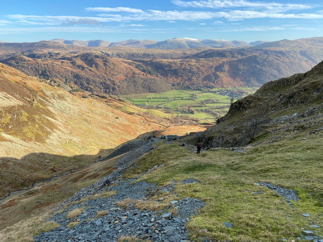
The glorious view from the upper quarry over to the Eastern Fells
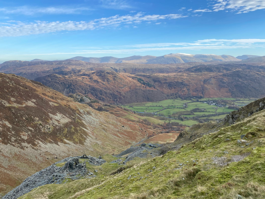
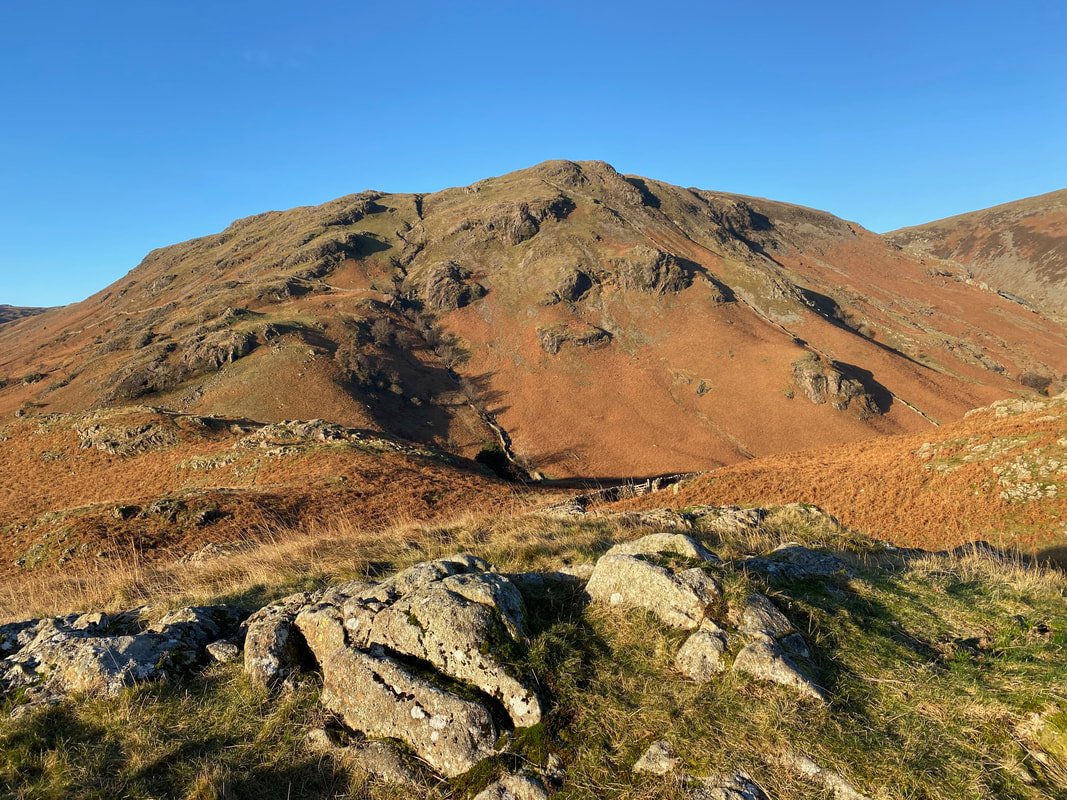
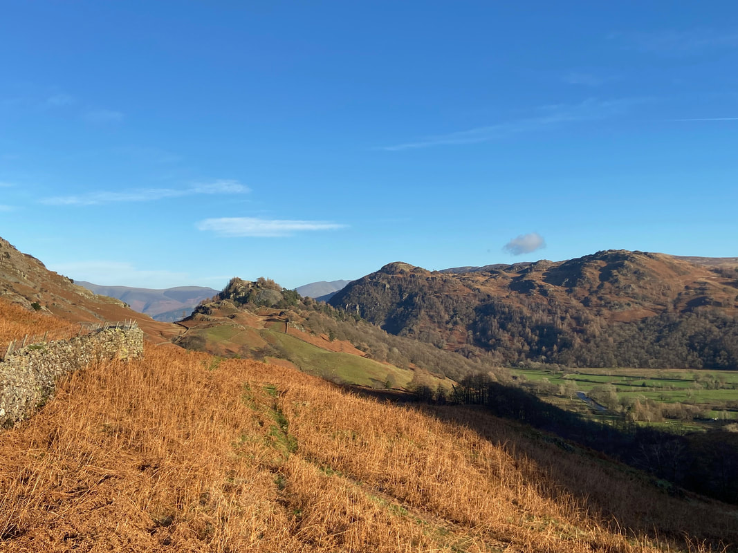
A bit further on from the upper quarry we left the main path and headed off over rough ground to visit the summit of High Scawdel & Launchy Tarn.
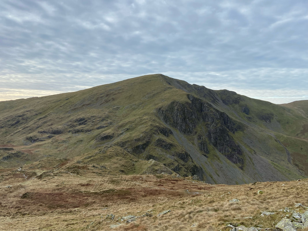
Launchy Tarn below a cirrocumulus cloud base - also known as a "Mackerel Sky". The fell to the rear is Dale Head with the summit of High Scawdel a few yards away to the left.
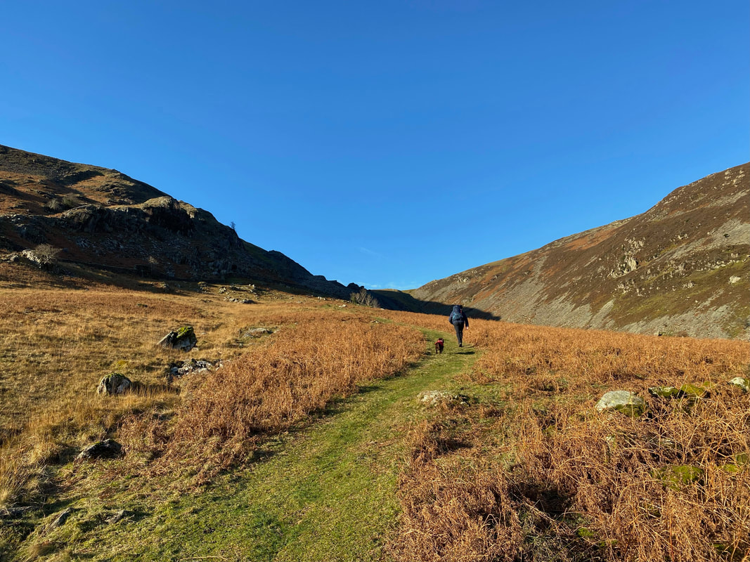
The transit to High Spy from Launchy Tarn via Robin Fold Edge. Firstly we would cross Wilson's Bield and then join the path coming up from Dale Head over to the left.
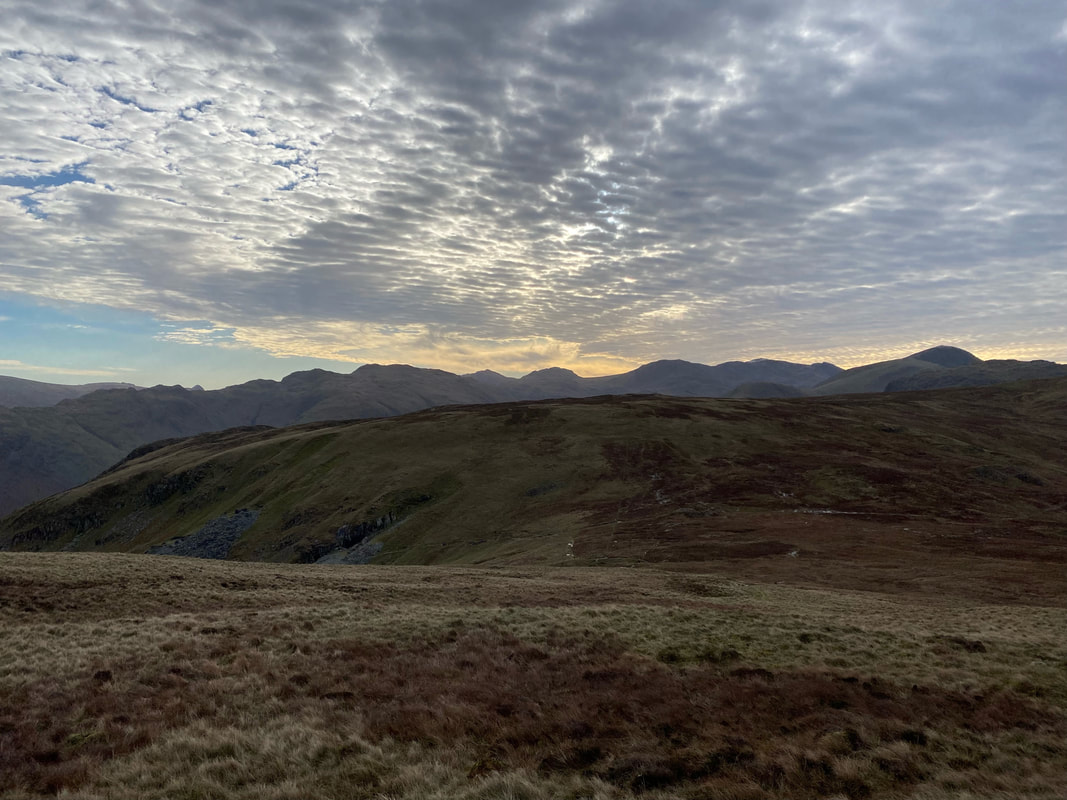
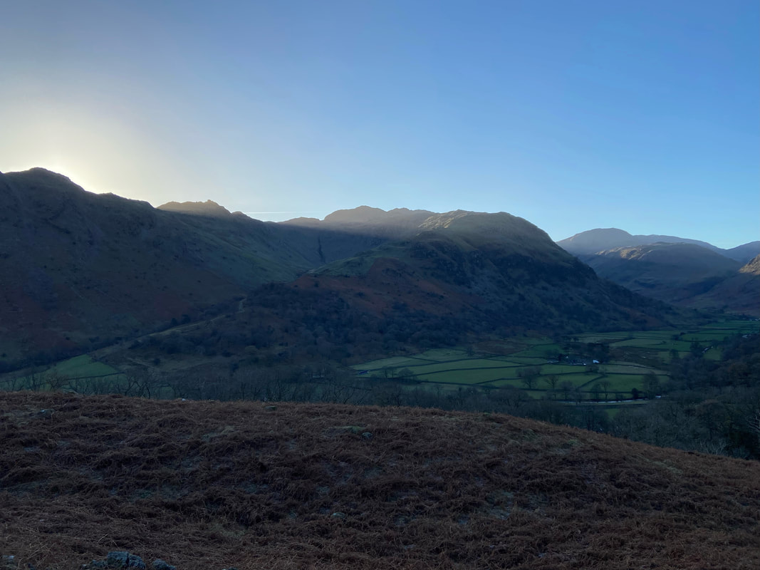
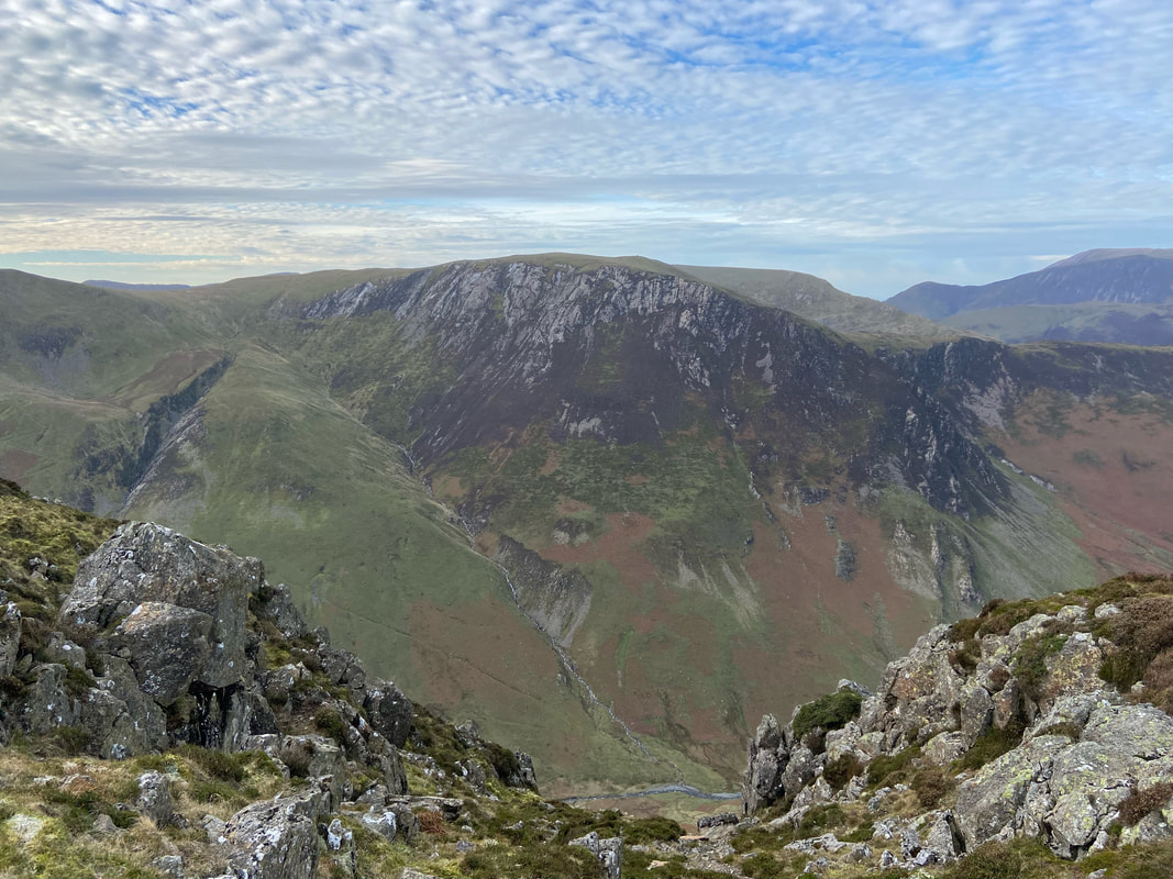
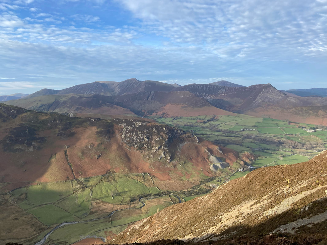
Looking back to High Scawdel with Glaramara, Bowfell, Esk Pike, the Scafells, Great Gable and Grey Knotts below a moody sky
Dalehead Crags, Great Gable (the other one) & Dale Head from Robin Fold Edge
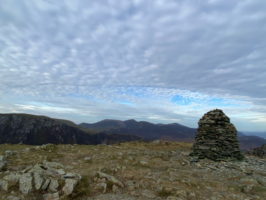
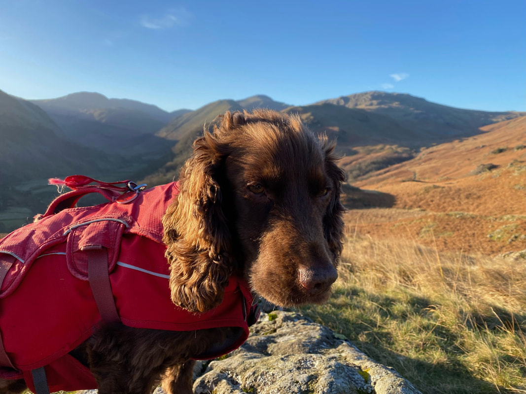
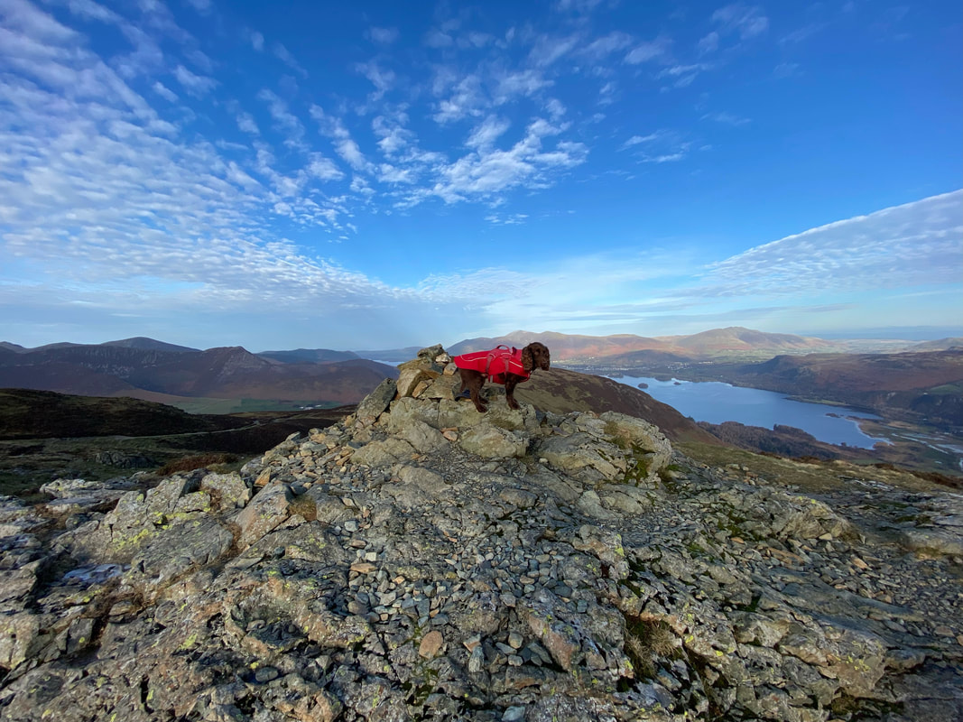
The summit of High Spy with Hindscarth to the left
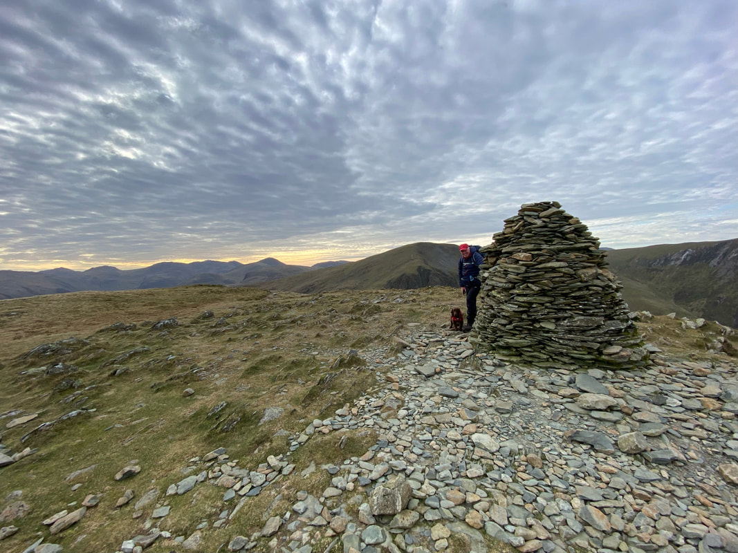
Peekaboo on High Spy
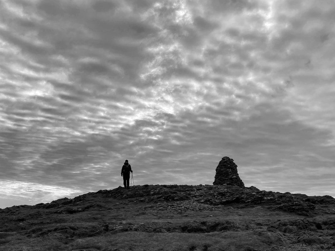
A mono shot of Angie on the summit of High Spy
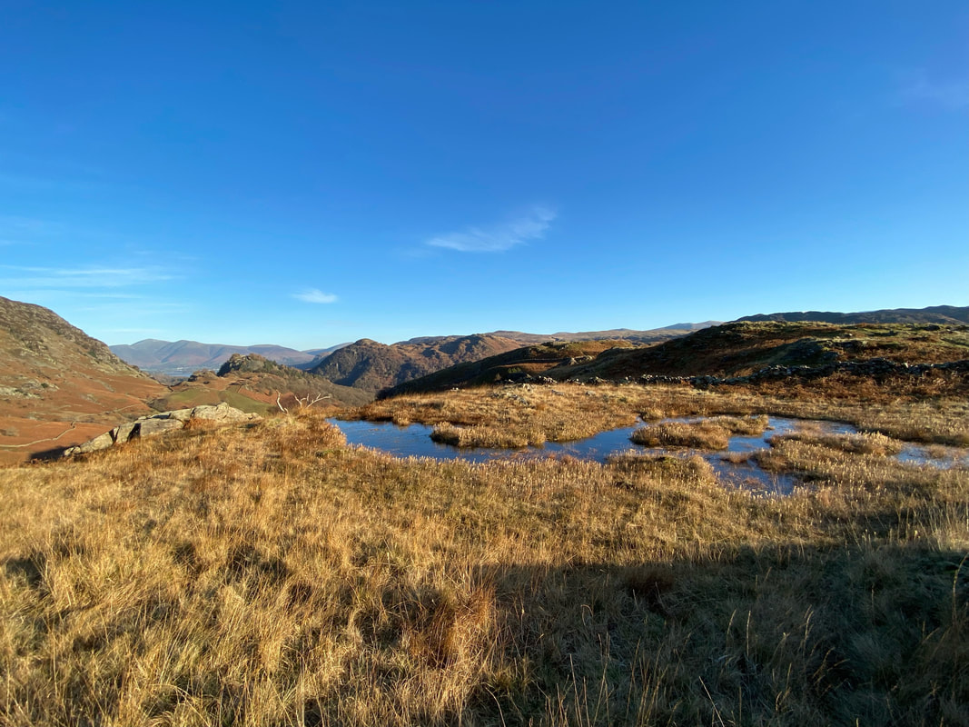
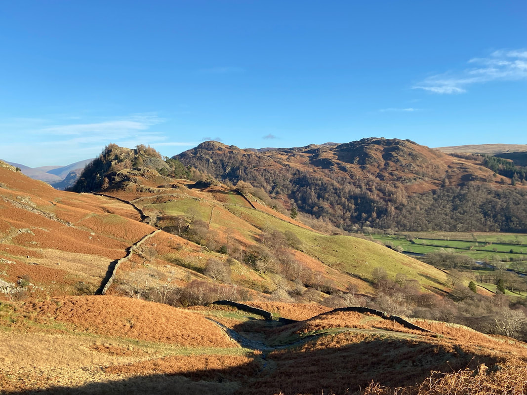
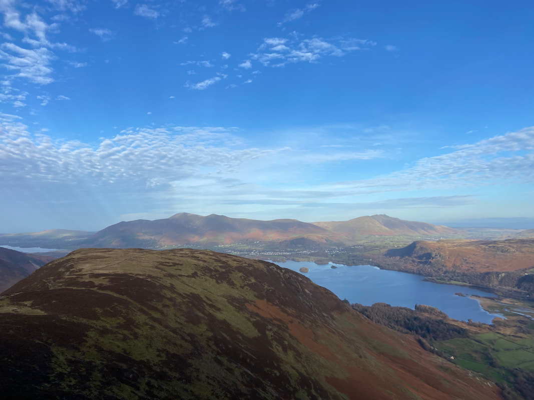
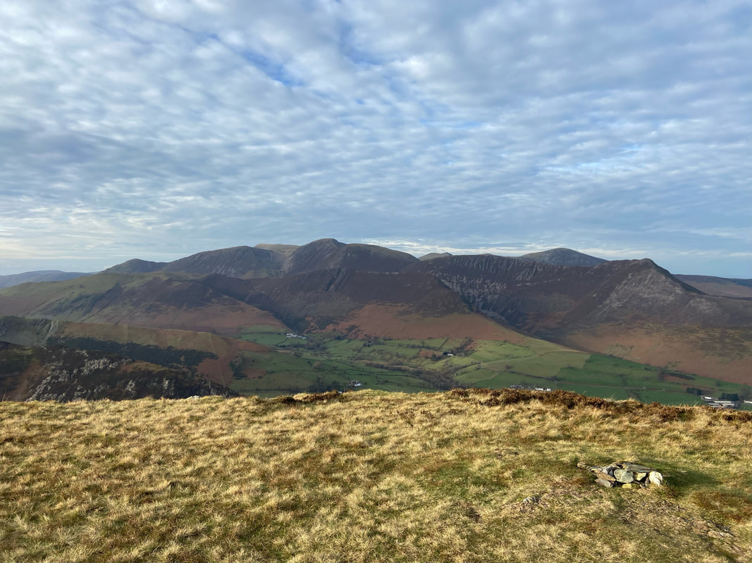
From High Spy the transit to Maiden Moor begins with a level walk across the escarpment above Eel Crags
Looking back to High Spy & Dale Head from the path above Eel Crags
Hindscarth with Robinson beyond - Whiteless Pike & Grasmoor are to the right
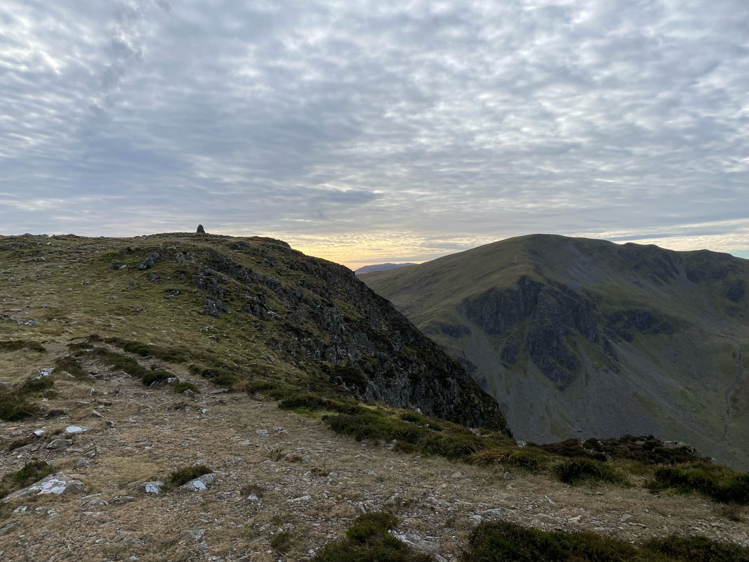
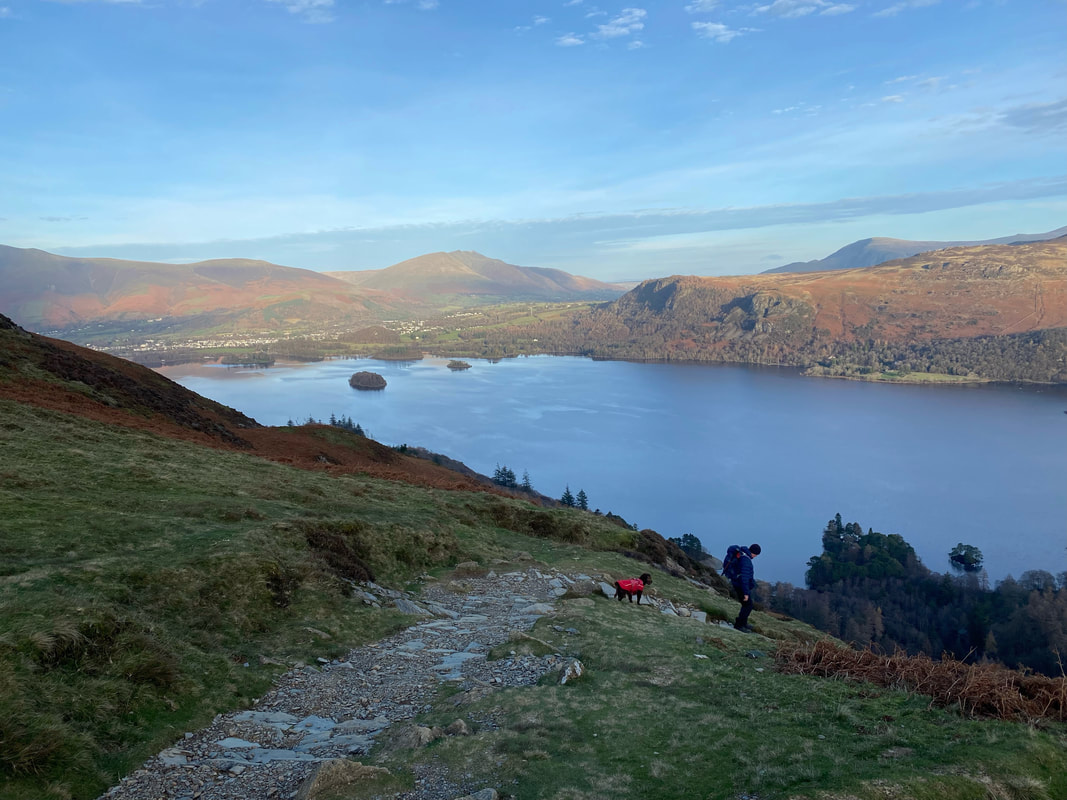
A little off path is the summit of High Spy North Top - well worth the short detour
The summit of High Spy North Top looking over Derwentwater to Blencathra
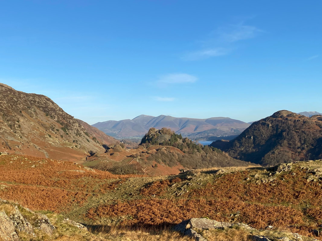
Maiden Moor, Skiddaw & Blencathra from High Spy North Top
Looking over Newlands to Scope End with the North Western Fells beyond
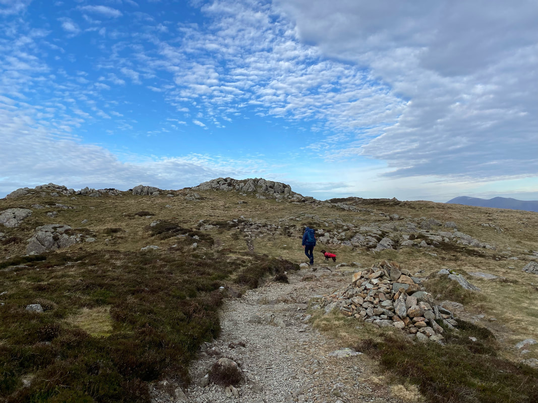
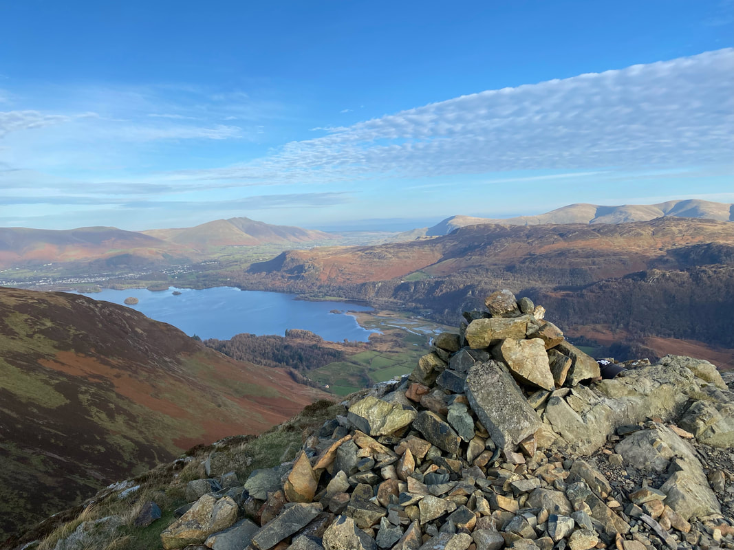
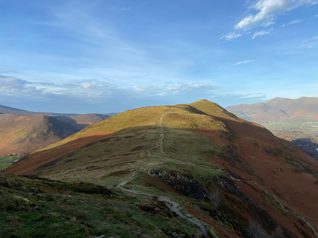
The summit of Maiden Moor
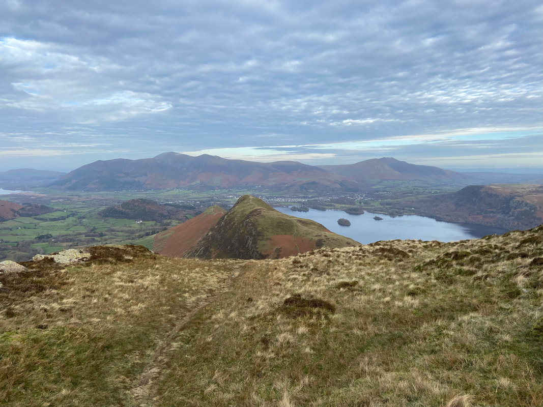
From Maiden Moor the path continues over to the left to reach Bull Crag to then turn right here and head north once more in the direction of Cat Bells which can be seen ahead
Hause Gate & Cat Bells from near Trap Knotts. Our path down to Manesty can be seen heading down the fellside to the right.
Fudge watches my careful descent down the stepped path with clear disdain
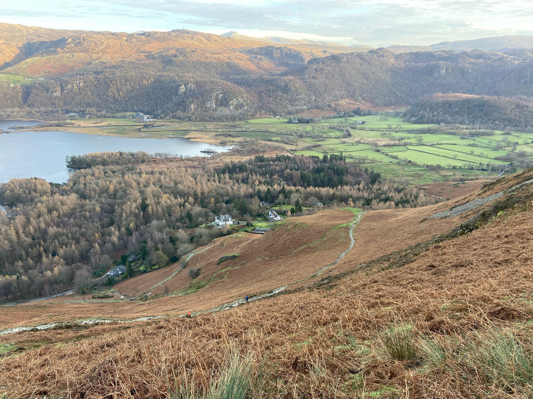
After a steep section the path levels out
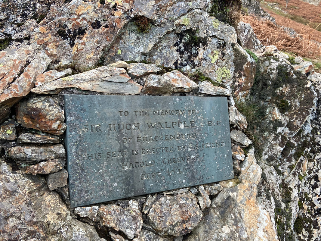
At the valley bottom just before Manesty I headed off route to the north to seek out the commemorative seat to Sir Hugh Walpole. The seat commands a superb view over Derwent Water and is sited just above Walpole's house at Brackenburn in Manesty Park. Walpole was a successful novelist and his range included disturbing studies of the macabre, children's stories and historical fiction, most notably his Herries Chronicle series, set in the Lake District. He also worked in Hollywood writing scenarios for two Metro-Goldwyn-Mayer films in the 1930s, and played a cameo role in the 1935 version of David Copperfield. New Zealand by birth, Walpole died in 1941 aged 57.
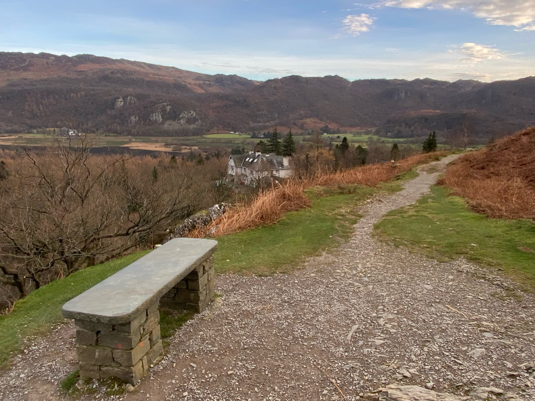
The memorial seat to Sir Hugh Walpole - his home for many years, Brackenburn sits below
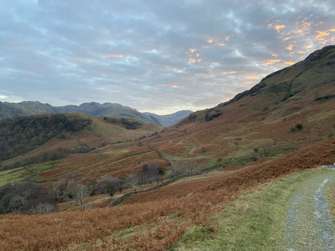
Back on route now as we head towards Grange
Castle Crag comes back into view as dusk nears
The path continues along the lower flank of Maiden Moor as we near Grange - the building in the distance is Hollows Farm
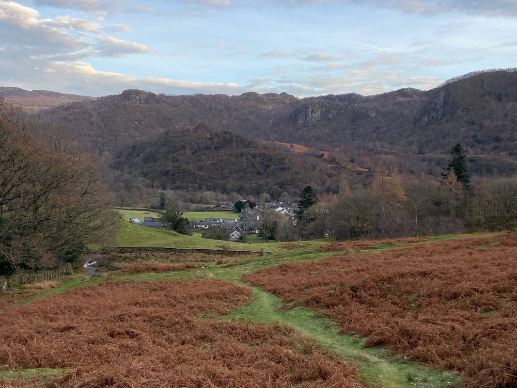
The lovely village of Grange in Borrowdale
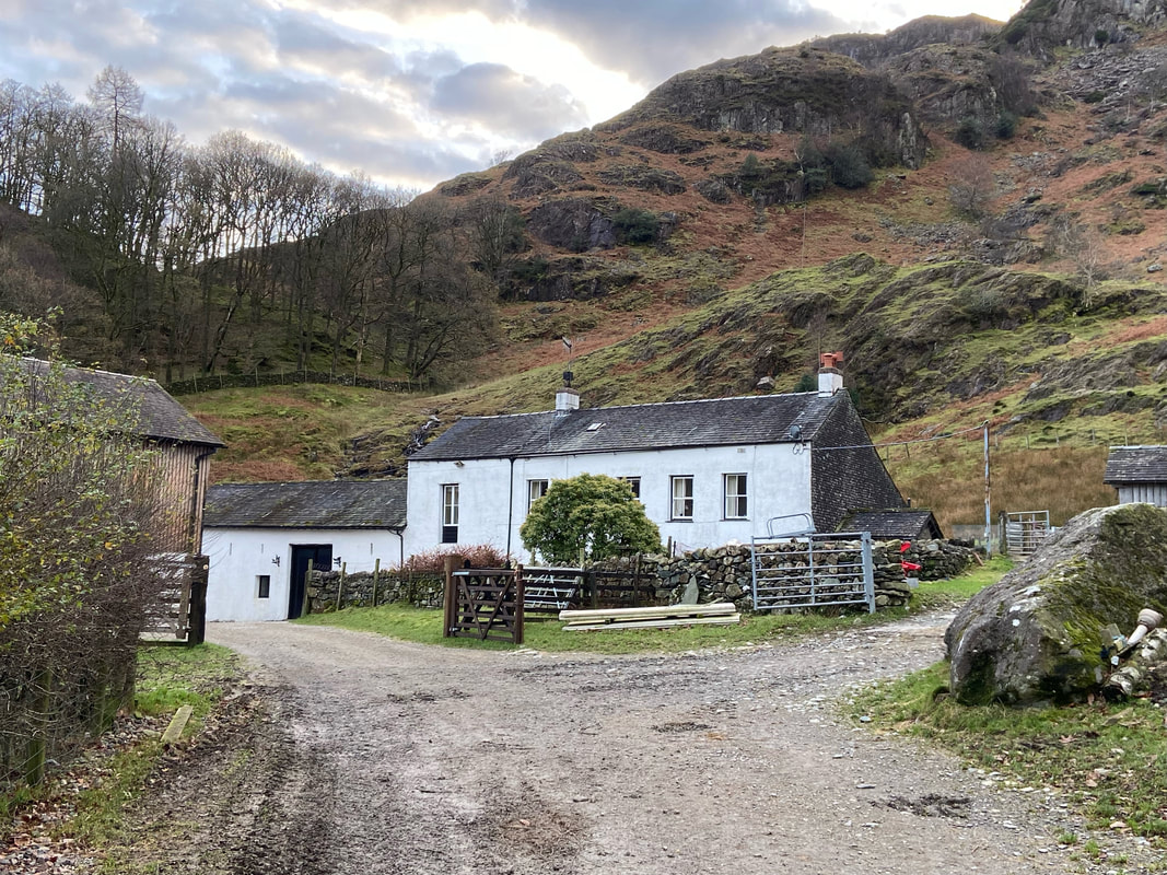
Hollows Farm - the place is a Mecca for the outdoor enthusiast providing Self-Catering, Bed & Breakfast and Campsite Accommodation in the beautiful Borrowdale Valley.
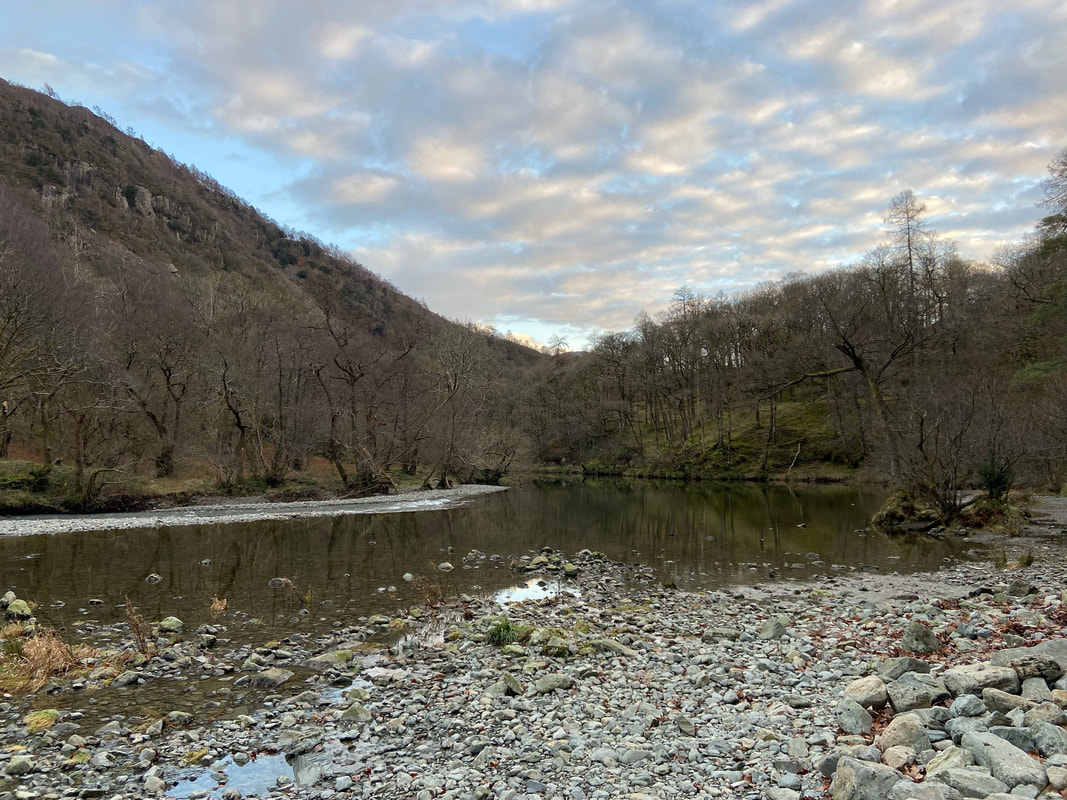
Gowder Dub where Broadslack Gill flows into the River Derwent
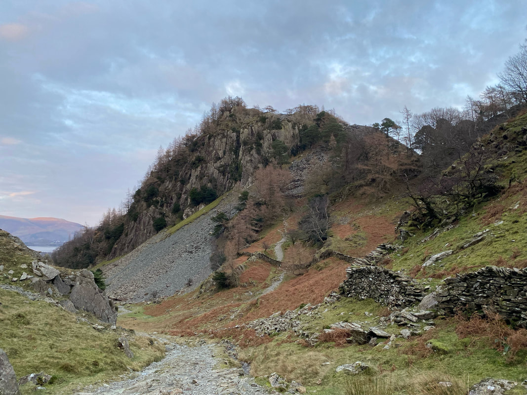
The path to Castle Crag - ordinarily we would have nipped up but it was getting dark therefore we pressed on
Approaching Seatoller after a fine days walking