Mynydd Mawr - Saturday 16 October 2021
Route
Rhyd Ddu - Bwlch y Moch - Foel Rudd - Craig y Bera - Mynydd Mawr - Craig y Bera - Foel Rudd - Bwlch y Moch - Rhyd Ddu
Parking
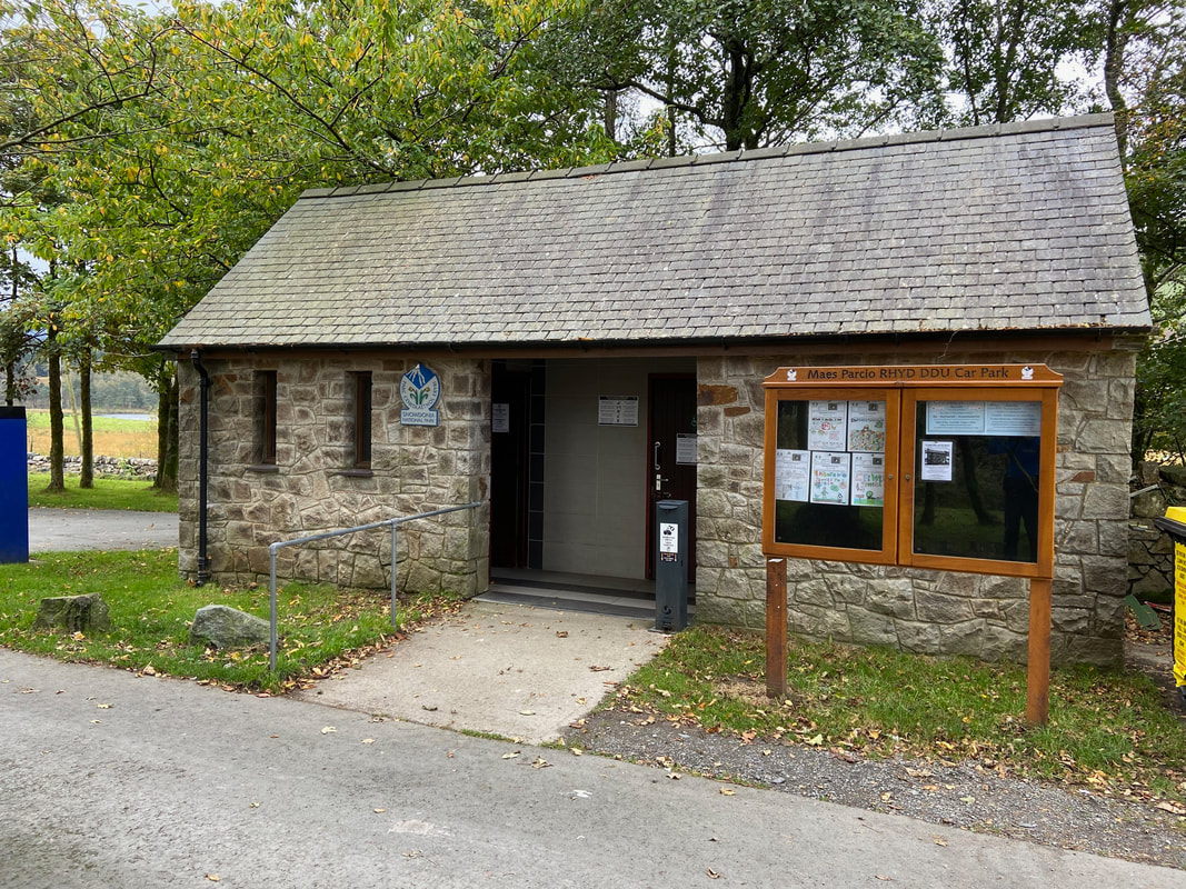
The Snowdonia National Park Authority Car Park 4 miles north of Beddgelert on the A4085 at the southern end of Rhyd Ddu (Charge). This is a popular starting point for both Snowdon & the Nantlle Ridge therefore it fills up pretty quickly - especially at weekends. The Grid Reference of the Car Park is SH 57101 52554 and the nearest postcode is LL54 6TH.
Mileage
7 miles
Terrain
Good paths throughout.
Weather
Overcast with some low cloud.
Time Taken
5hrs
Total Ascent
2011ft (613m)
Map
OL17 - Snowdon & Conwy Valley
Walkers
Dave, Angie & Fudge with Sharon O'Malley
Rhyd Ddu - Bwlch y Moch - Foel Rudd - Craig y Bera - Mynydd Mawr - Craig y Bera - Foel Rudd - Bwlch y Moch - Rhyd Ddu
Parking
The Snowdonia National Park Authority Car Park 4 miles north of Beddgelert on the A4085 at the southern end of Rhyd Ddu (Charge). This is a popular starting point for both Snowdon & the Nantlle Ridge therefore it fills up pretty quickly - especially at weekends. The Grid Reference of the Car Park is SH 57101 52554 and the nearest postcode is LL54 6TH.
Mileage
7 miles
Terrain
Good paths throughout.
Weather
Overcast with some low cloud.
Time Taken
5hrs
Total Ascent
2011ft (613m)
Map
OL17 - Snowdon & Conwy Valley
Walkers
Dave, Angie & Fudge with Sharon O'Malley
|
GPX File
|
| ||
If the above GPX file fails to download or presents itself as an XML file once downloaded then please feel free to contact me and I will send you the GPX file via e-mail.
Route Map
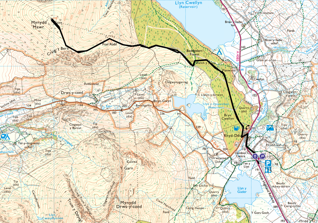
Today's walk started from the popular Car Park in the small village of Rhyd Ddu. As explained in the "Parking" header above, the Car Park is a popular starting point for ascending Snowdon by the Rhyd Ddu path & South Ridge plus over the road begins the glorious Nantlle Ridge. It gets extremely busy at the weekend therefore to make sure of a space get here early.
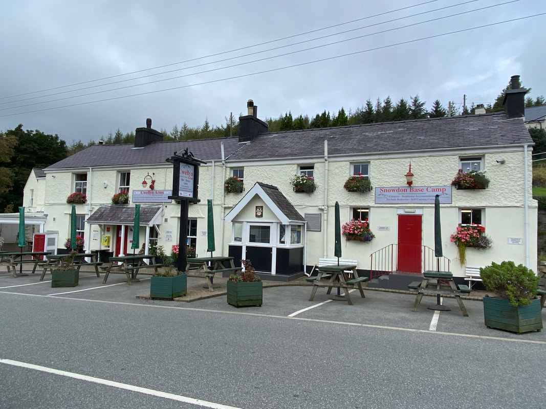
Heading north out of the village the route passes The Cwellyn Arms - a lovely pub which we would use for our debrief later.
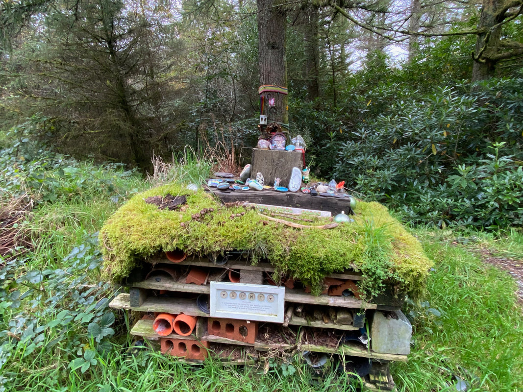
Apparently this is what's known as a "Bug Home" - an environment for insects (bees, ladybirds etc) to hibernate in winter. Seems like it is also a nice place for people to leave their tat.
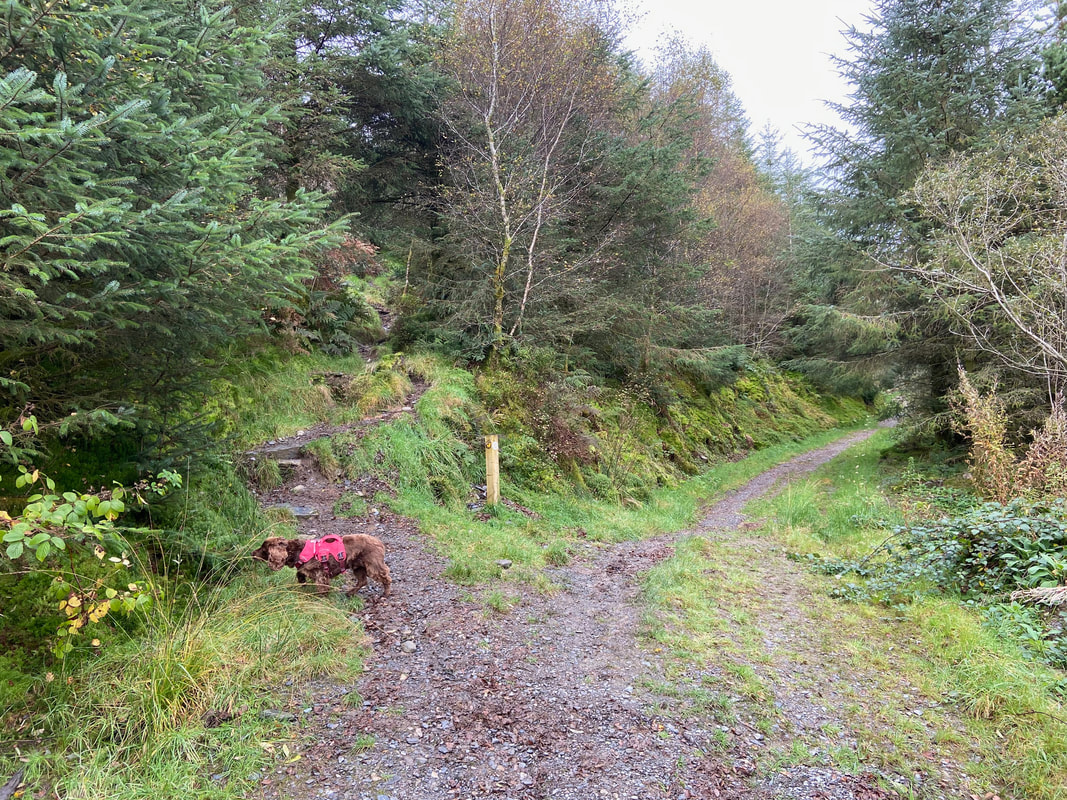
After a mile and a quarter the route leaves the main path through the forest at Bwlch y Moch and heads uphill to the left
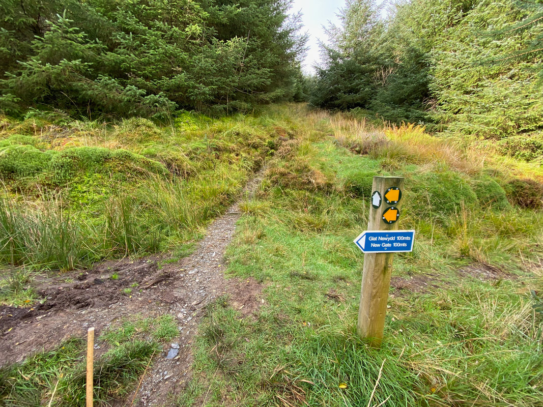
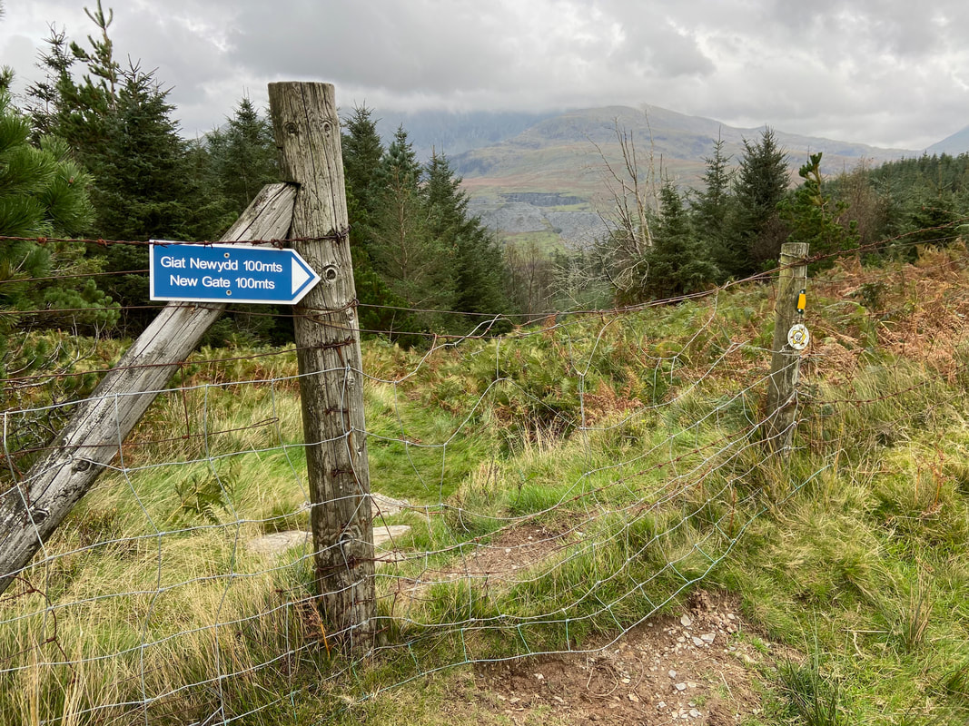
A short way up the hill the route enters a clearing at Grid Reference SH 56144 54077. The old route originally headed straight on here however a new gate has been provided a little further to the south and this route should now be used. The original route has been blocked off by a fence (see photographs later on in the walk).
This photograph is from a few feet to the left of the previous one and shows the new path on the left and the old one on the right
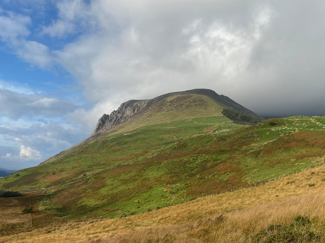
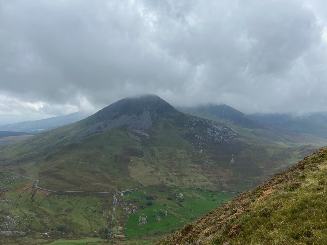
The ascent of Mynydd Mawr begins with a climb to Foel Rudd which is ahead. The crags to the left are Craig y Bera and our route would pass along the top of the crags once we left the summit of Foel Rudd.
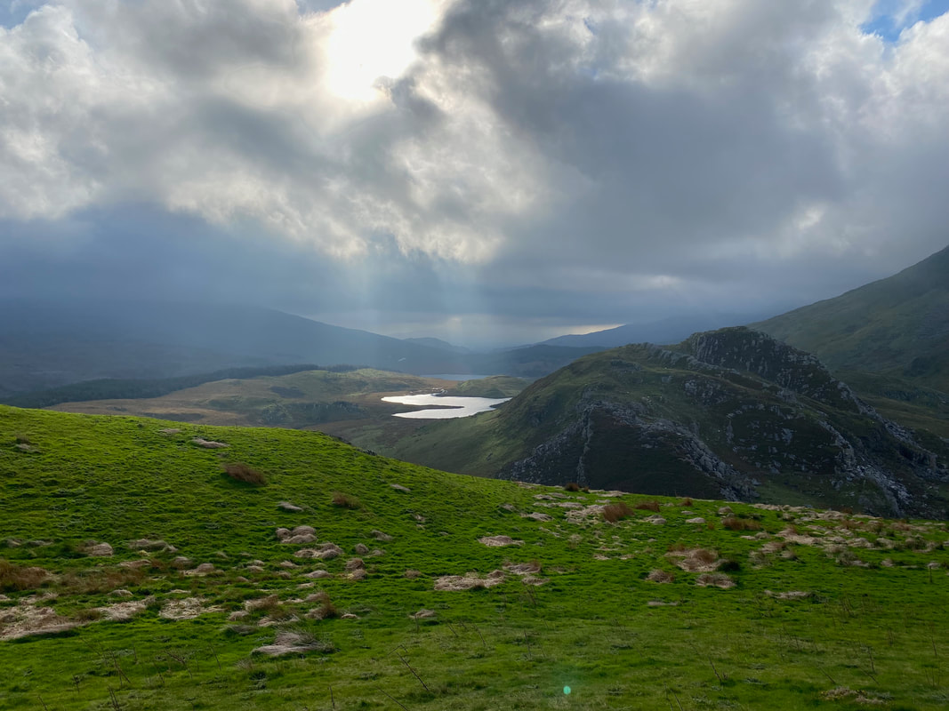
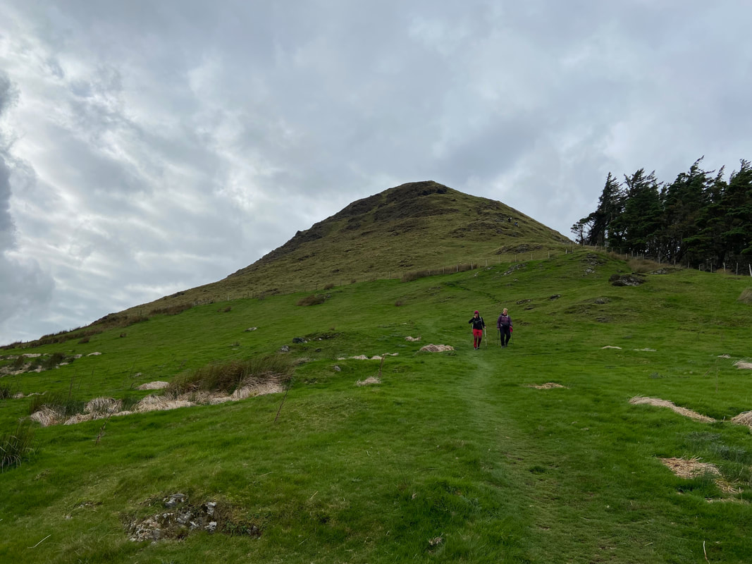
Ascending Foel Rudd as we look back to Y Garn, Llyn y Dywarchen and Llyn y Gader
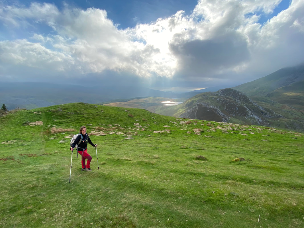
Sharon our walking companion today on the ascent of Foel Rudd
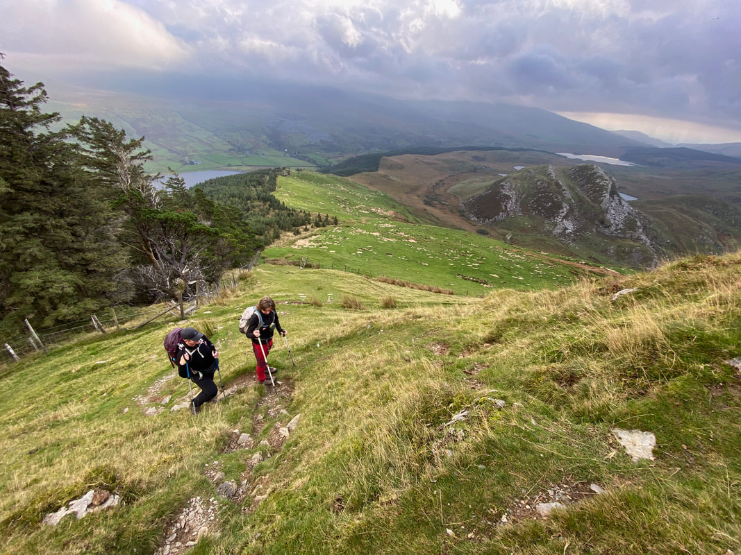
The route climbs more steeply now as we look back to the small hill of Clogwynygarreg
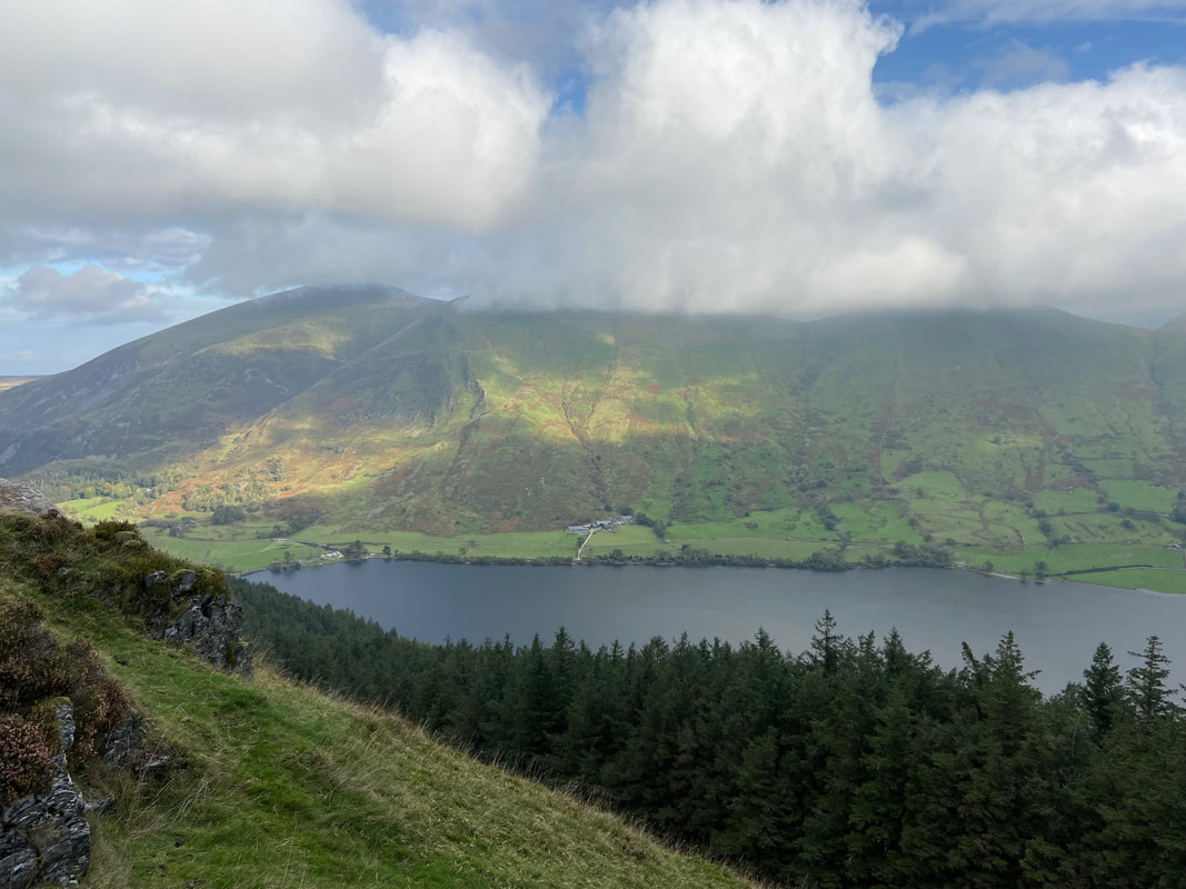
Looking over Llyn Cwellyn to Foel Goch, Foel Gron & Moel Eilio
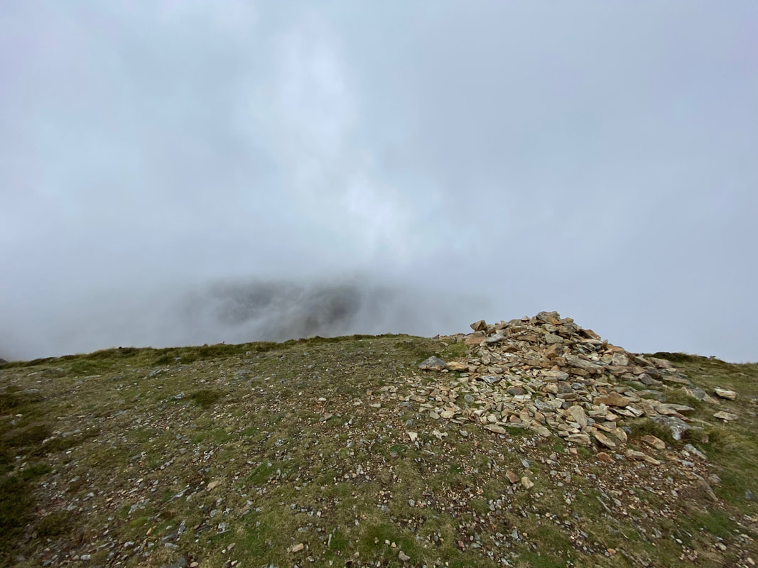
The summit cairn on Foel Rudd. By now it was looking pretty bleak with a lot of low cloud about. Would we get lucky?
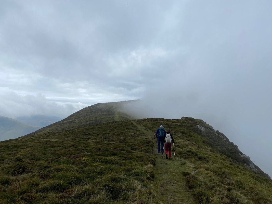
From Foel Rudd begins a level transit above the crags of Craig y Bera - meanwhile the low cloud sits up against the slopes of Foel Rudd
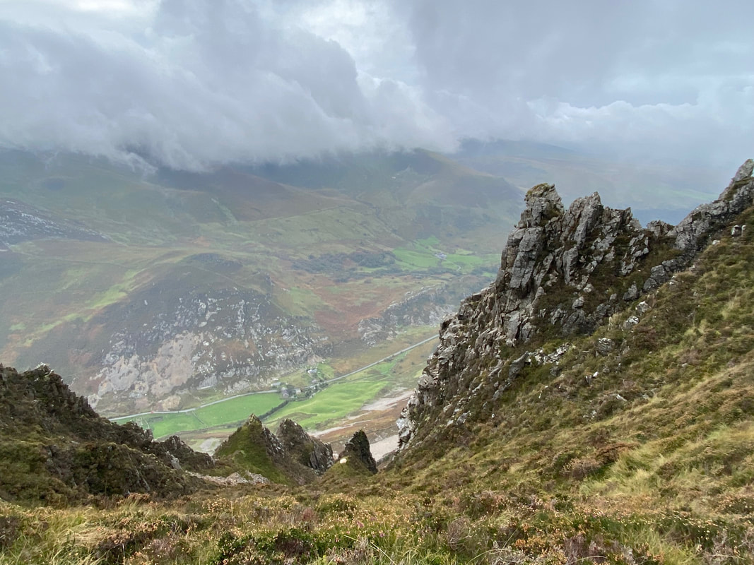
The crags of Craig y Bera
Looking back to Foel Rudd as we continue along the escarpment
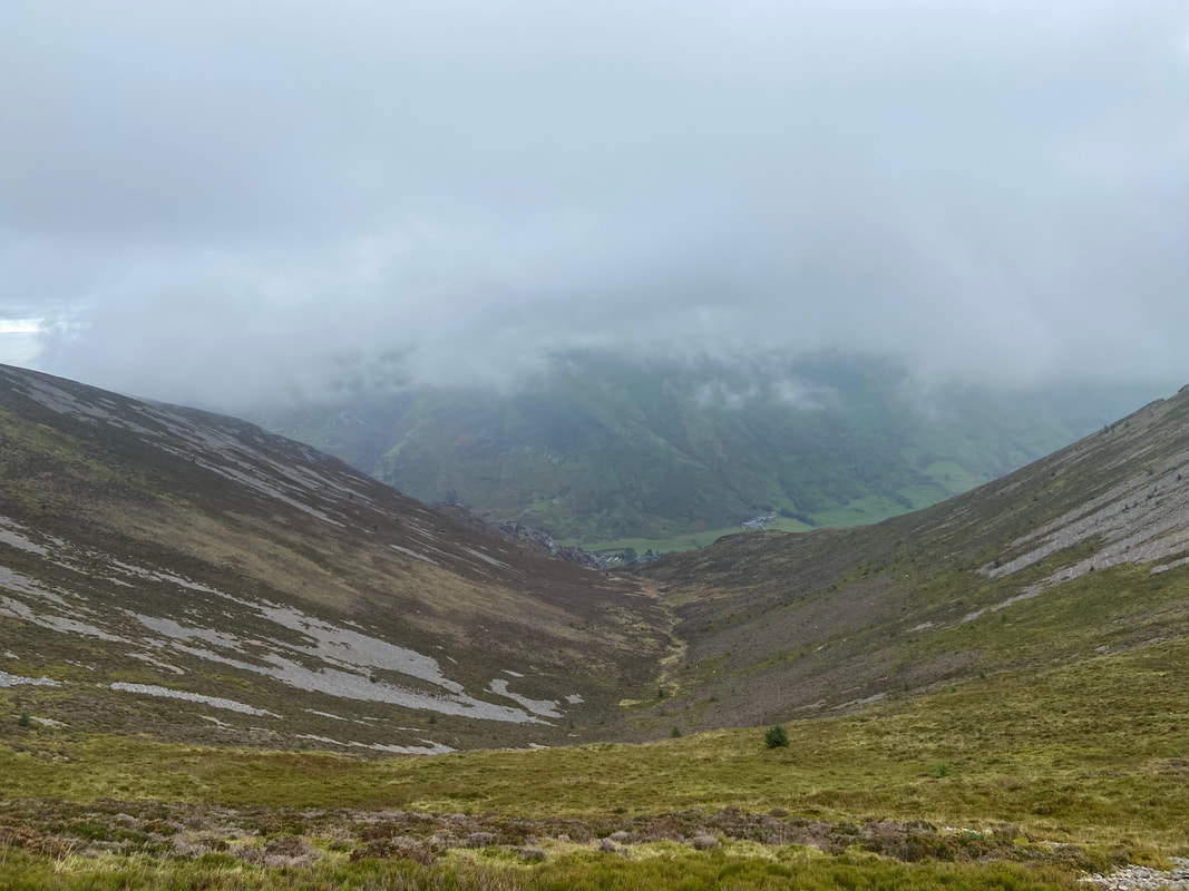
Cwm Planwydd
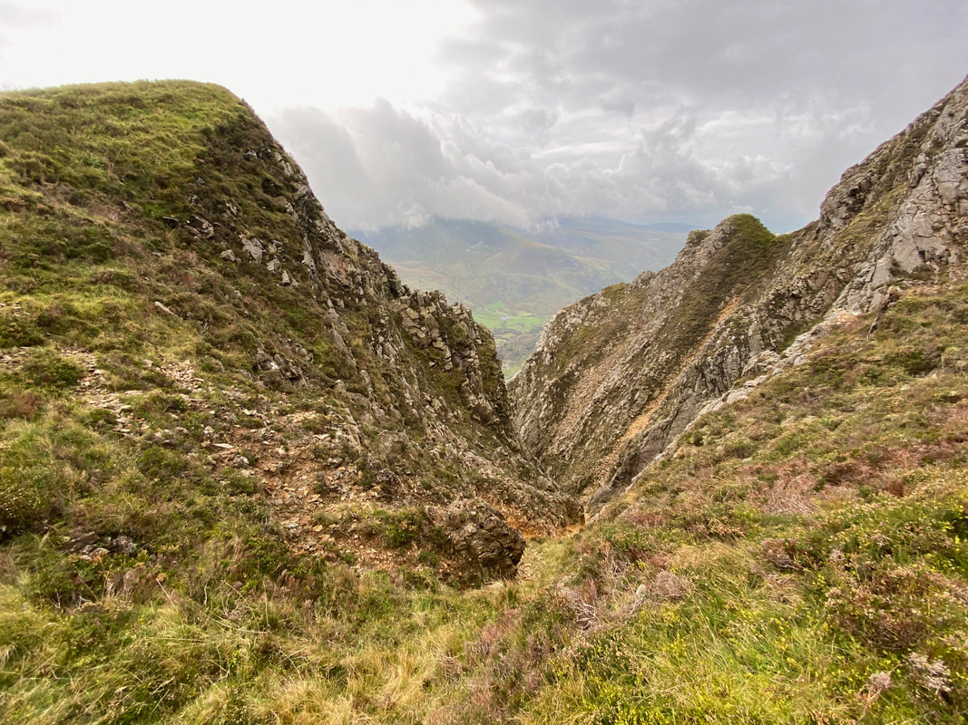
Looking into the depths of one of Craig y Bera's many gullies
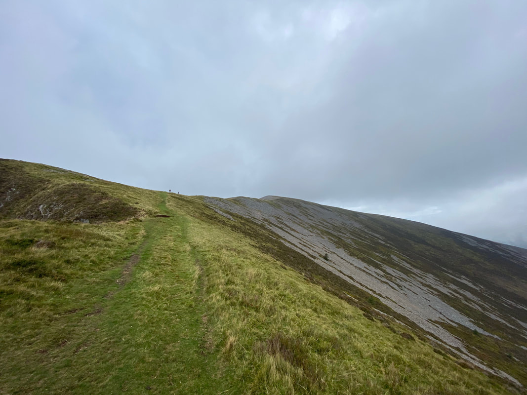
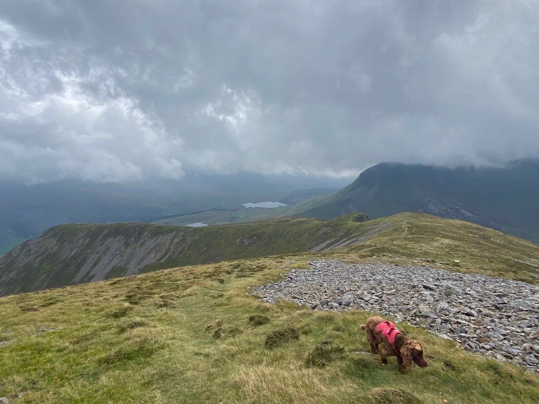
Angie & Sharon ahead of me now as they near the summit of Mynydd Mawr
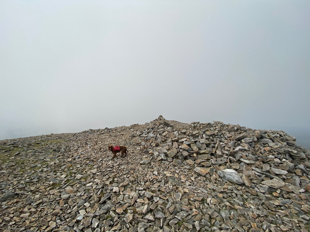
Fudge reaches the summit of Mynydd Mawr and looks very pleased with himself - the name translates to "Big Mountain"
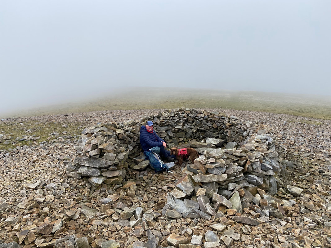
Just below the summit cairn is a fine shelter and as the wind had picked up Fudge and I decided to try it out

Moel Eilio from Mynydd Mawr
The summit of Mynydd Mawr with Angie & Sharon in the stone shelter
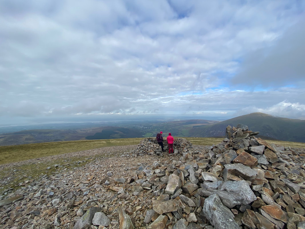
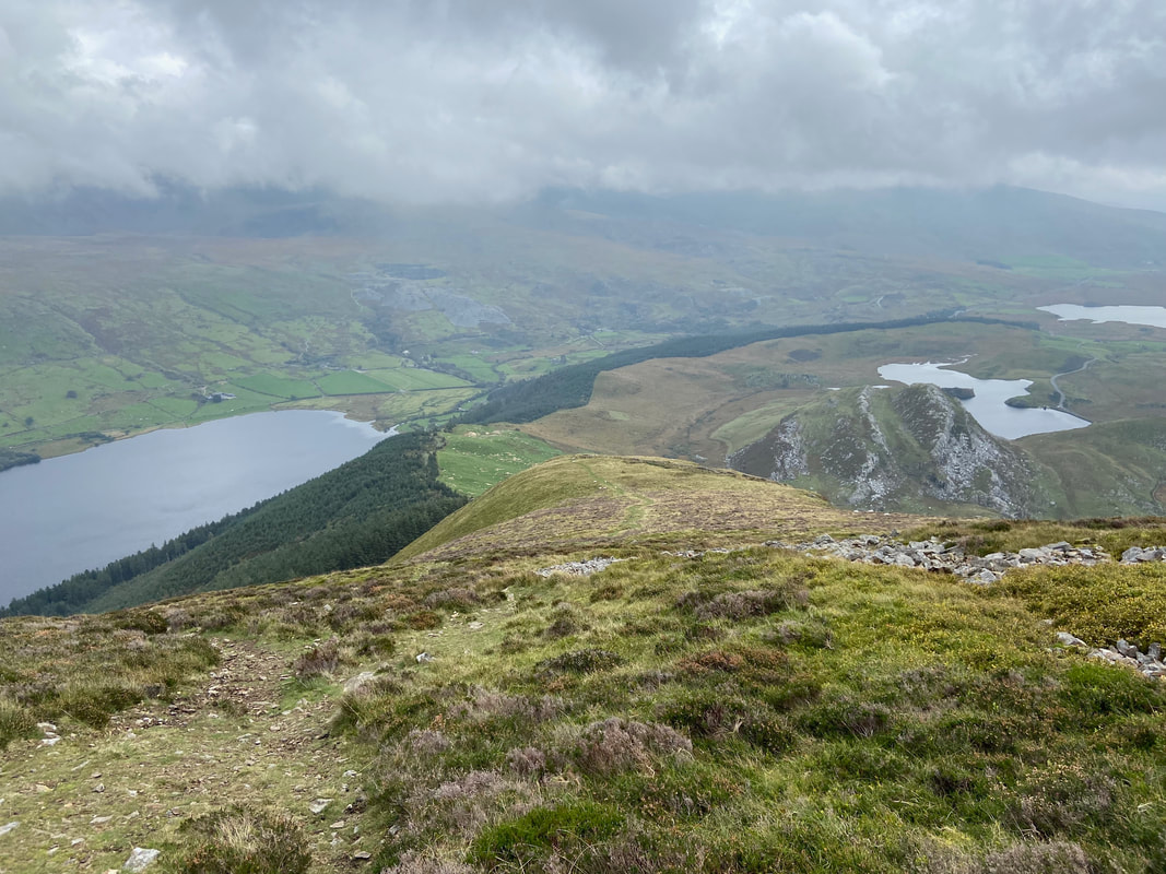
The view to our outward and return routes from the summit of Mynydd Mawr
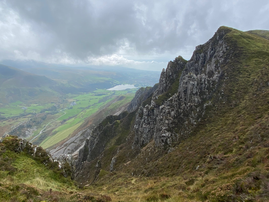
The impressive crags of Craig y Bera. The body of water in the distance is Llyn Nantlle Uchaf
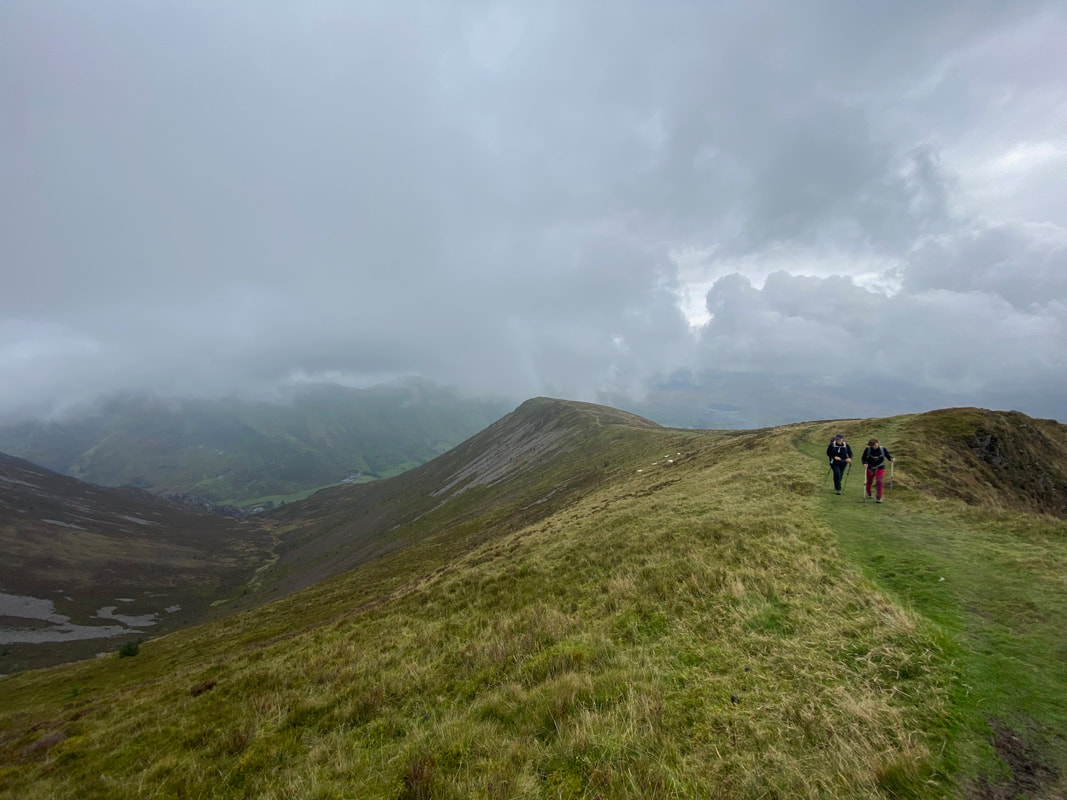
Our steep descent from Foel Rudd
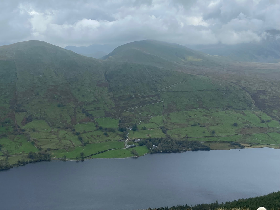
Looking over Llyn Cwellyn to the Snowdon Ranger path as it snakes its way up the mountain side. Foel Goch is to the left with Moel Cynghorion centre.
Y Garn with the Nantlle Ridge in cloud
Looking back to the final part of our descent from Foel Rudd
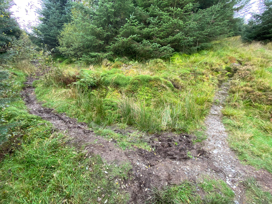
This is where the old path from Bwlch y Moch originally exited the forest at Grid Reference SH 56047 54079. By the look of it, the wire has been negotiated by some people who either cannot read or worse still can't be bothered to take notice of signage and simply walk a further 100 yards to the new gate.
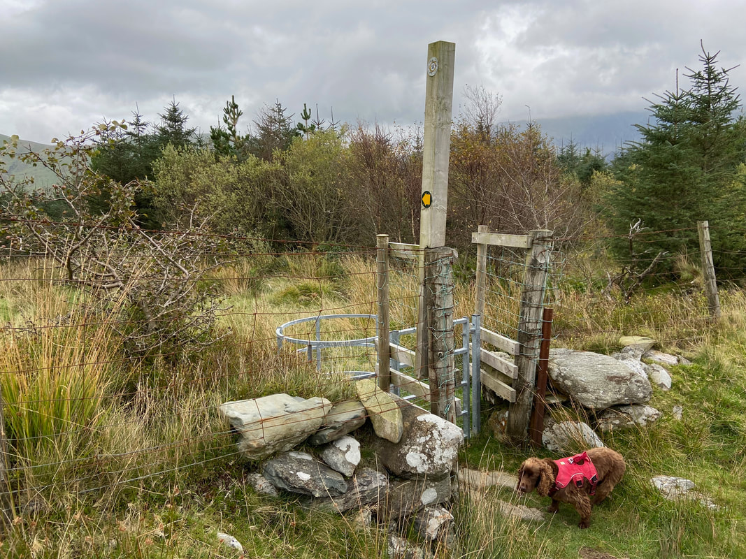
Fudge waits patiently for me to open the new gate up from (and back to) Bwlch y Moch - the gate is at Grid Reference SH 56125 54006
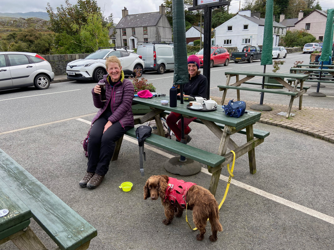
As is customary, after the walk we held a 'Debrief" at a suitable hostelry - this time at the excellent Cwellyn Arms in Rhyd Ddu
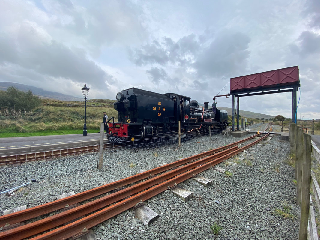
The Car Park is right next to Rhyd Ddu Station on the West Highland Railway
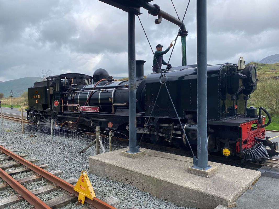
The Steam Engine "The Harbourmaster" taking on water at Rhyd Ddu Station