Lingmell, Scafell Pike, Broad Crag & Ill Crag via Piers Gill - Thursday 22 September 2016
Route
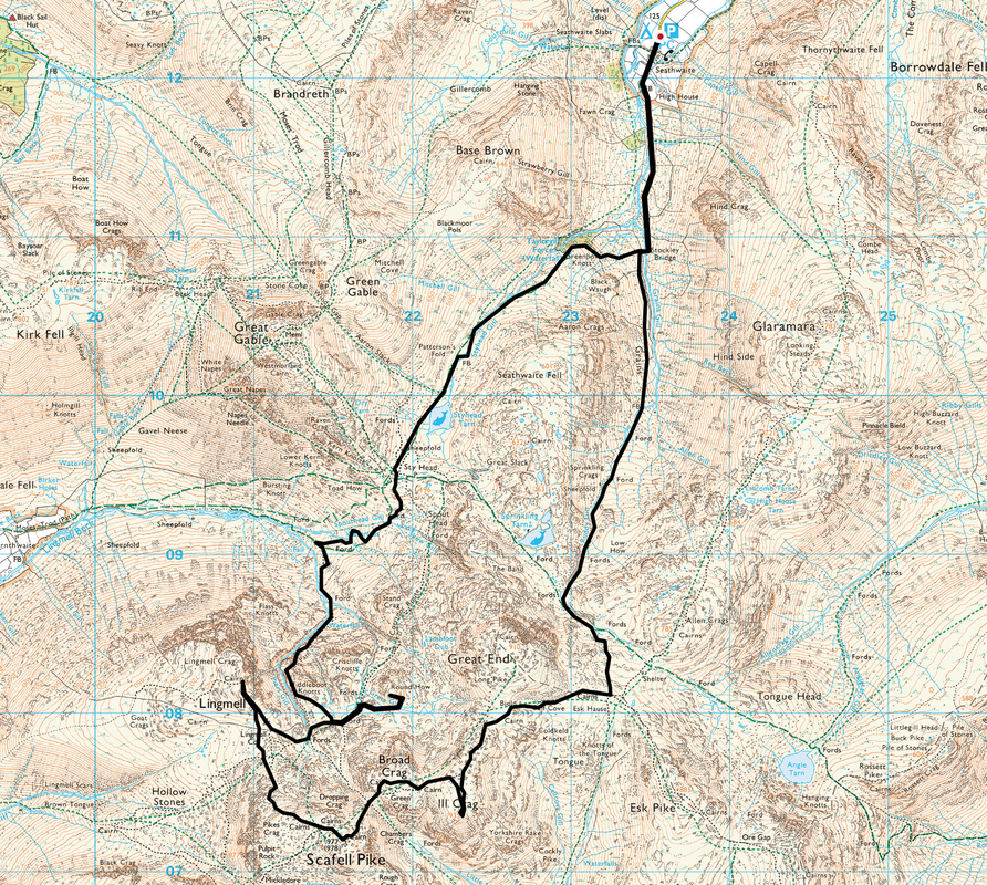
Seathwaite Farm - Stockley Bridge - Sty Head - Piers Gill - Middleboot Knotts - Round How - Lingmell Col - Lingmell - Lingmell Col - Scafell Pike - Broad Crag Col - Broad Crag - Ill Crag - Esk Hause - Ruddy Gill - Grains Gill - Stockley Bridge - Seathwaite Farm
Parking
Seathwaite Farm (Free) - Grid Ref NY236123
Mileage
12.3 miles
Terrain
Well used and clear mountain paths for the most part - a description of the route up via Piers Gill can be found in Wainwright's Book 4 (The Southern Fells) on page Scafell Pike 14. The path up the side of Piers Gill is intermittent and there is some easy scrambling to negotiate. The descent into Broad Crag Col is steep and stony - care should be taken.
Weather
Overcast, sunny spells and light breezes with very good visibility.
Time Taken
8hrs 40mins
Total Ascent
5459ft (1664m)
Wainwrights
2
Map
OL6 - The English Lakes (South Western Area)
|
GPX File
|
| ||
If the above GPX file fails to download or presents itself as an XML file once downloaded then please feel free to contact me and I will send you the GPX file via e-mail.
Walk Description
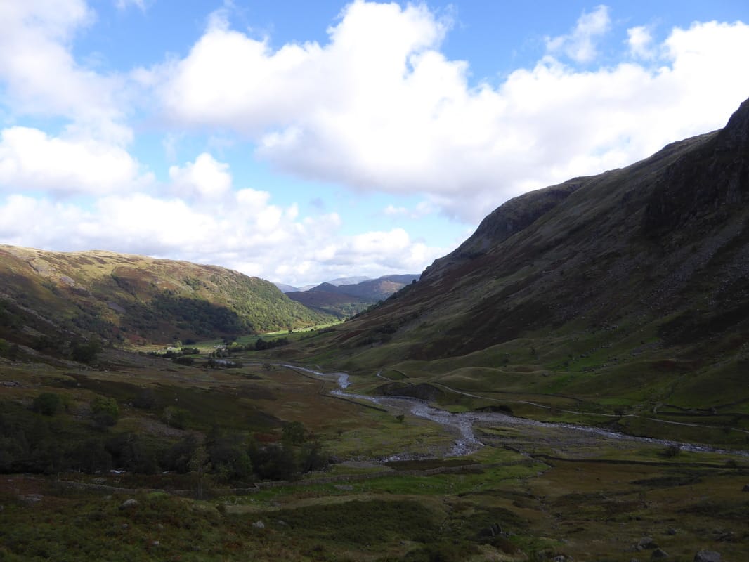
People have often said to us that one of the best ways up Scafell Pike is the route via Piers Gill. Whilst not anti social, we do not like crowds that much therefore any ascent of Scafell Pike in the past has been on the less popular routes, late in the day and then on days when there are not too many people about. Therefore the intention today was to walk to Sty Head, pick up the Piers Gill path, bag a couple of Nuttalls and then head to Lingmell. From Lingmell we then intended to join the Hollow Stones path coming up from Wasdale and visit Scafell Pike before returning to Seathwaite via Broad Crag, Ill Crag and Esk Hause - that was the plan anyway.
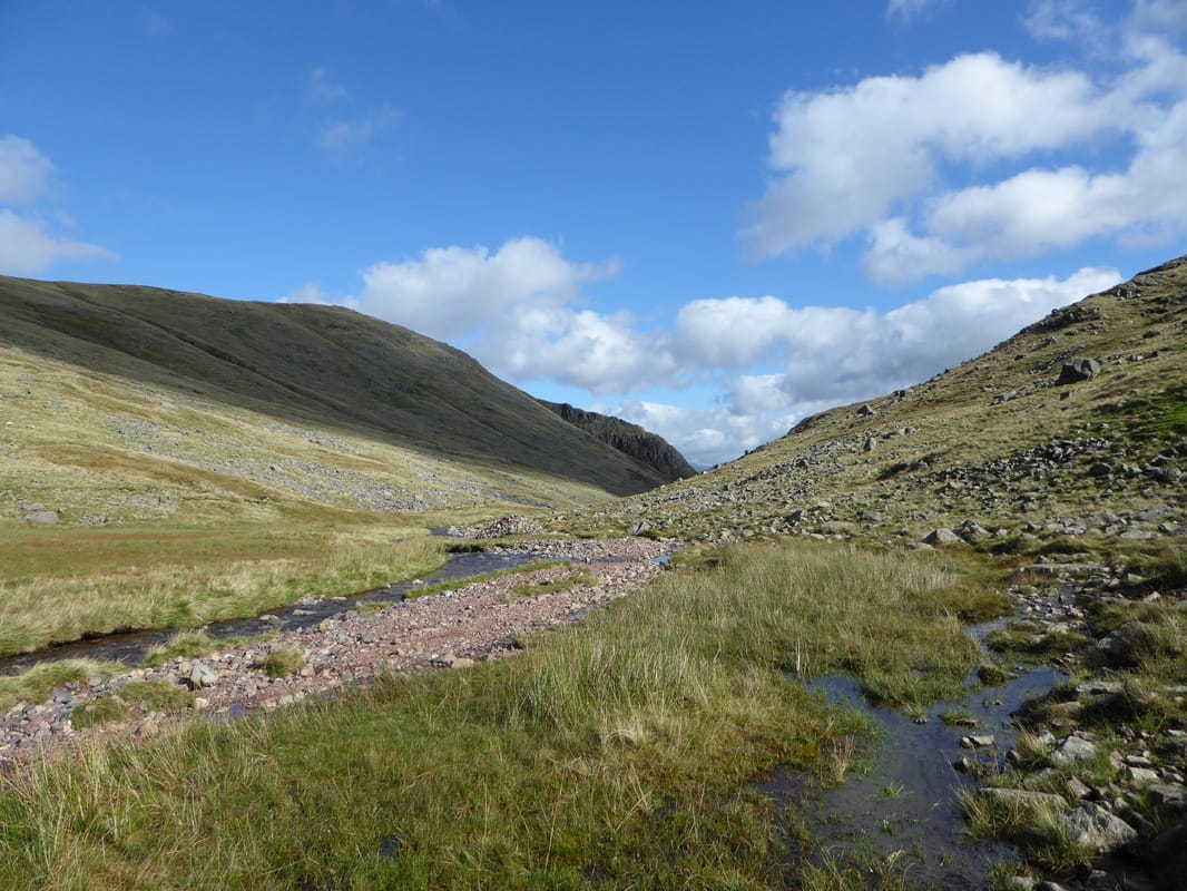
The route today could be started from either Seathwaite Farm or Wasdale - we chose Seathwaite as we were staying in the Northern Lakes. Leaving the farm we headed up to Stockley Bridge and from there steeply up to Greenhow Knott from where the gradient eases. The route then handrails Styhead Beck, passes Styhead Tarn to then arrive at the Mountain Rescue Post at Sty Head. From Sty Head there are a myriad of paths leading all over the place therefore it is important to get your Nav sorted before moving off. The path leaves Sty Head to move more or less parallel with Spouthead Gill, losing height as it heads in the direction of Wasdale Head. At a large boulder, the route changes direction to the south and heads uphill once more on a faint path to reach the lower reaches of Piers Gill. There are fantastic views right down into Wasdale and over to Great Gable.
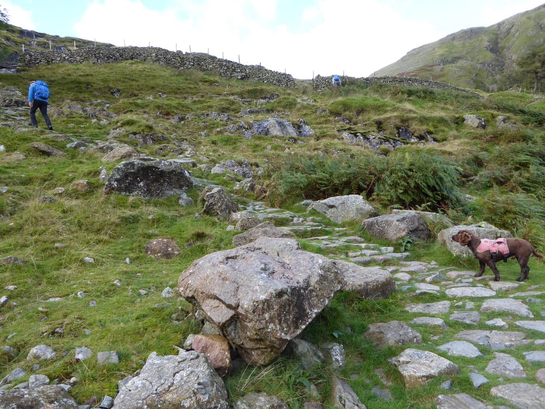
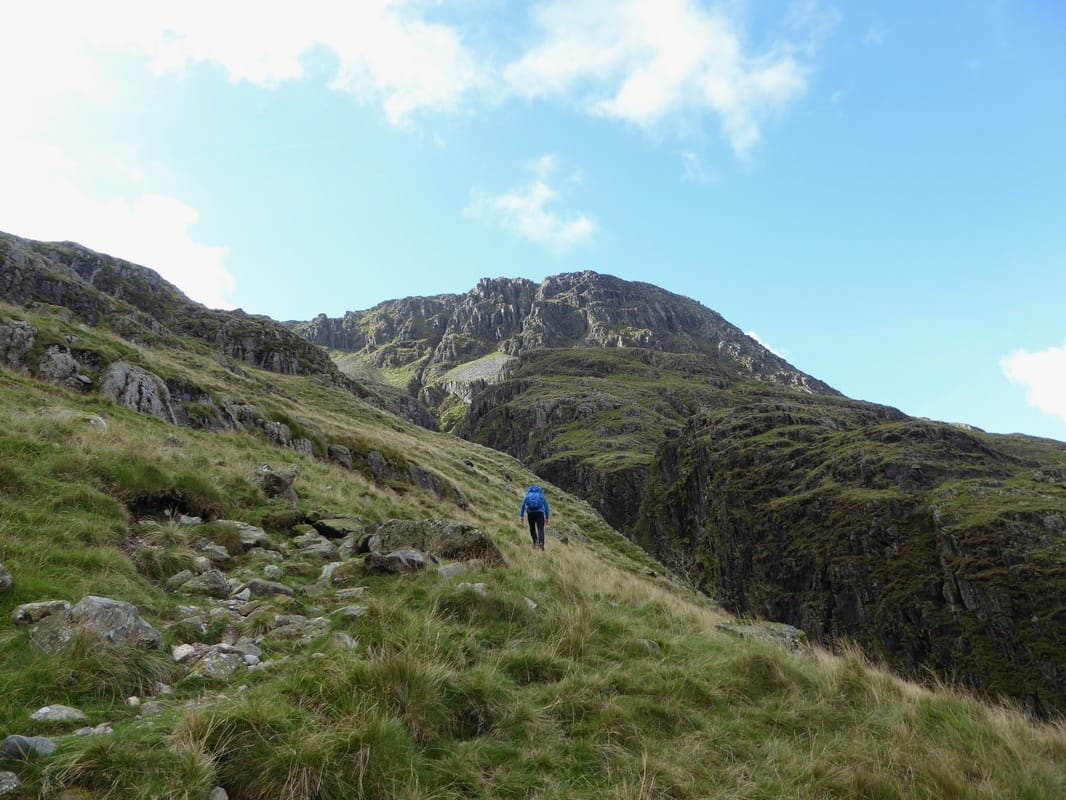
Heading away from the gill for a short time, the path then fords Greta Gill before once more heading up the left hand side of Piers Gill. The climb up the side of the impressive ravine is exhilarating and opportunity should be taken to enjoy the striking scene into the depths below. However, extreme caution should be exercised as there is loose rock and erosion on the edges of the Gill. Shortly before Piers Gill turns sharply left there is a scramble to be negotiated over a steep wall of broken crag but this is not overly difficult. The remainder of the ascent was along the grassy path and shortly before reaching the head of the gill we left the path to make the short ascent up to the Nuttall of Middleboot Knotts.
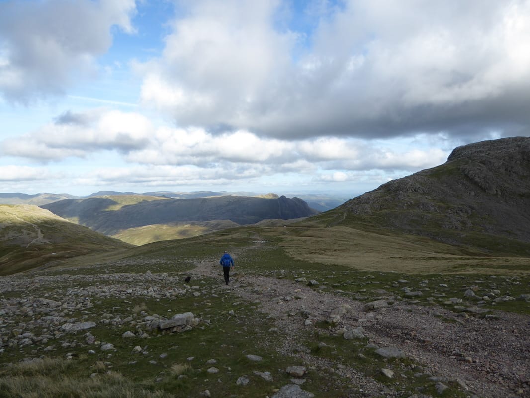
From the summit of Middleboot Knotts we headed south east to join the Corridor Route coming up from Sty Head but left this on a vague path to eventually handrail the stony bed of Greta Gill. The path up via the gill is easy to see in good visibility but could be missed when the clag is down. After crossing the gill, it was an easy ascent to attain the summit of Round How and again the views were spectacular. Returning the same way, we headed along the Corridor Route to reach the head of Piers Gill where there is a great view down into the ravine. The route then heads uphill once more to reach a broken wall which we followed to the grassy area of Lingmell Col although there is a clearer path a bit further south which also reaches the col but a little further to the west.
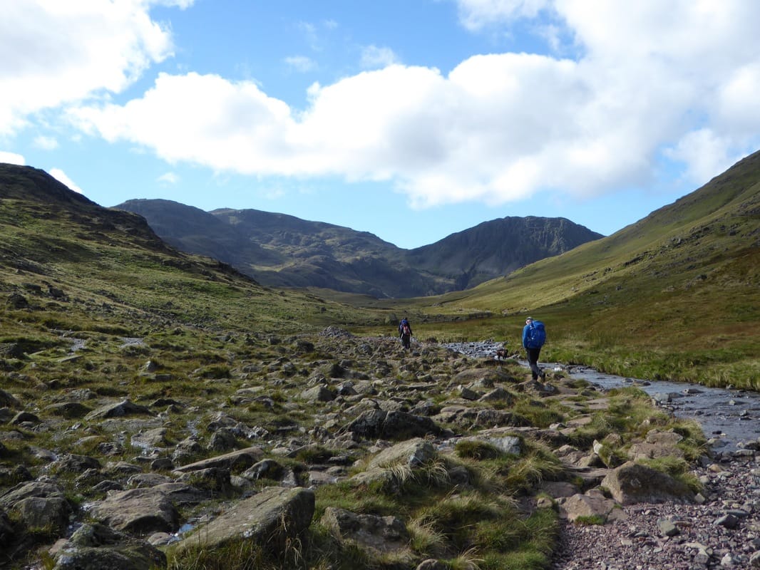
From Lingmell Col we watched the many people descending into Wasdale from Scafell Pike via the Hollow Stones path - by this time it was about 1530 and there were not that many people coming up the other way. The ascent up to Lingmell is gradual and soon the large and impressive cairn on the summit is reached and with it a superb panorama down over Wasdale, Wastwater and over Mosedale to Yewbarrow and Pillar. Returning to Lingmell Col, there was now a bouldery and steep descent up the popular path to Scafell Pike and with only a handful of people making the ascent we knew that we would see it fairly quiet on the summit - and so it proved. As you would expect, there is a fabulous Lakeland panorama from the Roof of England and we hung around a while here just taking in the spectacular view on offer.
Scafell Pike can be a confusing place even in good visibility and it is worth just making sure you are heading in the right direction before you make your exit off the mountain. We were heading north east to make the steep descent into Broad Crag Col - on reaching the col there is a fabulous view to the right down Little Narrowcove - a long, steep & stony hollow which comes up from Eskdale. From the col it is another steep and stony ascent to gain the summit of Broad Crag. The top affords a great view back to Scafell Pike and onward to our next summit of Ill Crag that we reached via another descent & ascent on a good path. It is my guess that Ill Crag is not visited as much as it should be - it is off the main path back to Esk Hause and involves a bouldery clamber to gain its summit but it is worth it for the views to Crinkle Crags & the Coniston Fells - and it is a Furth also therefore worth the trip.
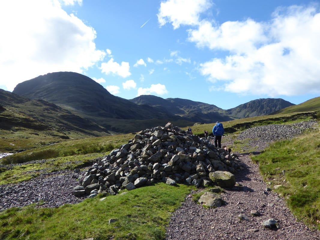
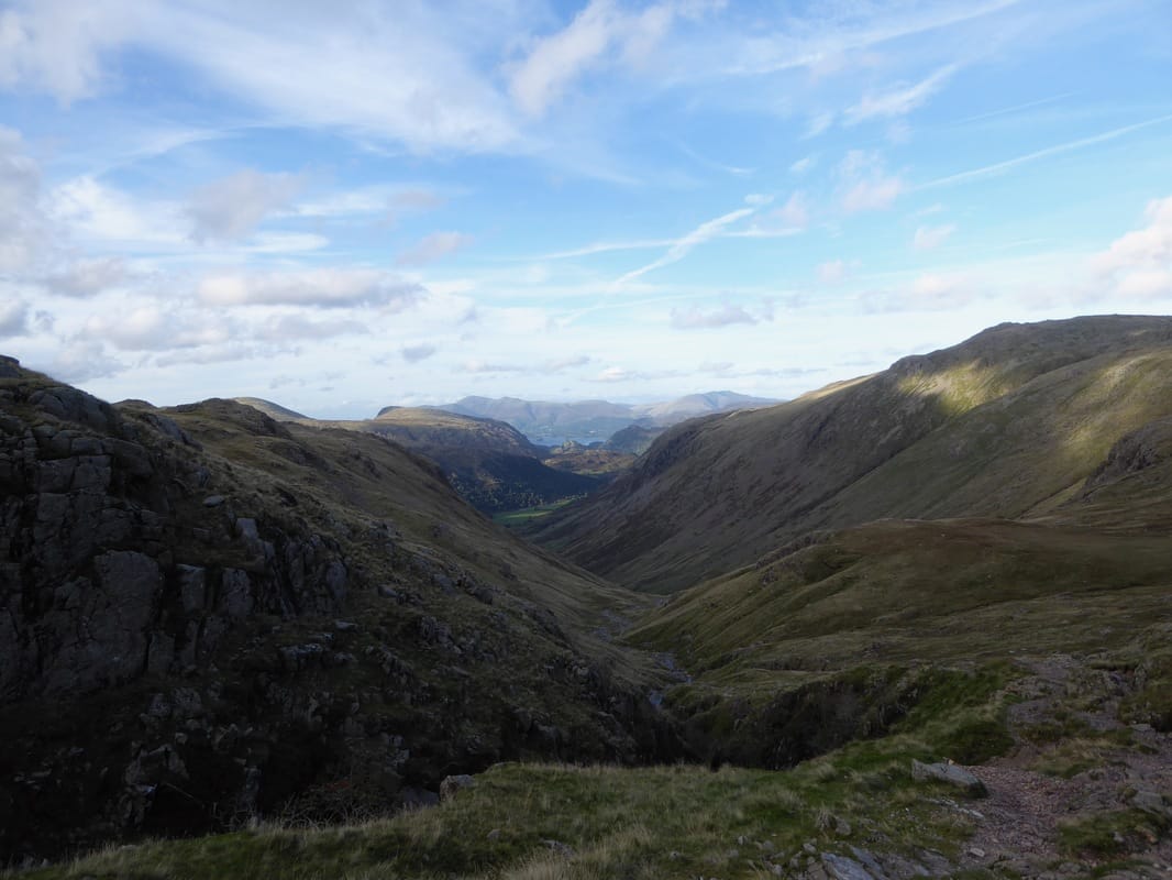
Leaving the summit of Ill Crag we headed back to the main path that now steepened gradually to reach the mountain pass of Esk Hause. It was about 1700 now and we appeared to have the area to ourselves as we passed the path to Sprinkling Tarn to head northwards down the long and steep at times Ruddy Gill/Grains Gill route to Stockley Bridge from where we would retrace our steps back to the start at Seathwaite Farm.
There are lots of ways up to the hotspot of Scafell Pike but getting there via Piers Gill is extremely enjoyable, full of interest and a fabulous walk. We saw few people until we reached Lingmell Col and no more after we left Scafell Pike. If you pick the right time & route then an ascent of the highest mountain in England can be an almost lonely one.
The route today could be started from either Seathwaite Farm or Wasdale - we chose Seathwaite as we were staying in the Northern Lakes. Leaving the farm we headed up to Stockley Bridge and from there steeply up to Greenhow Knott from where the gradient eases. The route then handrails Styhead Beck, passes Styhead Tarn to then arrive at the Mountain Rescue Post at Sty Head. From Sty Head there are a myriad of paths leading all over the place therefore it is important to get your Nav sorted before moving off. The path leaves Sty Head to move more or less parallel with Spouthead Gill, losing height as it heads in the direction of Wasdale Head. At a large boulder, the route changes direction to the south and heads uphill once more on a faint path to reach the lower reaches of Piers Gill. There are fantastic views right down into Wasdale and over to Great Gable.
Heading away from the gill for a short time, the path then fords Greta Gill before once more heading up the left hand side of Piers Gill. The climb up the side of the impressive ravine is exhilarating and opportunity should be taken to enjoy the striking scene into the depths below. However, extreme caution should be exercised as there is loose rock and erosion on the edges of the Gill. Shortly before Piers Gill turns sharply left there is a scramble to be negotiated over a steep wall of broken crag but this is not overly difficult. The remainder of the ascent was along the grassy path and shortly before reaching the head of the gill we left the path to make the short ascent up to the Nuttall of Middleboot Knotts.
From the summit of Middleboot Knotts we headed south east to join the Corridor Route coming up from Sty Head but left this on a vague path to eventually handrail the stony bed of Greta Gill. The path up via the gill is easy to see in good visibility but could be missed when the clag is down. After crossing the gill, it was an easy ascent to attain the summit of Round How and again the views were spectacular. Returning the same way, we headed along the Corridor Route to reach the head of Piers Gill where there is a great view down into the ravine. The route then heads uphill once more to reach a broken wall which we followed to the grassy area of Lingmell Col although there is a clearer path a bit further south which also reaches the col but a little further to the west.
From Lingmell Col we watched the many people descending into Wasdale from Scafell Pike via the Hollow Stones path - by this time it was about 1530 and there were not that many people coming up the other way. The ascent up to Lingmell is gradual and soon the large and impressive cairn on the summit is reached and with it a superb panorama down over Wasdale, Wastwater and over Mosedale to Yewbarrow and Pillar. Returning to Lingmell Col, there was now a bouldery and steep descent up the popular path to Scafell Pike and with only a handful of people making the ascent we knew that we would see it fairly quiet on the summit - and so it proved. As you would expect, there is a fabulous Lakeland panorama from the Roof of England and we hung around a while here just taking in the spectacular view on offer.
Scafell Pike can be a confusing place even in good visibility and it is worth just making sure you are heading in the right direction before you make your exit off the mountain. We were heading north east to make the steep descent into Broad Crag Col - on reaching the col there is a fabulous view to the right down Little Narrowcove - a long, steep & stony hollow which comes up from Eskdale. From the col it is another steep and stony ascent to gain the summit of Broad Crag. The top affords a great view back to Scafell Pike and onward to our next summit of Ill Crag that we reached via another descent & ascent on a good path. It is my guess that Ill Crag is not visited as much as it should be - it is off the main path back to Esk Hause and involves a bouldery clamber to gain its summit but it is worth it for the views to Crinkle Crags & the Coniston Fells - and it is a Furth also therefore worth the trip.
Leaving the summit of Ill Crag we headed back to the main path that now steepened gradually to reach the mountain pass of Esk Hause. It was about 1700 now and we appeared to have the area to ourselves as we passed the path to Sprinkling Tarn to head northwards down the long and steep at times Ruddy Gill/Grains Gill route to Stockley Bridge from where we would retrace our steps back to the start at Seathwaite Farm.
There are lots of ways up to the hotspot of Scafell Pike but getting there via Piers Gill is extremely enjoyable, full of interest and a fabulous walk. We saw few people until we reached Lingmell Col and no more after we left Scafell Pike. If you pick the right time & route then an ascent of the highest mountain in England can be an almost lonely one.
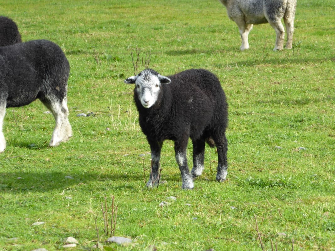
A Herdy Lamb at Seathwaite Farm
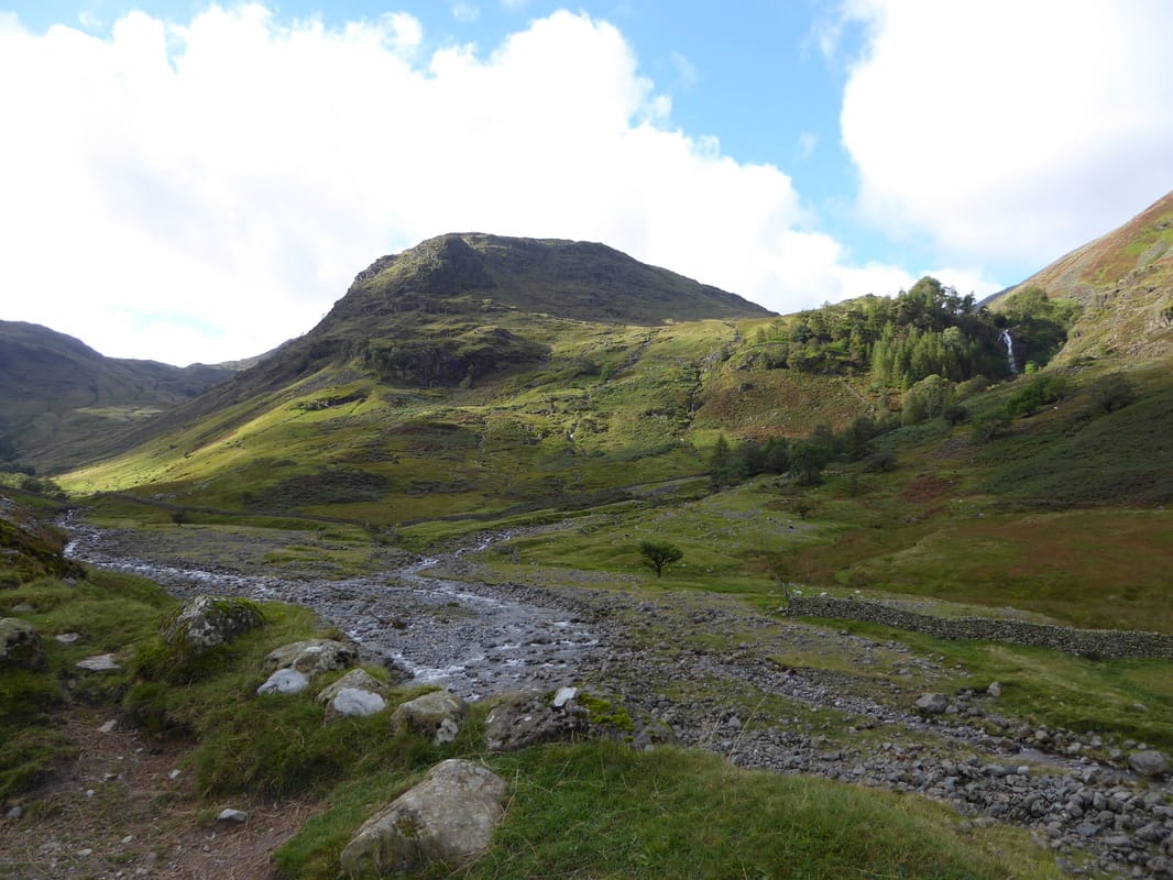
Heading for Stockley Bridge - Seathwaite Fell is ahead with Taylorgill Force to the right
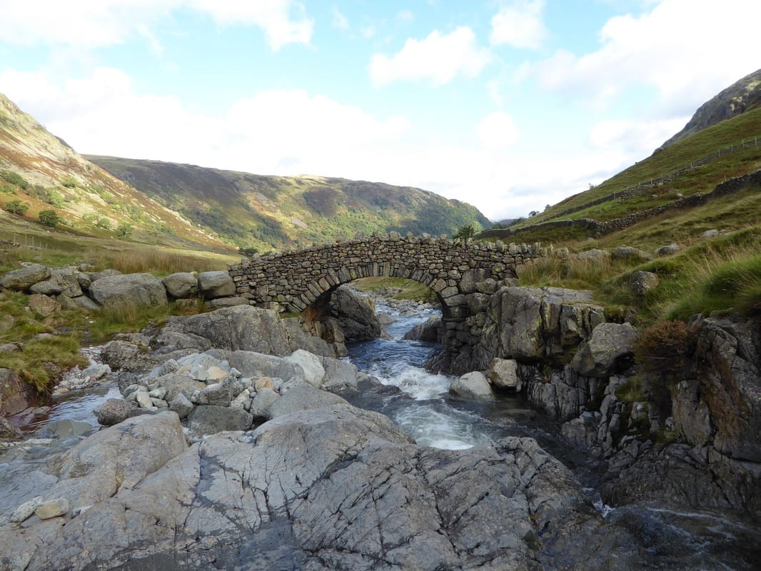
Stockley Bridge
Looking back to Seathwaite Farm & Borrowdale
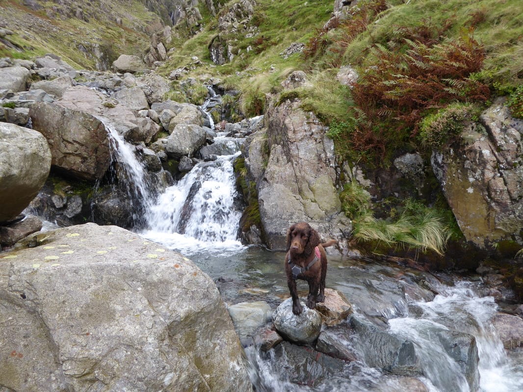
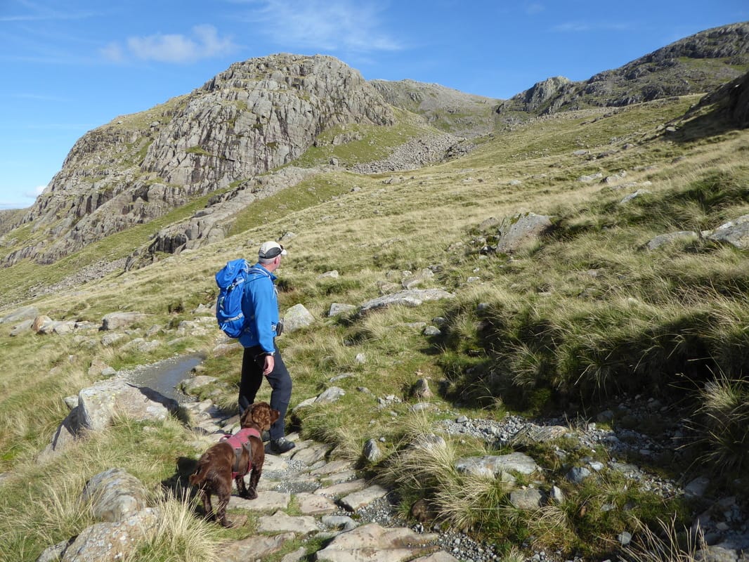
Heading to Sty Head from Stockley Bridge - Fudge looks a bit unsure as to my navigation
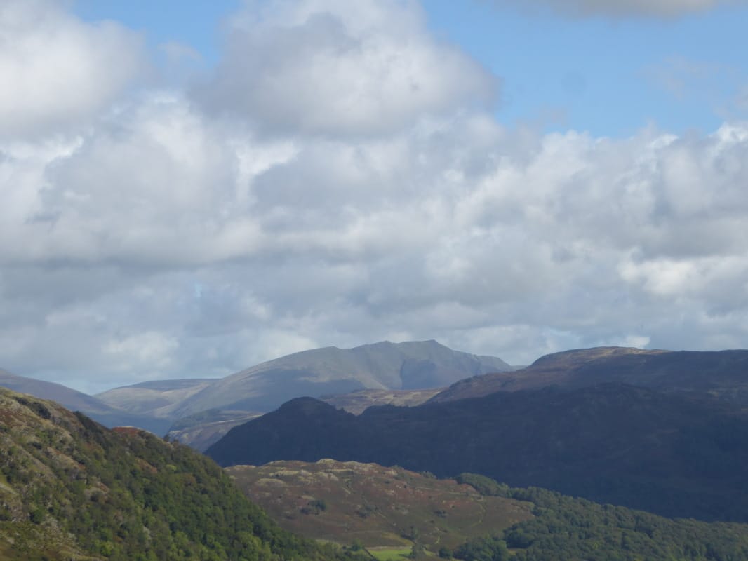
Zooming in on Blencathra
The stony path along Styhead Gill - Lingmell Col dead centre with Scafell Pike to the left with Lingmell right
Looking back along Styhead Gill
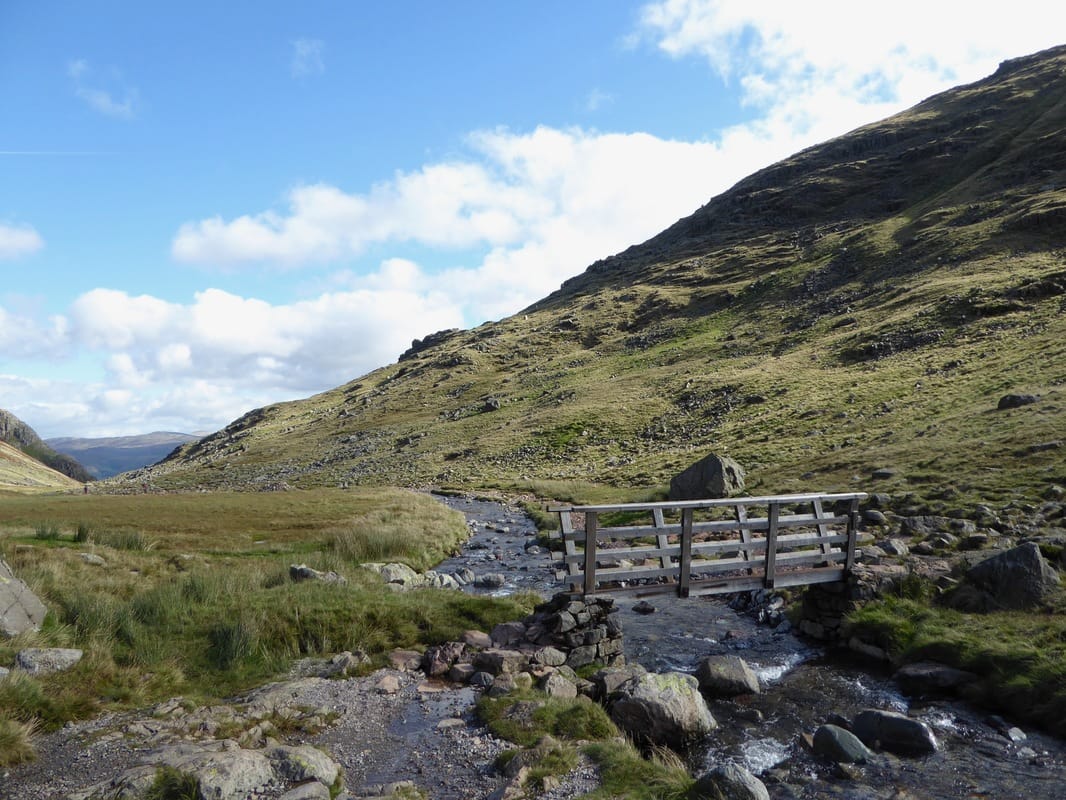
A Styhead Gill footbridge - this is a lovely transit
Nearing Sty Head, Great End comes into view to the left
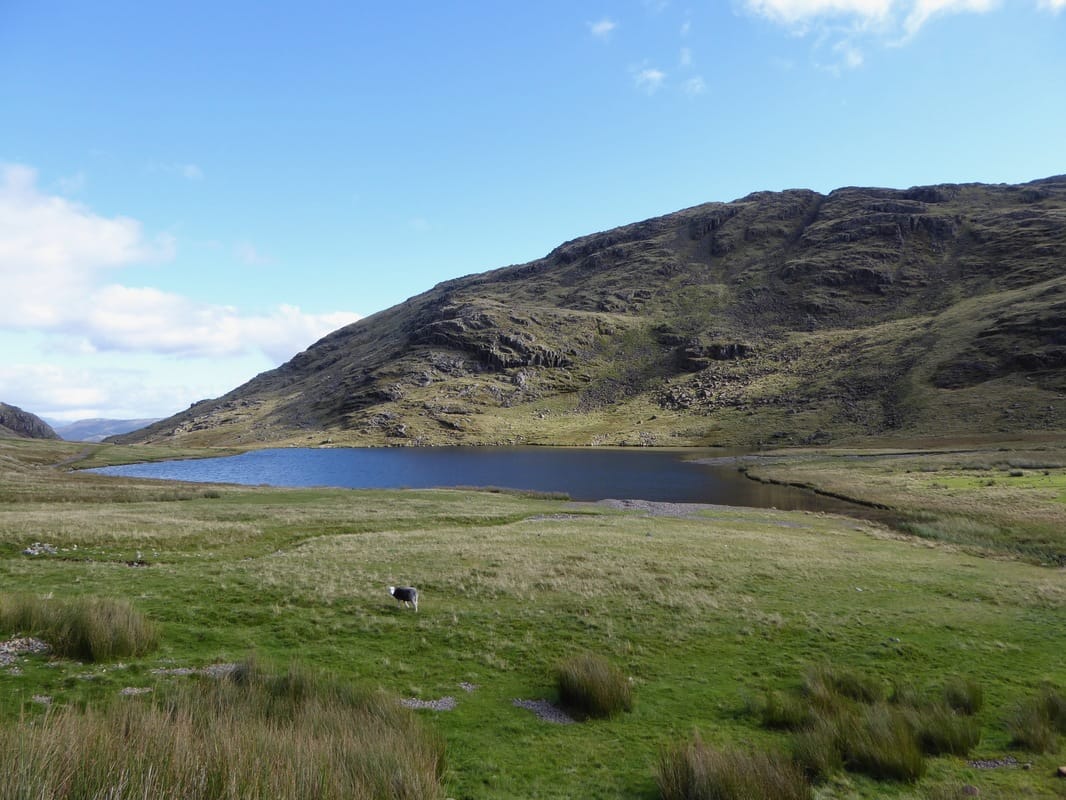
Styhead Tarn & Seathwaite Fell
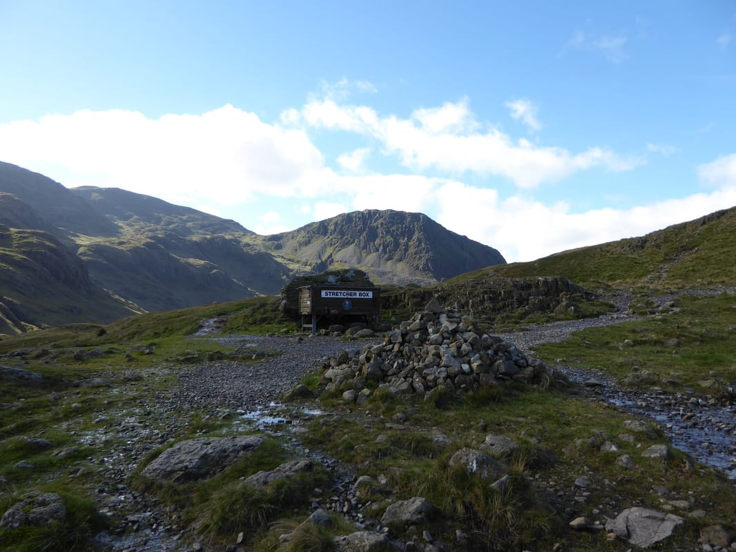
Sty Head, Scafell Pike & Lingmell
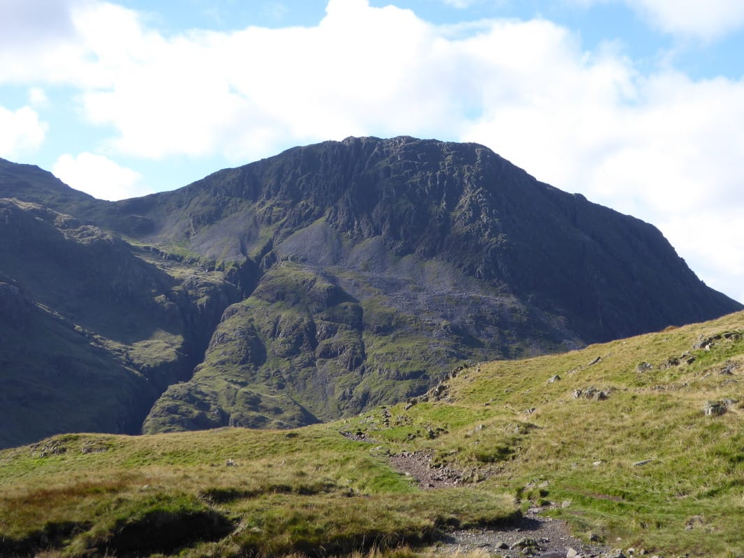
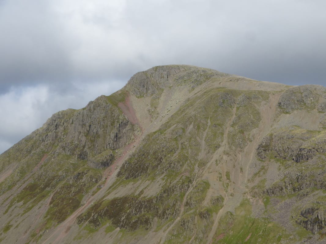
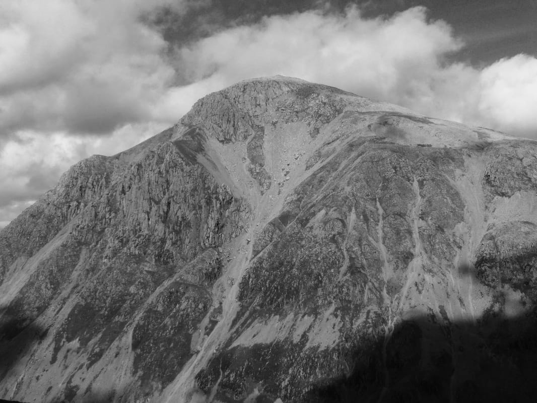
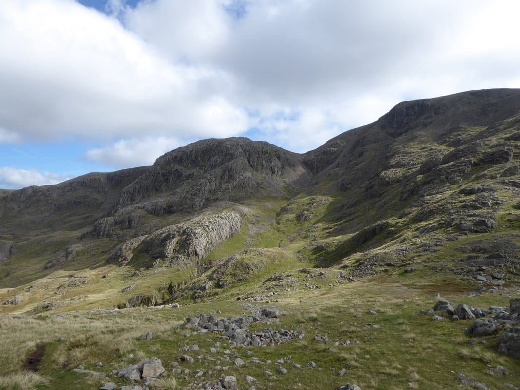
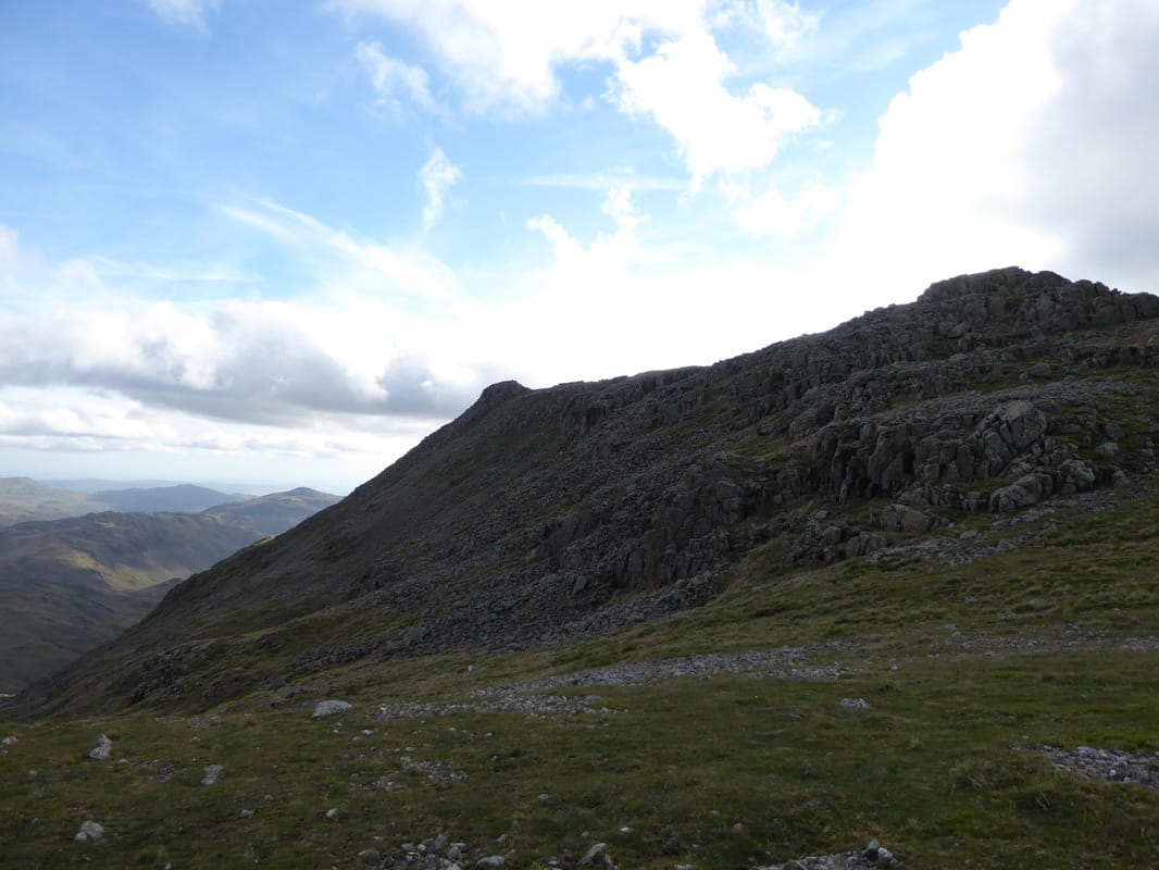
Lingmell's impressive eastern face with the huge cleft of Piers Gill
From Sty Head the path heads down steeply and continues to the right - the lower reaches of Piers Gill can be seen ahead
Lingmell Beck looking to Wasdale. Yewbarrow & Red Pike are ahead with the slopes of Kirk Fell to the right
We turned left at this boulder and followed the vague path to meet Piers Gill to the right
It is necessary to cross a ford near where Piers Gill & Greta Gill meet a few yards up from here - it is an easy crossing to make
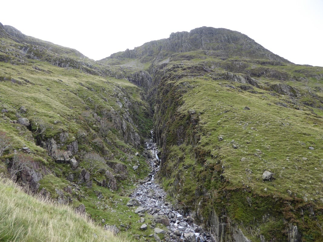
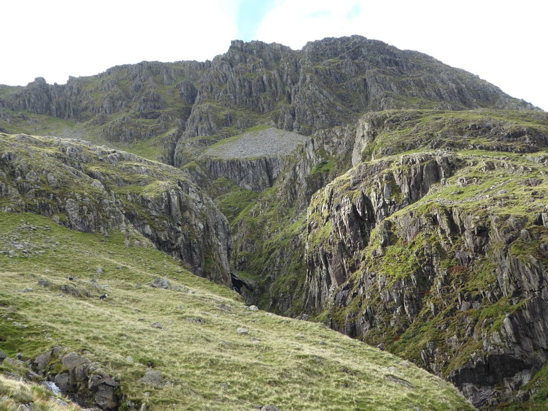
Piers Gill
Time for a breather and to drink in that view - looking to Great Gable & Kirk Fell
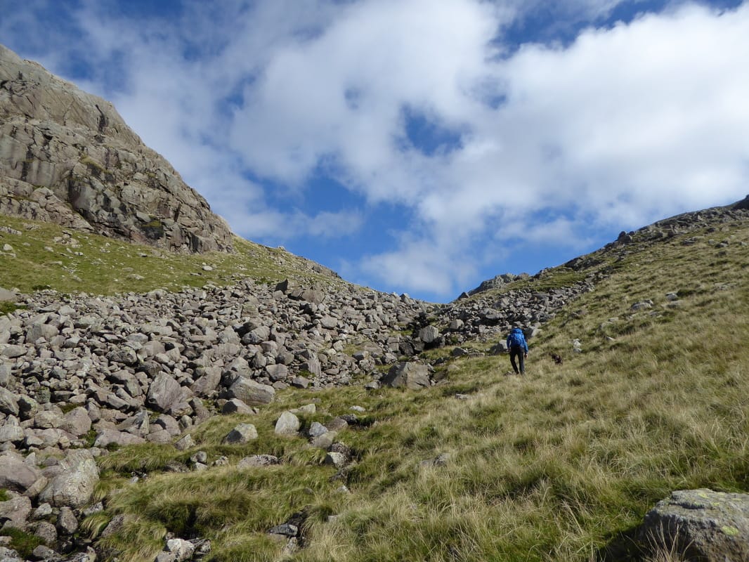
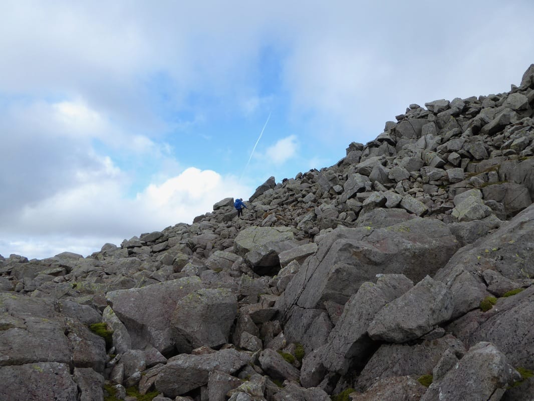
Breather over it was time to continue climbing steeply alongside Piers Gill
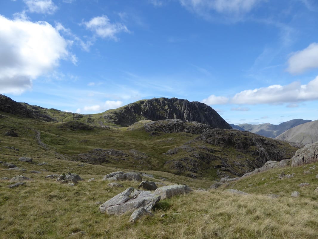
Great Hell Gate & Little Hell Gate on Great Gable
Never get tired of looking at this beautiful mountain - Great Gable
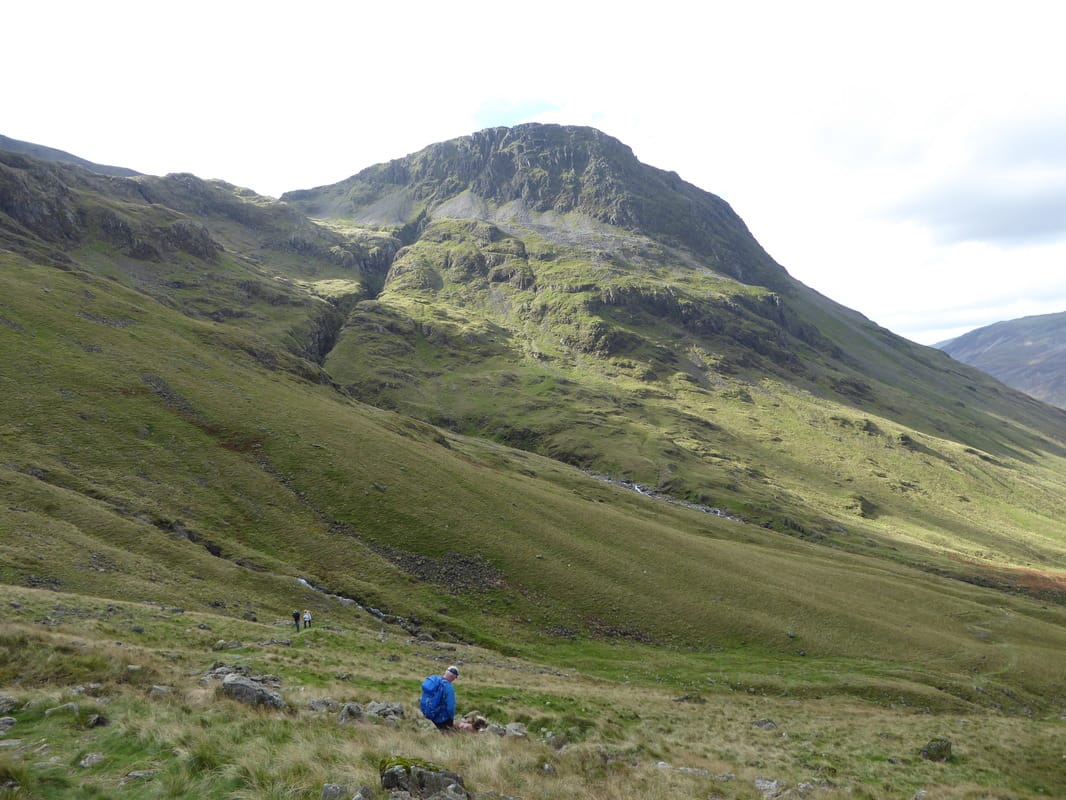
A bit of gloom as we continue to climb - Lingmell's eastern face continues to impress
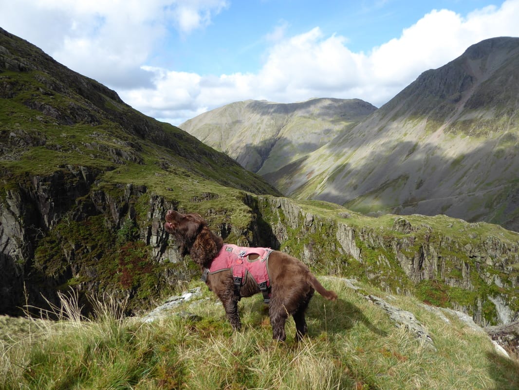
A break in proceedings as Fudge decides now would be as good a time as any to have a bit of a howl
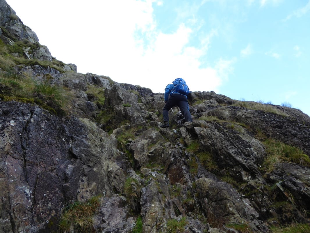
This was a nice little scramble
Looking back to Sty Head. The path to Wasdale is to the left, our path to Piers Gill is central & the Corridor Route is to the right
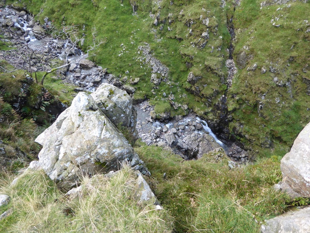
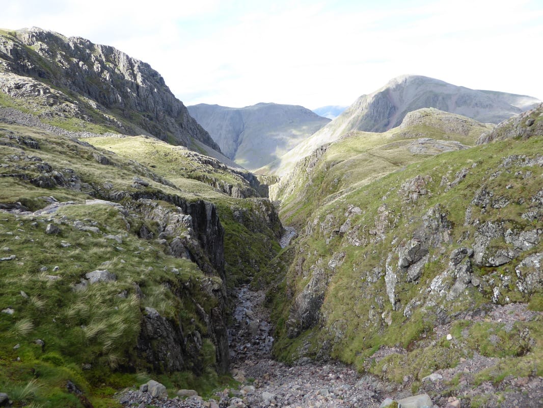
It was a long way down into Piers Gill
Another superb view of Great Hell Gate on Great Gable - this time in mono
Looking back to Sty Head this time with Styhead Tarn clearly visible
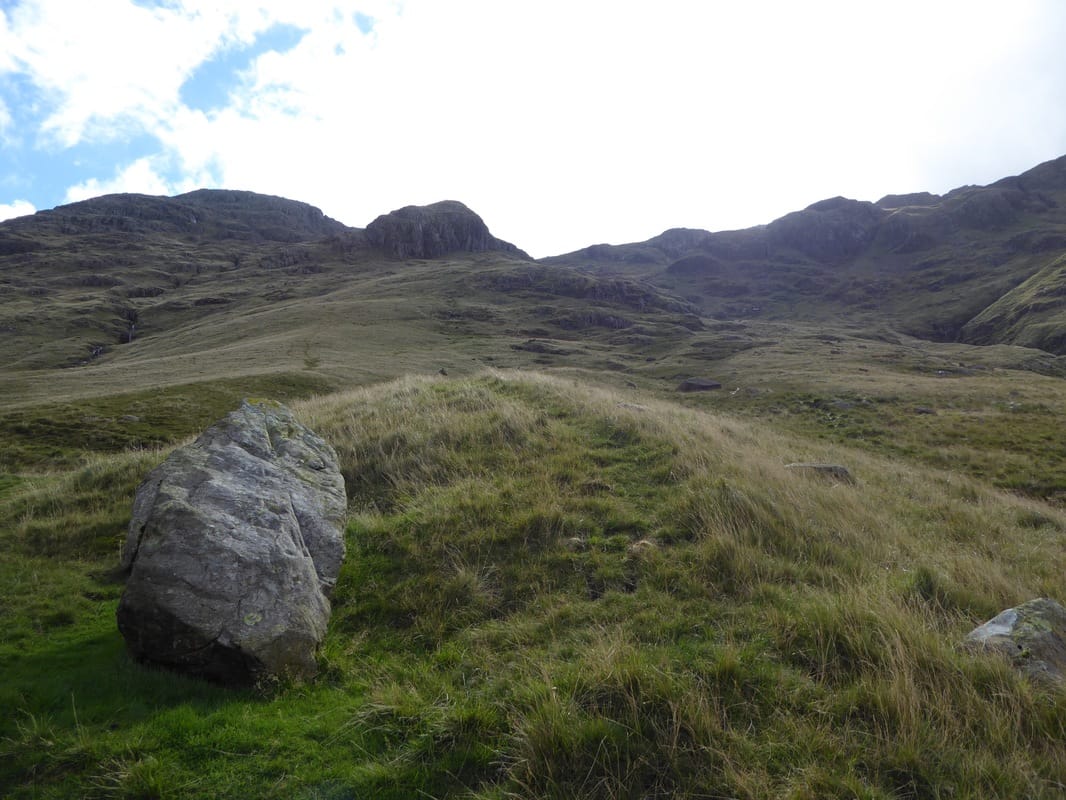
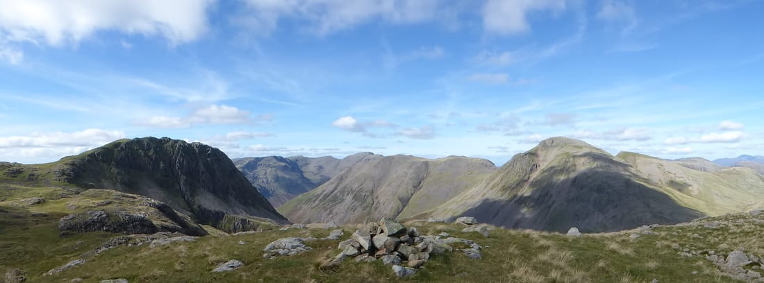
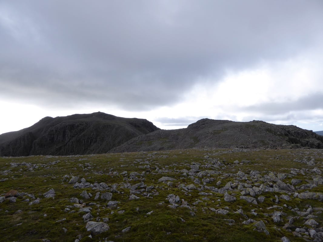
A Middleboot Knotts panoramic
Middleboot Knotts
Round How from Middleboot Knotts
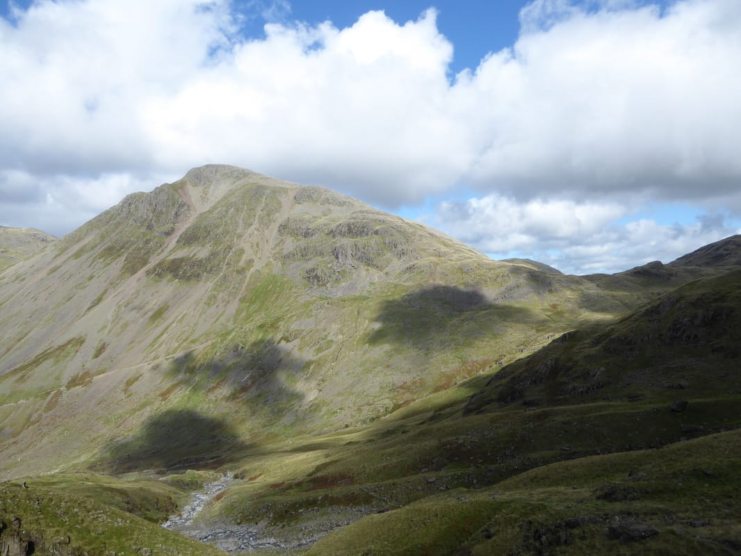
Lingmell from Middleboot Knotts
Zooming in on Sty Head
Great Gable from Middleboot Knotts
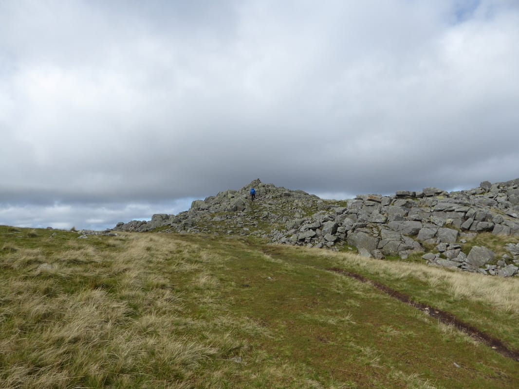
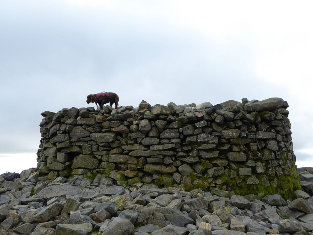
The summit of Middleboot Knotts
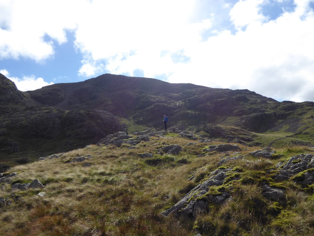
From Middleboot Knotts we headed across to join the Corridor Route - the path to Round How is at Grid Reference NY21606 07953. Fudge and I are looking in the direction of the path - Round How is left of centre
Looking back to Lingmell & The Corridor Route
Ascending Greta Gill which we would cross a bit further up the fell side
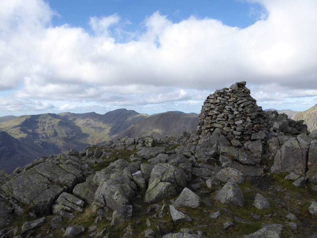
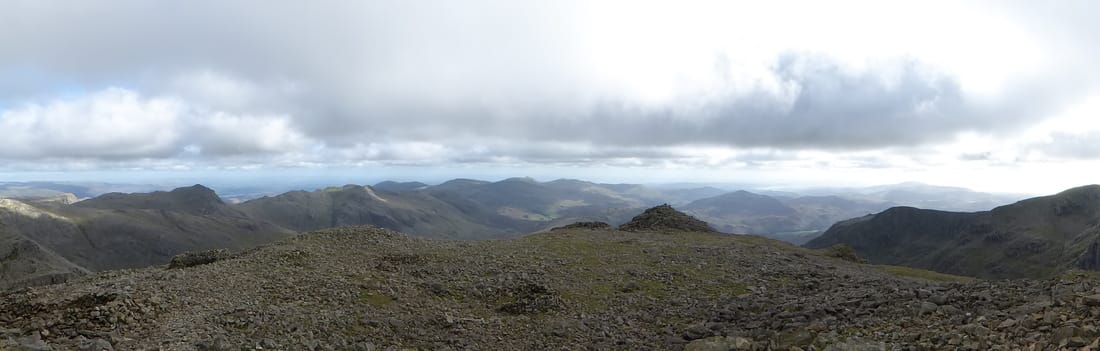
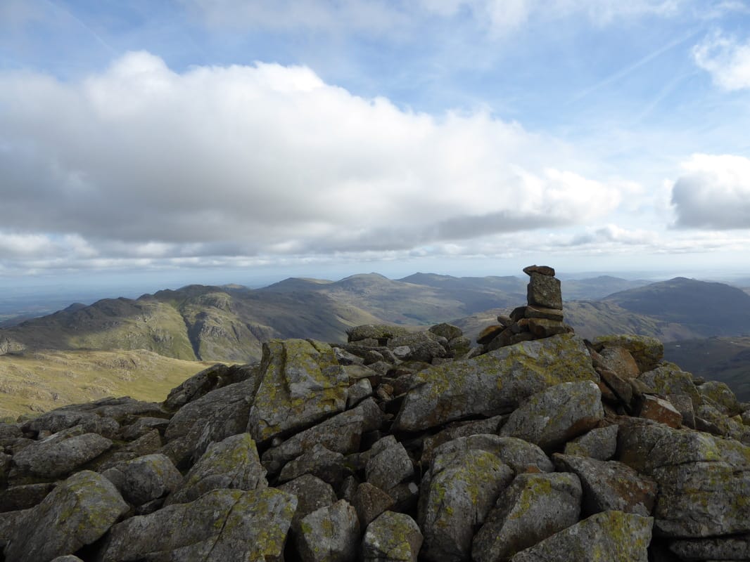
Superb panoramic from the summit of Round How
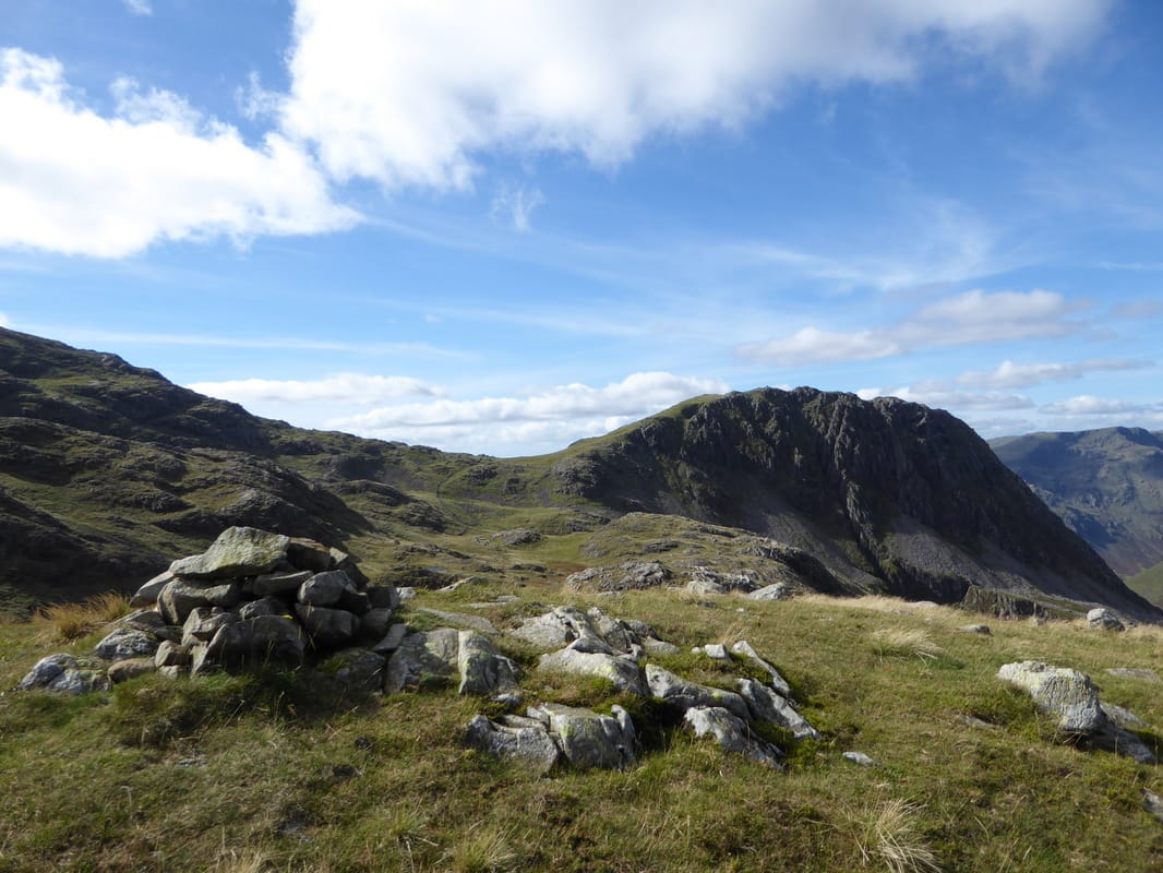
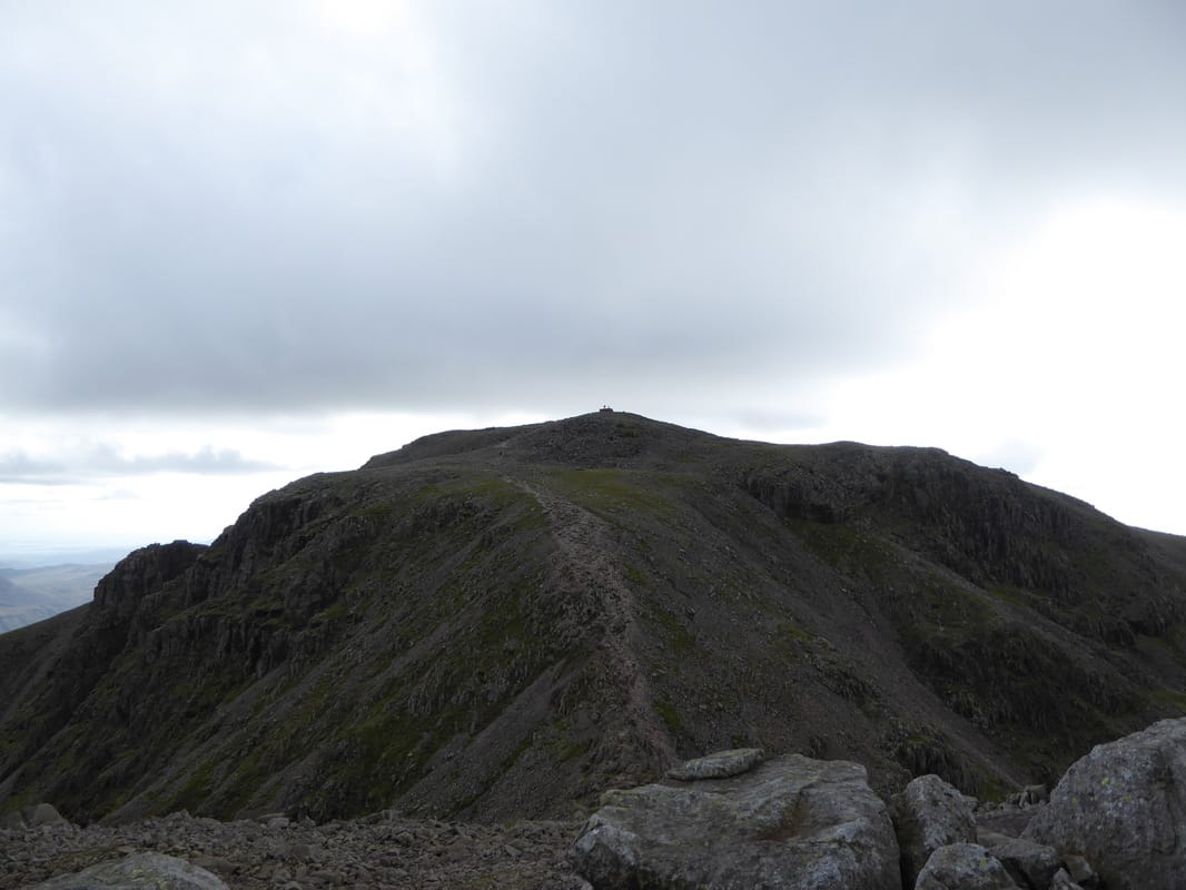
The summit of Round How looking to Lingmell Col & Lingmell
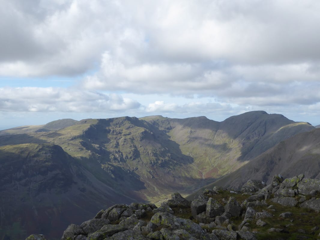
It doesn't get much better than this - the summit of Round How with Lingmell, Yewbarrow, Red Pike, Scoat Fell, Pillar, Kirk Fell & Great Gable for company.
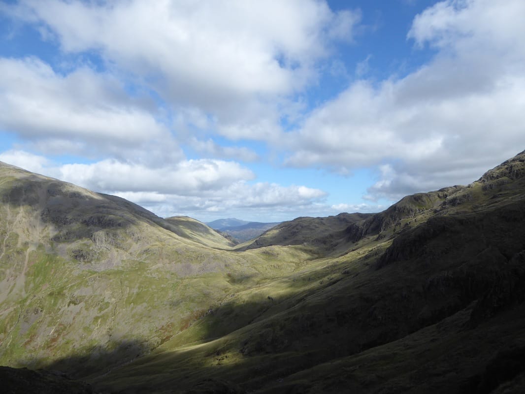
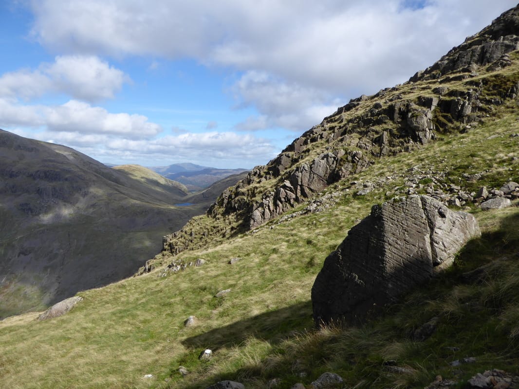
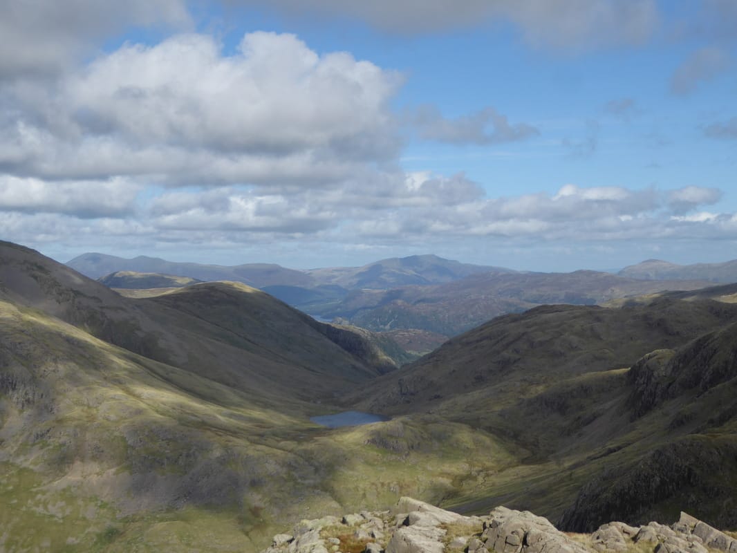
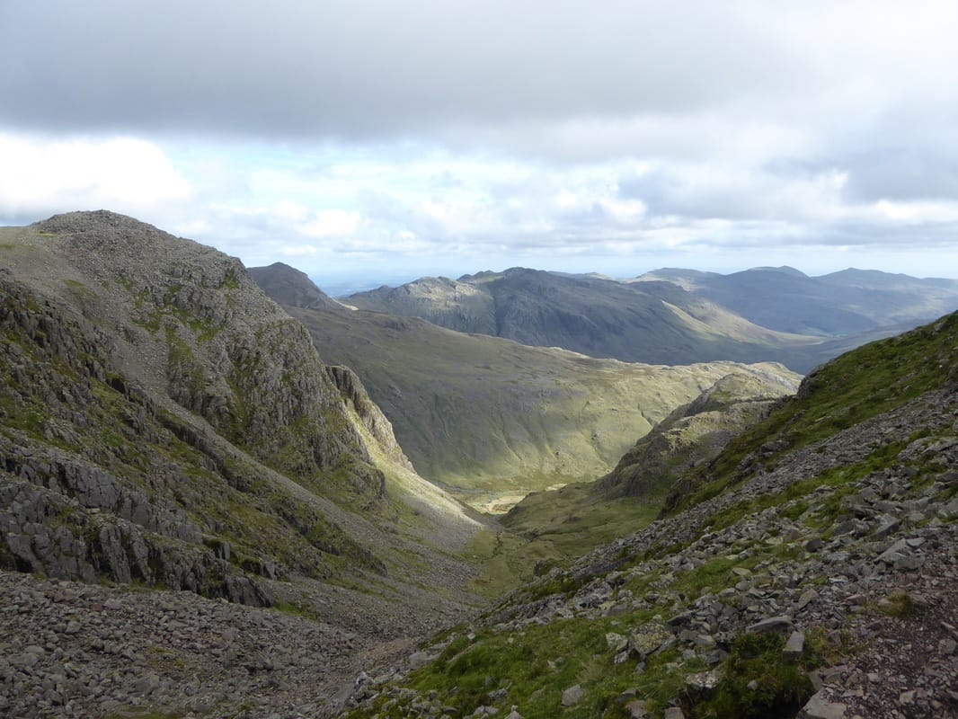
Looking into the head of Piers Gill before our ascent up to Lingmell Col
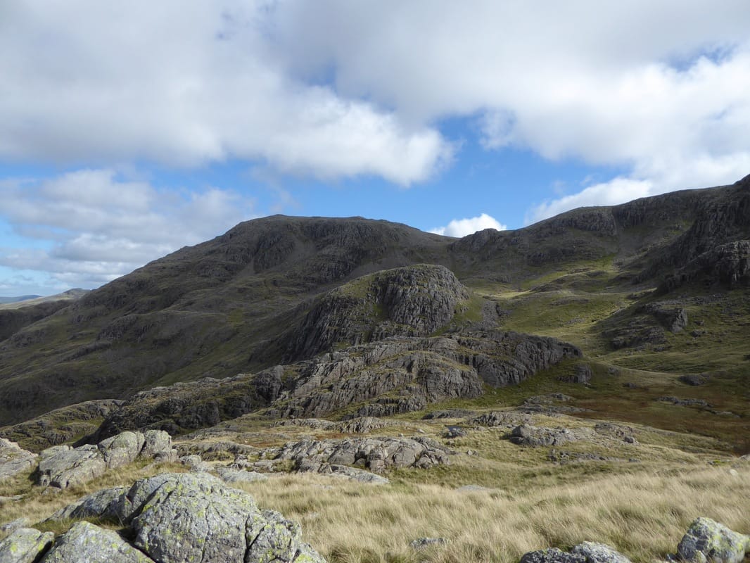
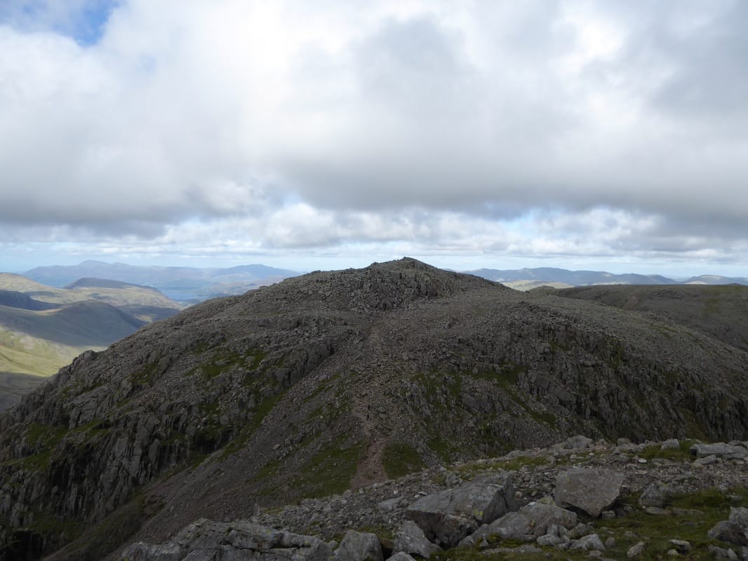
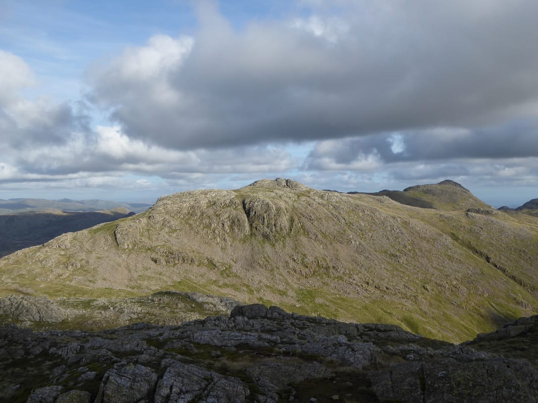
Broad Crag
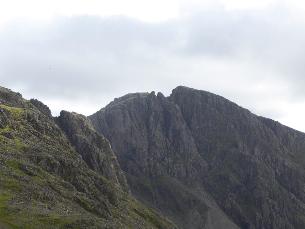
Zooming in on the West Wall Traverse on Scafell with l-r Pulpit Rock, Broad Stand & Deep Gill
The final ascent to Lingmell
The summit cairn on Lingmell
Superb view into Mosedale from Lingmell
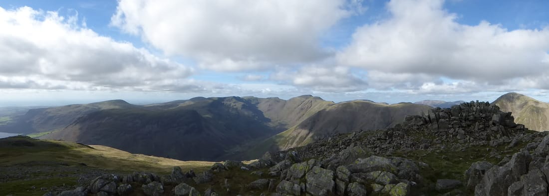
A Lingmell panorama
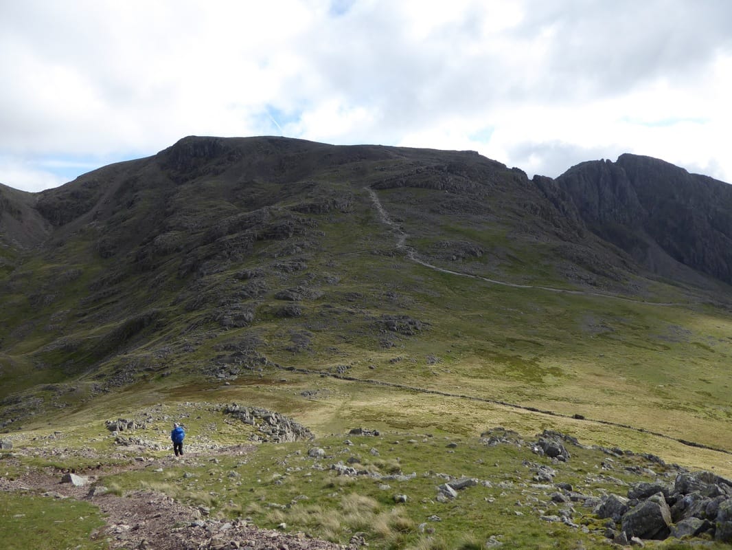
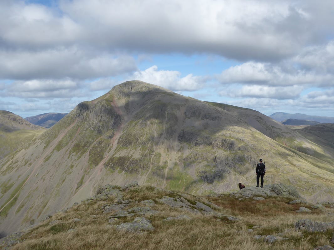
Heading back down to Lingmell Col with Scafell Pike ahead and Scafell to the right. The path coming in from the right is the popular Hollow Stones one from Wasdale
Looking back down to Lingmell from the ascent of Scafell Pike
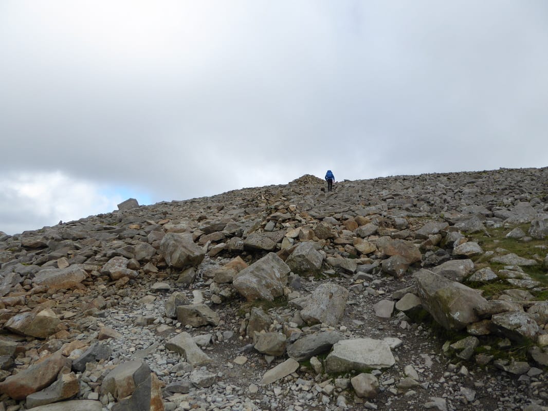
The bouldery ascent to to the Roof of England
The Trig Point on Scafell Pike
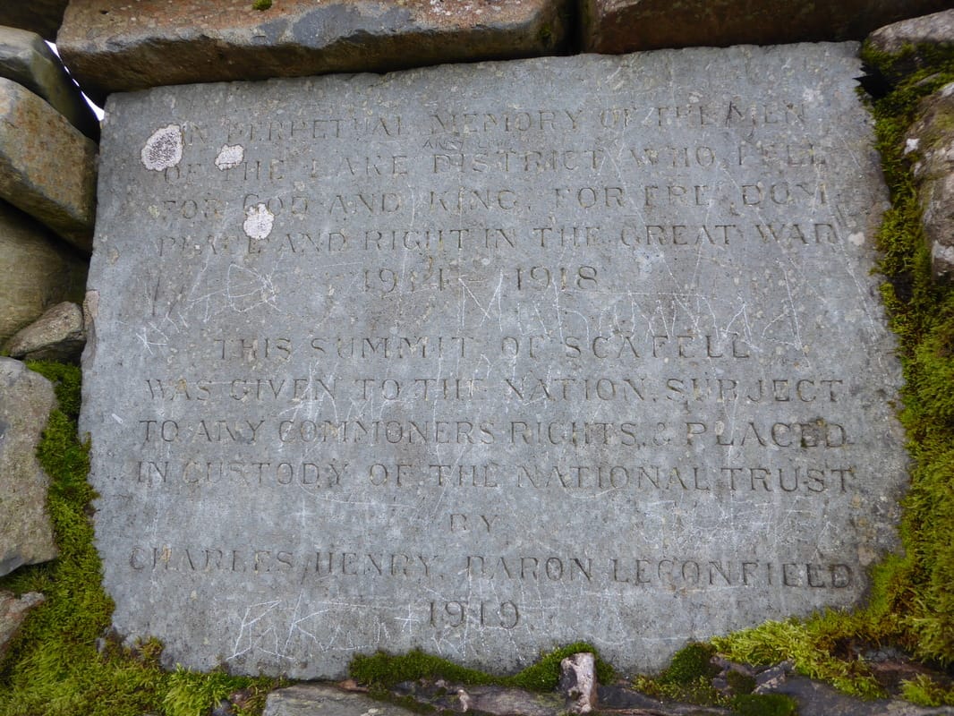
The plaque recessed into the Summit Cairn on Scafell Pike - the inscription reads:
'In perpetual memory of the men of the Lake District who fell for God and King, for freedom, peace and right in the Great War 1914 - 1918.
This summit of Scafell was given to the nation subject to any commoners rights & placed in custody of the National Trust
by Charles Henry Baron Legonfield 1919'.
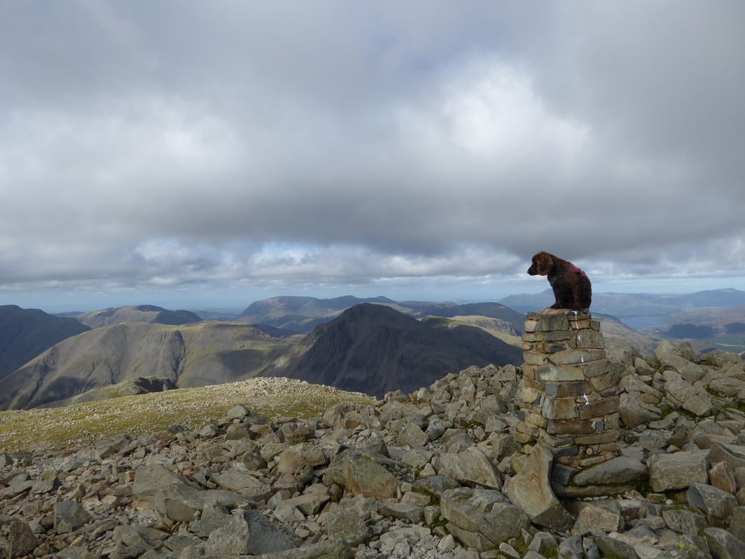
Fudge on the Roof of England, Scafell Pike
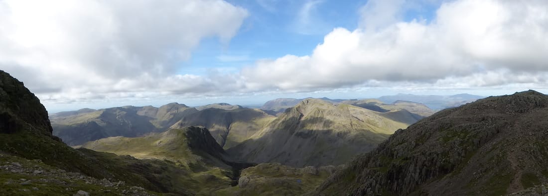
The superb panoramic view south from Scafell Pike - L-R Bowfell, Crinkle Crags, The Coniston Fells, Harter Fell, Slight Side & the lower slopes of Scafell
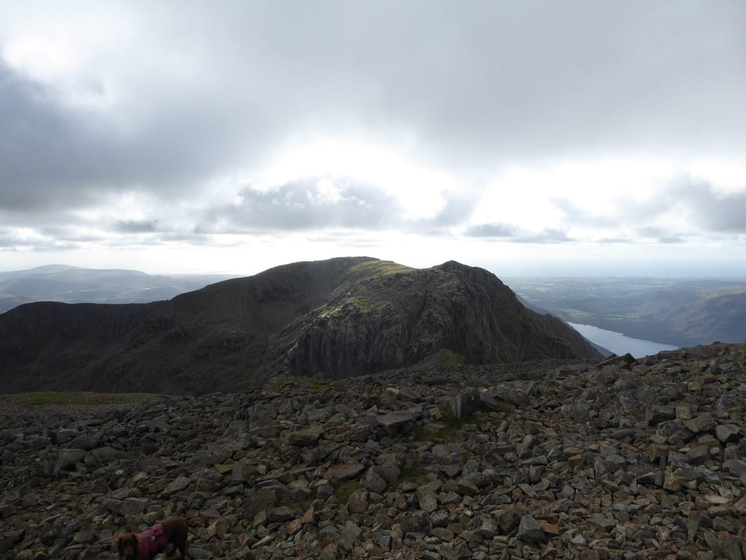
Looking over Mickledore to Scafell - Wastwater is below to the right
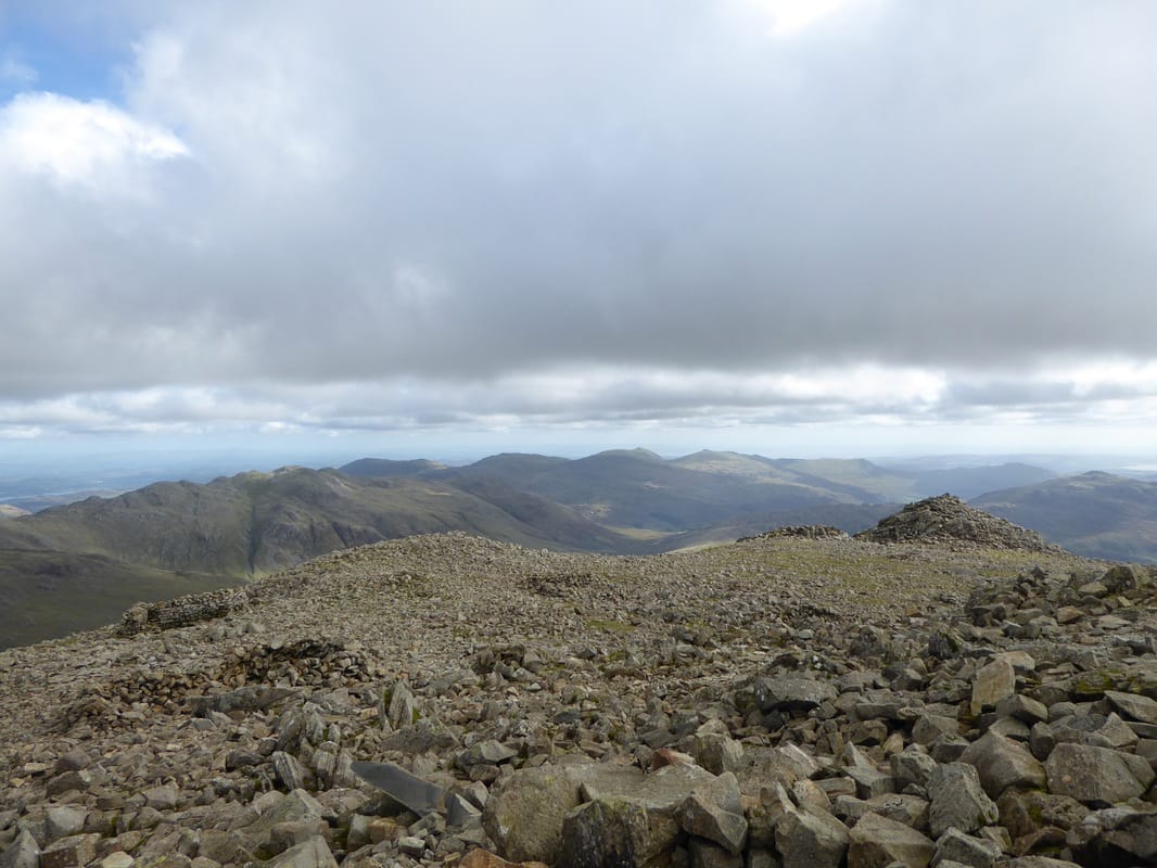
The south cairn on Scafell Pike looking to Crinkle Crags & The Coniston Fells
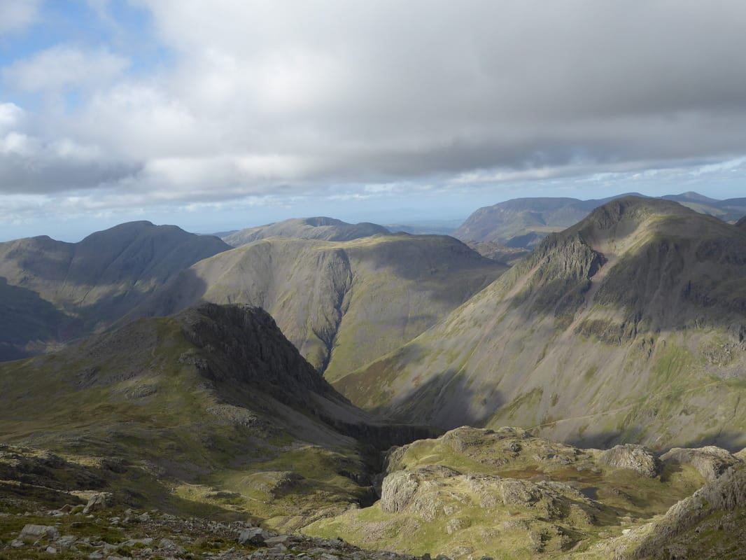
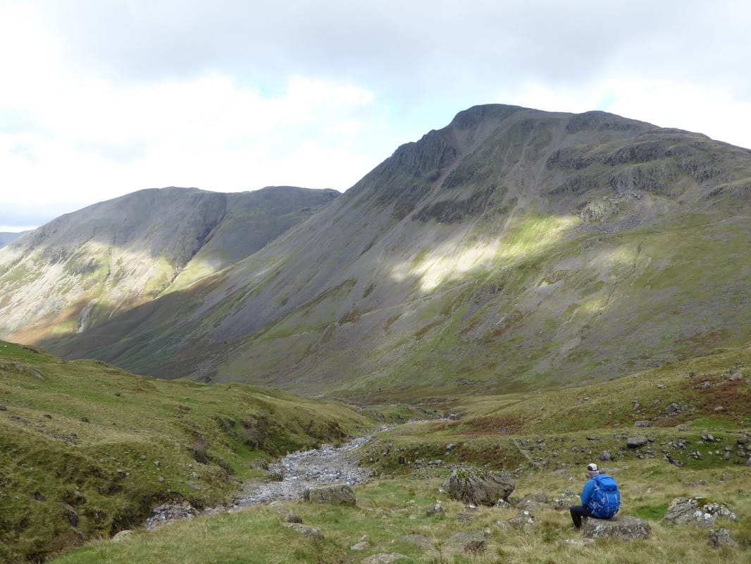
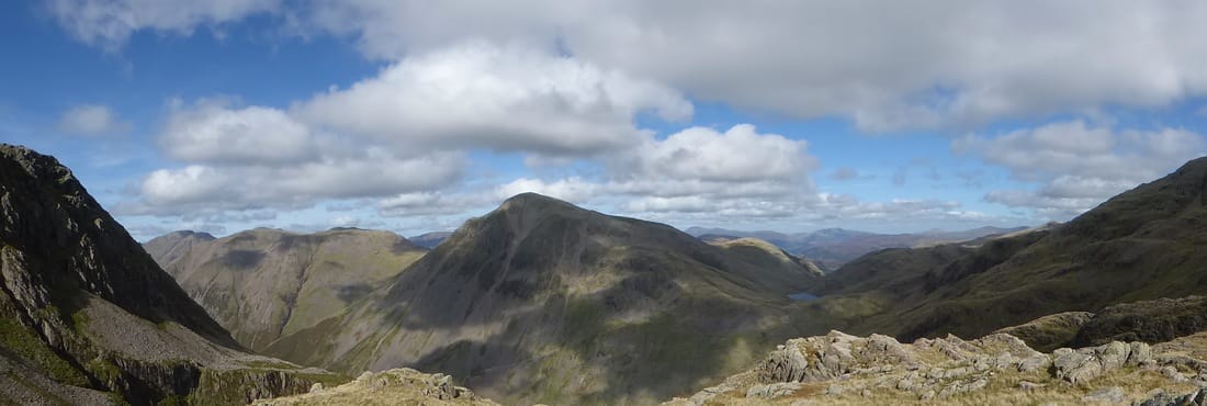
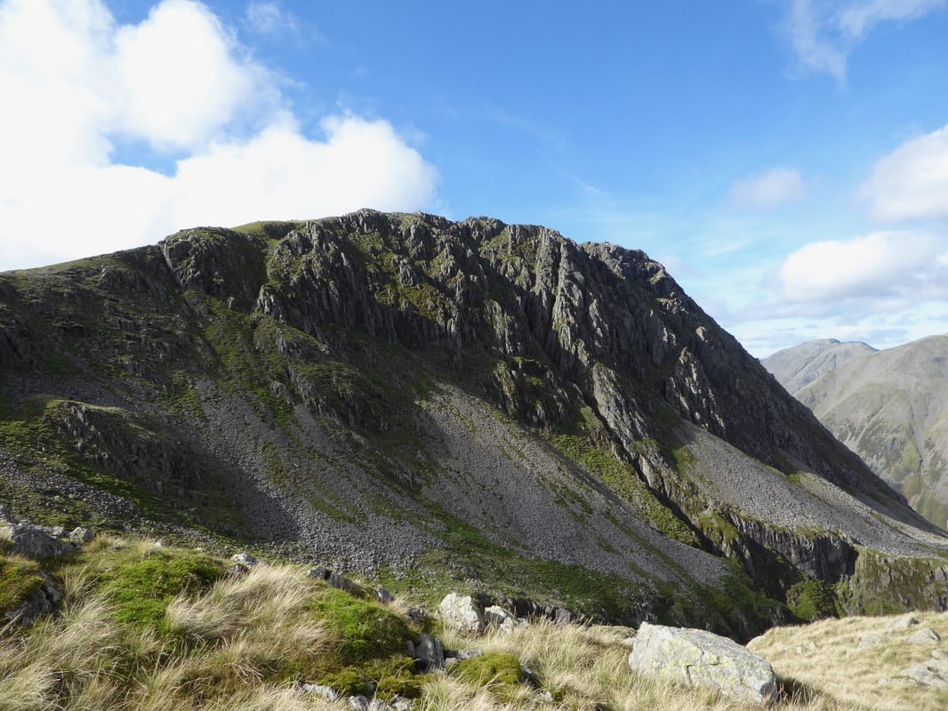
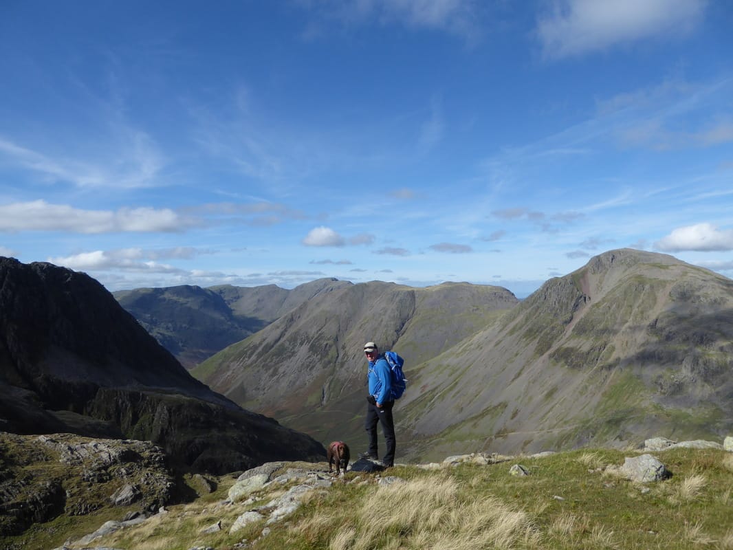
Descending to Broad Crag Col - the High Stile Ridge & Grasmoor can be seen in the distance. Just behind Lingmell are three classics - Pillar, Kirk Fell & Great Gable
Broad Crag Col below with Broad Crag above
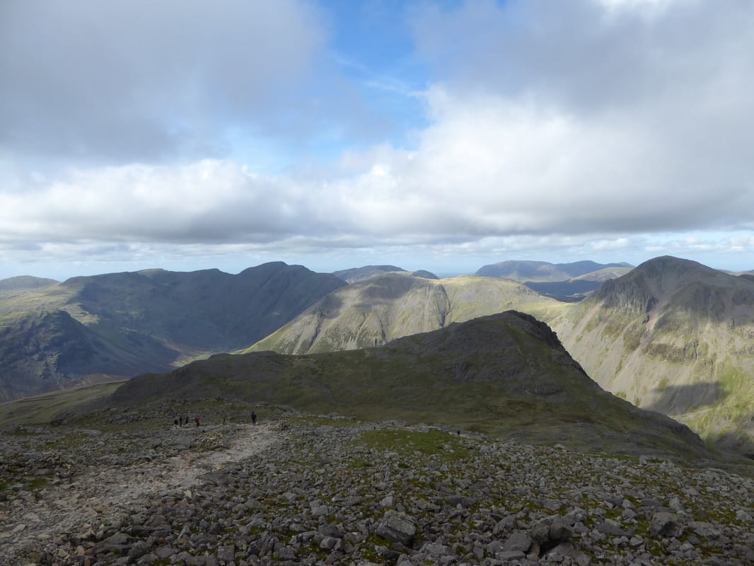
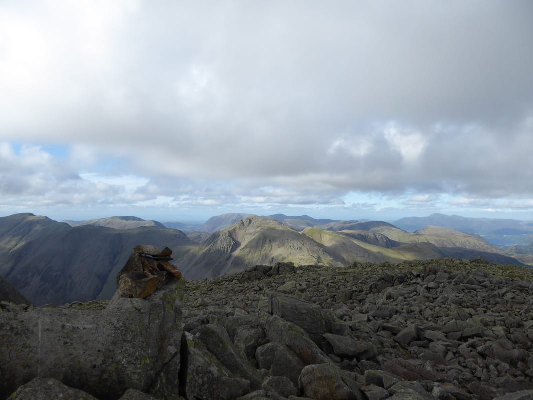
Another superb panorama - this time from Broad Crag Col
Broad Crag Col - last time we were here we could see nowt
Little Narrowcove
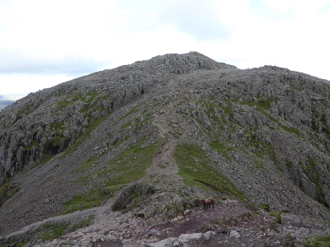
The steep & bouldery ascent of Broad Crag
Getting gloomy now as we look back to Scafell Pike and our descent to Broad Crag Col
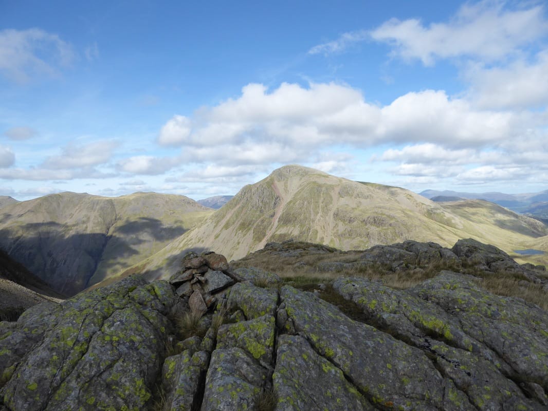
The summit of Broad Crag
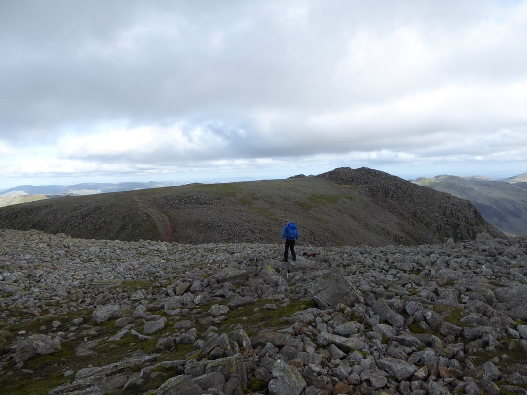
Another bouldery descent & ascent to Ill Crag
Scafell Pike & Broad Crag in the gloom
The summit of Ill Crag
Ill Crag from the descent to Esk Hause
A bit of sun on Esk Pike & Bowfell
Esk Hause and the path to Esk Pike - the Langdale Pikes are centre
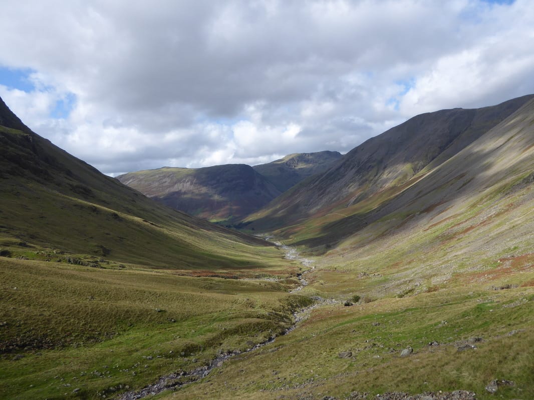
The Ruddy Gill/Grains Gill descent to Stockley Bridge
Thankfully no wet stuff today