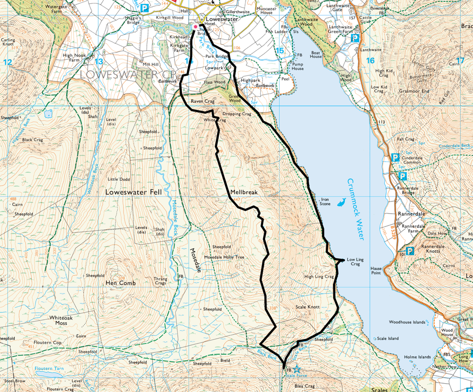
Mellbreak via the North Ridge - Tuesday 13 August 2019
Route
Loweswater - Church Bridge - Kirkgate Farm - White Crag - Mellbreak North Top - Mellbreak South Top - Scale Force - Low Ling Crag - Lowpark - Loweswater
Parking
Small parking area by the village telephone box in Loweswater (Free) - Grid Ref NY143211. The nearest postcode is CA13 9UX. Please park sensibly at this location.
Mileage
6.5 miles
Terrain
Mountain paths for the most part with some road walking at the start & finish. The ascent of Mellbreak from the North appears daunting at first but is on a generally good path. There is some scree to negotiate on the early part of the ascent.
Weather
Overcast with sunny spells and a couple of light showers.
Time Taken
4hrs
Total Ascent
1696ft (517m)
Wainwrights
1
Map
OL4 - The English Lakes (North Western Area)
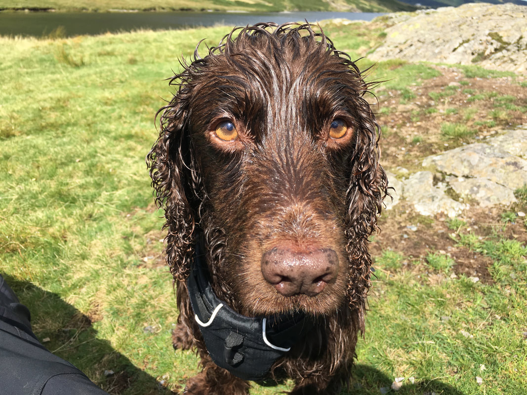
Walkers
Dave & Fudge
Loweswater - Church Bridge - Kirkgate Farm - White Crag - Mellbreak North Top - Mellbreak South Top - Scale Force - Low Ling Crag - Lowpark - Loweswater
Parking
Small parking area by the village telephone box in Loweswater (Free) - Grid Ref NY143211. The nearest postcode is CA13 9UX. Please park sensibly at this location.
Mileage
6.5 miles
Terrain
Mountain paths for the most part with some road walking at the start & finish. The ascent of Mellbreak from the North appears daunting at first but is on a generally good path. There is some scree to negotiate on the early part of the ascent.
Weather
Overcast with sunny spells and a couple of light showers.
Time Taken
4hrs
Total Ascent
1696ft (517m)
Wainwrights
1
Map
OL4 - The English Lakes (North Western Area)
Walkers
Dave & Fudge
|
GPX File
|
| ||
If the above GPX file fails to download or presents itself as an XML file once downloaded then please feel free to contact me and I will send you the GPX file via e-mail.
Route Map
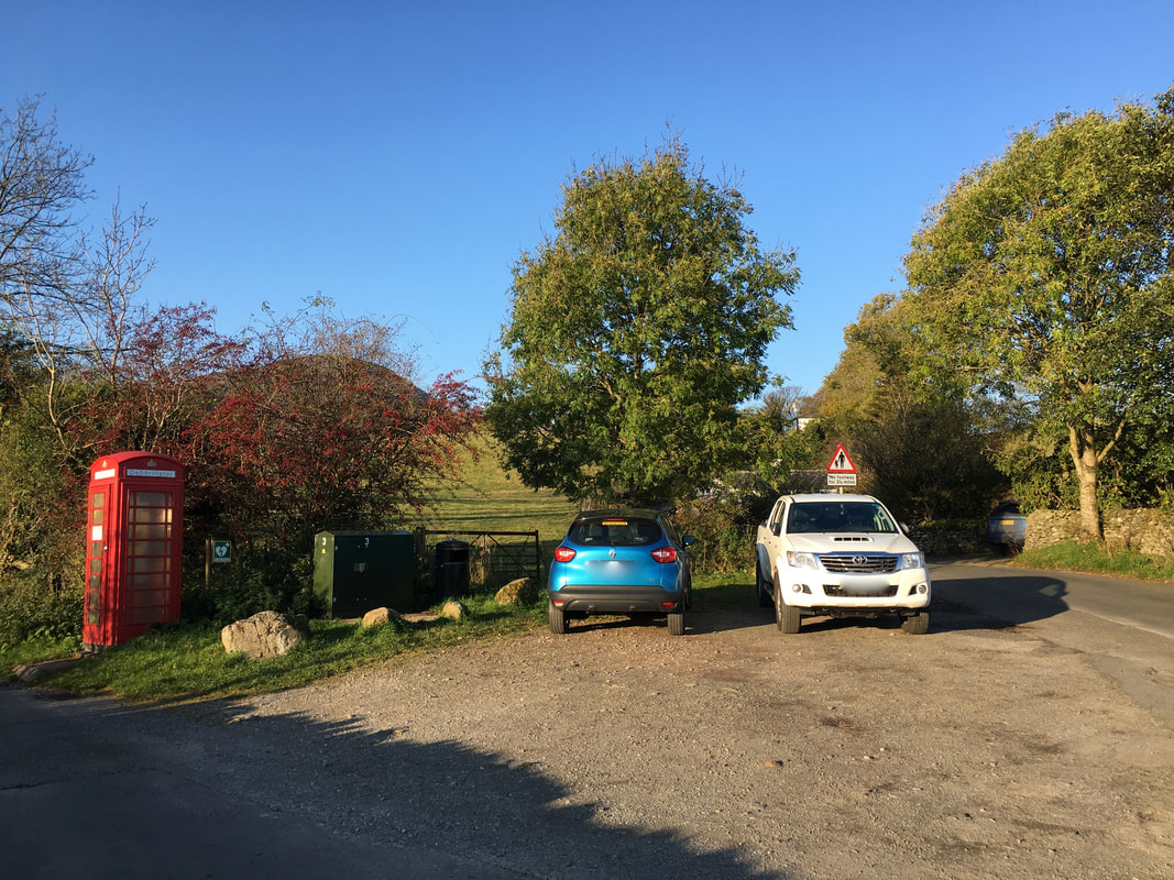
There are a few parking areas and Car Parks in and around Loweswater that can be used for this walk. The parking area I used today is just as you enter the village where there is room for a few cars - however please park sensibly as this is a road junction.
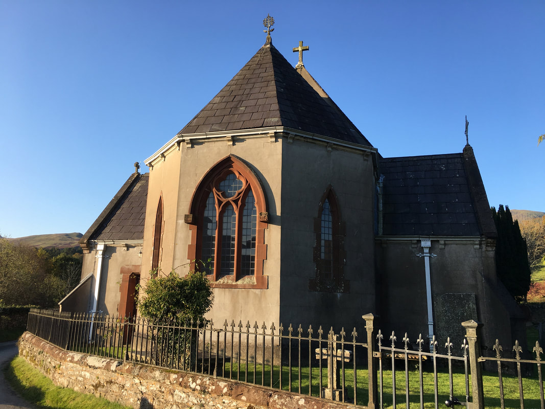
St Bartholemew's Church in Loweswater. The Church here today dates almost entirely from the year 1884, when a small plain Lakeland chapel consecrated in 1829 was extensively enlarged and improved. The work was undertaken because a leadmine was opened at Godferhead, and a vast expansion in population was predicted. In the event, the mine failed, and the population remained static.
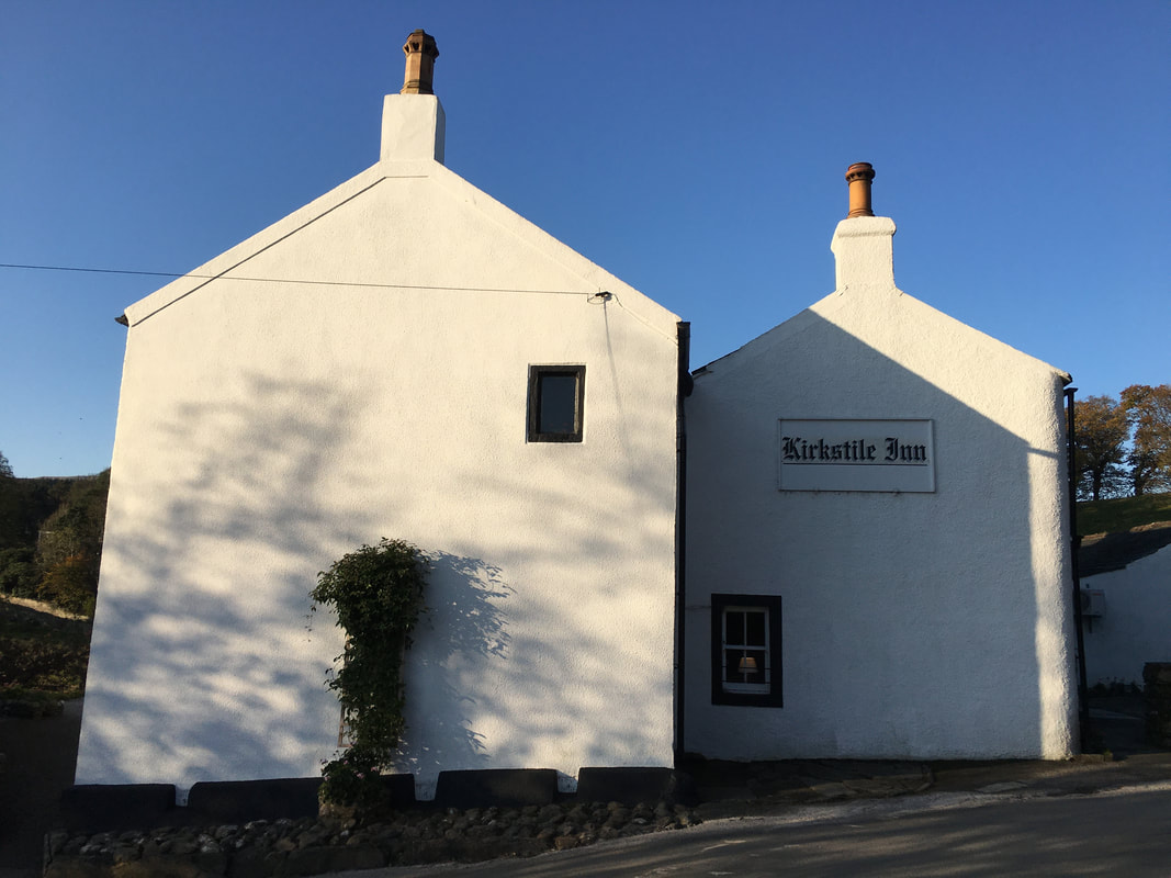
The Kirkstile Inn in Loweswater - home of the most excellent Lakeland Beer "Loweswater Gold"
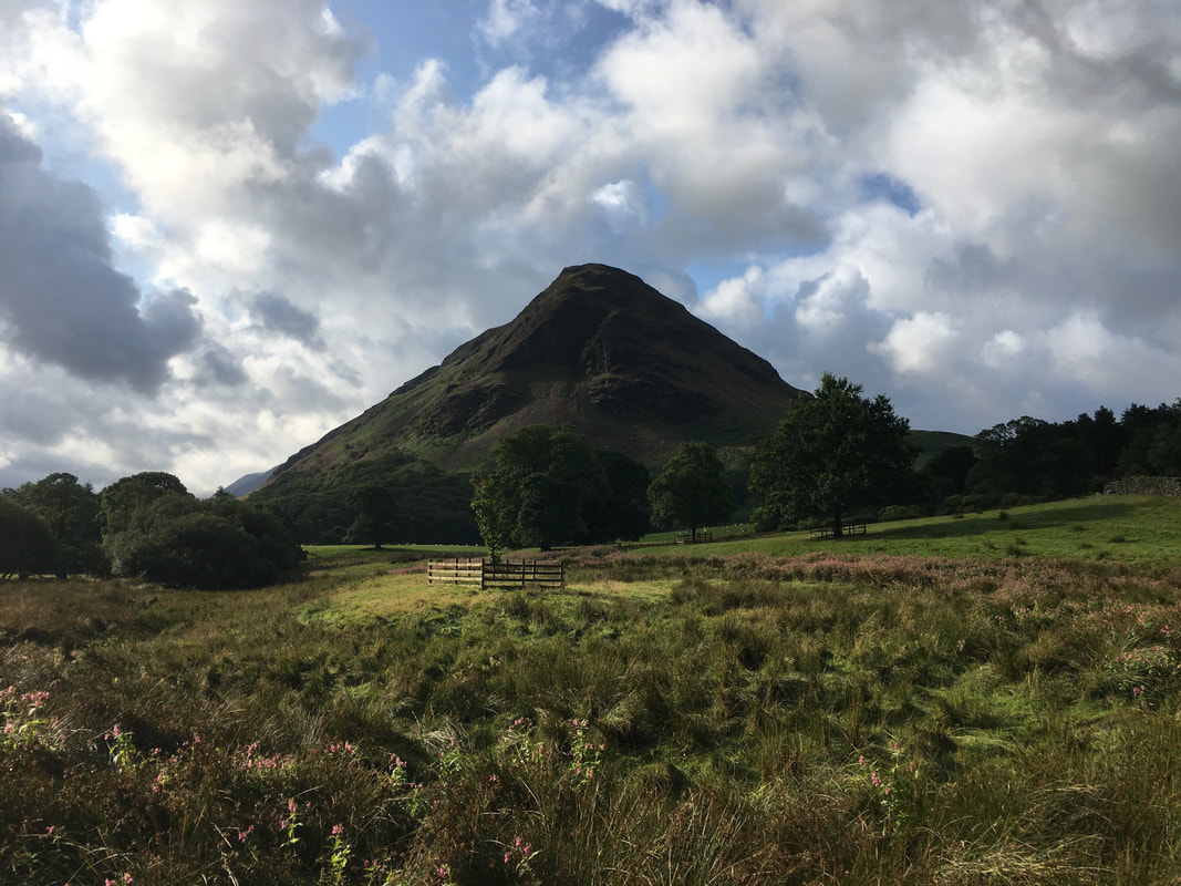
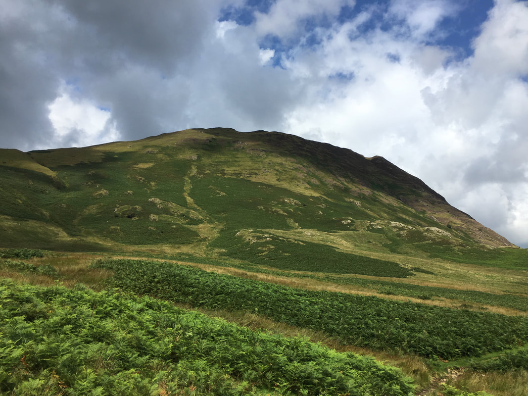
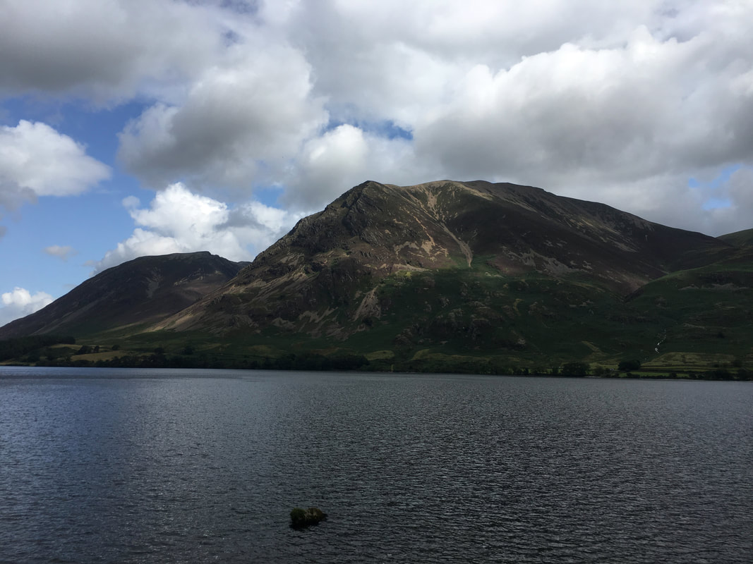
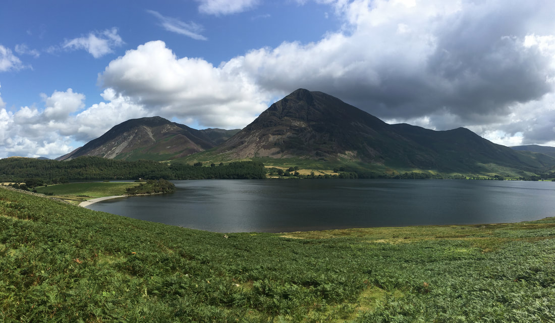
Our goal today - Mellbreak. Climbed her via this route quite a few times now and never get bored of it.
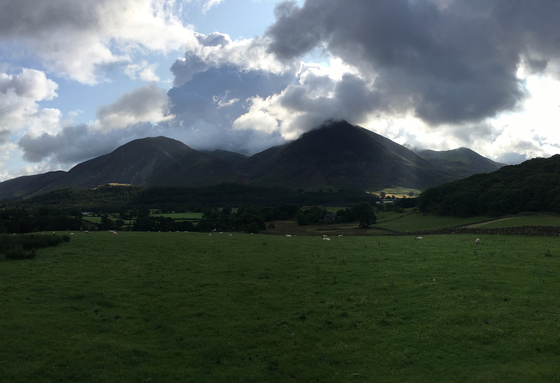
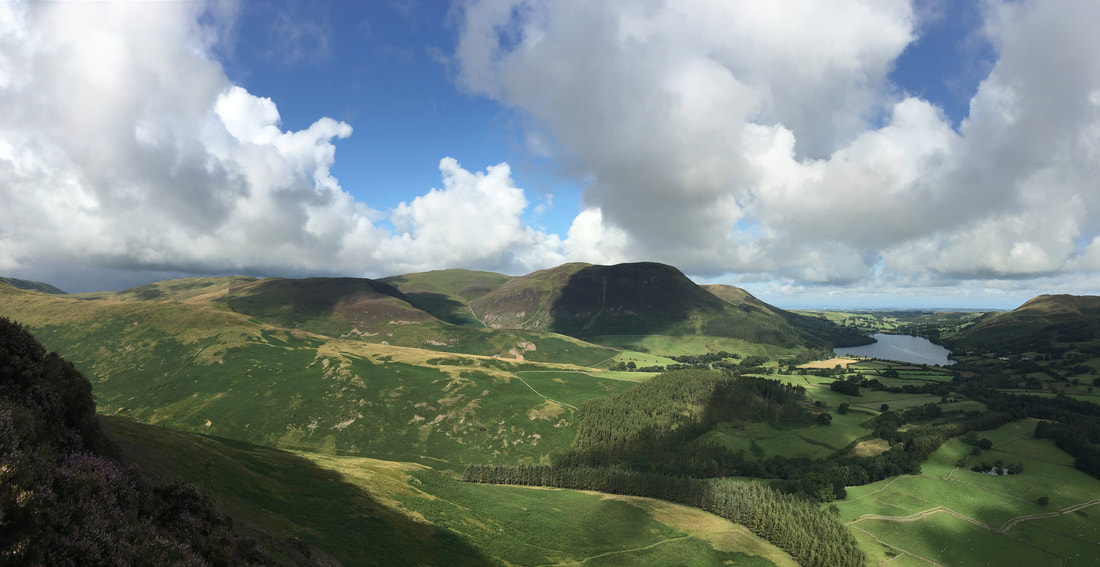
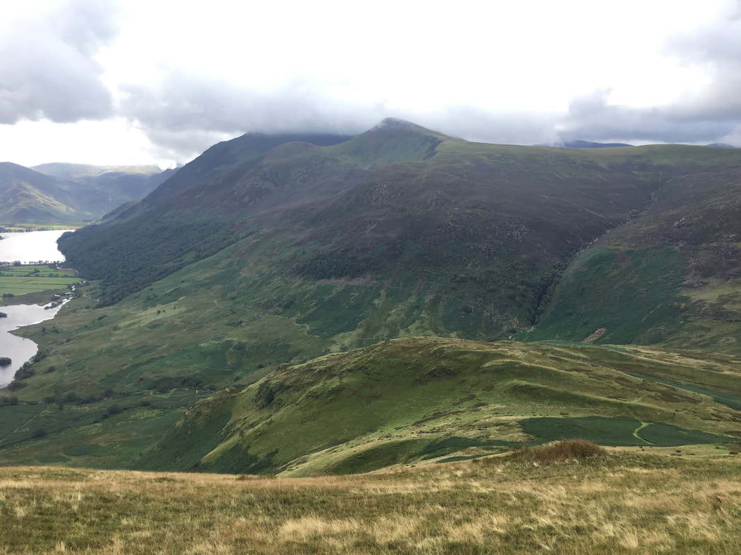
Looking across to a moody Whiteside, Grasmoor & Whiteless Pike
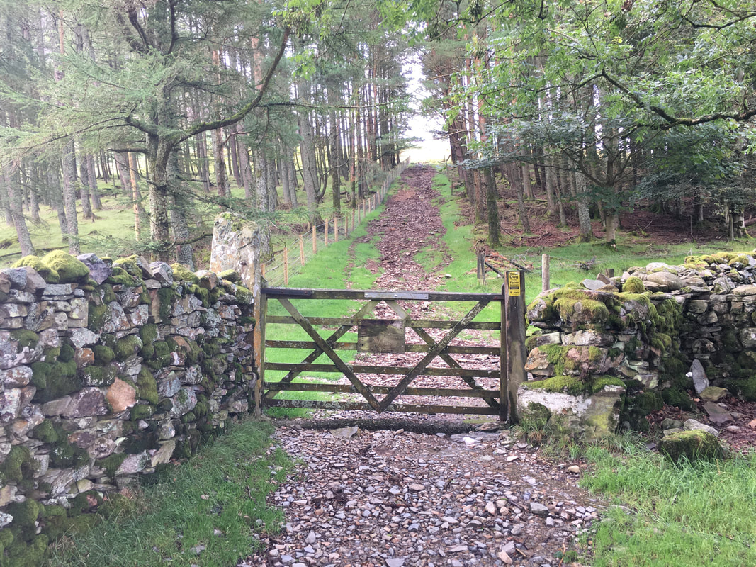
The path passes through the farm at Kirkgate then meanders up a rough lane to reach a firebreak between the trees. The route to Mellbreak heads straight on through the firebreak.
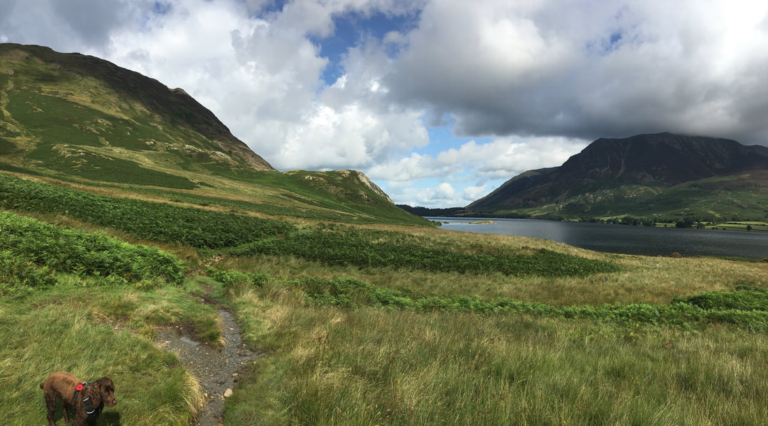
Once clear of the firebreak, the path starts to climb steeply giving a fantastic view back over Loweswater to Darling Fell & Low Fell
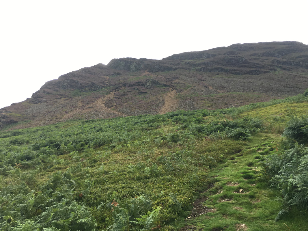
Continuing along the steepening grassy path towards the foot of the scree on Mellbreak's lower northern ridge
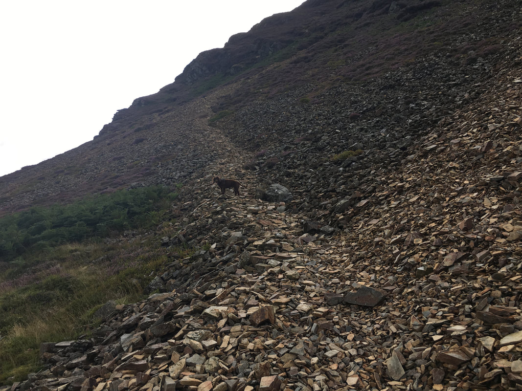
And up we go - despite it looking to the contrary, this is easy enough terrain although a little further up the gradient steepens making it a bit challenging. I have never descended this way and don't particularly wish to!
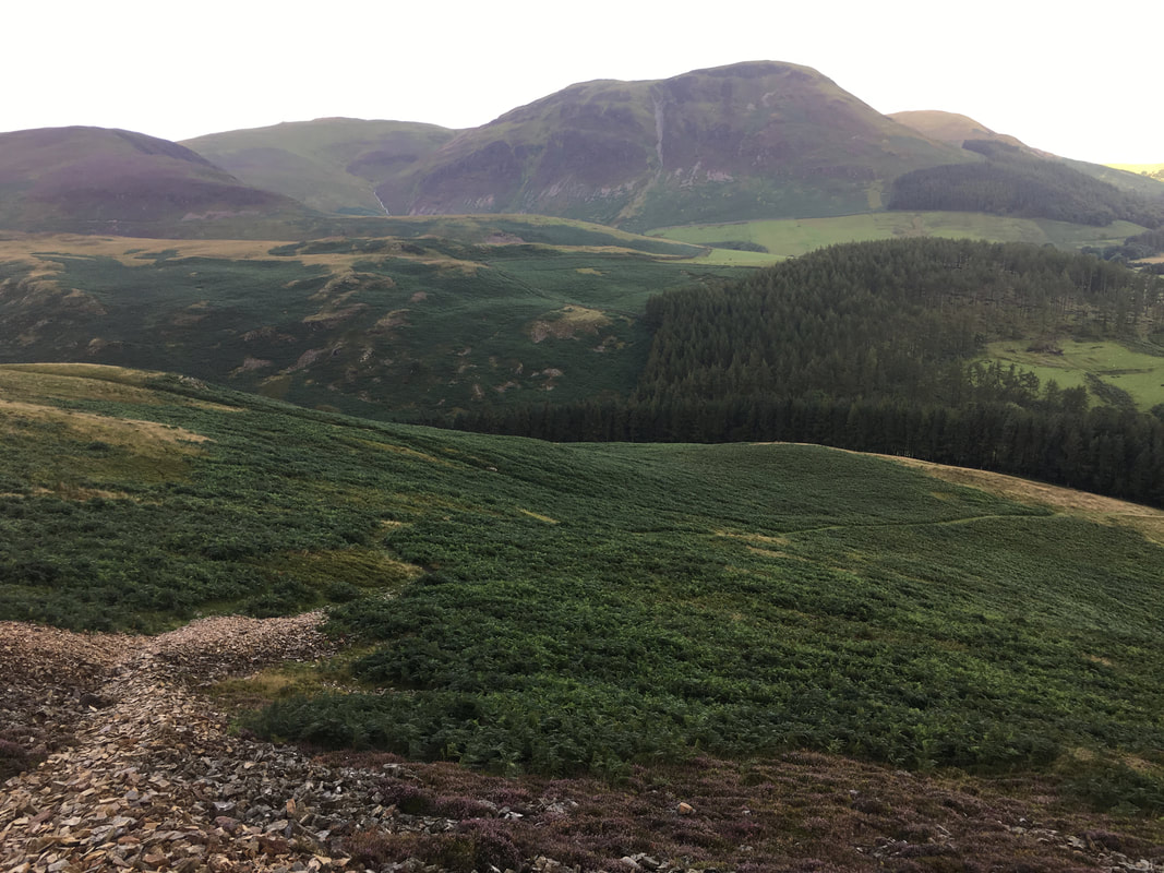
Looking back down our route of ascent from the firebreak with Little Dodd, Blake Fell, Carling Knott & Burnbank Fell providing the overcast backdrop.
The path steepens over loose scree and walking becomes a case of just taking your time
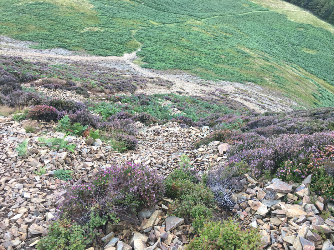
Glimpses of blue sky as Fudge & I enjoy a panoramic view from the scree
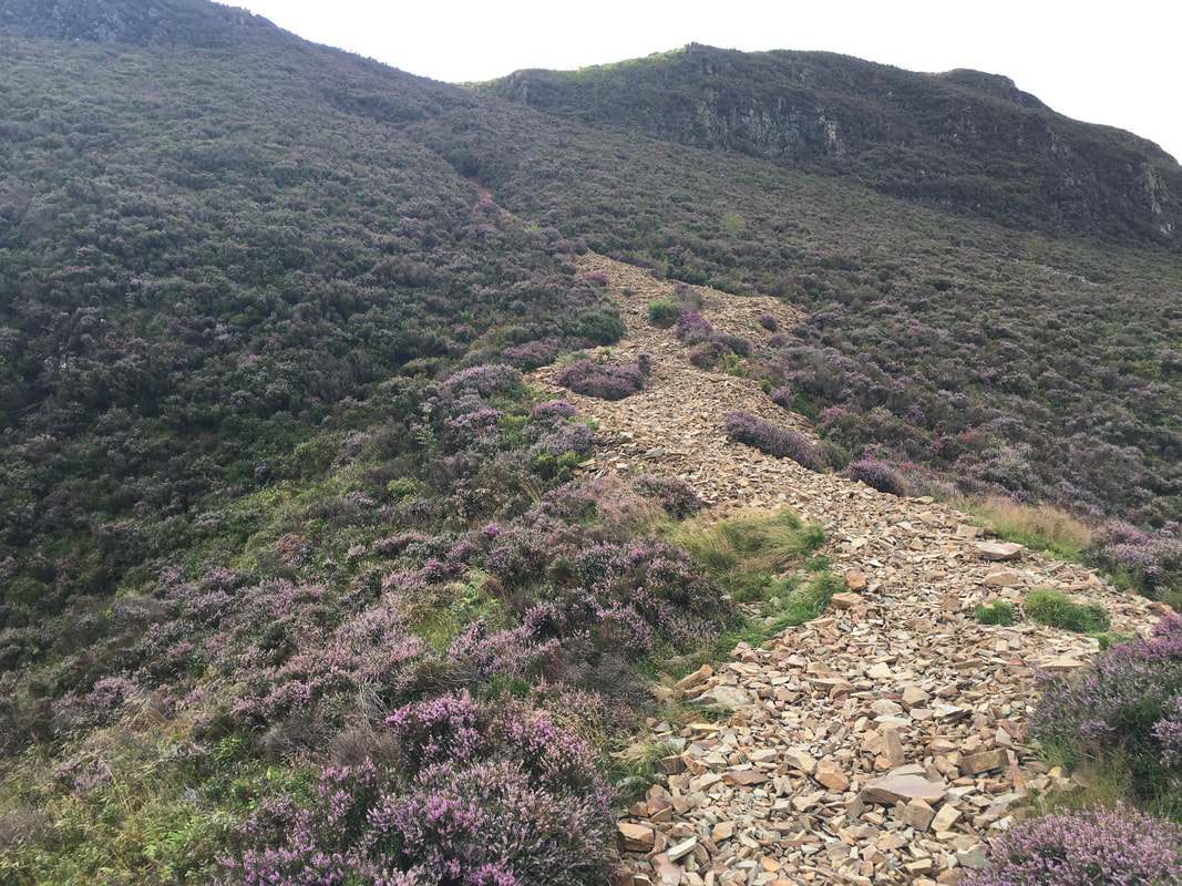
About another 150 yards of scree to negotiate and we would be on a steep but solid path.
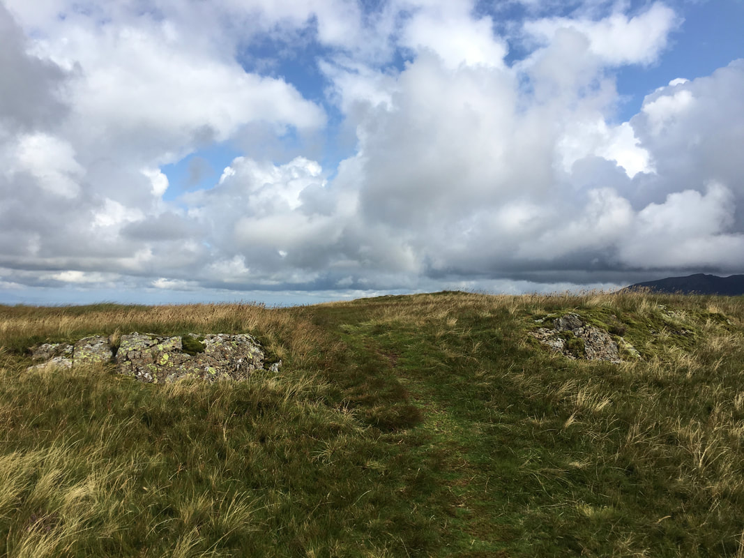
The route eventually arrives at a grassy area with two paths emanating from it. The path to the right leads to Mellbreak's North Top and would be our route from here. However a vague path to the left leads to what Wainwright described as "a lovely peep around a corner" (Mellbreak 4 & 5).
Ascending Mellbreak to the "lovely peep around a corner" (click Play to view)
The view from the "peep around a corner" - a glorious vista over Crummock Water to Grasmoor with Rannerdale Knotts to the right with Buttermere beyond. I'm convinced most people just plough on at the path junction and miss this wonderful view.
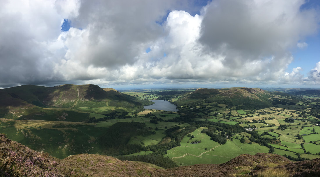
Another glorious panorama over the Vale of Lorton from Mellbreak's North Ridge ascent
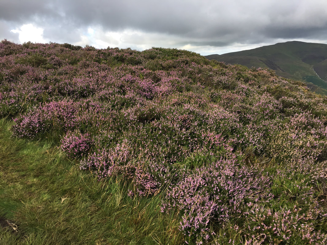
Heather in colour as we approach the summit of Mellbreak's North Top
Approaching Mellbreak's summit (click Play to view)
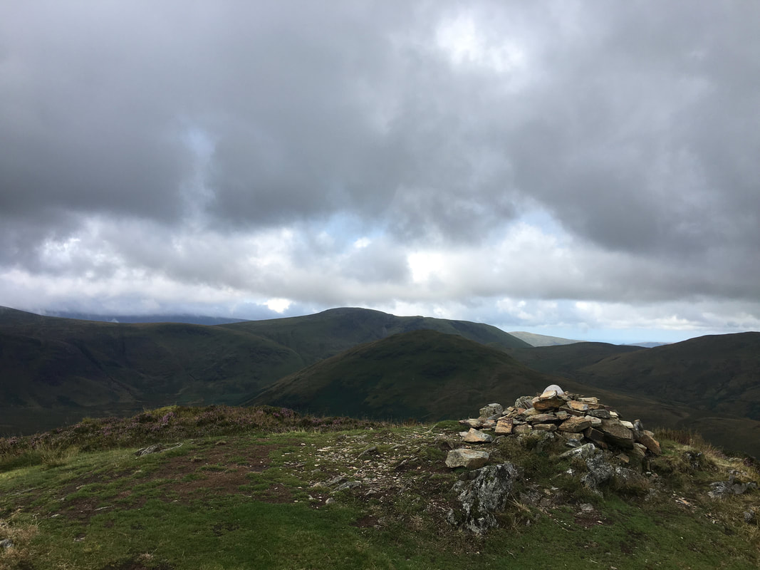
The North Top summit of Mellbreak looking to Hen Comb & Gavel Fell

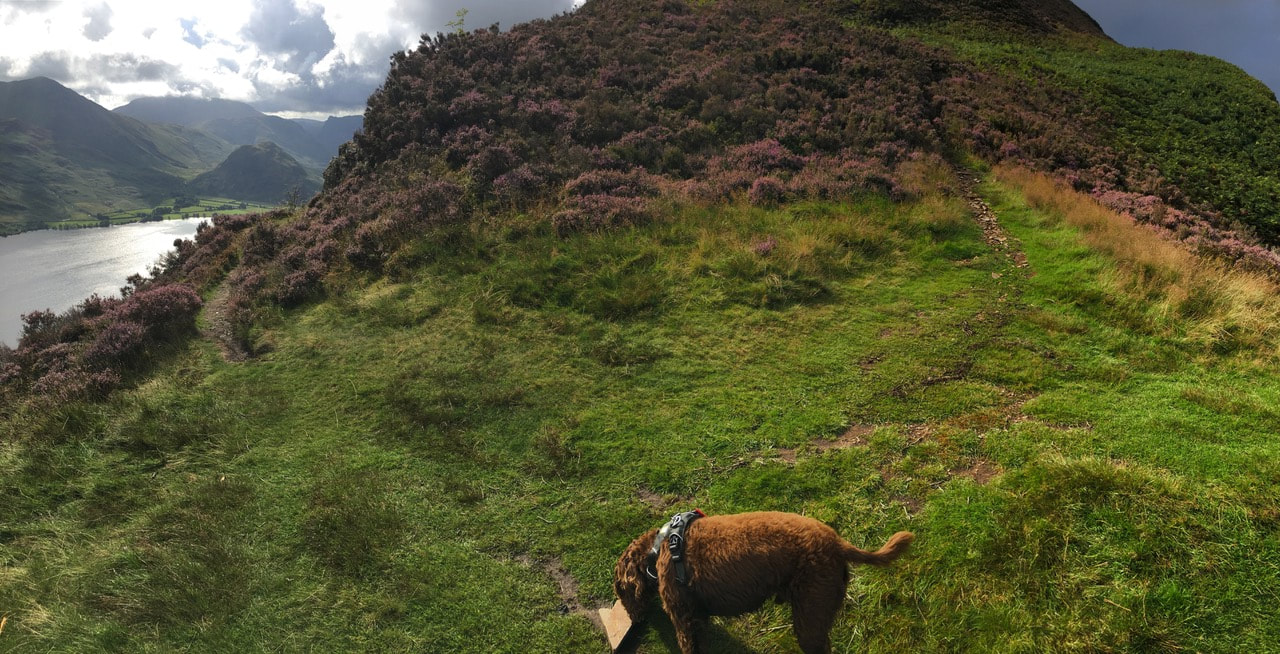
From the North Top the route heads across a wide grassy depression to reach Mellbreak's South Top ahead
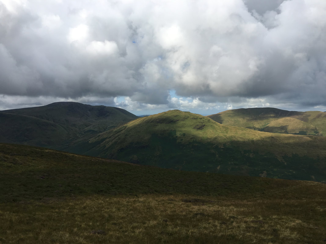
Great Borne, Hen Comb & Gavel Fell from Mellbreak
The summit of Mellbreak on the South Top
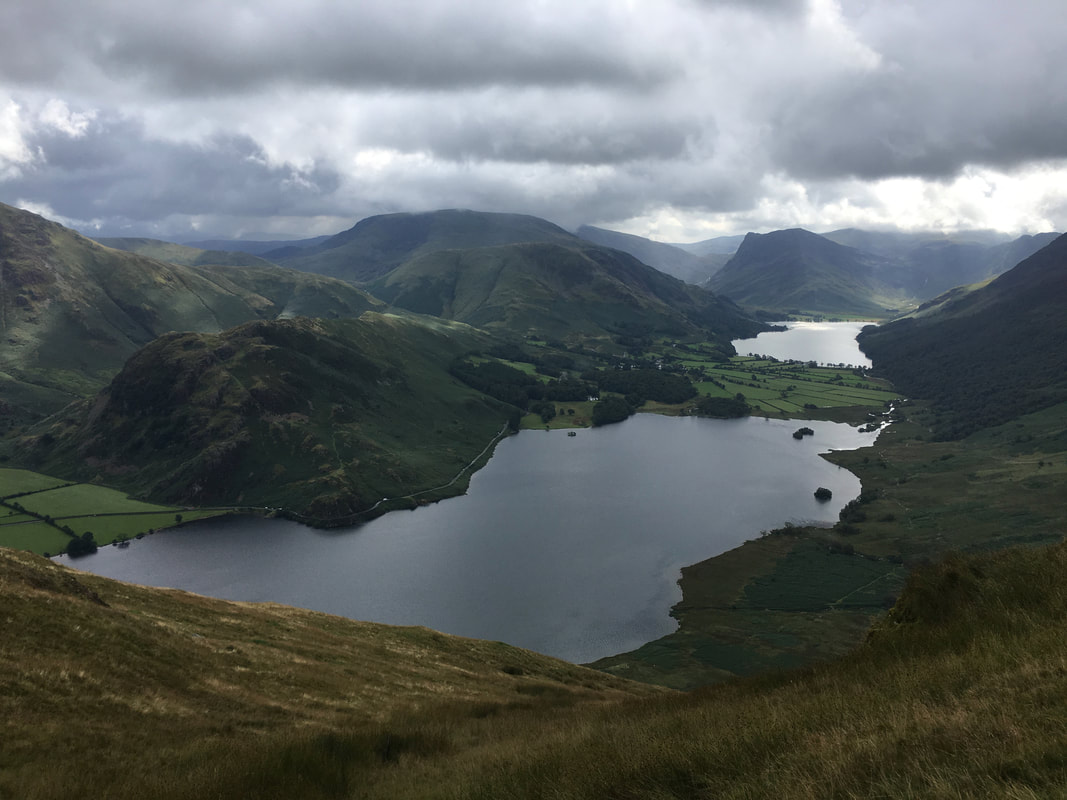
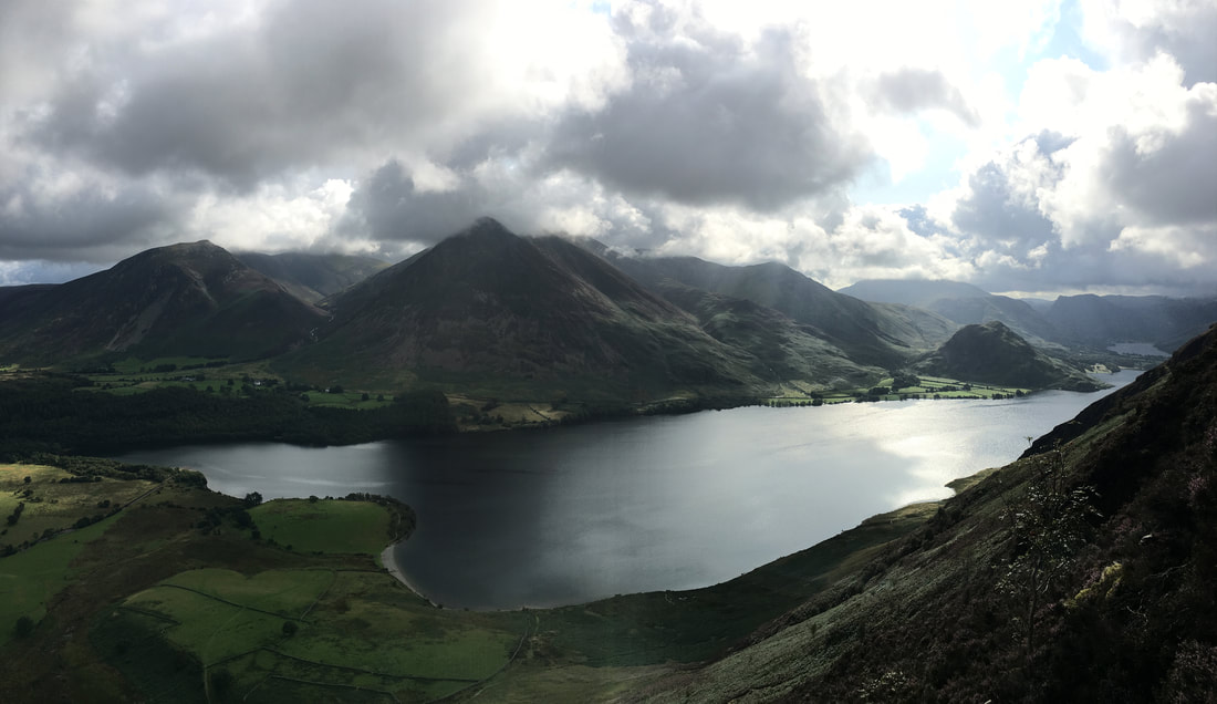
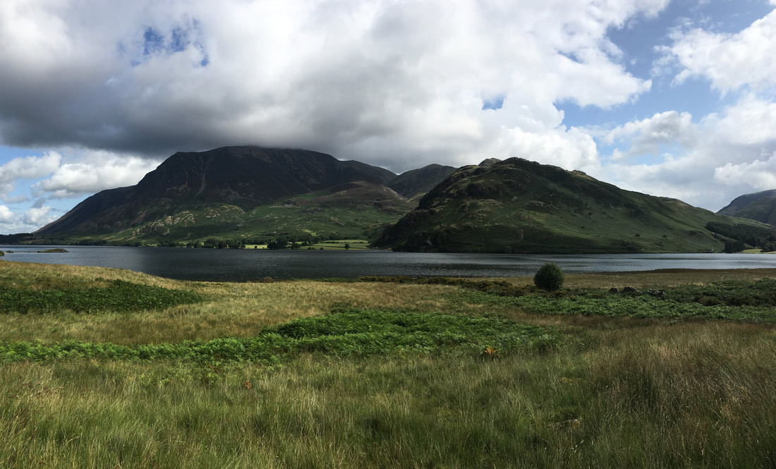
Rannerdale Knotts, High Snockrigg, Robinson, Dale Head & Fleetwith Pike with Crummock Water below and Buttermere distant
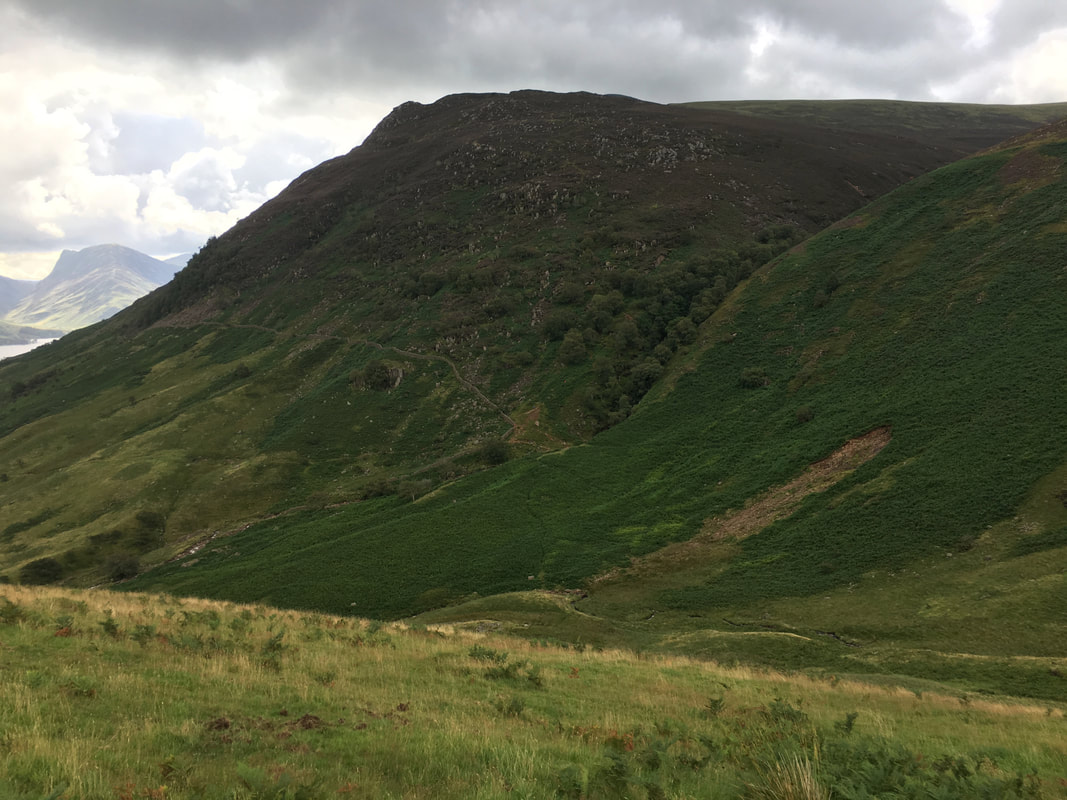
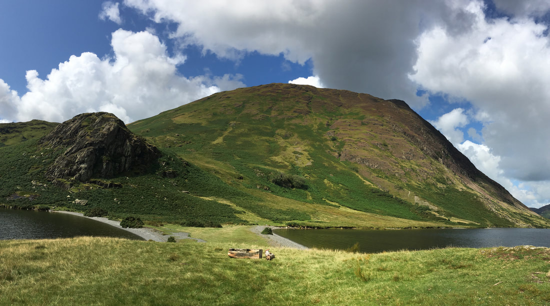
Descending to Scale Force with Red Pike centre & High Stile in cloud
Our route over to Scale Force can be seen ahead with the waterfall hidden in the trees just right of centre
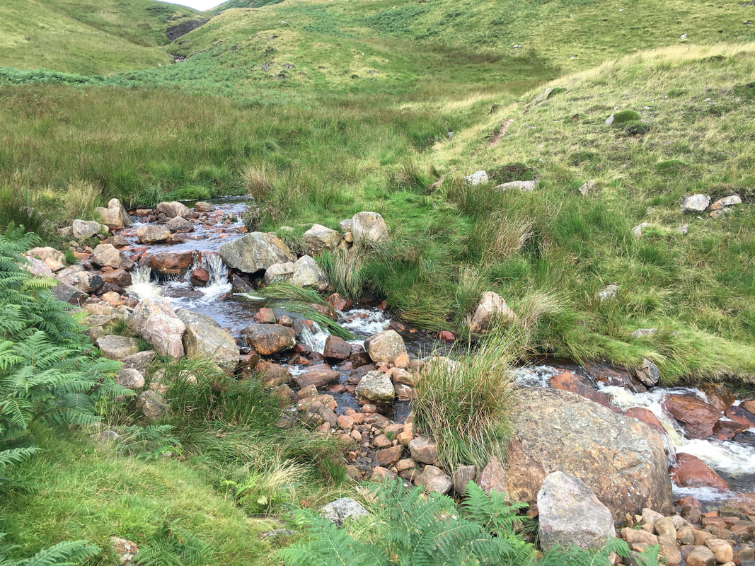
Crossing Black Beck
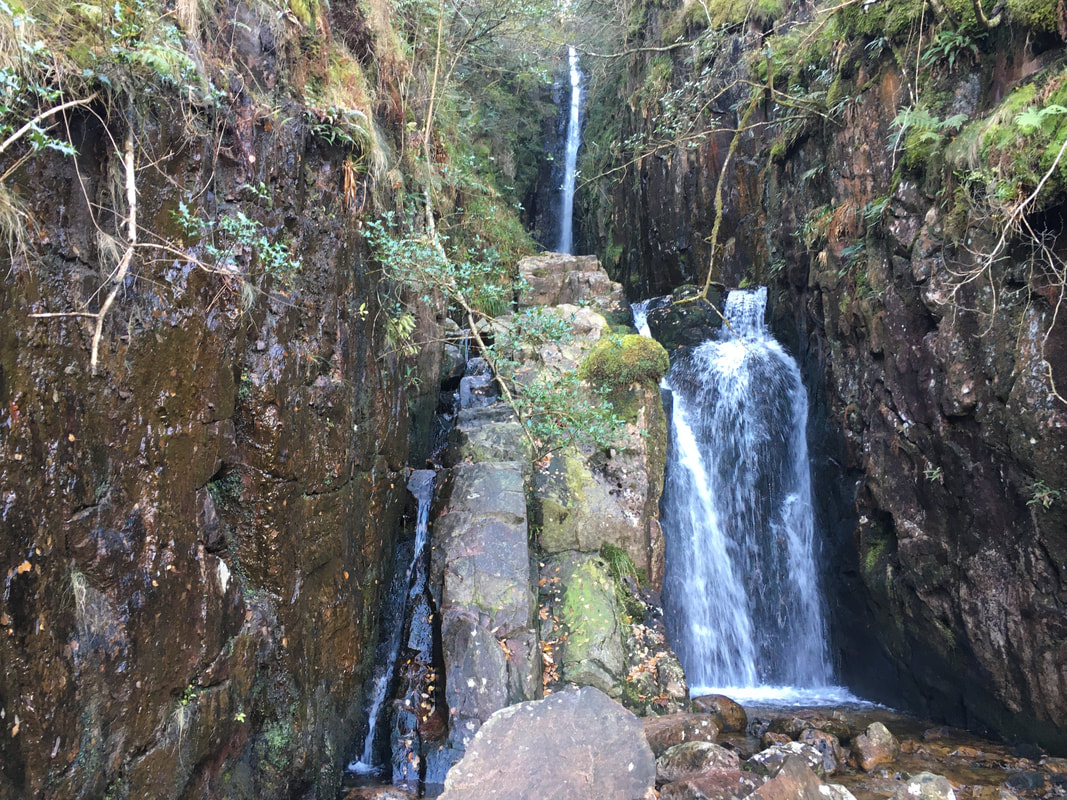
Scale Force - more impressive actually being there rather than in a photograph
Leaving Scale Force we followed the path to the left of Scale Beck towards Crummock Water
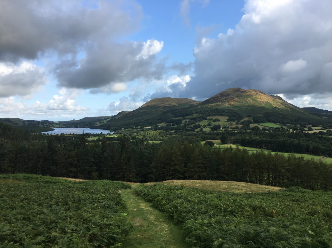
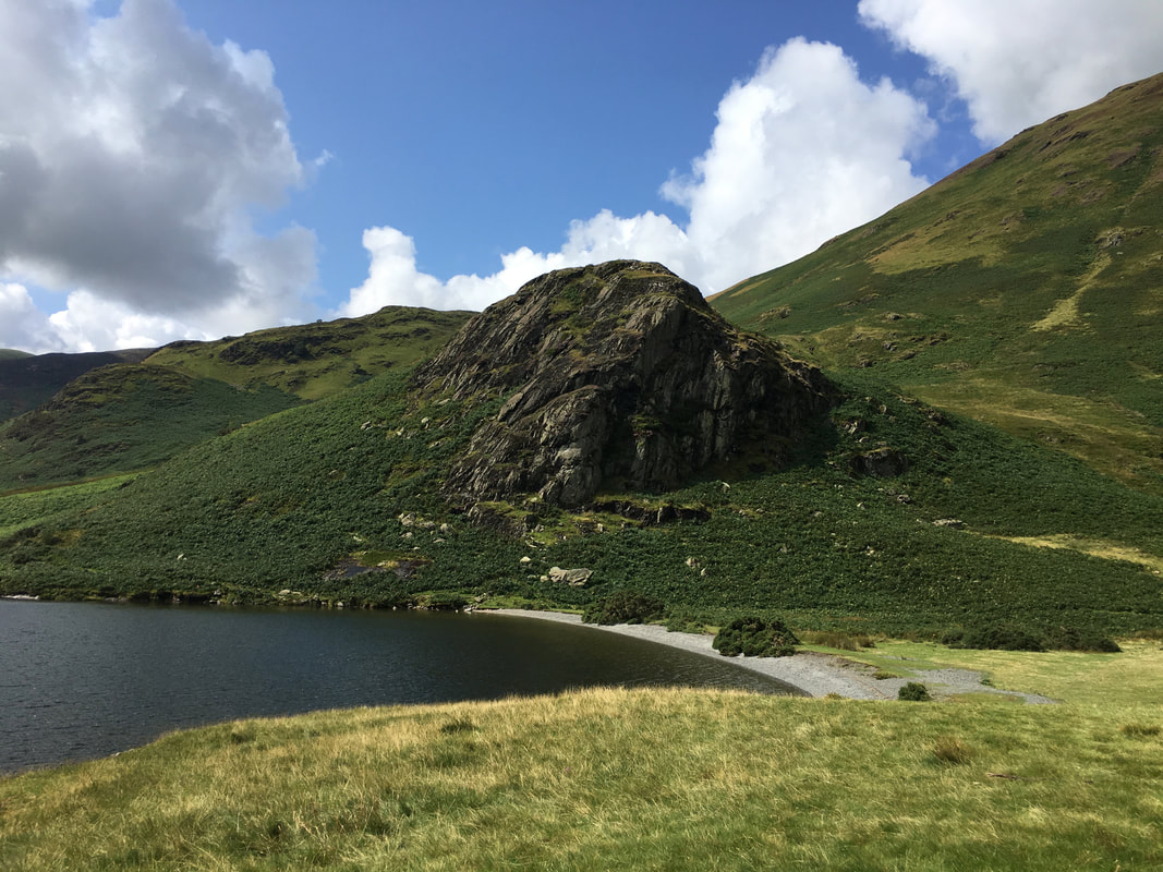
Looking across to Scale Knott - a link to one of our walks featuring this fell can be found here
We would now be hand railing the lakeshore of Crummock Water back to Loweswater
The beautiful High Ling Crag from the peninsula of Low Ling Crag
Someone has clearly had a classic "arsing about session" in Crummock Water
High Ling Crag & Mellbreak from Low Ling Crag
Fudge on Low Ling Crag (click Play to view)
Whiteside & Grasmoor across Crummock Water. The lump of rock in the lower foreground is The Iron Stone.
The route turns inland near Peel leaving a simple walk along a quiet country lane via High & Low Park back to Loweswater