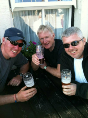
Yorkshire 3 Peaks - Wednesday 19 June 2013
Introduction
For anybody that does not know, there are many 3 peaks or more challenges however the two that are more commonly known in the UK are The National Three Peaks Challenge and The Yorkshire Three Peaks Challenge.
The National Three Peaks Challenge is an attempt to climb the highest peaks in Scotland, England and Wales, namely Ben Nevis (4409ft), Scafell Pike (3209ft) and Snowdon (3560ft), all within a 24 hour period. This includes travelling time between the 3 peaks.
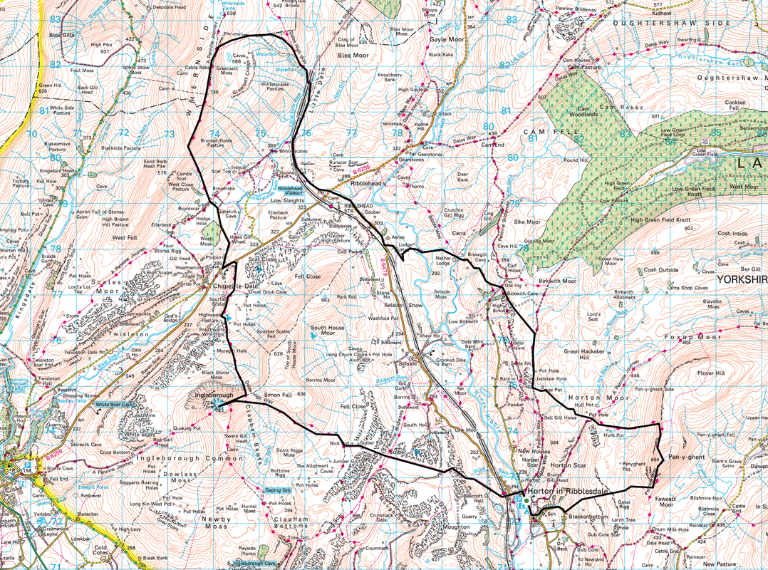
The Yorkshire Three Peaks Challenge is an attempt to climb the peaks of Pen-Y-Ghent (2277ft), Whernside (2415ft) and Ingleborough (2372ft), usually in that order starting and finishing from wherever you like but normally from the Pen-Y-Ghent cafe in Horton-in Ribblesdale. The challenge is to complete the walk in less than 12 hours. The total length of the walk is approximately 25 miles.
Both challenges are tough in their own way but I do not have masochistic tendencies therefore I opted to organise an attempt on the Yorkshire 3 Peaks Challenge whilst we were on holiday in Hawes on a very warm day in June 2013. My brother Ronnie and our cousin Tom were up for the challenge also. Our Working Cocker Spaniel Fudge, only 10 months old at the time was too young to walk the entire route, therefore my wife Angie would sit this one out and act as the back up team whilst Fudge would come with us on the last leg from Chapel-le-Dale back over Ingleborough to Horton.
Planning and Preparation
Apart from making sure you are fit enough to walk 25 miles with over 5500 feet of ascent in under 12 hours there is much you can do to make sure you are as prepared as you can be for this tough day out on the hill. The Internet provides you with a myriad of advice regarding the route and there are many websites giving information on accommodation, kit and more importantly where to have that post walk beer! In addition to making sure we had the right kit and trusty worn in boots, it was vital that we could sustain ourselves for the duration of the walk with enough high energy food and water to keep the legs moving. In addition to what we carried, we kept additional water and food in the car with Angie who met us at various stages of the walk.
Angie and I had climbed all 3 peaks individually in 2012, therefore had an idea of both the terrain and the ascent/descent of each summit. In planning the walk, I read and utilised the many blogs and forums associated with this challenge but in particular found much needed advice and encouragement from the Walking Places website and also mac.hawk on www.3peaks.co.uk. These are both excellent sites and provided me with, amongst other things detailed information concerning the alternative route to avoid the notorious boggy section over Black Dub Moss between Pen-Y-Ghent and Ribblehead – more of this later.
The Walk
Angie and I were already in Hawes and had been for a few days as we were staying in our Caravan just off the Pennine Way between Hawes and Hardraw. Tom came over from Liverpool to stay with Ronnie in Leeds and they made their way over to Hawes very early on the morning of Wednesday 19 June 2013. It was promising to be a glorious day today and we met with Tom & Ronnie at 0600 in the village and made the 30 minute journey over to the start point at Horton-in-Ribblesdale. We parked at the car park just up the road from the Pen-Y-Ghent Cafe but did not bother with all the shenanigans of clocking in and all that malarkey. There were other walkers milling about but not too many thankfully. Therefore at 0637 on the dot we shouldered our rucksacks and started out on what we hoped would be a fantastic day out on the hills.
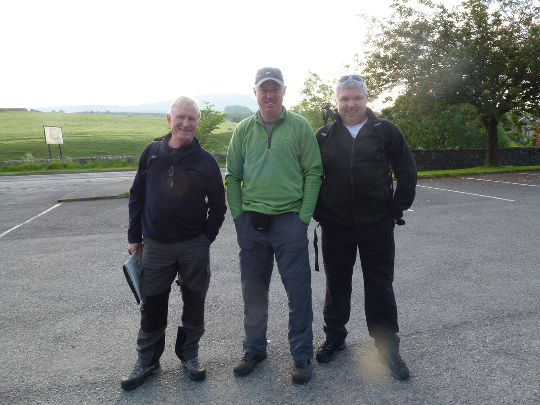
Fresh as Daisies - L-R Tom, Me and Ronnie at the Car Park in Horton-in-Ribblesdale
Horton-in Ribblesdale to Pen-Y-Ghent Summit Trig Point (2.5 miles, 1558 feet of ascent)
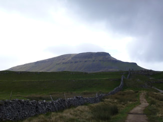
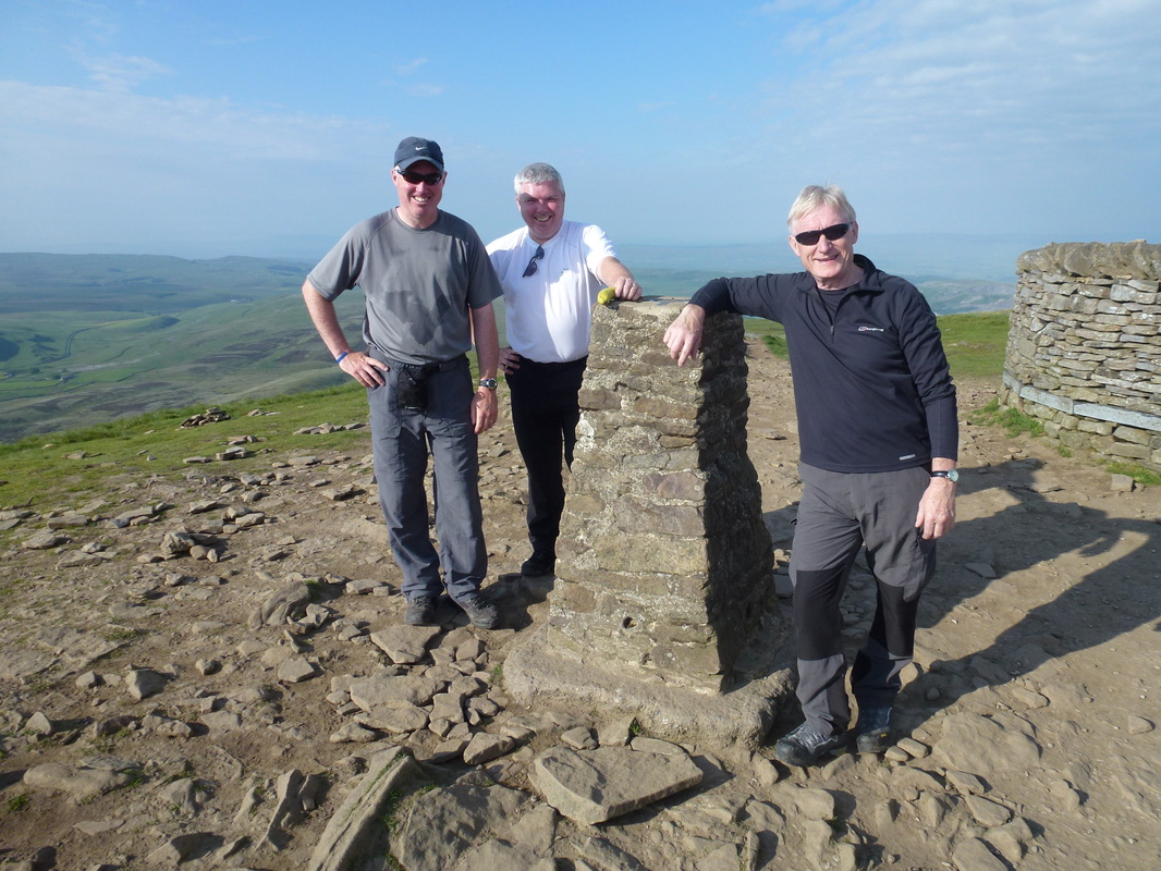
Setting off down the B6479 out of Horton we knew that weather wise, today was going to be a scorcher and that the correct management of our fluid intake would be the key in getting around safely. As I said earlier, luckily we had a back up team (Angie and Fudge) who we had planned to be in position to provide replenishment at Tarn Bar, Ribblehead and Chapel-le-Dale. We then made our way to the path junction at Brackenbottom in order to make the steady ascent up to join the Pennine Way near Gavel Rigg. We were already starting to feel the heat and it was only just past 0700. At the Pennine Way junction it is a short but strenuous pull up to the Trig Point and wall on the summit of Pen-Y-Ghent which we reached at 0740, just over an hour after setting off. We met only one other walker on the summit and he had set off just before us in Horton. The visibility was exceptional and therefore the view back over to Fountains Fell and Plover Hill was superb and the other two summits of Whernside and Ingleborough, whilst intimidating looking at the distance to them, were clear to see.
Setting off down the B6479 out of Horton we knew that weather wise, today was going to be a scorcher and that the correct management of our fluid intake would be the key in getting around safely. As I said earlier, luckily we had a back up team (Angie and Fudge) who we had planned to be in position to provide replenishment at Tarn Bar, Ribblehead and Chapel-le-Dale. We then made our way to the path junction at Brackenbottom in order to make the steady ascent up to join the Pennine Way near Gavel Rigg. We were already starting to feel the heat and it was only just past 0700. At the Pennine Way junction it is a short but strenuous pull up to the Trig Point and wall on the summit of Pen-Y-Ghent which we reached at 0740, just over an hour after setting off. We met only one other walker on the summit and he had set off just before us in Horton. The visibility was exceptional and therefore the view back over to Fountains Fell and Plover Hill was superb and the other two summits of Whernside and Ingleborough, whilst intimidating looking at the distance to them, were clear to see.
On the Summit of Pen-y-Ghent at 0740 in the morning
Pen-Y-Ghent to Ribblehead (7.5 miles, 610 feet of ascent)
After a brief stop at the summit we made our way off the top by way of the very good Pennine Way path heading north. It was always our intention, no matter the weather to avoid Black Dub Moss and instead use the new route via Tarn Bar and Whitber Hill. The path was good underfoot and the signage excellent. We resisted the temptation to visit Hull Pot and instead made our water rendezvous with Angie and Fudge who had walked up to the top of Horton Scar Lane at Tarn Bar. Suitably refreshed and licked to death by Fudge, we took stock of the situation - we were making good time, felt ok and were enjoying the experience. Whitber Hill and Sell Gill Hill came and went and we rejoined the Pennine Way just south of Jackdaw Hole.
After a short while, we left the Pennine Way and headed North West to meet the Ribble Way just south of Dismal Hill. The easy terrain was to last to God’s Bridge, Nether Lodge and Lodge Hall where we made our way through the rather messy farmyard onto the Gauber Road. There now followed a period of road walking, running the gauntlet of boy racers, Chelsea Tractors and white van men all the way to the junction with the Blea Moor Road at Ribblehead. Arriving at about 1120, Angie and Fudge were waiting for us with our food and water and we rested up for about 30 minutes. Ribblehead was very busy and the mobile snack bar was doing a roaring trade.
Ronnie then asked me to have a look at his feet which were in a pretty bad way. Several Compeed patches and surgery later and it seemed he was ok to continue. As we were heading away to cross the road it was clear he was in some pain and reluctantly he said he would call it a day. It was a real shame he had to pack it in but to be fair it was a brave call by him considering had he kept it to himself it would have caused us all sorts of problems had he been unable to go on half way up Whernside.
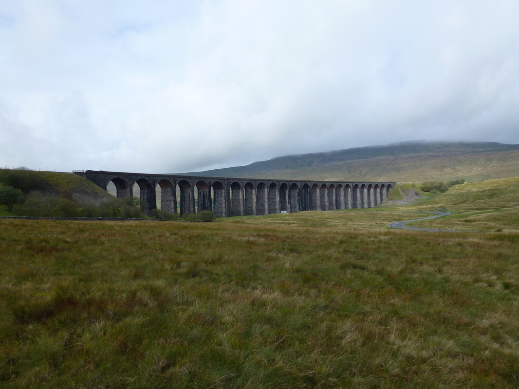
Ribblehead Viaduct
Ribblehead to Whernside Summit Trig Point (4 miles, 1696 feet of ascent)
I really enjoyed climbing Whernside last year with Angie. On a good day with not many people about it is a lovely climb and not overly strenuous, being gradual in its ascent. The view from the start of this leg could not be more striking with the 400 metres long and the 24 x 104 or so feet high arches of the Ribblehead Viaduct in full view. It is a tremendous piece of engineering and architecture built between 1870 and 1874 to carry steam trains on the Settle to Carlisle railway. This part of the line was one of the most difficult sections to be built and looking at the structure you can clearly see why.
I really enjoyed climbing Whernside last year with Angie. On a good day with not many people about it is a lovely climb and not overly strenuous, being gradual in its ascent. The view from the start of this leg could not be more striking with the 400 metres long and the 24 x 104 or so feet high arches of the Ribblehead Viaduct in full view. It is a tremendous piece of engineering and architecture built between 1870 and 1874 to carry steam trains on the Settle to Carlisle railway. This part of the line was one of the most difficult sections to be built and looking at the structure you can clearly see why.
Anyway, enough of the history lesson and on with the walk. As I stated earlier, Ribblehead was very busy and now I knew why. Tom and I had to dodge lots of steam train enthusiasts coming down from the railway line. All had various large lensed cameras and video recording equipment – I asked a couple of them why so many people were here with cameras etc and apparently a very rare steam train had just passed over the viaduct on its way to Carlisle.
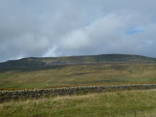
Having dodged the last of the steam train enthusiasts we passed the signal box at Blea Moor and climbed steadily alongside the railway line to the Aqueduct where we headed North West on the path to Grain Head. All through this section the enormous, whale-like bulk of Whernside was in full view to the left. At Grain Head the path turns west and increases in gradient somewhat before levelling off on the main ridge. Tom and I still felt really good at this point, we were well hydrated and suffering no injuries. The ridge on Whernside was pretty busy and on reaching the summit there were lots of people having lunch and enjoying the day. After a quick snack and a brief photo opportunity we were away.
Having dodged the last of the steam train enthusiasts we passed the signal box at Blea Moor and climbed steadily alongside the railway line to the Aqueduct where we headed North West on the path to Grain Head. All through this section the enormous, whale-like bulk of Whernside was in full view to the left. At Grain Head the path turns west and increases in gradient somewhat before levelling off on the main ridge. Tom and I still felt really good at this point, we were well hydrated and suffering no injuries. The ridge on Whernside was pretty busy and on reaching the summit there were lots of people having lunch and enjoying the day. After a quick snack and a brief photo opportunity we were away.
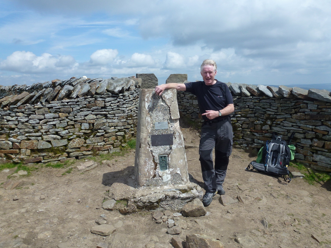
Looking windswept and interesting - Tom on the summit of Whernside
Whernside to Chapel-le-Dale (3 miles, 72 feet of ascent)
Leaving the crowds to their lunch, Tom and I made our way further along the ridge. All along the Whernside ridge are superb views and we were lucky that today the visibility was excellent. Reaching the path junction, we headed south east on the Chapel-le-Dale path down towards Bruntscar Farm. This is a real knee jarring, downhill section and we were glad to get down to Bruntscar and enjoy a bit of the flat again, in particular a nice section along a good track to the road at Chapel-le-Dale. Angie, Ronnie and Fudge were parked up at The Old Inn with refreshments therefore we trudged up the hill to meet them. We stopped here for about 20 minutes, aired our feet and had a nice cool drink. Fudge was going to join us for the next leg and we therefore made our way to the path to Ingleborough which is just past the Old Inn pub at Philpin Sleights.
Leaving the crowds to their lunch, Tom and I made our way further along the ridge. All along the Whernside ridge are superb views and we were lucky that today the visibility was excellent. Reaching the path junction, we headed south east on the Chapel-le-Dale path down towards Bruntscar Farm. This is a real knee jarring, downhill section and we were glad to get down to Bruntscar and enjoy a bit of the flat again, in particular a nice section along a good track to the road at Chapel-le-Dale. Angie, Ronnie and Fudge were parked up at The Old Inn with refreshments therefore we trudged up the hill to meet them. We stopped here for about 20 minutes, aired our feet and had a nice cool drink. Fudge was going to join us for the next leg and we therefore made our way to the path to Ingleborough which is just past the Old Inn pub at Philpin Sleights.
Chapel-le-Dale to Ingleborough Summit Trig Point (3 miles, 1456 feet of ascent)
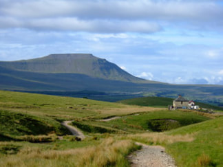
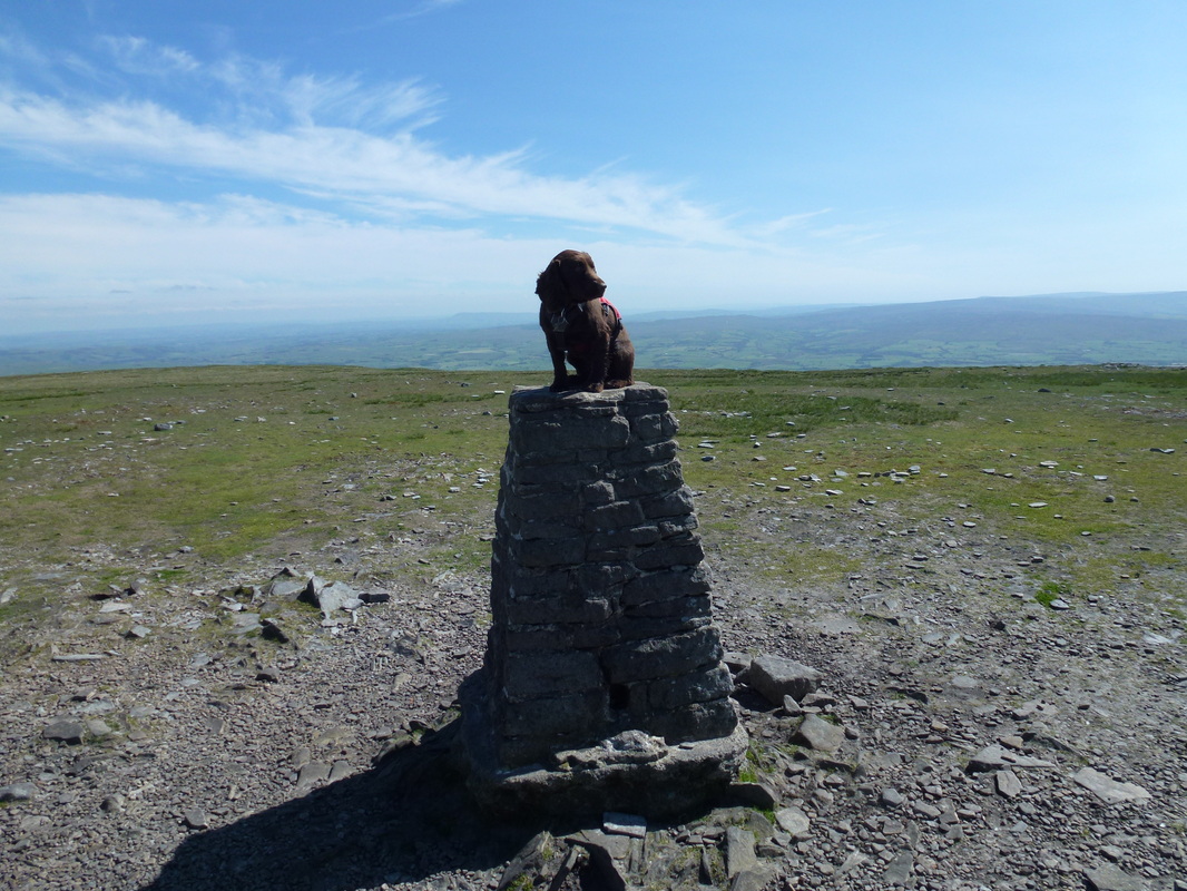
It was still very warm as we made our way over Highwood Pasture towards the amusingly named Humphrey Bottom and even worse named Braithwaite Wife Hole. I knew that the near vertical ascent of Ingleborough from just past Humphrey Bottom was a real energy sapper and no matter how fit you are this ascent is hard work but Tom and I still felt as though we had plenty left in the tank. We arrived at the start of the steps at the foot of Ingleborough and slowly made our way up the zig zag vertical steps, pausing at times to draw breath and regain composure whereas Fudge was doing his usual trick of running up the path and then coming back down to see why we were not keeping up with him. After what seemed an eternity, the path levelled off and we made our way on to the vast flat expanse of the summit of Ingleborough. Surprisingly there was no-one here!! We did not stay long, but long enough to admire the views over the seemingly large area we had walked today.
It was still very warm as we made our way over Highwood Pasture towards the amusingly named Humphrey Bottom and even worse named Braithwaite Wife Hole. I knew that the near vertical ascent of Ingleborough from just past Humphrey Bottom was a real energy sapper and no matter how fit you are this ascent is hard work but Tom and I still felt as though we had plenty left in the tank. We arrived at the start of the steps at the foot of Ingleborough and slowly made our way up the zig zag vertical steps, pausing at times to draw breath and regain composure whereas Fudge was doing his usual trick of running up the path and then coming back down to see why we were not keeping up with him. After what seemed an eternity, the path levelled off and we made our way on to the vast flat expanse of the summit of Ingleborough. Surprisingly there was no-one here!! We did not stay long, but long enough to admire the views over the seemingly large area we had walked today.
Fudge on the summit of Ingleborough
Ingleborough to Horton-in-Ribblesdale (5 miles, 134 feet of ascent)
I knew from reading the walkers forums that the 3 Peaks Challenge was not all done and dusted once you had cracked the final summit. Lots of people had commented on how much they had underestimated the almost 5 mile long slog back down to Horton-in-Ribblesdale. Tom and I knew we would be comfortably inside 12 hours even taking our time like we did today, but like other people, felt that we were not getting any nearer to our goal, no matter how fast we walked. We were making good progress as we passed over Simon Fell Breast and our next goal of the ruined shooting hut. The path was very good here and we made solid progress down towards the Clapham turning just before Sulber. We looked at our watches and saw that if we continued with our rate of progress we could probably get inside 11 hours although unimportant for us, it was only now that we were conscious of our time. Sulber Nick came and went and we were soon glad of the grassy path down to the station at Horton. Crossing the station, we could then make out our welcoming committee and we made it down to the car park just inside 11 hours.
I knew from reading the walkers forums that the 3 Peaks Challenge was not all done and dusted once you had cracked the final summit. Lots of people had commented on how much they had underestimated the almost 5 mile long slog back down to Horton-in-Ribblesdale. Tom and I knew we would be comfortably inside 12 hours even taking our time like we did today, but like other people, felt that we were not getting any nearer to our goal, no matter how fast we walked. We were making good progress as we passed over Simon Fell Breast and our next goal of the ruined shooting hut. The path was very good here and we made solid progress down towards the Clapham turning just before Sulber. We looked at our watches and saw that if we continued with our rate of progress we could probably get inside 11 hours although unimportant for us, it was only now that we were conscious of our time. Sulber Nick came and went and we were soon glad of the grassy path down to the station at Horton. Crossing the station, we could then make out our welcoming committee and we made it down to the car park just inside 11 hours.
Aftermath
The Crown Inn is a suitable place to have a post walk beer therefore we made our way to the pub and enjoyed a couple of long cool glasses of the cold stuff prior to making the journey back over to Hawes where we would meet up later at another Crown Inn. Excellent food and a few nice pints of Old Peculier and sleep came very easy that night.
Conclusion
The Yorkshire 3 Peaks is an absolutely fabulous day out and even better with the weather we had plus it was great fun sharing the day with my walking companions and Angie & Fudge. At 25 miles it is a very long way to walk and I can imagine it is a completely different beast when it is inclement but we were lucky to have great weather on our day. A time of less than 12 hours with fair weather is quite achievable even with plenty of stops to take on refreshment and enjoy the scenery. After all, although to complete the walk inside 12 hours is nice, isn’t the enjoyment of your surroundings what this kind of walking is all about anyway??
Aahhhh - that's better!
Data
|
Start
Finish Distance Total Time Maximum Height Total Ascent |
0637
1736 25 miles 10 hrs 59 min 2415 feet 5526 feet |
|
Download GPX File
|
| ||
If the above GPX file fails to download or presents itself as an XML file once downloaded then please feel free to contact me and I will send you the GPX file via e-mail.
