Grey Knotts, Brandreth, Base Brown, Green Gable & Great Gable - Thursday 19 November 2020
Route
Honister - Grey Knotts - Brandreth - Gillercomb Head - Blackmoor Pols - Base Brown - Blackmoor Pols - Green Gable - Windy Gap - Great Gable - Westmorland Cairn - Beck Head - Moses Trod - Drum House - Honister
Parking
Honister Slate Mine (£5 all day, pay in the shop) - Grid Reference NY 22458 13538. Nearest postcode is CA12 5XN which will take you to Seatoller however the Slate Mine is 1.4 miles further on up the B5289 (Honister Pass).
Mileage
8.2 miles
Terrain
Good mountain paths throughout. The descent from Great Gable to Beck Head is steep and over loose stone and scree therefore care needs to be taken.
Weather
The morning was overcast however after lunch the gloom lifted and we enjoyed mostly sunny spells. The visibility today was very good.
Time Taken
7hrs
Total Ascent
2900ft (884m)
Wainwrights
5
Map
OL4 - The English Lakes (North Western Area)
Walkers
Dave, Angie & Fudge
|
GPX File
|
| ||
If the above GPX file fails to download or presents itself as an XML file once downloaded then please feel free to contact me and I will send you the GPX file via e-mail.
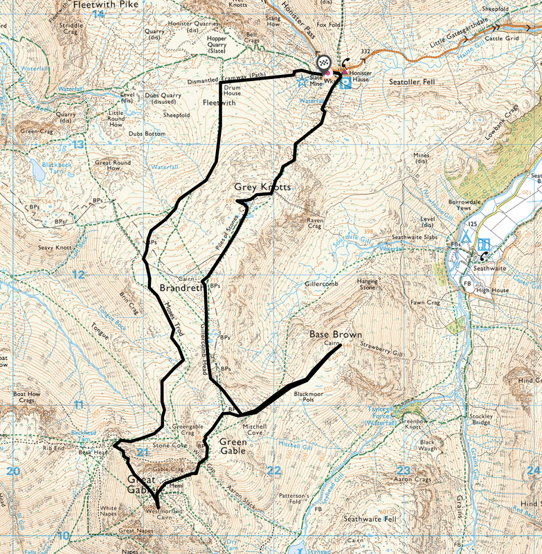
Route Map
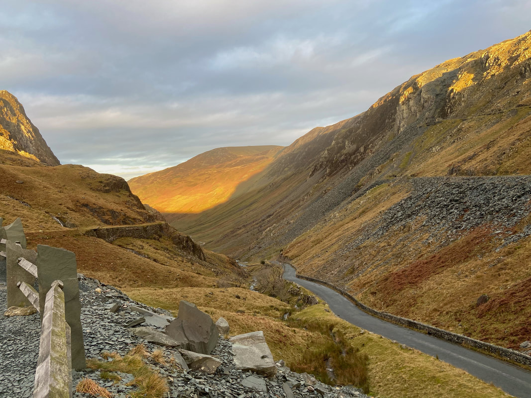
The view down the Honister Pass from the Car Park.
The sun had just come up and Hindscarth is bathed in the most beautiful light.
The sun had just come up and Hindscarth is bathed in the most beautiful light.
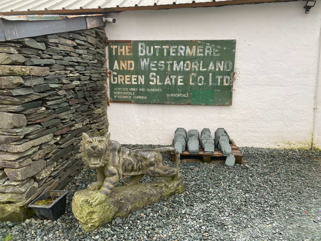
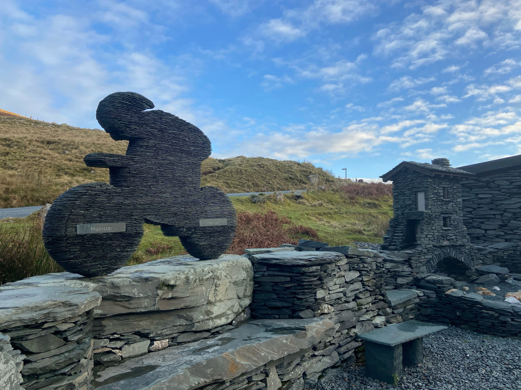
The green slate has been mined at Honister since the early 1700s and the Buttermere and Westmorland Green Slate Company Limited was founded in 1879. All activity ceased at Honister in 1986 after a period of decline. However, in 1996, Bill Taylor and Mark Weir, son and grandson of former miners re-opened the site and production re-commenced in December 1997. I can heartily recommend the Mine Tour which gives a fascinating insight into how the mine functions both now and in the past - details can be found here
The skill of the present workforce is clearly evident in and around the place. The building to the right is a slate representation of Bridge House in Ambleside, a famous landmark in the Lake District.
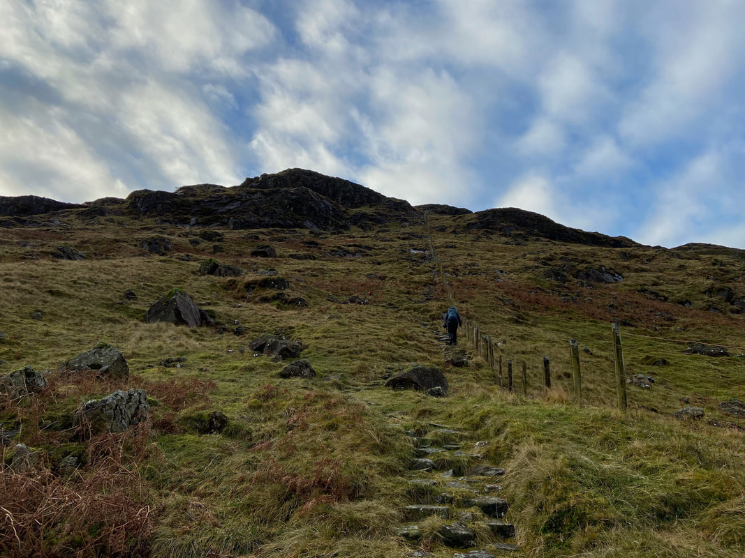
Anyway, enough of the history lesson, lets get on with the walk. From the rear of the mine buildings a path heads up the lower slopes of Seatoller Fell. We were not blessed with very good light in the morning therefore it was quite dull for photographs however the light did improve from Brandreth therefore stick with it!
As we ascend towards Grey Knotts the Hopper Quarry on Black Star (Honister Crag) comes into view.
Looking back to Honister Mine from the ascent as we handrail the fence. Dale Head rises majestically to the rear.
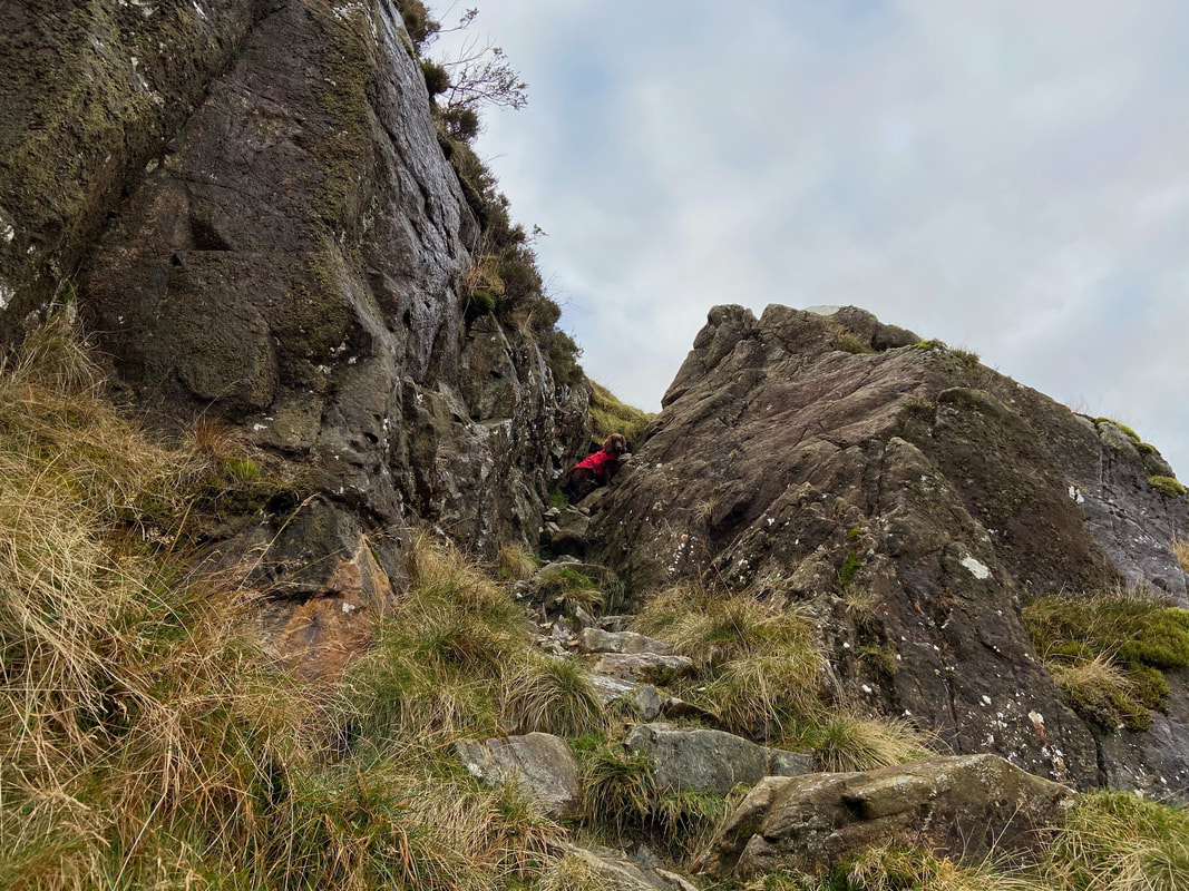
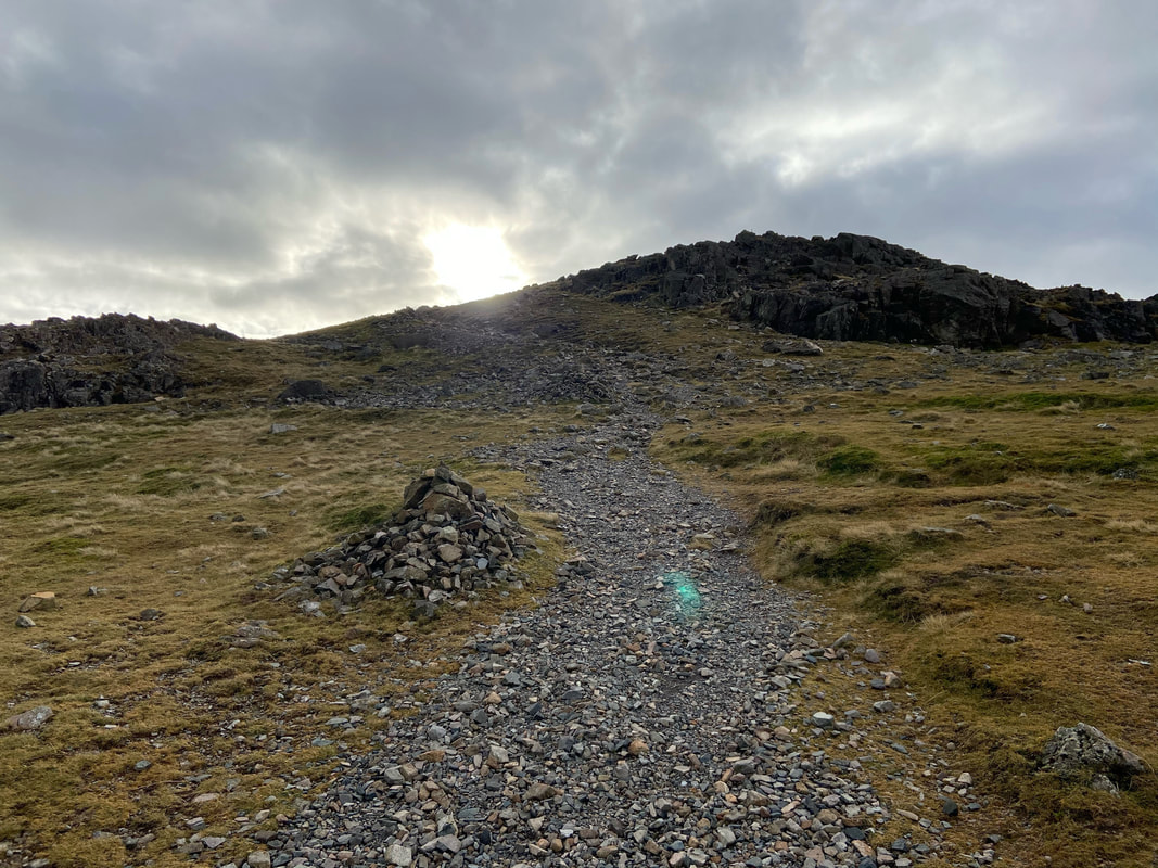
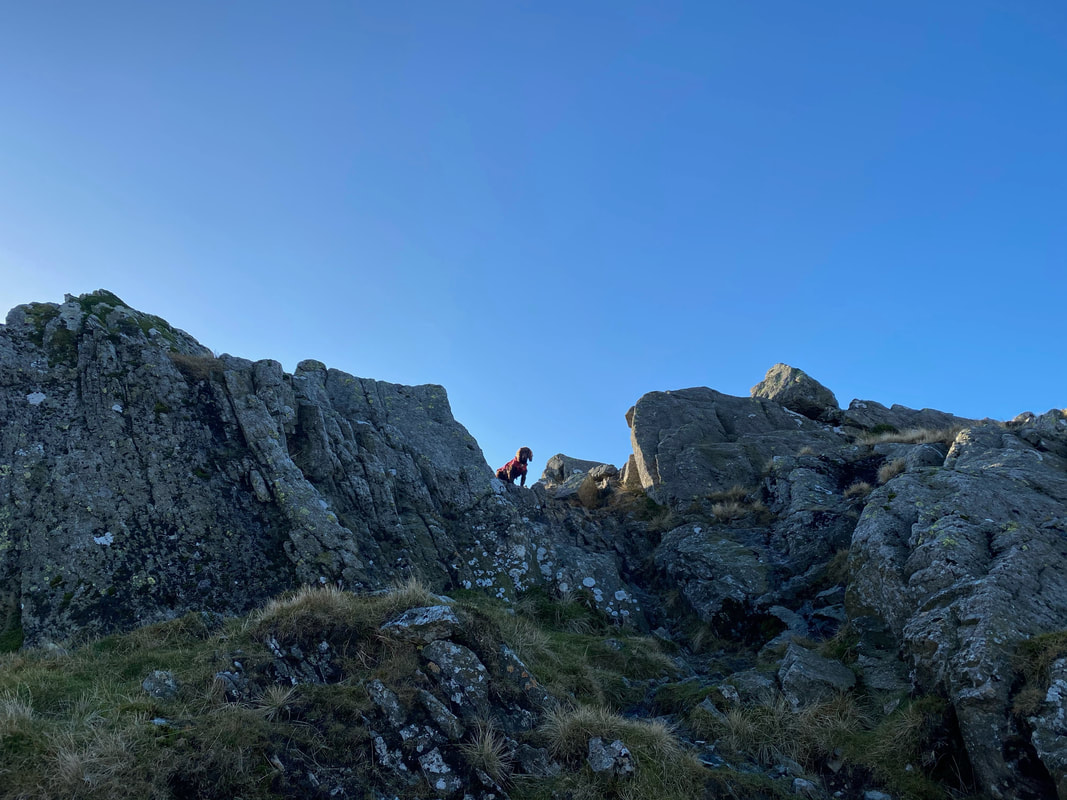
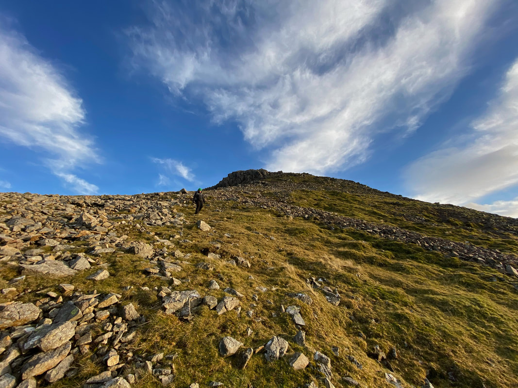
Wainwright described this rock groove as "a little gully or cleft in the rocks and it is necessary to handle rock" (Grey Knotts 7). The groove is neither difficult or technical and is a pleasant and easy scramble.
The Honister Pass coming up from Borrowdale
Another view of Dale Head as we continue to follow the fence up which leads directly to the summit plateau of Grey Knotts............
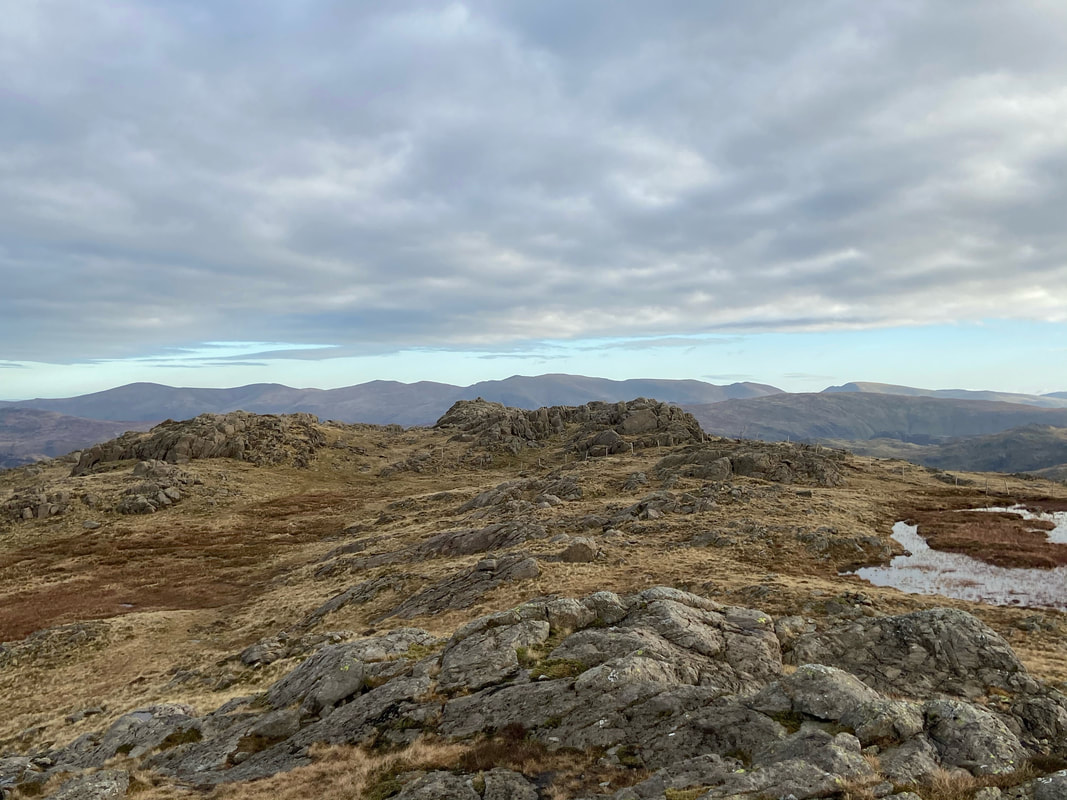
.............. and here we are at the summit which is a hundred yards or so from where the fence line turns to the left towards Brandreth.
To the left are Red Pike (Wasdale) & Pillar with the High Stile ridge behind Fudge's head. To the right are Mellbreak & Crummock Water with Grasmoor on the far side of the shot. There are two rocky outcrops that adorn the top of Grey Knotts and from initial appearance there is little difference in height. The western tor is the only top that is afforded a spot height measurement on the OS Map and is considered to be the summit. Visit both!!
To the left are Red Pike (Wasdale) & Pillar with the High Stile ridge behind Fudge's head. To the right are Mellbreak & Crummock Water with Grasmoor on the far side of the shot. There are two rocky outcrops that adorn the top of Grey Knotts and from initial appearance there is little difference in height. The western tor is the only top that is afforded a spot height measurement on the OS Map and is considered to be the summit. Visit both!!
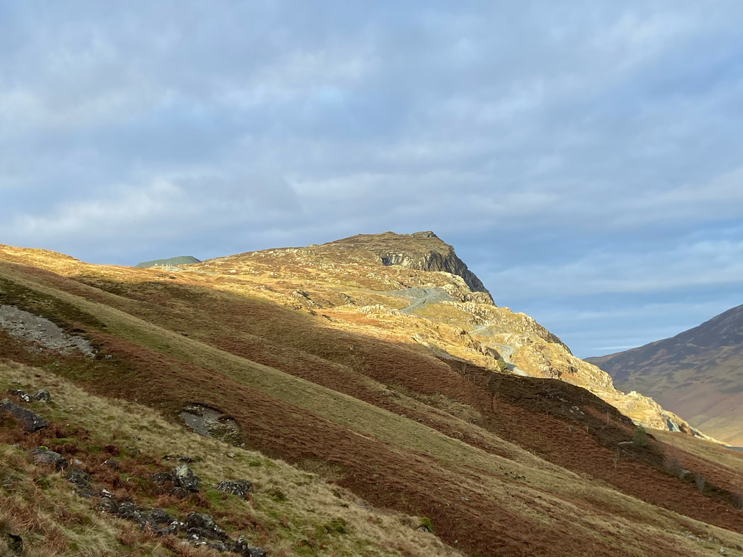
The Hopper Quarry on Fleetwith Pike with the North Western Fells to the rear. The conditions today were a game of two halves with an overcast morning followed by a stunning afternoon.
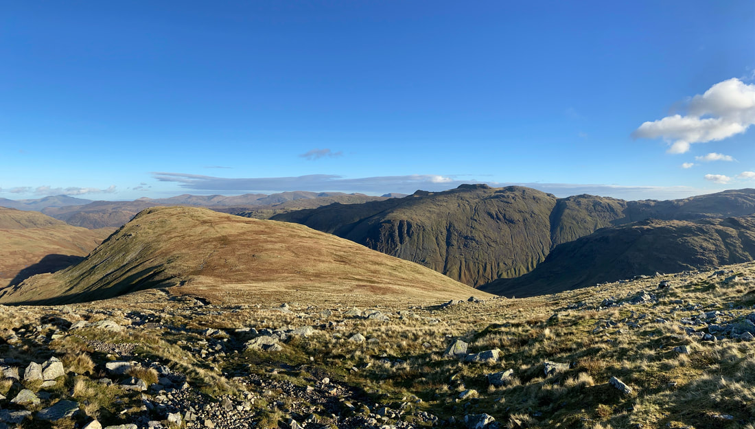
From Grey Knotts we were now off to Brandreth to the right with the unmistakeable lump of Great Gable behind
A closer look at Red Pike & Pillar. Black Crag & Scoat Fell are just right of centre with Looking Stead in the central foreground.
Looking to the eastern rock tor from the summit of Grey Knotts
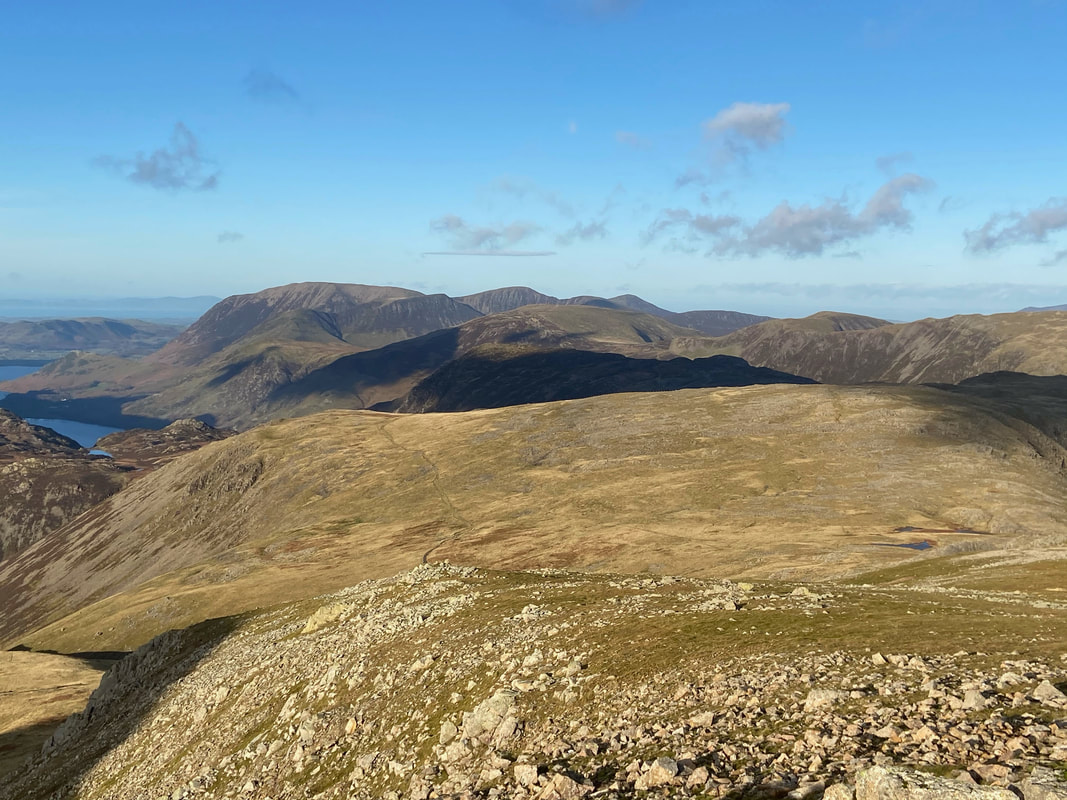
Grey Knotts gives excellent views to the west. From left to right Crag Fell sitting above Ennerdale Water, Hay Stacks, High Crag, High Stile, Crummock Water, Fleetwith Pike, Grasmoor & Crag Hill prominent.
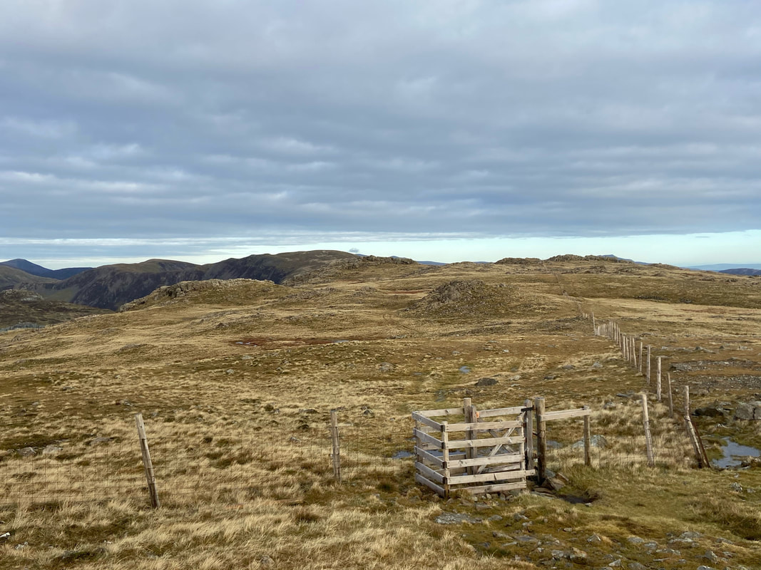
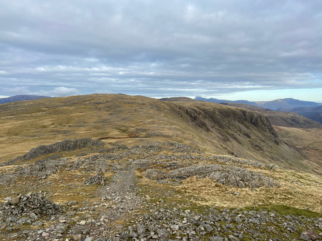
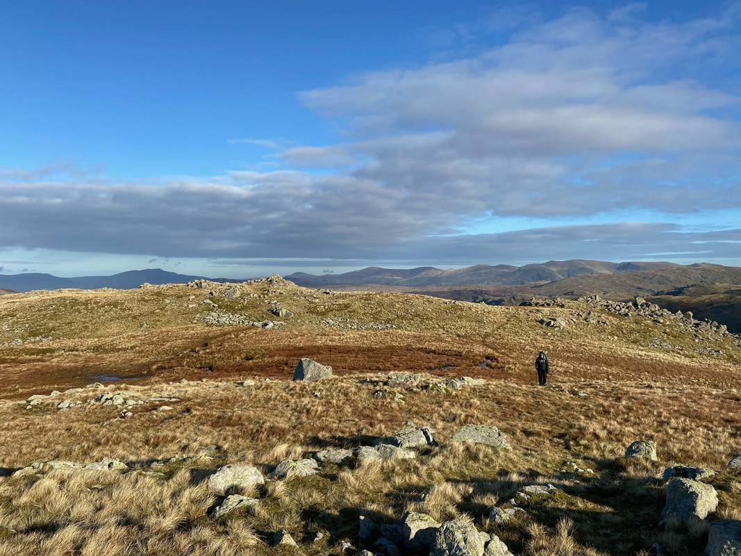
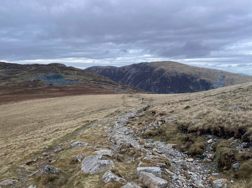
Looking back to Grey Knotts from the approach to Brandreth - simply follow the fence to this gate then go straight on to my rear.
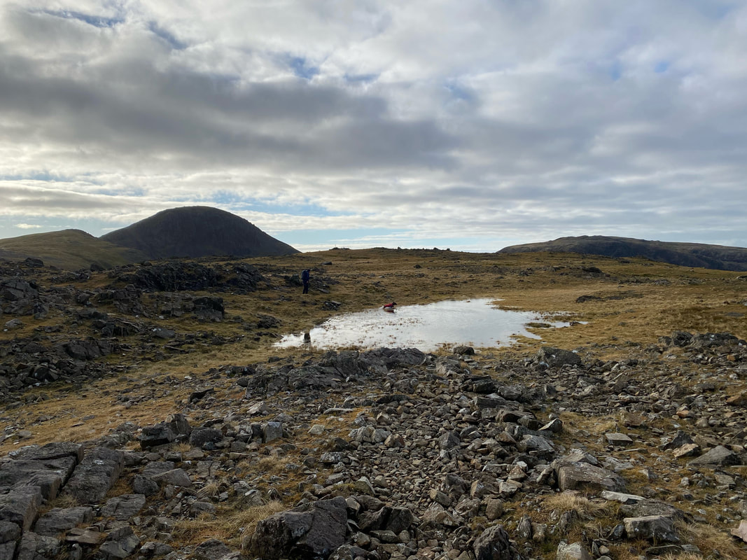
Nearing Brandreth it was time for Fudge to have a good old mess about in one of the small tarns that adorn the route over.
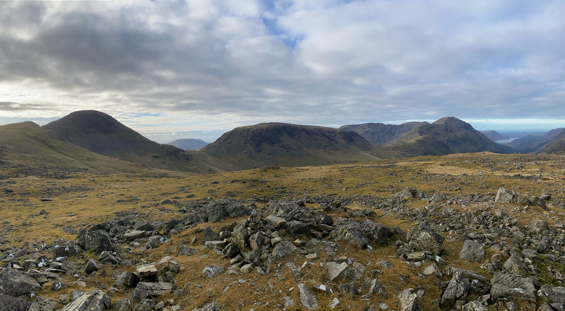
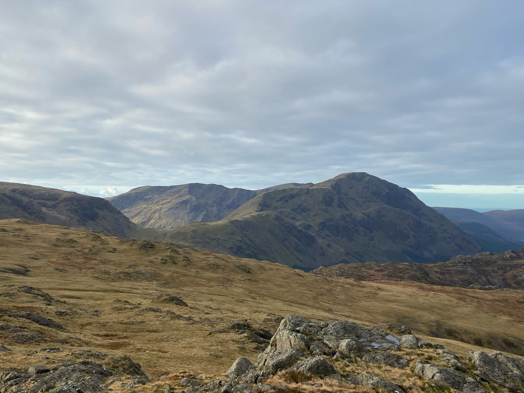
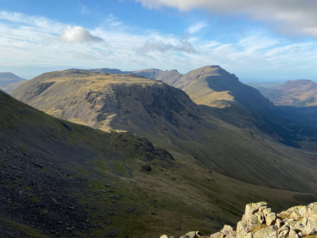
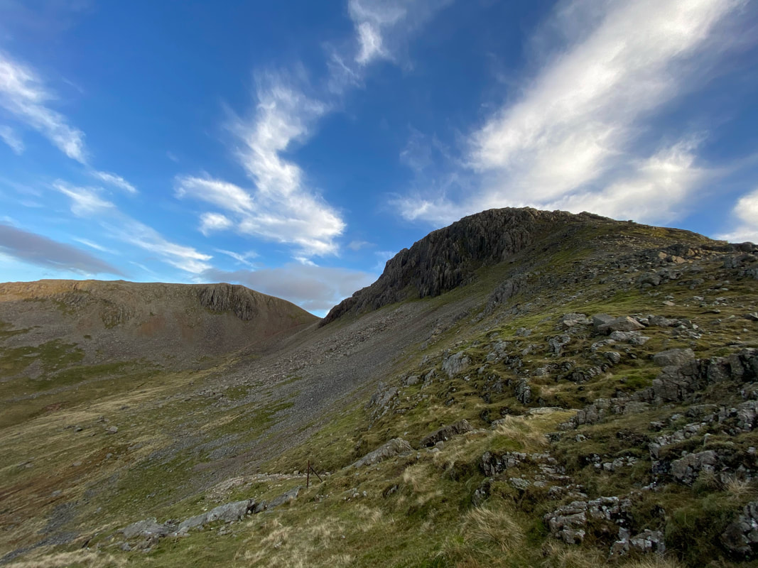
Green Gable, Great Gable, Kirk Fell, Red Pike & Pillar from near the summit of Brandreth
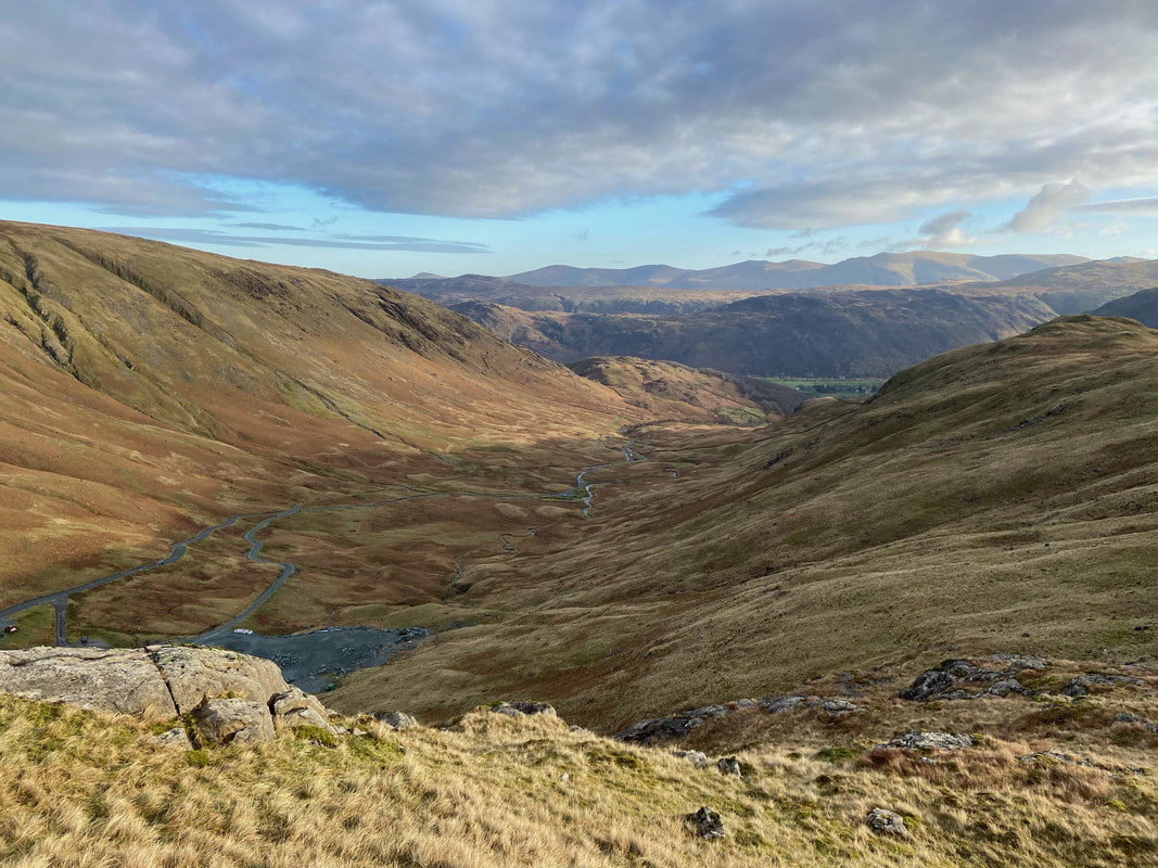
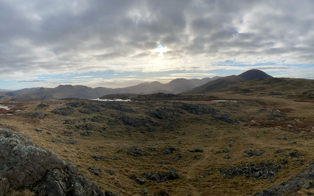
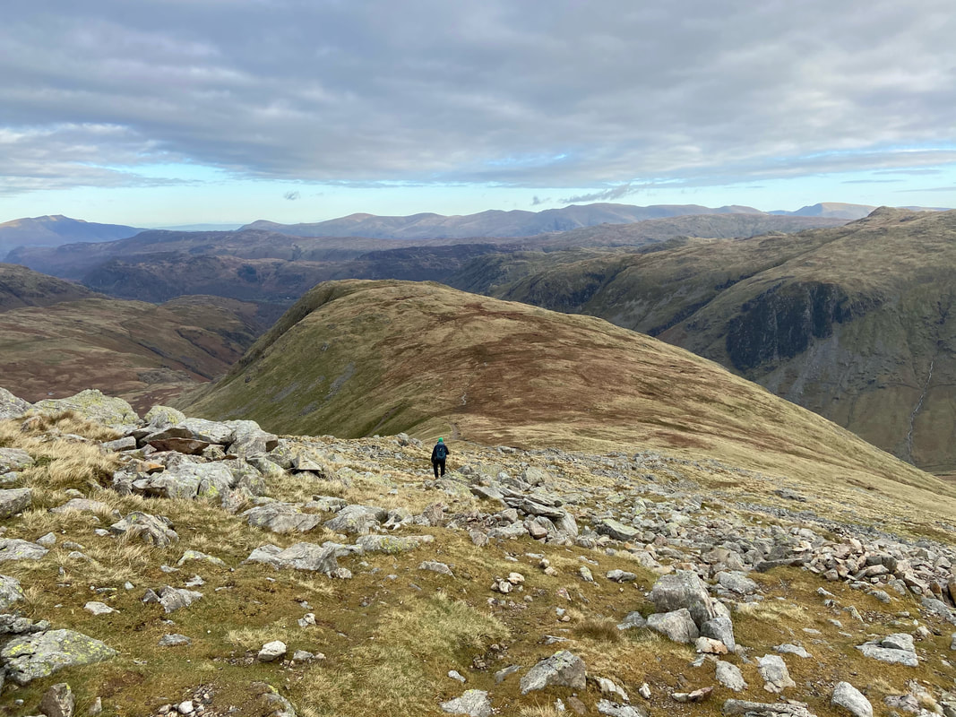
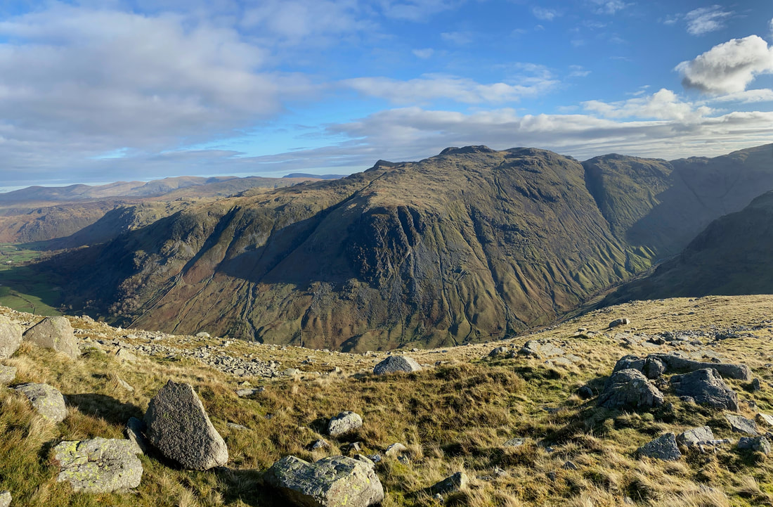
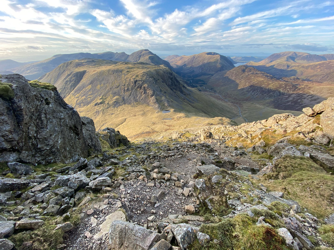
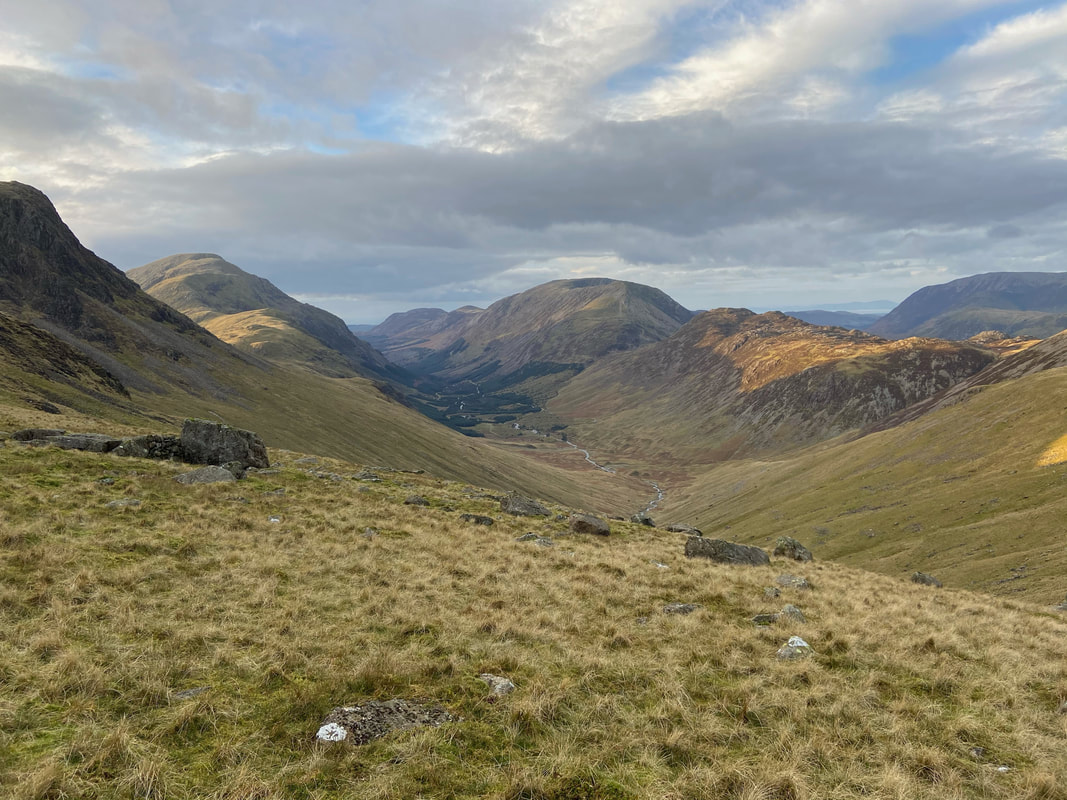
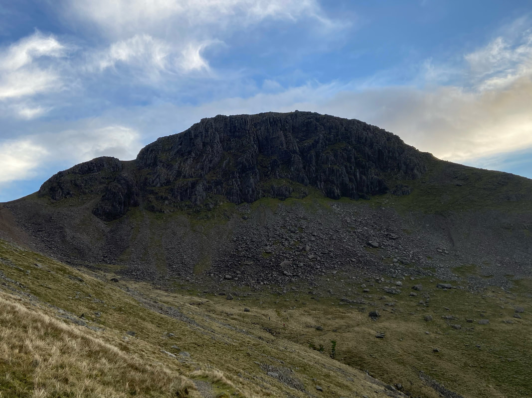
Our next destination of Base Brown over Gillercomb with Glaramara behind. The path coming up from Seathwaite can be seen rising to the right. Whilst it may be tempting to drop down to traverse below Gillercomb Head and thus reduce the mileage to Base Brown, it is hardly worth it. Simply stay high and use the natural contours of Gillercomb Head to reach Base Brown via the path between it & Green Gable.
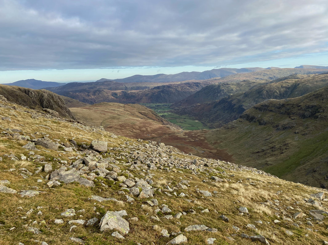
Looking into Gillercomb towards Seathwaite with Raven Crag (Gillercomb Buttress) to the left
The path junction between Base Brown & Green Gable
Brandreth from the path junction
Moses Trod from near the path junction - this would be part of our return route from Great Gable
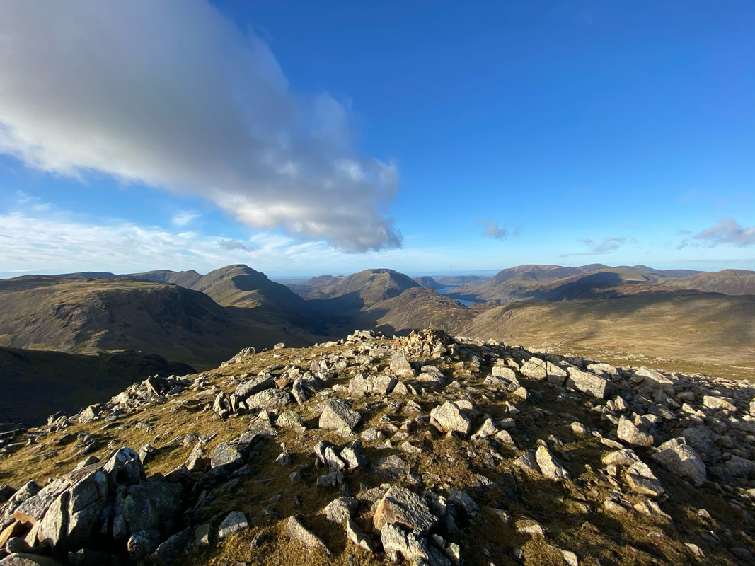
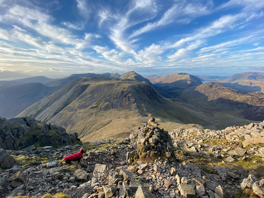
From Gillercomb Head it was a simple out & back from the path junction to Base Brown. Whilst it was very pleasant to descend to Base Brown we knew that we would have to climb back up this way. Blencathra can be seen on the far left with Clough Head, The Dodds, the Helvellyn Range & Fairfield providing the rest of the backdrop.
The summit of Base Brown looking to Glaramara
Our route down from Gillercomb Head looking to Green Gable. From here it looks like Green Gable & Great Gable are one and the same however they are separated by the unseen Windy Gap.
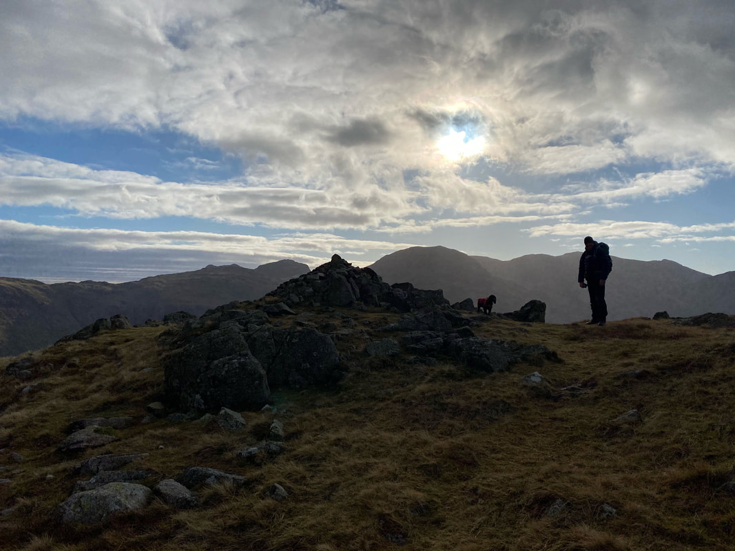
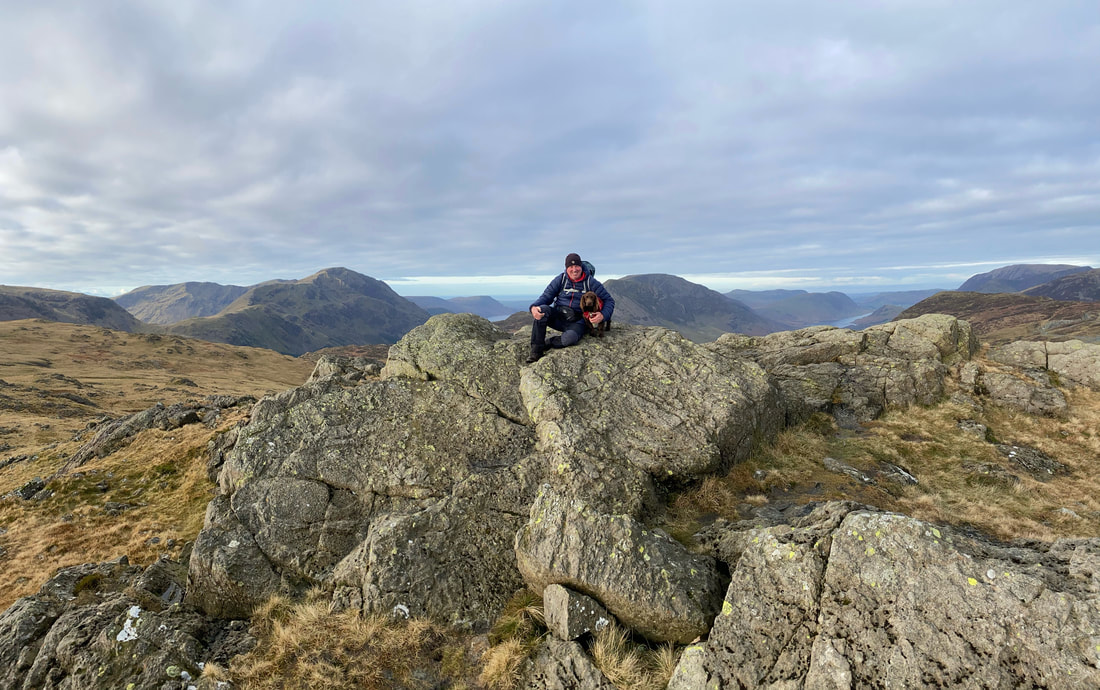
Fudge and I in silhouette on the summit of Base Brown
Glaramara
After a hearty lunch it was time to leave Base Brown and head to Green Gable
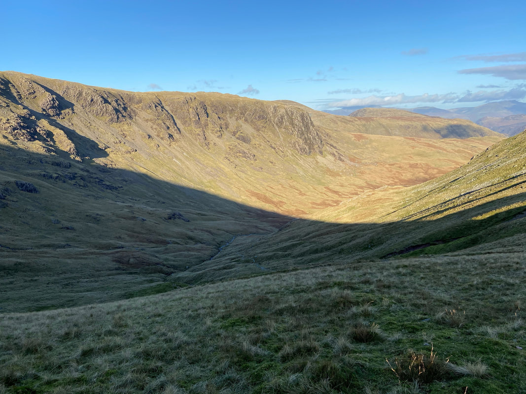
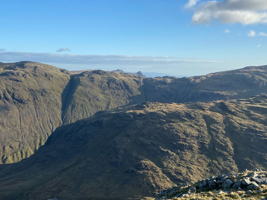
The hanging valley of Gillercomb. A hanging valley is a tributary valley that is higher than the main valley. They are most commonly associated with U-shaped valleys when a tributary glacier flows into a glacier of larger volume. The main glacier erodes a deep U-shaped valley with nearly vertical sides while the tributary glacier, with a smaller volume of ice, makes a shallower U-shaped valley.
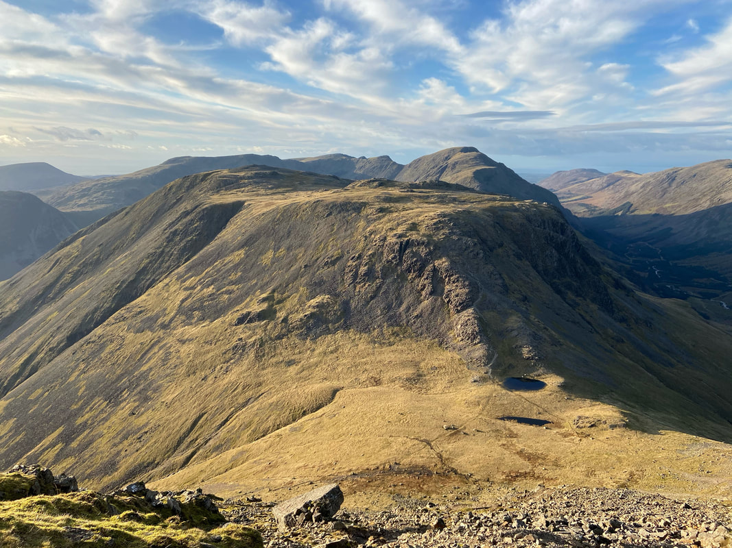
Base Brown, Glaramara & Seathwaite Fell from the transit to Green Gable
Another small rock groove as we near Green Gable
Zooming in on the Langdale Pikes over Seathwaite Fell
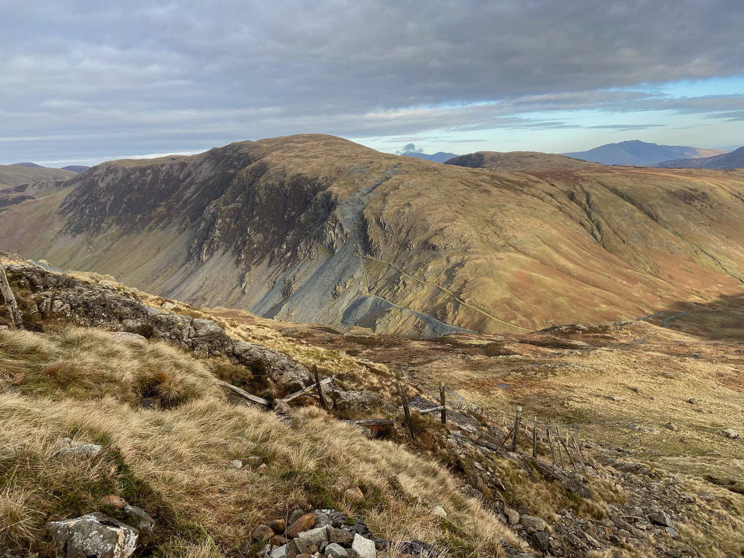
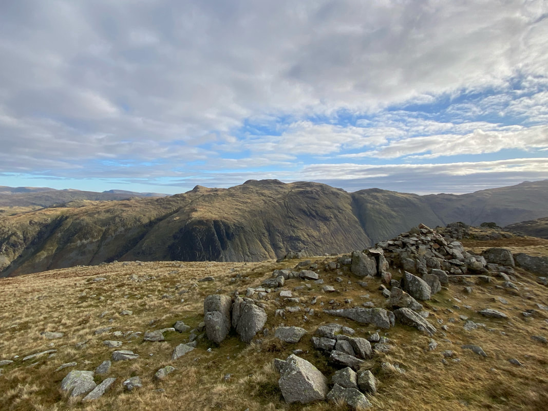
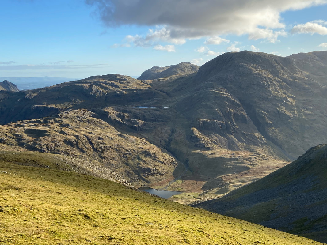
Beck Head from the ascent to Green Gable. Kirk Fell is to the left with Pillar right - our return path of Moses Trod can be seen left of centre
Looking to Brandreth & the North Western Fells
Whilst Green Gable is overshadowed to some extent by its near neighbour, the views in all directions from the summit are simply superb
Pike O'Stickle, Allen Crags, Bowfell, Esk Pike & Great End with the the tarns of Sprinkling (above) & Styhead (below)
Angie & Fudge down at Windy Gap as I look to Gable Crag to the right on Great Gable
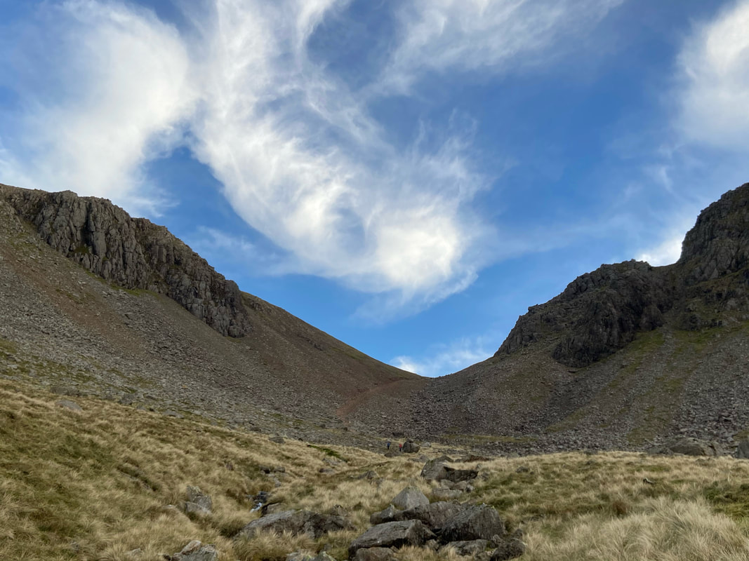
Stone Cove from Windy Gap. Windy Gap is a crossroads of paths in a col which provides routes down to Ennerdale via Stone Cove and Sty Head via Aaron Slack in addition to the summits of Green & Great Gable.
Making my descent from Green Gable to Windy Gap
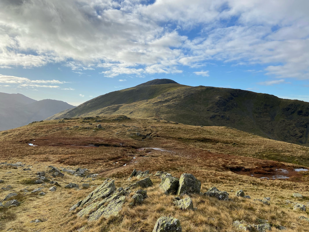
Windy Gap & Green Gable from the lower slopes of Great Gable
Looking down Aaron Slack to Styhead Tarn - slack is another definition of "scree"
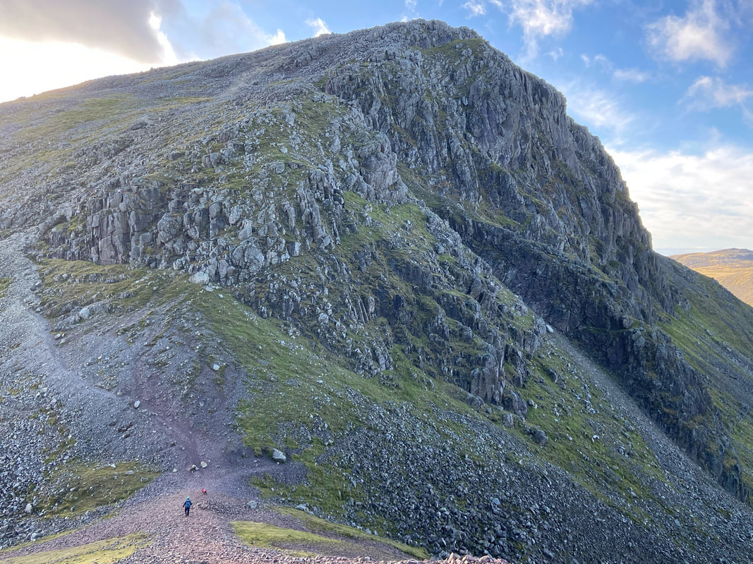
The ascent of Great Gable from Windy Gap is over steep and loose stone in some sections therefore care needs to be taken
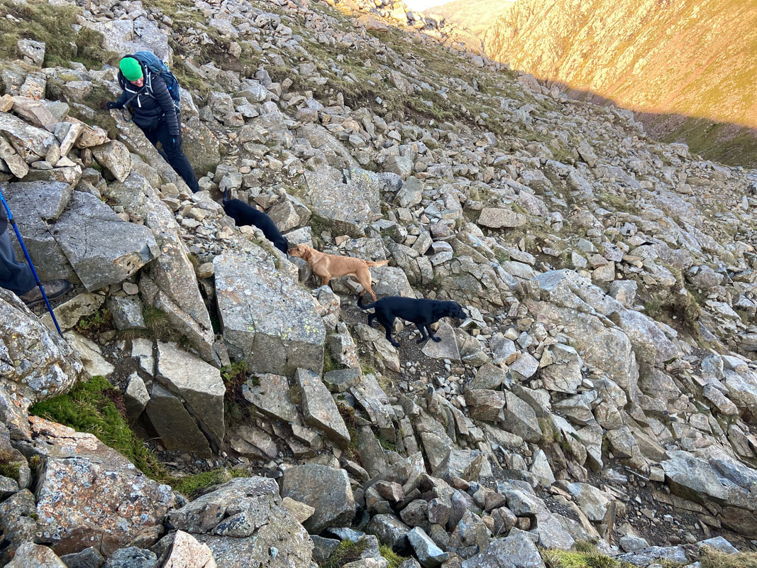
As we ascended we encountered a chap and his friend walking 7 Labradors - one Working Cocker is bad enough!
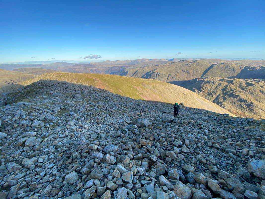
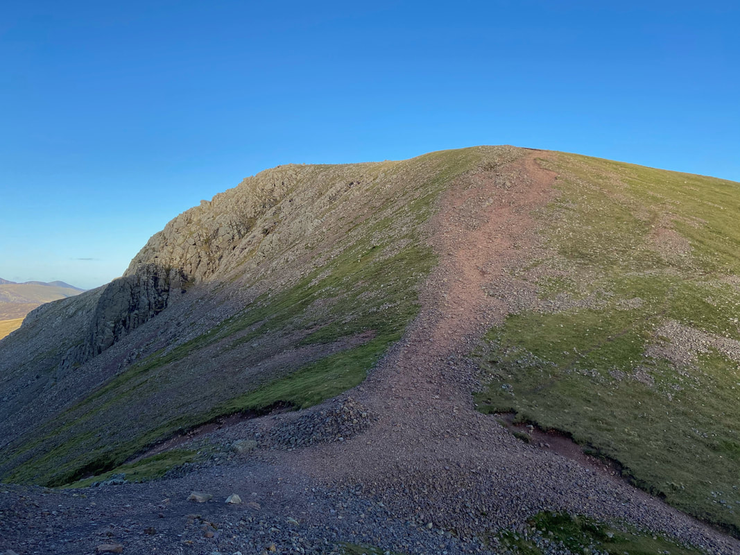
Nearing the summit of Great Gable the gradient eases slightly
A lone walker on the summit of Green Gable with Skiddaw & Blencathra distant
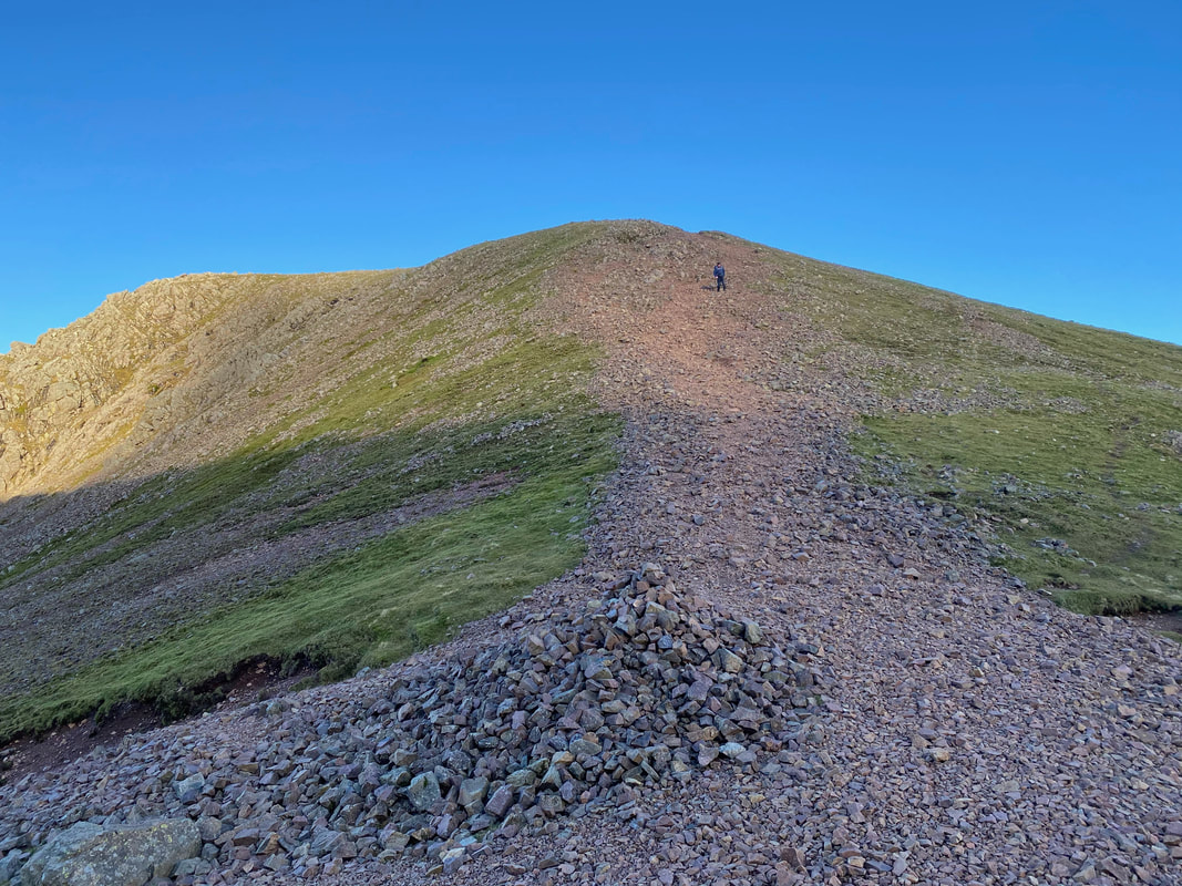
Almost there now - the terrain was very stony near the summit
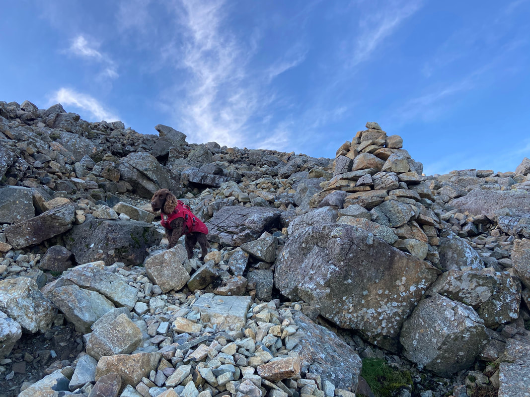
Fudge doing his "catalogue" pose near the summit of Great Gable
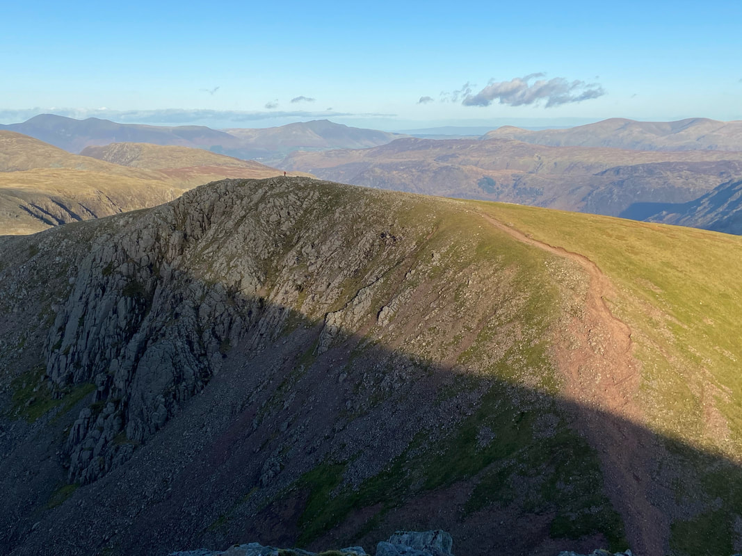
As always it should be standard practice to pause and look back otherwise you would miss views like this.
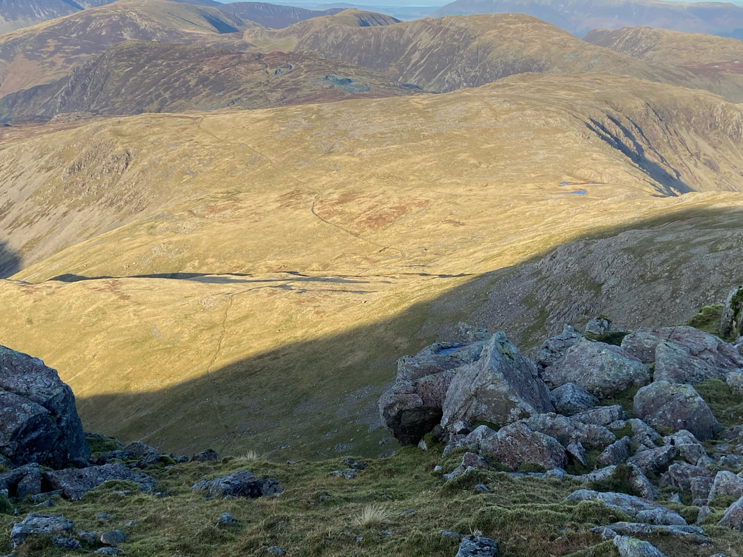
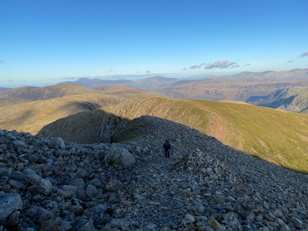
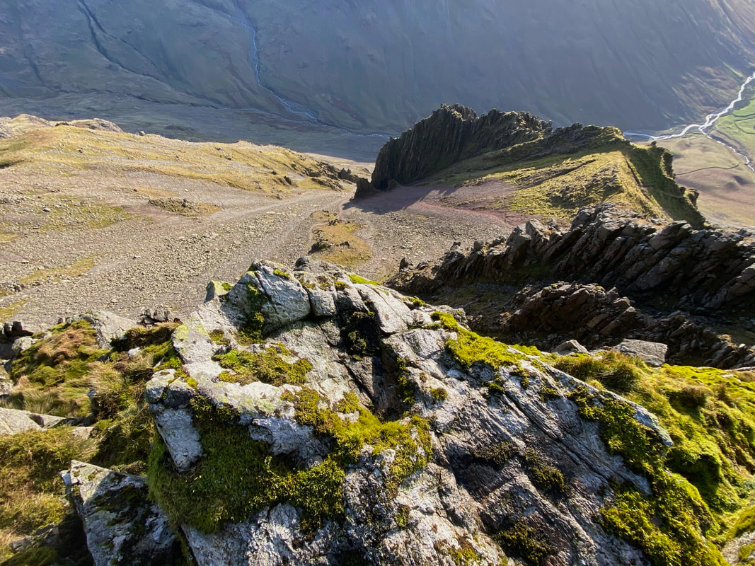
Another view of our return route to Honister via Moses Trod which can be seen snaking its way across the fell side
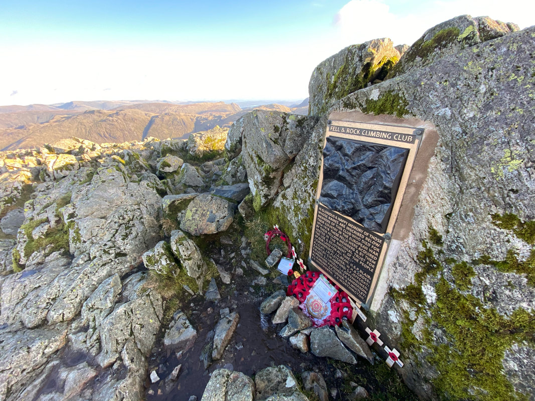
Just below the summit of Great Gable is a memorial erected by the FRCC dedicated to its members who died in the Great War
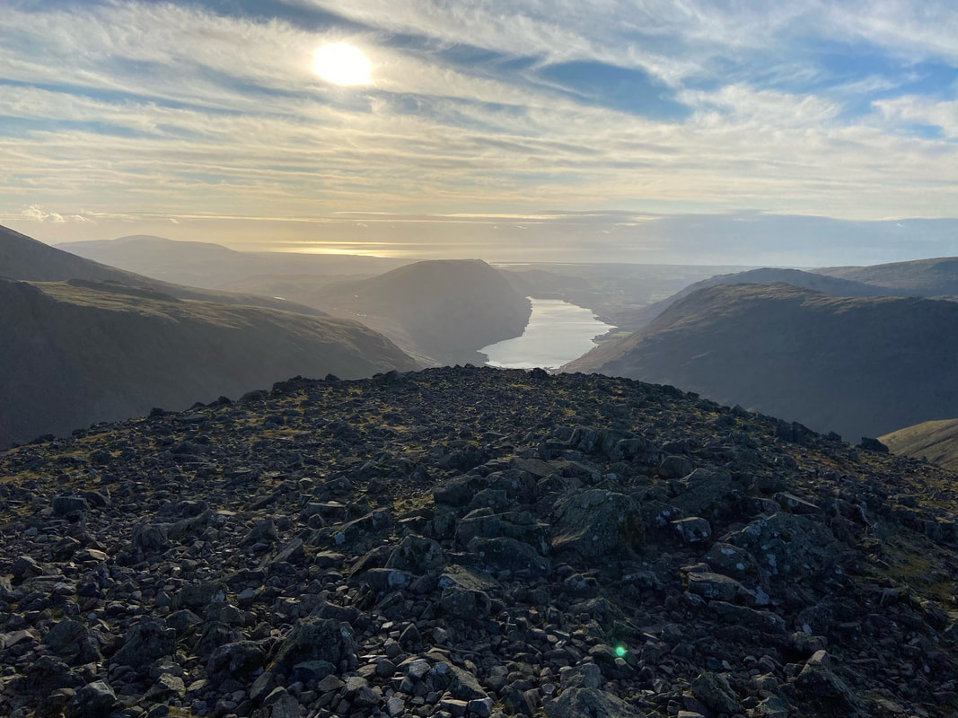
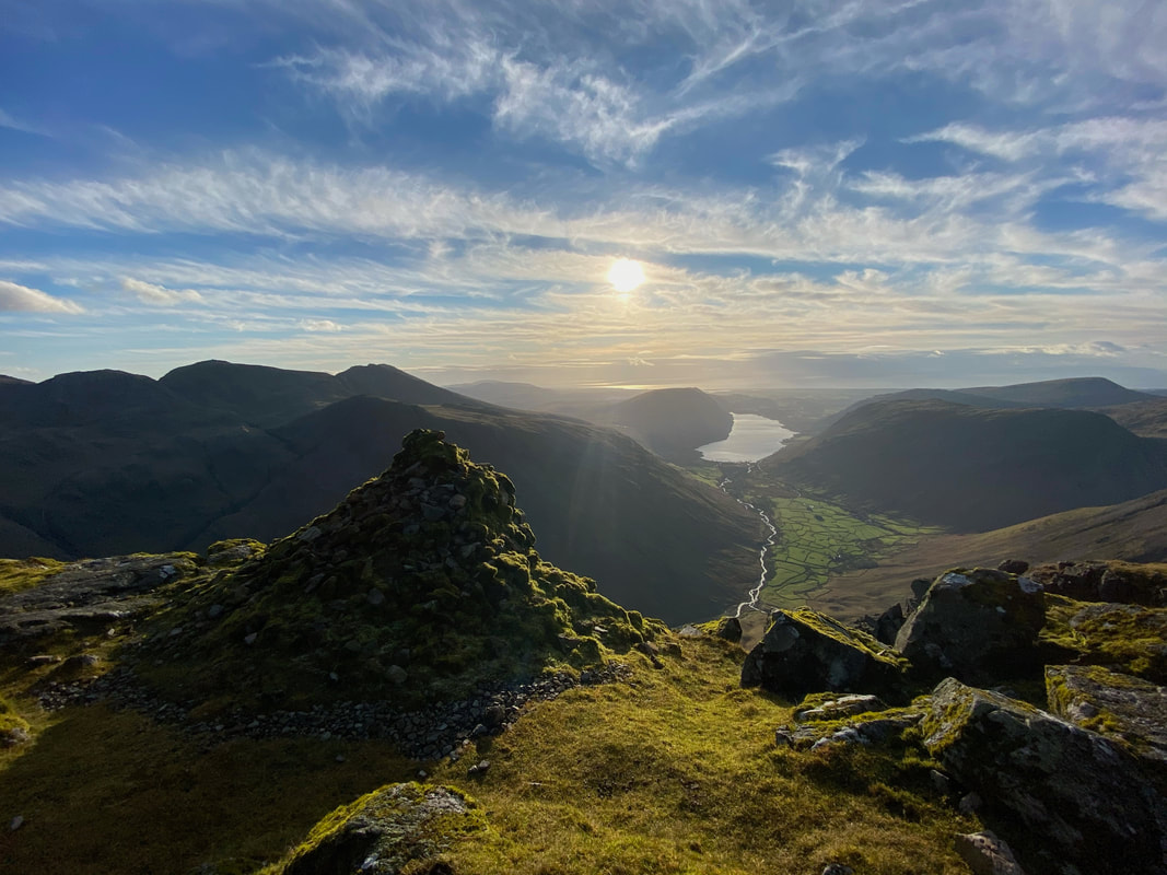
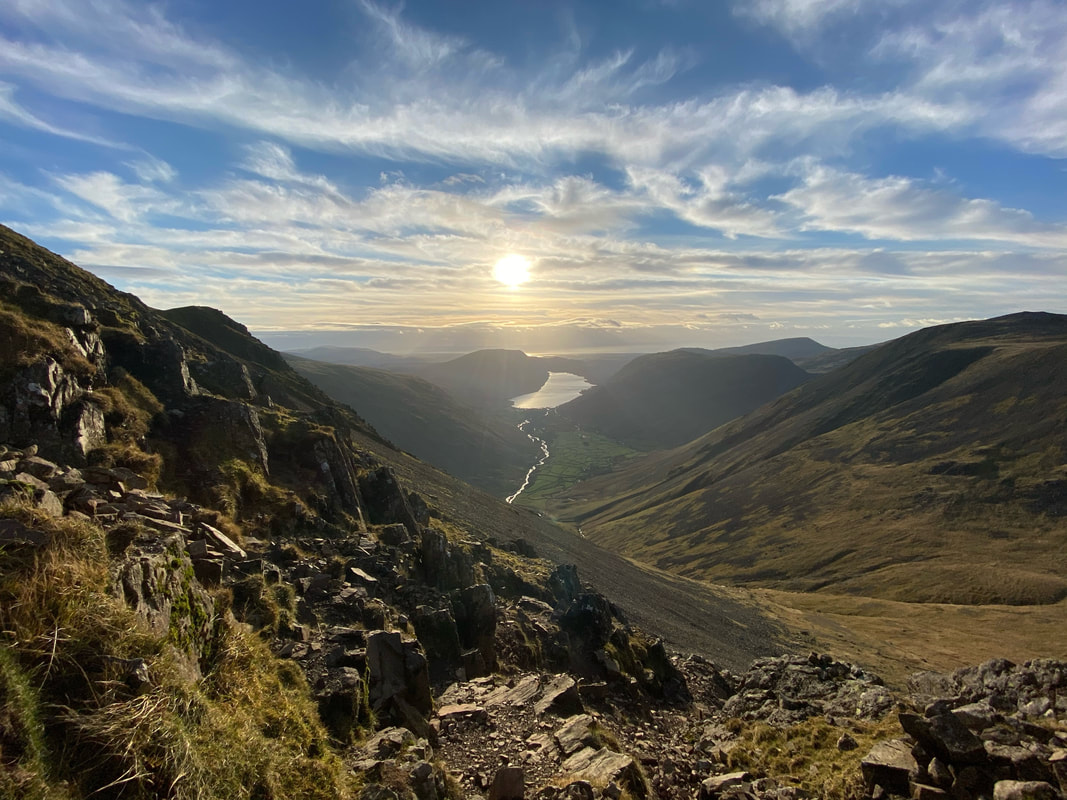
The classic view down Wast Water from the summit of Great Gable
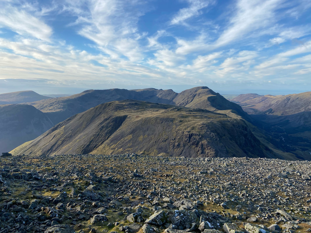
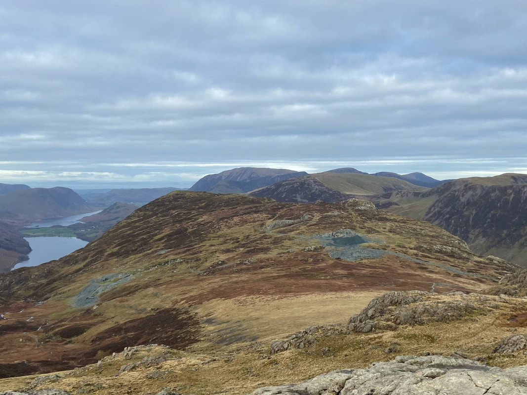
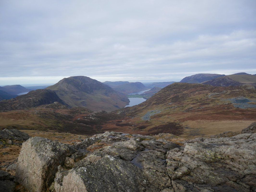
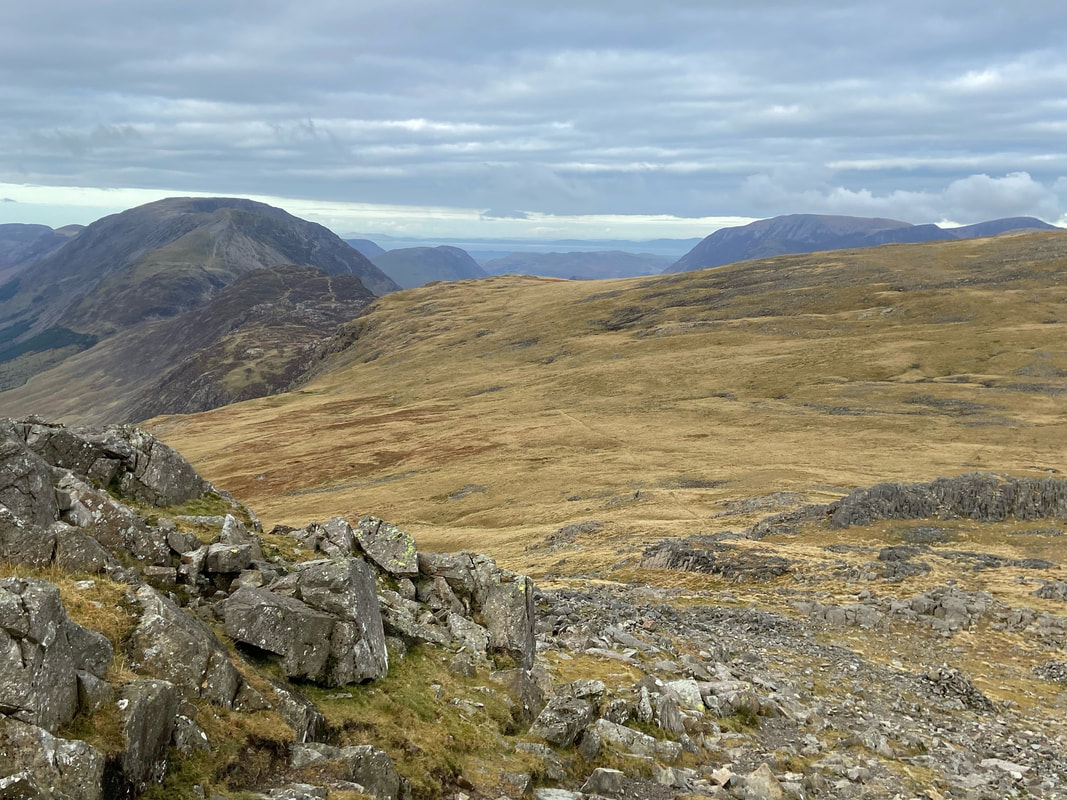
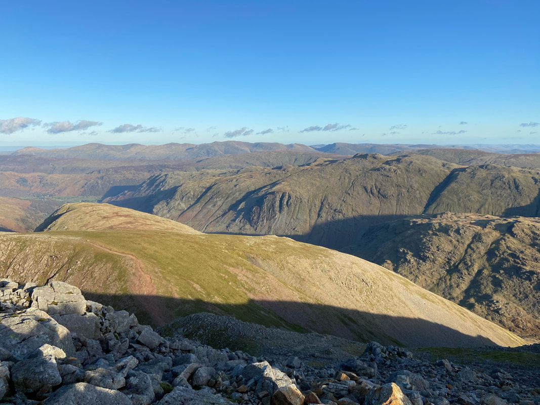
Looking to Seatallan, Yewbarrow, Red Pike, Kirk Fell, Scoat Fell, Pillar & Great Borne from the summit of Great Gable. The route towards Kirk Fell would be our way off the mountain but first we were off to the Westmorland Cairn.
I can't think of a better place to be than the summit of Great Gable as the day nears sunset - just look at that view.
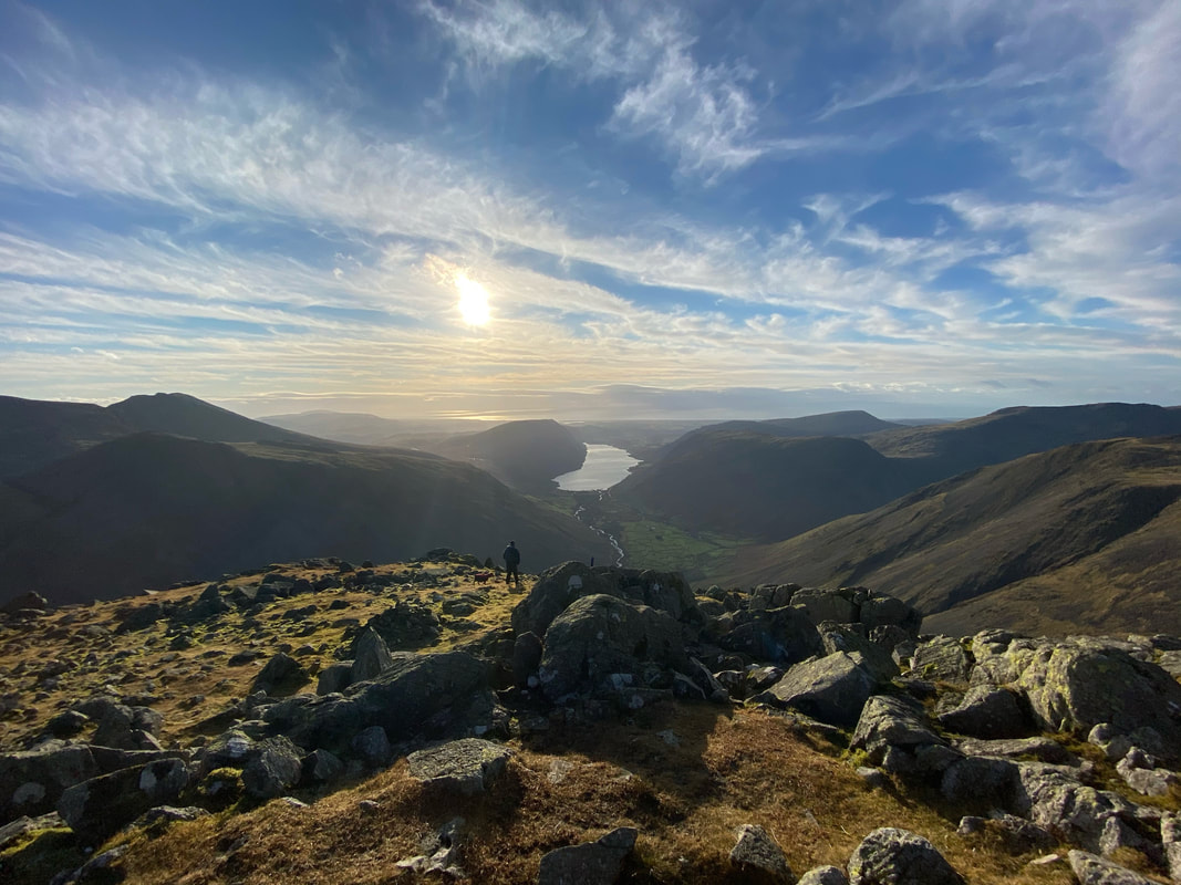
Looking down Wast Water from the Westmorland Cairn with the Scafell Range to the left
Looking down to Great Hell Gate & Tophet Bastion from the Westmorland Cairn
Another aspect of the view from the Westmorland Cairn. I'm convinced that many people don't make the effort to explore Great Gable as I have hardly seen anybody at the cairn when the mountain has been busy. The cairn sits above a precipice and is approximately 150 yards south of the summit. It was erected in 1876 by two brothers named Westmorland to mark what they considered to be the finest view in the Lake District - it is hard to argue against that.
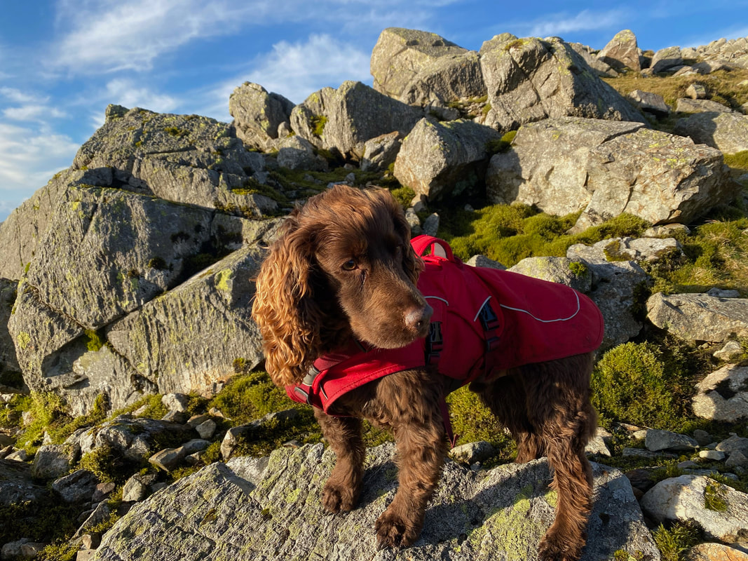
It would be extremely safe to say that Fudge had a cracking workout today
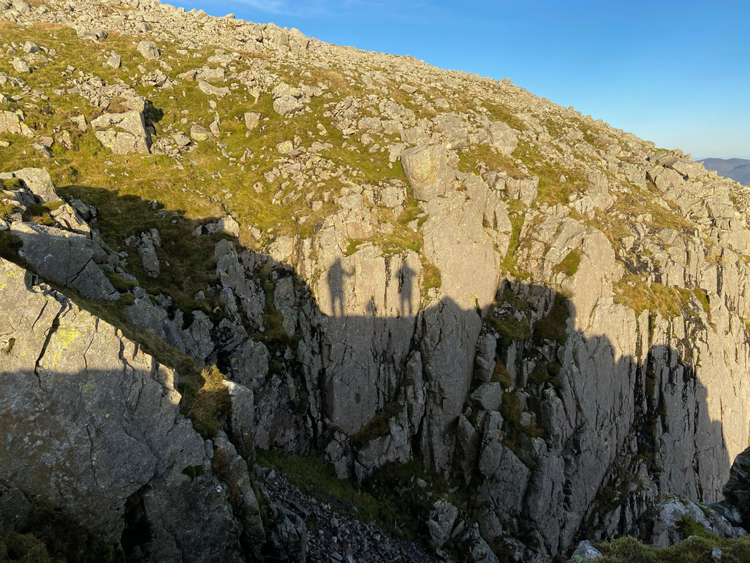
Shadows of our former selves
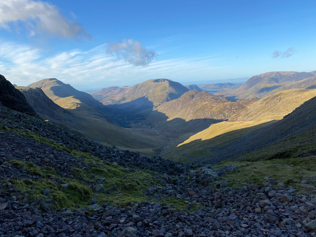
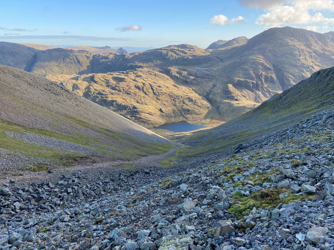
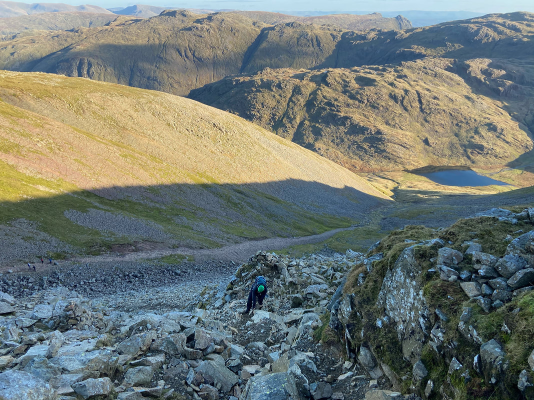
The steep and stony descent down to Beck Head from Great Gable - this isn't easy therefore take your time
Whilst the descent is steep and over loose scree and stone for most of the way, it is certainly worth it for the fabulous views on offer.
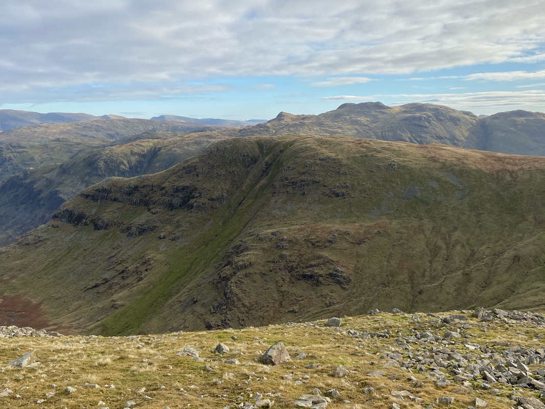
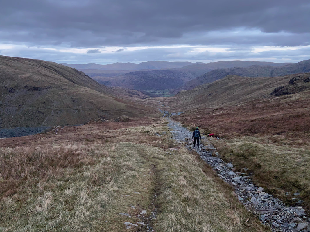
A closer view of Kirk Fell from the descent to Beck Head which sits below. If you wished to extend the walk then an ascent of Kirk Fell is certainly recommended followed by a descent to the the top of the Black Sail Pass. From there cross the valley to the base of Loft Beck. You would now be on the Coast to Coast route which could then be followed all the way back to Honister.
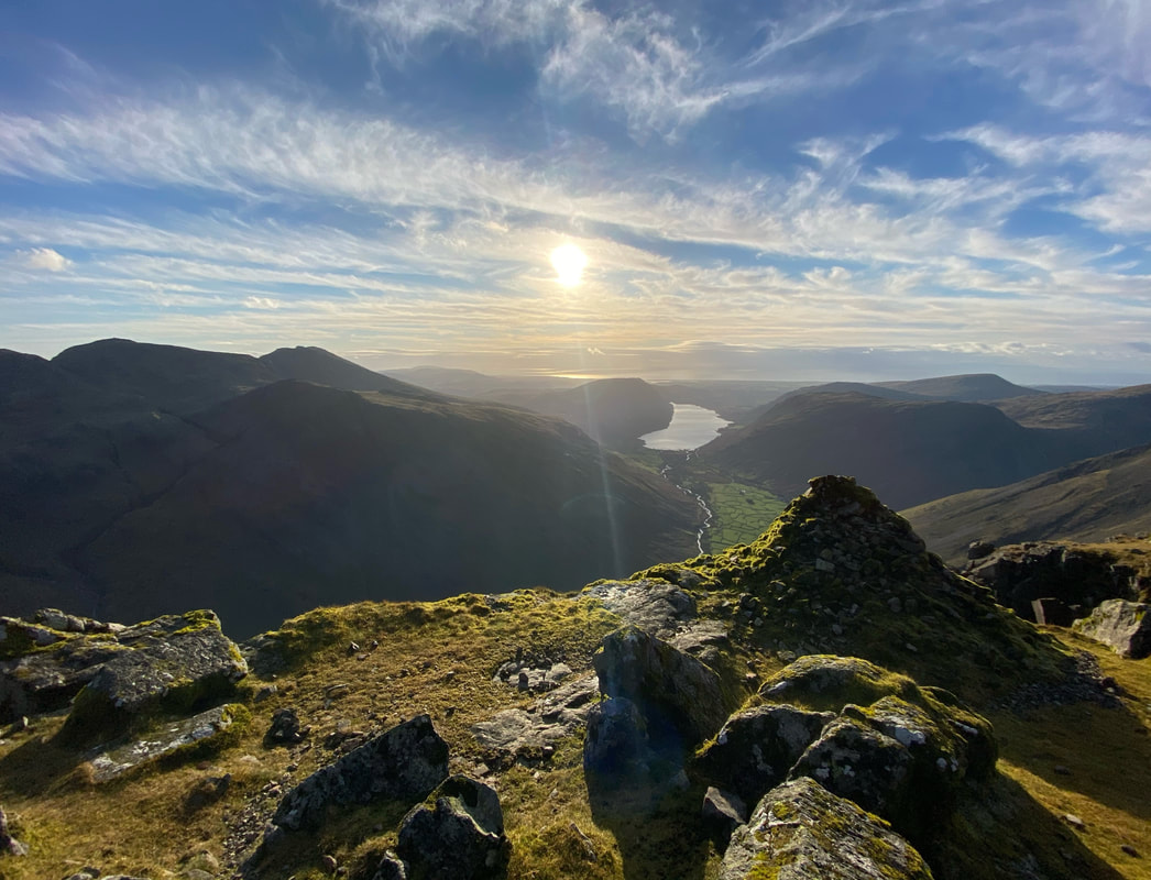
A last look down Wast Water from the descent to Beck Head
The final part of the descent to Beck Head from Great Gable
From Moses Trod looking to Green Gable, Stone Cove & Gable Crag on Great Gable. Moses Trod is an old track that links Honister to Wasdale Head and was the quickest route to transport slate from one valley to the next. It did however have a dual purpose in that it became a smuggler’s route used by Moses Rigg who used it to move illegal moonshine hidden amongst the slate. It is thought that Moses had an illegal still somewhere "en route" between Honister & Wasdale Head.
Ennerdale from Moses Trod
Windy Gap from the base of Stone Cove
Gable Crag on Great Gable
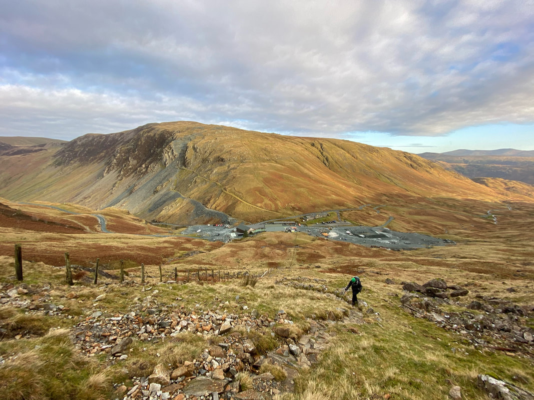
Heading to the Drum House on the Coast to Coast route looking to Fleetwith Pike & Dale Head
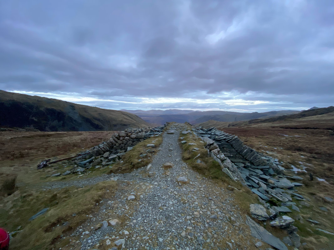
The remains of the Drum House. Wainwright called the path from the quarry buildings at Honister to Dubs Quarry "the straightest mile in Lakeland". The path we are stood on was once the permanent route for trucks conveying stone from the quarry back down to Honister. (Fleetwith Pike 4)
Honister below as light fades - what a cracking day out that was.