Grisedale Pike & Hopegill Head - Thursday 27 February 2020
Route
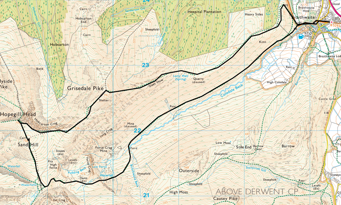
Braithwaite - Coledale - Kinn - Sleet How - Grisedale Pike - Hobcarton Crag - Hopegill Head - Sand Hill - Coledale Hause - Force Crag Mine - Braithwaite
Parking
Plenty of roadside parking in Braithwaite however please park responsibly. The postcode for Braithwaite village is CA12 5TJ.
Mileage
8.3 miles
Terrain
Good mountain paths throughout however when snow is on the ground and visibility is poor then care needs to be taken. The ability to navigate in poor conditions is vital, particularly with the added danger of snow cornicing on mountains and ridges (see pictures below).
Weather
A mixed bag - sunny and clear in the valleys however above 2000ft (600m) visibility was poor. A vital lesson in that whatever the weather is like at low level can be markedly different when up high.
Time Taken
6hrs
Total Ascent
2837ft (865m)
Wainwrights
2
Map
OL4 - The English Lakes (North Western Area)
Walkers
Dave, Angie & Fudge
|
GPX File
|
| ||
If the above GPX file fails to download or presents itself as an XML file once downloaded then please feel free to contact me and I will send you the GPX file via e-mail.
Route Map
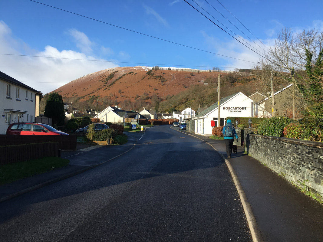
Leaving the village of Braithwaite with Kinn ahead.
The route heads out of the village to Coledale on the Whinlatter Pass (B5292).
The route heads out of the village to Coledale on the Whinlatter Pass (B5292).
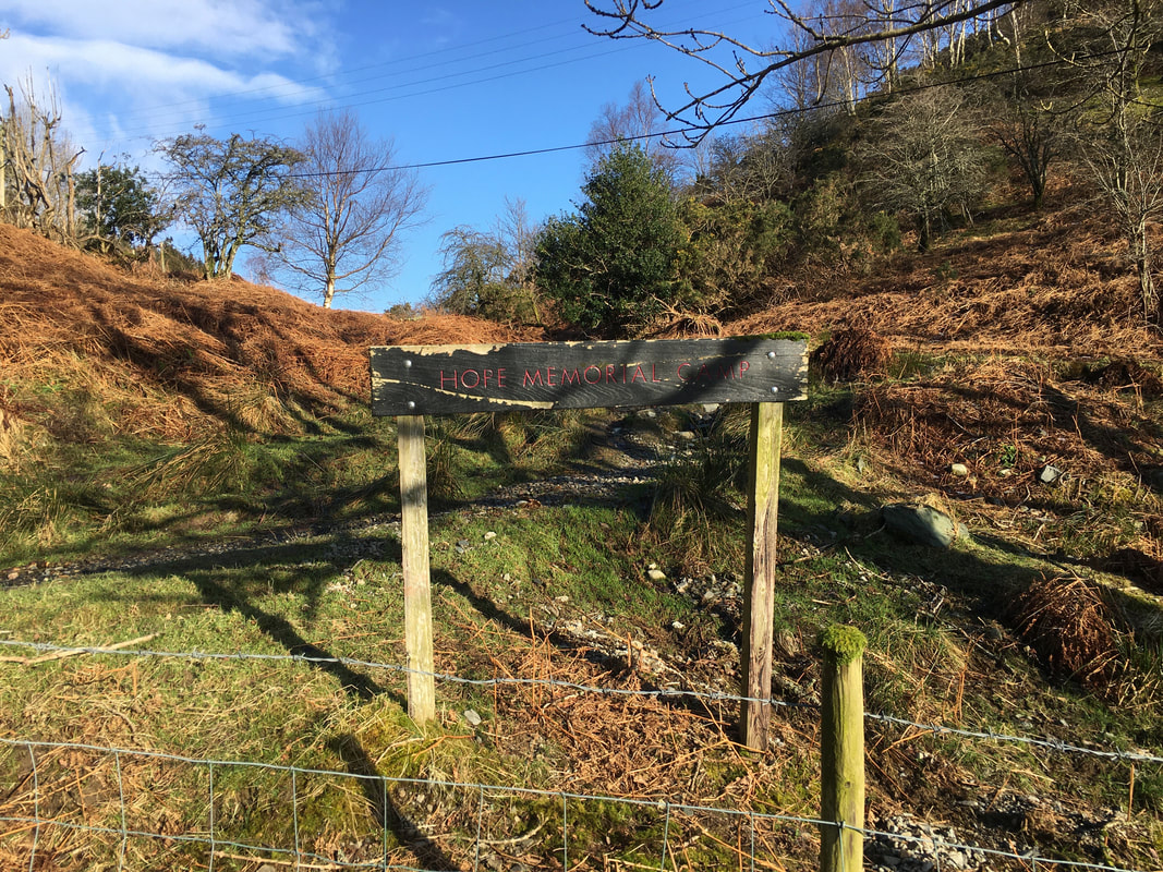
Just before leaving the B5292 on the right hand side of the road is the Hope Memorial Camp, a residential centre used throughout the year by youth groups from all over the country. The camp was the brain-child of Mr A H Hope, Headmaster of The Roan School, Greenwich (now The John Roan School) from 1916 to 1930. In 1923, with his own money, Hope bought forty acres of land to the north-west of the village and built four huts on it, to provide his South London grammar school boys with 'an opportunity of seeing mountains and lakes and of having the valuable experience of camping and living at close quarters with others.' With the aid of The Roan Foundation, the original green and white painted wooden structures were replaced in 1989 by more substantial ones using modern building materials.
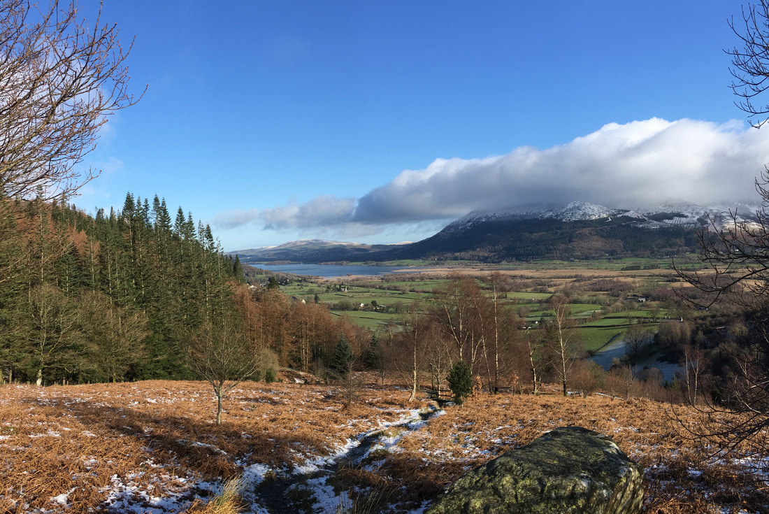
On the ascent of Kinn looking to Bassenthwaite Lake & the Skiddaw range.
It looked like we were in for a beautiful day but appearances can be deceiving sometimes!
It looked like we were in for a beautiful day but appearances can be deceiving sometimes!
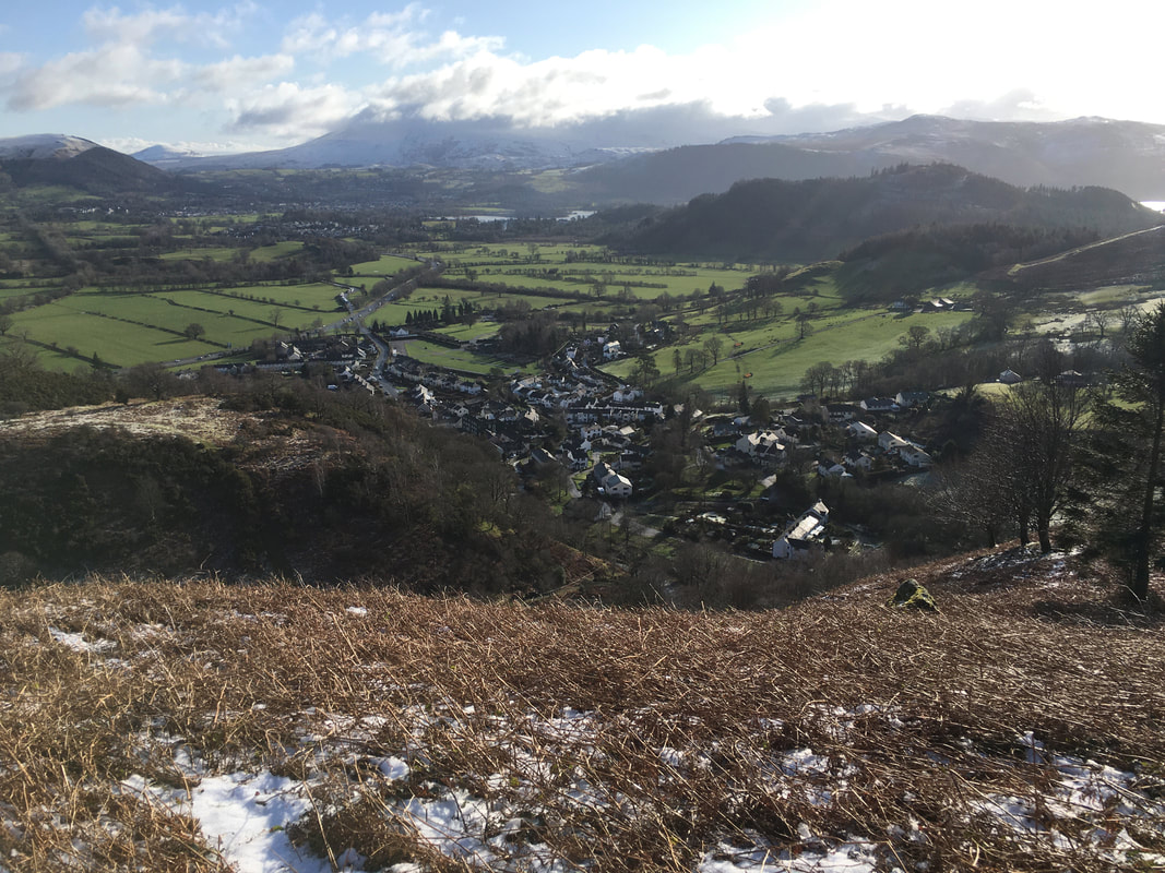
Braithwaite from the ascent of Kinn
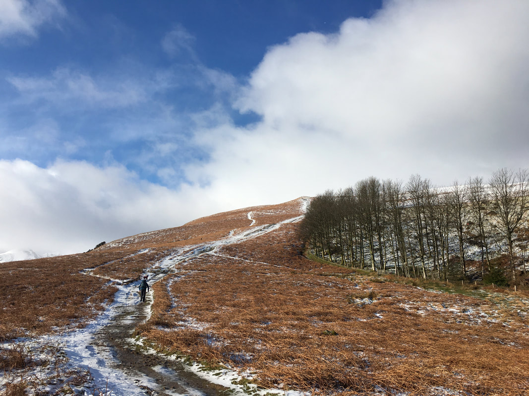
Chugging up Kinn - well one of us is!
As height is gained on the ascent of Kinn it is important to look behind you or you would miss views like this.
The snow and cloud capped tops of Skiddaw & Blencathra with Latrigg right of centre and Clough Head to the right.
The snow and cloud capped tops of Skiddaw & Blencathra with Latrigg right of centre and Clough Head to the right.
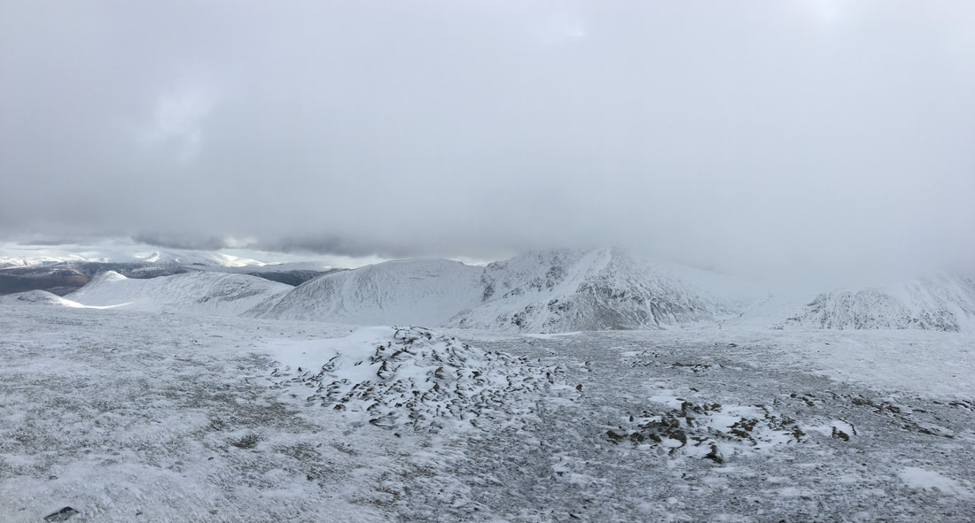
The cloud looks a tad ominous as we continue along Kinn's ridge towards Sleet How.
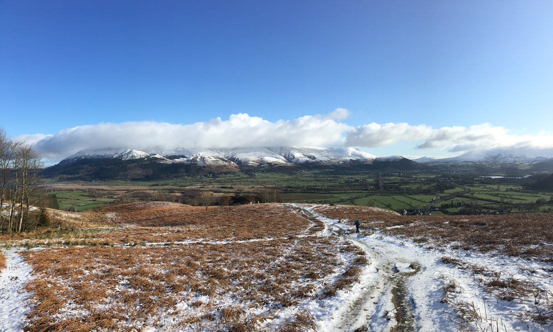
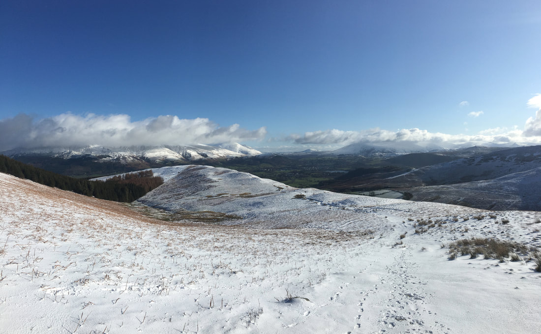
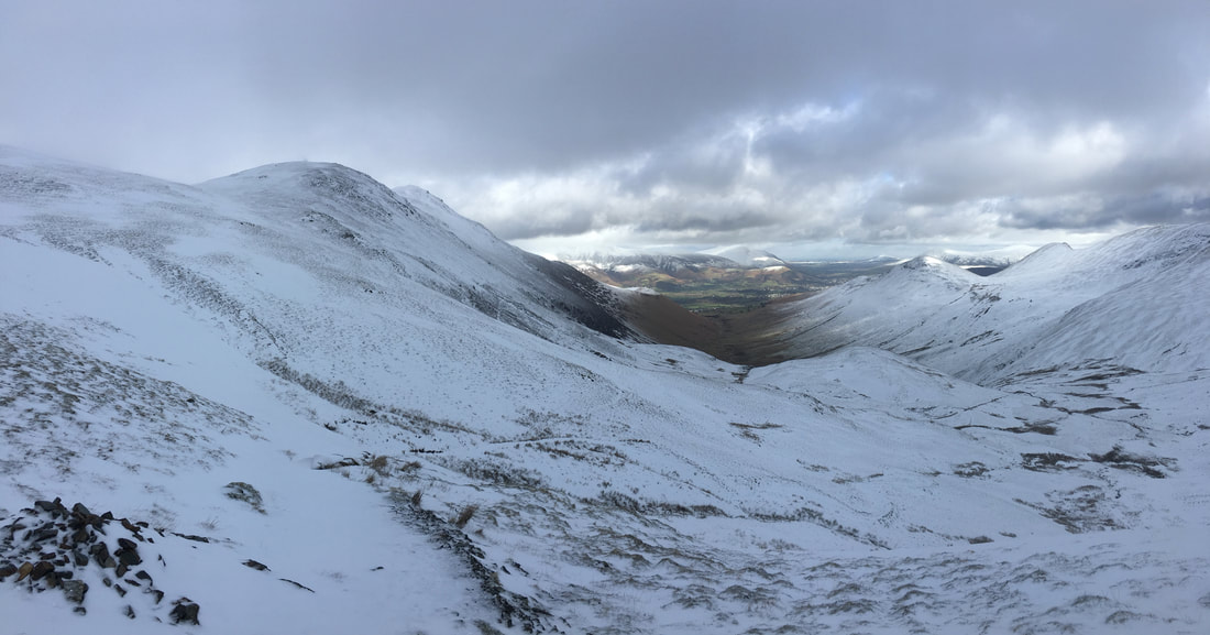
Coledale Hause is the dip in the left centre of shot and would be our return route back to Braithwaite.
Coledale Hause is the dip in the left centre of shot and would be our return route back to Braithwaite.
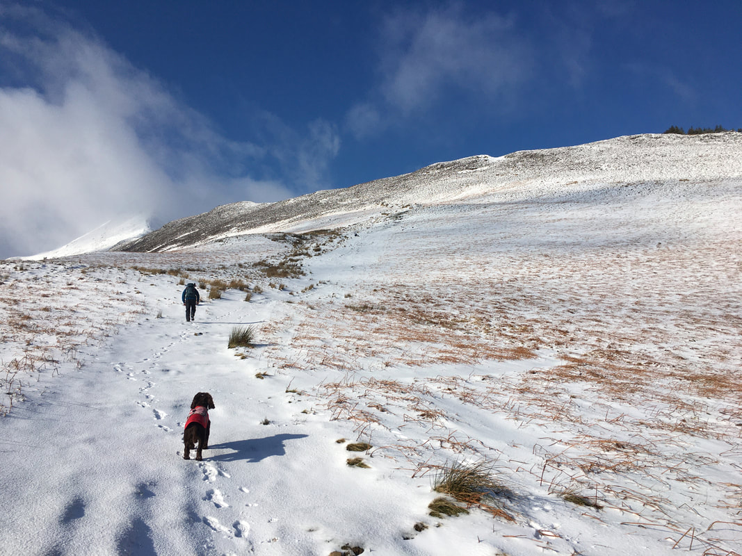
Ascending Sleet How - once more Fudge seems unsure as to my navigational prowess.
Looking back to Kinn from the ascent of Sleet How
Causey Pike in the centre with Scar Crags to the right and Outerside in the foreground
The lovely flat ridge of Kinn from the ascent of Sleet How - looks like we have company today.
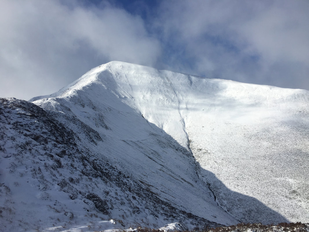
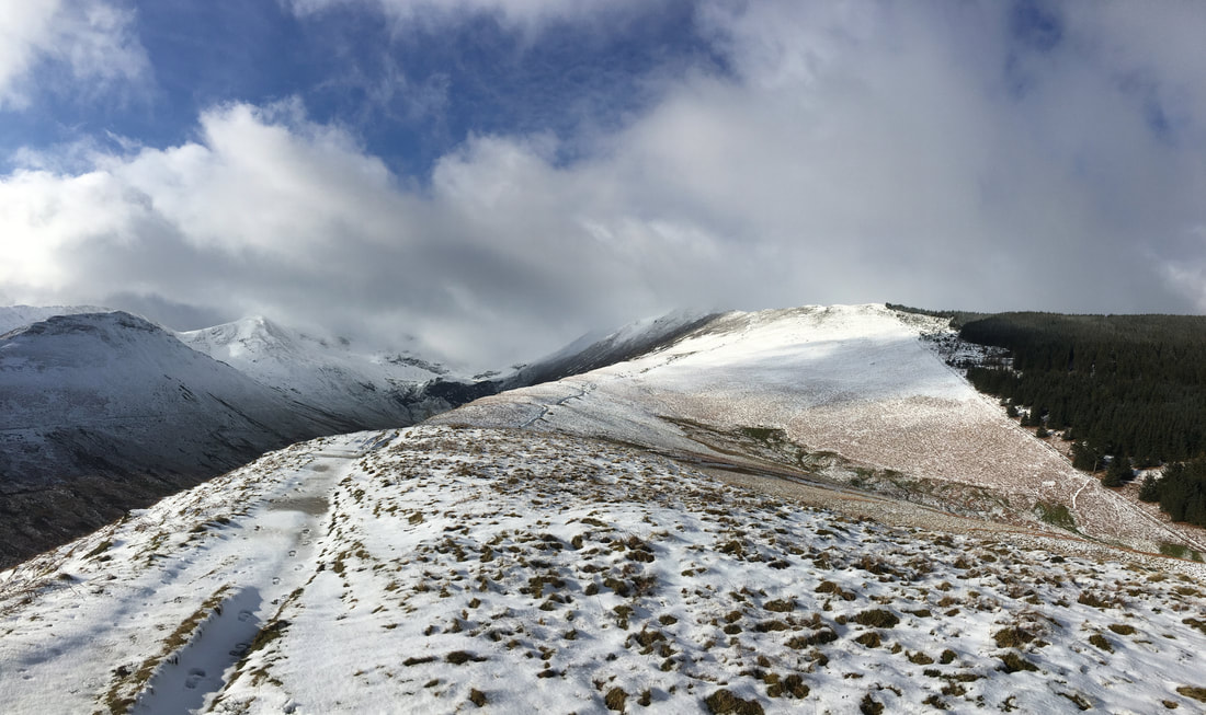
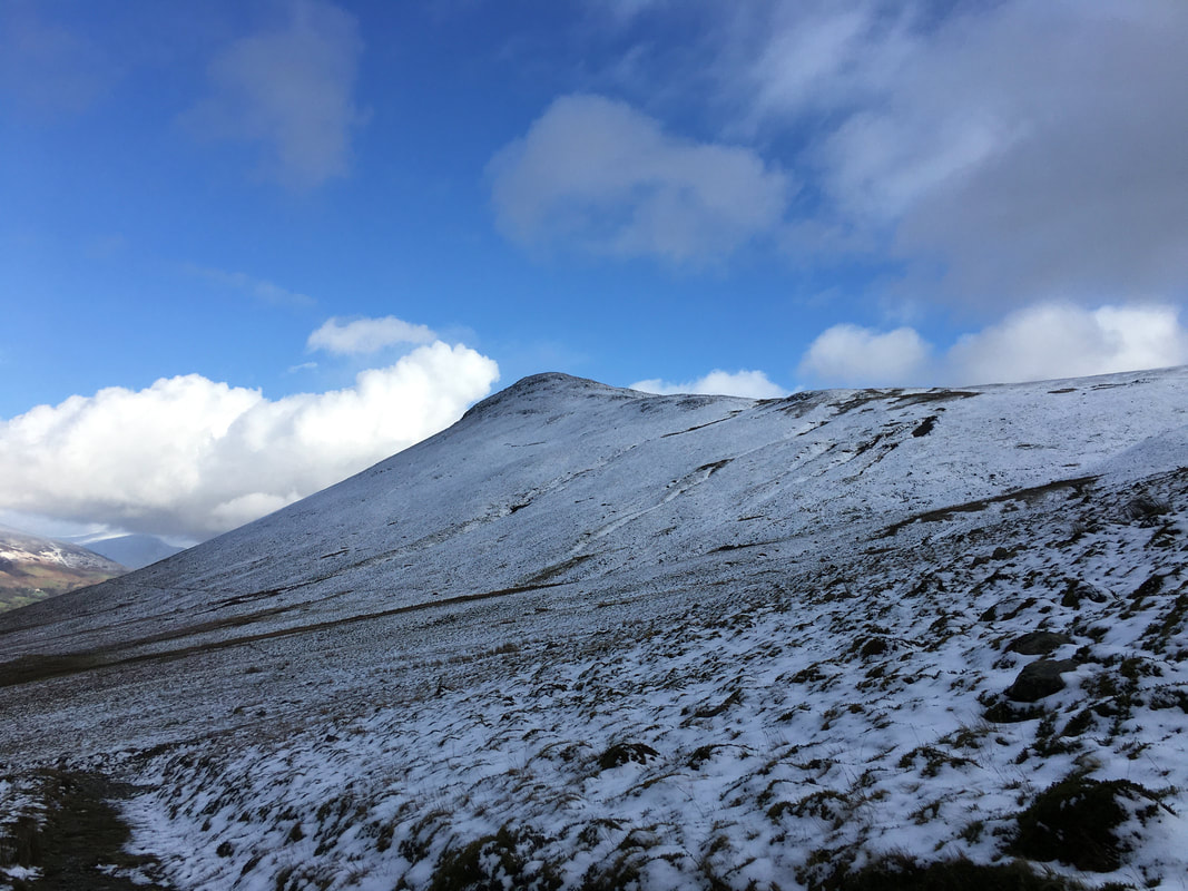
Grisedale Pike from Sleet How - from here the ascent up the east ridge looks precarious but it isn't
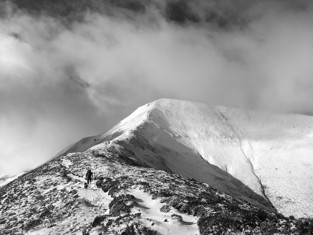
The east ridge of Grisedale Pike in mono.
This is a fantastic ascent of a much underrated mountain in my humble opinion.
This is a fantastic ascent of a much underrated mountain in my humble opinion.
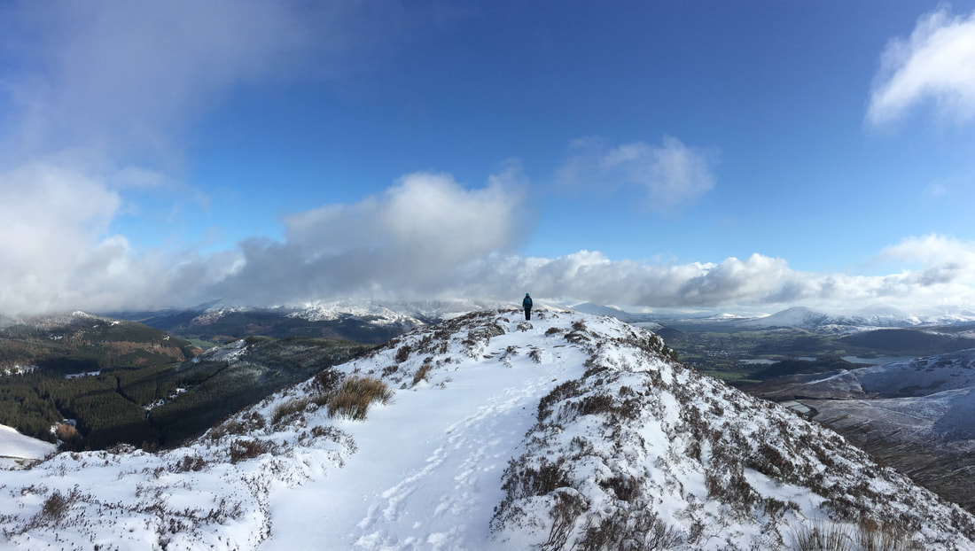
Angie up on the highest point of Sleet How
Barrow & Stile End from Sleet How.
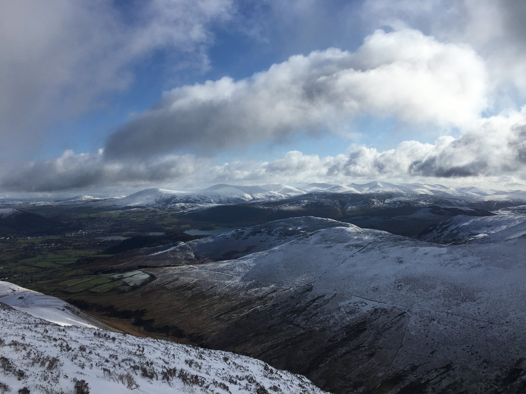
Clough Head, The Dodds & the Helvellyn range provide a glorious backdrop.
Clough Head, The Dodds & the Helvellyn range provide a glorious backdrop.
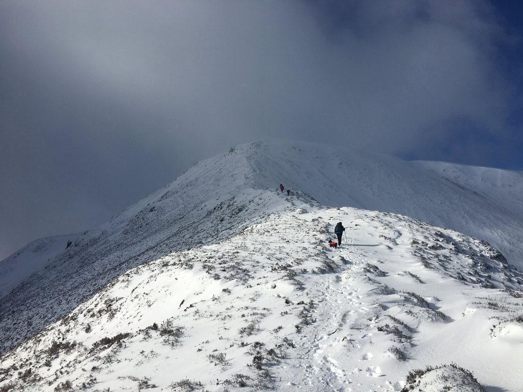
The final push now to the summit of Grisedale Pike.
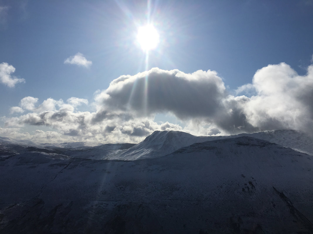
From here it looked like we would be in for some low cloud once we reached the top of the ascent.
From here it looked like we would be in for some low cloud once we reached the top of the ascent.
The ridge of Sleet How
From here on in we attached our micro spikes as the terrain gradient increased.
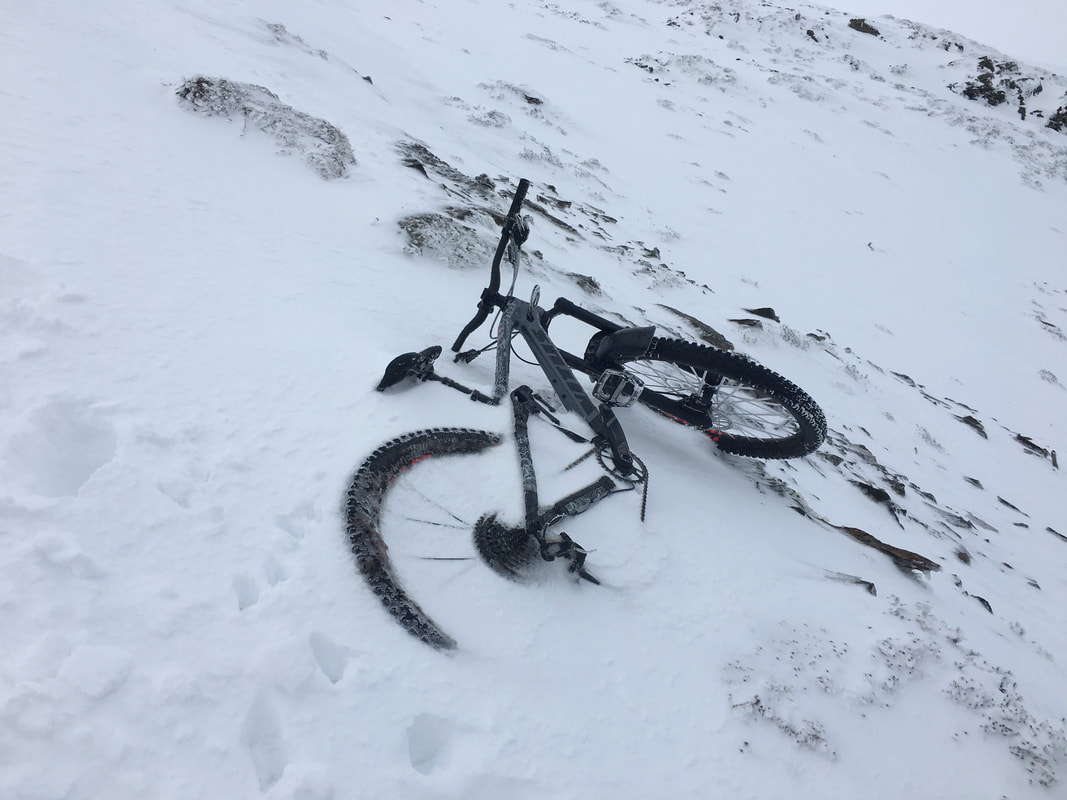
I hope they came back for it
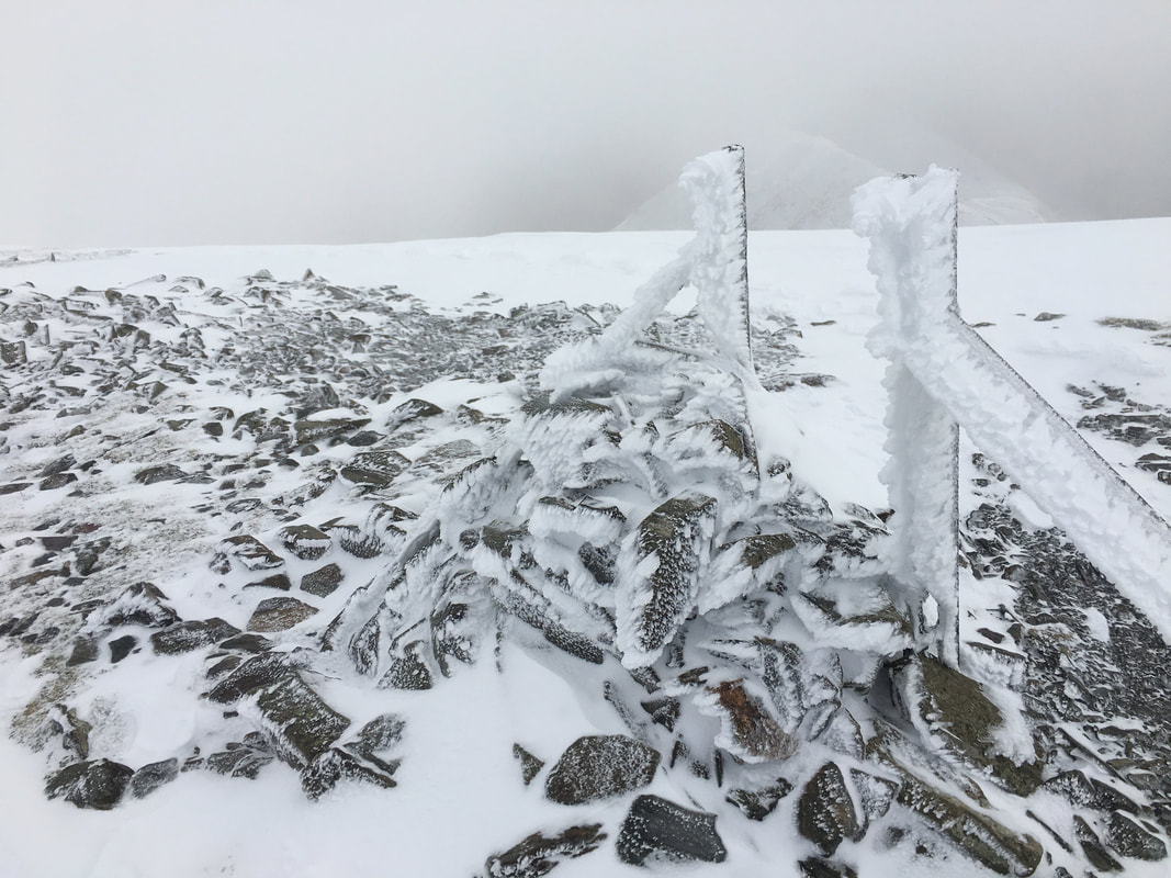
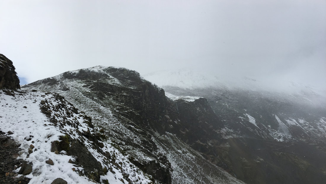
The top of the north ridge fence line on Grisedale Pike. As can be seen, it was a bit tasty up here.
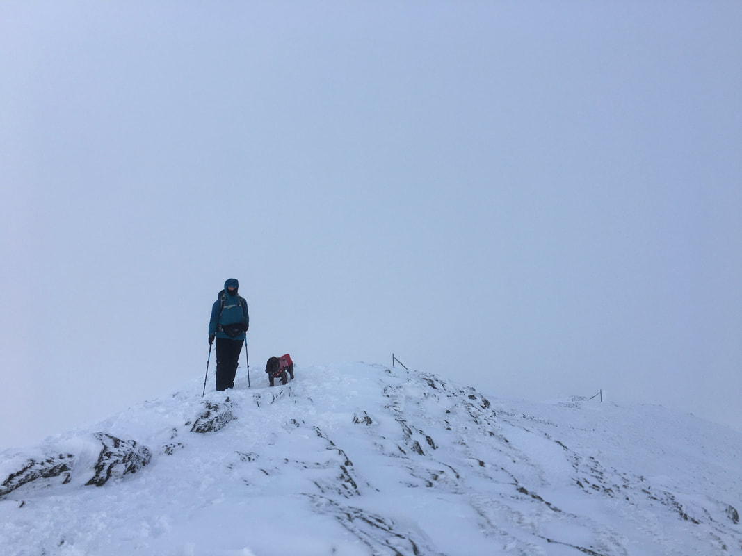
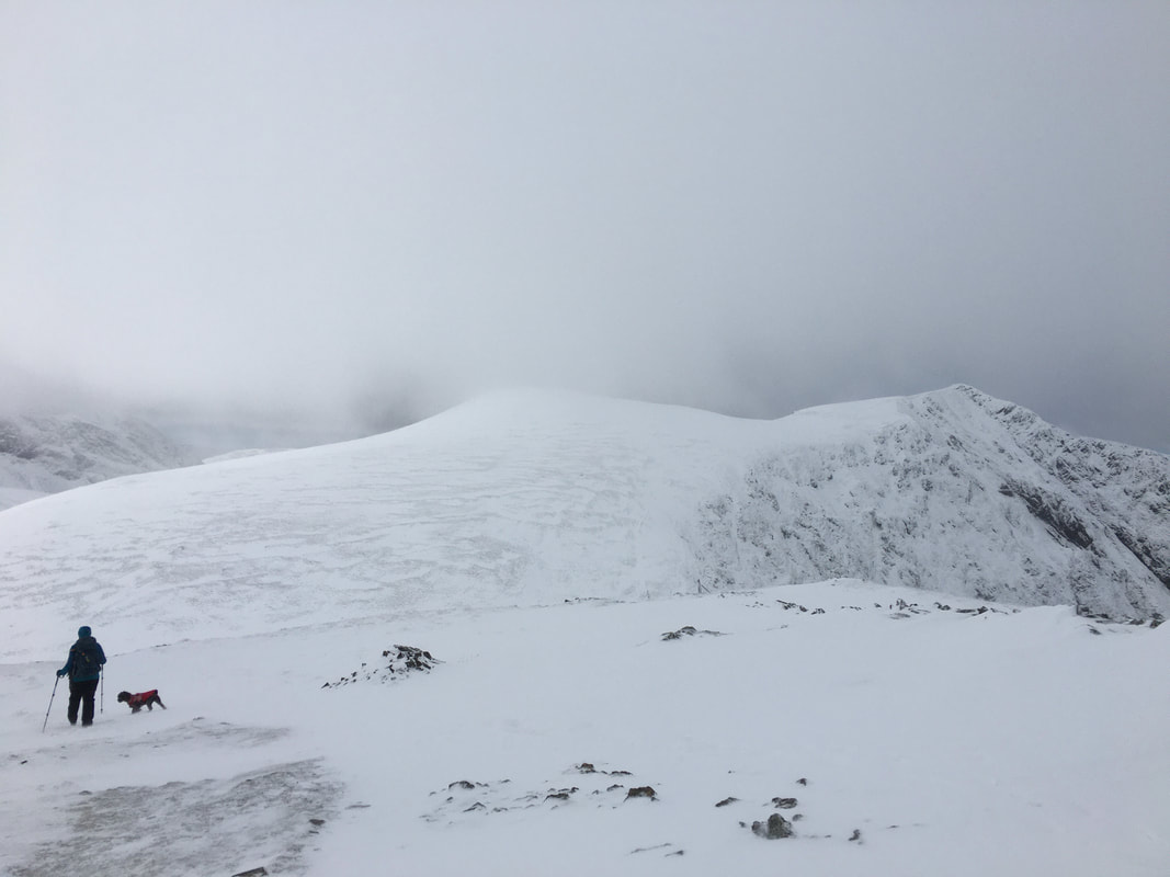
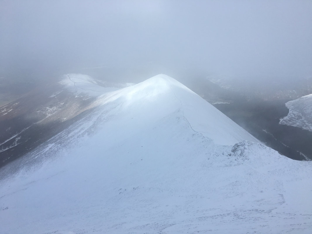
Almost whiteout conditions on the summit of Grisedale Pike
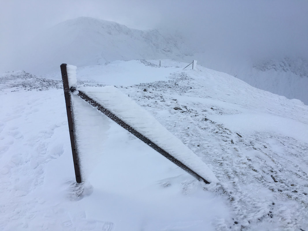
Our route down from Grisedale Pake to Hobcarton Crag - just follow the posts and the broken wall (if you can see them that is).
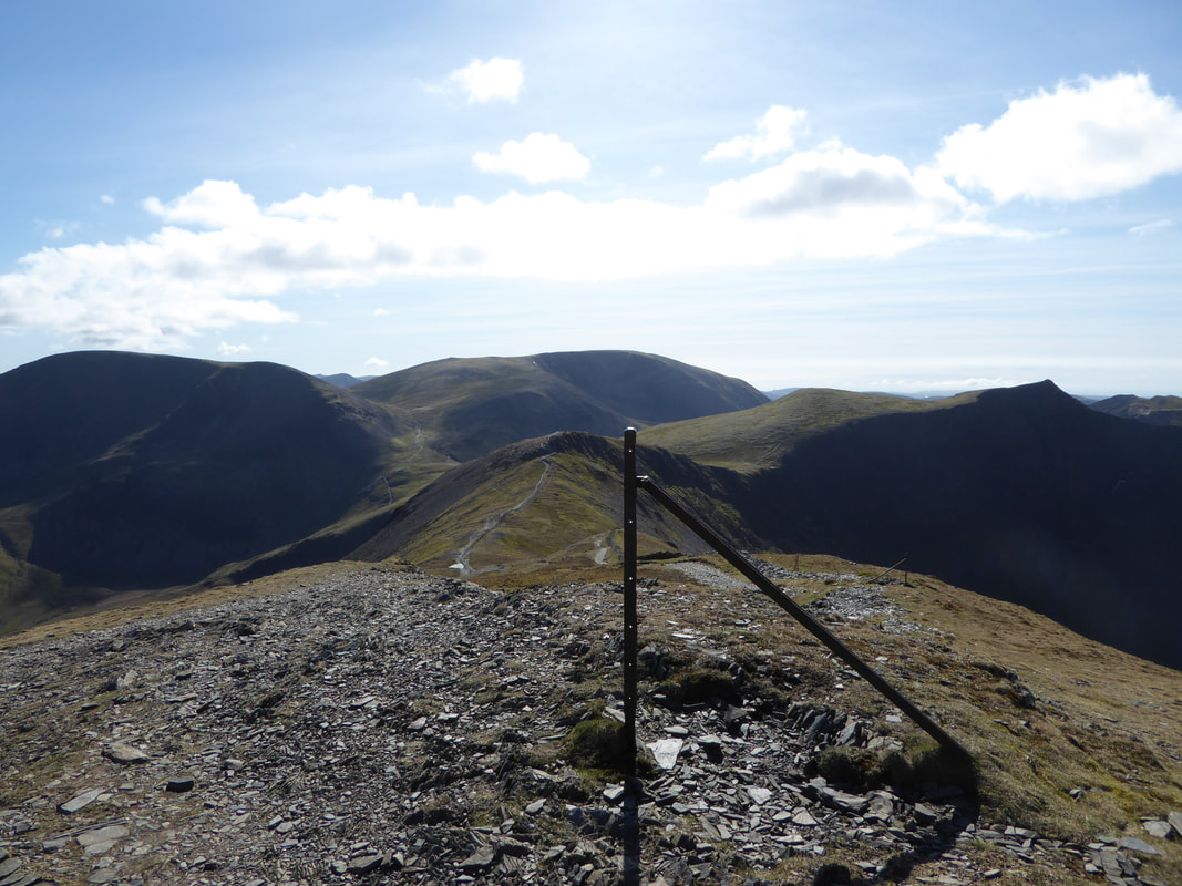
Roughly the same view as the picture above - taken in April 2017
Somebody has been arsing about in the snow - I wonder who?
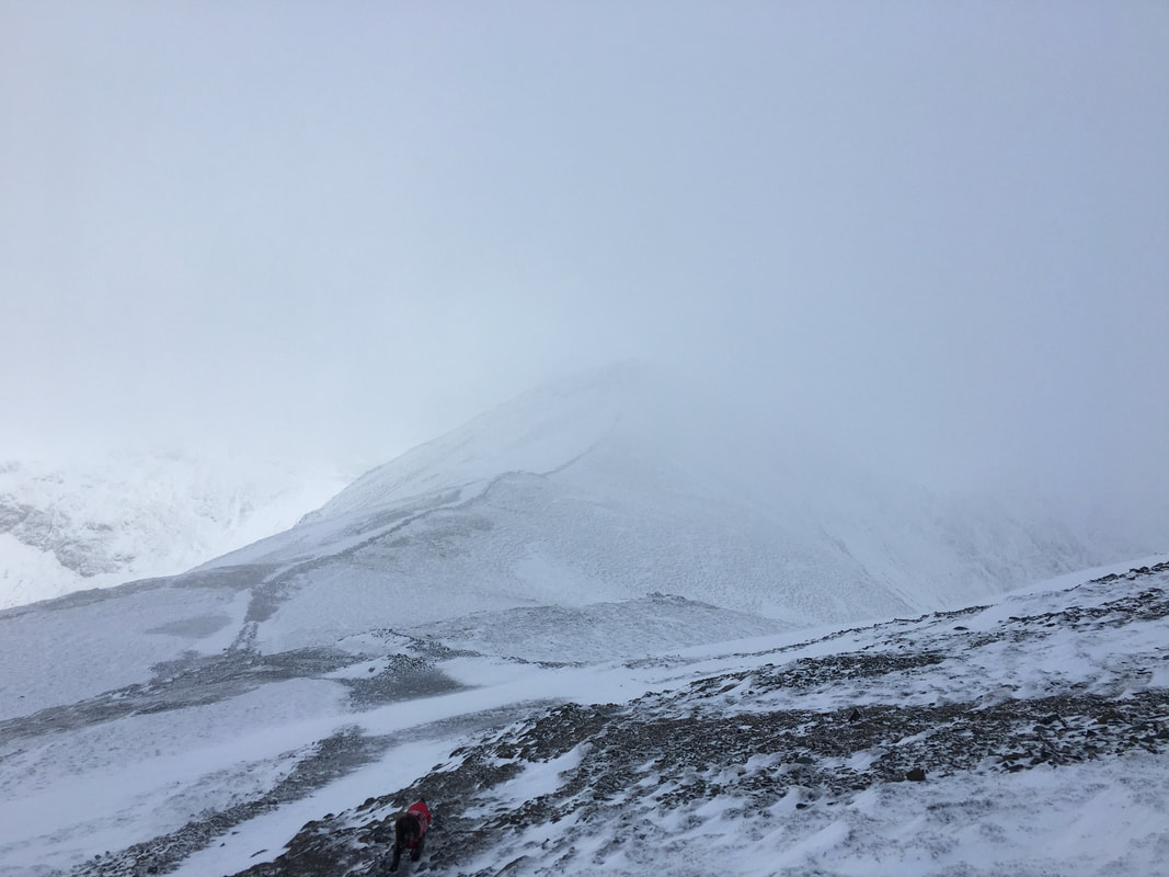
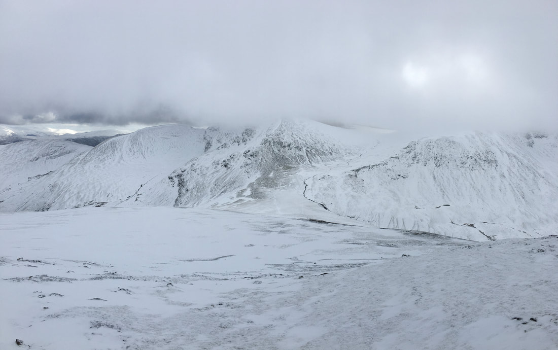
The weather continued to drift in & out of cloud. The wind had also increased markedly resulting in spindrift which made for an interesting descent into the col between Grisedale Pike & Hobcarton Crag.

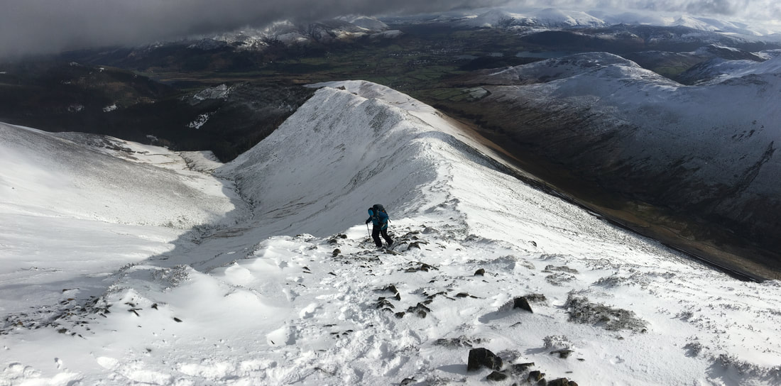
Looking back to Grisedale Pike
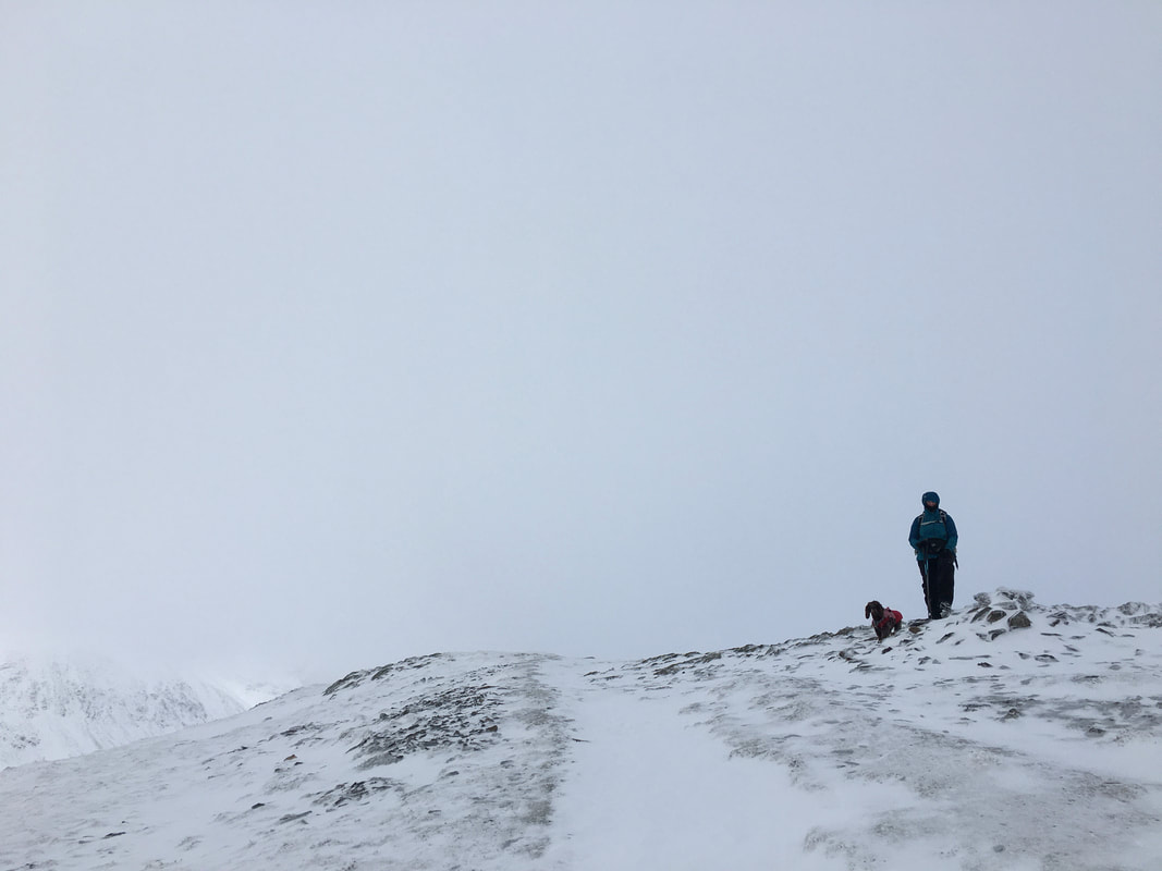
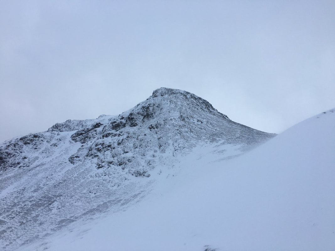
The summit of Hobcarton Crag
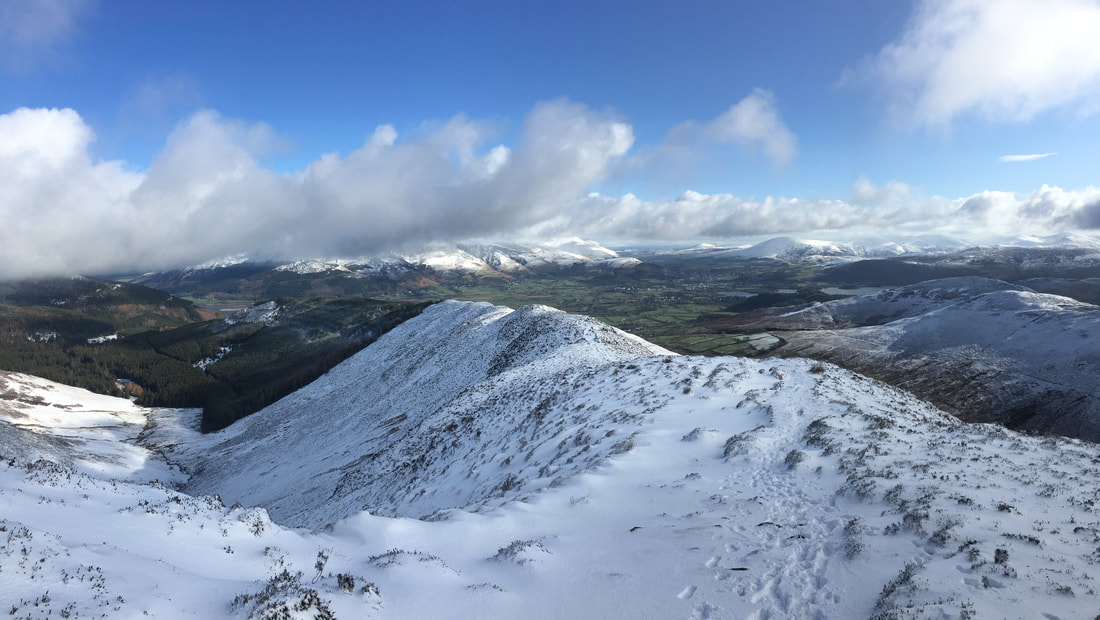
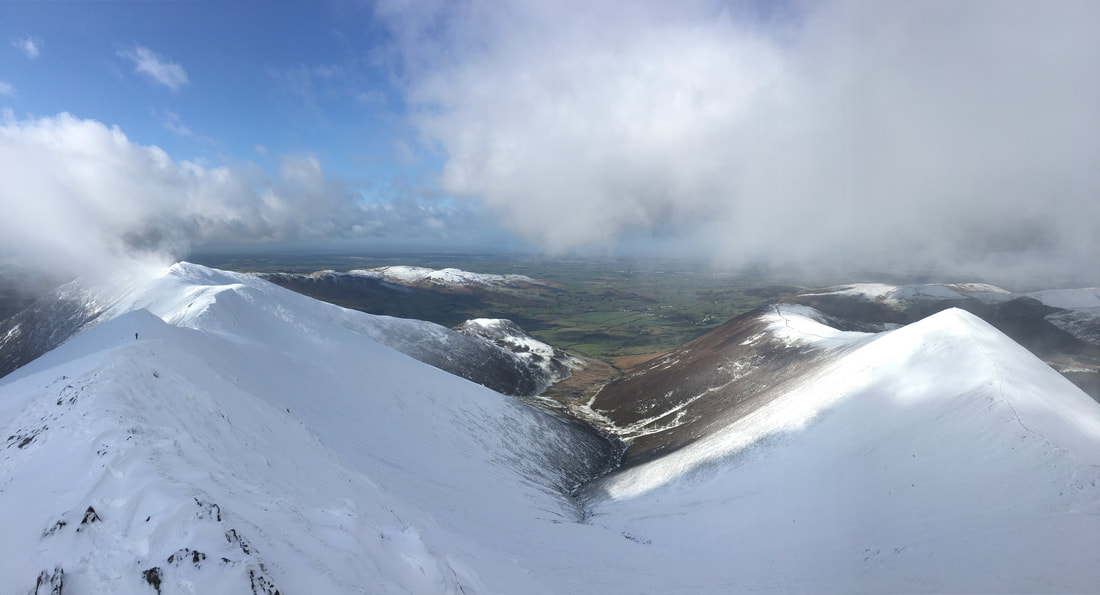
Hopegill Head & Ladyside Pike from Hobcarton Crag
From Hobcarton Crag the route drops down into another col to then rise again to reach Hopegill Head which is to the right.
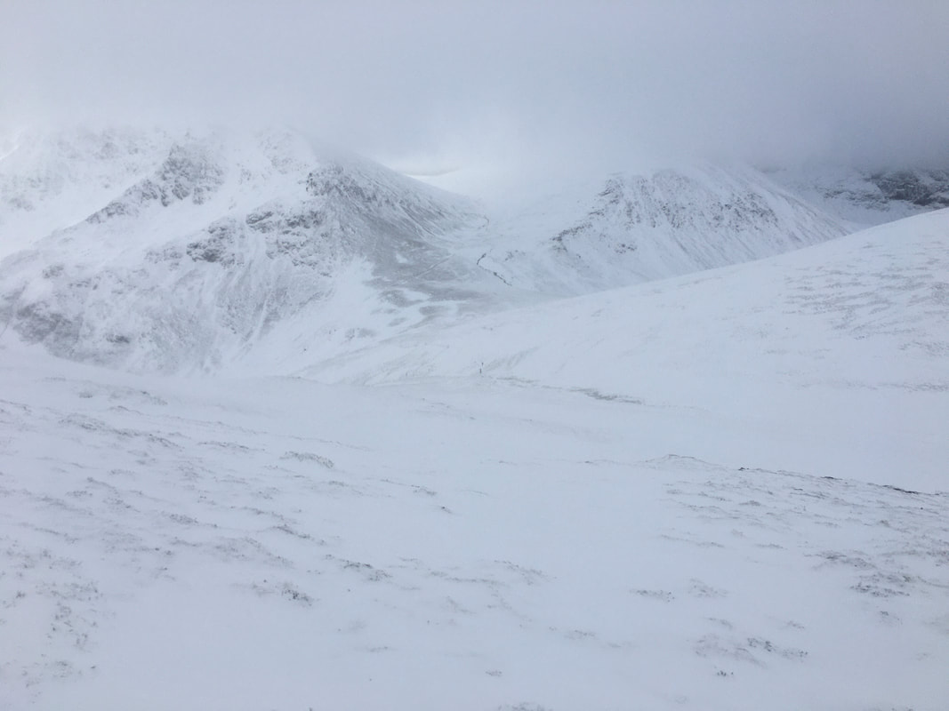
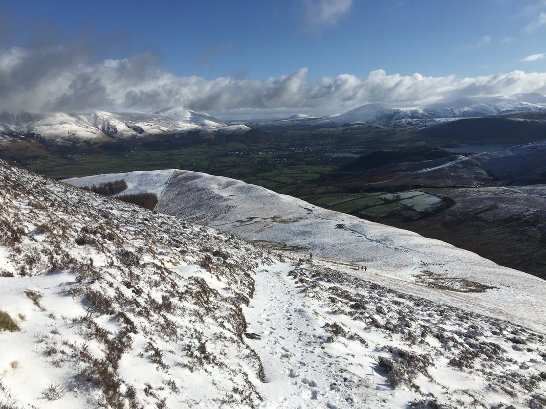
Coledale Hause - looks a bit grim down there
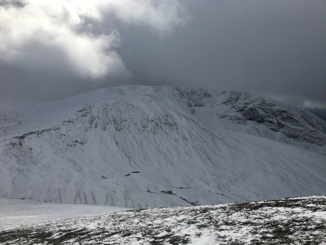
Grisedale Pike & Hobcarton Crag from the ascent to Hopegill Head
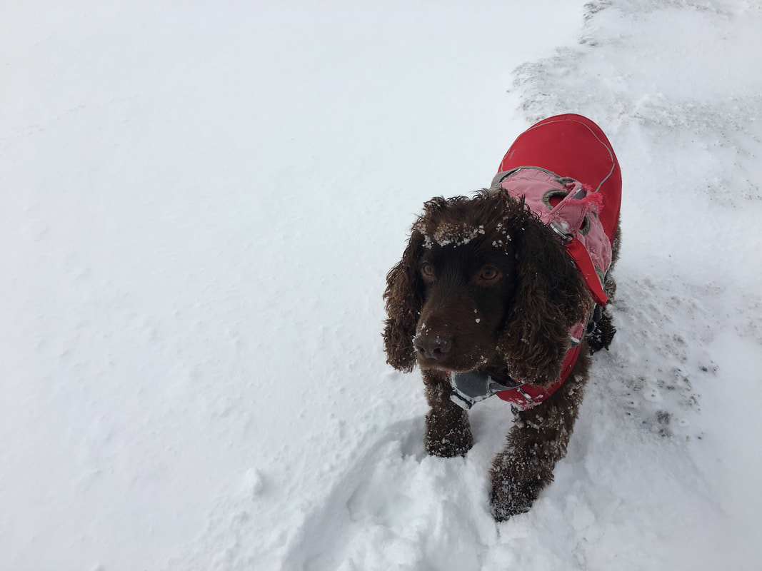
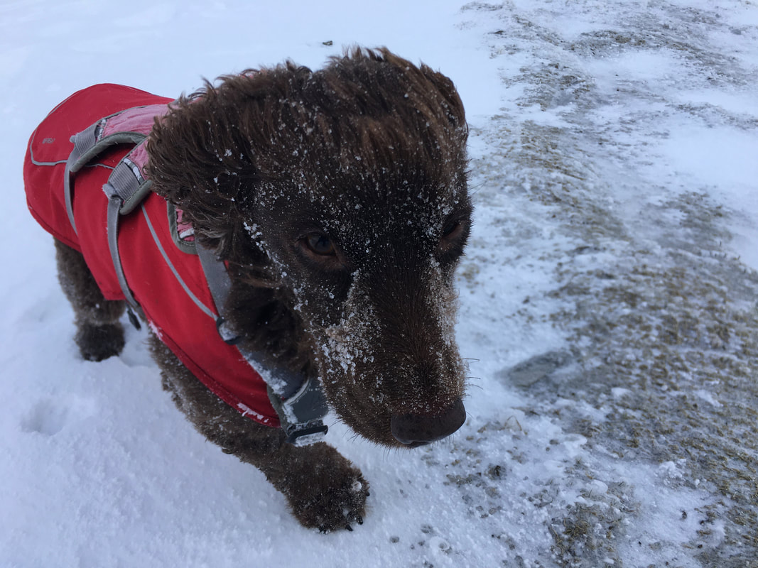
Loving the "Tiara" look Fudge
Ladyside Pike from the summit of Hopegill Head - this makes for a cracking out & back if you have time.
A panoramic view of Whiteside & Ladyside Pike from Hopegill Head
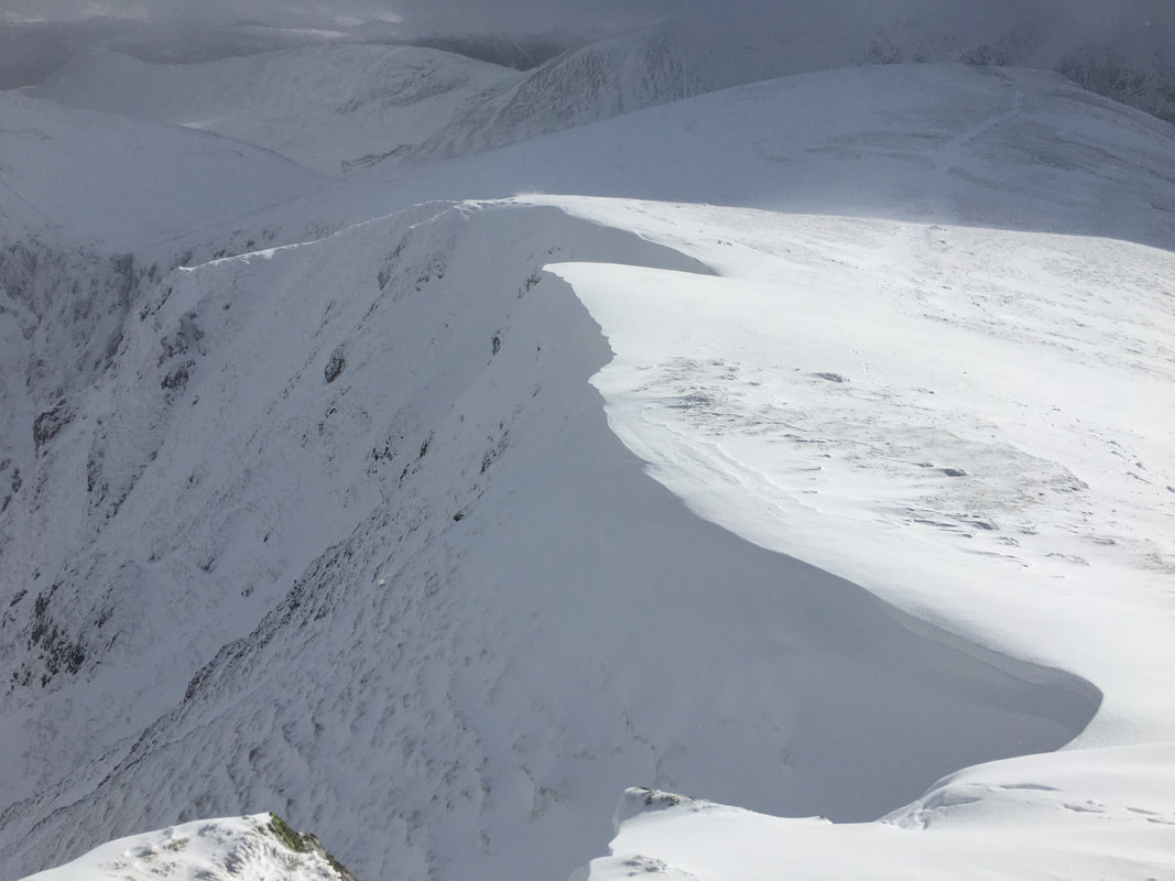
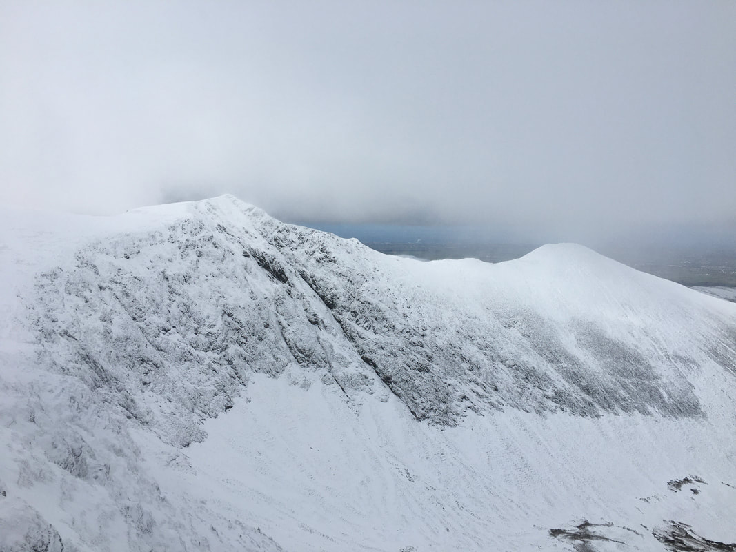
A classic example of dangerous cornicing seen here just below Hopegill Head - too close and the consequences are unthinkable.
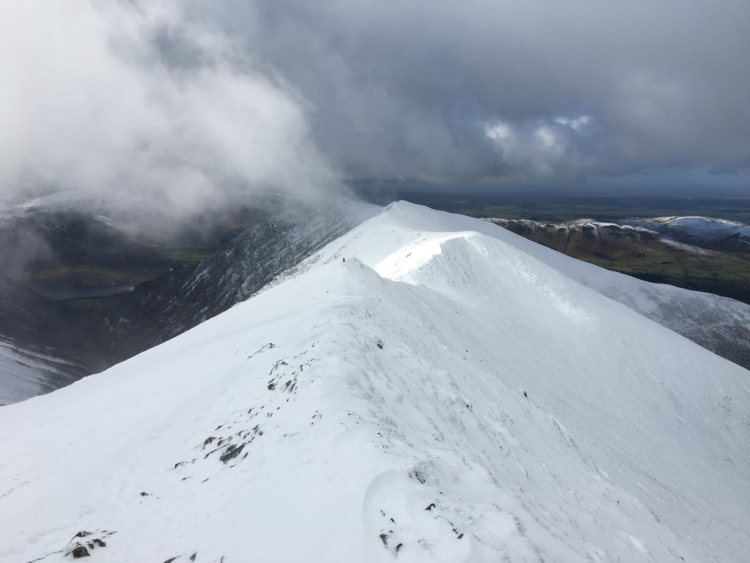
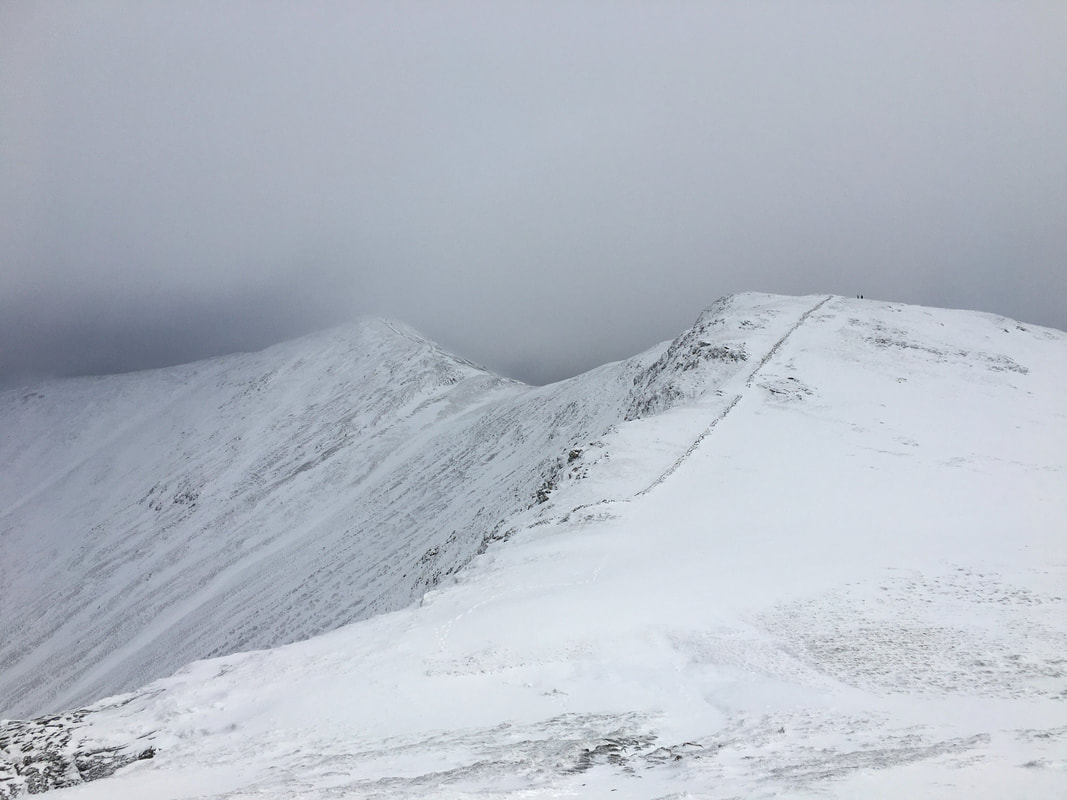
The connecting ridge to Whiteside from Hopegill Head - in my opinion one of the finest ridge walks in Lakeland.
The summit of Sand Hill
Descending to Coledale Hause from Sand Hill.
Eel Crag and Crag Hill are centre with Grasmoor to the right. To the left are Sail & Scar Crags.
Eel Crag and Crag Hill are centre with Grasmoor to the right. To the left are Sail & Scar Crags.
Gorgeous Grasmoor
Eel Crag from Coledale Hause
Our descent into the valley of Coledale
Force Crag
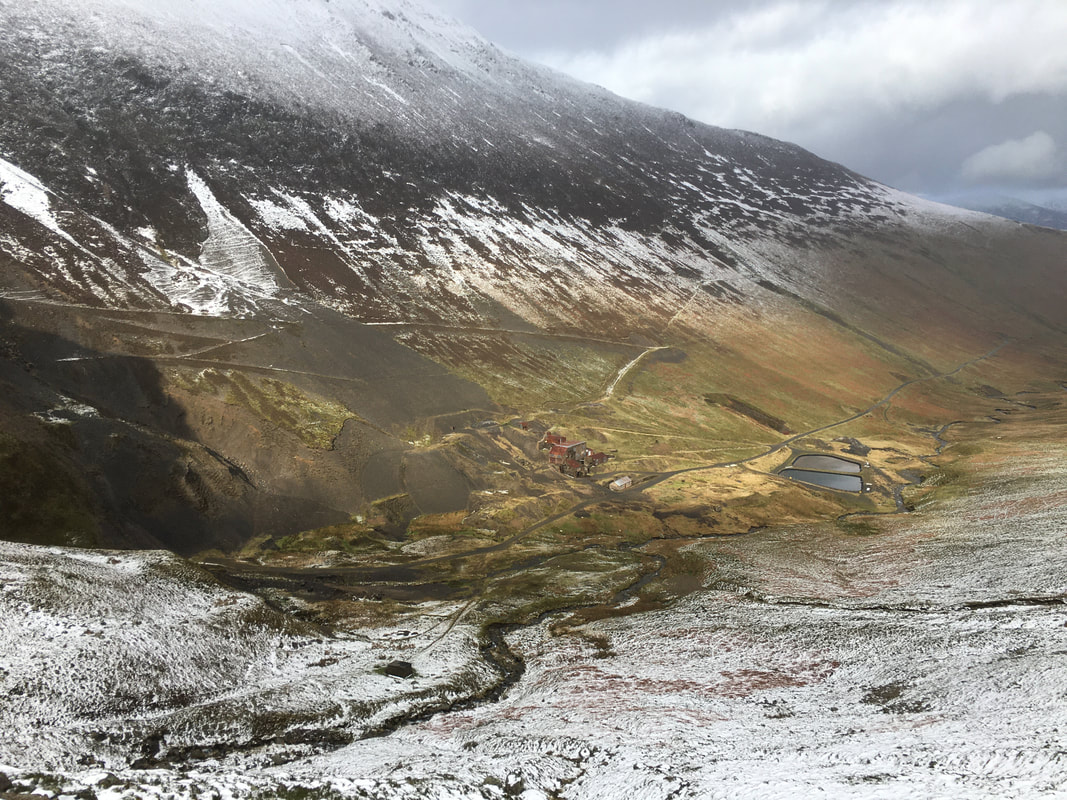
Dropping down into Coledale from the Hause with Force Crag Mine to the left
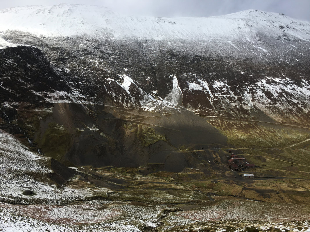
Force Crag Mine
Force Crag Mine was the last working metal mine in the Lake District, prior to its final abandonment in 1991. The site was mined for lead from 1839 until 1865, and for zinc and barytes from 1867. The job of the mill to the right was to separate these minerals from each other, and from any other minerals and the country rock. It is a Scheduled Ancient Monument, and a geological SSSI (site of special scientific interest). The mine occupies a spectacular location at the head of the Coledale Valley. The mill buildings below were built in 1908-9 and redesigned in 1939-40. The mill contains the ore-refining machinery that was in use during the 1980s. It is the only former mineral mining site in the country that has retained its processing equipment in something approaching complete order. The National Trust now owns the site and access to the processing mill buildings and machinery was restored in 2004. Visitors can discover what was mined and follow the processing of the minerals through the mill plant.
Force Crag Mine was the last working metal mine in the Lake District, prior to its final abandonment in 1991. The site was mined for lead from 1839 until 1865, and for zinc and barytes from 1867. The job of the mill to the right was to separate these minerals from each other, and from any other minerals and the country rock. It is a Scheduled Ancient Monument, and a geological SSSI (site of special scientific interest). The mine occupies a spectacular location at the head of the Coledale Valley. The mill buildings below were built in 1908-9 and redesigned in 1939-40. The mill contains the ore-refining machinery that was in use during the 1980s. It is the only former mineral mining site in the country that has retained its processing equipment in something approaching complete order. The National Trust now owns the site and access to the processing mill buildings and machinery was restored in 2004. Visitors can discover what was mined and follow the processing of the minerals through the mill plant.
Outerside from near Force Crag Mine - hasn't the weather improved!
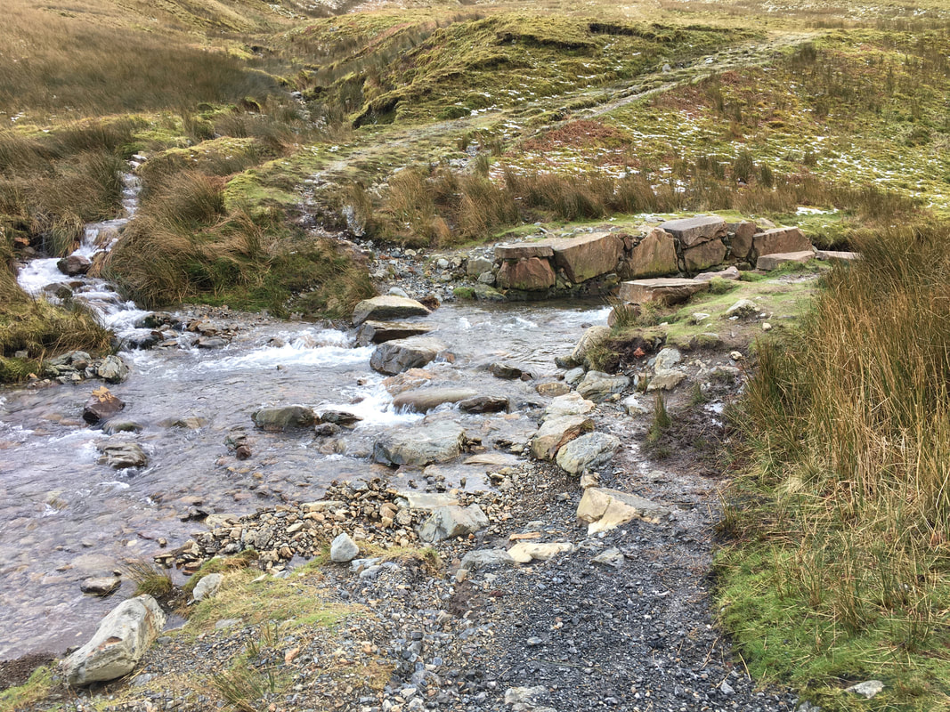
The stepping stones over Coledale Beck near Force Crag Mine
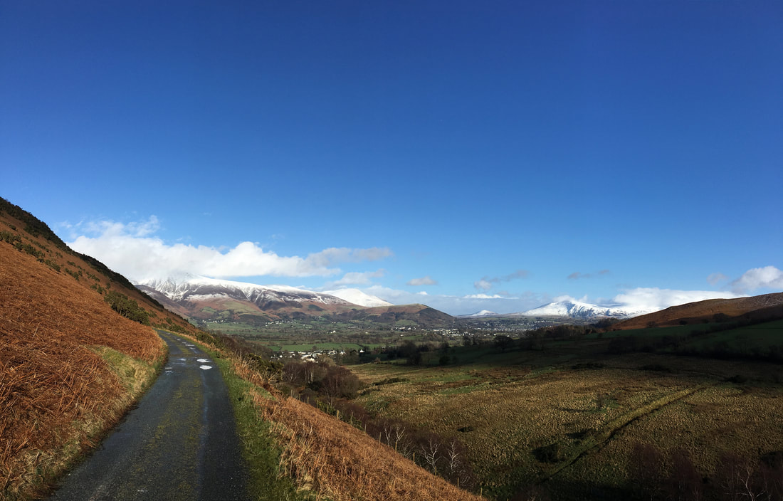
The final part of the walk is along the Force Crag Mine access road which leads directly back to the start at Braithwaite