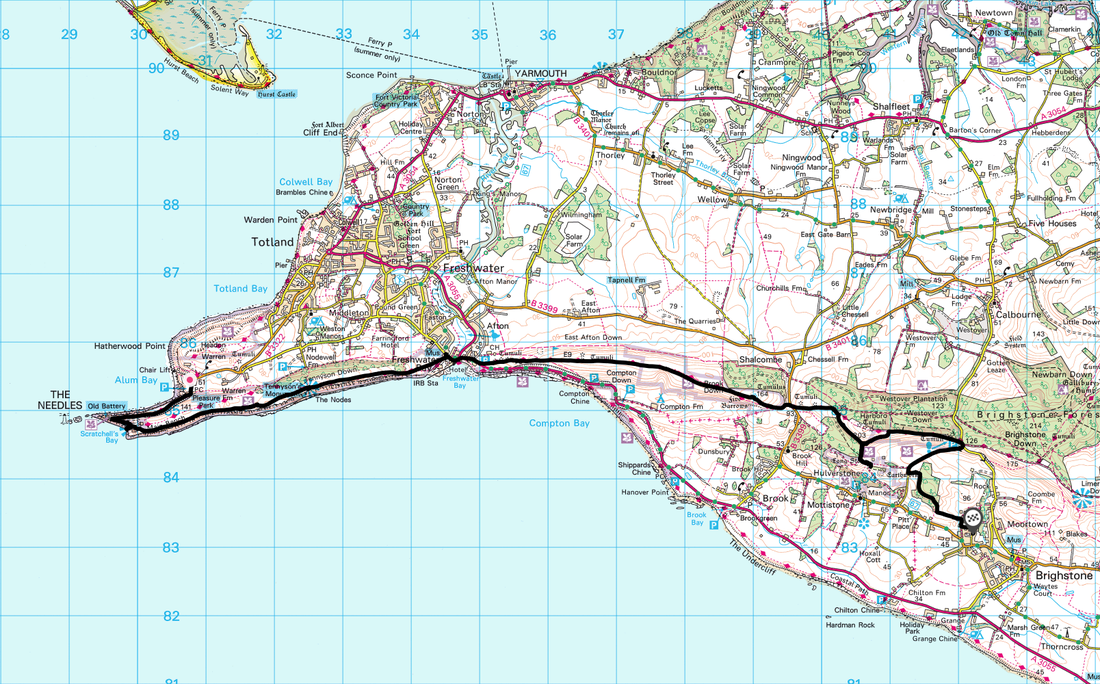
The Needles to Brighstone - Monday 5 February 2018
Route
Alum Bay - The Needles - West High Down - Tennyson's Monument - Freshwater Bay - Afton Down - Compton Down - Five Barrows - Long Stone - Mottistone Down - Strawberry Lane - Grammar's Common - Brighstone
Parking
This was a linear walk therefore we caught the bus from Brighstone to Alum Bay and walked back. There is plenty of parking at The Needles & Brighstone in order to complete this walk either way.
Mileage
12 miles
Terrain
Farm tracks, grassy downs with some road walking on quiet lanes. After rain some of the paths can become muddy but are easily avoided.
Weather
Overcast with sunny spells. Visibility was very good.
Time Taken
6hrs
Total Ascent
2316ft (706m)
Map
OL29 Isle of Wight
Walkers
Dave, Angie & Fudge
|
GPX File
|
| ||
If the above GPX file fails to download or presents itself as an XML file once downloaded then please feel free to contact me and I will send you the GPX file via e-mail.
Route Map
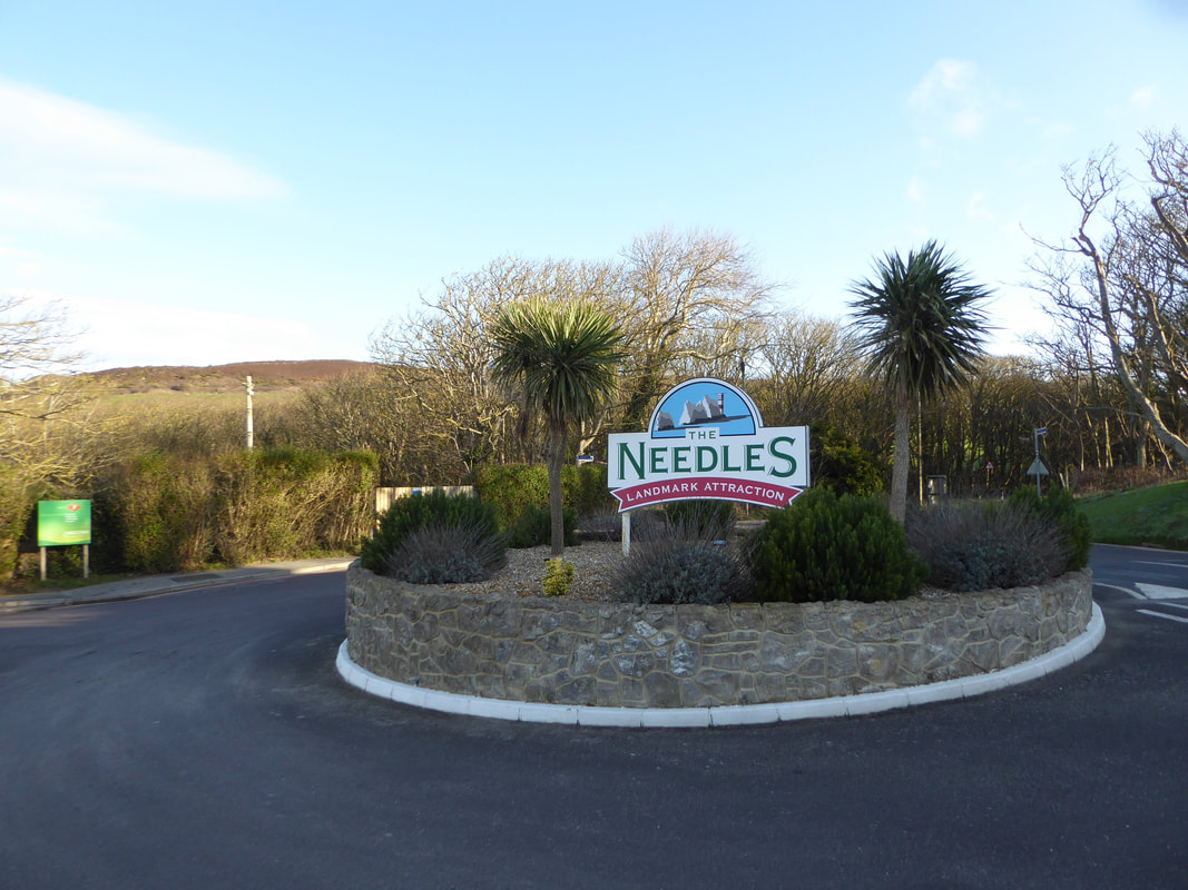
The bus from Brighstone dropped us right outside The Needles Landmark Attraction
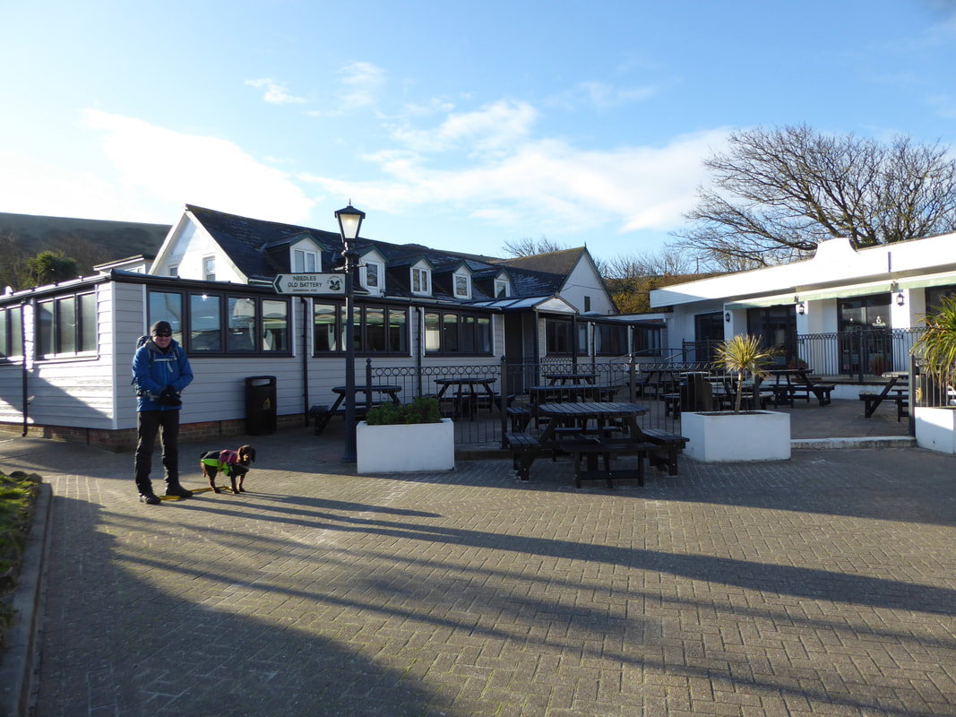
All ready for the off - a sign points the way towards the Old Battery and that is where we were off to first............
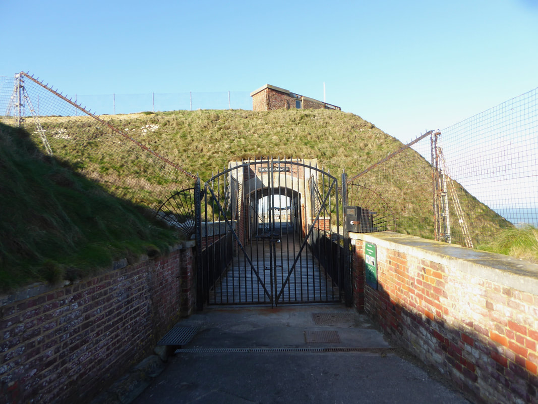
......... although as it was off season access to the Battery was strictly off limits today. For those wishing to visit a link to the website is here
The batteries were built above the Needles stacks to guard the West end of the Solent. The field of fire was from West South West clockwise to Northeast and they were designed to defend against enemy ships. The Old Battery was constructed between 1861 and 1863. It was equipped with six 7 inch Armstrong rifled breechloading guns. These were replaced by four 7 inch and two 9 inch rifled muzzle loaders in 1872, and six 9 inch rifled muzzle loaders in 1893. The 9 inch guns took a team of 9 men to load and fire. These guns fired projectiles weighing 256 pounds (116 kg). The 9-inch guns remained in place until 1903 when they were discarded by throwing them over the side of the cliff. These were later recovered and two are now on display at the Old Battery
The batteries were built above the Needles stacks to guard the West end of the Solent. The field of fire was from West South West clockwise to Northeast and they were designed to defend against enemy ships. The Old Battery was constructed between 1861 and 1863. It was equipped with six 7 inch Armstrong rifled breechloading guns. These were replaced by four 7 inch and two 9 inch rifled muzzle loaders in 1872, and six 9 inch rifled muzzle loaders in 1893. The 9 inch guns took a team of 9 men to load and fire. These guns fired projectiles weighing 256 pounds (116 kg). The 9-inch guns remained in place until 1903 when they were discarded by throwing them over the side of the cliff. These were later recovered and two are now on display at the Old Battery
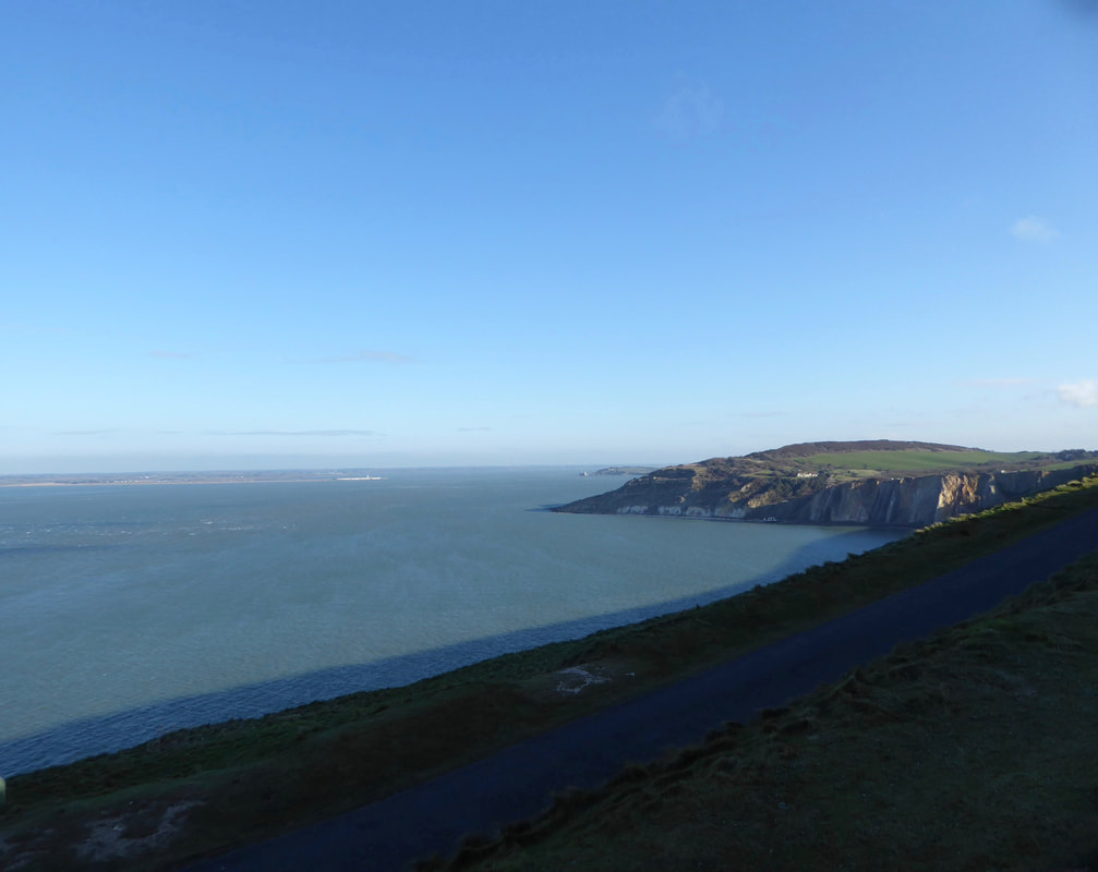
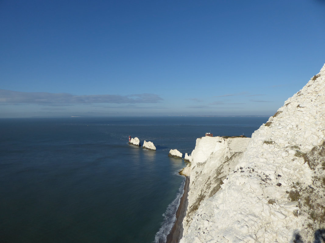
Alum Bay from the access road to Needles Old Battery
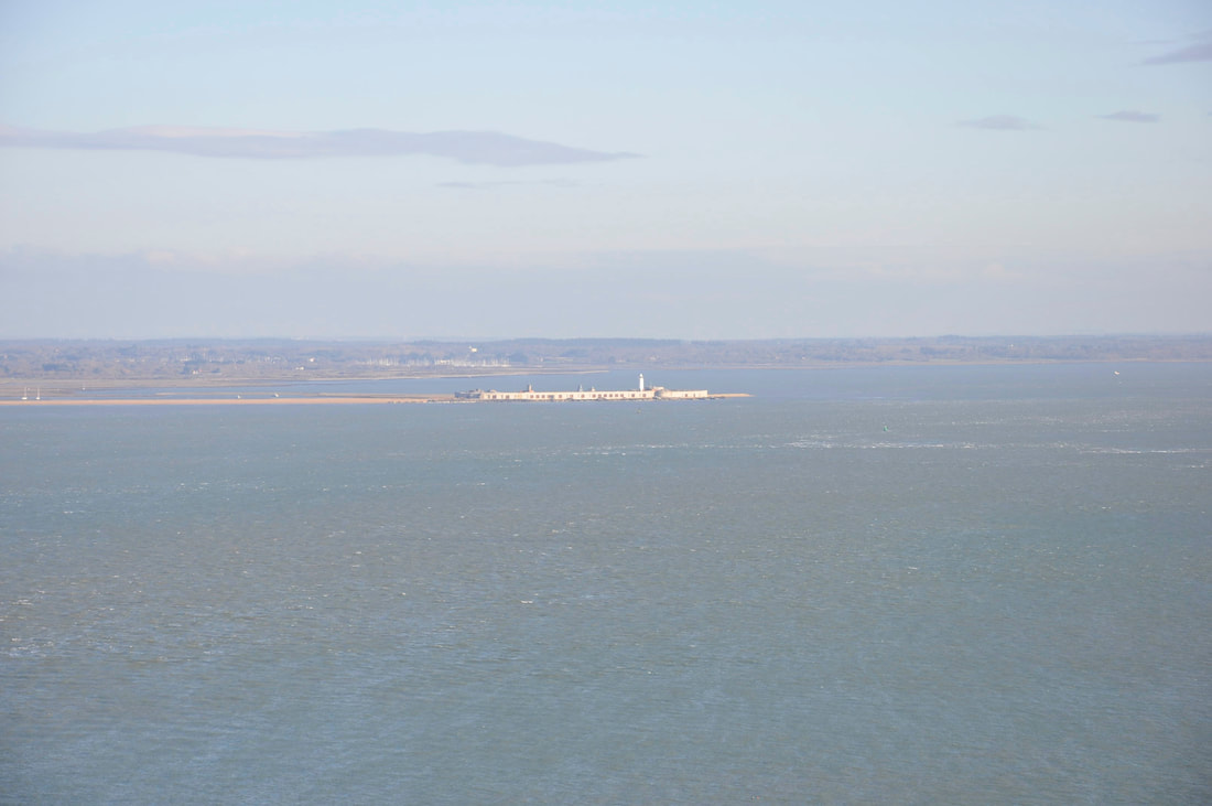
Zooming in on Hurst Castle near Milford on Sea
Hurst Castle is an artillery fort established by Henry VIII on the Hurst Spit between 1541 and 1544. Defending the western entrance to the Solent waterway, the fort formed part of the King's "Device Forts" coastal protection programme against invasion from France and the Holy Roman Empire.
Hurst Castle is an artillery fort established by Henry VIII on the Hurst Spit between 1541 and 1544. Defending the western entrance to the Solent waterway, the fort formed part of the King's "Device Forts" coastal protection programme against invasion from France and the Holy Roman Empire.
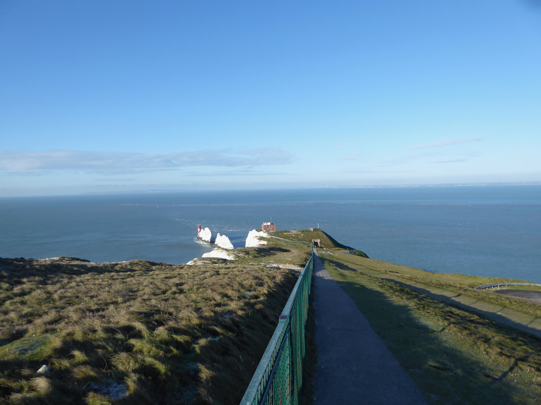
We walked back up the access path above the Battery to gain a better view of The Needles
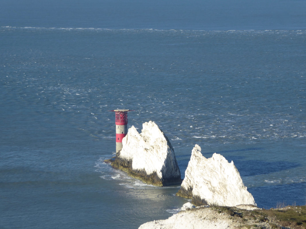
Zooming in on The Needles and the Lighthouse
The Needles Lighthouse is an active 19th century lighthouse on the outermost of the chalk rocks. The lighthouse was designed by James Walker for Trinity House at a cost of £20,000. It was completed in 1859 from granite blocks, stands 33.25 metres (109.1 ft) high and is a circular tower with straight sides. It replaced an earlier light tower on top of a cliff overhanging Scratchell's Bay.
The Needles Lighthouse is an active 19th century lighthouse on the outermost of the chalk rocks. The lighthouse was designed by James Walker for Trinity House at a cost of £20,000. It was completed in 1859 from granite blocks, stands 33.25 metres (109.1 ft) high and is a circular tower with straight sides. It replaced an earlier light tower on top of a cliff overhanging Scratchell's Bay.
Above Scratchell's Bay looking to The Needles
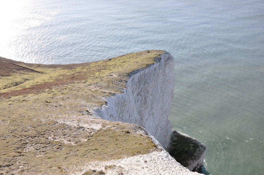
Sun Corner at Scratchell's Bay
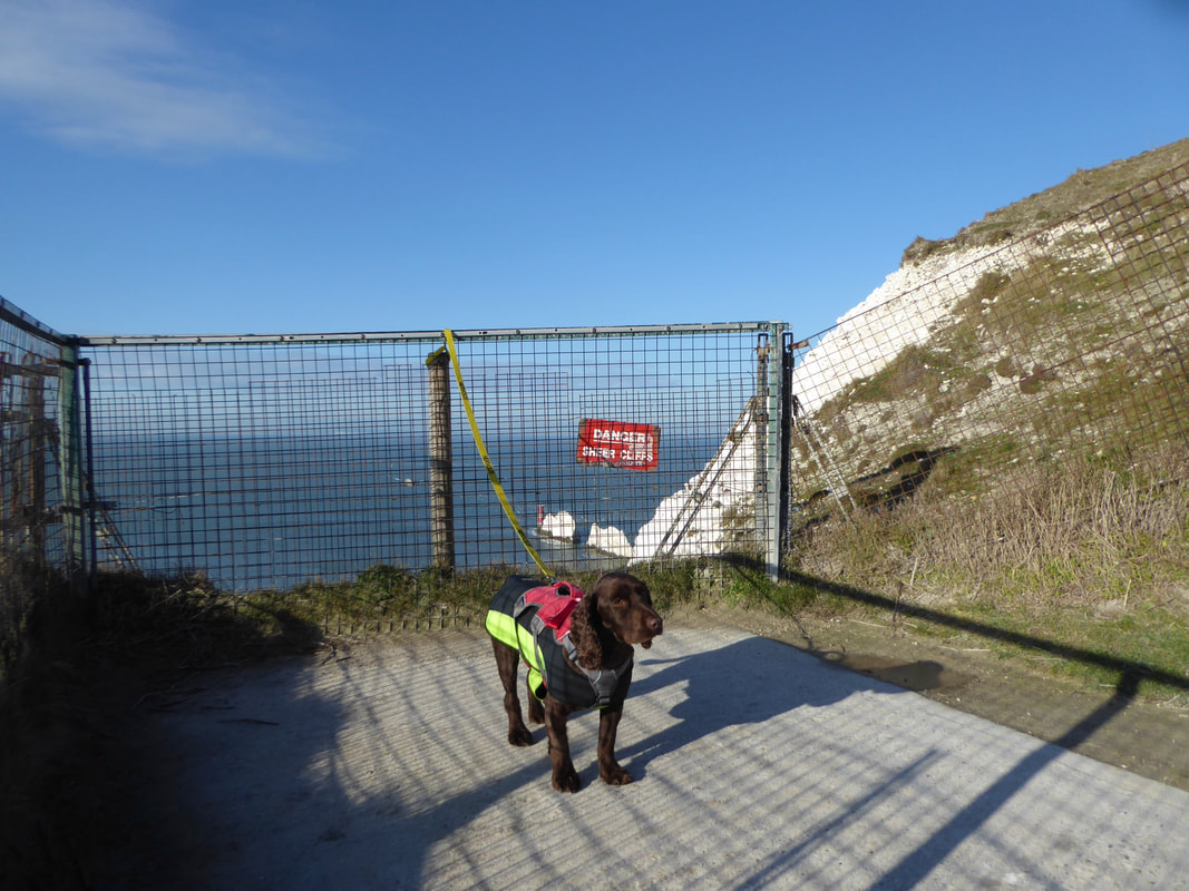
There area above Scratchell's Bay is quite rightly fenced off and notwithstanding this it was strictly "on lead" time for Fudge until we moved inland
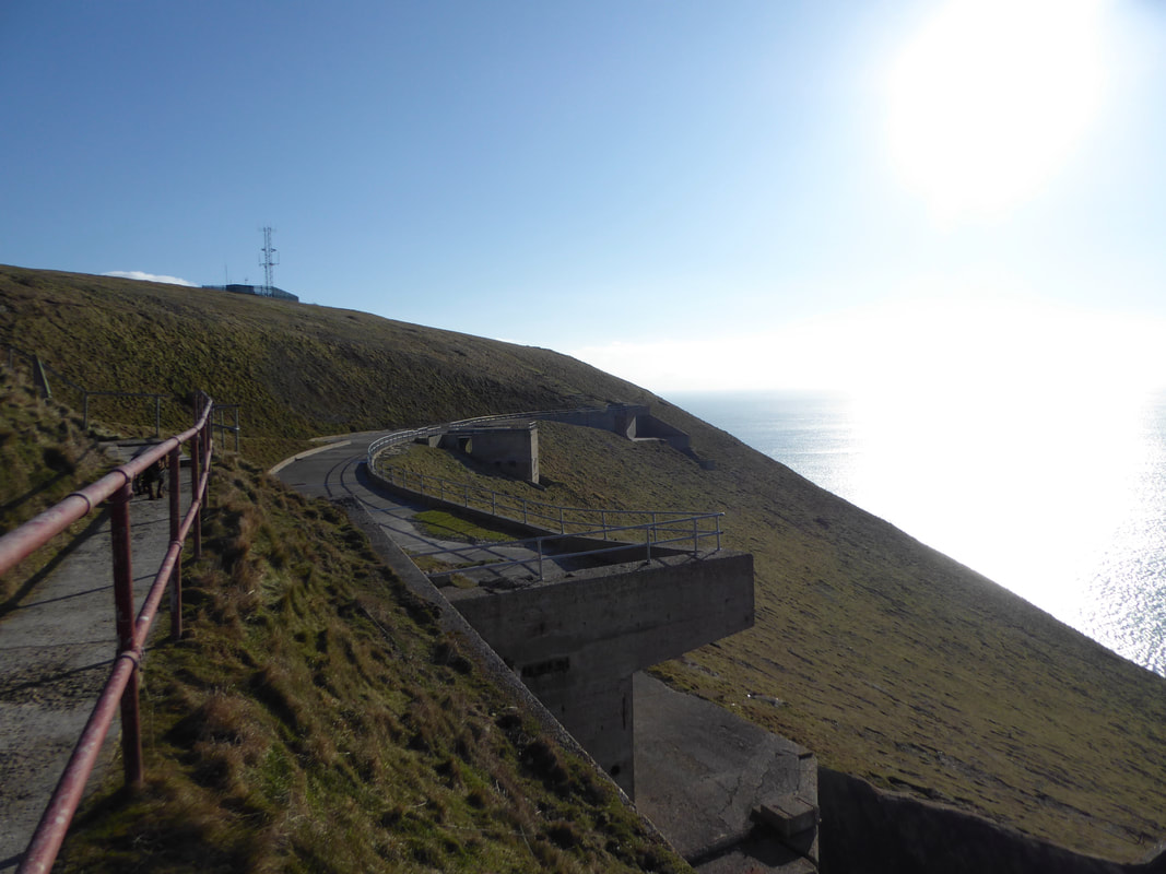
The remains of the Rocket Testing Site at West High Down near The Needles
The High Down Rocket Test Site is a former Rocket Testing facility and the remains are a rare example of a 1950s British rocket test facility, built at a time when the country was amongst a handful of nations at the forefront of rocket and missile technology. Internationally, large rocket testing facilities of this date are uncommon. The site was built and operated in secret, from the 1950s. The Black Arrow rocket was tested at the site, which was used to launch Prospero which was a wholly British project. Black Knight was also tested there. The development of rocketry was a part of the Cold War, in particular the development of Black Knight. The site is now under the ownership of the National Trust.
The High Down Rocket Test Site is a former Rocket Testing facility and the remains are a rare example of a 1950s British rocket test facility, built at a time when the country was amongst a handful of nations at the forefront of rocket and missile technology. Internationally, large rocket testing facilities of this date are uncommon. The site was built and operated in secret, from the 1950s. The Black Arrow rocket was tested at the site, which was used to launch Prospero which was a wholly British project. Black Knight was also tested there. The development of rocketry was a part of the Cold War, in particular the development of Black Knight. The site is now under the ownership of the National Trust.
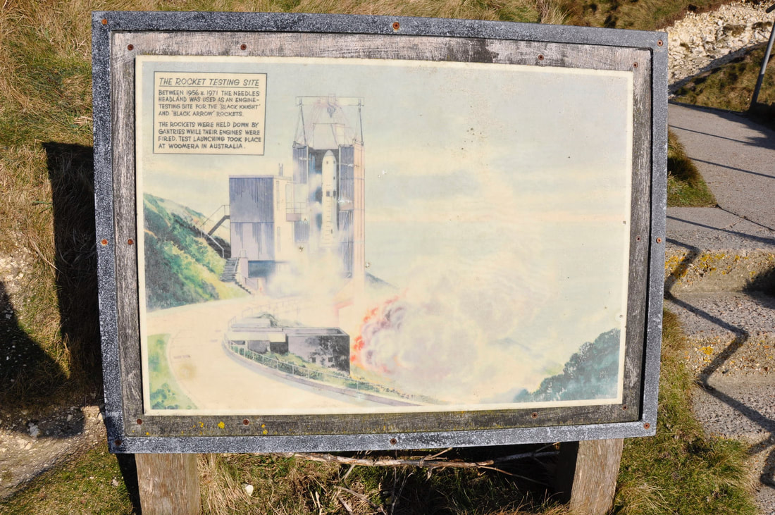
Near the remains is a sign with a drawing of what the site originally looked like
Up on High Down Fudge can now enjoy a bit of off lead shenanigans
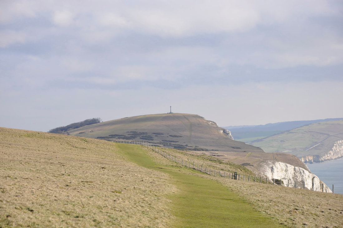
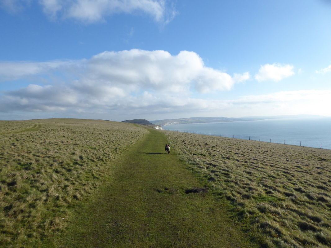
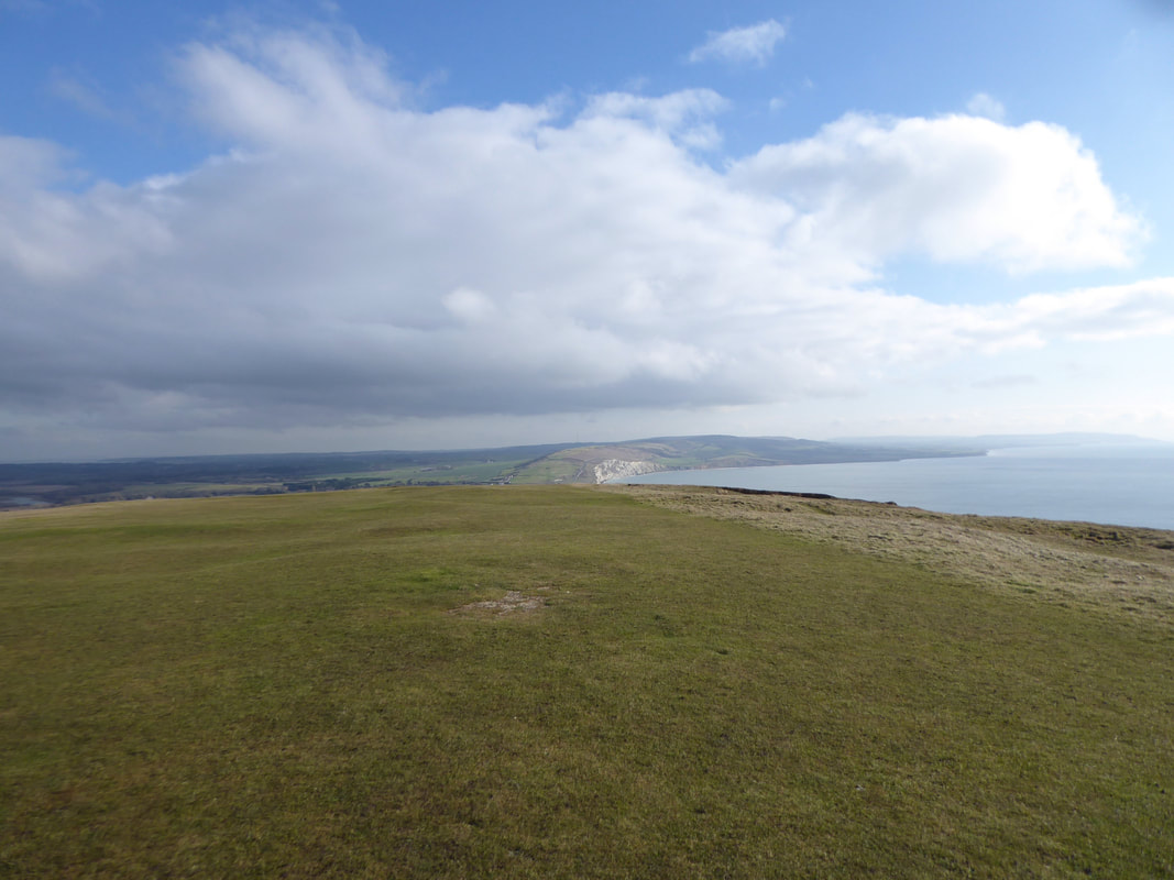
Zooming in on Tennyson Down and the Monument - this was delightful walking
Looking back to Old Pepper Rock
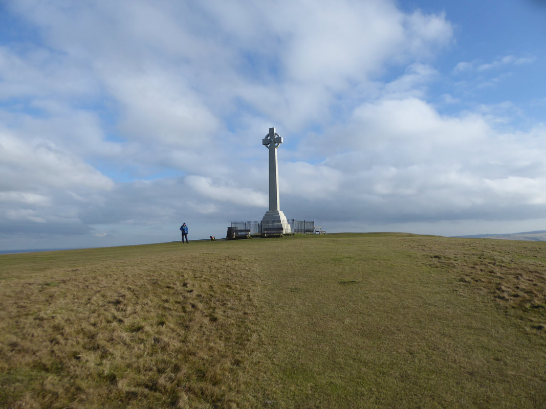
The Monument on Tennyson Down
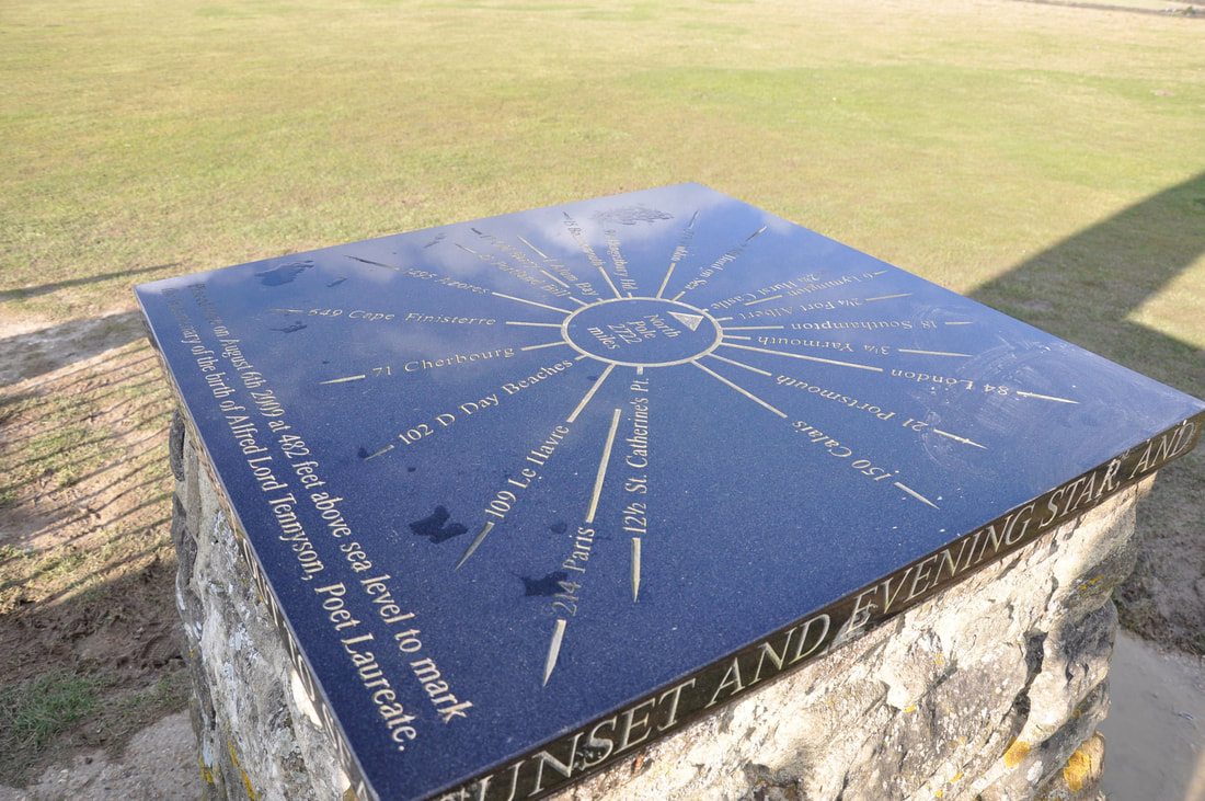
The Toposcope on Tennyson Down
Tennyson lived at nearby Farringford House at Freshwater Bay from 1853 until his death in 1892. The toposcope marks the bicentenary of the birth of Alfred Lord Tennyson and was erected here in 2009. The inscription around the rim comes from his poem "Crossing the Bar". The poem compares death with crossing the "sandbar" between the river of life, with its outgoing "flood", and the ocean that lies beyond (death), the "boundless deep", to which we return.
Tennyson lived at nearby Farringford House at Freshwater Bay from 1853 until his death in 1892. The toposcope marks the bicentenary of the birth of Alfred Lord Tennyson and was erected here in 2009. The inscription around the rim comes from his poem "Crossing the Bar". The poem compares death with crossing the "sandbar" between the river of life, with its outgoing "flood", and the ocean that lies beyond (death), the "boundless deep", to which we return.
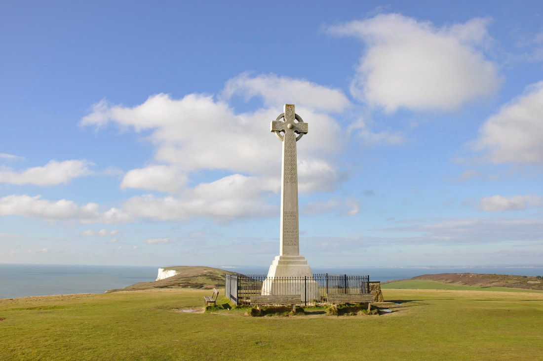
The Tennyson Monument - we were lucky to have it to ourselves for a while. The marble monument was erected as a memorial to Tennyson in 1895.
Tennyson often walked up on the down with his wife & friends and famously quoted that "The air is worth sixpence a pint."
Tennyson often walked up on the down with his wife & friends and famously quoted that "The air is worth sixpence a pint."
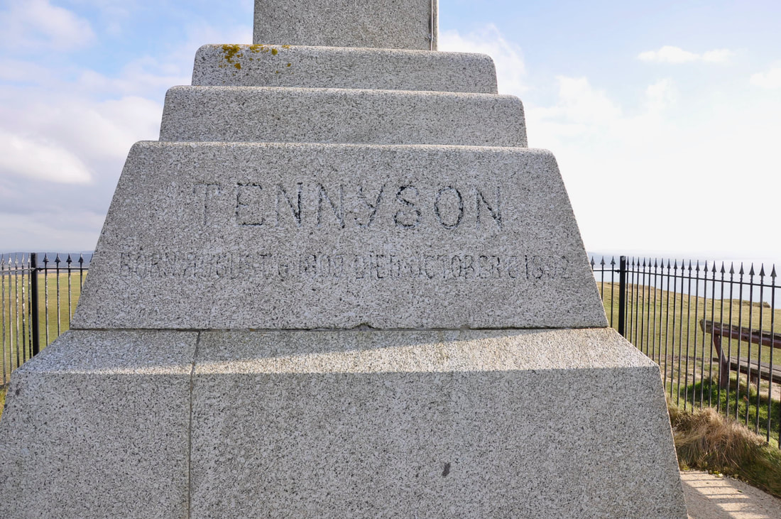
The inscription on one side of the monument gives the dates of Tennyson's life. The inscription on the other side states:
"In memory of Alfred Lord Tennyson this Cross is raised as a beacon to sailors by the people of Freshwater and other friends in England"
"In memory of Alfred Lord Tennyson this Cross is raised as a beacon to sailors by the people of Freshwater and other friends in England"
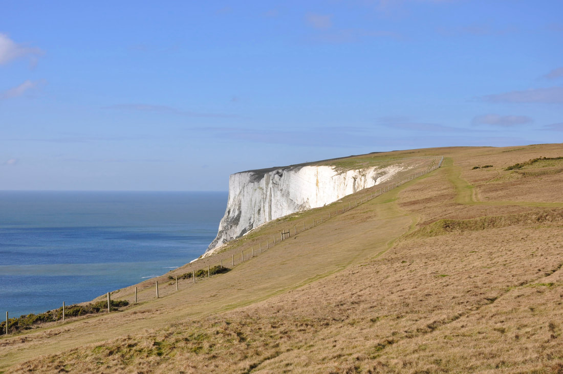
Heading over Tennyson Down to Freshwater Bay
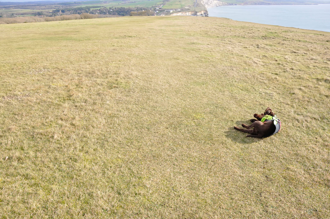
Despite the fantastic scenery on offer Fudge took it upon himself to "arse about a bit"
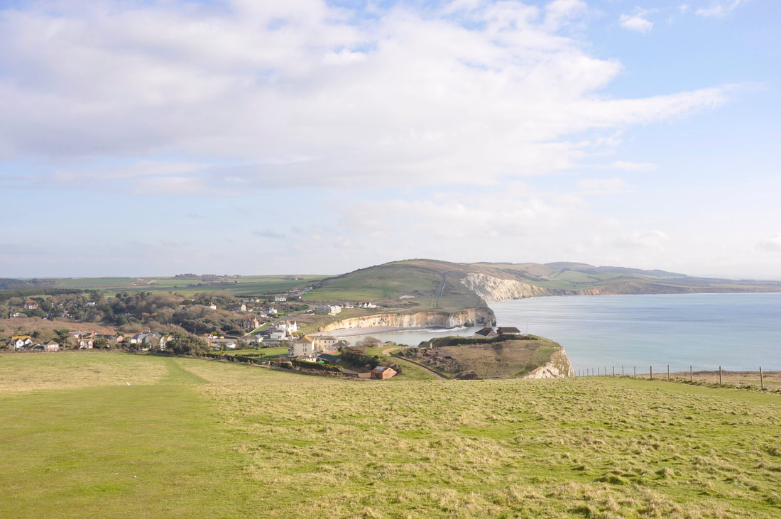
Freshwater Bay
And a glorious walk it was too
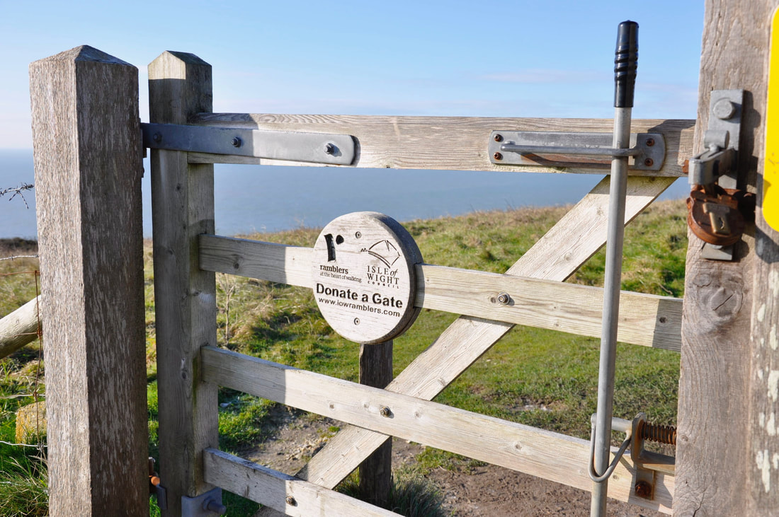
What a great idea - putting a bit back into the area
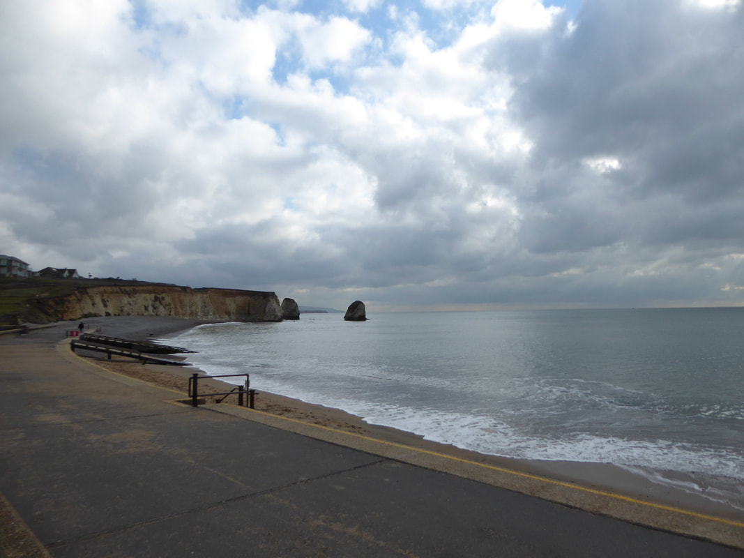
The promenade at Freshwater Bay - the rocks jutting out are known as Stag & Arch
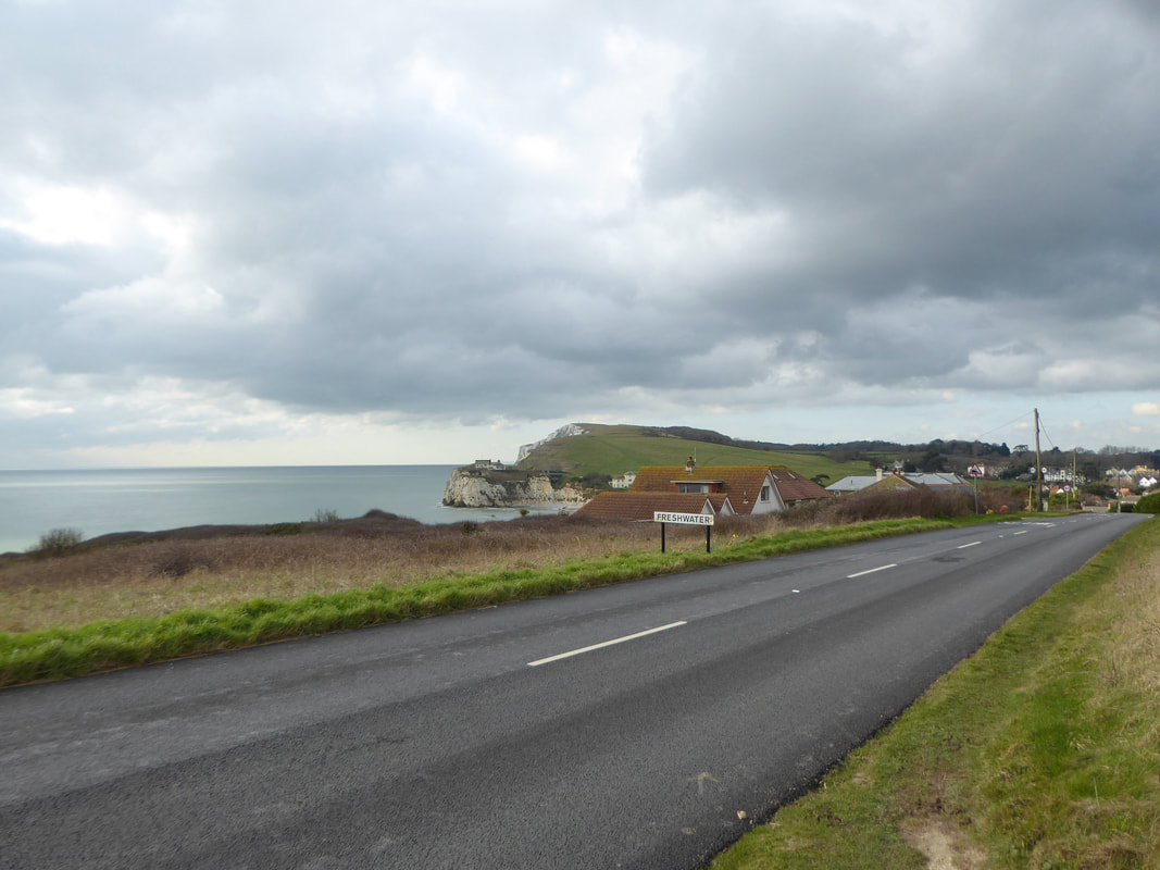
After a short bit of road walking we leave Freshwater and walk up on a path leading to the golf course
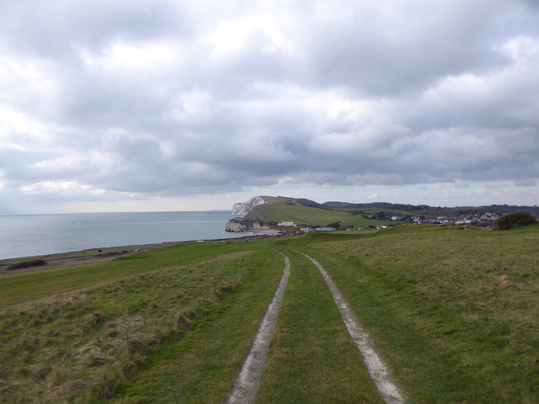
Looking back down to Freshwater Bay & Tennyson Down from the golf course path
As we entered the golf course we were hoping that all the players were hitting straight today
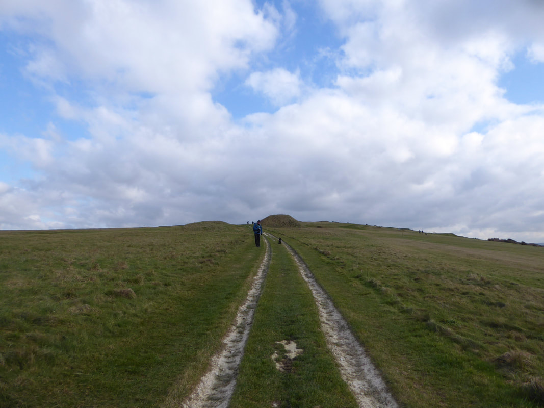
Approaching the round barrow cemetery on Brook Down - the megalithic burial spot is known as "Five Barrows"
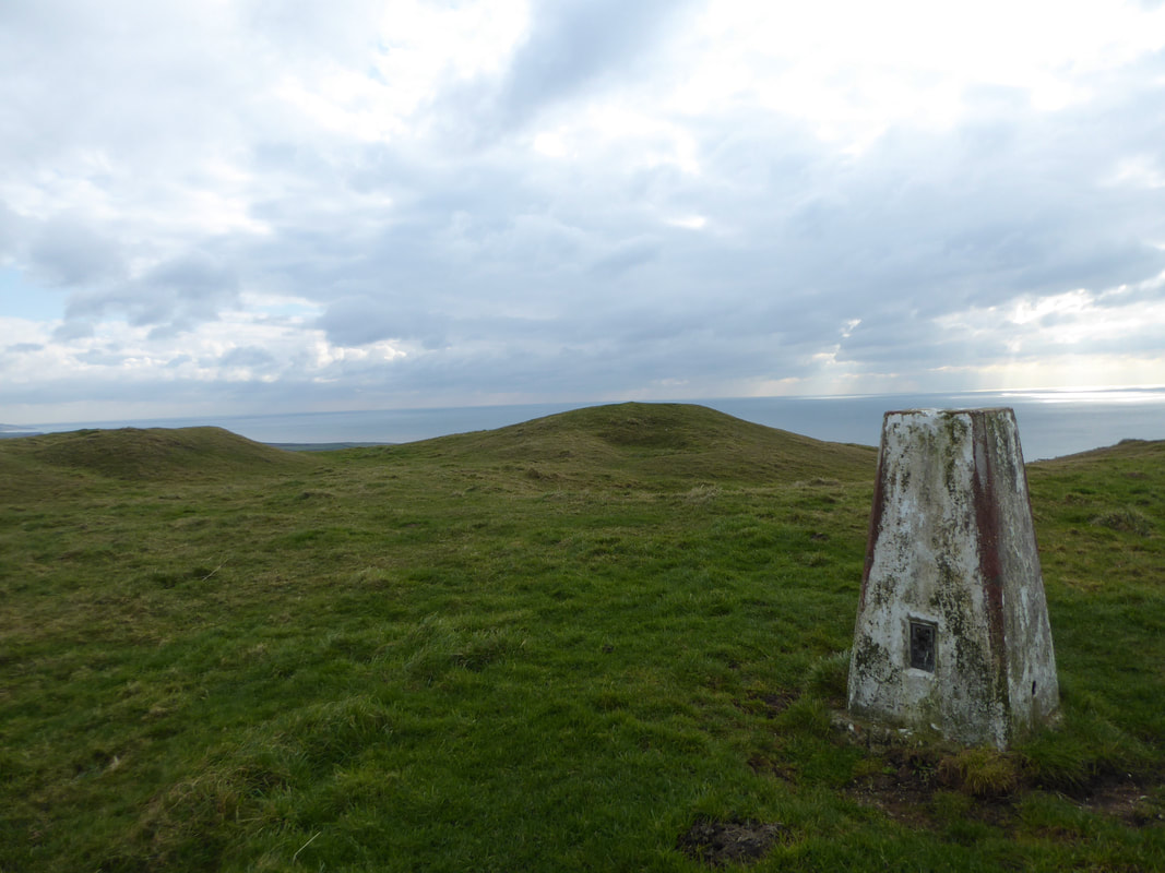
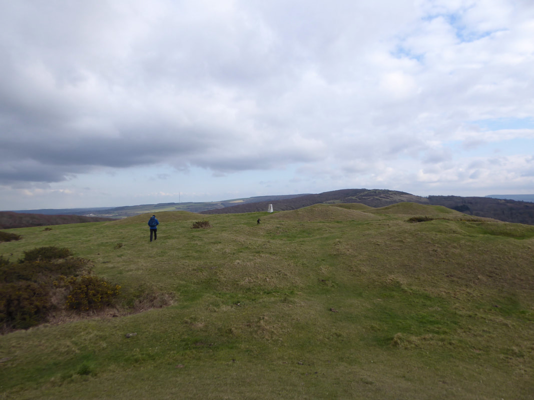
The Trig Point on Five Barrows
Heading to Mottistone Down............
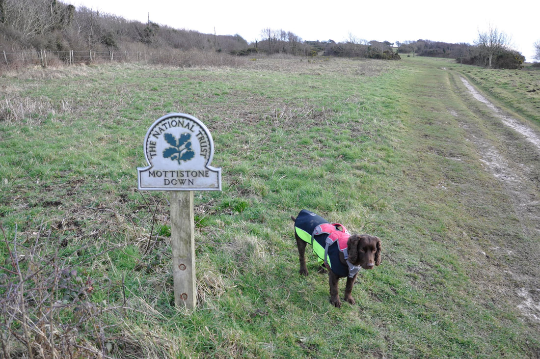
......... and here we are
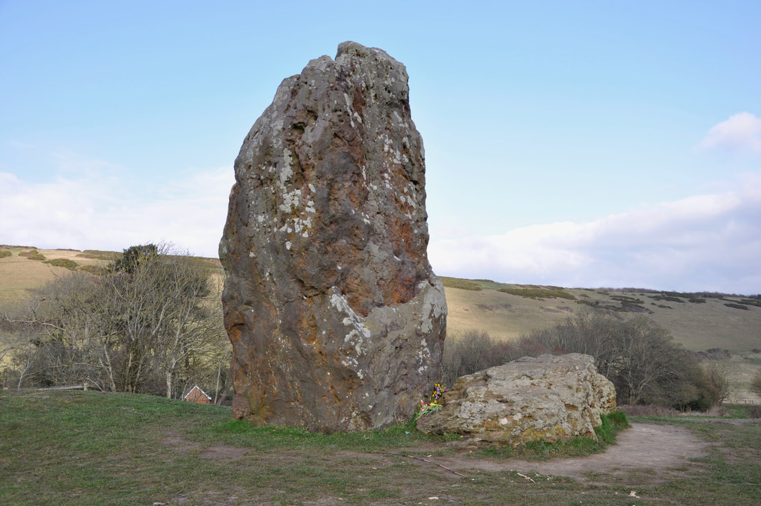
The Long Stone megalithic monument on the common just below Mottistone Down
Legend has it that St Catherine and the Devil had a contest to see who should control the Isle of Wight. The Longstone’s tall iron sandstone pillar was supposedly thrown by St Catherine from the Down to the east which bears her name. At over 4m high and 2m wide, this was a mighty feat indeed. The Devil’s smaller stone (a mere 2.9m high and 1.2m wide) fell short and he lost the wager. The final resting place of the stones shows St Catherine’s dominating the recumbent smaller stone and is said to symbolise the triumph of good over evil.
Legend has it that St Catherine and the Devil had a contest to see who should control the Isle of Wight. The Longstone’s tall iron sandstone pillar was supposedly thrown by St Catherine from the Down to the east which bears her name. At over 4m high and 2m wide, this was a mighty feat indeed. The Devil’s smaller stone (a mere 2.9m high and 1.2m wide) fell short and he lost the wager. The final resting place of the stones shows St Catherine’s dominating the recumbent smaller stone and is said to symbolise the triumph of good over evil.
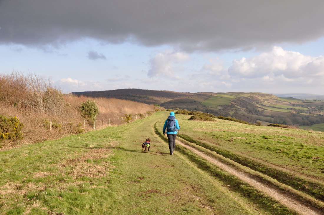
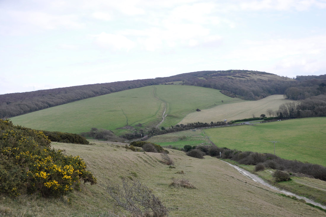
The delightful transit over Mottistone Down
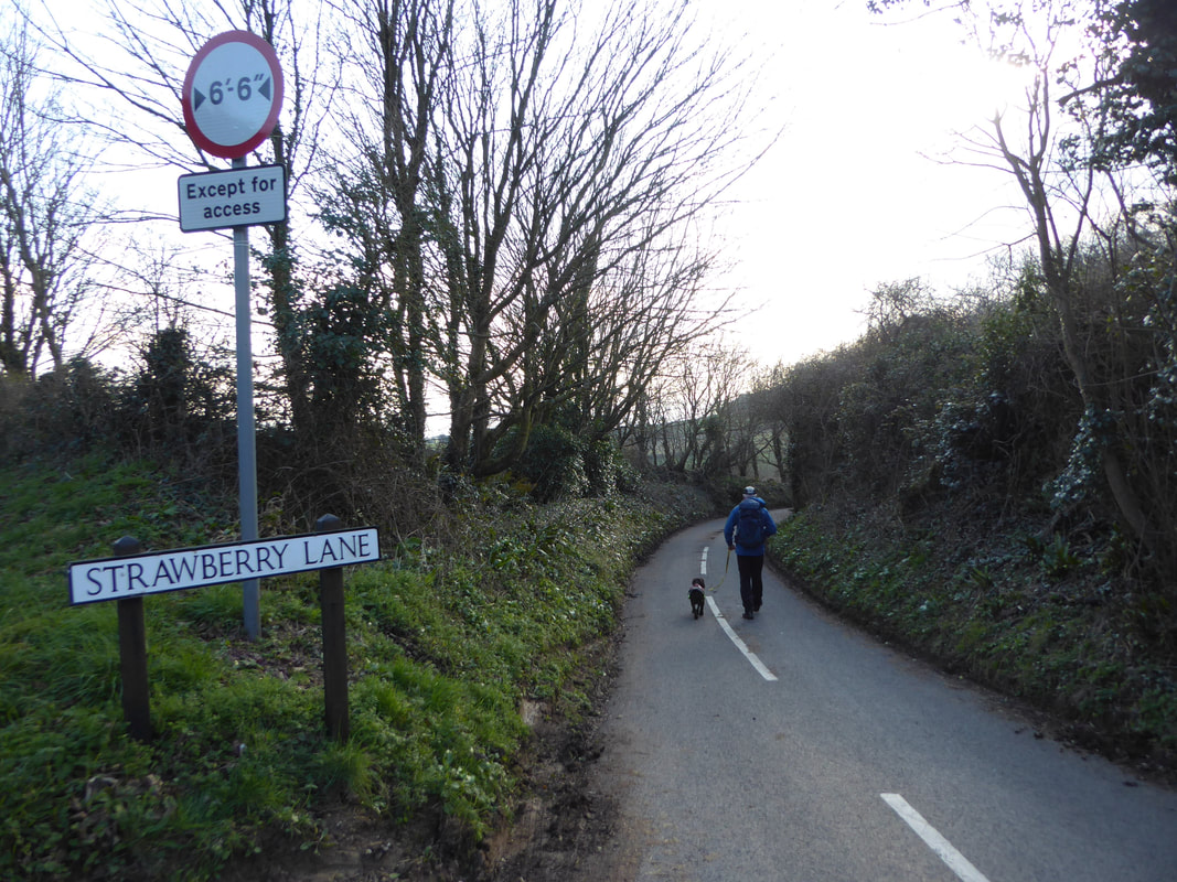
The delightfully named Strawberry Lane which took us back to Brighstone