Conival & Ben More Assynt - Sunday 1 May 2022
Route
Inchnadamph - Glenbain - Traligill Caves - Gleann Dubh - Conival - Ben More Assynt - Conival - Gleann Dubh - Traligill Caves - Glenbain - Inchnadamph
Parking
Small Car Park (Free) near The Inchnadamph Hotel just off the A837. The Grid Reference is NC 251 216 and the nearest postcode is IV27 4HN.
Mileage
12.2 miles
Terrain
A mixture of rough terrain, pathless mountain side and ridge walking. It should be noted that once Gleann Dubh is left at Grid Reference NC 283 205 no paths are marked on the OS Map for the remainder of the walk until reaching the same point on the return journey. However the paths are visible on the ground.
Weather
Game of two halves - low cloud and overcast in the morning which cleared in the afternoon.
Time Taken
8hrs
Total Ascent
3877ft (1182m)
Map
OS Explorer 442 Assynt & Lochinver
Walkers
Dave
|
GPX File
|
| ||
If the above GPX file fails to download or presents itself as an XML file once downloaded then please feel free to contact me and I will send you the GPX file via e-mail.
Route Map

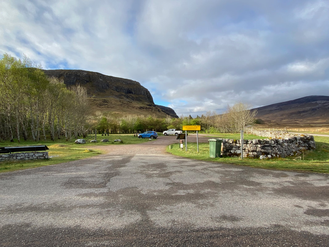
The parking area just off the A837 by The Inchnadamph Hotel. I was flying solo today as Angie was resting up having pulled a muscle climbing Suilven and we also decided to give Fudge a breather too.
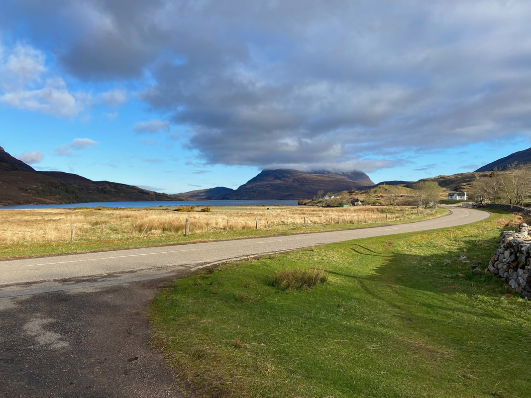
From the Car Park the route heads along the right hand side of the A837 for about a 100 yards to roughly where the house is on the right of shot. The body of water is Loch Assynt and the mountain with a cloudy hat on is Quinag.
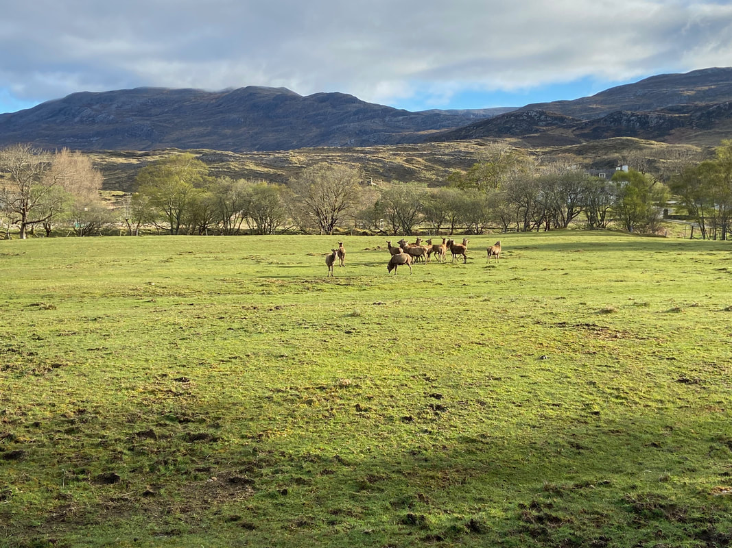
Nice little bonus as I turn off the A837 - a herd of Deer. This was very appropriate as the start point of this walk, Inchnadamph translated from the Gaelic means "The Meadow of the Stags".
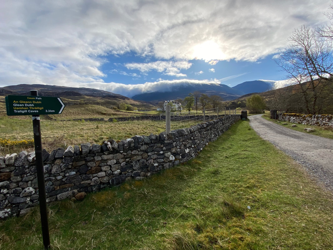
The signpost at the turn off on the A837. I would eventually follow the path through Gleann Dubh but first I wanted to visit the Traligill Caves
Just off to the left was this lovely des res called Inchnadamph Lodge. The 200 year old Grade B listed former manse/shooting lodge is a commercial property and is on the market for £850k should you have a few spare shekels.
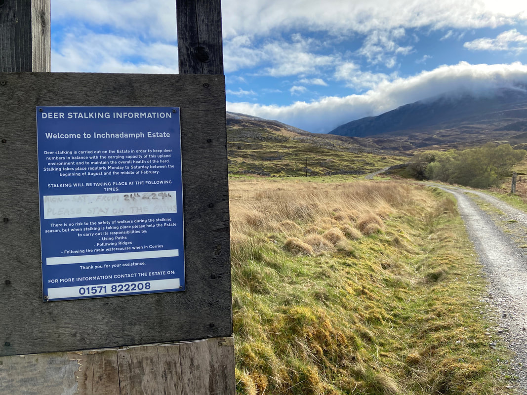
Thankfully this didn't affect me today but obviously needs adhering to should anybody come across warnings of this nature
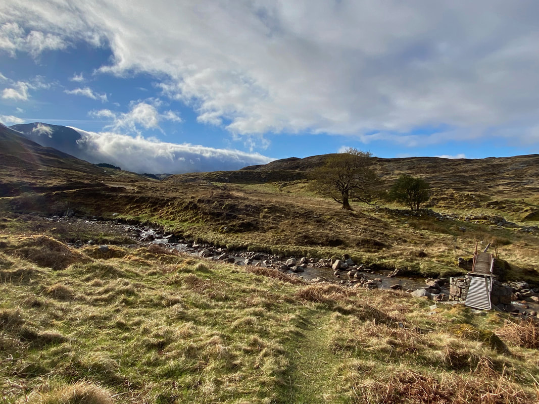
The footbridge over the River Traligill. My route did not cross this bridge but one further up to the left. Whilst the weather looked clear at the moment I was just a bit concerned about that cloud engulfing the southern slopes of Conival ahead.
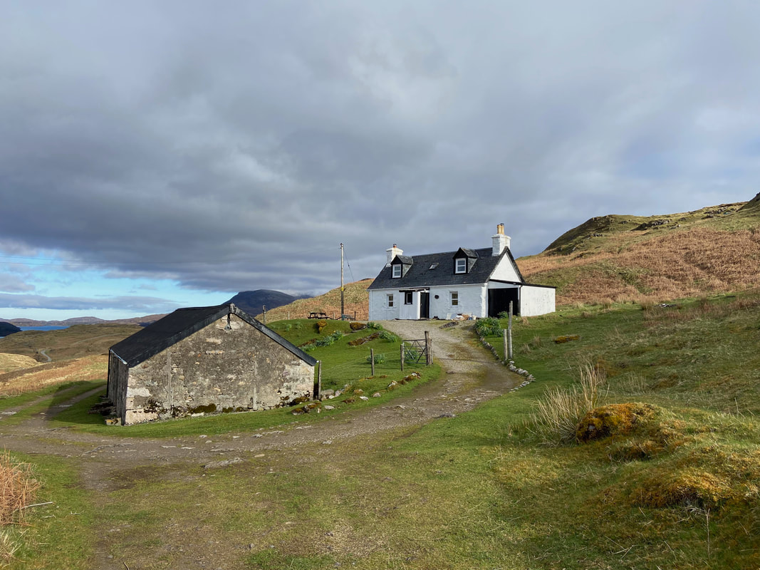
Glenbain Cottage - a former Shepherd's House which is now holiday accommodation - link here
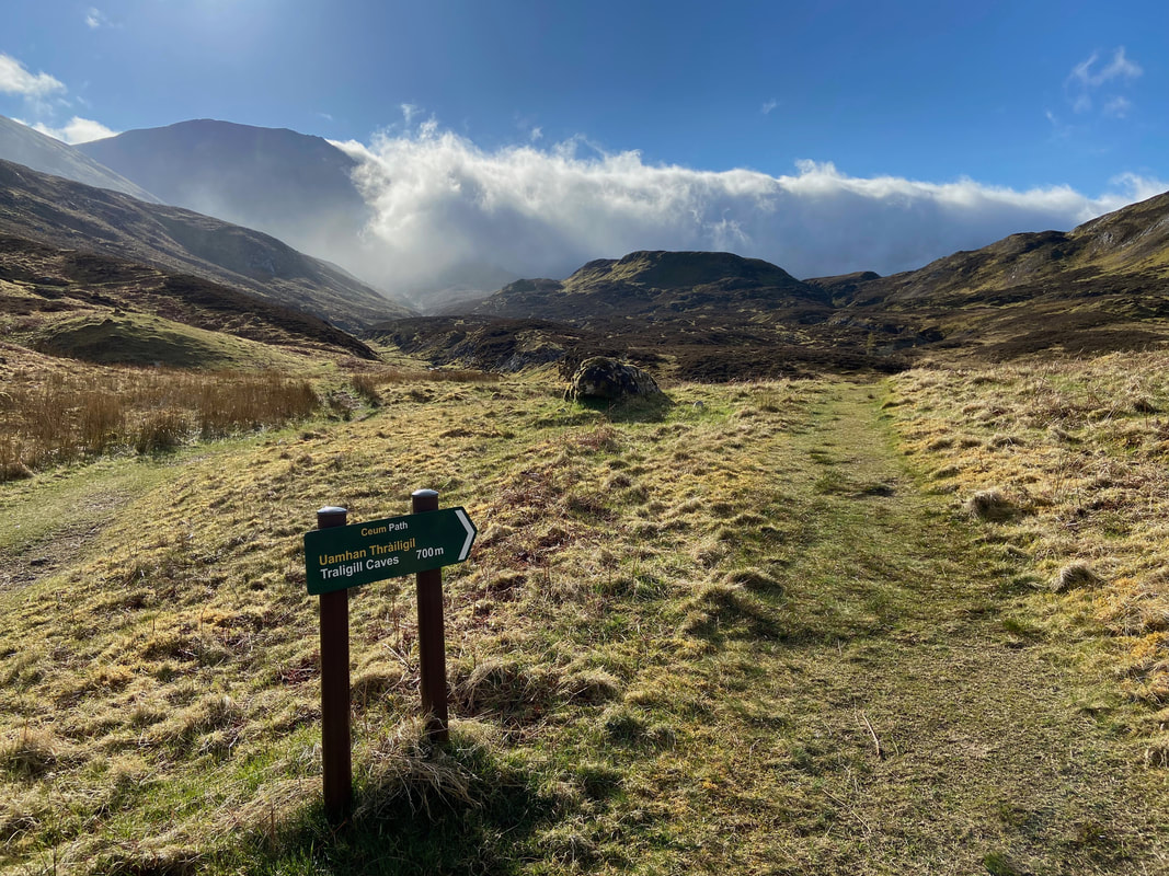
The path splits at Grid Reference NC 27063 21048. I was off to the right in order to pay a brief visit to Traligill Caves - the main path heads left and would be my return route. As can be seen over Conival, the cloud was rolling in and didn't look promising.
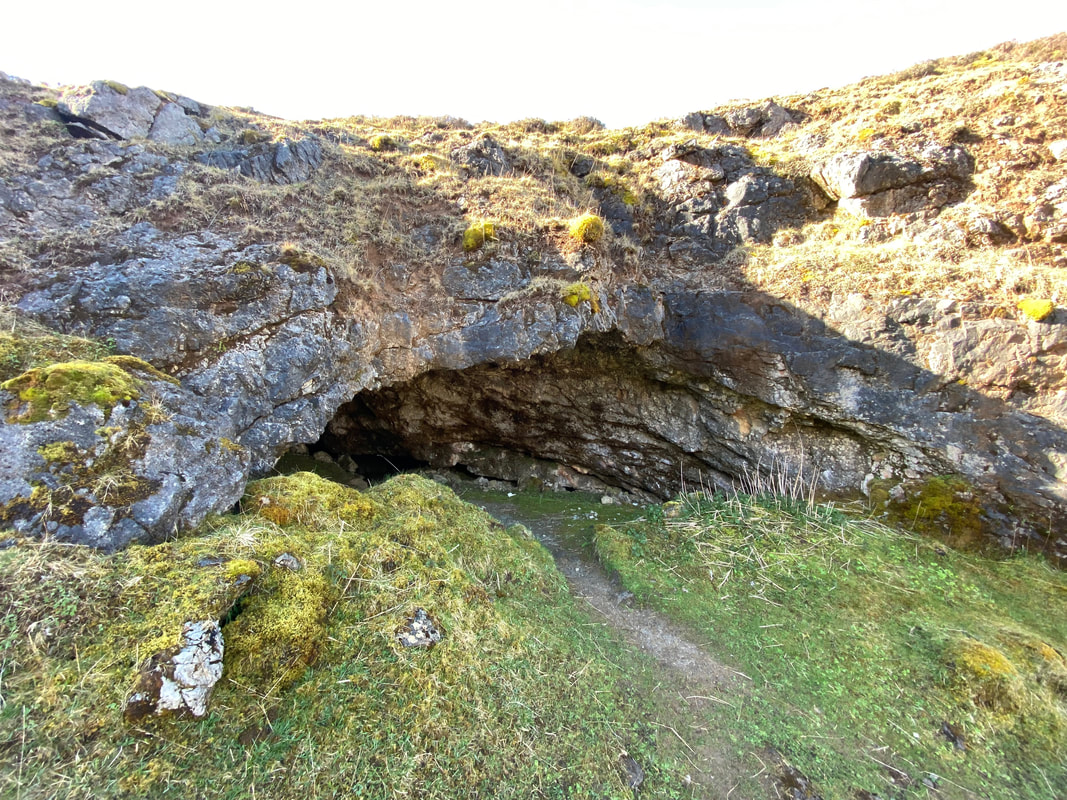
One of the three large entrances to Traligill Caves. One of these entrances is called the 'Waterslide' and the cave system contains several drops into large holes. The caves should only be explored by experienced cavers or with a qualified guide.
The sun hits the lens as I make my way the 200 yards or so over rough ground to rejoin the main path to Gleann Dubh
Having crossed the River Traligill I was now back on the main path through Gleann Dubh
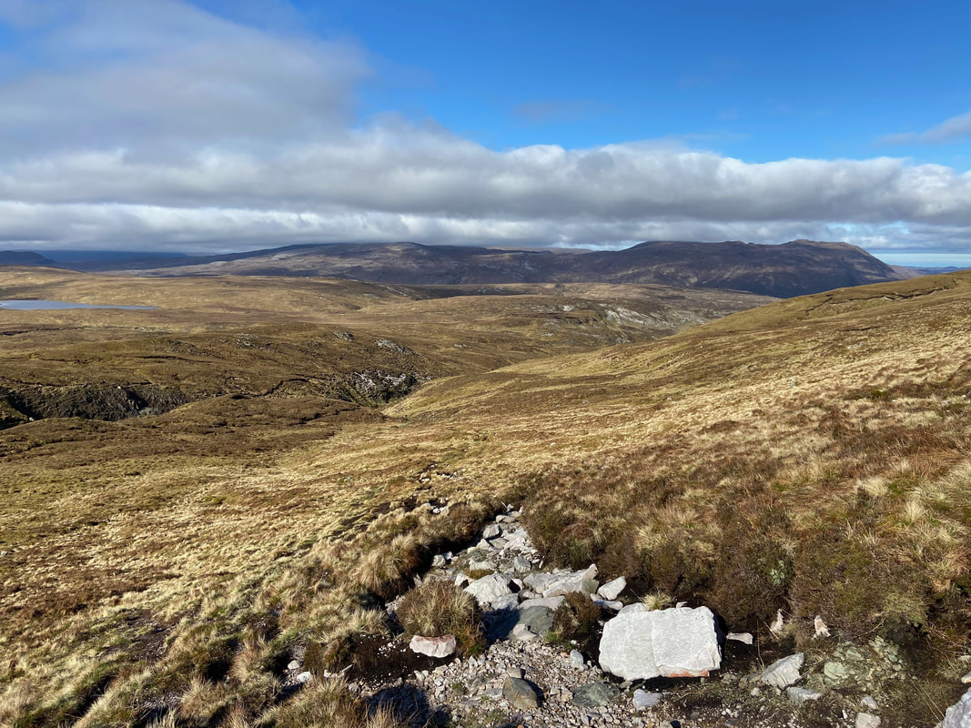
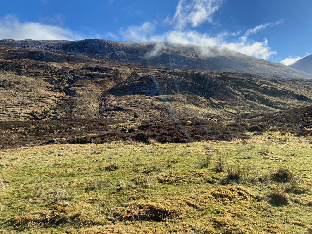
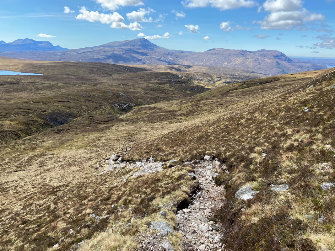
Having exited Gleann Dubh I now started to climb steeply to handrail the burn of Allt a' Choinne Mhill. As explained in the "Terrain" description above, I was now following a decent path but this was not detailed on the OS Map.
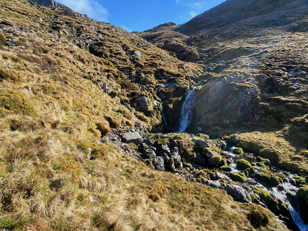
Whilst steep, the climb up the burn was packed full of small cascades and waterfalls
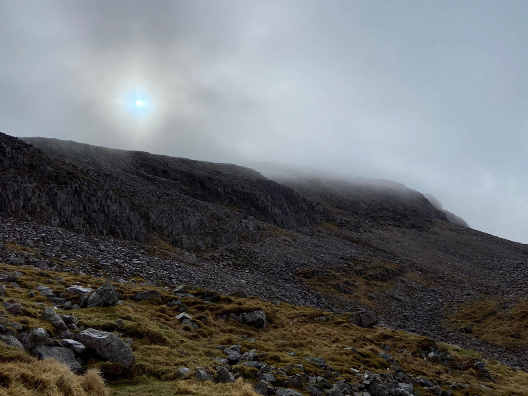
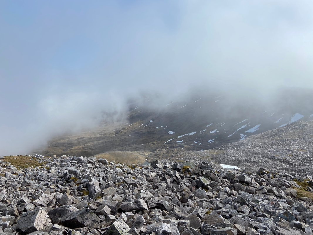
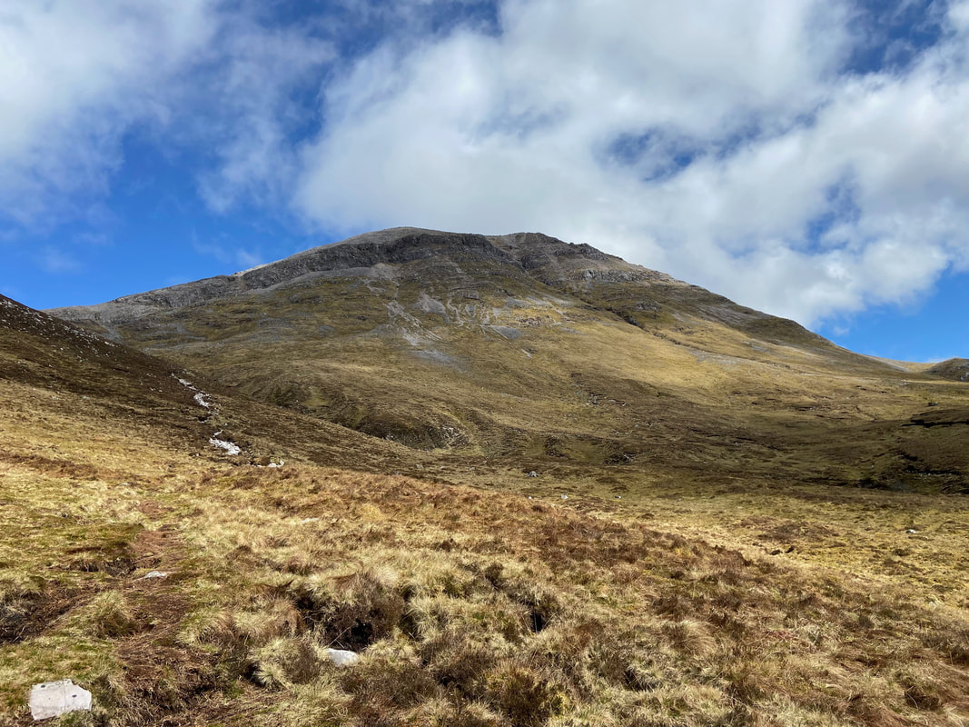
The lower slopes of Conival were now a mass of cloud which didn't bode well for the rest of my walk. Would I get lucky later? Read on to find out!
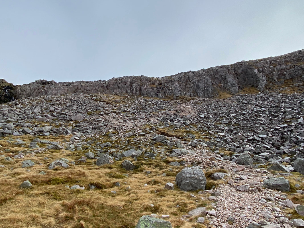
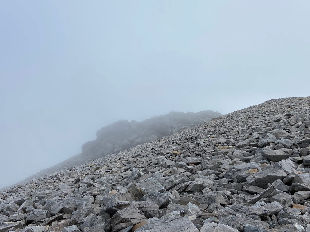
Leaving the burn there now began a short transit over loose rock followed by a brief scramble in order to gain the ridge to Conival
Looking back down my route of ascent from the rocky scramble
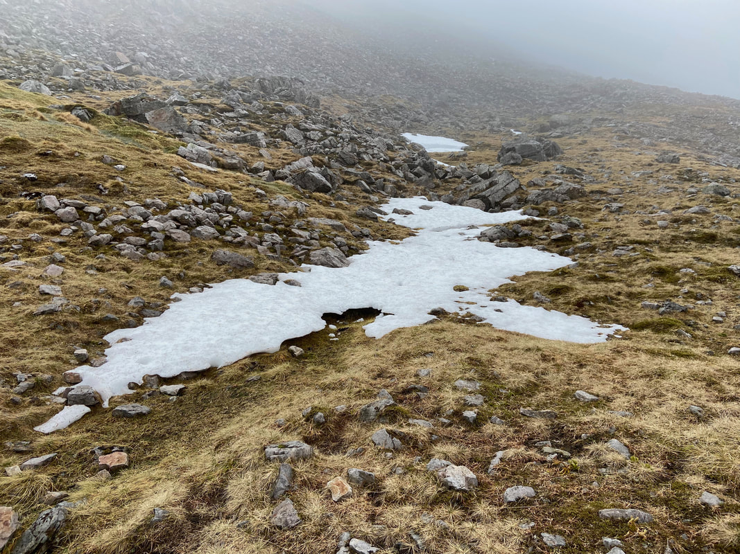
The 1st of May and there was still snow about - quite normal for Scotland
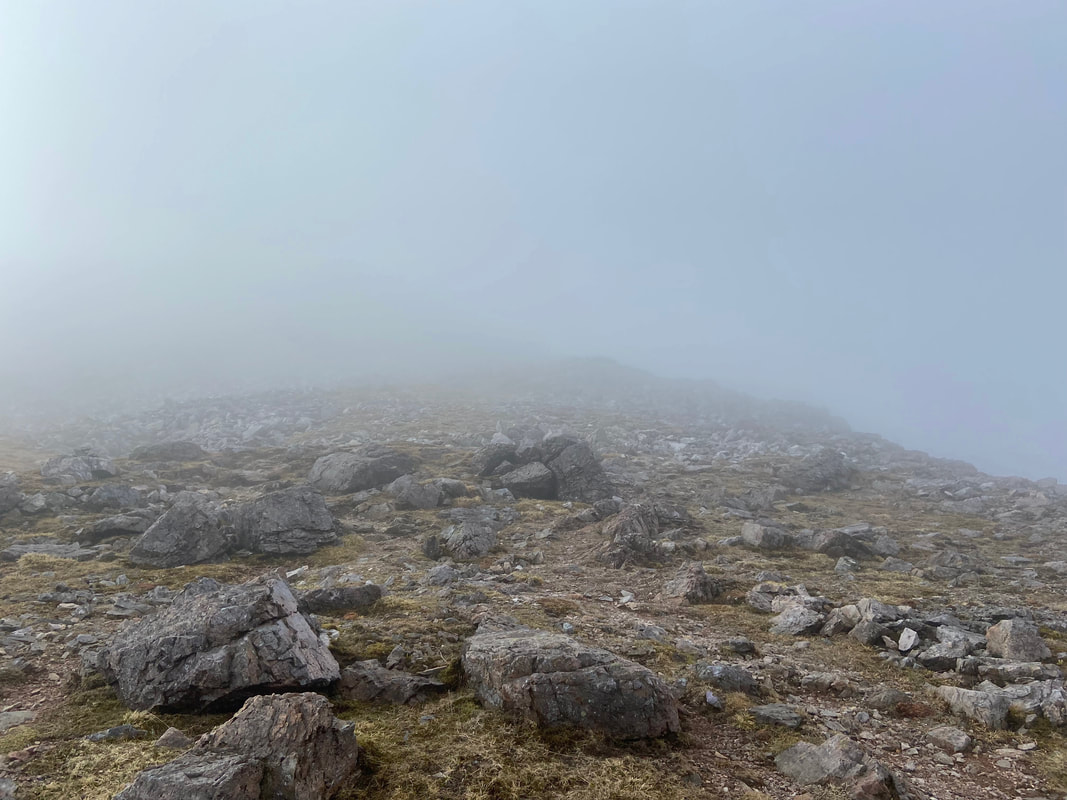
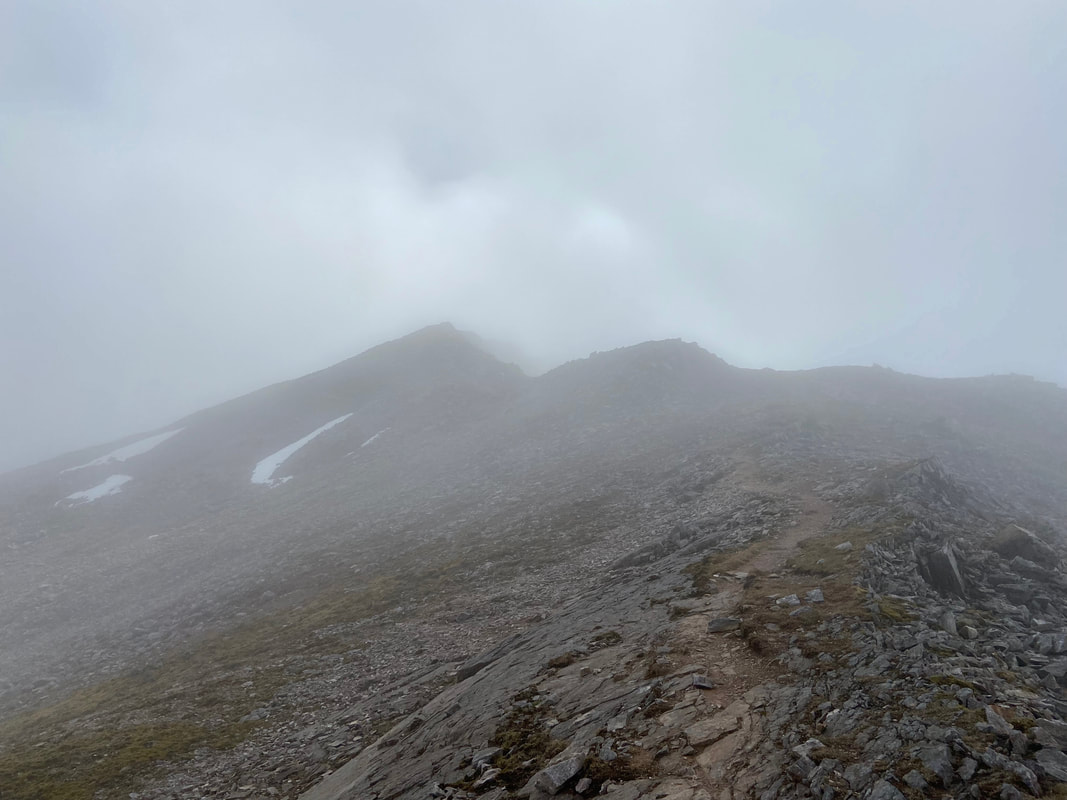
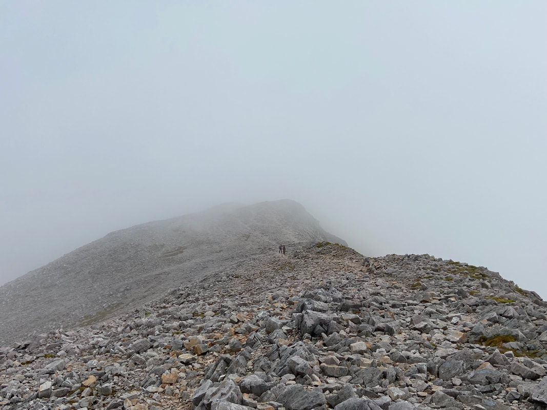
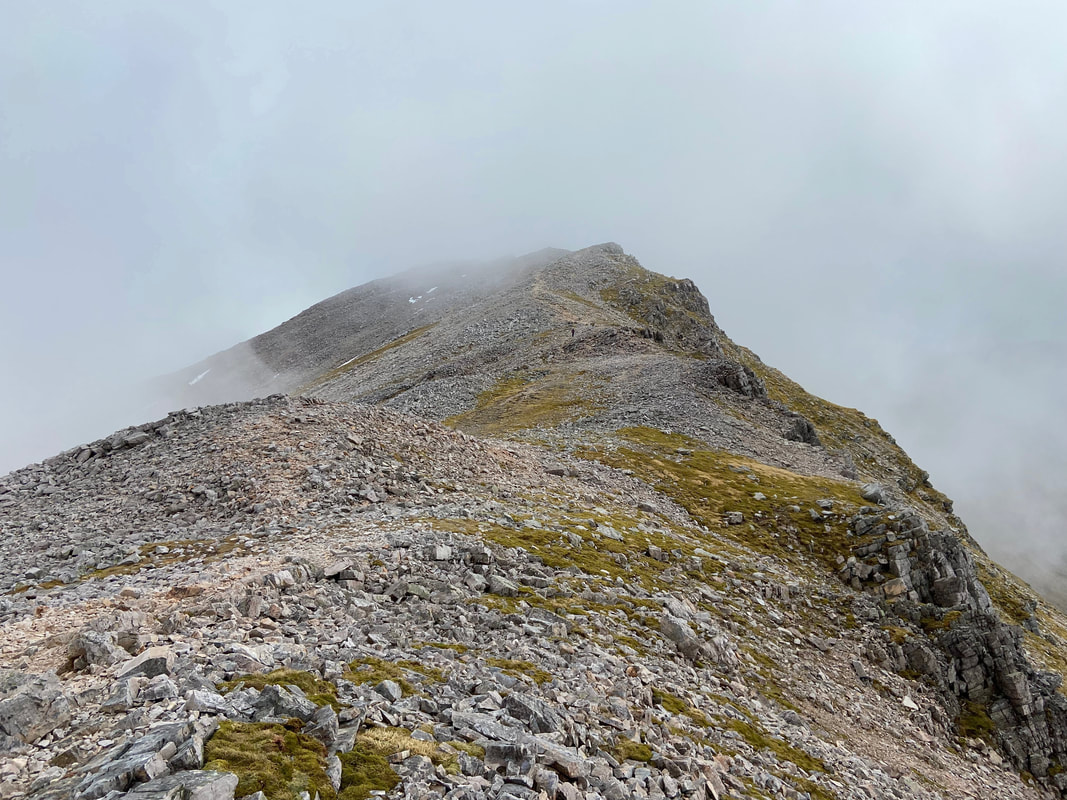
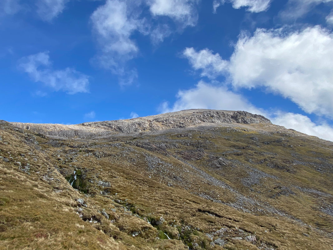
The final ridge to Conival and just as I envisaged - the cloud was here in abundance
As I made my way to Conival's summit the cloud broke and I suddenly realised that I may get away with intermittent clag and not be in a continuous bowl of thick grey soup.
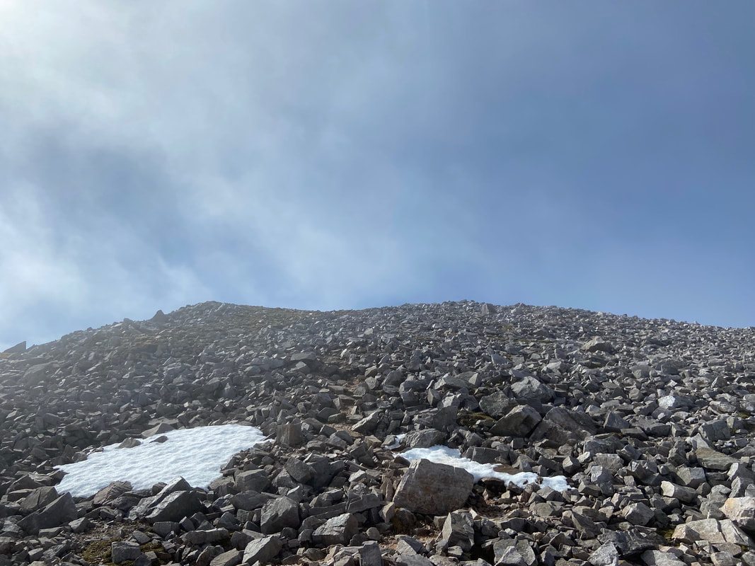
Hopefully I would be in for some more atmospheric shots like this as I neared the top of Conival
The final stretch of minor undulations to reach the summit of Conival
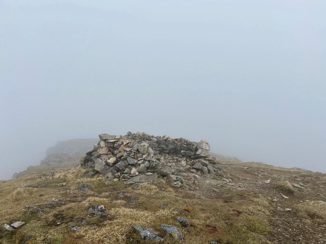
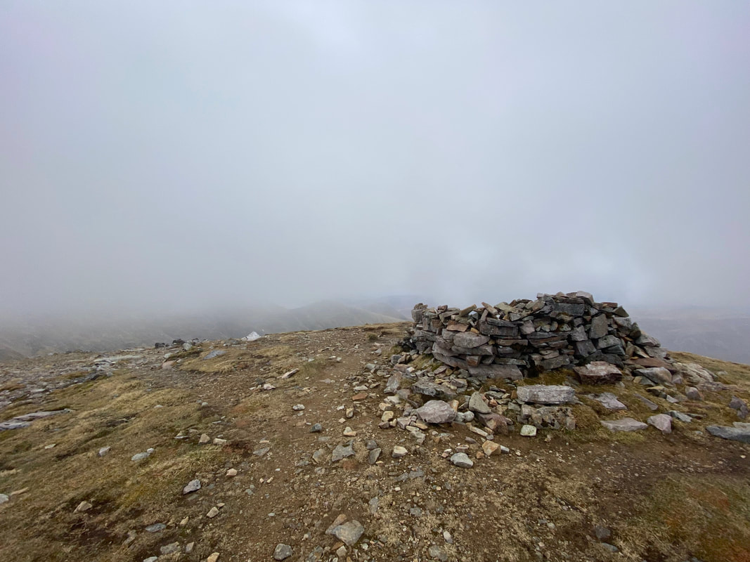
The shelter which marks the 3238ft (987m) summit of Conival - higher than Scafell Pike
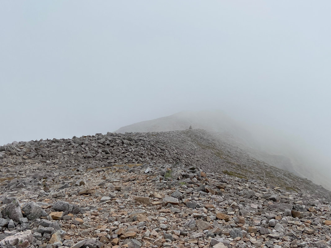
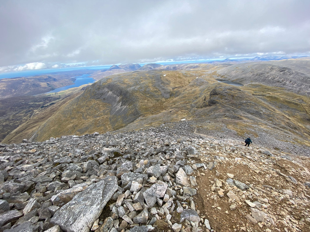
From what I could see, my transit over to Ben More Assynt would be a stony one but on a good path
As I left the summit of Conival, I met a Mother & Daughter who were out Munro Bagging. After a brief chat I let them crack on whilst I followed sedately behind them. I met them later on at the summit of Ben More Assynt where they very kindly took my photograph.
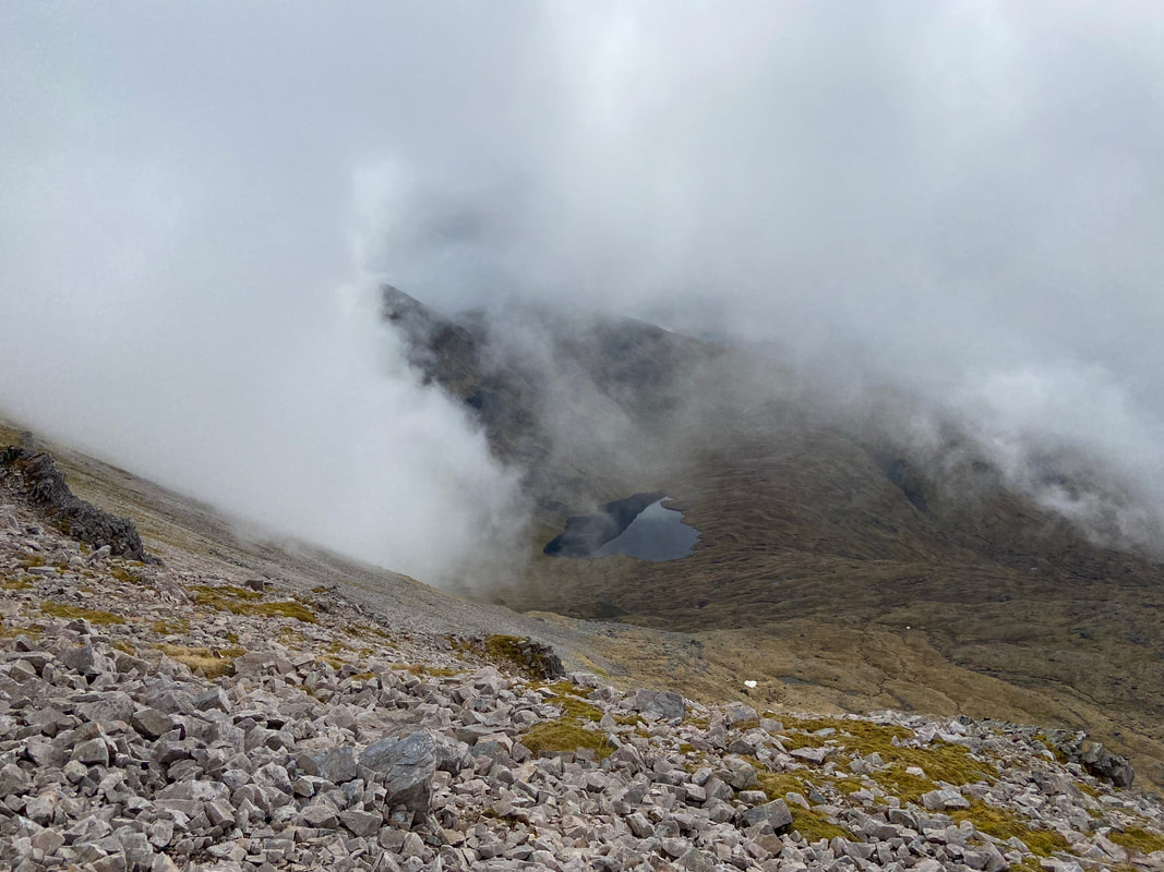
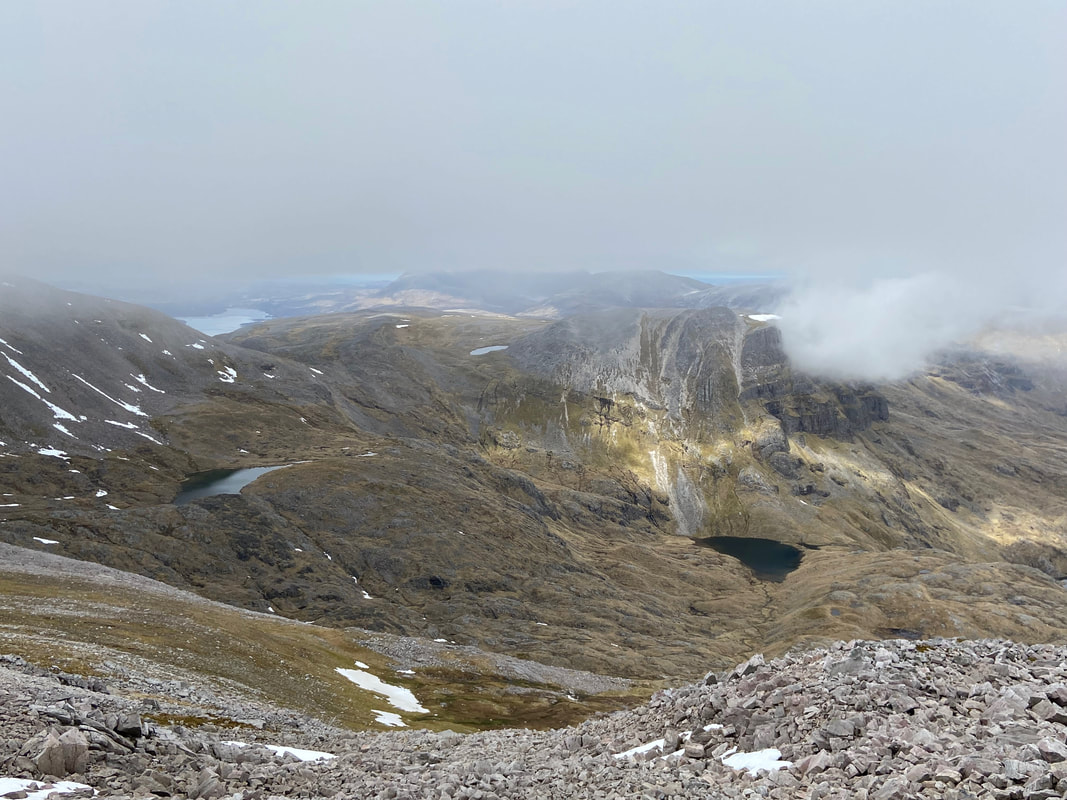
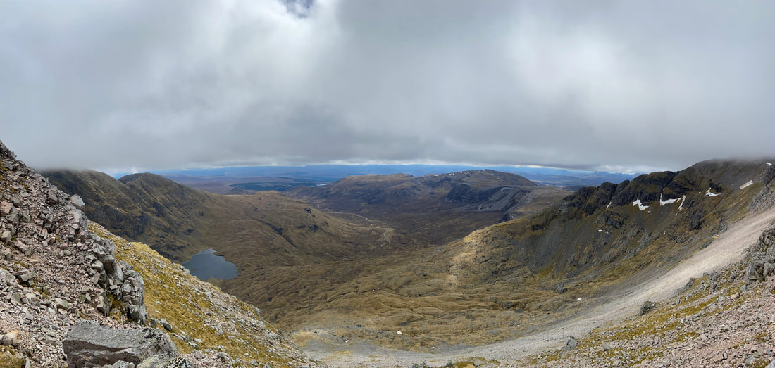
Looking down into Garbh Choire from the transit to Ben More Assynt - the body of water is Dubh Loch Mor
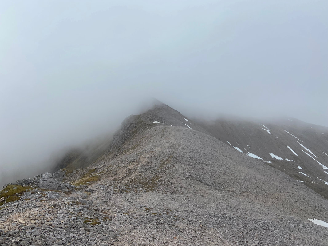
Transiting the wide arête to the summit of Ben More Assynt. At this point the low cloud was still hanging around however I had the feeling that I might get lucky soon and it would clear totally.
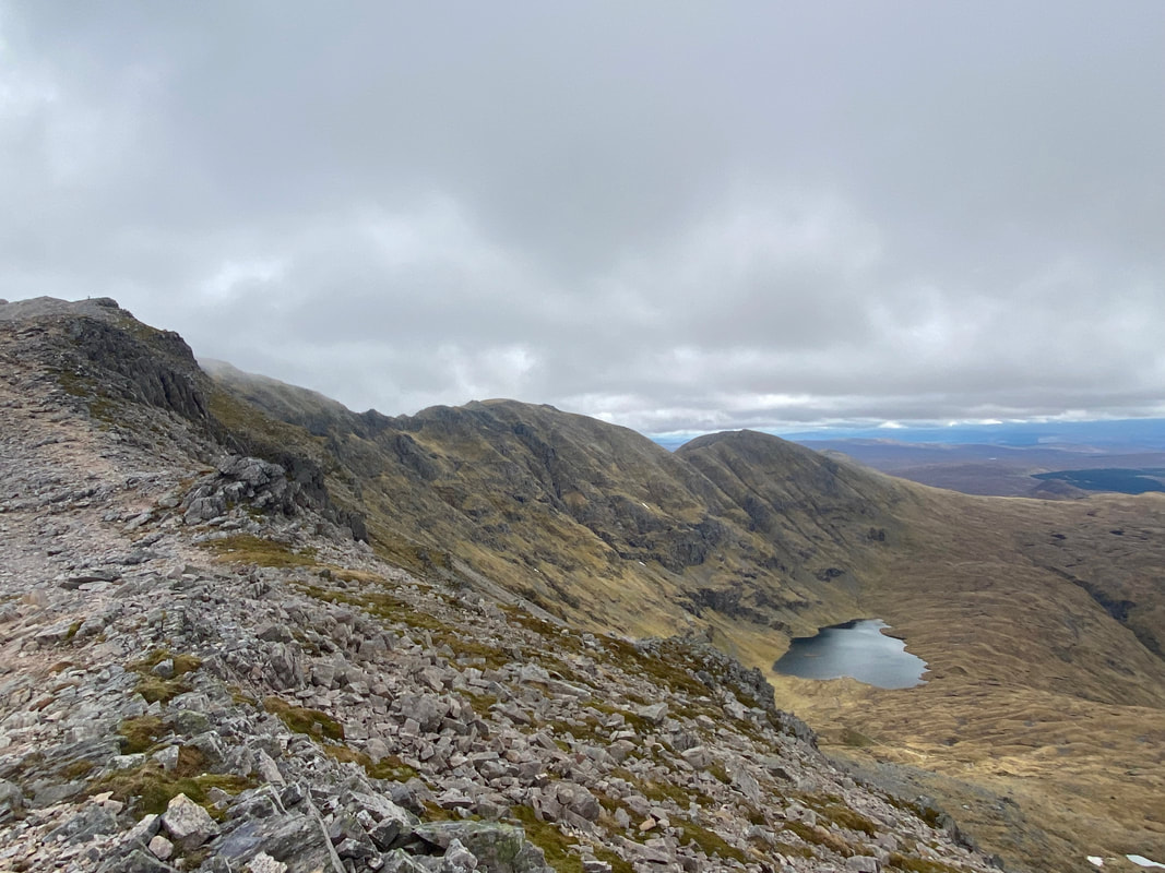
Looking back to Conival from the arête
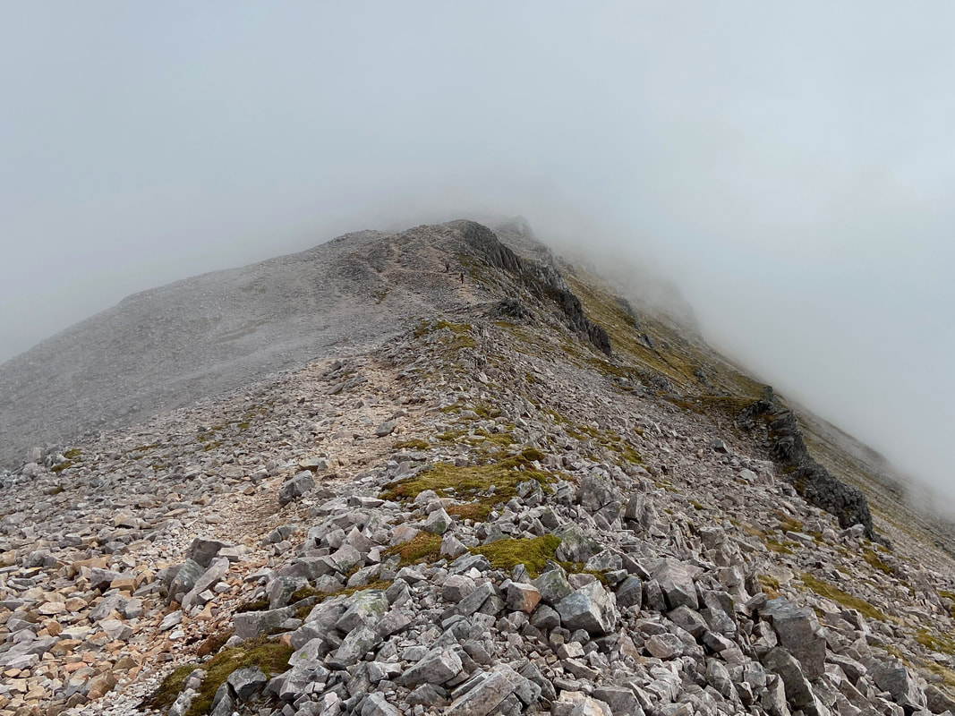
Continuing along the arête to Ben More Assynt with the summit almost in sight. This was a cracking ridge walk.
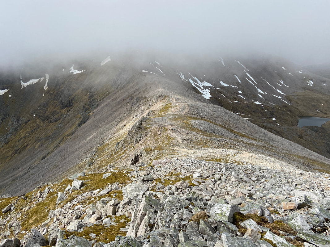
Another view back towards Conival - the visibility was improving all the time
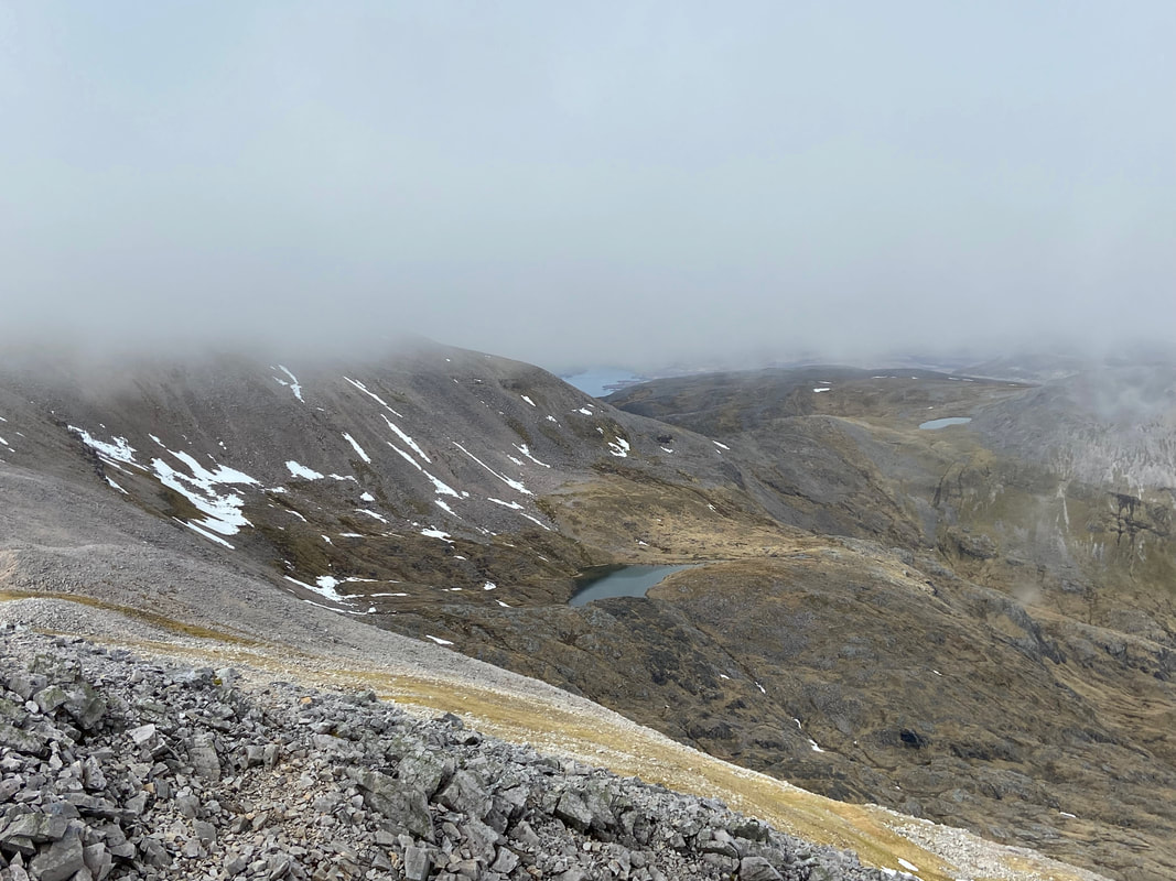
Looking down to Coire a' Mhadaidh with Loch Assynt distant
I was not far from the summit now as I look back once again towards Conival
Nearing the summit of Ben More Assynt - just one last short climb
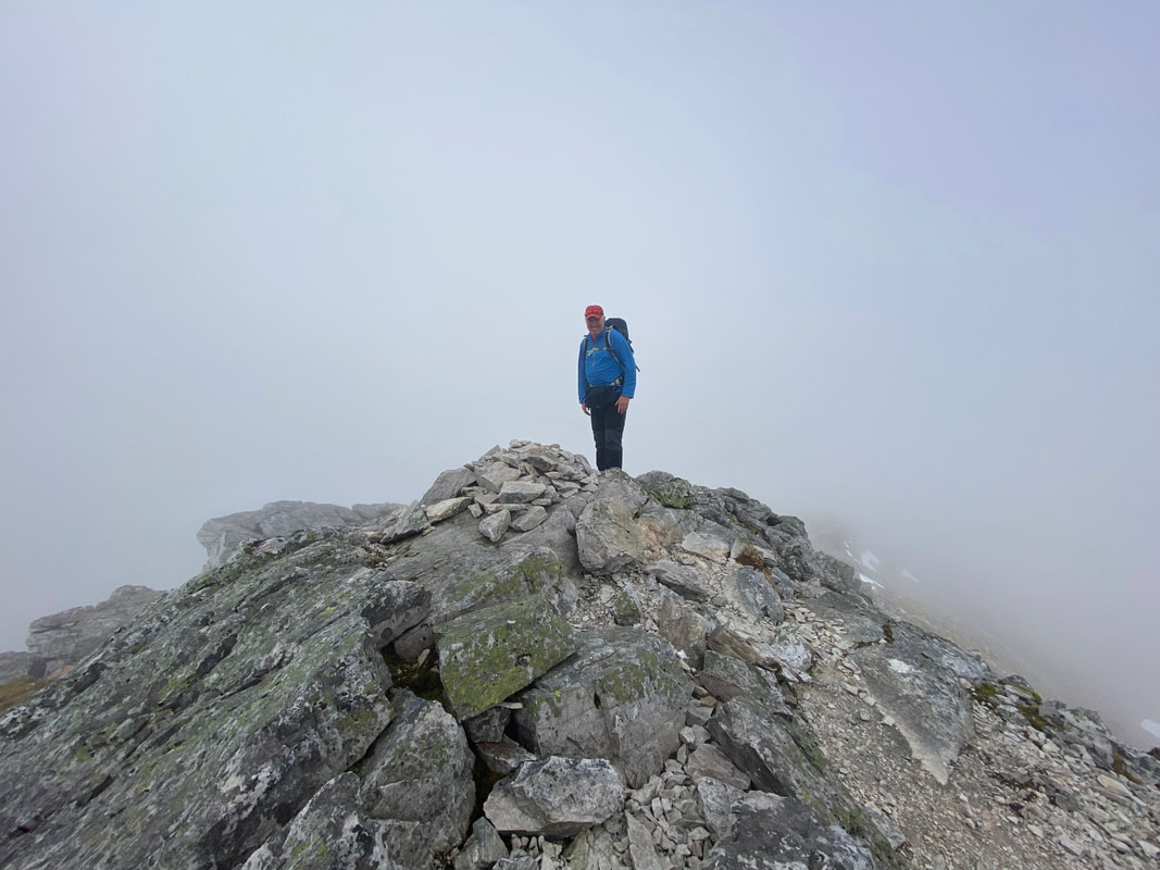
Yours truly on the 3274ft (998m) summit of Ben More Assynt
An improving view into Coire a' Mhadaidh as I leave the summit of Ben More Assynt
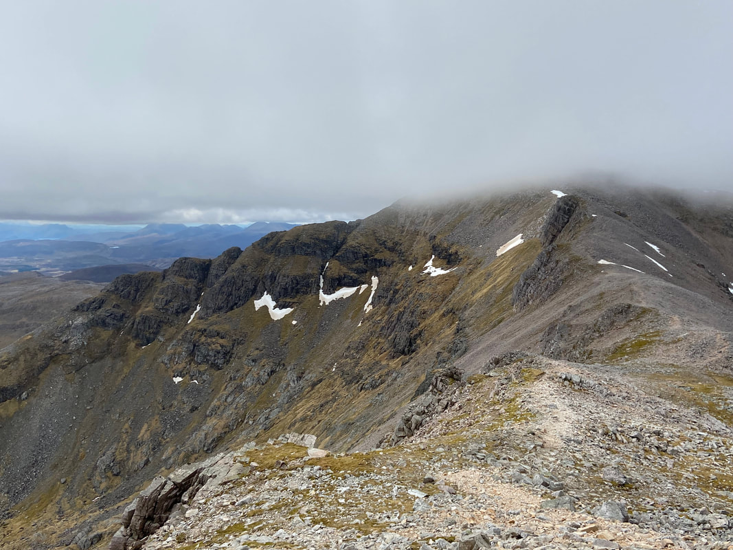
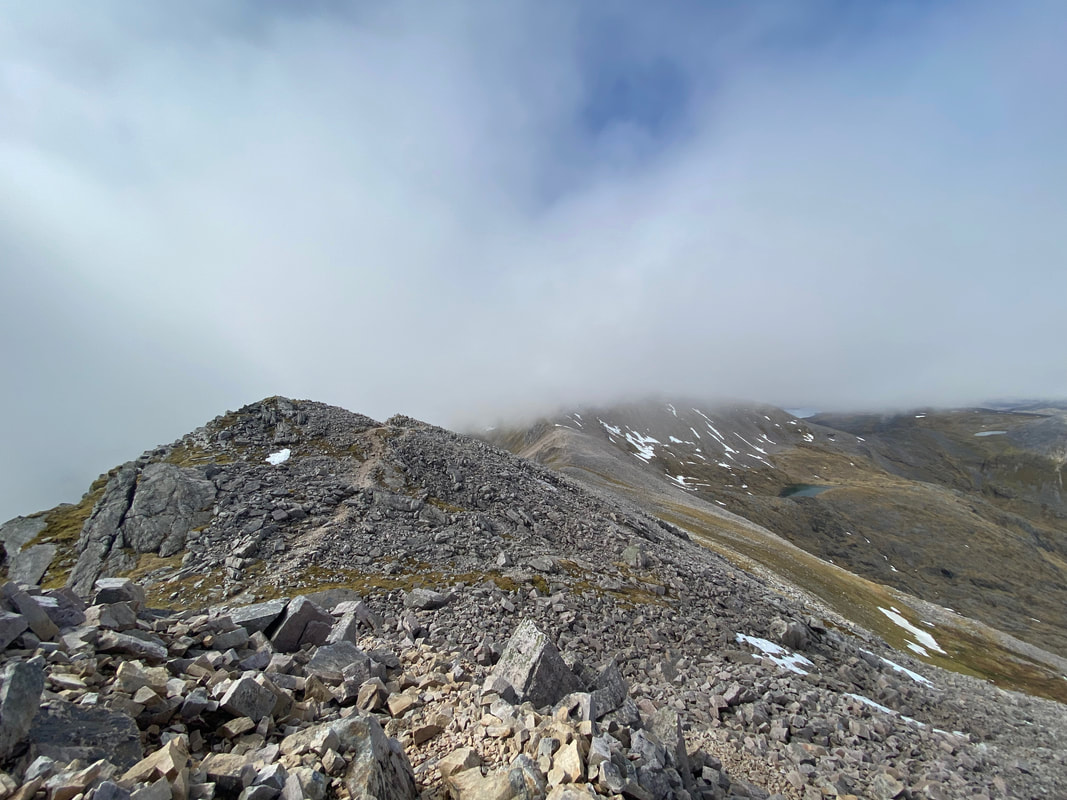
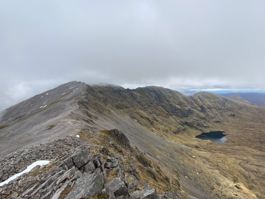
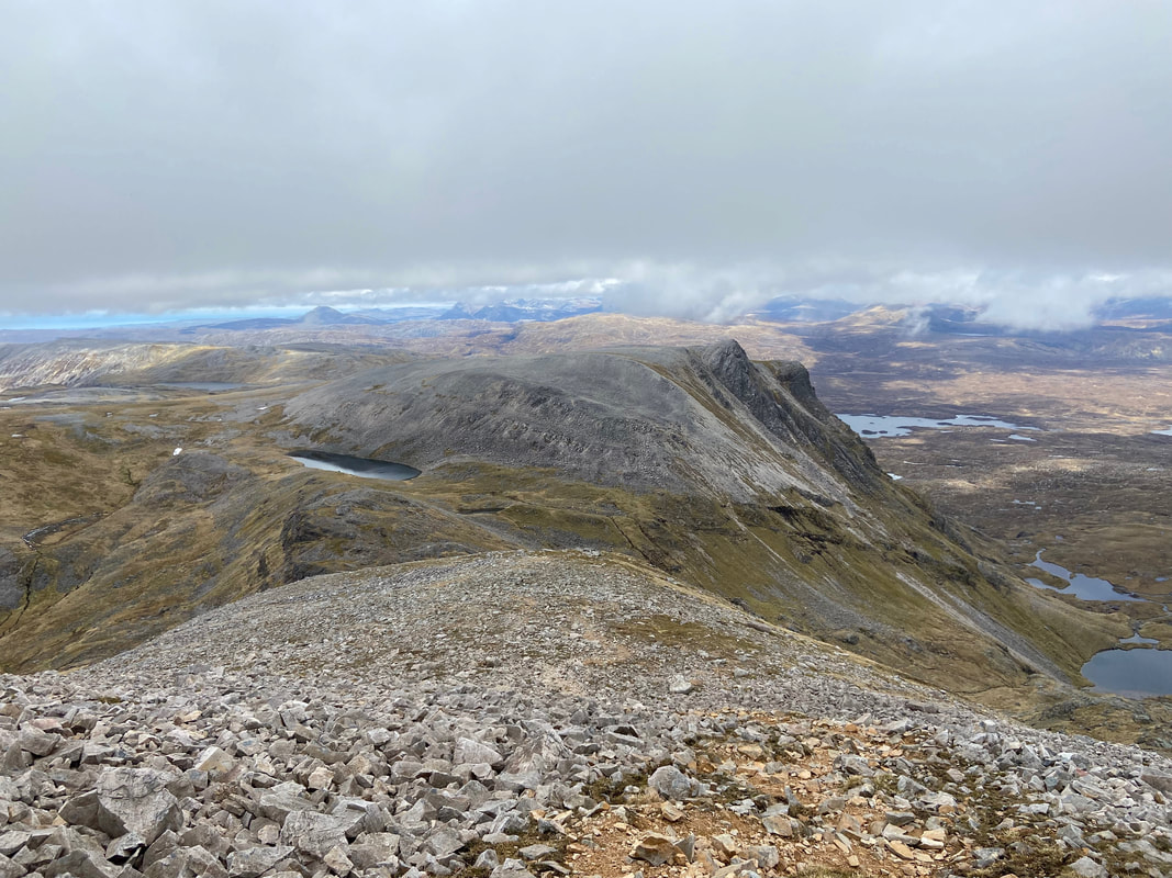
Really clearing up now as I make my way back to Conival with a cracking view of its south ridge
The south ridges of Ben More Assynt & Conival. I did contemplate doing a quick out and back to visit the south top of Ben More Assynt (left of shot) but decided not to.
A closer look at Garbh Choire & Dubh Loch Mor with Ben More Assynt's south top clearly visible
The view back along the arête from near Conival's summit to Ben More Assynt
Conival's summit once more and a pretty similar view last time I was here about an hour ago
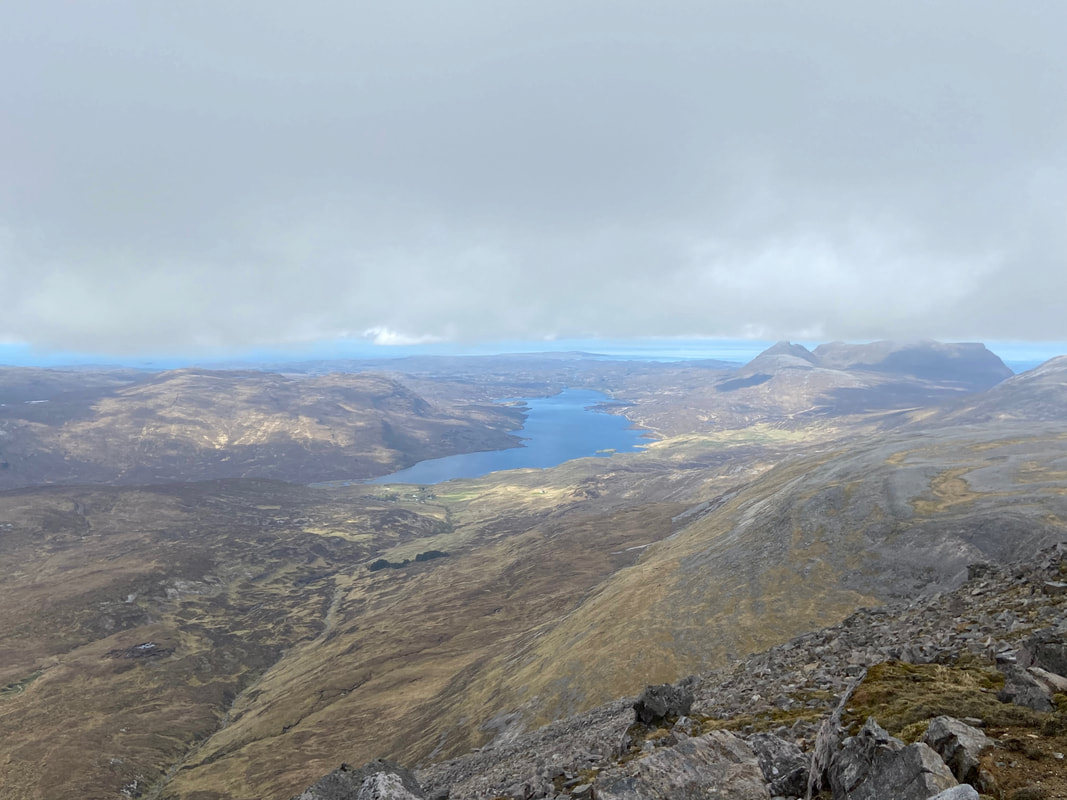
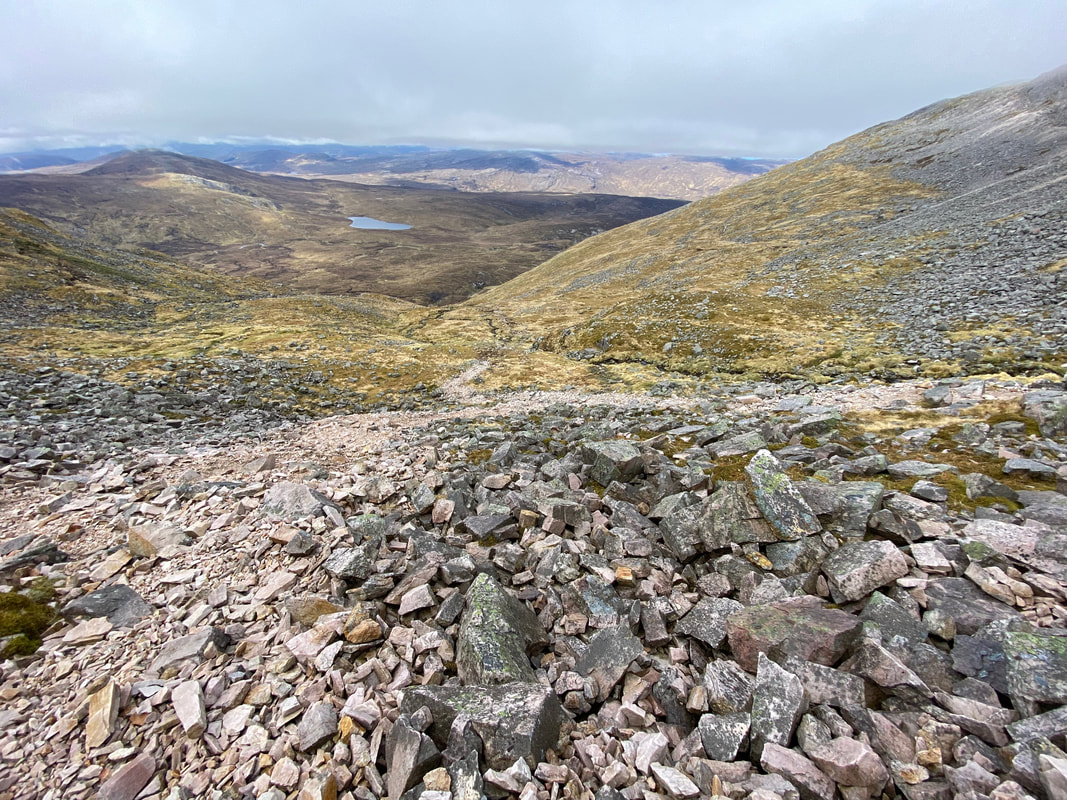
It was now time to begin my descent from Conival by the exact same route. Ahead of me is Loch Assynt with Inchnadamph centre left.
The steep and stony descent of Conival via the north ridge. The mountain immediately ahead of me is Na Tuadhan.
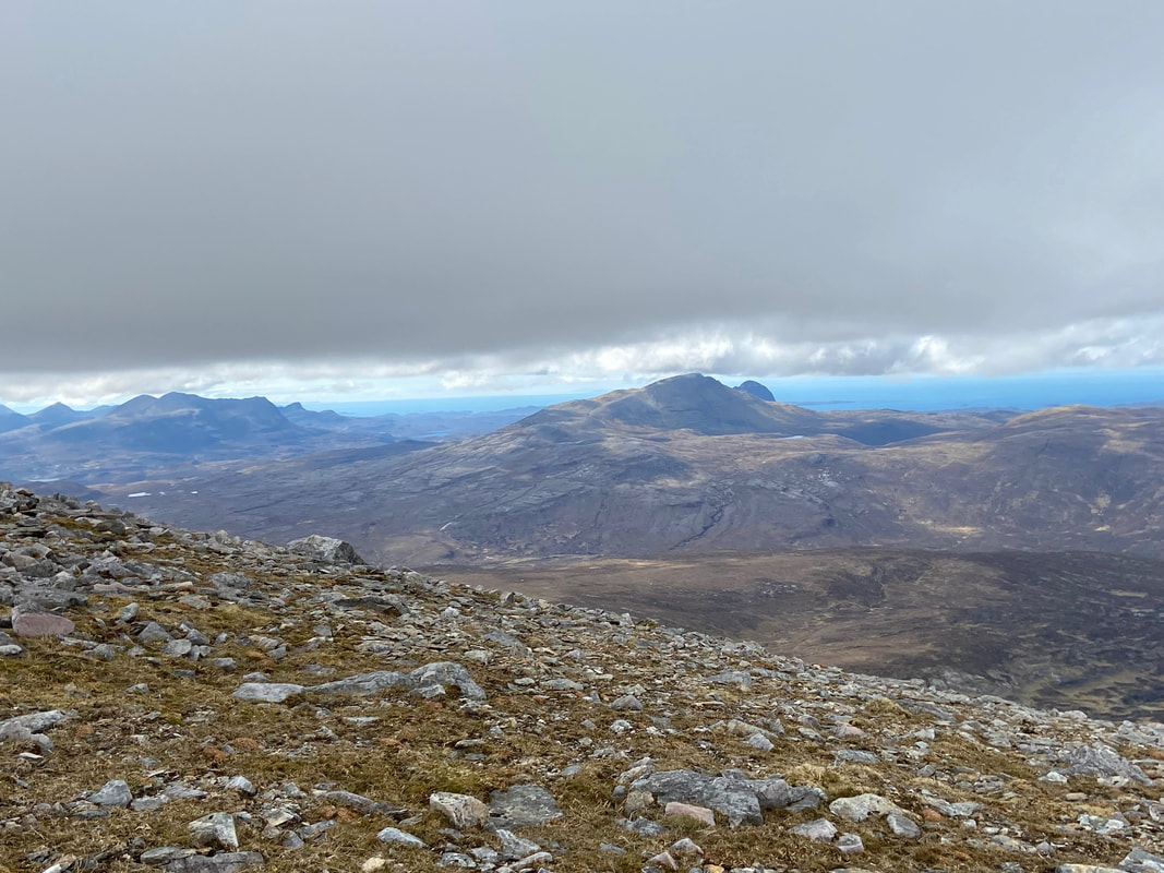
With the low cloud now disappearing I was afforded excellent views over to the south west to Cul Mor (left), Canisp & Suilven (centre right).
As I made my descent of the ridge I was passed by another walker who was in such a hurry I thought he was late for a dinner date or something. He was one of only 3 walkers I saw all day.
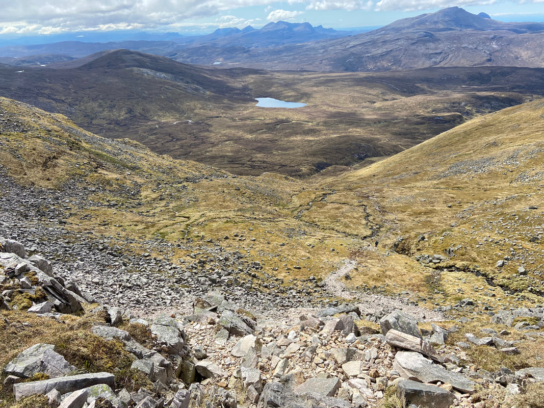
Another view over to the south west and Loch Mhaolach Coire. The mountain to the left of the loch is Beinn nan Cnaimhseag.
Descending from Conival's north ridge back to Gleann Dubh - just look at that blue sky.
Approaching Gleann Dubh
One last look at Conival before I enter Gleann Dubh
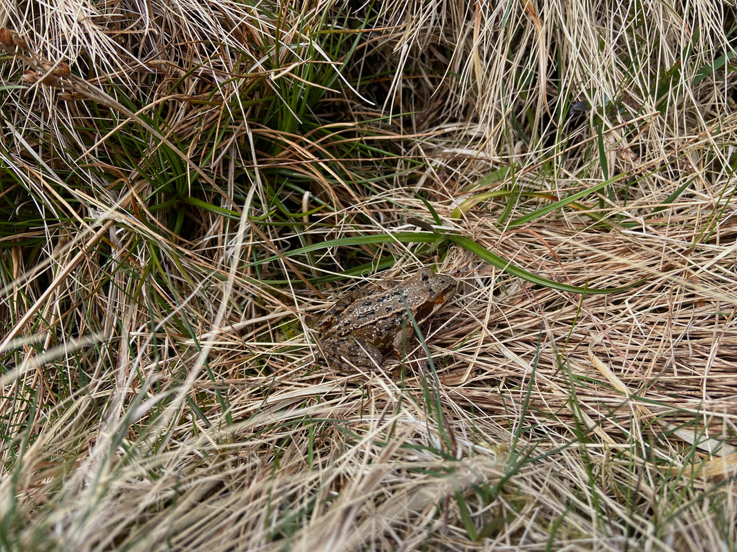
Almost stood on this little chap - if I had he would have been hopping mad!
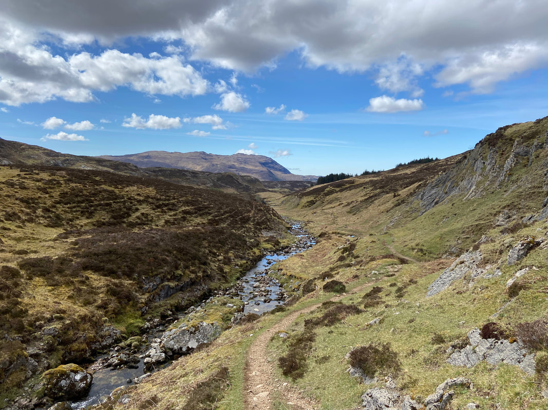
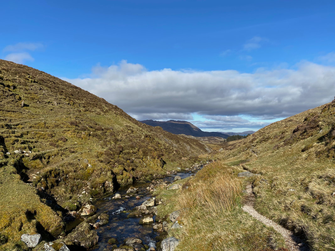
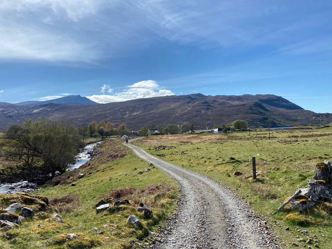
Gleann Dubh
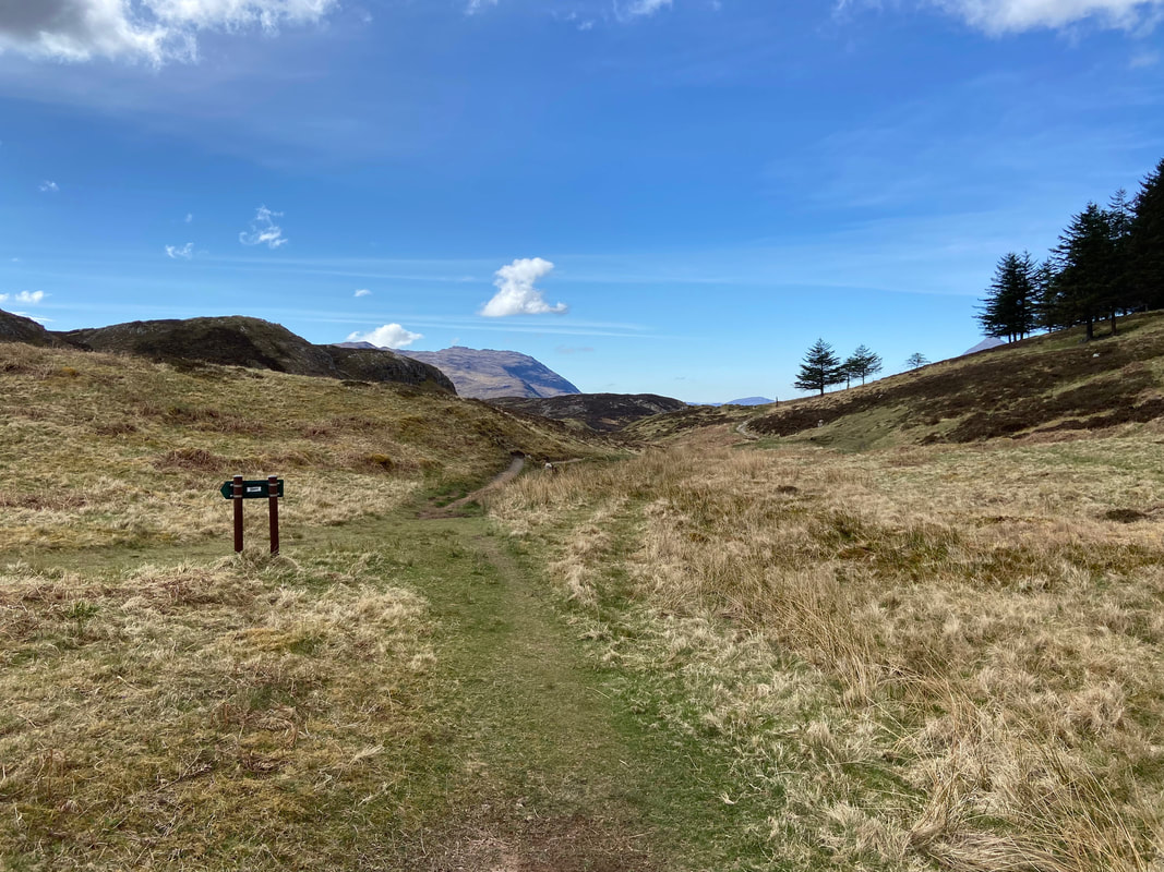
Back at the fork with the path to Traligill Caves going off to the left - I was going straight on to Inchnadamph
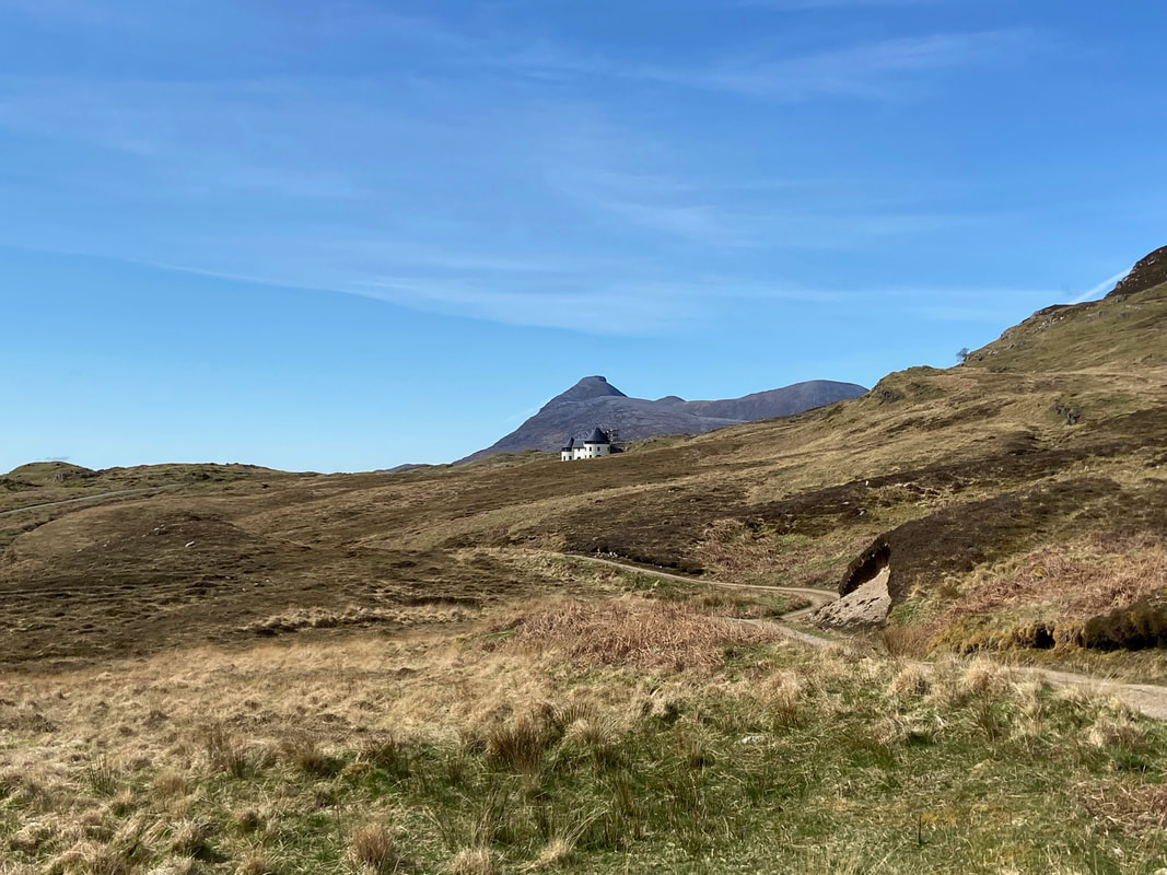
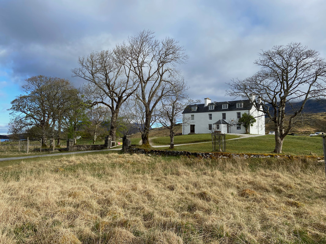
Nearing Inchnadamph I spotted a lovely looking property over to the right. This is Inchnadamph House - a three-storey house which was built in 2013 by the renowned architect, Lachie Stewart. The property is available to rent.
The final few yards back to Inchnadamph after a stunning day on two classic Munros