Ennerdale to Wasdale Head - Wednesday 10 January 2024
Route
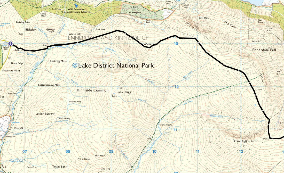
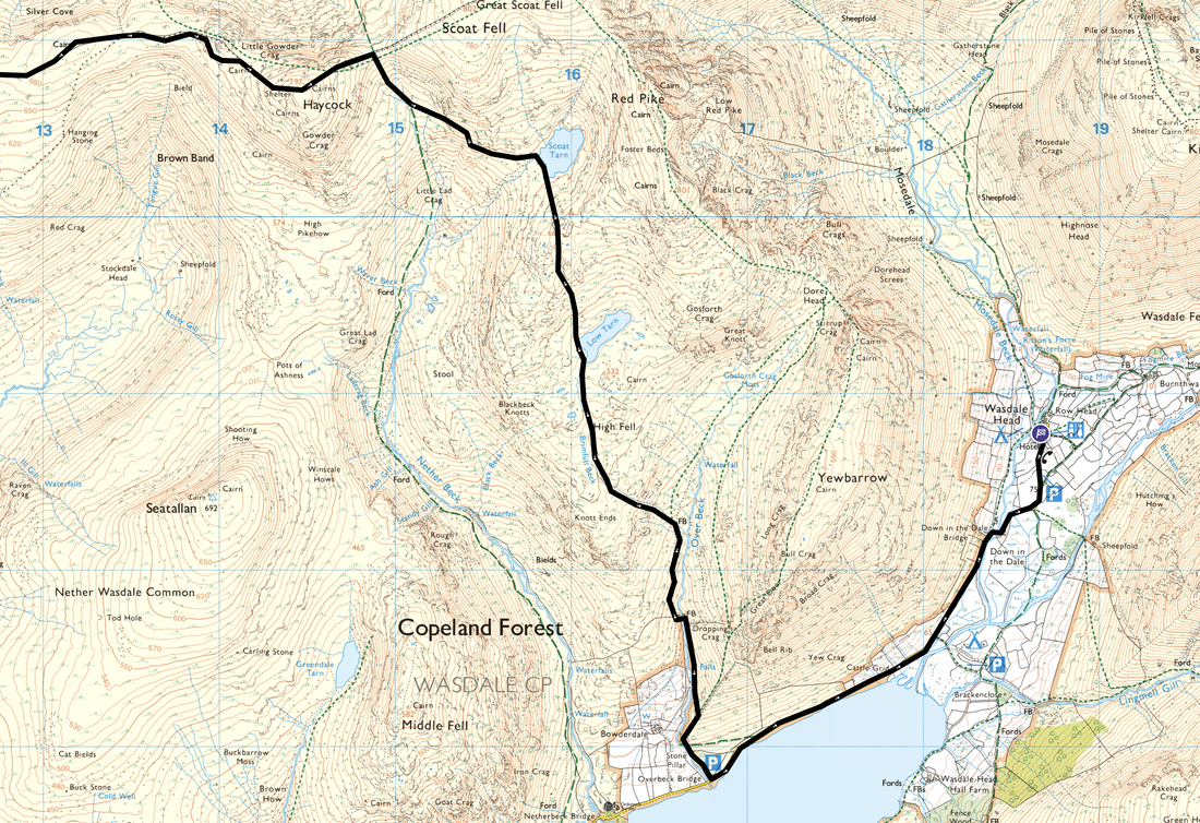
Whorl Gill - River Calder - Whoap - Iron Crag - Caw Fell - Little Gowder Crag - Haycock - Scoat Tarn - Low Tarn - High Fell - Overbeck Bridge - Down in the Dale Bridge - Wasdale Head - Burnthwaite Farm
Parking
Not required as Angie dropped us off at Whorl Gill and met us at Wasdale Head as we were staying at Burnthwaite Farm
Mileage
12.4 miles
Terrain
Good paths for the most part although from the turn off on the Nether Beck path below Haycock via Scoat & Low Tarns to Over Beck the going was over pathless terrain. Whilst pathless, the going was surprisingly good.
Weather
Overcast at the start but brightened up in the afternoon. I had some low cloud but the visibility was surprisingly good.
Time Taken
6hrs 25mins
Total Ascent
2342ft (714m)
Wainwrights
2
Map
OL4 The English Lakes (North Western Area)
Walkers
Dave & Fudge
GPX File
|
|
If the above GPX file fails to download or presents itself as an XML file once downloaded then please feel free to contact me and I will send you the GPX file via e-mail.
Route Map
A lovely linear walk today. We were staying over in Wasdale in the evening therefore whilst Angie drove around there from home, Fudge and I decided to walk over via Caw Fell & Haycock etc. We sort of made the route up as we went along today however if the weather remained favourable then we intended to visit Scoat Tarn & Low Tarn. Here we are crossing a ford near the River Calder on our way up to the first of todays fells - that of Whoap.
Whoap ahead now as we near the start of the short climb to gain the summit
Lank Rigg across Kinniside Common
Looking over to Grike from the ascent of Whoap
It was extremely cold today as can be seen by the solid icy patches. It wasn't quite micro spike weather however they were in my rucksack just in case I needed them.
Blakeley Raise & Grike from Whoap
Arriving at the small cairn & boulder on Whoap. The highest point is a short distance to the east.
The summit of Whoap looking to Lank Rigg - Fudge acts as a temporary cairn (unpaid)
From Whoap we headed east to join the wall which would lead us all the way to Caw Fell. On the way it passes the cairned summit of Iron Crag with Haycock & Caw Fell over to the right.
Continuing to follow the wall, the path drops into a depression below Caw Fell. Where the wall heads to the right there is a stile which I crossed to then head up the left hand side of the wall to gain the ridge.
Looking back to Iron Crag from just below Caw Fell
The summit of Caw Fell looking to Iron Crag - Fudge gives me his "is it lunchtime yet" look
From Caw Fell we now headed over to Haycock which is ahead with Little Gowder Crag centre left
The weather decided to close in therefore we sat down against the wall and had our lunch whilst the cloud cleared off. As is usual, Fudge hoovered his down straight away then started to scrounge mine. Having been told "no", he turned his back on me for a good old sulk.
Passing Little Gowder Crag on our way to Haycock
The summit of Haycock
From the summit we dropped down into the col between Haycock & Scoat Fell. At the bottom we would be heading to the right on to the Nether Beck path - the route to the left returns to Ennerdale via Tewit How.
Looking down the Nether Beck path to Middle Fell, Wastwater, Whin Rigg & Illgill Head
After a few hundred yards on the Nether Beck path I headed off piste to pass this split boulder which Wainwright drew in his Western Fells Pictorial Guide (Scoat Fell 5). My aim was to stay around the 600m contour as best I could to then drop down to Scoat Tarn.
Scoat Tarn
Another view of Scoat Tarn - absolutely nobody here
Haycock from near Scoat Tarn
Seatallan over Nether Beck
Dropping down to Low Tarn with Yewbarrow beyond - that shoreline looks a bit icy from here
The icy shoreline of Low Tarn - not even Fudge could be tempted to have a dip in that
From Low Tarn we headed along the eastern side of Brimfull Beck
As is tradition, Fudge had a bit of an arse about in Brimfull Beck
A last look at Haycock before we headed down to Over Beck
Yewbarrow from the descent to Over Beck
Descending steeply, our route crossed a small footbridge over Brimfull Beck to reach Over Beck beyond
Over Beck and one massive boulder
Bell Rib on Yewbarrow from near Overbeck Bridge
Lingmell, Scafell Pike & Scafell across Wastwater
Fudge in Wastwater and what a backdrop that is
The shoreline of Wastwater looking to Yewbarrow, Great Gable, Lingmell & The Scafells
Lovely evening light as we look to Lingmell from Down in the Dale Bridge
The Wasdale Head Inn - I think it is time for something cold in a warm place
And here it is - a nice pint of Loweswater Gold
Burnthwaite Farm