Masarnen Ramblers
Contact us or visit us on Facebook
  • Home
  • About Us
  • Long Distance Walks
    • Coast to Coast (C2C) 2012 >
      • Planning & Preparation
      • Day 0 - Arrival in Kirkby Stephen
      • Day 1 - St Bees to Ennerdale Bridge
      • Day 2 - Ennerdale Bridge to Rosthwaite
      • Day 3 - Rosthwaite to Patterdale
      • Day 4 - Patterdale to Shap
      • Day 5 - Rest Day in Shap
      • Day 6 - Shap to Kirkby Stephen
      • Day 7 - Kirkby Stephen to Muker
      • Day 8 - Muker to Reeth
      • Day 9 - Reeth to Richmond
      • Day 10 - Rest Day in Richmond
      • Day 11 - Richmond to Danby Wiske
      • Day 12 - Danby Wiske to Ingleby Cross
      • Day 13 - Ingleby Cross to Blakey Ridge
      • Day 14 - Blakey Ridge to Grosmont
      • Day 15 - Grosmont to Robin Hood's Bay
      • C2C - Thoughts in Conclusion
    • Yorkshire 3 Peaks 2013
    • Dales Way 2014 >
      • Day 0 - Arrival in Ilkley
      • Day 1 - Ilkley to Linton
      • Day 2 - Linton to Cray
      • Day 3 - Cray to Ribblehead
      • Day 4 - Ribblehead to Sedbergh
      • Day 5 - Sedbergh to Burneside
      • Day 6 - Burneside to Bowness
      • Dales Way - Thoughts in Conclusion
    • Pennine Way 2015 >
      • Day 0 - Wales to Torside
      • Day 1 - Edale to Torside
      • Day 2 - Torside to Delph
      • Day 3 - Delph to Hebden Bridge
      • Day 4 - Hebden Bridge to Ponden
      • Day 5 - Ponden to Gargrave
      • Day 6 - Gargrave to Malham
      • Day 7 - Malham to Ribblehead
      • Day 8 - Ribblehead to Hawes
      • Day 9 - Hawes to Keld
      • Day 10 - Keld to Bowes
      • Day 11 - Bowes to Middleton
      • Day 12 - Middleton to Langdon Beck
      • Day 13 - Langdon Beck to Dufton
      • Day 14 - Dufton to Alston
      • Day 15 - Rest Day in Alston
      • Day 16 - Alston to Greenhead
      • Day 17 - Greenhead to Saughy Rigg
      • Day 18 - Saughy Rigg - to Bellingham
      • Day 19 - Bellingham to Byrness
      • Day 20 - Byrness to Trows Farm
      • Day 21 - Trows Farm to Kirk Yetholm
      • Thoughts in Conclusion
    • Sarn Sabrina 2015
    • Mortimer Trail 2016 >
      • Mortimer Trail - Day 1
      • Mortimer Trail - Day 2
    • Coast to Coast (C2C) 2016 >
      • C2C Planning & Preparation
      • Day 0 - Arrival in Kirkby Stephen
      • Day 1 - St Bees to Ennerdale Bridge
      • Day 2 - Ennerdale Bridge to Seatoller
      • Day 3 - Seatoller to Patterdale
      • Day 4 - Patterdale to Shap
      • Day 5 - Shap to Kirkby Stephen
      • Day 6 - Kirkby Stephen to Keld
      • Day 7 - Keld to Reeth
      • Day 8 - Reeth to Richmond
      • Day 9 - Richmond to Danby Wiske
      • Day 10 - Danby Wiske to Ingleby Cross
      • Day 11 - Ingleby Cross to Blakey Ridge
      • Day 12 - Blakey Ridge to Egton Bridge
      • Day 13 - Egton Bridge to Robin Hood's Bay
      • C2C - Thoughts in Conclusion
    • South West Coast Path 2017 >
      • SWCP Itinerary
      • SWCP Charity, Planning & Preparation
  • Day Walks
    • Cornwall >
      • Mount Edgcumbe, Kingsand & Rame Head
      • Perranporth to Newquay
    • Cumbria (not Lake District) >
      • Cautley Spout, The Calf, Calders, Arant Haw & Winder
      • Cross Fell
      • Great Coum & Crag Hill
      • High Cup Nick
      • Yarlside, Randygill Top & The Calf
    • Dorset >
      • Charmouth to Bridport
      • Hardy's Monument from Abbotsbury
    • Durham >
      • Cauldron Snout
      • High & Low Force
    • Lake District >
      • Eastern Fells >
        • Birkett Fell, Hart Side & The Dodds
        • Catstycam & Birkhouse Moor
        • Clough Head & Great Dodd
        • Dodds, Clough Head & Raise
        • Fairfield Horseshoe
        • Fairfield, St Sunday Crag, Birks & Arnison Crag
        • Fairfield, Great Rigg & Heron Pike
        • Gowbarrow Fell
        • Great Mell Fell
        • Helvellyn Range
        • Helvellyn, Catstycam & Birkhouse Moor via Striding Edge
        • Little Mell Fell
        • Middle Dodd, Red Screes, Little Hart Crag & High Hartsop Dodd
        • Seat Sandal
        • Sheffield Pike, Raise, Stybarrow Dodd, Watson's Dodd and Hart Side
      • Far Eastern Fells >
        • Caudale Moor & Hartsop Dodd
        • Gray Crag, Thornthwaite Crag, Froswick & Ill Bell
        • Grey Crag, Tarn Crag & Branstree
        • Hallin Fell
        • High Street, Mardale Ill Bell and Harter Fell
        • High Street, Thornthwaite Crag, Gray Crag, Mardale Ill Bell & Harter Fell
        • Kentmere Pike & Shipman Knotts
        • Place Fell - Oct 15
        • Place Fell - Dec 17
        • Rest Dodd, The Nab and Brock Crags
        • Sour Howes, Sallows, Yoke, Ill Bell, Froswick & Thornthwaite Crag
        • Steel Knotts & Beda Fell
        • Troutbeck to Pooley Bridge
      • Central Fells >
        • Armboth Fell, High Tove & High Seat
        • Blea Rigg, Sergeant Man, High Raise, Steel Fell, Calf Crag, Gibson Knott & Helm Crag
        • Eagle Crag & Sergeants Crag
        • Grasmere & Langdale Epic
        • Langdale Pikes, Pavey Ark, Thunacar Knott & High Raise
        • Langdale Pikes & Thunacar Knott
        • Pike O'Stickle
        • Rosthwaite to Keswick via Watendlath
        • Silver How & Loughrigg Fell
        • Steel Fell, Calf Crag, Gibson Knott & Helm Crag
      • Southern Fells >
        • Coniston Fells
        • Coniston 7
        • Grey Friar, Great Carrs, Swirl How & Wetherlam
        • Irton Pike, Whin Rigg & Illgill Head
        • Lingmell
        • Lingmell, Scafell Pike, Broad Crag & Ill Crag via Piers Gill
        • Pike O'Blisco, Cold Pike & Crinkle Crags
        • Pike O'Blisco, Cold Pike, Little Stand & Crinkle Crags
        • Rossett Pike, Allen Crags, Glaramara, Esk Pike & Bowfell
        • Scafell Pike & Great End
        • Seathwaite Fell
        • Seathwaite Fell, Allen Crags & Glaramara
        • Slight Side & Scafell
        • Walna Scar, Dow Crag, Brim Fell & Coniston Old Man
      • Northern Fells >
        • Back O'Skidda
        • Bakestall & Great Calva
        • Blencathra, Mungrisdale Common, Skiddaw & Skiddaw Little Man
        • Blencathra via Sharp Edge
        • Dodd, Carl Side, Long Side & Ullock Pike
        • Great Calva & The Cumbria Way
        • High Pike & Carrock Fell
        • Latrigg, Blencathra, Mungrisdale Common, Skiddaw and Skiddaw Little Man
        • Souther Fell
        • Ullock Pike, Long Side, Carl Side & Skiddaw
      • North Western Fells >
        • Barrow
        • Castle Crag
        • Coledale Horseshoe 17 Sep 16
        • Coledale Horseshoe 2 Apr 17
        • Grasmoor & Whiteless Pike
        • Knott Rigg & Ard Crags
        • Lord's Seat, Barf, Broom Fell & Graystones
        • Robinson, Hindscarth, Dale Head, High Spy, Maiden Moor & Cat Bells
        • Sale Fell & Ling Fell
        • Whiteside
      • Western Fells >
        • Base Brown, Green Gable & Great Gable
        • Ennerdale to Black Sail Hut
        • Fleetwith Pike, Grey Knotts, Brandreth, Green Gable, Base Brown & Haystacks
        • Great Gable
        • Grike, Crag Fell & Lank Rigg
        • Hay Stacks
        • Hen Comb, Gavel Fell, Blake Fell & Burnbank Fell
        • High Stile Ridge
        • High Stile Ridge & Dodd
        • Kirk Fell
        • Kirk Fell from Gatesgarth
        • Low Fell & Fellbarrow
        • Mellbreak - July 2014
        • Mellbreak - December 2017
        • Middle Fell, Seatallan & Buckbarrow - May 14
        • Middle Fell, Seatallan & Buckbarrow - May 16
        • Pillar, Scoat Fell, Steeple, Haycock, Caw Fell & Red Pike
        • Yewbarrow, Red Pike, Scoat Fell, Steeple & Pillar
        • Yewbarrow
        • Yewbarrow, Red Pike & Pillar
      • Outlying Fells >
        • Black Combe
        • Devoke Water Circuit
    • Malvern Hills >
      • Herefordshire Beacon
      • Malvern Hills End to End
      • Worcestershire Beacon
    • North Yorkshire Moors >
      • Goathland, Mallyan Spout & the Wheeldale Roman Road
      • Roseberry Topping & Captain Cook's Monument
      • Runswick Bay & Staithes
      • Westerdale Moor
    • Northumberland >
      • Bamburgh Castle
      • Lindisfarne (Holy Island)
      • The Cheviot
      • Windy Gyle
    • Peak District >
      • Derwent Edge
      • Hollins Cross, Back Tor, Lose Hill, Win Hill & Hope
      • Ilam & Dovedale
      • Ladybower Reservoir & Crook Hill
      • Parkhouse Hill & Chrome Hill
      • Shutlingsloe, Shining Tor & Axe Edge Moor
      • Stanage Edge
      • Three Shire Heads, Hen Cloud, The Roaches & Lud's Church
    • Scotland >
      • The Schil
      • St Abbs Head
    • Shropshire >
      • Brown Clee Hill
      • Church Stretton to Shrewsbury
      • The Long Mynd
      • The Wrekin
    • Somerset >
      • Withypool & Tarr Steps
    • Wales >
      • Allt Lwyd, Bwlch y Ddwyallt & Waun Rydd
      • Berwyn Horseshoe
      • Black Mountain Wild Camp - Day 1
      • Black Mountain Wild Camp - Day 2
      • Black Mountains Circular Day 1
      • Black Mountains Circular Day 2
      • Brecon Beacons Horseshoe
      • Cadair Idris
      • Carmarthen Fan
      • Carnau, Gorllwyn, Carreg yr Ast & Drygarn Fawr
      • Cnicht & Moelwyn Mawr
      • Craig Cerrig-gleisiad, Fan Frynyrch, Fan Llia & Fan Fawr
      • Craig Eigiau & Pen Llithrig y Wrach
      • Fan y Big from Torpantau
      • Fan Fraith, Fan Gyhirych & Fan Nedd
      • Glyder Fach, Glyder Fawr, Y Garn & Foel-goch
      • Hay Bluff, Twmpa, Rhos Dirion & Chwarel y Fan
      • Hergest Ridge
      • Llanddwyn Island, Anglesey
      • Moel Cynghorion, Foel Goch, Foel Gron & Moel Eilio
      • Moel Hebog
      • Moel Siabod
      • Nantlle Ridge
      • Pumlumon from Eisteddfa Gurig
      • Pumlumon from Nant y Moch
      • Rhayader, Maen Serth & Gilfach
      • Snowdon & Garnedd Ugain
      • Talybont-on-Usk to The Storey Arms via 8 Nuttalls
      • Tryfan via Heather Terrace
      • Tryfan, Y Foel Goch & Gallt yr Ogof
      • Waun Fach from Pengenffordd
      • Waun Fach & The Black Mountains from Llanbedr
      • Whimble, Bache Hill, Black Mixen & Great Rhos
    • Yorkshire >
      • Buckden 4 Corners
      • Buckden Pike & Starbotton
      • Buckden Pike & Great Whernside
      • Dodd Fell Hill & Drumaldrace
      • Flamborough Head
      • Harrogate Ringway
      • Ingleborough
      • Ingleborough & Simon Fell
      • Keld to Reeth
      • Keld, Swaledale, Old Gang & Gunnerside
      • Malham Cove & Gordale Scar
      • Muker, Keld, Swaledale and Tan Hill
  • Hill Tick Lists
    • Wainwrights >
      • Abstract
      • The Eastern Fells
      • The Far Eastern Fells
      • The Central Fells
      • The Southern Fells
      • The Northern Fells
      • The North Western Fells
      • The Western Fells
      • The Outlying Fells
      • Completion Day
    • Trail 100
  • Useful Links
  • Contact Us

Day 26 - Sunday 4 June 2017

The Lizard to Porthallow (16.3 miles)

Picture

What a lovely stay at Hellarcher Farm.  Jenny our host was an absolute delight - super breakfast and she even packed us off with a small parcel of food and a Bonio for Fudge.  The rain was beating down as we ate Breakfast therefore we held off leaving until 1000 when the rain stopped - the remainder of the day was a mixed bag with overcast and humid conditions early on followed by sunny spells in the afternoon.  From Lizard the path was a little tricky underfoot as the rain had turned the terrain to mud therefore we took our time on this up and down enclosed section.  Met Chris & his son Jason at the cafe at Cadgwith Cove - brief chat then we popped next door to the pub for a drink.

At Kennack Sands we bought 2 x Anne's Pasties (she also has a shop in Lizard) and ate them on the beach.  Amusement was provided by 2 Canadians who were deciding which direction to go in from the beach - we met these two later in Charlestown and Fowey where they were staying in the same B&B as us - a lovely couple.  Further along we followed the path down to Porthbeer Cove - an extremely tricky descent and with hindsight we should have taken the path to Coverack via Sculpture Park but purist tendencies meant following the path to the letter.  

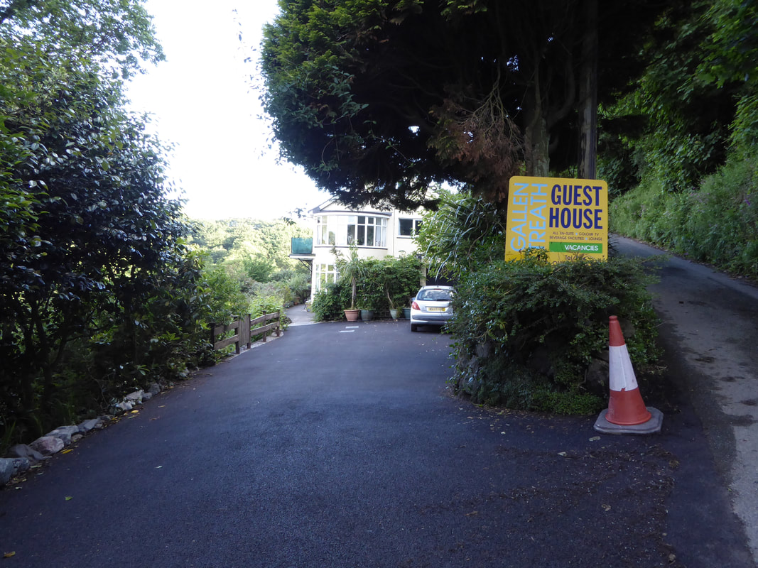
​Coverack was lovely and we lingered for a while and when exiting the village we were hit by a half mile boggy section.  At Lowland Point we sat on the rocks and watched a Seal playing about - he knew we were there and gave us a show for a good 15 minutes. Then began a long trudge to Porthallow via the quarry and the village of Porthoustock.  Arrived in Porthallow to be greeted by the half way marker and as the weather was extremely pleasant I left Angie at The Five Pilchards whilst I took our gear up to the B&B at Gallen Treath to check in.  Really lovely meal at the pub and a great nights sleep at the B&B - half way now!!  
​
Picture
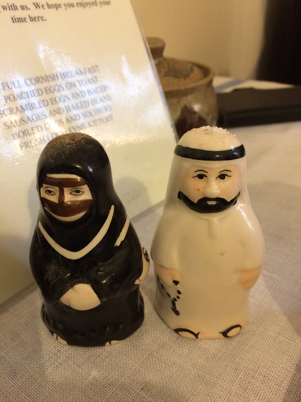
An interesting Cruet set at Hellarcher Farm
Picture
Lizard Point
Picture
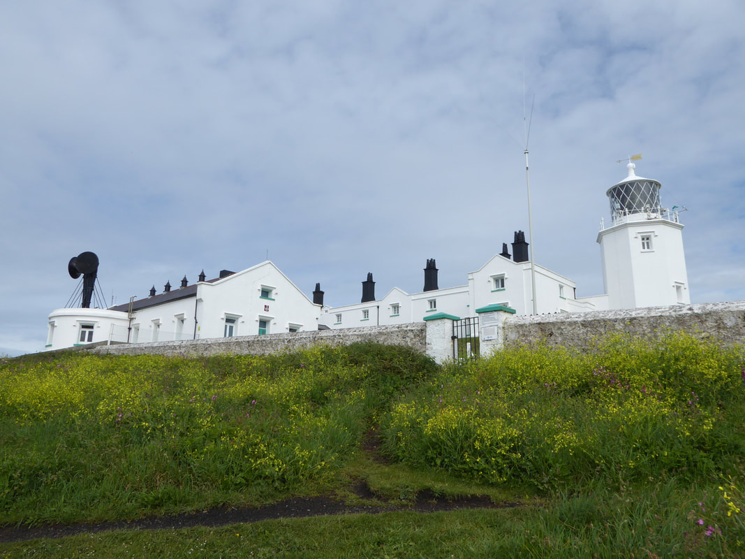
Another look at the impressive lighthouse at Lizard Point
Picture
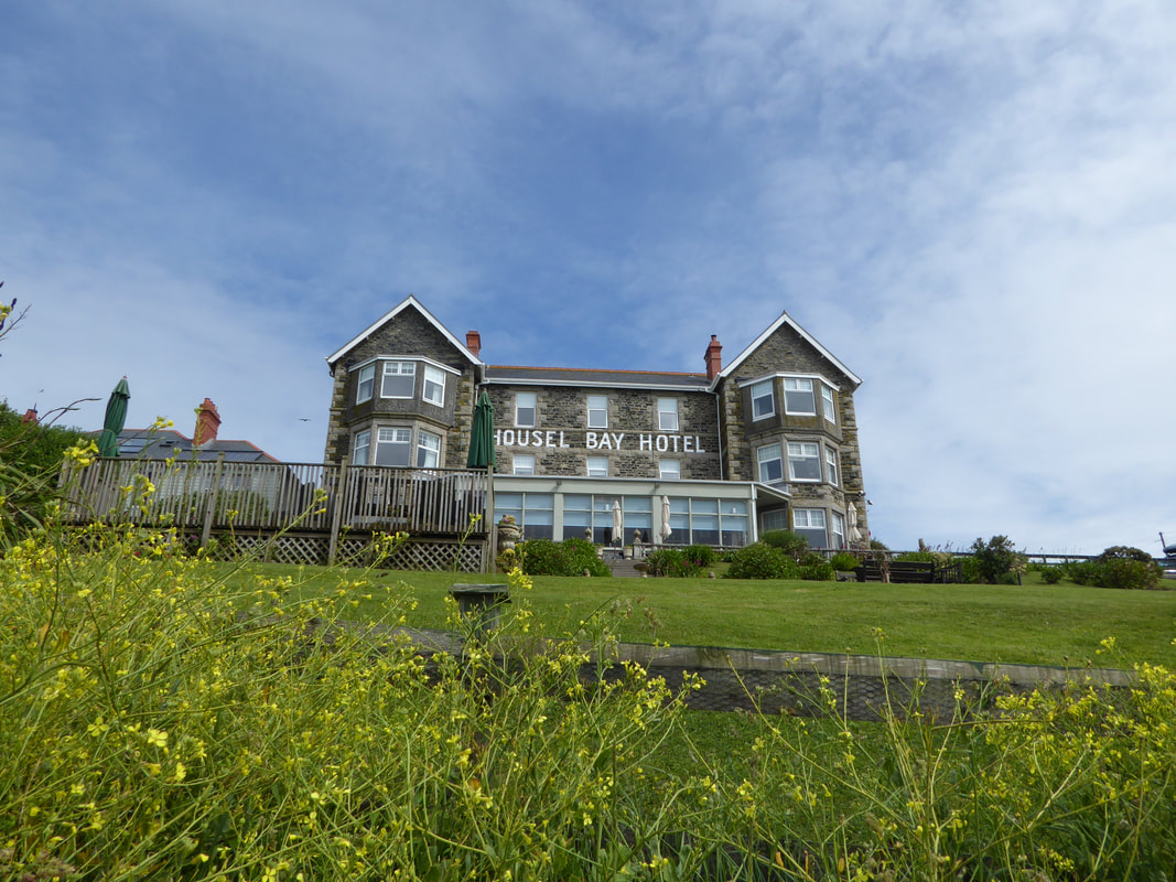
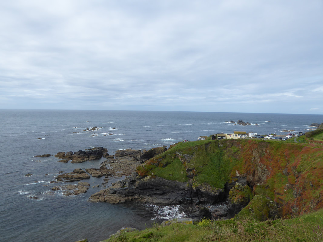
The path passes below The Housel Bay Hotel at Lizard
Picture
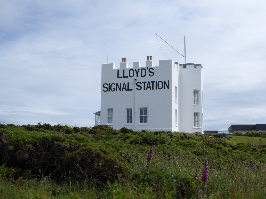
The former Wireless Station at Bass Point - as of May 2017 it was on sale for £750,000
Picture
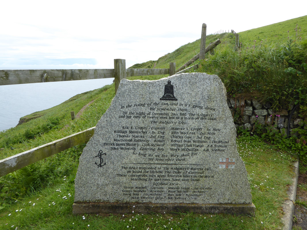
The Memorial above the new RNLI Station at Kilcobben Cove.

​
The memorial remembers the crew of the coaster Ardgarry - she was making her way to Rouen in France from Swansea and was loaded with coal when she got into difficulty three miles south west of the Lands End.  The wind was gusting to force 11 when the 600 tonne ship capsized.  The Lizard lifeboat was launched and searched in vain for 14 hours before being forced home by the bad weather. The wreck of the Ardgarry lay hidden until 2012 when divers discovered the vessel and her bell. 

​12 men on board lost their lives and were never found.
Picture
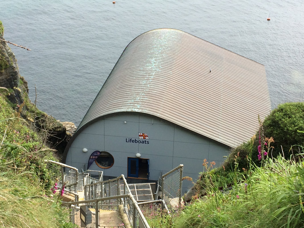
The RNLI Station at Kilcobben Cove
Picture
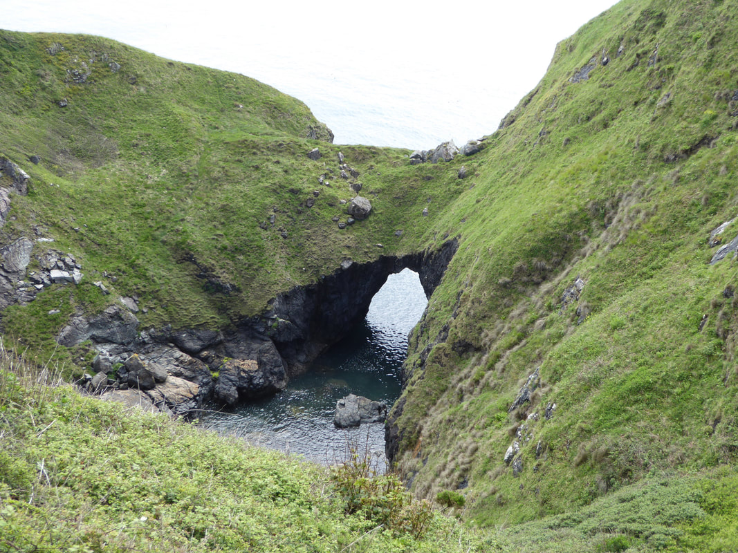
The Devil's Frying Pan near Cadgwith Cove - a deep hole with a very narrow land bridge
Picture
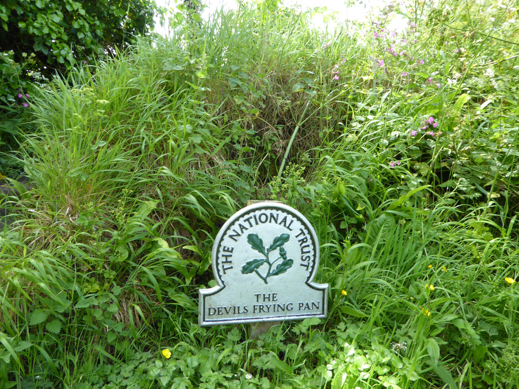
The NT sign which highlights the way to The Devil's Frying Pan
Picture
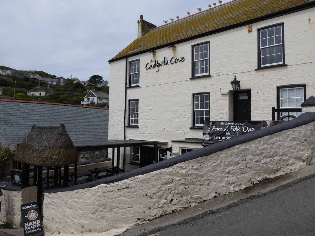
A very pleasant stop in Cadgwith Cove
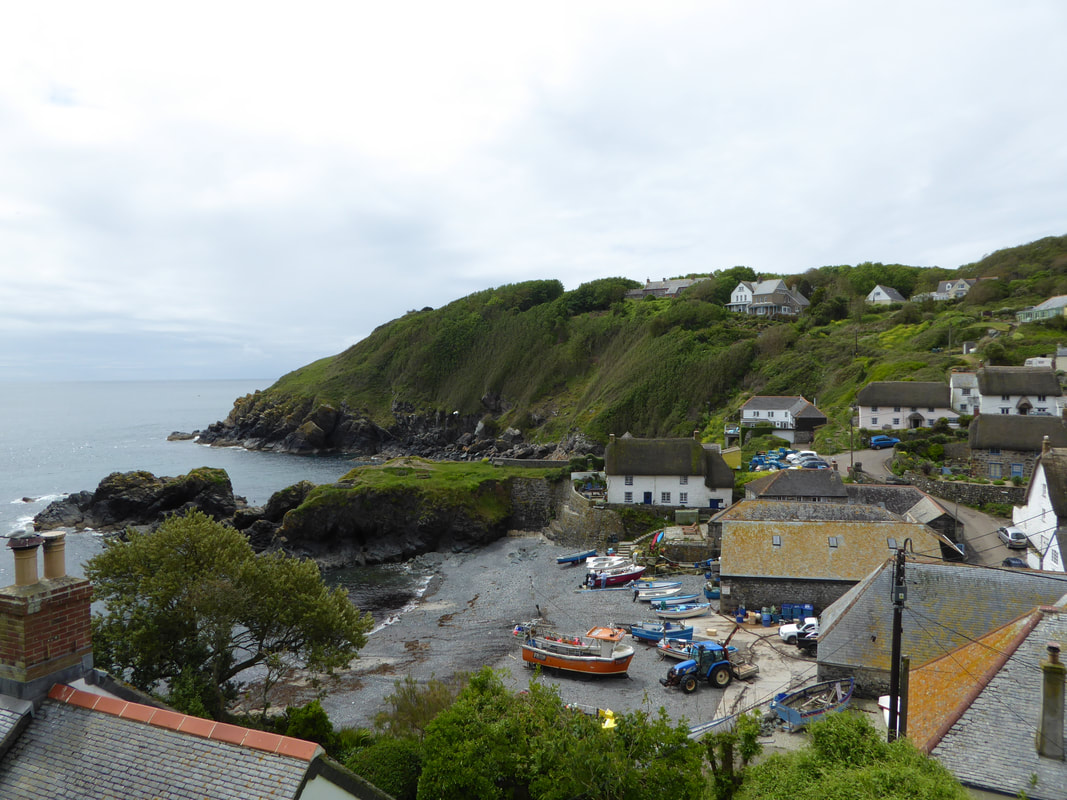
Picture
​Cadgwith Cove
Picture
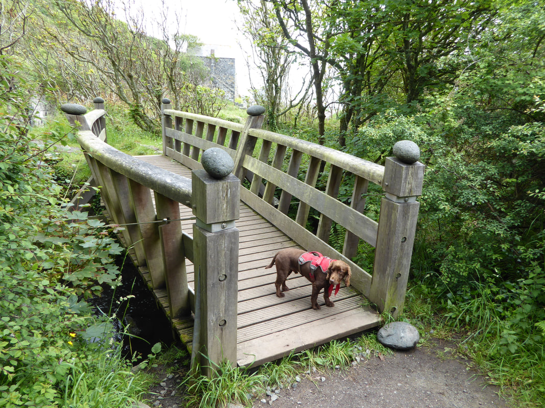
The lovely wooden bridge above Carleon Cove
Picture
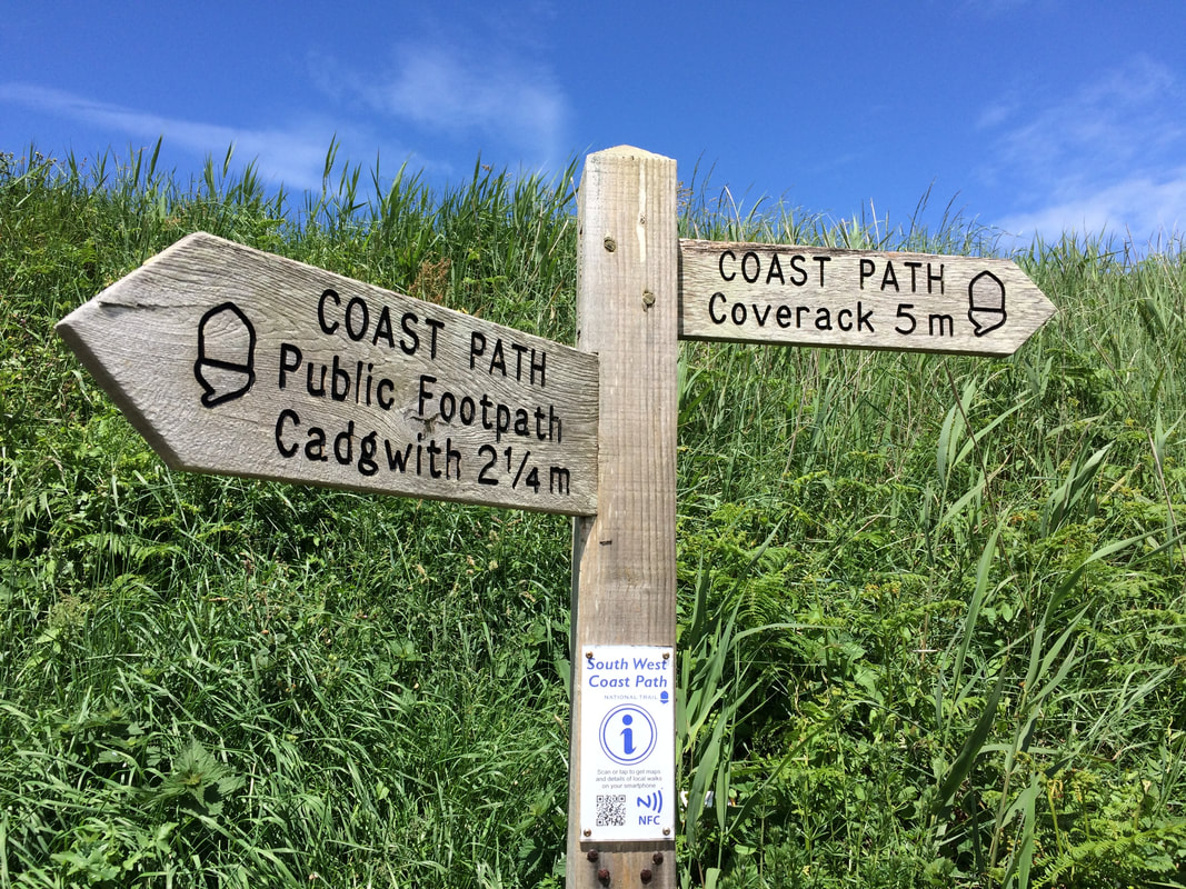
The way mark sign near Kennack Sands
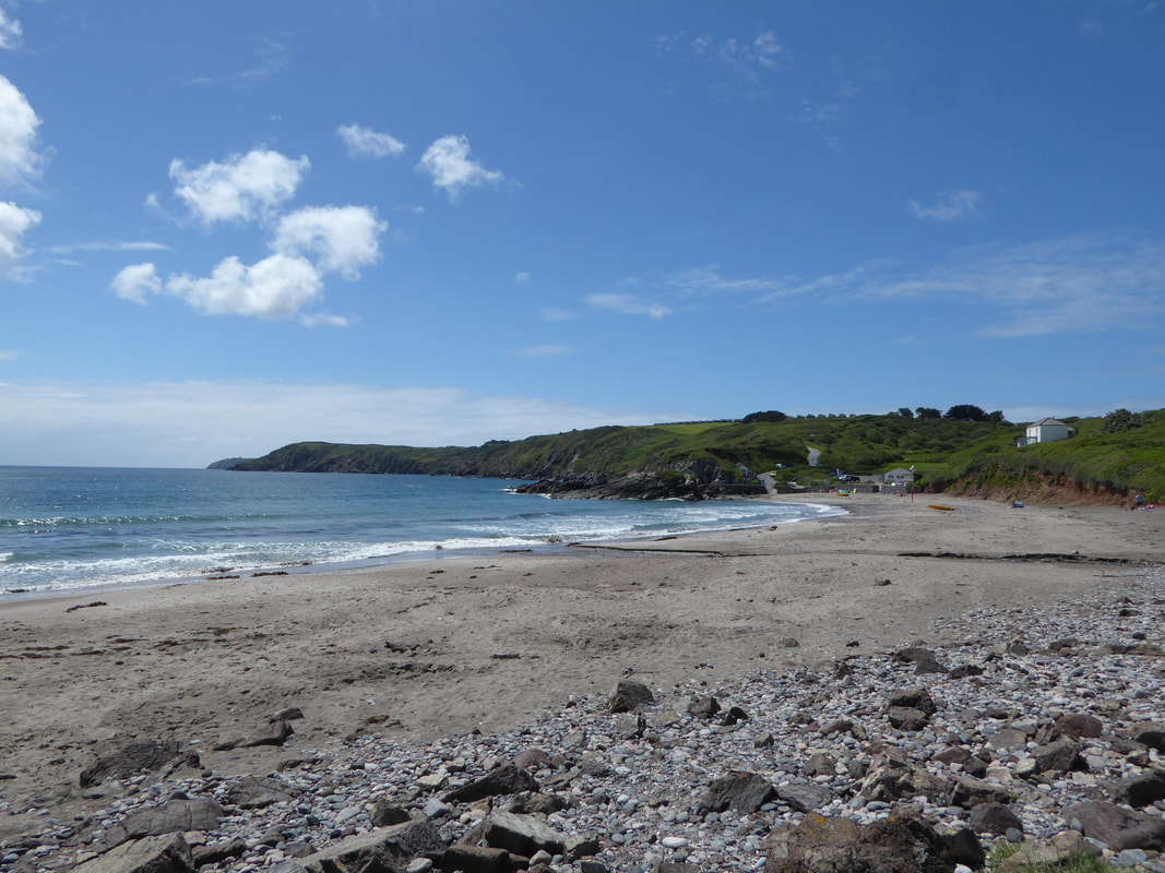
Picture
Kennack Sands
Picture
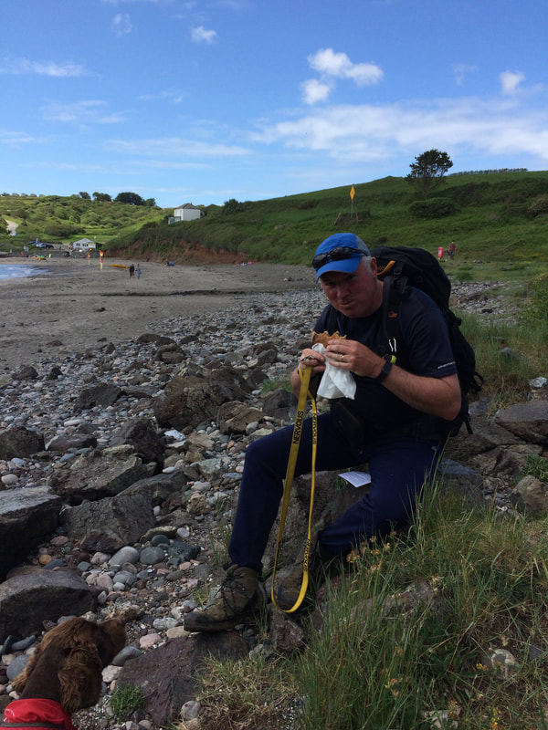
Eating my "Anne's Pastie" at Kennack Sands - as usual I had an audience
Picture
"Yeah but what else do they do Dad?"
Picture
The Old Lookout at Black Head - oh and a really nice building
Picture
Chynhalls Point Cliff Fort
Picture
The steep and difficult descent into Porthbeer Cove.
It probably would have been wiser to take the left fork signposted "Sculpture Park" which rejoins the SWCP above Perprean Cove
Picture
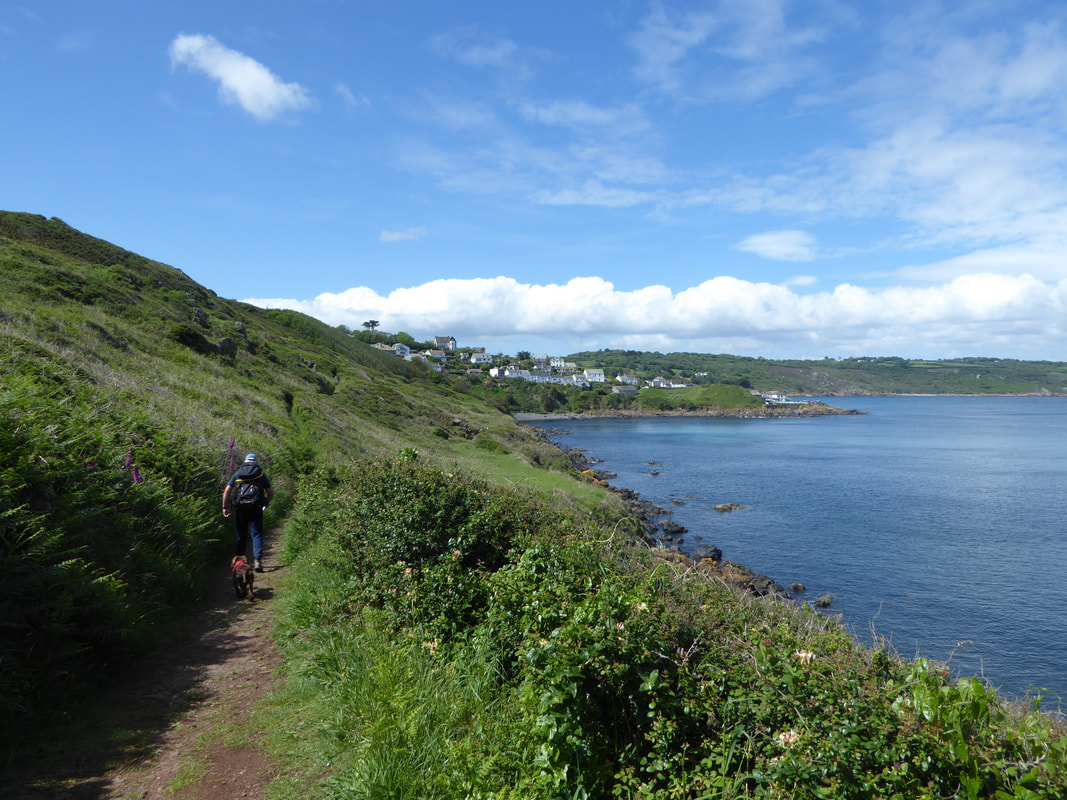
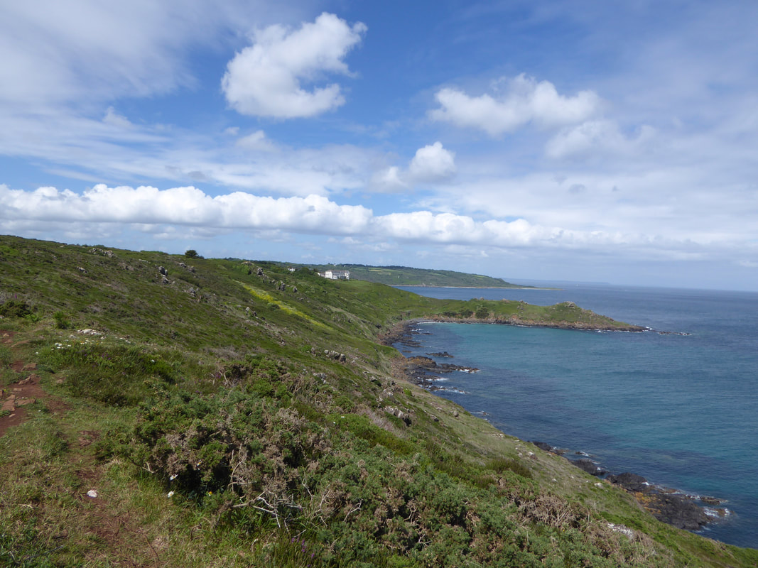
Approaching Coverack
Picture
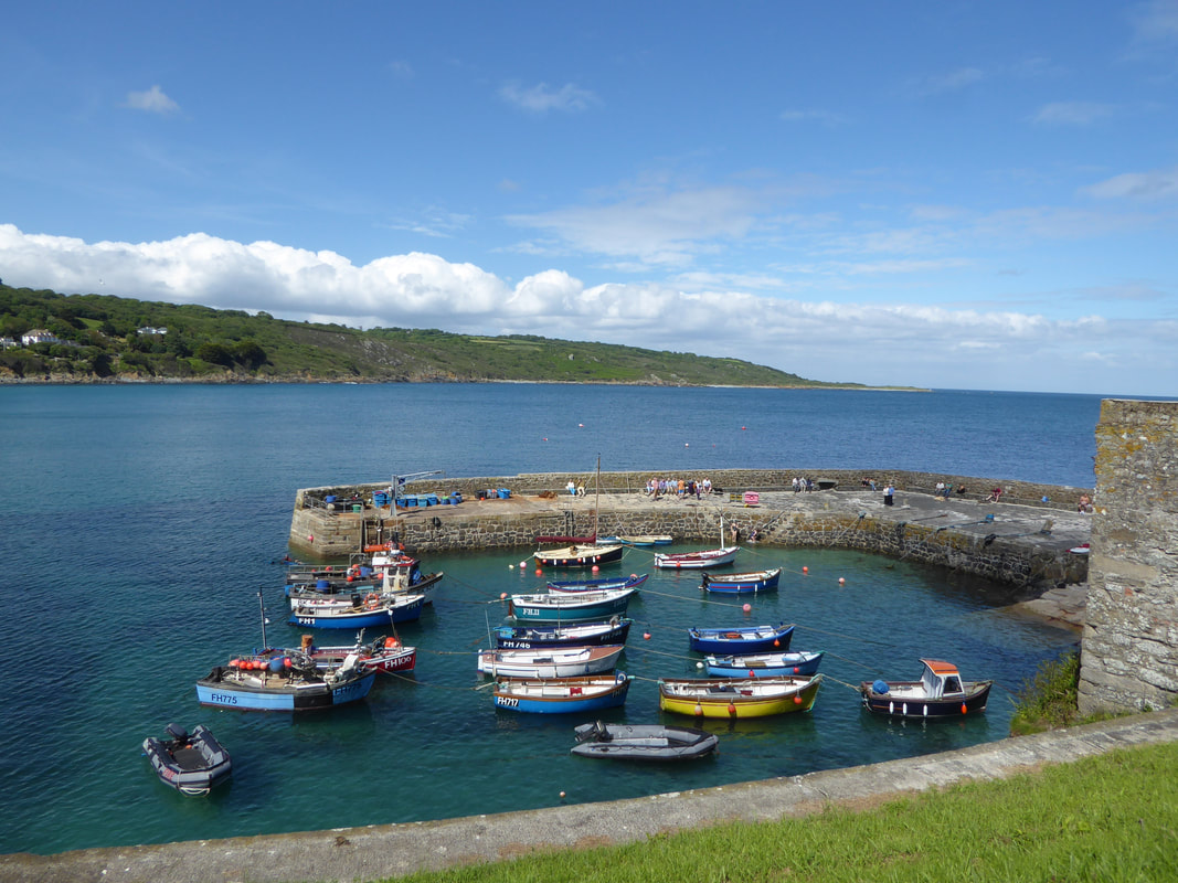
​The quaint harbour at Coverack
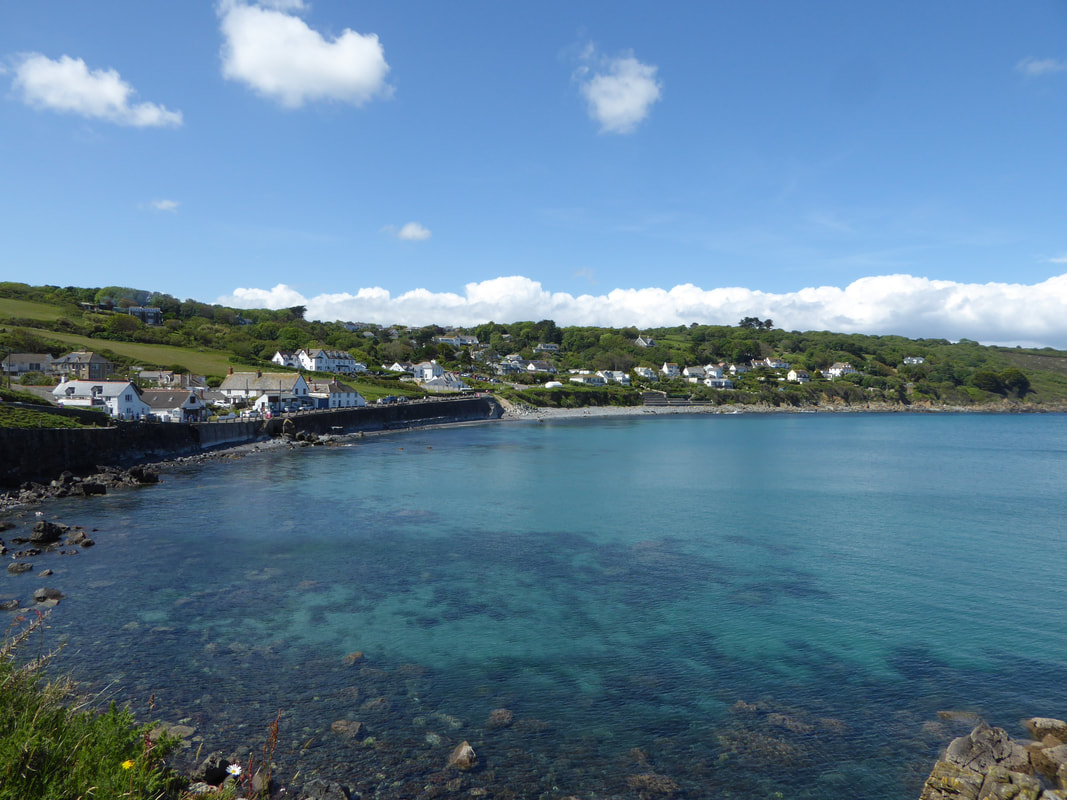
Picture
​Coverack
Picture
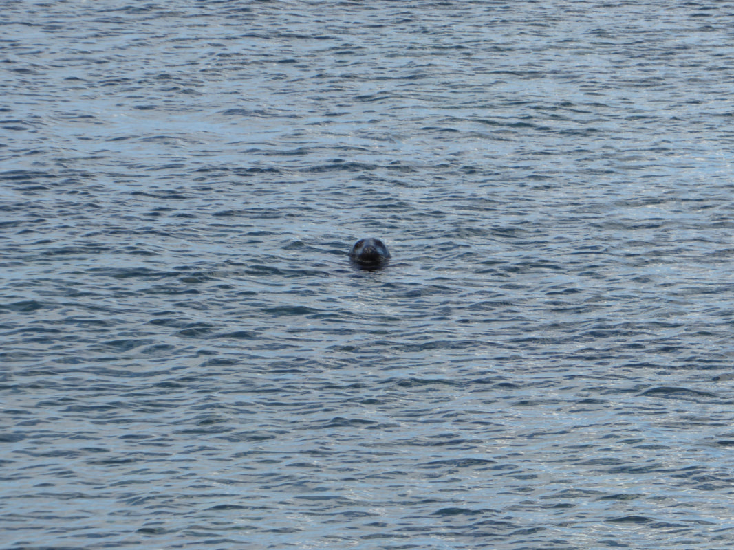
This fellow definitely knew were watching him - he put on a 15 minute show for us
Picture
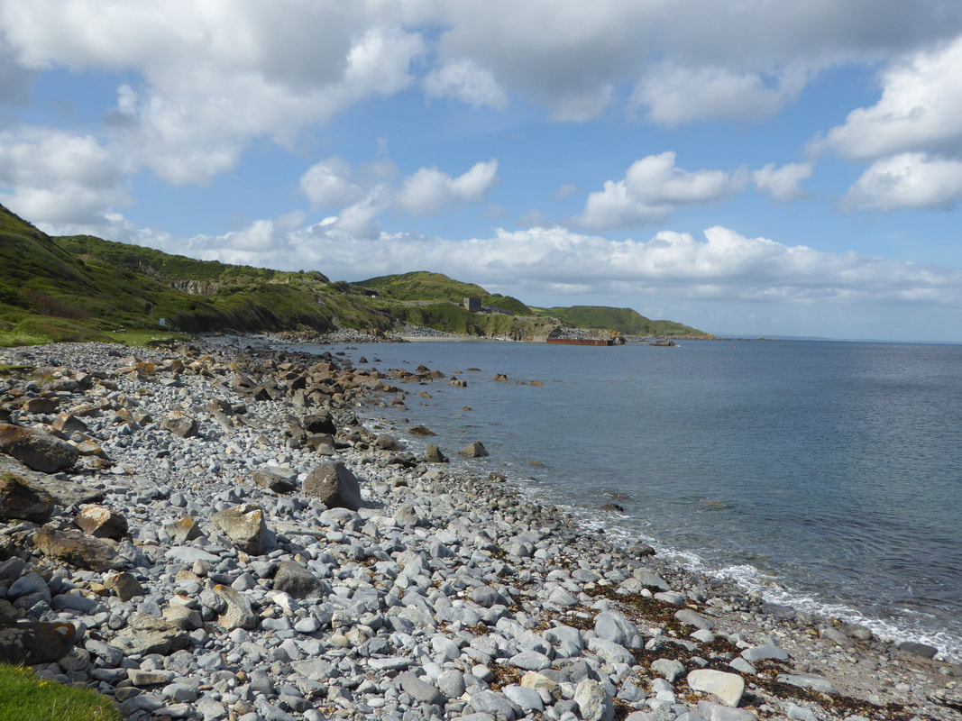
The stony foreshore at Lowland Point
Picture
​Once through the quarry we arrived at the lovely Godrevy Cove
Picture
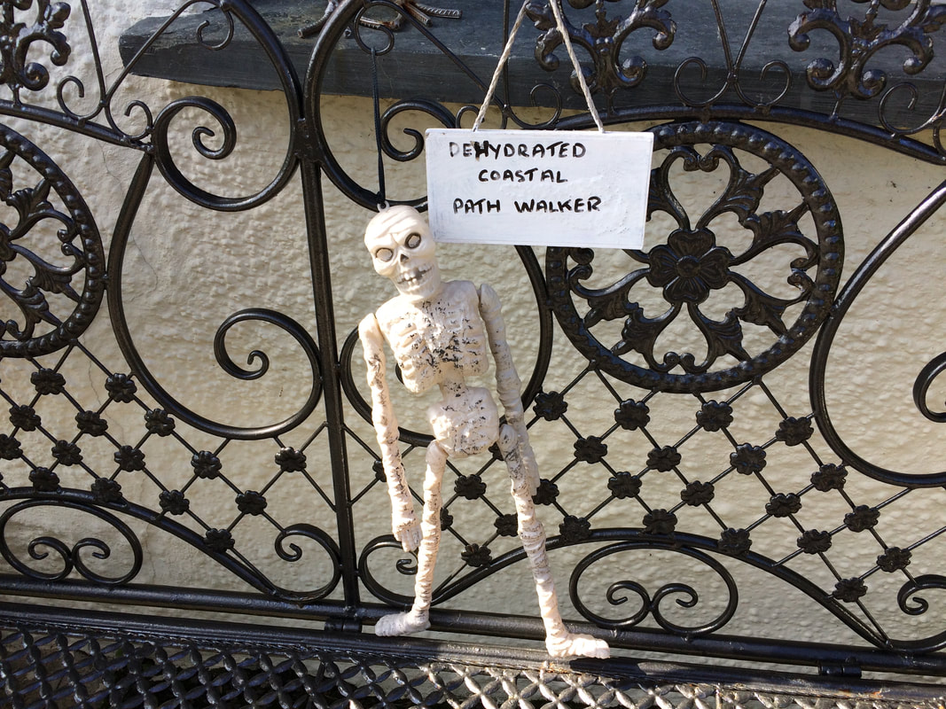
​Clearly the people of Porthoustock have a sense of humour.....
Picture
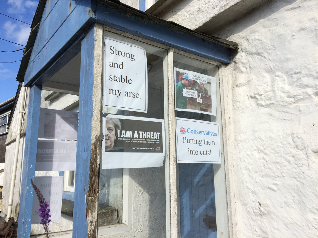
..... and strong political views........
Picture
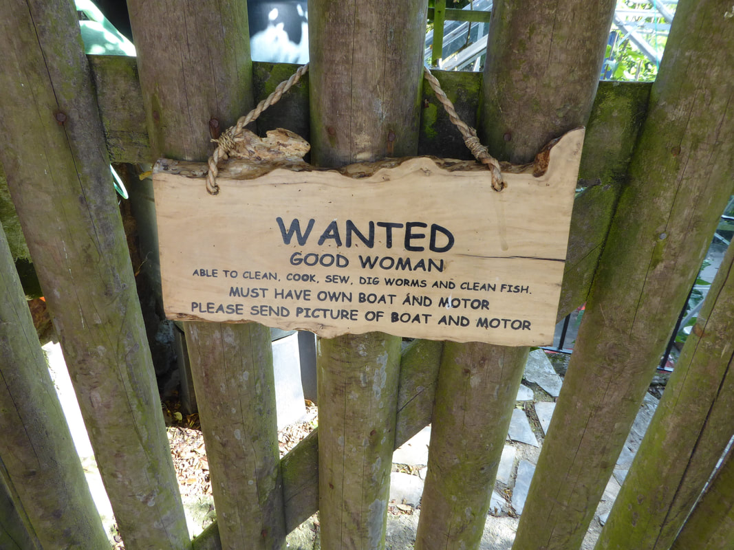
...... and don't give a toss about sexism
Picture
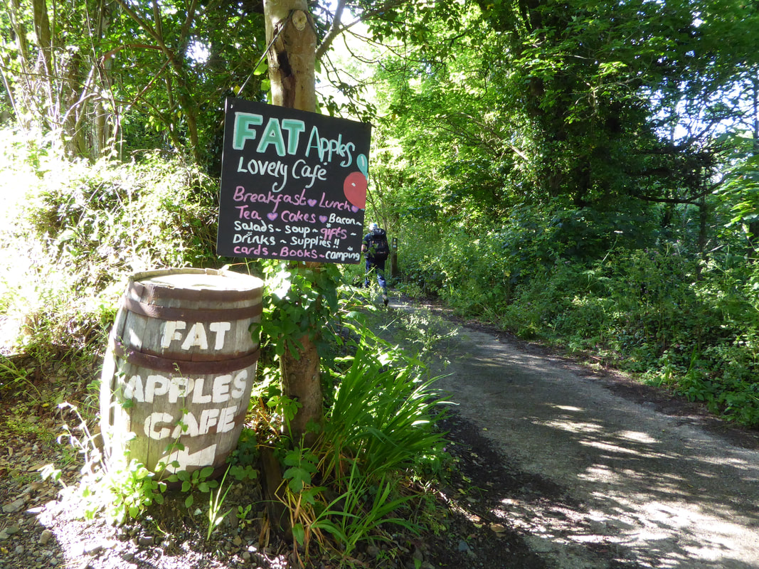
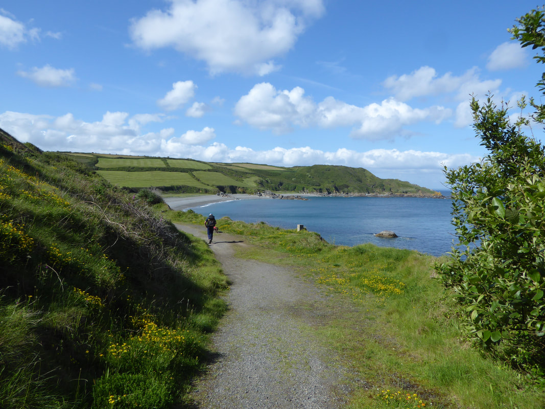
​Passing Fat Apples Cafe near Porthallow
Picture
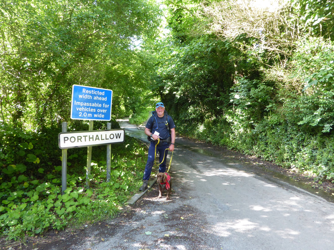
​It had been a long day but we were here - shocking spelling on the sign by the way
Picture
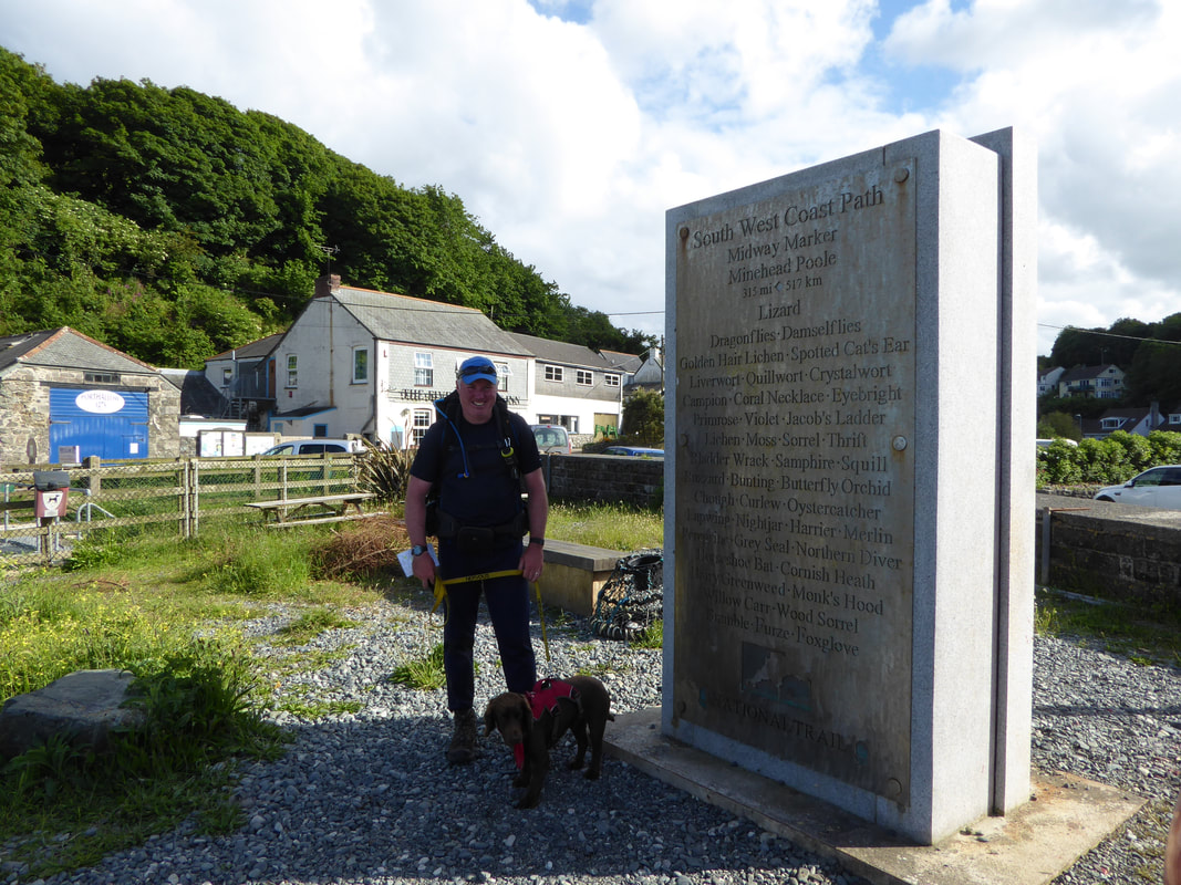
The South West Coast Path official half way point at Porthallow
Picture
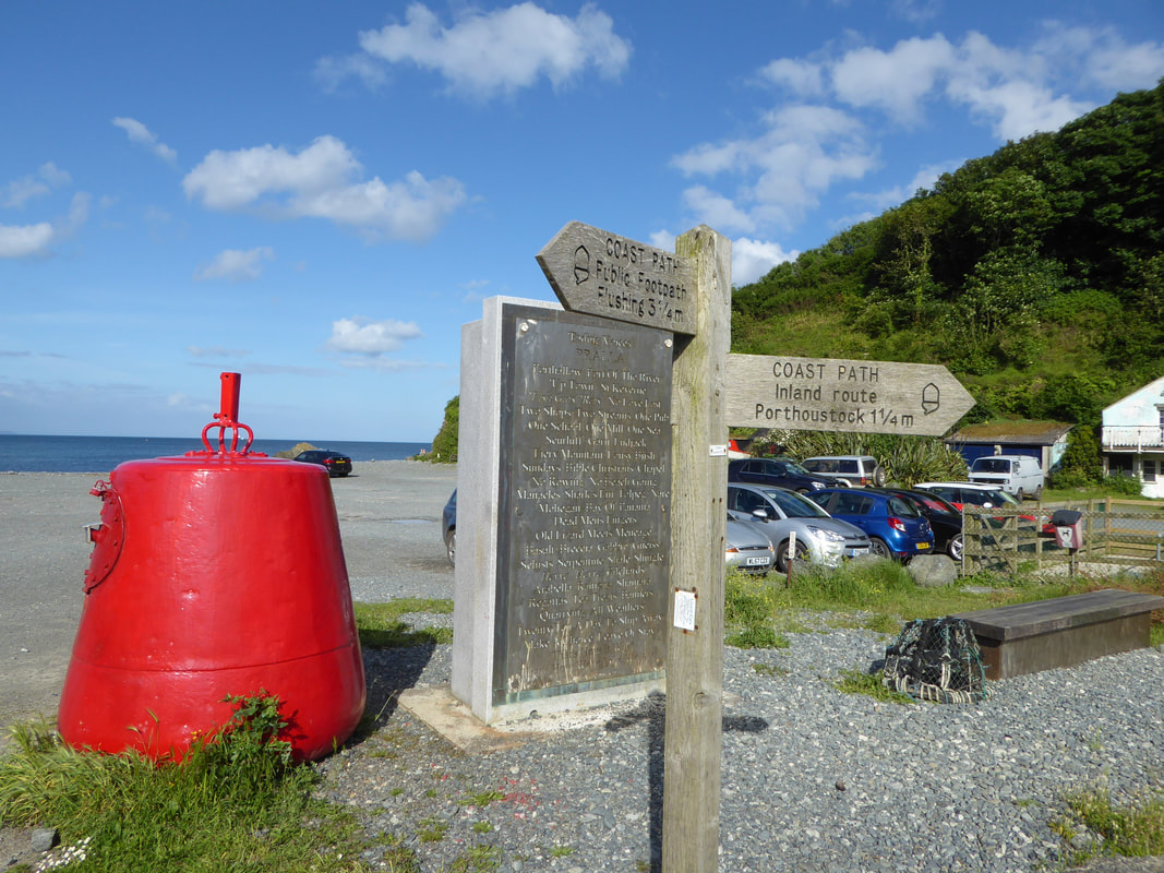
The landward side of the half way marker seen here has a poem engraved on it called 'Fading Voices’ consisting of words and phrases gathered together in workshops to represent the voices of Porthallow. The sea-facing side is engraved with the names of local flora and fauna.
Picture
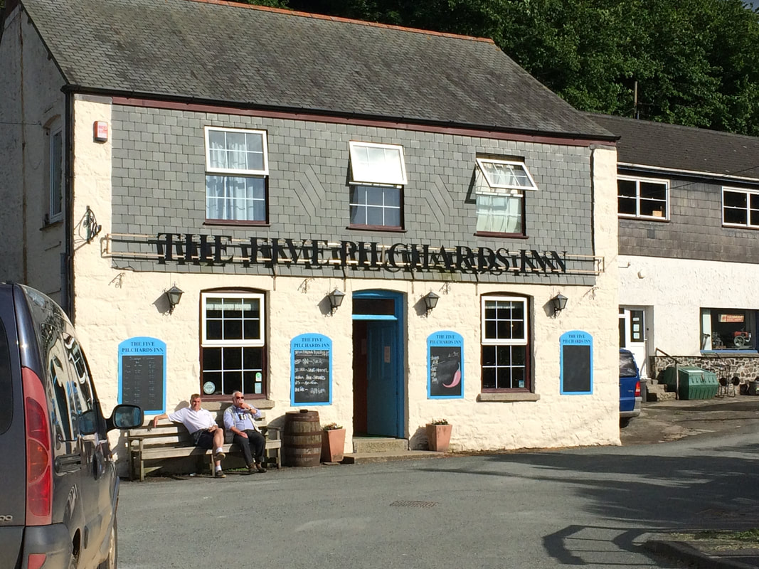
We had a lovely meal here at the pub in Porthallow
Overnight Accommodation

Gallen-Treath, Porthallow - www.gallen-treath.com
​   
Picture
Day 26 Data
Mileage 

Cumulative Mileage

Time

Cumulative Time

Total Ascent

Cumulative Ascent
16.3 miles

336.8 miles

7 hrs 50 mins

164 hrs 15 mins

3736 ft

78404 ft

Day 25
Day 27
© Copyright Dave Walsh 2013 - 2018 All Rights Reserved
Powered by
✕