Masarnen Ramblers
Contact us or visit us on Facebook
  • Home
  • About Us
  • Long Distance Walks
    • Coast to Coast (C2C) 2012 >
      • Planning & Preparation
      • Day 0 - Arrival in Kirkby Stephen
      • Day 1 - St Bees to Ennerdale Bridge
      • Day 2 - Ennerdale Bridge to Rosthwaite
      • Day 3 - Rosthwaite to Patterdale
      • Day 4 - Patterdale to Shap
      • Day 5 - Rest Day in Shap
      • Day 6 - Shap to Kirkby Stephen
      • Day 7 - Kirkby Stephen to Muker
      • Day 8 - Muker to Reeth
      • Day 9 - Reeth to Richmond
      • Day 10 - Rest Day in Richmond
      • Day 11 - Richmond to Danby Wiske
      • Day 12 - Danby Wiske to Ingleby Cross
      • Day 13 - Ingleby Cross to Blakey Ridge
      • Day 14 - Blakey Ridge to Grosmont
      • Day 15 - Grosmont to Robin Hood's Bay
      • C2C - Thoughts in Conclusion
    • Yorkshire 3 Peaks 2013
    • Dales Way 2014 >
      • Day 0 - Arrival in Ilkley
      • Day 1 - Ilkley to Linton
      • Day 2 - Linton to Cray
      • Day 3 - Cray to Ribblehead
      • Day 4 - Ribblehead to Sedbergh
      • Day 5 - Sedbergh to Burneside
      • Day 6 - Burneside to Bowness
      • Dales Way - Thoughts in Conclusion
    • Pennine Way 2015 >
      • Day 0 - Wales to Torside
      • Day 1 - Edale to Torside
      • Day 2 - Torside to Delph
      • Day 3 - Delph to Hebden Bridge
      • Day 4 - Hebden Bridge to Ponden
      • Day 5 - Ponden to Gargrave
      • Day 6 - Gargrave to Malham
      • Day 7 - Malham to Ribblehead
      • Day 8 - Ribblehead to Hawes
      • Day 9 - Hawes to Keld
      • Day 10 - Keld to Bowes
      • Day 11 - Bowes to Middleton
      • Day 12 - Middleton to Langdon Beck
      • Day 13 - Langdon Beck to Dufton
      • Day 14 - Dufton to Alston
      • Day 15 - Rest Day in Alston
      • Day 16 - Alston to Greenhead
      • Day 17 - Greenhead to Saughy Rigg
      • Day 18 - Saughy Rigg - to Bellingham
      • Day 19 - Bellingham to Byrness
      • Day 20 - Byrness to Trows Farm
      • Day 21 - Trows Farm to Kirk Yetholm
      • Thoughts in Conclusion
    • Sarn Sabrina 2015
    • Mortimer Trail 2016 >
      • Mortimer Trail - Day 1
      • Mortimer Trail - Day 2
    • Coast to Coast (C2C) 2016 >
      • C2C Planning & Preparation
      • Day 0 - Arrival in Kirkby Stephen
      • Day 1 - St Bees to Ennerdale Bridge
      • Day 2 - Ennerdale Bridge to Seatoller
      • Day 3 - Seatoller to Patterdale
      • Day 4 - Patterdale to Shap
      • Day 5 - Shap to Kirkby Stephen
      • Day 6 - Kirkby Stephen to Keld
      • Day 7 - Keld to Reeth
      • Day 8 - Reeth to Richmond
      • Day 9 - Richmond to Danby Wiske
      • Day 10 - Danby Wiske to Ingleby Cross
      • Day 11 - Ingleby Cross to Blakey Ridge
      • Day 12 - Blakey Ridge to Egton Bridge
      • Day 13 - Egton Bridge to Robin Hood's Bay
      • C2C - Thoughts in Conclusion
    • South West Coast Path 2017 >
      • SWCP Itinerary
      • SWCP Charity, Planning & Preparation
      • SWCP Day 0
      • SWCP Day 1 - Minehead to Porlock
      • SWCP Day 2 - Porlock to Lynmouth
      • SWCP Day 3 - Lynmouth to Combe Martin
      • SWCP Day 4 - Combe Martin to Croyde
      • SWCP Day 5 - Croyde to Braunton
      • SWCP Day 6 - Braunton to Northam
      • SWCP Day 7 - Northam to Clovelly
      • SWCP Day 8 - Clovelly to Stoke
      • SWCP Day 9 - Stoke to Bude
      • SWCP Day 10 - Rest Day in Stoke
      • SWCP Day 11 - Bude to Boscastle
      • SWCP Day 12 - Boscastle to Port Isaac
      • SWCP Day 13 - Port Isaac to Padstow
      • SWCP Day 14 - Padstow to Porthcothan
      • SWCP Day 15 - Porthcothan to Newquay
      • SWCP Day 16 - Newquay to Perranporth
      • SWCP Day 17 - Perranporth to Portreath
      • SWCP Day 18 - Portreath to St Ives
      • SWCP Day 19 - Rest Day in Penzance
      • SWCP Day 20 - St Ives to Lower Boscaswell
      • SWCP Day 21 - Lower Boscaswell - Porthcurno
      • SWCP Day 22 - Porthcurno to Penzance
      • SWCP Day 23 - Penzance to Porthleven
      • SWCP Day 24 - Rest Day in Penzance
      • SWCP Day 25 - Porthleven to The Lizard
      • SWCP Day 26 - The Lizard to Porthallow
      • SWCP Day 27 - Porthallow to Falmouth
      • SWCP Day 28 - Falmouth to Portloe
      • SWCP Day 29 - Portloe to Mevagissey
      • SWCP Day 30 - Mevagissey to Fowey
      • SWCP Day 31 - Fowey to Polperro
      • SWCP Day 32 - Polperro to Portwrinkle
      • SWCP Day 33 - Rest Day in Portwrinkle
      • SWCP Day 34 - Portwrinkle to Plymouth
      • SWCP Day 35 - Plymouth to Noss Mayo
      • SWCP Day 36 - Noss Mayo to Bantham
      • SWCP Day 37 - Bantham to Salcombe
      • SWCP Day 38 - Salcombe to Slapton
      • SWCP Day 39 - Slapton to Dartmouth
      • SWCP Day 40 - Rest Day in Dartmouth
      • SWCP Day 41 - Dartmouth to Brixham
      • SWCP Day 42 - Torquay to Brixham
      • SWCP Day 43 - Torquay to Teignmouth
      • SWCP Day 44 - Teignmouth to Exmouth
      • SWCP Day 45 - Exmouth to Beer
      • SWCP Day 46 - Beer to Bridport
      • SWCP Day 47 - Lulworth Cove to Kimmeridge Bay
      • SWCP Day 48 - Bridport to Abbotsbury
      • SWCP Day 49 - Abbotsbury to Weymouth
      • SWCP Day 50 - Rest Day in Bridport
      • SWCP Day 51 - The Portland Loop
      • SWCP Day 52 - Weymouth to Lulworth Cove
      • SWCP Day 53 - Kimmeridge Bay to Worth Matravers
      • SWCP Day 54 - Worth Matravers to South Haven Point
      • SWCP - Thoughts in Conclusion
    • Triple Spine Lakeland Challenge >
      • TSLC Day 1
      • TSLC Day 2
      • TSLC Day 3
  • Day Walks
    • Cornwall >
      • Mount Edgcumbe, Kingsand & Rame Head
      • Perranporth to Newquay
    • Cumbria (not Lake District) >
      • Cautley Spout, The Calf, Calders, Arant Haw & Winder
      • Cross Fell
      • Great Coum & Crag Hill
      • High Cup Nick
      • High Cup Nick
      • Yarlside, Randygill Top & The Calf
    • Dorset >
      • Charmouth to Bridport
      • Hardy's Monument from Abbotsbury
    • Durham >
      • Cauldron Snout
      • High & Low Force
    • Lake District >
      • Eastern Fells >
        • Birkett Fell, Hart Side & The Dodds
        • Catstycam & Birkhouse Moor
        • Clough Head & Great Dodd
        • Dodds, Clough Head & Raise
        • Fairfield Horseshoe
        • Fairfield Horseshoe - January 2019
        • Fairfield, St Sunday Crag, Birks & Arnison Crag
        • Fairfield, Great Rigg & Heron Pike
        • Gowbarrow Fell
        • Great Mell Fell
        • Helvellyn Range
        • Helvellyn, Catstycam & Birkhouse Moor via Striding Edge
        • Little Mell Fell
        • Middle Dodd, Red Screes, Little Hart Crag & High Hartsop Dodd
        • Seat Sandal
        • Sheffield Pike, Raise, Stybarrow Dodd, Watson's Dodd and Hart Side
      • Far Eastern Fells >
        • Caudale Moor & Hartsop Dodd
        • Gray Crag, Thornthwaite Crag, Froswick & Ill Bell
        • Grey Crag, Tarn Crag & Branstree
        • Hallin Fell
        • High Street, Mardale Ill Bell and Harter Fell
        • High Street, Thornthwaite Crag, Gray Crag, Mardale Ill Bell & Harter Fell
        • Kentmere Pike & Shipman Knotts
        • Place Fell - Oct 15
        • Place Fell - Dec 17
        • Rest Dodd, The Nab and Brock Crags
        • Sour Howes, Sallows, Yoke, Ill Bell, Froswick & Thornthwaite Crag
        • Steel Knotts & Beda Fell
        • Troutbeck to Pooley Bridge
        • Troutbeck to Patterdale
      • Central Fells >
        • Armboth Fell, High Tove & High Seat
        • Blea Rigg, Sergeant Man, High Raise, Steel Fell, Calf Crag, Gibson Knott & Helm Crag
        • Eagle Crag & Sergeants Crag
        • Grasmere & Langdale Epic
        • Langdale Pikes, Pavey Ark, Thunacar Knott & High Raise
        • Langdale Pikes & Thunacar Knott
        • Pike O'Stickle
        • Rosthwaite to Keswick via Watendlath
        • Silver How & Loughrigg Fell
        • Steel Fell, Calf Crag, Gibson Knott & Helm Crag
        • Walla Crag, Bleaberry Fell, High Seat & High Tove
      • Southern Fells >
        • Coniston Fells
        • Coniston 7
        • Grey Friar, Great Carrs, Swirl How & Wetherlam
        • Irton Pike, Whin Rigg & Illgill Head
        • Lingmell
        • Lingmell, Scafell Pike, Broad Crag & Ill Crag via Piers Gill
        • Pike O'Blisco, Cold Pike & Crinkle Crags
        • Pike O'Blisco, Cold Pike, Little Stand & Crinkle Crags
        • Rossett Pike, Allen Crags, Glaramara, Esk Pike & Bowfell
        • Rossett Pike, Esk Pike & Bowfell
        • Scafell Pike & Great End
        • Seathwaite Fell
        • Seathwaite Fell, Allen Crags & Glaramara
        • Seathwaite Fell, Allen Crags, Glaramara & Rosthwaite Fell
        • Slight Side & Scafell - May 2014
        • Slight Side & Scafell - July 2018
        • Walna Scar, Dow Crag, Brim Fell & Coniston Old Man
      • Northern Fells >
        • Back O'Skidda
        • Bakestall & Great Calva
        • Blencathra, Mungrisdale Common, Skiddaw & Skiddaw Little Man
        • Blencathra via Sharp Edge
        • Blencathra via Sharp Edge & Hall's Fell Ridge
        • Dodd, Carl Side, Long Side & Ullock Pike
        • Great Calva & The Cumbria Way
        • High Pike & Carrock Fell
        • Latrigg, Blencathra, Mungrisdale Common, Skiddaw and Skiddaw Little Man
        • Souther Fell
        • Ullock Pike, Long Side, Carl Side & Skiddaw
        • Ullock Pike, Long Side, Carl Side, Skiddaw & Lonscale Fell
      • North Western Fells >
        • Barrow
        • Castle Crag
        • Coledale Horseshoe 17 Sep 16
        • Coledale Horseshoe 2 Apr 17
        • Grasmoor & Whiteless Pike
        • Knott Rigg & Ard Crags
        • Lord's Seat, Barf, Broom Fell & Graystones
        • Robinson, Hindscarth, Dale Head, High Spy, Maiden Moor & Cat Bells
        • Sale Fell & Ling Fell
        • Whiteside
      • Western Fells >
        • Base Brown, Green Gable & Great Gable
        • Crag Fell, Iron Crag, Caw Fell & Haycock
        • Ennerdale to Black Sail Hut
        • Fleetwith Pike, Grey Knotts, Brandreth, Green Gable, Base Brown & Haystacks
        • Great Gable
        • Grike, Crag Fell & Lank Rigg
        • Hay Stacks
        • Hen Comb, Gavel Fell, Blake Fell & Burnbank Fell
        • High Stile Ridge
        • High Stile Ridge & Dodd
        • Kirk Fell
        • Kirk Fell from Gatesgarth
        • Kirk Fell, Pillar, Scoat Fell & Red Pike
        • Low Fell & Fellbarrow
        • Mellbreak - July 2014
        • Mellbreak - December 2017
        • Middle Fell, Seatallan & Buckbarrow - May 14
        • Middle Fell, Seatallan & Buckbarrow - May 16
        • Pillar, Scoat Fell, Steeple, Haycock, Caw Fell & Red Pike
        • Yewbarrow - June 2011
        • Yewbarrow, Red Pike & Pillar - May 2015
        • Yewbarrow, Red Pike, Scoat Fell, Steeple & Pillar - May 2016
        • Yewbarrow, Red Pike, Scoat Fell, Steeple & Pillar - August 2018
      • Outlying Fells >
        • Black Combe
        • Devoke Water Circuit
    • Malvern Hills >
      • Herefordshire Beacon
      • Malvern Hills End to End
      • Worcestershire Beacon
    • North Yorkshire Moors >
      • Goathland, Mallyan Spout & the Wheeldale Roman Road
      • Roseberry Topping & Captain Cook's Monument
      • Runswick Bay & Staithes
      • Westerdale Moor
    • Northumberland >
      • Bamburgh Castle
      • Lindisfarne (Holy Island)
      • The Cheviot
      • Windy Gyle
    • Peak District >
      • Derwent Edge
      • Hollins Cross, Back Tor, Lose Hill, Win Hill & Hope
      • Ilam & Dovedale
      • Ladybower Reservoir & Crook Hill
      • Parkhouse Hill & Chrome Hill
      • Shutlingsloe, Shining Tor & Axe Edge Moor
      • Stanage Edge
      • Three Shire Heads, Hen Cloud, The Roaches & Lud's Church
    • Scotland >
      • Ben Lomond
      • The Schil
      • St Abbs Head
    • Shropshire >
      • Brown Clee Hill
      • Church Stretton to Shrewsbury
      • The Long Mynd
      • The Wrekin
    • Somerset >
      • Withypool & Tarr Steps
    • Wales >
      • Allt Lwyd, Bwlch y Ddwyallt & Waun Rydd
      • Berwyn Horseshoe
      • Black Mountain Wild Camp - Day 1
      • Black Mountain Wild Camp - Day 2
      • Black Mountains Circular Day 1
      • Black Mountains Circular Day 2
      • Brecon Beacons Horseshoe
      • Cadair Idris
      • Carmarthen Fan
      • Carnau, Gorllwyn, Carreg yr Ast & Drygarn Fawr
      • Cnicht & Moelwyn Mawr
      • Craig Cerrig-gleisiad, Fan Frynyrch, Fan Llia & Fan Fawr
      • Craig Eigiau & Pen Llithrig y Wrach
      • Elidir Fawr, Mynydd Perfedd, Carnedd y Filiast & Foel-goch
      • Fan y Big from Torpantau
      • Fan Fraith, Fan Gyhirych & Fan Nedd
      • Glyder Fach, Glyder Fawr, Y Garn & Foel-goch
      • Hay Bluff, Twmpa, Rhos Dirion & Chwarel y Fan
      • Hergest Ridge
      • Llanddwyn Island, Anglesey
      • Moel Cynghorion, Foel Goch, Foel Gron & Moel Eilio
      • Moel Hebog
      • Moel Siabod - April 2011
      • Nantlle Ridge
      • Pumlumon from Eisteddfa Gurig
      • Pumlumon from Nant y Moch
      • Rhayader, Maen Serth & Gilfach
      • Snowdon & Garnedd Ugain
      • Talybont-on-Usk to The Storey Arms via 8 Nuttalls
      • Tryfan via Heather Terrace
      • Tryfan, Y Foel Goch & Gallt yr Ogof
      • Waun Fach from Pengenffordd
      • Waun Fach & The Black Mountains from Llanbedr
      • Western Carneddau
      • Whimble, Bache Hill, Black Mixen & Great Rhos
    • Yorkshire >
      • Buckden 4 Corners
      • Buckden Pike & Starbotton
      • Buckden Pike & Great Whernside
      • Dodd Fell Hill & Drumaldrace
      • Flamborough Head
      • Harrogate Ringway
      • Ingleborough
      • Ingleborough & Simon Fell
      • Keld to Reeth
      • Keld, Swaledale, Old Gang & Gunnerside
      • Malham Cove & Gordale Scar
      • Muker, Keld, Swaledale and Tan Hill
  • Hill Tick Lists
    • Wainwrights >
      • Abstract
      • The Eastern Fells
      • The Far Eastern Fells
      • The Central Fells
      • The Southern Fells
      • The Northern Fells
      • The North Western Fells
      • The Western Fells
      • The Outlying Fells
      • Completion Day
      • Trail 100
  • Useful Links
  • Contact Us

Pennine Way Day 9 - Wednesday 17 June 2015

Hawes to Keld (13.1 miles)
​

Picture
GPX File
day_9_pennine_way_-_hawes_to_keld.gpx
File Size: 141 kb
File Type: gpx
Download File


​Today’s leg was very familiar to us with the only unknown part being that between the summit of Great Shunner Fell & Thwaite. Looking out of the window at breakfast it looked as if we were in for a drizzly and windy walk over to Keld.  As it happened the weather only improved as we left Thwaite.  

 
Hawes is a lovely market town and is always busy with people and visitors flock to it for most of the year.  It is in a beautiful part of the Yorkshire Dales and we have been here many times and never tire of visiting.  We had a really nice stay with Helen at The Bulls Head - no frills, a lovely room and a cracking pub a few doors down, what's not t
o like?
 
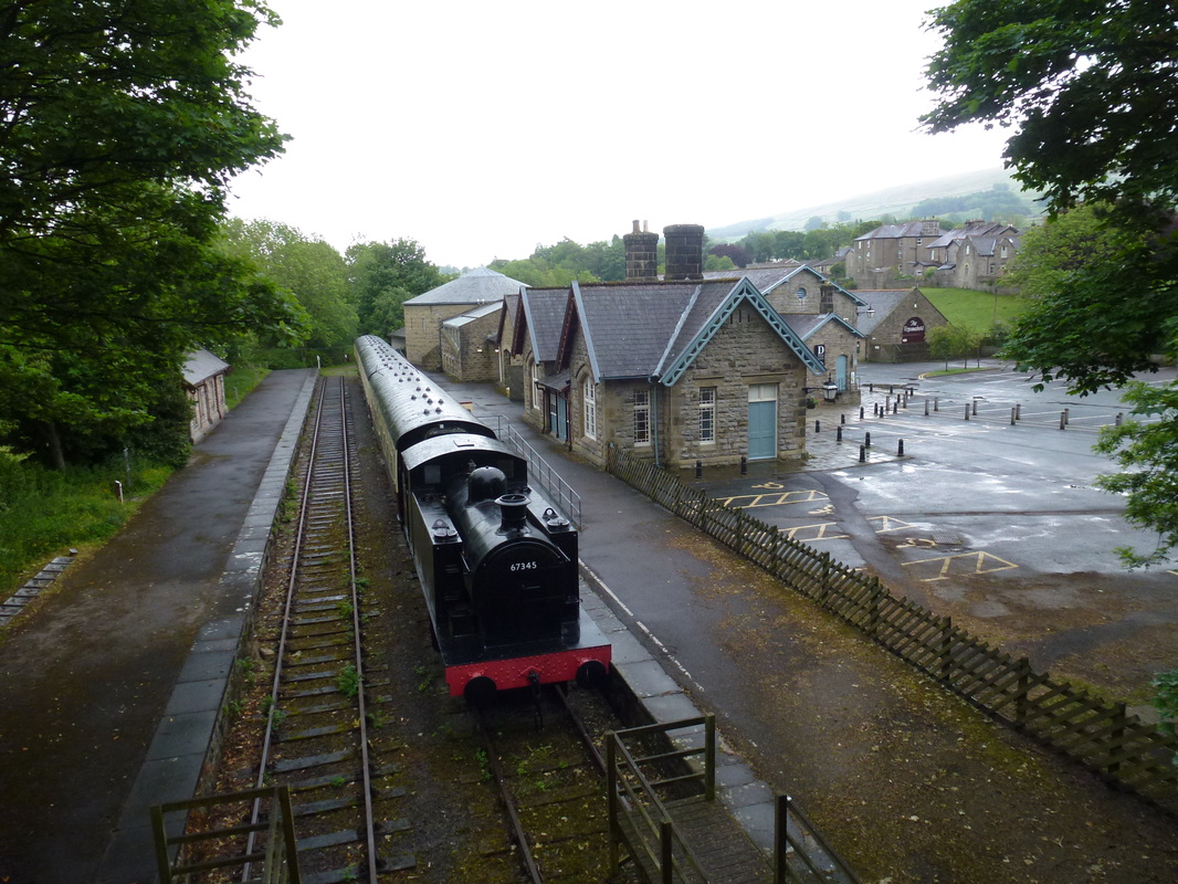
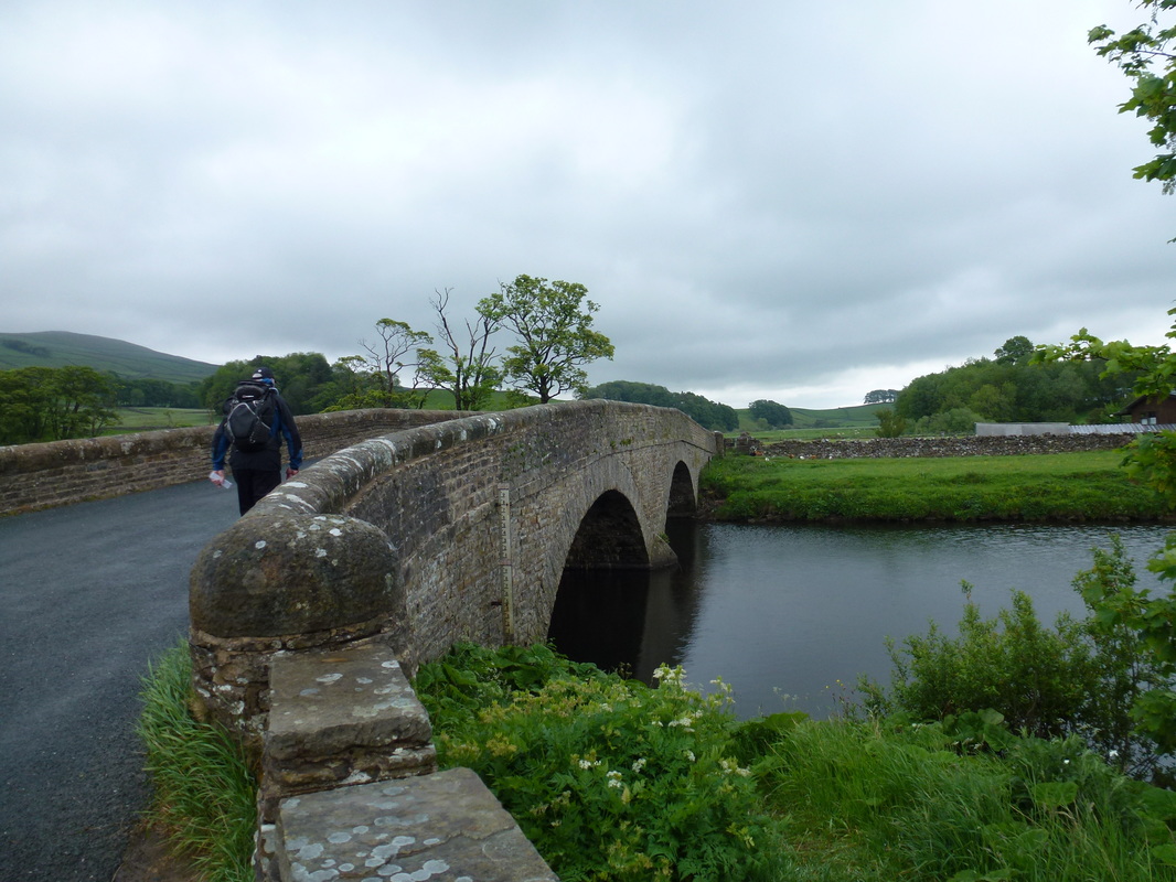
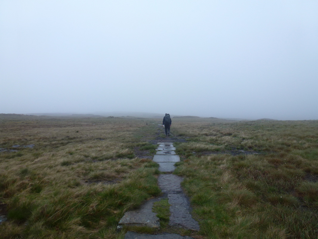
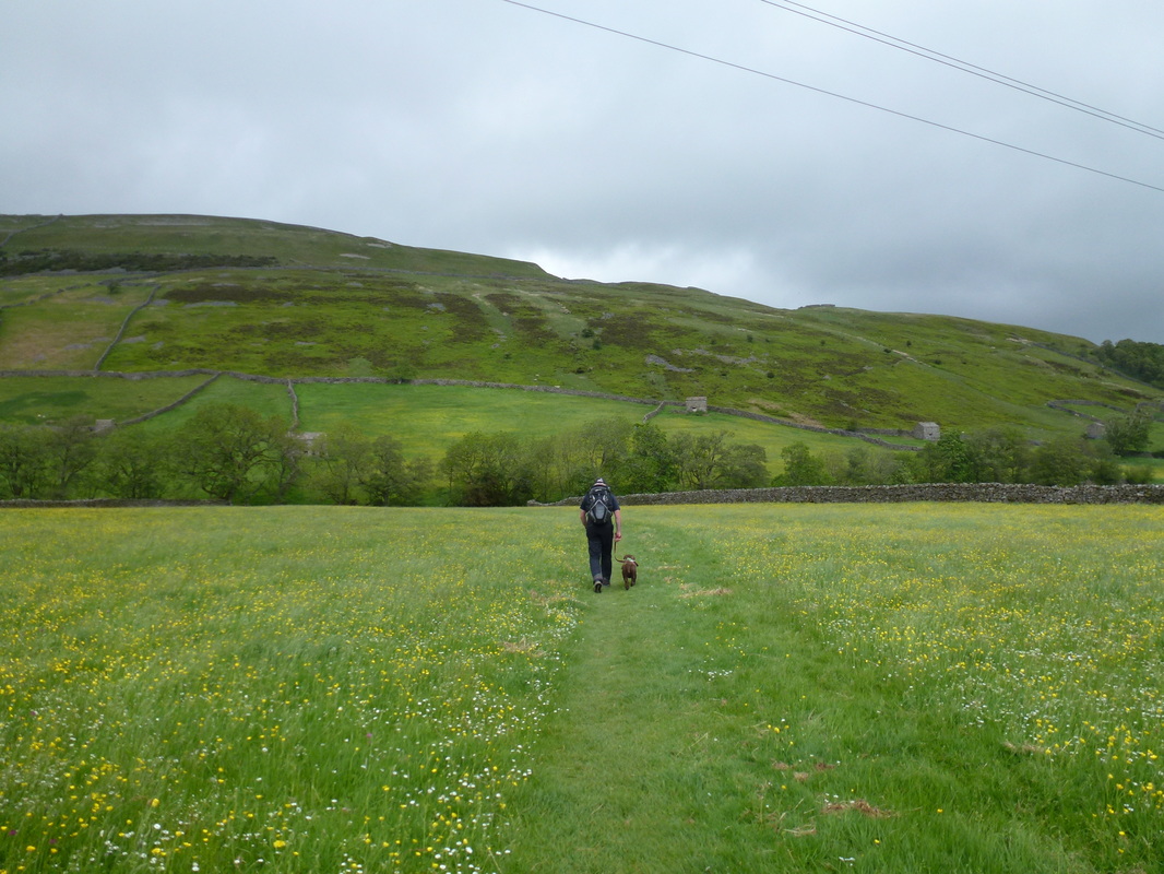
The Pennine Way passes right through Hawes and leaves via the bridge over the old railway before heading over fields and Hylands Bridge to reach Hardraw.  This section is a delightful walk through Wensleydale although we were not seeing it at its best today.  We had already been to Hardraw Force which is reached by paying a fee and proceeding through the back of The Green Dragon Pub in the village.  Leaving Hardraw, the route headed steeply up a track between walls to reach a gate on to open hillside.  There now began a 4½ mile gradual climb to the summit of Great Shunner Fell.  In drizzle and poor visibility this was not the most enjoyable way to spend 2 hours as we could not see a lot but having walked this path before we knew what we were missing.


Picture
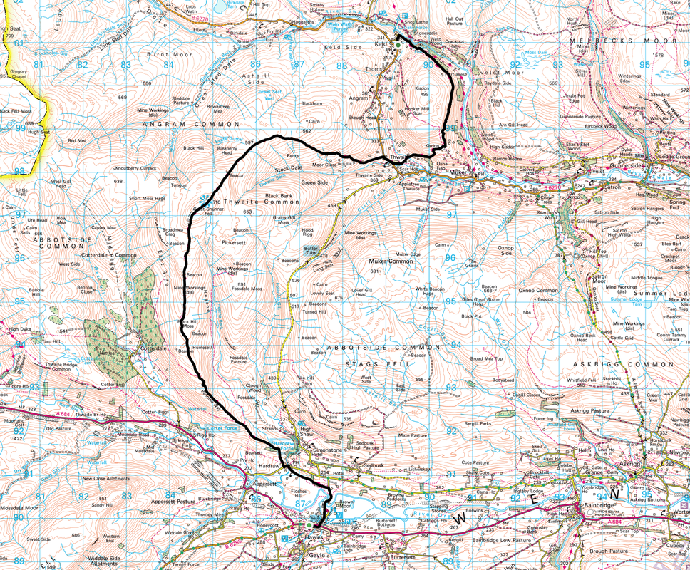
The old railway station in Hawes
Picture
Crossing Hylands Bridge out of Hawes
Picture
Hardraw Force can be visited through the back of the pub

The path was pretty easy to follow, even in mist as we headed along the ridge.  It was clear to see that this path had suffered in the past with erosion as the terrain flitted between duckboards, sunken slabs and steps.  Reaching the summit we were surprised to see quite a few people occupying the cross shelter and sheltering from the drizzle coming across the top.  We had a bit of lunch and met a couple of people who were walking the Heriot way and were off to Aysgarth.  Lunch over it was time once more to brave the elements and head off in the direction of Thwaite.
​
Picture
Looks a bit grim as we head up to Great Shunner Fell
Picture
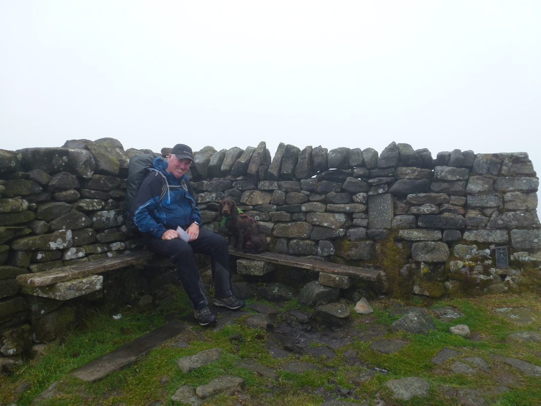
A white out on the top - notice how the Trig Point forms part of the shelter

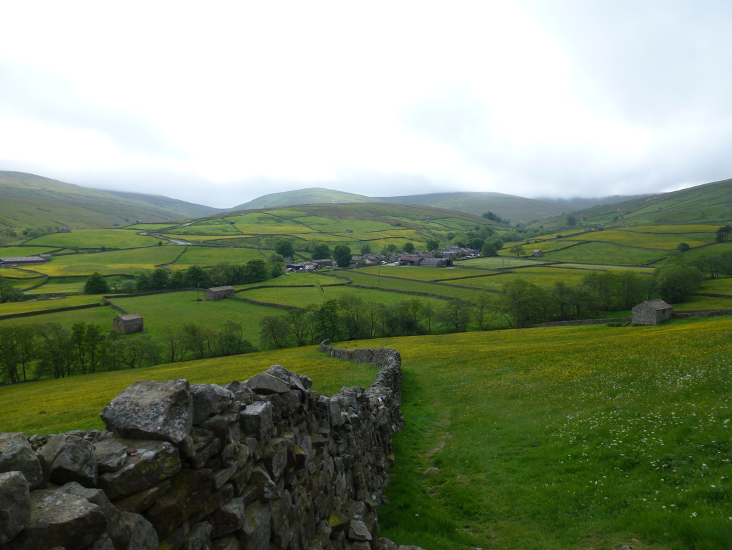
The descent from Great Shunner Fell is gradual on similar terrain to that of the ascent and was completed in mist for the most part.
​We passed a couple of large cairns about halfway down and crossed two groughs before reaching a stony track which was hard going but eased as we neared the village.  At Thwaite we stopped at the Kearton Tea Room and sat outside as by this time the weather had eased.  
​
Picture
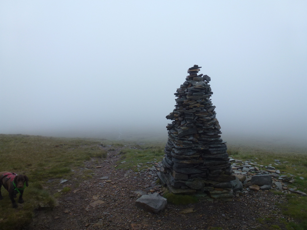
This large cairn shows the way down - the viz is not getting much better!
Picture
Again, thank goodness for flagstones as we head for another large cairn on the horizon - the 2 Heriot Way walkers are ahead of us
Picture
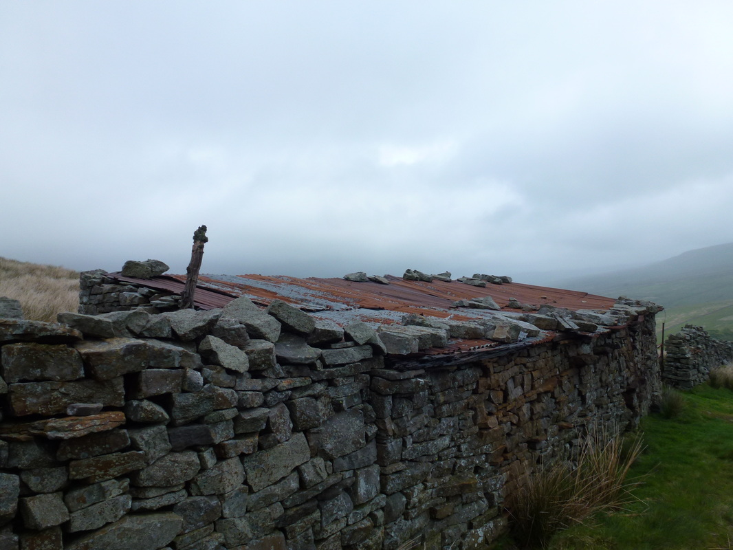
Hope it keeps his roof on
Picture
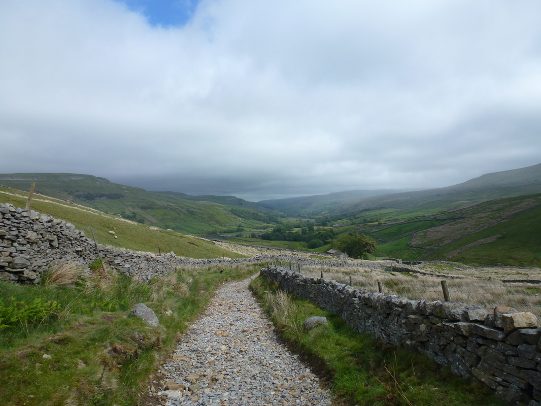
The stony path down to Thwaite - weather is better at last
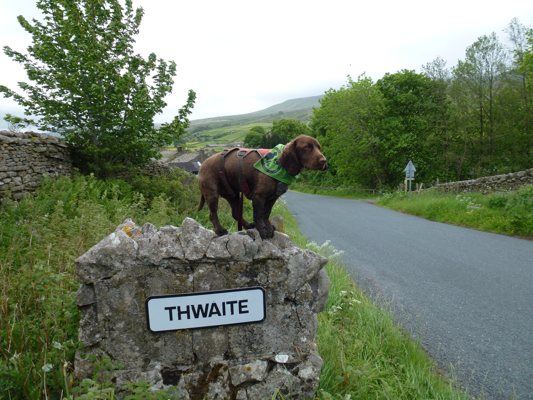
Picture
... and here we are
Picture
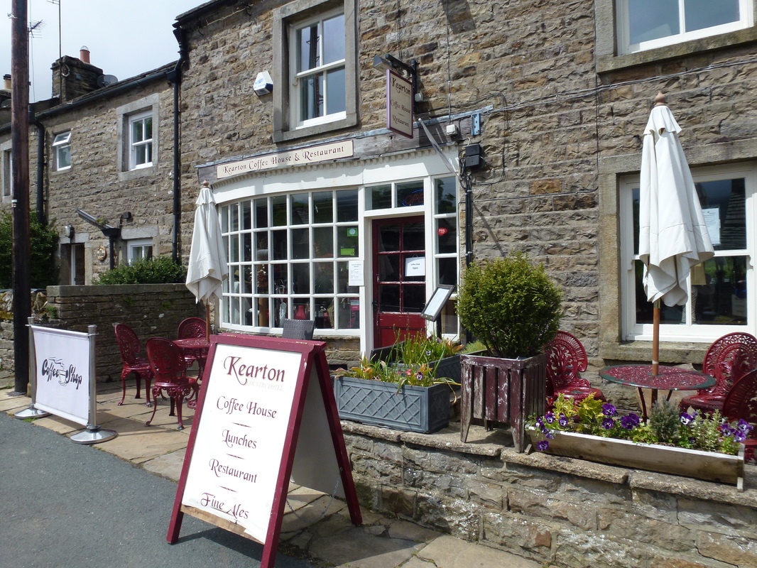
Never one to pass a tea room opportunity - this one was in Thwaite

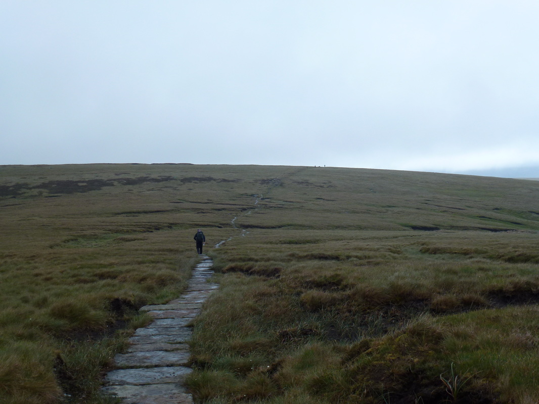
Leaving Thwaite, the path took a convoluted route through houses to pass through fields and by several barns before arriving at Kisdon House.  From the farm we passed through several gap stiles before climbing steeply to begin the long 2 miles along a rocky path high above the Swale to Keld via the slopes of Kisdon Hill.  The only issue we had on this path was a group of feisty cows about half way along.
​
Picture
Lovely walk out of Thwaite towards Keld - the weather had improved markedly!
Picture
Looking back to the rise out of Thwaite
Picture
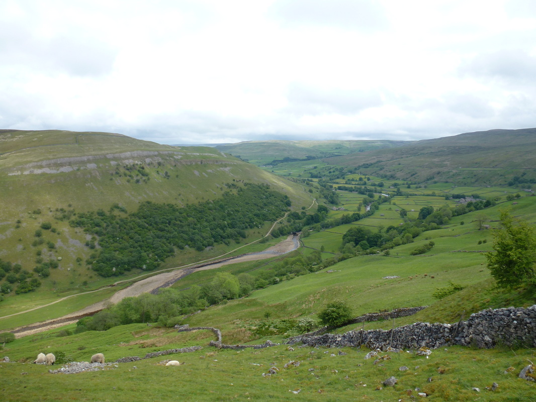
Looking down to Rampsholme Bridge, the Swale & Muker
Picture
Looking forward to seeing Keld again Fudge?
Picture
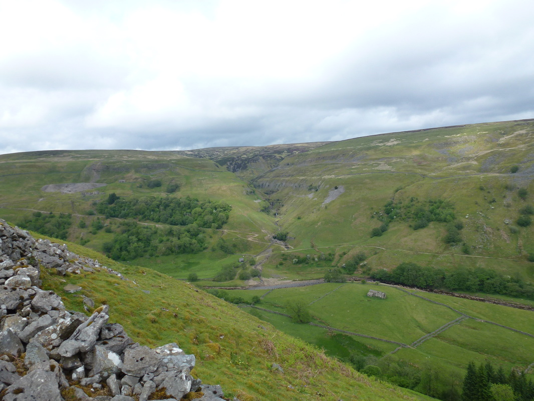
Swinner Gill with Crackpot Hall to the left

The path finally eased as we neared Keld and became easier underfoot and we soon arrived at the bridge over the Swale where the Coast to Coast route meets The Pennine Way - we would come back to this point tomorrow, however for now we were off to find our bed for the night at Butt House.  The owners Chris & Jackie gave us a lovely welcome and we settled in knowing we would not have to move out of here tonight as they also do an evening meal - Black Sheep on draught too!!  At dinner we were joined by 7 people who were doing the Coast to Coast - 4 Australians and 3 Brits and we had a delightful evening in their company.
​
Picture
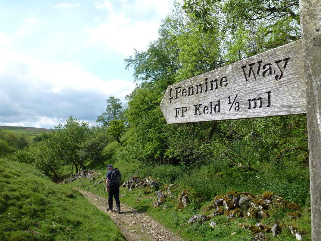
Nearly there - it was an extremely long 2 miles or so from Thwaite
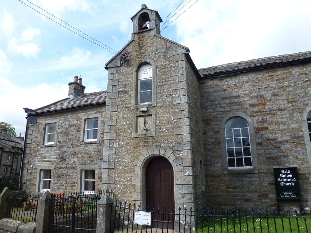
Picture
The church in Keld

Overnight Accommodation
​
Picture

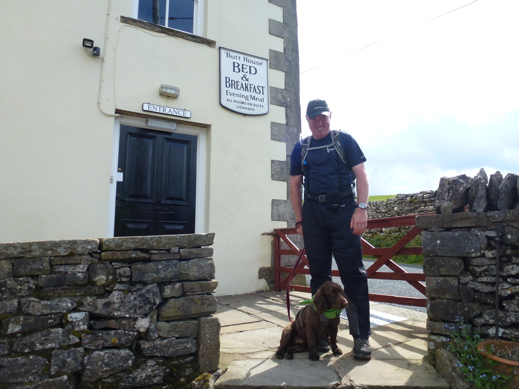
​Butt House, Keld - 
http://www.butthousekeld.co.uk   


Chris & Jackie have not been here long however they run a fantastic B&B.  Black Sheep Beer on tap and a superb evening meal made for an excellent stay - so much so we have booked to stay with them next year when we do the Coast to Coast again.  

​Day 9 Data
Mileage 

Cumulative Mileage

Time

Cumulative Time

Maximum Ascent

Total Ascent

Cumulative Ascent
​

13.1 miles

126.7 miles

6 hrs 15 min

58 hrs 35 min

2391 feet

2654 feet

24672 feet
Day 8
Day 10
© Copyright Dave Walsh 2013 - 2018 All Rights Reserved
Powered by Create your own unique website with customizable templates.