Masarnen Ramblers
Contact us or visit us on Facebook
  • Home
  • About Us
  • Long Distance Walks
    • Coast to Coast (C2C) 2012 >
      • Planning & Preparation
      • Day 0 - Arrival in Kirkby Stephen
      • Day 1 - St Bees to Ennerdale Bridge
      • Day 2 - Ennerdale Bridge to Rosthwaite
      • Day 3 - Rosthwaite to Patterdale
      • Day 4 - Patterdale to Shap
      • Day 5 - Rest Day in Shap
      • Day 6 - Shap to Kirkby Stephen
      • Day 7 - Kirkby Stephen to Muker
      • Day 8 - Muker to Reeth
      • Day 9 - Reeth to Richmond
      • Day 10 - Rest Day in Richmond
      • Day 11 - Richmond to Danby Wiske
      • Day 12 - Danby Wiske to Ingleby Cross
      • Day 13 - Ingleby Cross to Blakey Ridge
      • Day 14 - Blakey Ridge to Grosmont
      • Day 15 - Grosmont to Robin Hood's Bay
      • C2C - Thoughts in Conclusion
    • Yorkshire 3 Peaks 2013
    • Dales Way 2014 >
      • Day 0 - Arrival in Ilkley
      • Day 1 - Ilkley to Linton
      • Day 2 - Linton to Cray
      • Day 3 - Cray to Ribblehead
      • Day 4 - Ribblehead to Sedbergh
      • Day 5 - Sedbergh to Burneside
      • Day 6 - Burneside to Bowness
      • Dales Way - Thoughts in Conclusion
    • Pennine Way 2015 >
      • Day 0 - Wales to Torside
      • Day 1 - Edale to Torside
      • Day 2 - Torside to Delph
      • Day 3 - Delph to Hebden Bridge
      • Day 4 - Hebden Bridge to Ponden
      • Day 5 - Ponden to Gargrave
      • Day 6 - Gargrave to Malham
      • Day 7 - Malham to Ribblehead
      • Day 8 - Ribblehead to Hawes
      • Day 9 - Hawes to Keld
      • Day 10 - Keld to Bowes
      • Day 11 - Bowes to Middleton
      • Day 12 - Middleton to Langdon Beck
      • Day 13 - Langdon Beck to Dufton
      • Day 14 - Dufton to Alston
      • Day 15 - Rest Day in Alston
      • Day 16 - Alston to Greenhead
      • Day 17 - Greenhead to Saughy Rigg
      • Day 18 - Saughy Rigg - to Bellingham
      • Day 19 - Bellingham to Byrness
      • Day 20 - Byrness to Trows Farm
      • Day 21 - Trows Farm to Kirk Yetholm
      • Thoughts in Conclusion
    • Sarn Sabrina 2015
    • Mortimer Trail 2016 >
      • Mortimer Trail - Day 1
      • Mortimer Trail - Day 2
    • Coast to Coast (C2C) 2016 >
      • C2C Planning & Preparation
      • Day 0 - Arrival in Kirkby Stephen
      • Day 1 - St Bees to Ennerdale Bridge
      • Day 2 - Ennerdale Bridge to Seatoller
      • Day 3 - Seatoller to Patterdale
      • Day 4 - Patterdale to Shap
      • Day 5 - Shap to Kirkby Stephen
      • Day 6 - Kirkby Stephen to Keld
      • Day 7 - Keld to Reeth
      • Day 8 - Reeth to Richmond
      • Day 9 - Richmond to Danby Wiske
      • Day 10 - Danby Wiske to Ingleby Cross
      • Day 11 - Ingleby Cross to Blakey Ridge
      • Day 12 - Blakey Ridge to Egton Bridge
      • Day 13 - Egton Bridge to Robin Hood's Bay
      • C2C - Thoughts in Conclusion
    • South West Coast Path 2017 >
      • SWCP Itinerary
      • SWCP Charity, Planning & Preparation
  • Day Walks
    • Cornwall >
      • Mount Edgcumbe, Kingsand & Rame Head
      • Perranporth to Newquay
    • Cumbria (not Lake District) >
      • Cautley Spout, The Calf, Calders, Arant Haw & Winder
      • Cross Fell
      • Great Coum & Crag Hill
      • High Cup Nick
      • Yarlside, Randygill Top & The Calf
    • Dorset >
      • Charmouth to Bridport
      • Hardy's Monument from Abbotsbury
    • Durham >
      • Cauldron Snout
      • High & Low Force
    • Lake District >
      • Eastern Fells >
        • Birkett Fell, Hart Side & The Dodds
        • Catstycam & Birkhouse Moor
        • Clough Head & Great Dodd
        • Dodds, Clough Head & Raise
        • Fairfield Horseshoe
        • Fairfield, St Sunday Crag, Birks & Arnison Crag
        • Fairfield, Great Rigg & Heron Pike
        • Gowbarrow Fell
        • Great Mell Fell
        • Helvellyn Range
        • Helvellyn, Catstycam & Birkhouse Moor via Striding Edge
        • Little Mell Fell
        • Middle Dodd, Red Screes, Little Hart Crag & High Hartsop Dodd
        • Seat Sandal
        • Sheffield Pike, Raise, Stybarrow Dodd, Watson's Dodd and Hart Side
      • Far Eastern Fells >
        • Caudale Moor & Hartsop Dodd
        • Gray Crag, Thornthwaite Crag, Froswick & Ill Bell
        • Grey Crag, Tarn Crag & Branstree
        • Hallin Fell
        • High Street, Mardale Ill Bell and Harter Fell
        • High Street, Thornthwaite Crag, Gray Crag, Mardale Ill Bell & Harter Fell
        • Kentmere Pike & Shipman Knotts
        • Place Fell - Oct 15
        • Place Fell - Dec 17
        • Rest Dodd, The Nab and Brock Crags
        • Sour Howes, Sallows, Yoke, Ill Bell, Froswick & Thornthwaite Crag
        • Steel Knotts & Beda Fell
        • Troutbeck to Pooley Bridge
      • Central Fells >
        • Armboth Fell, High Tove & High Seat
        • Blea Rigg, Sergeant Man, High Raise, Steel Fell, Calf Crag, Gibson Knott & Helm Crag
        • Eagle Crag & Sergeants Crag
        • Grasmere & Langdale Epic
        • Langdale Pikes, Pavey Ark, Thunacar Knott & High Raise
        • Langdale Pikes & Thunacar Knott
        • Pike O'Stickle
        • Rosthwaite to Keswick via Watendlath
        • Silver How & Loughrigg Fell
        • Steel Fell, Calf Crag, Gibson Knott & Helm Crag
      • Southern Fells >
        • Coniston Fells
        • Coniston 7
        • Grey Friar, Great Carrs, Swirl How & Wetherlam
        • Irton Pike, Whin Rigg & Illgill Head
        • Lingmell
        • Lingmell, Scafell Pike, Broad Crag & Ill Crag via Piers Gill
        • Pike O'Blisco, Cold Pike & Crinkle Crags
        • Pike O'Blisco, Cold Pike, Little Stand & Crinkle Crags
        • Rossett Pike, Allen Crags, Glaramara, Esk Pike & Bowfell
        • Scafell Pike & Great End
        • Seathwaite Fell
        • Seathwaite Fell, Allen Crags & Glaramara
        • Slight Side & Scafell
        • Walna Scar, Dow Crag, Brim Fell & Coniston Old Man
      • Northern Fells >
        • Back O'Skidda
        • Bakestall & Great Calva
        • Blencathra, Mungrisdale Common, Skiddaw & Skiddaw Little Man
        • Blencathra via Sharp Edge
        • Dodd, Carl Side, Long Side & Ullock Pike
        • Great Calva & The Cumbria Way
        • High Pike & Carrock Fell
        • Latrigg, Blencathra, Mungrisdale Common, Skiddaw and Skiddaw Little Man
        • Souther Fell
        • Ullock Pike, Long Side, Carl Side & Skiddaw
      • North Western Fells >
        • Barrow
        • Castle Crag
        • Coledale Horseshoe 17 Sep 16
        • Coledale Horseshoe 2 Apr 17
        • Grasmoor & Whiteless Pike
        • Knott Rigg & Ard Crags
        • Lord's Seat, Barf, Broom Fell & Graystones
        • Robinson, Hindscarth, Dale Head, High Spy, Maiden Moor & Cat Bells
        • Sale Fell & Ling Fell
        • Whiteside
      • Western Fells >
        • Base Brown, Green Gable & Great Gable
        • Ennerdale to Black Sail Hut
        • Fleetwith Pike, Grey Knotts, Brandreth, Green Gable, Base Brown & Haystacks
        • Great Gable
        • Grike, Crag Fell & Lank Rigg
        • Hay Stacks
        • Hen Comb, Gavel Fell, Blake Fell & Burnbank Fell
        • High Stile Ridge
        • High Stile Ridge & Dodd
        • Kirk Fell
        • Kirk Fell from Gatesgarth
        • Low Fell & Fellbarrow
        • Mellbreak - July 2014
        • Mellbreak - December 2017
        • Middle Fell, Seatallan & Buckbarrow - May 14
        • Middle Fell, Seatallan & Buckbarrow - May 16
        • Pillar, Scoat Fell, Steeple, Haycock, Caw Fell & Red Pike
        • Yewbarrow, Red Pike, Scoat Fell, Steeple & Pillar
        • Yewbarrow
        • Yewbarrow, Red Pike & Pillar
      • Outlying Fells >
        • Black Combe
        • Devoke Water Circuit
    • Malvern Hills >
      • Herefordshire Beacon
      • Malvern Hills End to End
      • Worcestershire Beacon
    • North Yorkshire Moors >
      • Goathland, Mallyan Spout & the Wheeldale Roman Road
      • Roseberry Topping & Captain Cook's Monument
      • Runswick Bay & Staithes
      • Westerdale Moor
    • Northumberland >
      • Bamburgh Castle
      • Lindisfarne (Holy Island)
      • The Cheviot
      • Windy Gyle
    • Peak District >
      • Derwent Edge
      • Hollins Cross, Back Tor, Lose Hill, Win Hill & Hope
      • Ilam & Dovedale
      • Ladybower Reservoir & Crook Hill
      • Parkhouse Hill & Chrome Hill
      • Shutlingsloe, Shining Tor & Axe Edge Moor
      • Stanage Edge
      • Three Shire Heads, Hen Cloud, The Roaches & Lud's Church
    • Scotland >
      • The Schil
      • St Abbs Head
    • Shropshire >
      • Brown Clee Hill
      • Church Stretton to Shrewsbury
      • The Long Mynd
      • The Wrekin
    • Somerset >
      • Withypool & Tarr Steps
    • Wales >
      • Allt Lwyd, Bwlch y Ddwyallt & Waun Rydd
      • Berwyn Horseshoe
      • Black Mountain Wild Camp - Day 1
      • Black Mountain Wild Camp - Day 2
      • Black Mountains Circular Day 1
      • Black Mountains Circular Day 2
      • Brecon Beacons Horseshoe
      • Cadair Idris
      • Carmarthen Fan
      • Carnau, Gorllwyn, Carreg yr Ast & Drygarn Fawr
      • Cnicht & Moelwyn Mawr
      • Craig Cerrig-gleisiad, Fan Frynyrch, Fan Llia & Fan Fawr
      • Craig Eigiau & Pen Llithrig y Wrach
      • Fan y Big from Torpantau
      • Fan Fraith, Fan Gyhirych & Fan Nedd
      • Glyder Fach, Glyder Fawr, Y Garn & Foel-goch
      • Hay Bluff, Twmpa, Rhos Dirion & Chwarel y Fan
      • Hergest Ridge
      • Llanddwyn Island, Anglesey
      • Moel Cynghorion, Foel Goch, Foel Gron & Moel Eilio
      • Moel Hebog
      • Moel Siabod
      • Nantlle Ridge
      • Pumlumon from Eisteddfa Gurig
      • Pumlumon from Nant y Moch
      • Rhayader, Maen Serth & Gilfach
      • Snowdon & Garnedd Ugain
      • Talybont-on-Usk to The Storey Arms via 8 Nuttalls
      • Tryfan via Heather Terrace
      • Tryfan, Y Foel Goch & Gallt yr Ogof
      • Waun Fach from Pengenffordd
      • Waun Fach & The Black Mountains from Llanbedr
      • Whimble, Bache Hill, Black Mixen & Great Rhos
    • Yorkshire >
      • Buckden 4 Corners
      • Buckden Pike & Starbotton
      • Buckden Pike & Great Whernside
      • Dodd Fell Hill & Drumaldrace
      • Flamborough Head
      • Harrogate Ringway
      • Ingleborough
      • Ingleborough & Simon Fell
      • Keld to Reeth
      • Keld, Swaledale, Old Gang & Gunnerside
      • Malham Cove & Gordale Scar
      • Muker, Keld, Swaledale and Tan Hill
  • Hill Tick Lists
    • Wainwrights >
      • Abstract
      • The Eastern Fells
      • The Far Eastern Fells
      • The Central Fells
      • The Southern Fells
      • The Northern Fells
      • The North Western Fells
      • The Western Fells
      • The Outlying Fells
      • Completion Day
    • Trail 100
  • Useful Links
  • Contact Us

Black Mountains Circular Day 2 - Wednesday 24 February 2016
​

Route                


​Parking


Mileage

Terrain


​Weather

Time Taken

Total Ascent

Map
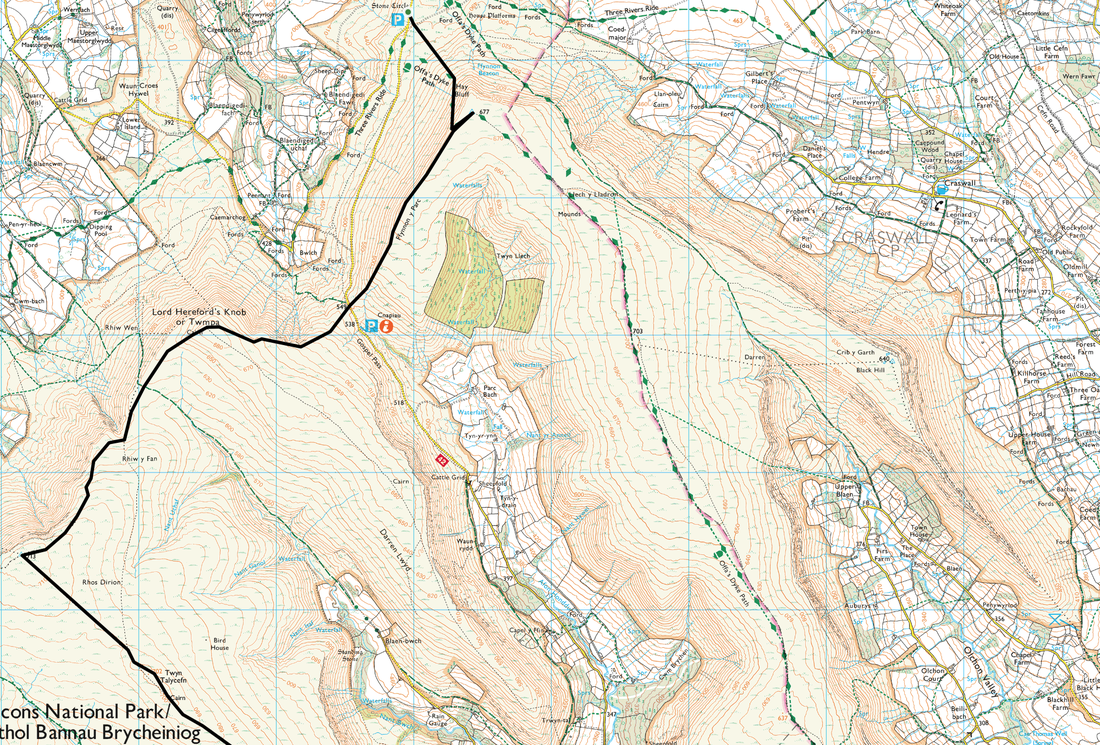
Llanthony - Bal Bach - Bal Mawr - Chwarel y Fan - Blacksmith's Anvil - Twyn Talycefn - Rhos Dirion - Twmpa - Hay Bluff - Hay Bluff Stone Circle​

NA

12 miles

Good mountain paths.  Sleep climb out of the re-entrant to Bal Bach but from there it is ridge walking at its best - undulating and on good paths.  The descent from Hay Bluff to the Stone Circle is steep for the last 400m

Gloriously sunny with a stiff breeze at times on the ridge

5hrs 20min

​2952ft (900m)

OL13 - Brecon Beacons National Park (Eastern Area)


GPX File
black_mountains__in_.gpx
File Size: 7 kb
File Type: gpx
Download File

Walk Description

Picture
Picture

We awoke to a fantastic weather day and breakfasted safe in the knowledge that today would be one of excellent visibility.  Our stay at The Half Moon was super - unpretentious, clean, good food & beer and great value for money.  The owners, Lynda & Steve have not been at the pub long but have already done much to make visitors even more comfortable and welcome in their idyllic pub.
 
The route back to Hay on Wye was basically a reverse of the outward route but on the opposite western ridge.  I had been up on this ridge a couple of weeks back but in totally different conditions - that time we had snow and ice to contend with.  Now barely two weeks since that day it was now totally different - sunny and not a patch of snow in sight.   
 
From Llanthony the route climbed steeply up the side of a re-entrant to reach a crossroad of paths at Bal Bach.  From here the steepness relented to a gentle gradient to arrive at the summit of Bal Mawr where there was a superb view back to Ysgyryd Fawr, Sugar Loaf and over to Pen y Gadair Fawr.  From the Trig Point the path heads gently along the ridge before a gradual incline up to the summit of Chwarel y Fan.  The route then dropped down to the Blacksmith's Anvil before heading ever northwards on the long stretch towards Rhos Dirion - we had arranged to meet another friend, Chips, between the Anvil & Rhos Dirion and we soon spotted him making his way over the somewhat boggy terrain to meet up with us.
 
We soon arrived at Rhos Dirion, just in time to chat to a couple of lads on mountain bikes who were off back to Gwryne Fawr Reservoir. From the summit of Rhos Dirion there was a delightful undulating transit to firstly Twmpa (Lord Hereford's Knob) and then a steep drop to the Gospel Pass before a short, sharp pull back up on to the Ffynnon y Parc ridge.  From the ridge it was a half mile walk to reach Hay Bluff's summit for the second time in two days.  After a steep descent from Hay Bluff we arrived at the Stone Circle where Chips had left his car to end what was a fabulous two days in a wonderful part of the Brecon Beacons.


Picture
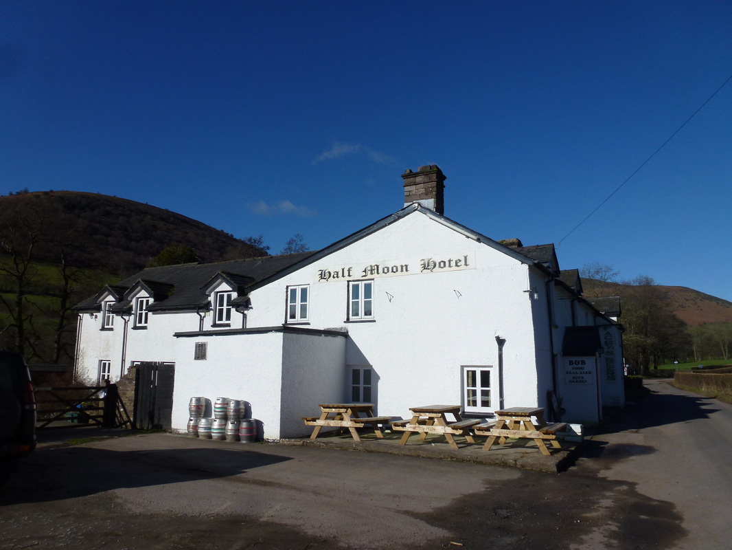
Leaving The Half Moon - weather looks promising
Picture
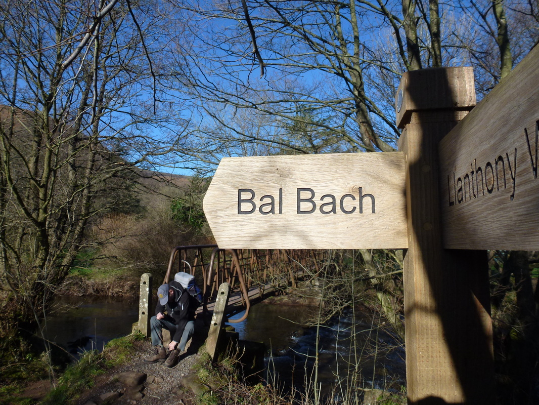
Leaving Llanthony via the footbridge to Bal Bach - the route out was via a steep re-entrant.
Waggers has heard there were Welsh Bandits up in the hills therefore he is hiding his one and only Five Pound Note down his sock
Picture
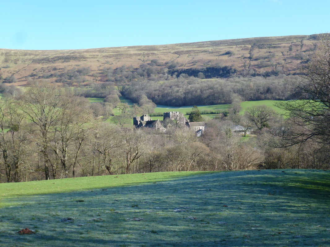
Looking back to Llanthony Priory
Picture
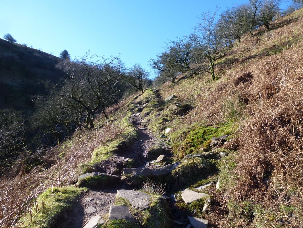
The steep ascent to Bal Bach
Picture
The steepness relented at the top of the rise near Bal Bach
Picture
Bal Mawr from Bal Bach
Picture
Zooming in on Sugar Loaf
Picture
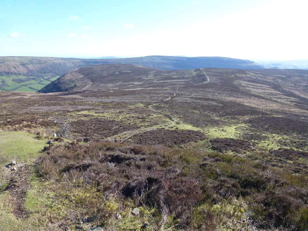
Our route of ascent up to Bal Mawr
Picture
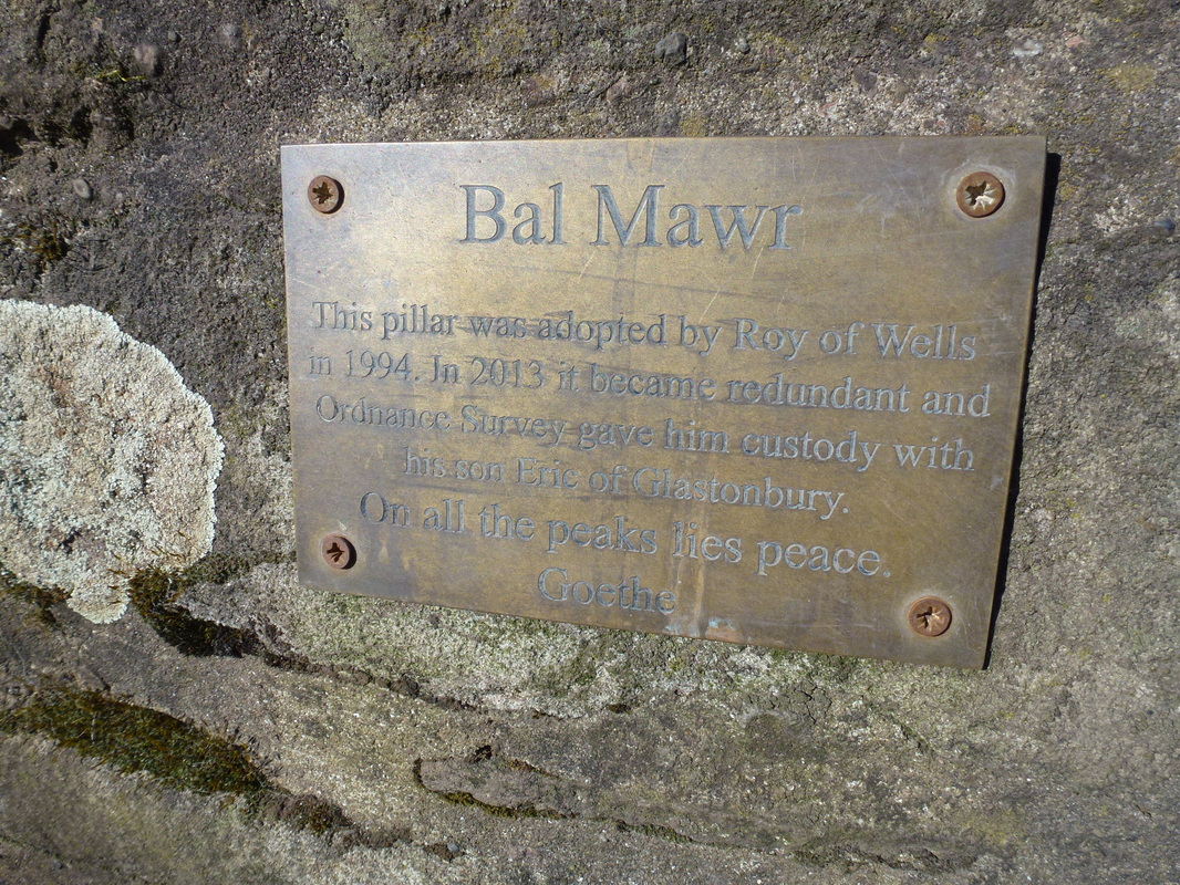
Even Trig Points get made redundant
Picture
Ysgyryd Fawr & Sugar Loaf from Bal Mawr
Picture
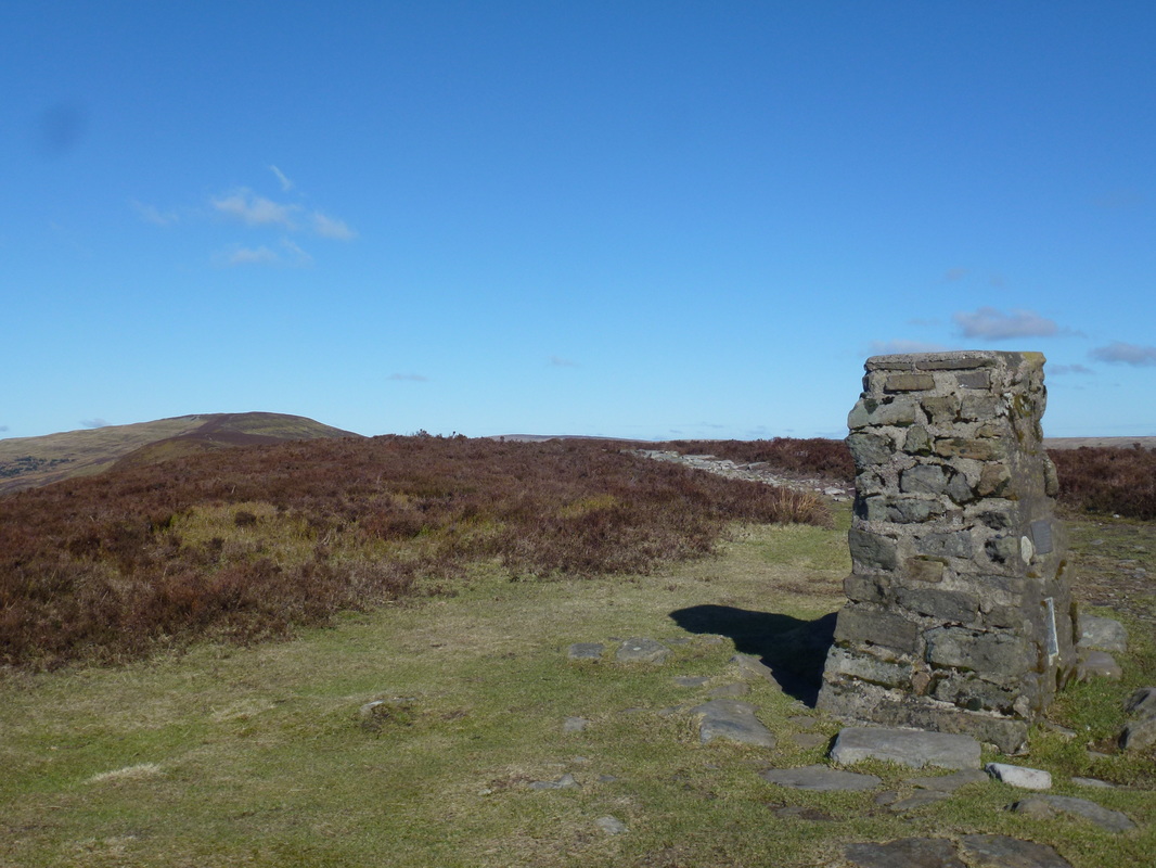
The summit of Bal Mawr
Picture
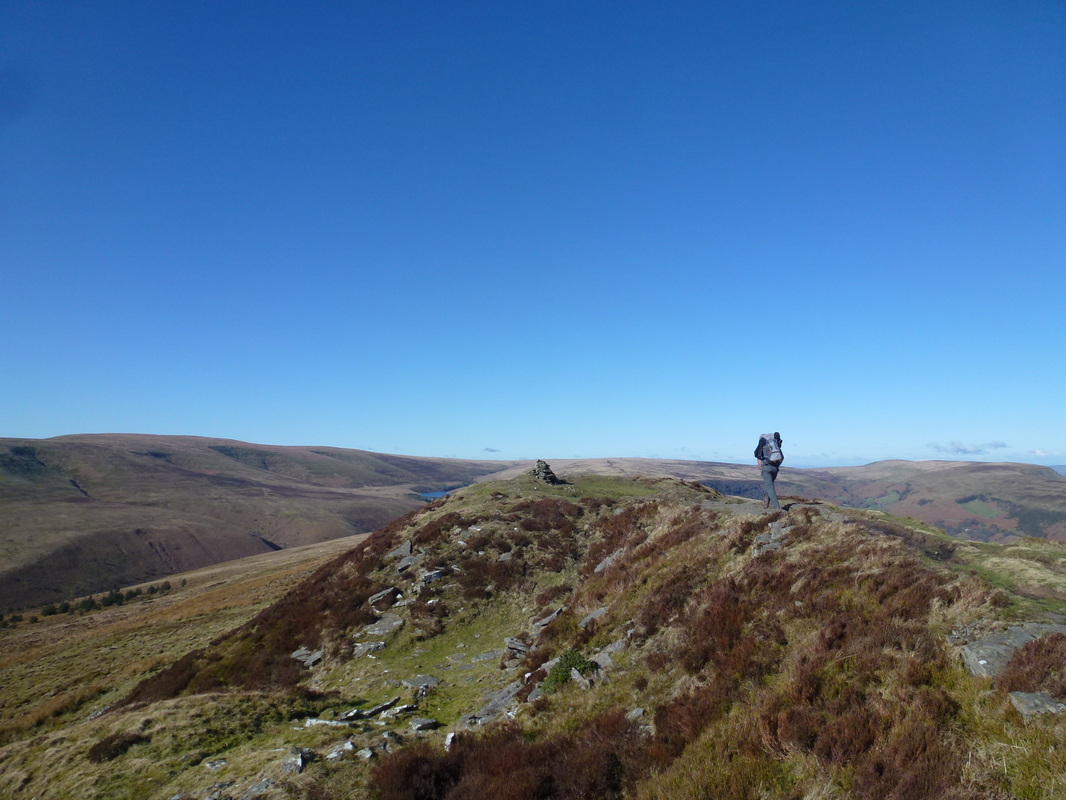
Heading for the summit of Chwarel y Fan
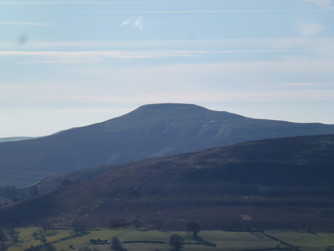
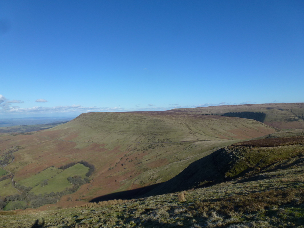
Picture
Pen y Gadair Fawr
Picture
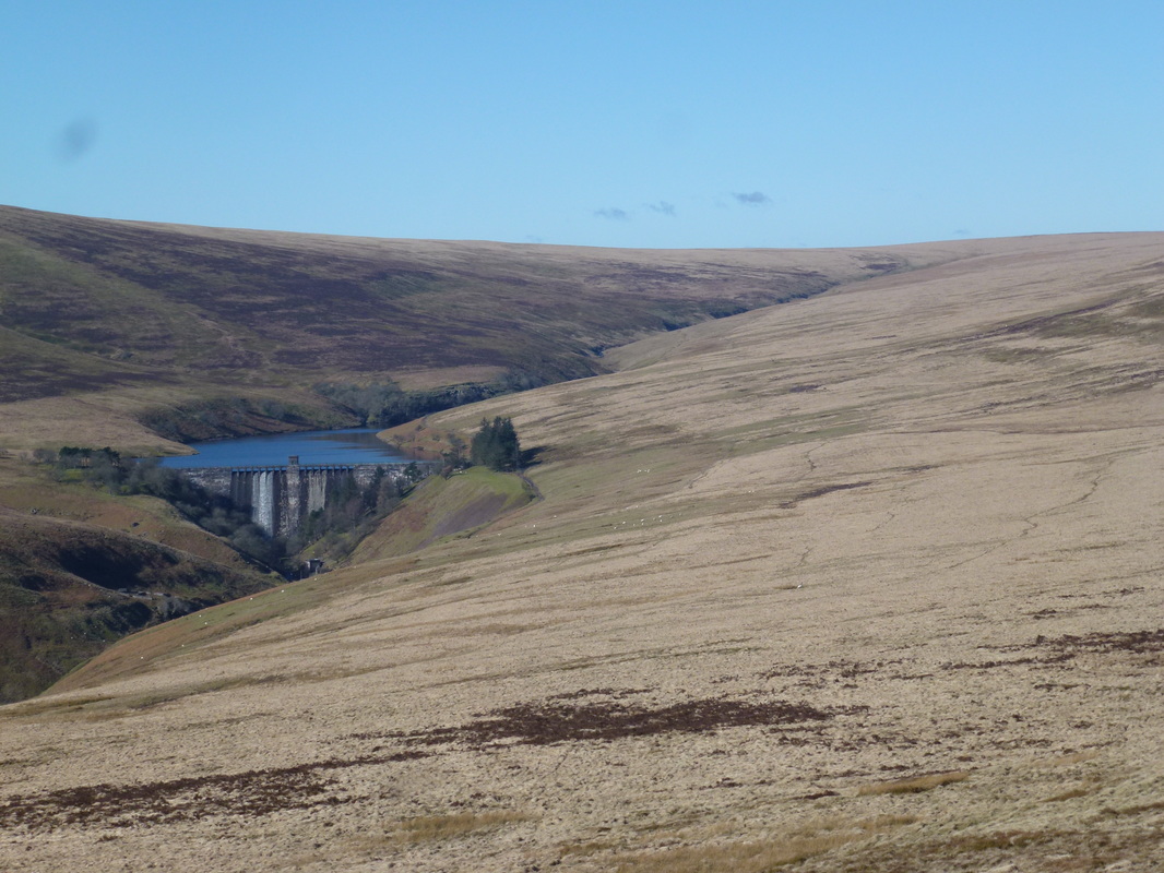
Grwyne Fawr Reservoir
Picture
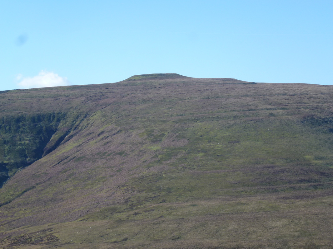
The Blacksmith's Anvil
Picture
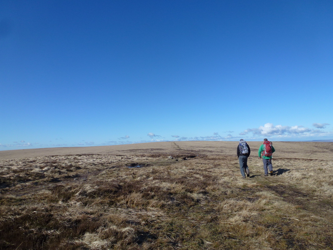
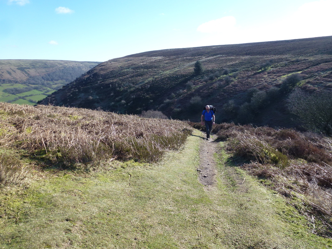
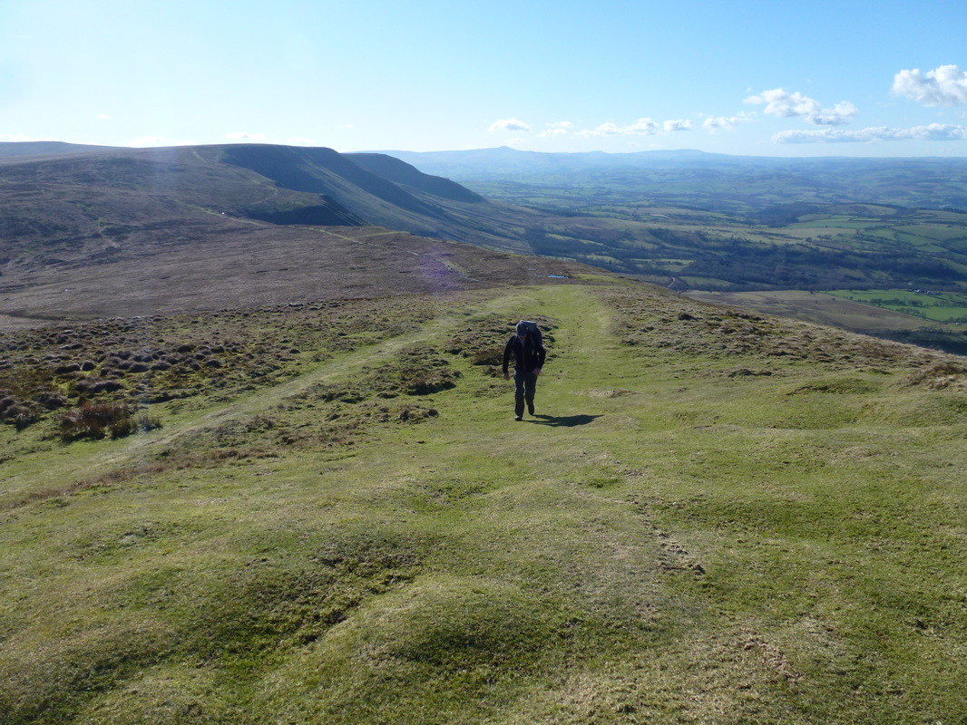
Heading for Twyn Talycefn 
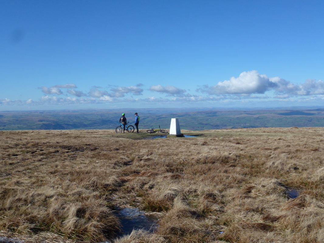
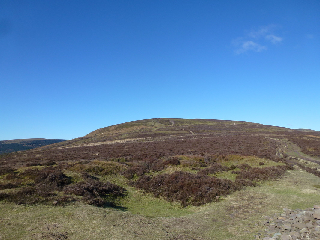
Picture
Rhos Dirion
Picture
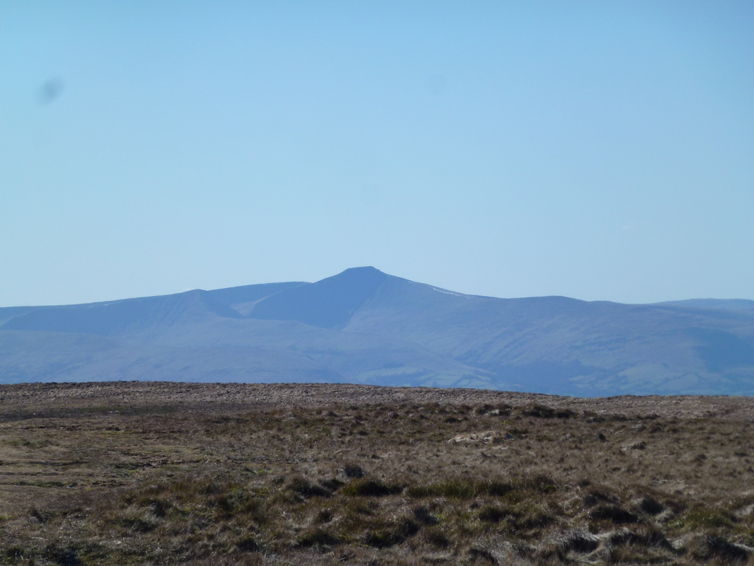
Cribyn & Pen y Fan from Rhos Dirion
Picture
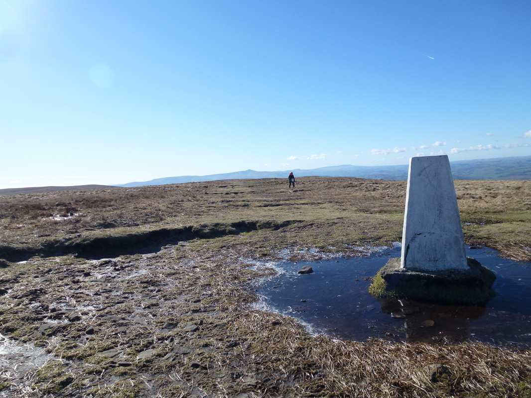
The summit of Rhos Dirion - and a bloke with a big map
Picture
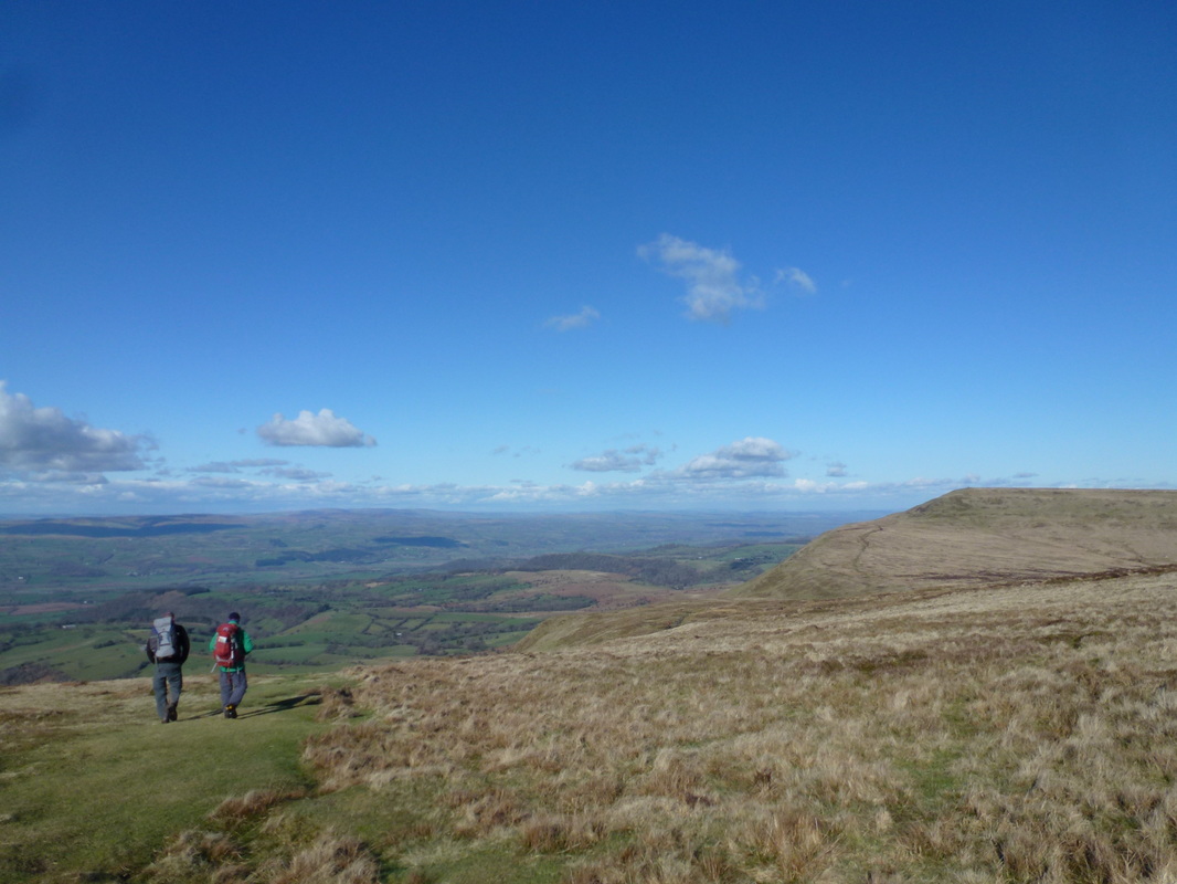
Heading down Rhos Dirion for Twmpa
Picture
The steepish incline to the summit of Twmpa
Picture
The summit of Twmpa (Lord Hereford's Knob)
Picture
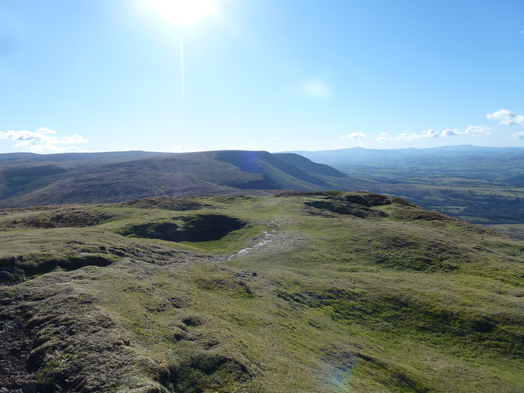
Rhos Dirion from Twmpa
Picture
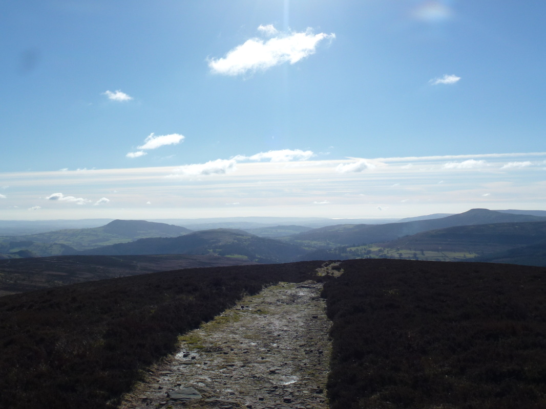
Looking to Hay Bluff across the Gospel Pass
Picture
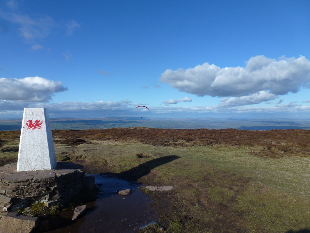
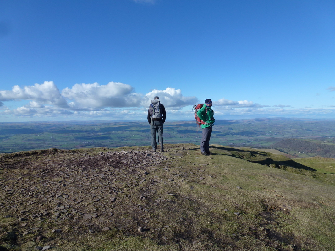
The summit of Hay Bluff
Picture
The 3 Amigos on the summit of Hay Bluff
Picture
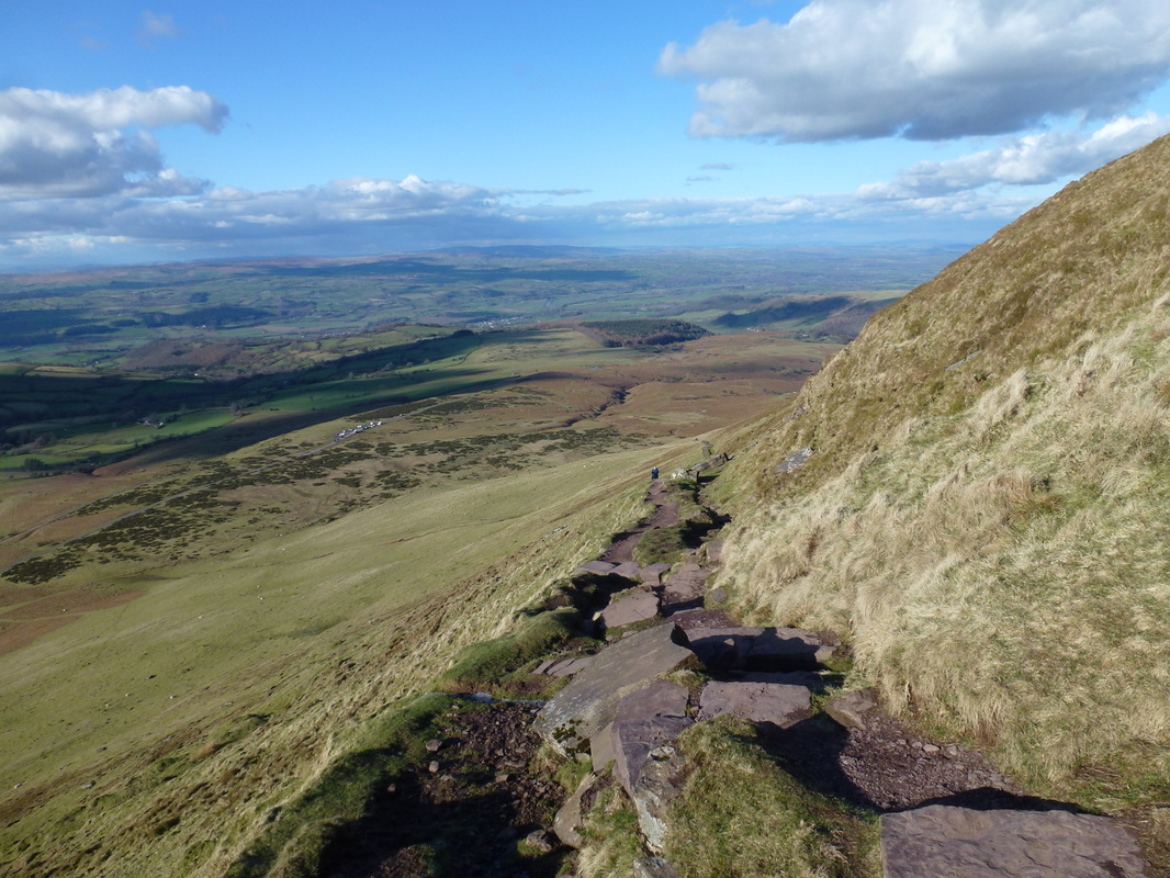
Descending Hay Bluff - the Stone Circle Car Park is to the left
Picture
The steep descent from Hay Bluff to the Stone Circle

    If you wish to make any comments regarding this walk or have any questions then please feel free to contact us by completing the form below

Submit
Home
 © Copyright Dave Walsh 2013 - 2018 All Rights Reserved
Powered by
✕