Clough Head & Great Dodd from Dockray - Tuesday 11 January 2011
Route
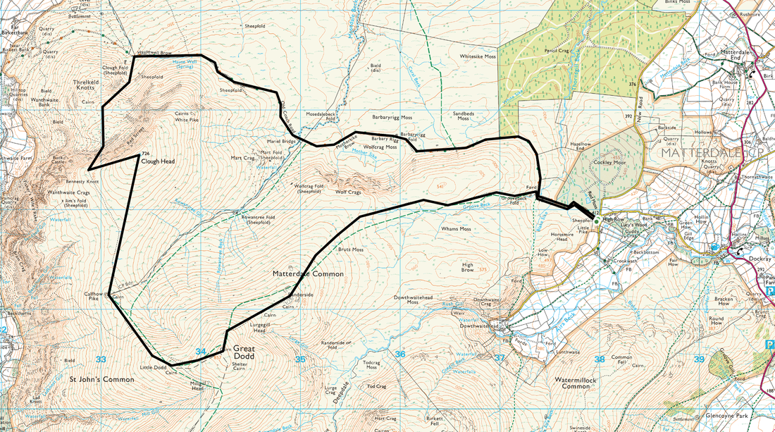
High Row Dockray - Old Coach Road - Threlkeld Knotts - Clough Head - Calfhow Pike - Great Dodd - Old Coach Road - High Row Dockray
Parking
High Row (Free) - Grid Ref NY380219
Mileage
9.5 miles
Terrain
Good path along the Old Coach Road as far as Hausewell Brow then intermittent paths which were covered in snow. Walking from Clough Head was very tricky because of ice and snow.
Weather
Extremely cold with fresh breezes. Visibility was surprisingly good.
Time Taken
6hrs 30mins
Total Ascent
2240 ft (683m)
Wainwrights
2
Map
OL5 - The English Lakes (North Eastern Area)
|
GPX File
|
| ||
If the above GPX file fails to download or presents itself as an XML file once downloaded then please feel free to contact me and I will send you the GPX file via e-mail.
Walk Description
After a couple of days holed up in the cottage we were keen to get out today and despite the freezing temperatures we made the short journey over to High Row at Dockray to tackle Clough Head and The Dodds and come back via Dowthwaitehead. As with any plan, it was always susceptible to the weather and our itinerary changed - more later.
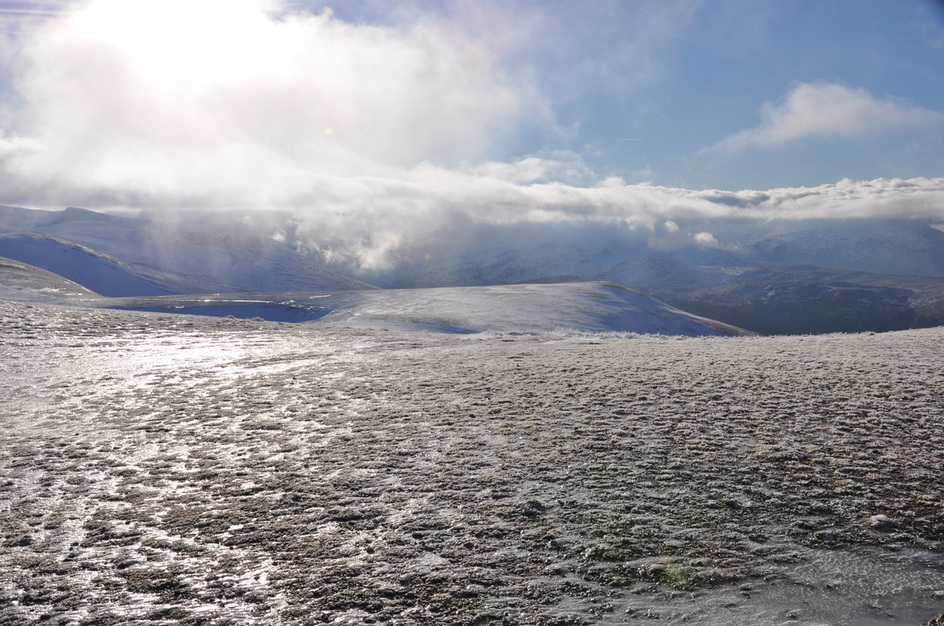
Fully wrapped up, we made our way along the Old Coach Road as far as Hausewell Brow and then climbed Threlkeld Knotts. From here there is quite a stiff pull up to the summit of Clough Head but the views from the top were glorious - it feels as though you could almost touch Blencathra. There was just a smattering of snow on the summit therefore we carried on to Calfhow Pike and on to Great Dodd. The summit was all ice and made for very tricky walking therefore we cut our losses and gave up plans to walk to Watson's, Stybarrow and Hart Side. Instead we headed North East over Matterdale Common to meet the Old Coach Road at Groove Beck - we would probably have been struggling for light anyway therefore it made the decision easier.
The descent was tricky as the path was covered in snow making it a guessing game as to how deep your feet would sink in to the snow. This made for a few comedy moments but we kept our sense of humour and made it safely down to the beck. From here it was a simple stroll along the path back to High Row.
Whilst the conditions today looked fairly benign it just goes to show that whilst it may be ok at the bottom of the fells it may be completely different at the top. If you have the slightest doubt then it is best to get off the hill as soon as possible - and we did.
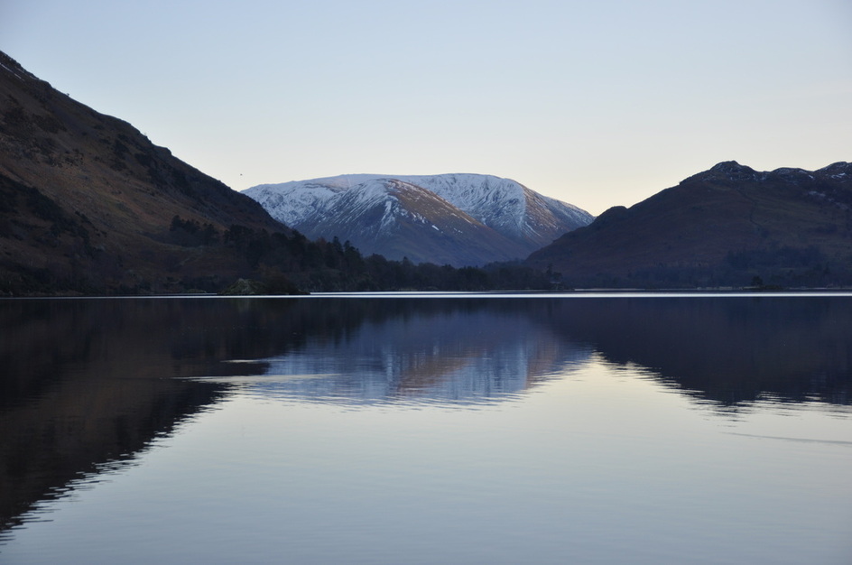
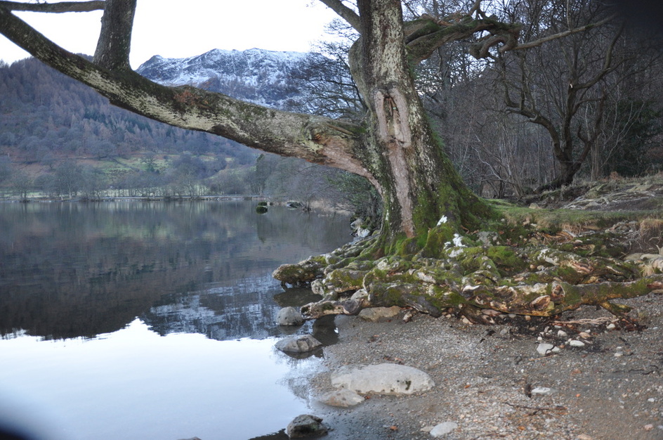
Driving back to Glenridding, we stopped off at Ullswater and took some photos of the lake in superb light. There are a few of these below.
Fully wrapped up, we made our way along the Old Coach Road as far as Hausewell Brow and then climbed Threlkeld Knotts. From here there is quite a stiff pull up to the summit of Clough Head but the views from the top were glorious - it feels as though you could almost touch Blencathra. There was just a smattering of snow on the summit therefore we carried on to Calfhow Pike and on to Great Dodd. The summit was all ice and made for very tricky walking therefore we cut our losses and gave up plans to walk to Watson's, Stybarrow and Hart Side. Instead we headed North East over Matterdale Common to meet the Old Coach Road at Groove Beck - we would probably have been struggling for light anyway therefore it made the decision easier.
The descent was tricky as the path was covered in snow making it a guessing game as to how deep your feet would sink in to the snow. This made for a few comedy moments but we kept our sense of humour and made it safely down to the beck. From here it was a simple stroll along the path back to High Row.
Whilst the conditions today looked fairly benign it just goes to show that whilst it may be ok at the bottom of the fells it may be completely different at the top. If you have the slightest doubt then it is best to get off the hill as soon as possible - and we did.
Driving back to Glenridding, we stopped off at Ullswater and took some photos of the lake in superb light. There are a few of these below.
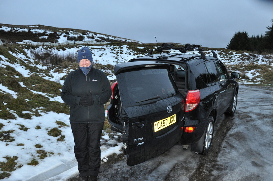
It was a bit nippy today!
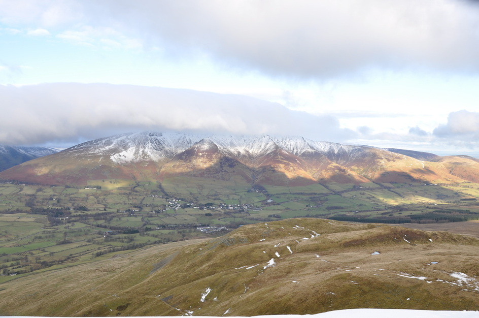
Blencathra with Threlkeld below from the Old Coach Road
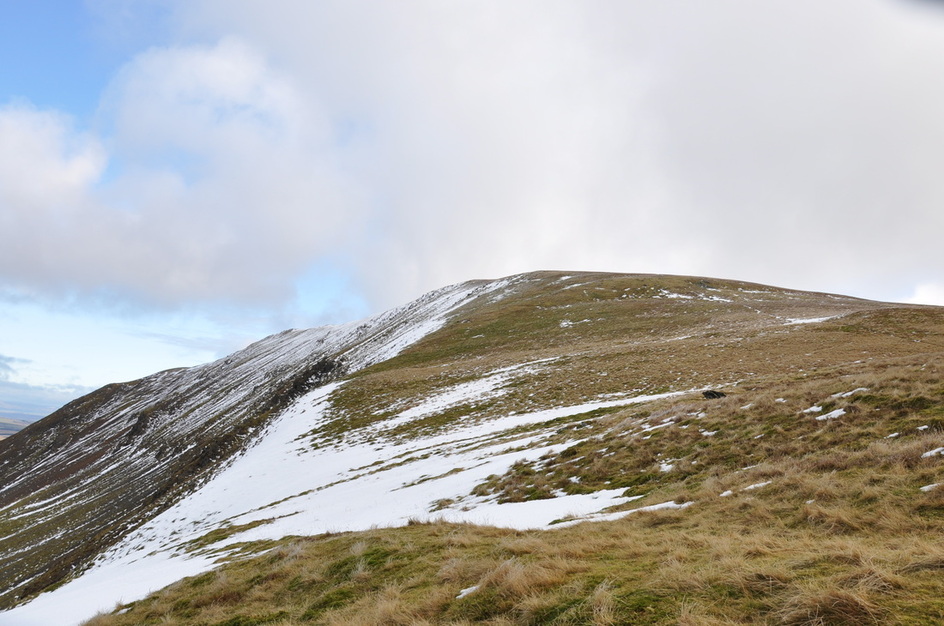
The snowy approach to Clough Head
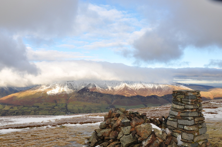
The summit of Clough Head with Blencathra providing a fitting backdrop
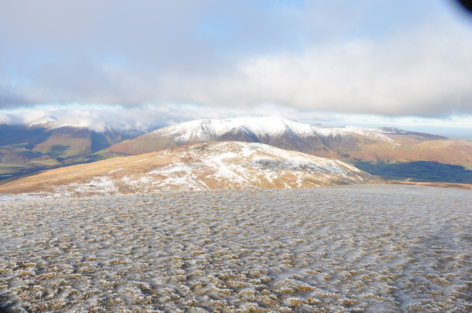
Clough Head summit looking towards Latrigg & Skiddaw. Bassenthwaite Lake is just about visible
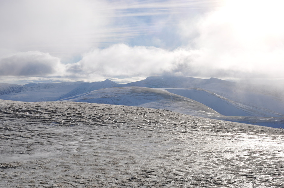
This was all ice - looking over to Watson's Dodd
Summit of Great Dodd with Stybarrow Dodd in the foreground.
The 'Witches Hat' tip of Catstycam is centre left with Helvellyn to the right
The 'Witches Hat' tip of Catstycam is centre left with Helvellyn to the right
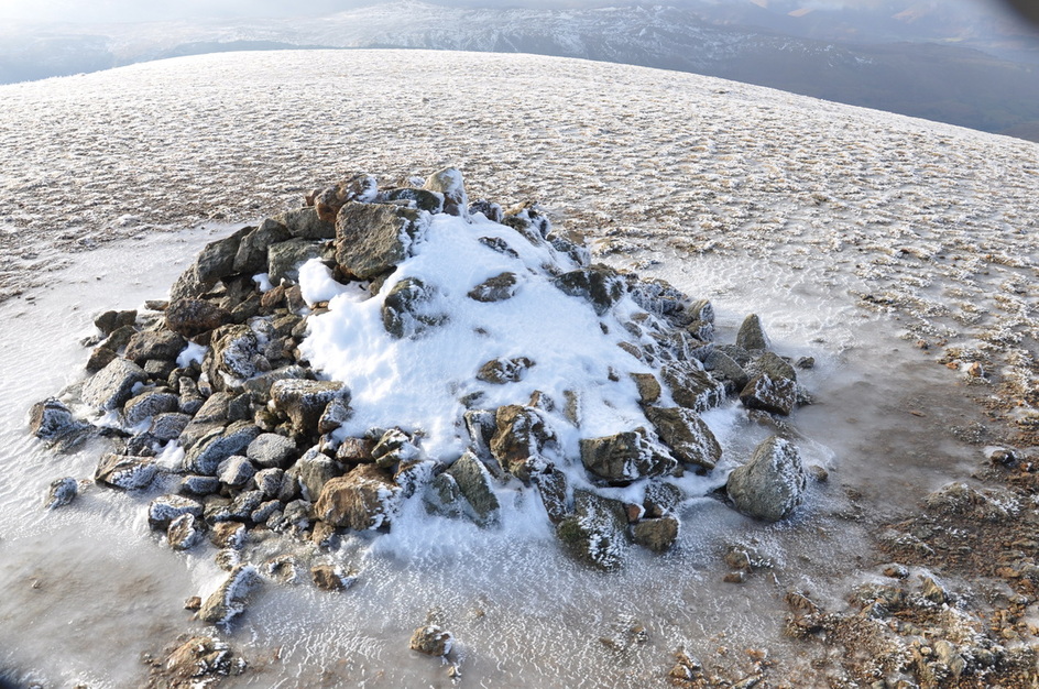
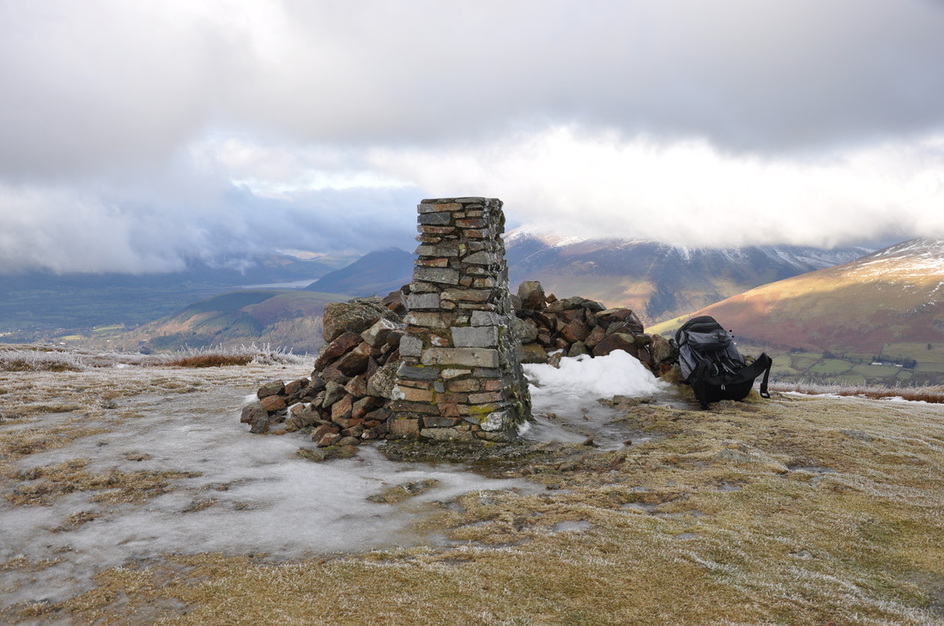
The frozen Summit Cairn on Great Dodd
Clough Head from Great Dodd with Blencathra behind
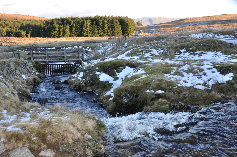
Groove Beck
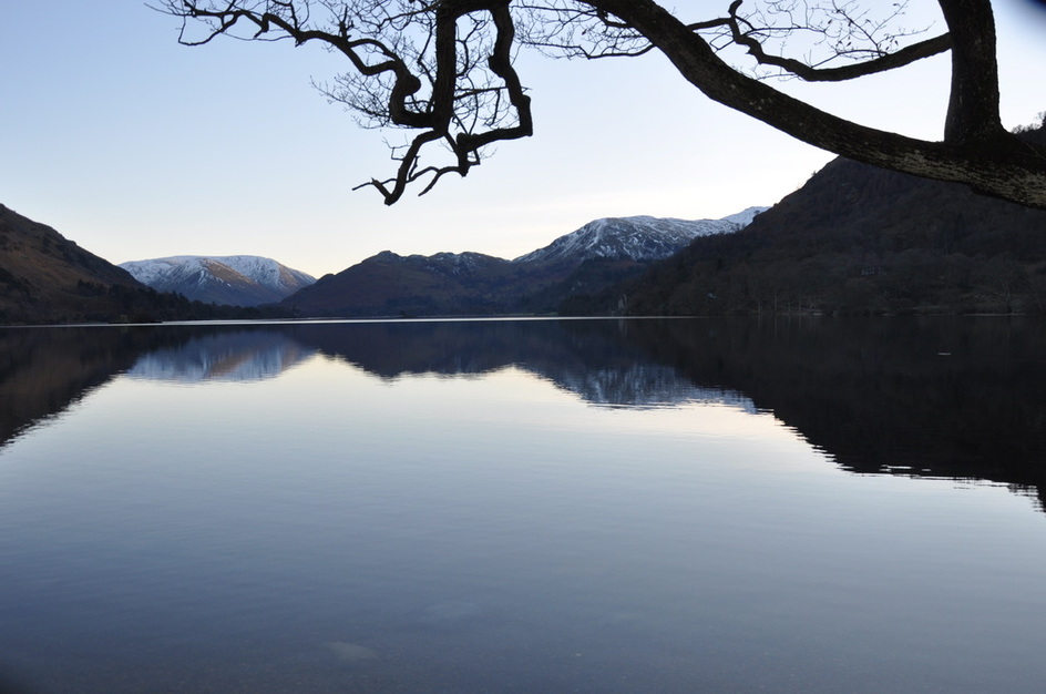
Ullswater
Hartsop Dodd and Ullswater
Ullswater