Masarnen Ramblers
Contact us or visit us on Facebook
  • Home
  • About Us
  • Long Distance Walks
    • Coast to Coast (C2C) 2012 >
      • Planning & Preparation
      • Day 0 - Arrival in Kirkby Stephen
      • Day 1 - St Bees to Ennerdale Bridge
      • Day 2 - Ennerdale Bridge to Rosthwaite
      • Day 3 - Rosthwaite to Patterdale
      • Day 4 - Patterdale to Shap
      • Day 5 - Rest Day in Shap
      • Day 6 - Shap to Kirkby Stephen
      • Day 7 - Kirkby Stephen to Muker
      • Day 8 - Muker to Reeth
      • Day 9 - Reeth to Richmond
      • Day 10 - Rest Day in Richmond
      • Day 11 - Richmond to Danby Wiske
      • Day 12 - Danby Wiske to Ingleby Cross
      • Day 13 - Ingleby Cross to Blakey Ridge
      • Day 14 - Blakey Ridge to Grosmont
      • Day 15 - Grosmont to Robin Hood's Bay
      • C2C - Thoughts in Conclusion
    • Yorkshire 3 Peaks 2013
    • Dales Way 2014 >
      • Day 0 - Arrival in Ilkley
      • Day 1 - Ilkley to Linton
      • Day 2 - Linton to Cray
      • Day 3 - Cray to Ribblehead
      • Day 4 - Ribblehead to Sedbergh
      • Day 5 - Sedbergh to Burneside
      • Day 6 - Burneside to Bowness
      • Dales Way - Thoughts in Conclusion
    • Pennine Way 2015 >
      • Day 0 - Wales to Torside
      • Day 1 - Edale to Torside
      • Day 2 - Torside to Delph
      • Day 3 - Delph to Hebden Bridge
      • Day 4 - Hebden Bridge to Ponden
      • Day 5 - Ponden to Gargrave
      • Day 6 - Gargrave to Malham
      • Day 7 - Malham to Ribblehead
      • Day 8 - Ribblehead to Hawes
      • Day 9 - Hawes to Keld
      • Day 10 - Keld to Bowes
      • Day 11 - Bowes to Middleton
      • Day 12 - Middleton to Langdon Beck
      • Day 13 - Langdon Beck to Dufton
      • Day 14 - Dufton to Alston
      • Day 15 - Rest Day in Alston
      • Day 16 - Alston to Greenhead
      • Day 17 - Greenhead to Saughy Rigg
      • Day 18 - Saughy Rigg - to Bellingham
      • Day 19 - Bellingham to Byrness
      • Day 20 - Byrness to Trows Farm
      • Day 21 - Trows Farm to Kirk Yetholm
      • Thoughts in Conclusion
    • Sarn Sabrina 2015
    • Mortimer Trail 2016 >
      • Mortimer Trail - Day 1
      • Mortimer Trail - Day 2
    • Coast to Coast (C2C) 2016 >
      • C2C Planning & Preparation
      • Day 0 - Arrival in Kirkby Stephen
      • Day 1 - St Bees to Ennerdale Bridge
      • Day 2 - Ennerdale Bridge to Seatoller
      • Day 3 - Seatoller to Patterdale
      • Day 4 - Patterdale to Shap
      • Day 5 - Shap to Kirkby Stephen
      • Day 6 - Kirkby Stephen to Keld
      • Day 7 - Keld to Reeth
      • Day 8 - Reeth to Richmond
      • Day 9 - Richmond to Danby Wiske
      • Day 10 - Danby Wiske to Ingleby Cross
      • Day 11 - Ingleby Cross to Blakey Ridge
      • Day 12 - Blakey Ridge to Egton Bridge
      • Day 13 - Egton Bridge to Robin Hood's Bay
      • C2C - Thoughts in Conclusion
    • South West Coast Path 2017 >
      • SWCP Itinerary
      • SWCP Charity, Planning & Preparation
  • Day Walks
    • Cornwall >
      • Mount Edgcumbe, Kingsand & Rame Head
      • Perranporth to Newquay
    • Cumbria (not Lake District) >
      • Cautley Spout, The Calf, Calders, Arant Haw & Winder
      • Cross Fell
      • Great Coum & Crag Hill
      • High Cup Nick
      • Yarlside, Randygill Top & The Calf
    • Dorset >
      • Charmouth to Bridport
      • Hardy's Monument from Abbotsbury
    • Durham >
      • Cauldron Snout
      • High & Low Force
    • Lake District >
      • Eastern Fells >
        • Birkett Fell, Hart Side & The Dodds
        • Catstycam & Birkhouse Moor
        • Clough Head & Great Dodd
        • Dodds, Clough Head & Raise
        • Fairfield Horseshoe
        • Fairfield, St Sunday Crag, Birks & Arnison Crag
        • Fairfield, Great Rigg & Heron Pike
        • Gowbarrow Fell
        • Great Mell Fell
        • Helvellyn Range
        • Helvellyn, Catstycam & Birkhouse Moor via Striding Edge
        • Little Mell Fell
        • Middle Dodd, Red Screes, Little Hart Crag & High Hartsop Dodd
        • Seat Sandal
        • Sheffield Pike, Raise, Stybarrow Dodd, Watson's Dodd and Hart Side
      • Far Eastern Fells >
        • Caudale Moor & Hartsop Dodd
        • Gray Crag, Thornthwaite Crag, Froswick & Ill Bell
        • Grey Crag, Tarn Crag & Branstree
        • Hallin Fell
        • High Street, Mardale Ill Bell and Harter Fell
        • High Street, Thornthwaite Crag, Gray Crag, Mardale Ill Bell & Harter Fell
        • Kentmere Pike & Shipman Knotts
        • Place Fell - Oct 15
        • Place Fell - Dec 17
        • Rest Dodd, The Nab and Brock Crags
        • Sour Howes, Sallows, Yoke, Ill Bell, Froswick & Thornthwaite Crag
        • Steel Knotts & Beda Fell
        • Troutbeck to Pooley Bridge
      • Central Fells >
        • Armboth Fell, High Tove & High Seat
        • Blea Rigg, Sergeant Man, High Raise, Steel Fell, Calf Crag, Gibson Knott & Helm Crag
        • Eagle Crag & Sergeants Crag
        • Grasmere & Langdale Epic
        • Langdale Pikes, Pavey Ark, Thunacar Knott & High Raise
        • Langdale Pikes & Thunacar Knott
        • Pike O'Stickle
        • Rosthwaite to Keswick via Watendlath
        • Silver How & Loughrigg Fell
        • Steel Fell, Calf Crag, Gibson Knott & Helm Crag
      • Southern Fells >
        • Coniston Fells
        • Coniston 7
        • Grey Friar, Great Carrs, Swirl How & Wetherlam
        • Irton Pike, Whin Rigg & Illgill Head
        • Lingmell
        • Lingmell, Scafell Pike, Broad Crag & Ill Crag via Piers Gill
        • Pike O'Blisco, Cold Pike & Crinkle Crags
        • Pike O'Blisco, Cold Pike, Little Stand & Crinkle Crags
        • Rossett Pike, Allen Crags, Glaramara, Esk Pike & Bowfell
        • Scafell Pike & Great End
        • Seathwaite Fell
        • Seathwaite Fell, Allen Crags & Glaramara
        • Slight Side & Scafell
        • Walna Scar, Dow Crag, Brim Fell & Coniston Old Man
      • Northern Fells >
        • Back O'Skidda
        • Bakestall & Great Calva
        • Blencathra, Mungrisdale Common, Skiddaw & Skiddaw Little Man
        • Blencathra via Sharp Edge
        • Dodd, Carl Side, Long Side & Ullock Pike
        • Great Calva & The Cumbria Way
        • High Pike & Carrock Fell
        • Latrigg, Blencathra, Mungrisdale Common, Skiddaw and Skiddaw Little Man
        • Souther Fell
        • Ullock Pike, Long Side, Carl Side & Skiddaw
      • North Western Fells >
        • Barrow
        • Castle Crag
        • Coledale Horseshoe 17 Sep 16
        • Coledale Horseshoe 2 Apr 17
        • Grasmoor & Whiteless Pike
        • Knott Rigg & Ard Crags
        • Lord's Seat, Barf, Broom Fell & Graystones
        • Robinson, Hindscarth, Dale Head, High Spy, Maiden Moor & Cat Bells
        • Sale Fell & Ling Fell
        • Whiteside
      • Western Fells >
        • Base Brown, Green Gable & Great Gable
        • Ennerdale to Black Sail Hut
        • Fleetwith Pike, Grey Knotts, Brandreth, Green Gable, Base Brown & Haystacks
        • Great Gable
        • Grike, Crag Fell & Lank Rigg
        • Hay Stacks
        • Hen Comb, Gavel Fell, Blake Fell & Burnbank Fell
        • High Stile Ridge
        • High Stile Ridge & Dodd
        • Kirk Fell
        • Kirk Fell from Gatesgarth
        • Low Fell & Fellbarrow
        • Mellbreak - July 2014
        • Mellbreak - December 2017
        • Middle Fell, Seatallan & Buckbarrow - May 14
        • Middle Fell, Seatallan & Buckbarrow - May 16
        • Pillar, Scoat Fell, Steeple, Haycock, Caw Fell & Red Pike
        • Yewbarrow, Red Pike, Scoat Fell, Steeple & Pillar
        • Yewbarrow
        • Yewbarrow, Red Pike & Pillar
      • Outlying Fells >
        • Black Combe
        • Devoke Water Circuit
    • Malvern Hills >
      • Herefordshire Beacon
      • Malvern Hills End to End
      • Worcestershire Beacon
    • North Yorkshire Moors >
      • Goathland, Mallyan Spout & the Wheeldale Roman Road
      • Roseberry Topping & Captain Cook's Monument
      • Runswick Bay & Staithes
      • Westerdale Moor
    • Northumberland >
      • Bamburgh Castle
      • Lindisfarne (Holy Island)
      • The Cheviot
      • Windy Gyle
    • Peak District >
      • Derwent Edge
      • Hollins Cross, Back Tor, Lose Hill, Win Hill & Hope
      • Ilam & Dovedale
      • Ladybower Reservoir & Crook Hill
      • Parkhouse Hill & Chrome Hill
      • Shutlingsloe, Shining Tor & Axe Edge Moor
      • Stanage Edge
      • Three Shire Heads, Hen Cloud, The Roaches & Lud's Church
    • Scotland >
      • The Schil
      • St Abbs Head
    • Shropshire >
      • Brown Clee Hill
      • Church Stretton to Shrewsbury
      • The Long Mynd
      • The Wrekin
    • Somerset >
      • Withypool & Tarr Steps
    • Wales >
      • Allt Lwyd, Bwlch y Ddwyallt & Waun Rydd
      • Berwyn Horseshoe
      • Black Mountain Wild Camp - Day 1
      • Black Mountain Wild Camp - Day 2
      • Black Mountains Circular Day 1
      • Black Mountains Circular Day 2
      • Brecon Beacons Horseshoe
      • Cadair Idris
      • Carmarthen Fan
      • Carnau, Gorllwyn, Carreg yr Ast & Drygarn Fawr
      • Cnicht & Moelwyn Mawr
      • Craig Cerrig-gleisiad, Fan Frynyrch, Fan Llia & Fan Fawr
      • Craig Eigiau & Pen Llithrig y Wrach
      • Fan y Big from Torpantau
      • Fan Fraith, Fan Gyhirych & Fan Nedd
      • Glyder Fach, Glyder Fawr, Y Garn & Foel-goch
      • Hay Bluff, Twmpa, Rhos Dirion & Chwarel y Fan
      • Hergest Ridge
      • Llanddwyn Island, Anglesey
      • Moel Cynghorion, Foel Goch, Foel Gron & Moel Eilio
      • Moel Hebog
      • Moel Siabod
      • Nantlle Ridge
      • Pumlumon from Eisteddfa Gurig
      • Pumlumon from Nant y Moch
      • Rhayader, Maen Serth & Gilfach
      • Snowdon & Garnedd Ugain
      • Talybont-on-Usk to The Storey Arms via 8 Nuttalls
      • Tryfan via Heather Terrace
      • Tryfan, Y Foel Goch & Gallt yr Ogof
      • Waun Fach from Pengenffordd
      • Waun Fach & The Black Mountains from Llanbedr
      • Whimble, Bache Hill, Black Mixen & Great Rhos
    • Yorkshire >
      • Buckden 4 Corners
      • Buckden Pike & Starbotton
      • Buckden Pike & Great Whernside
      • Dodd Fell Hill & Drumaldrace
      • Flamborough Head
      • Harrogate Ringway
      • Ingleborough
      • Ingleborough & Simon Fell
      • Keld to Reeth
      • Keld, Swaledale, Old Gang & Gunnerside
      • Malham Cove & Gordale Scar
      • Muker, Keld, Swaledale and Tan Hill
  • Hill Tick Lists
    • Wainwrights >
      • Abstract
      • The Eastern Fells
      • The Far Eastern Fells
      • The Central Fells
      • The Southern Fells
      • The Northern Fells
      • The North Western Fells
      • The Western Fells
      • The Outlying Fells
      • Completion Day
    • Trail 100
  • Useful Links
  • Contact Us

Hergest Ridge - Thursday 25 December 2014

Route                

Parking


Mileage

Terrain

Weather

Time Taken

Total Ascent

Map
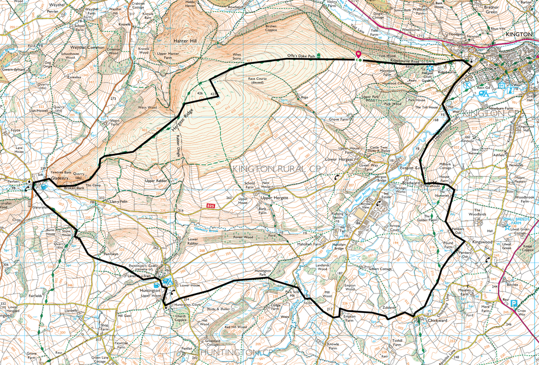
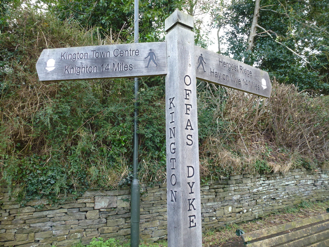
Hergest Croft - Hergest Ridge - Gladestry - Huntington - Chickward - Kington - Hergest Croft

Near Hergest Croft Gardens, Kington (Free) - Grid Ref SO275567

11.6 miles

Grassy paths over Hergest Ridge with some boggy terrain when crossing field paths

Clear & sunny at first deteriorating to overcast later

5hrs 

2148ft (655m)

OS 201 - Knighton & Presteigne 
GPX File
hergest_ridge.gpx
File Size: 7 kb
File Type: gpx
Download File

Walk Description

Picture

K
ington is about 20 miles from home therefore we were up early and off out to walk up on the Hergest Ridge and come back via Huntington and Chickward.  With a big flask of home made soup and the promise of good weather we headed out full of hope for a good days walking.  With it being Christmas Day we were also hoping to have the route to ourselves and so it proved.


The walk starts from just outside Kington on the lane leading up to Hergest Ridge, just past Hergest Croft Gardens.  Hergest Ridge is probably best known as the title of Mike Oldfield's second album and indeed Oldfield used to live at The Beacon on Bradnor Hill, which can be seen from Hergest Ridge.  It is also said that he recorded his third album 'Ommadawn" at The Beacon.  

The rise up to the summit of the Ridge was on a very good grassy path (Offa's Dyke) and soon the Monkey Puzzle trees at Whetstone were reached and from here it was a short walk over to the Trig Point on the summit.  From the summit plateau the grassy path continued before a slate and stone path was reached which led us down to the sleepy village of Gladestry.  Still on the Offa's Dyke path we headed off to join a lane to Huntington Castle and soon left Offa's Dyke to reach the sleepy hamlet of Huntington.  It was from this point that the path deteriorated, mainly to Huntington Park due in most part to the farmer ploughing all the way up to the hedge line.  

No matter - we were soon back on a proper path and soon reached the farm buildings at Chickward before heading up to Pound Farm and over fields and a short bit of road walking to reach Kington.  Once in Kington it is simply a case of heading back up the lane to Hergest Croft Gardens and the car parking area.   

We have been up on Hergest Ridge many times and keep coming back.  It is never really that busy and on a good day provides you with superb views over to Twmpa (Lord Hereford's Knob), Hay Bluff and The Brecon Beacons.
​

Picture
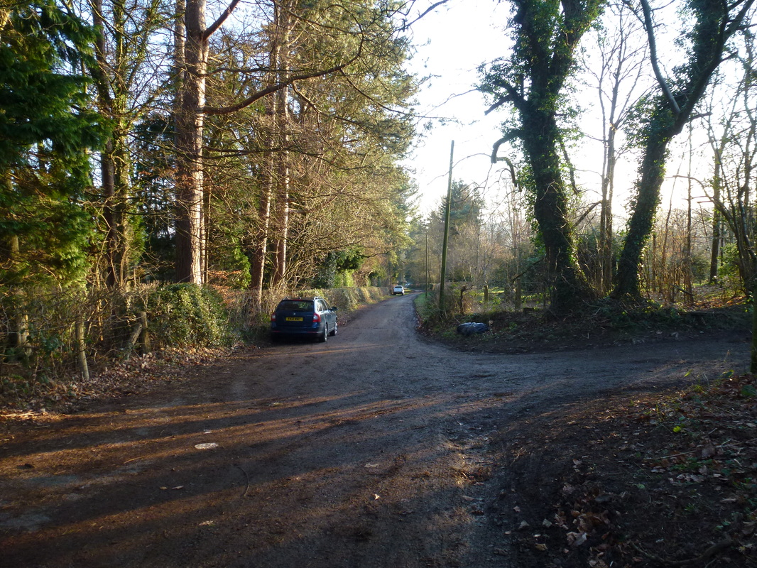
There is a car parking area just to the west of Hergest Croft Gardens
Picture
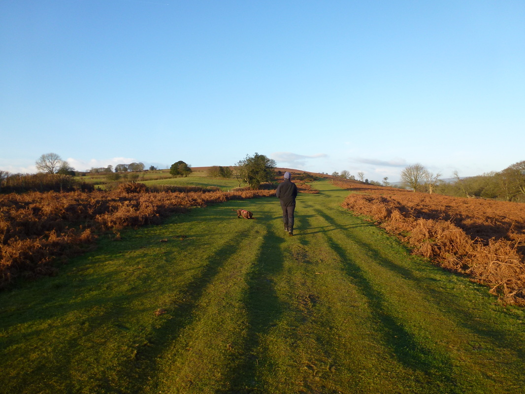
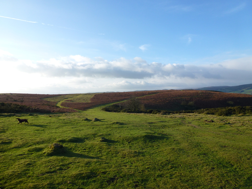
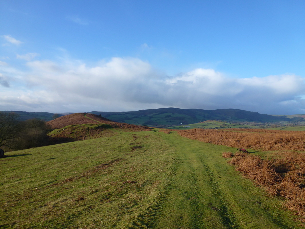
Glorious crisp & sunny Christmas Day as we headed up the slope on the Offa's Dyke path to the top of Hergest Ridge
Picture
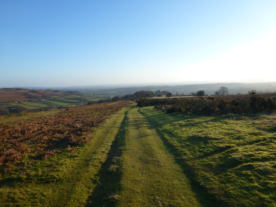
Looking back down the slope towards Kington
Picture
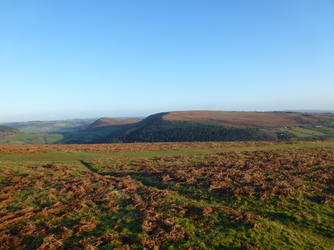
To the North lies Bradnor Hill & Herrock Hill
Picture
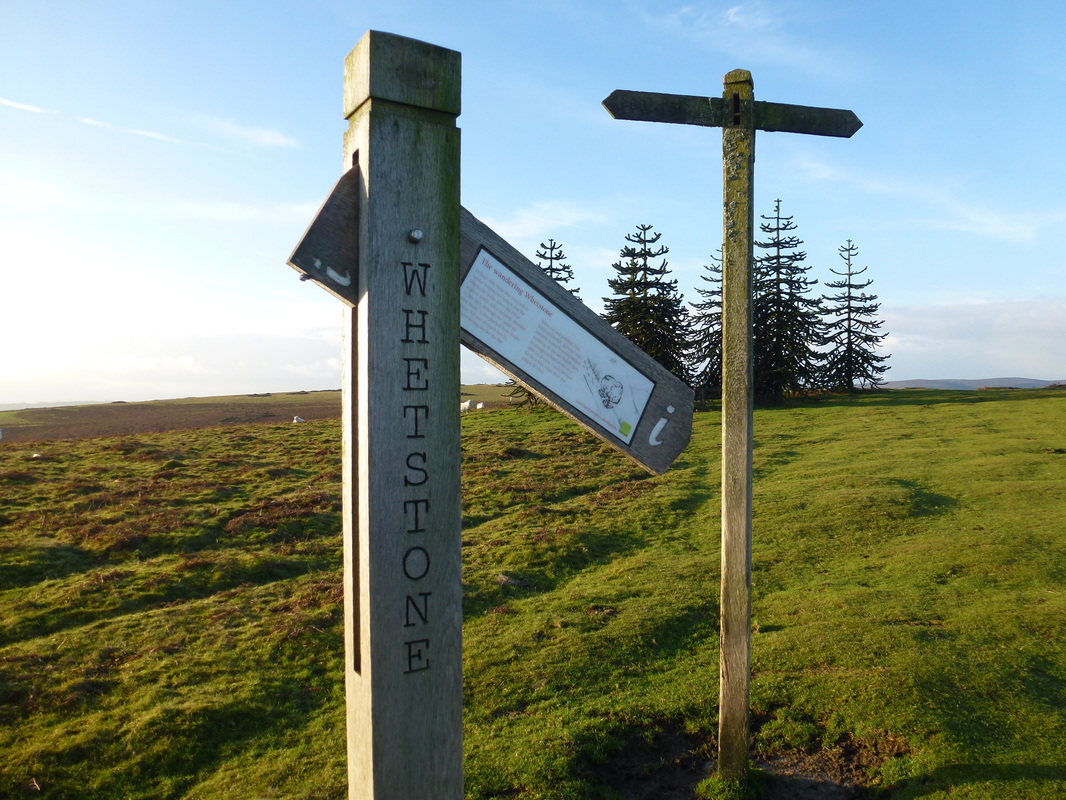
Whetstone - try as we might we could not repair the sign
Picture
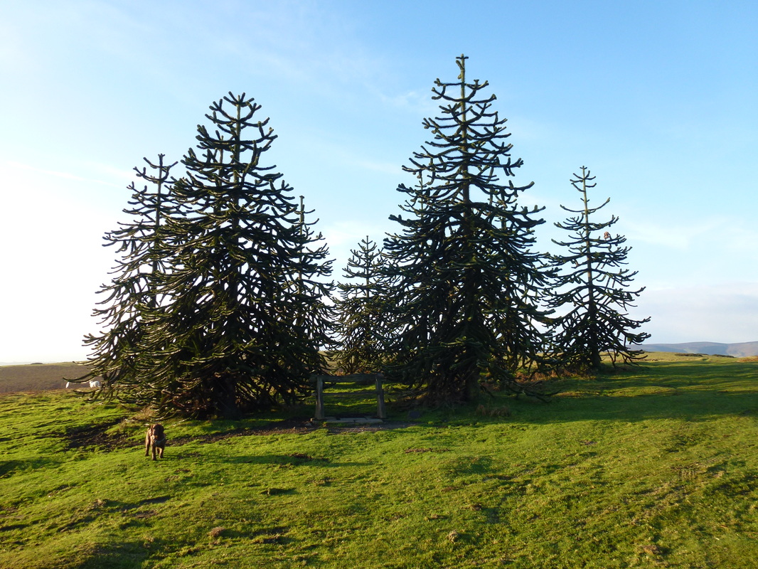
The lovely Monkey Puzzle trees at Whetstone
Picture
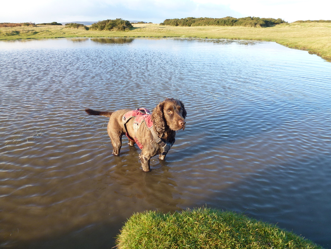
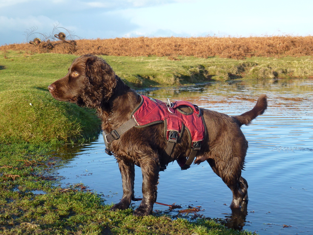
It was very cold but you try keeping him out of water - impossible!
Picture
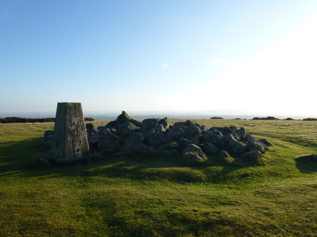
The summit Trig Point on Hergest Ridge
Picture
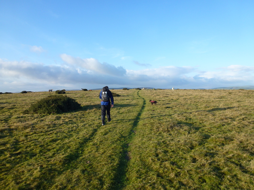
Heading for Gladestry
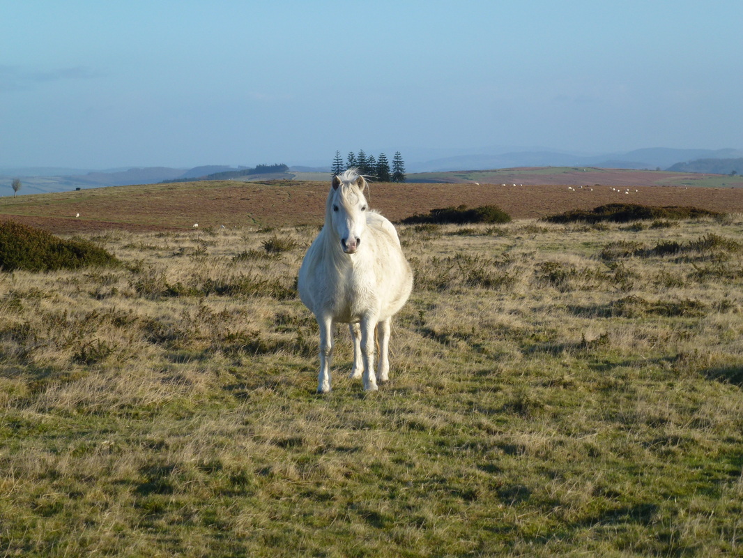
Picture
Why the long face?
Picture
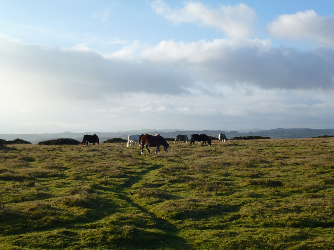
Wild ponies enjoying the sun & free food
Picture
Heading down Offa's Dyke towards Gladestry - although the path splits they end up in the same place - we headed to the left
Picture
Strike a pose Fudge
Picture
The sun was starting to head somewhere else now
Picture
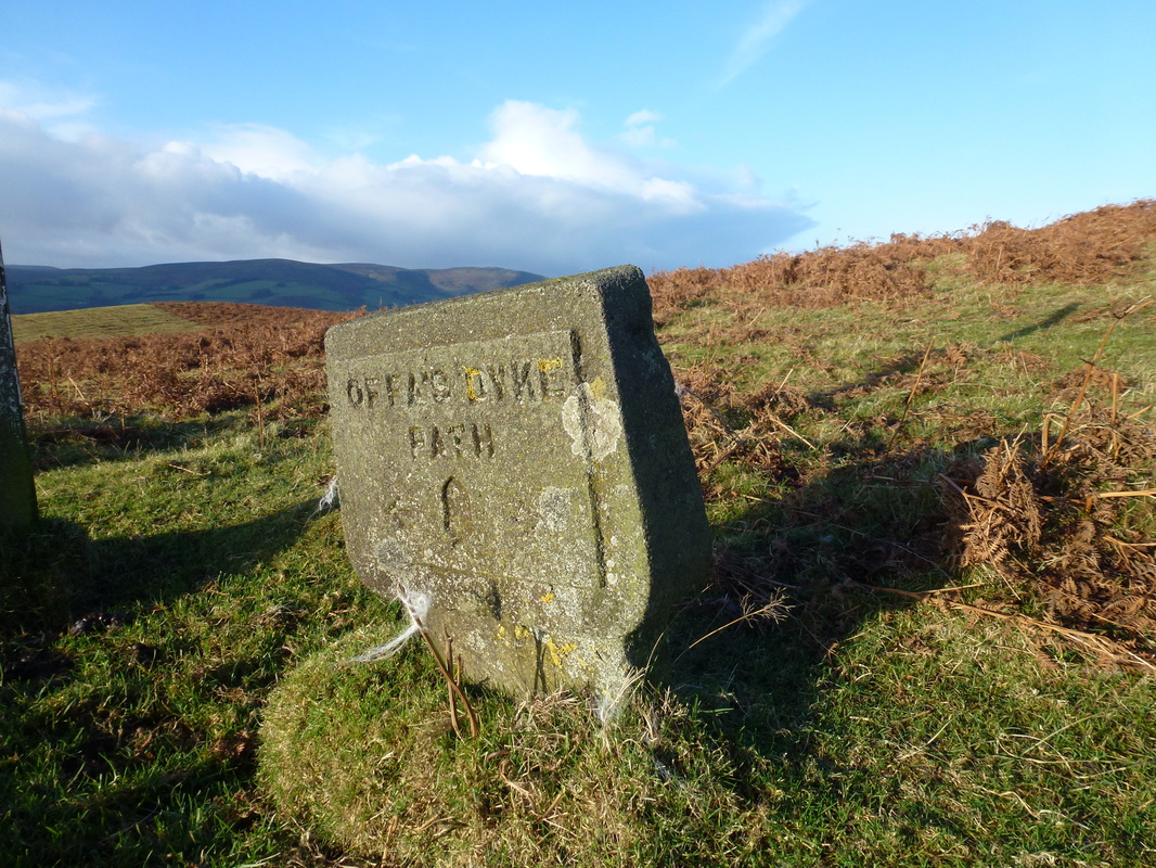
Lovely way marker on Hergest Ridge
Picture
The hill with no name above Gladestry
Picture
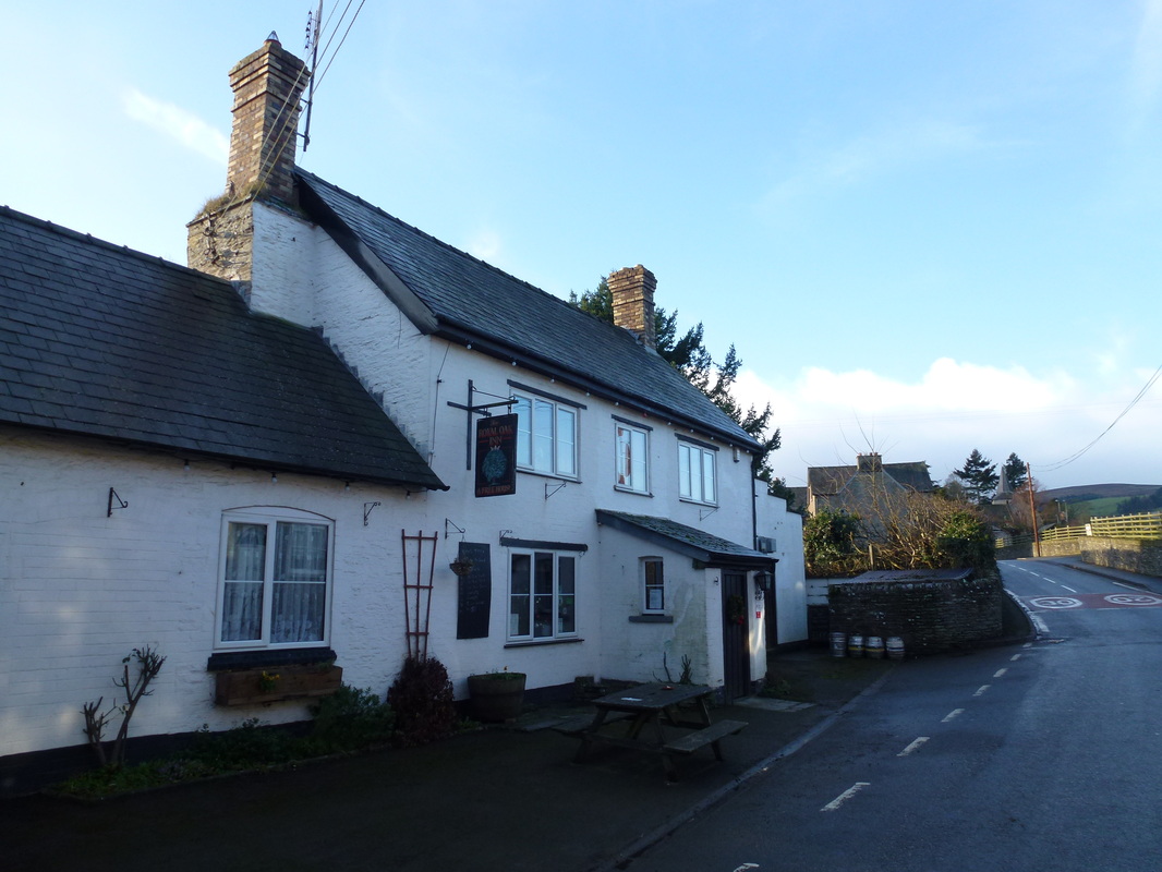
The Royal Oak, Gladestry - understandably shut on Christmas Day
Picture
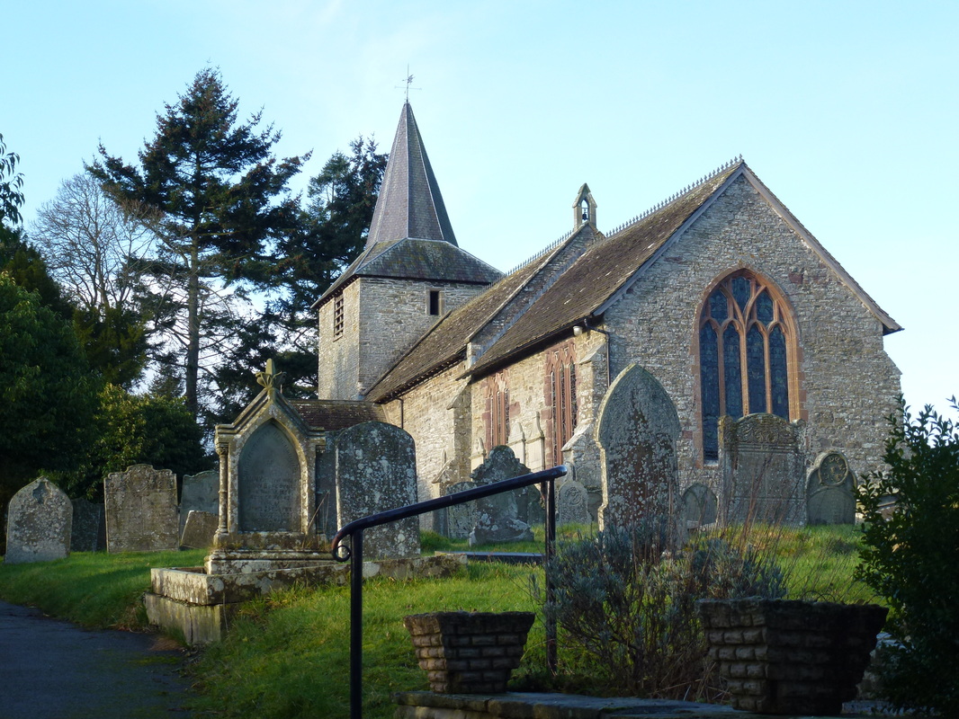
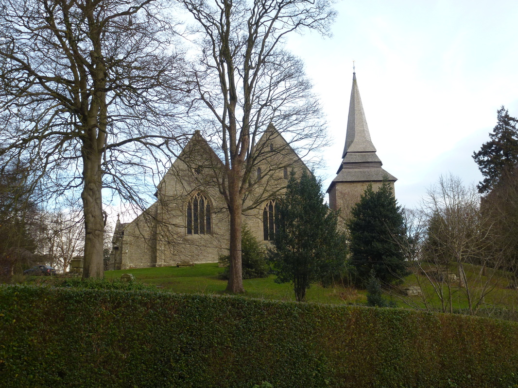
St Mary's Church, Gladestry
Picture
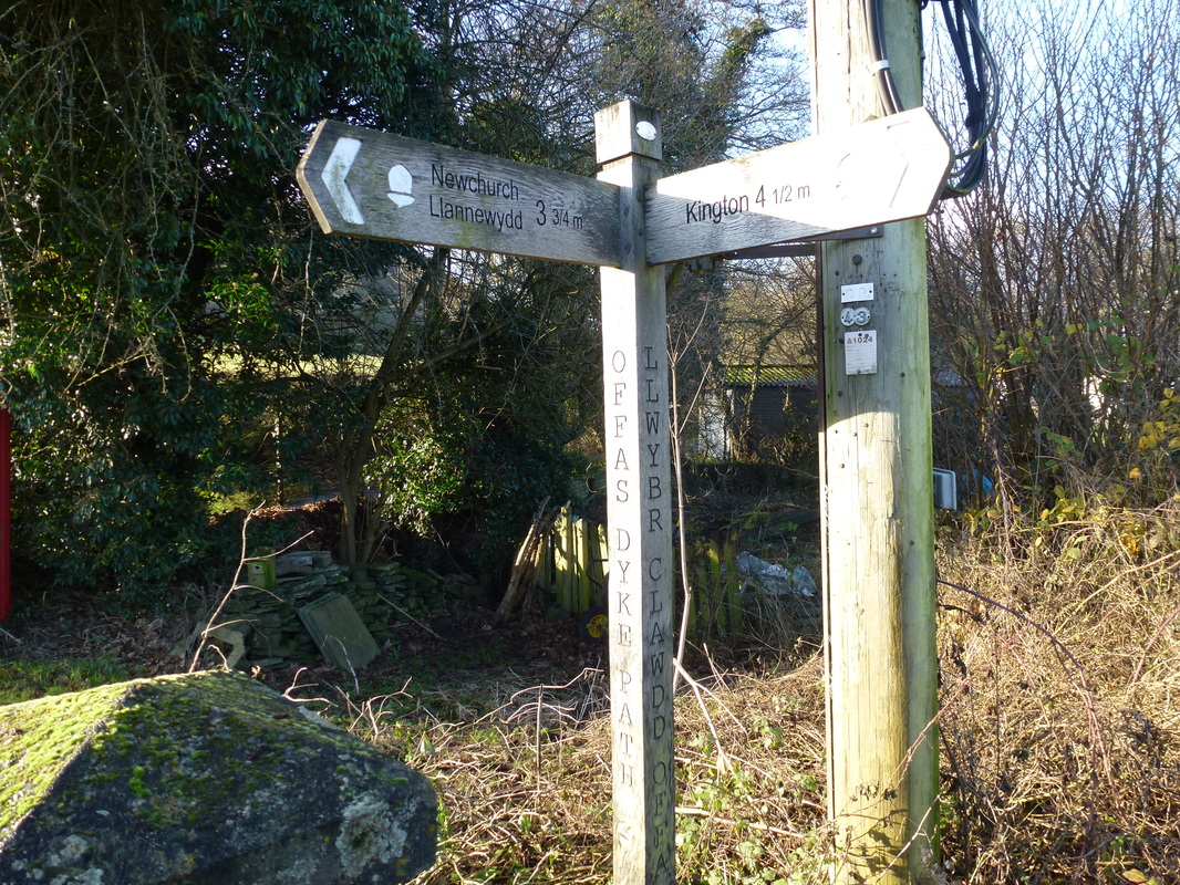
The road junction in Gladestry - we headed up towards Huntington
Picture
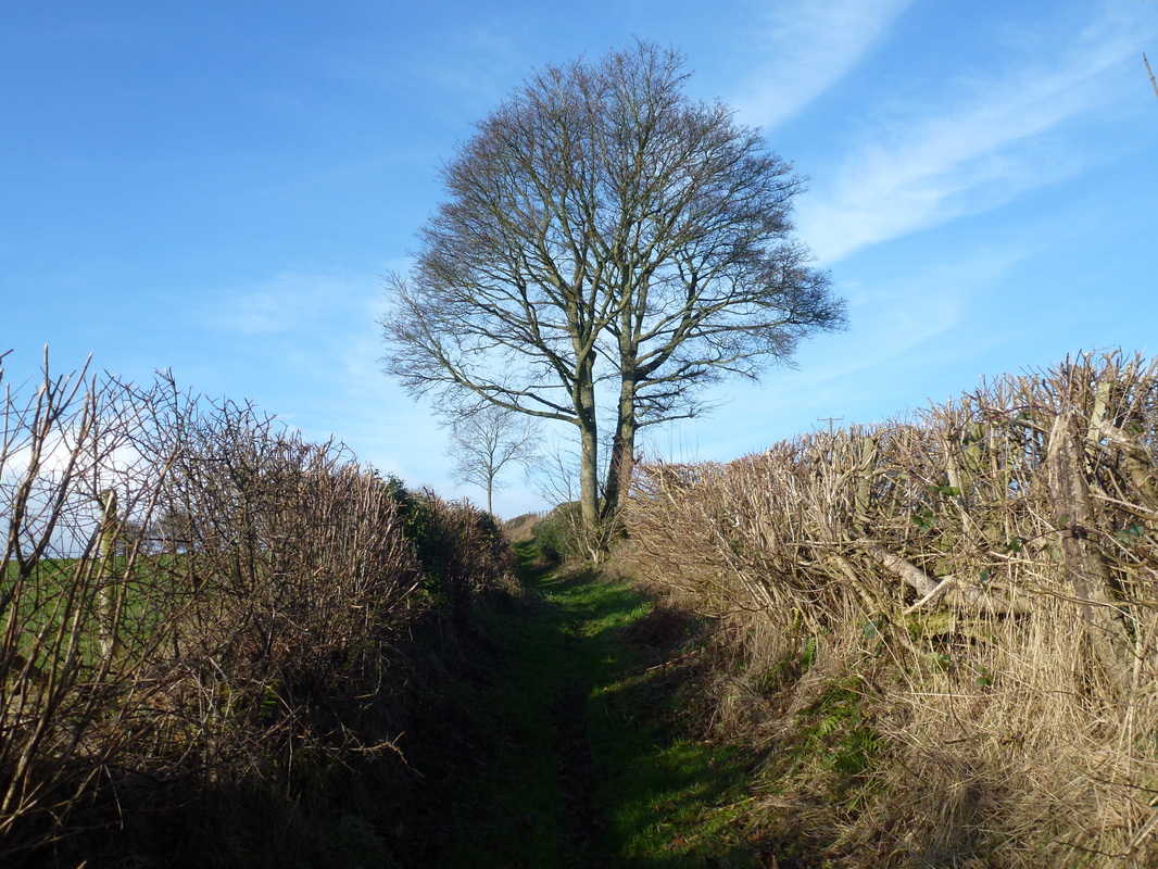
Sunken lane path to Huntington
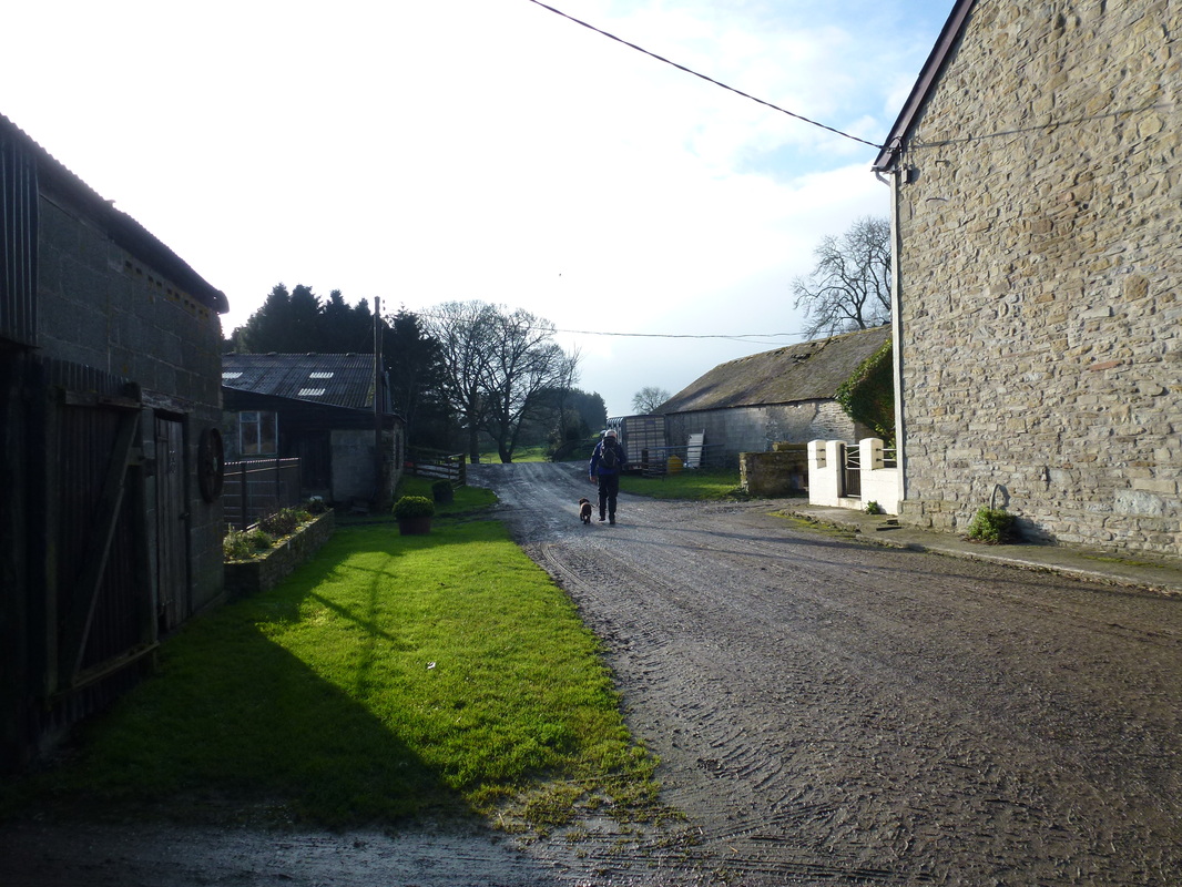
Picture
Sleepy Huntington
Picture
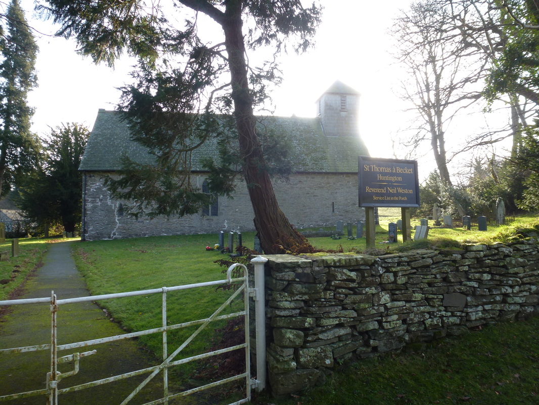
The route heads left here after passing through the churchyard
Picture
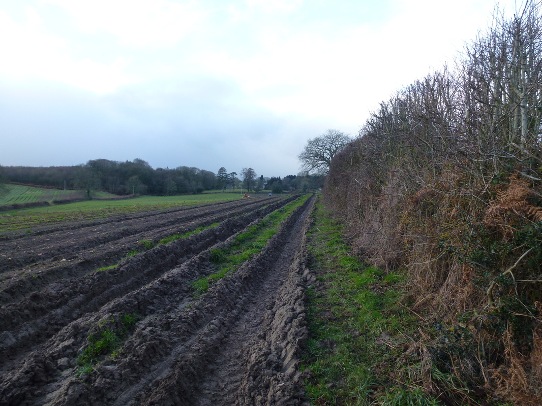
Thanks for churning the footpath up Mr Farmer!
Picture
St Mary's Church Kington
Picture
Just half a mile up to Hergest Croft then back home

Submit
Home
 © Copyright Dave Walsh 2013 - 2018 All Rights Reserved
Powered by
✕