Masarnen Ramblers
Contact us or visit us on Facebook
  • Home
  • About Us
  • Long Distance Walks
    • Coast to Coast (C2C) 2012 >
      • Planning & Preparation
      • Day 0 - Arrival in Kirkby Stephen
      • Day 1 - St Bees to Ennerdale Bridge
      • Day 2 - Ennerdale Bridge to Rosthwaite
      • Day 3 - Rosthwaite to Patterdale
      • Day 4 - Patterdale to Shap
      • Day 5 - Rest Day in Shap
      • Day 6 - Shap to Kirkby Stephen
      • Day 7 - Kirkby Stephen to Muker
      • Day 8 - Muker to Reeth
      • Day 9 - Reeth to Richmond
      • Day 10 - Rest Day in Richmond
      • Day 11 - Richmond to Danby Wiske
      • Day 12 - Danby Wiske to Ingleby Cross
      • Day 13 - Ingleby Cross to Blakey Ridge
      • Day 14 - Blakey Ridge to Grosmont
      • Day 15 - Grosmont to Robin Hood's Bay
      • C2C - Thoughts in Conclusion
    • Yorkshire 3 Peaks 2013
    • Dales Way 2014 >
      • Day 0 - Arrival in Ilkley
      • Day 1 - Ilkley to Linton
      • Day 2 - Linton to Cray
      • Day 3 - Cray to Ribblehead
      • Day 4 - Ribblehead to Sedbergh
      • Day 5 - Sedbergh to Burneside
      • Day 6 - Burneside to Bowness
      • Dales Way - Thoughts in Conclusion
    • Pennine Way 2015 >
      • Day 0 - Wales to Torside
      • Day 1 - Edale to Torside
      • Day 2 - Torside to Delph
      • Day 3 - Delph to Hebden Bridge
      • Day 4 - Hebden Bridge to Ponden
      • Day 5 - Ponden to Gargrave
      • Day 6 - Gargrave to Malham
      • Day 7 - Malham to Ribblehead
      • Day 8 - Ribblehead to Hawes
      • Day 9 - Hawes to Keld
      • Day 10 - Keld to Bowes
      • Day 11 - Bowes to Middleton
      • Day 12 - Middleton to Langdon Beck
      • Day 13 - Langdon Beck to Dufton
      • Day 14 - Dufton to Alston
      • Day 15 - Rest Day in Alston
      • Day 16 - Alston to Greenhead
      • Day 17 - Greenhead to Saughy Rigg
      • Day 18 - Saughy Rigg - to Bellingham
      • Day 19 - Bellingham to Byrness
      • Day 20 - Byrness to Trows Farm
      • Day 21 - Trows Farm to Kirk Yetholm
      • Thoughts in Conclusion
    • Sarn Sabrina 2015
    • Mortimer Trail 2016 >
      • Mortimer Trail - Day 1
      • Mortimer Trail - Day 2
    • Coast to Coast (C2C) 2016 >
      • C2C Planning & Preparation
      • Day 0 - Arrival in Kirkby Stephen
      • Day 1 - St Bees to Ennerdale Bridge
      • Day 2 - Ennerdale Bridge to Seatoller
      • Day 3 - Seatoller to Patterdale
      • Day 4 - Patterdale to Shap
      • Day 5 - Shap to Kirkby Stephen
      • Day 6 - Kirkby Stephen to Keld
      • Day 7 - Keld to Reeth
      • Day 8 - Reeth to Richmond
      • Day 9 - Richmond to Danby Wiske
      • Day 10 - Danby Wiske to Ingleby Cross
      • Day 11 - Ingleby Cross to Blakey Ridge
      • Day 12 - Blakey Ridge to Egton Bridge
      • Day 13 - Egton Bridge to Robin Hood's Bay
      • C2C - Thoughts in Conclusion
    • South West Coast Path 2017 >
      • SWCP Itinerary
      • SWCP Charity, Planning & Preparation
      • SWCP Day 0
      • SWCP Day 1 - Minehead to Porlock
      • SWCP Day 2 - Porlock to Lynmouth
      • SWCP Day 3 - Lynmouth to Combe Martin
      • SWCP Day 4 - Combe Martin to Croyde
      • SWCP Day 5 - Croyde to Braunton
      • SWCP Day 6 - Braunton to Northam
      • SWCP Day 7 - Northam to Clovelly
      • SWCP Day 8 - Clovelly to Stoke
      • SWCP Day 9 - Stoke to Bude
      • SWCP Day 10 - Rest Day in Stoke
      • SWCP Day 11 - Bude to Boscastle
      • SWCP Day 12 - Boscastle to Port Isaac
      • SWCP Day 13 - Port Isaac to Padstow
      • SWCP Day 14 - Padstow to Porthcothan
      • SWCP Day 15 - Porthcothan to Newquay
      • SWCP Day 16 - Newquay to Perranporth
      • SWCP Day 17 - Perranporth to Portreath
      • SWCP Day 18 - Portreath to St Ives
      • SWCP Day 19 - Rest Day in Penzance
      • SWCP Day 20 - St Ives to Lower Boscaswell
      • SWCP Day 21 - Lower Boscaswell - Porthcurno
      • SWCP Day 22 - Porthcurno to Penzance
      • SWCP Day 23 - Penzance to Porthleven
      • SWCP Day 24 - Rest Day in Penzance
      • SWCP Day 25 - Porthleven to The Lizard
      • SWCP Day 26 - The Lizard to Porthallow
      • SWCP Day 27 - Porthallow to Falmouth
      • SWCP Day 28 - Falmouth to Portloe
      • SWCP Day 29 - Portloe to Mevagissey
      • SWCP Day 30 - Mevagissey to Fowey
      • SWCP Day 31 - Fowey to Polperro
      • SWCP Day 32 - Polperro to Portwrinkle
      • SWCP Day 33 - Rest Day in Portwrinkle
      • SWCP Day 34 - Portwrinkle to Plymouth
      • SWCP Day 35 - Plymouth to Noss Mayo
      • SWCP Day 36 - Noss Mayo to Bantham
      • SWCP Day 37 - Bantham to Salcombe
      • SWCP Day 38 - Salcombe to Slapton
      • SWCP Day 39 - Slapton to Dartmouth
      • SWCP Day 40 - Rest Day in Dartmouth
      • SWCP Day 41 - Dartmouth to Brixham
      • SWCP Day 42 - Torquay to Brixham
      • SWCP Day 43 - Torquay to Teignmouth
      • SWCP Day 44 - Teignmouth to Exmouth
      • SWCP Day 45 - Exmouth to Beer
      • SWCP Day 46 - Beer to Bridport
      • SWCP Day 47 - Lulworth Cove to Kimmeridge Bay
      • SWCP Day 48 - Bridport to Abbotsbury
      • SWCP Day 49 - Abbotsbury to Weymouth
      • SWCP Day 50 - Rest Day in Bridport
      • SWCP Day 51 - The Portland Loop
      • SWCP Day 52 - Weymouth to Lulworth Cove
      • SWCP Day 53 - Kimmeridge Bay to Worth Matravers
      • SWCP Day 54 - Worth Matravers to South Haven Point
      • SWCP - Thoughts in Conclusion
    • Triple Spine Lakeland Challenge >
      • TSLC Day 1
      • TSLC Day 2
      • TSLC Day 3
  • Day Walks
    • Cornwall >
      • Mount Edgcumbe, Kingsand & Rame Head
      • Perranporth to Newquay
    • Cumbria (not Lake District) >
      • Cautley Spout, The Calf, Calders, Arant Haw & Winder
      • Cross Fell
      • Great Coum & Crag Hill
      • High Cup Nick
      • High Cup Nick
      • Yarlside, Randygill Top & The Calf
    • Dorset >
      • Charmouth to Bridport
      • Hardy's Monument from Abbotsbury
    • Durham >
      • Cauldron Snout
      • High & Low Force
    • Lake District >
      • Eastern Fells >
        • Birkett Fell, Hart Side & The Dodds
        • Catstycam & Birkhouse Moor
        • Clough Head & Great Dodd
        • Dodds, Clough Head & Raise
        • Fairfield Horseshoe
        • Fairfield Horseshoe - January 2019
        • Fairfield, St Sunday Crag, Birks & Arnison Crag
        • Fairfield, Great Rigg & Heron Pike
        • Gowbarrow Fell
        • Great Mell Fell
        • Helvellyn Range
        • Helvellyn, Catstycam & Birkhouse Moor via Striding Edge
        • Little Mell Fell
        • Middle Dodd, Red Screes, Little Hart Crag & High Hartsop Dodd
        • Seat Sandal
        • Sheffield Pike, Raise, Stybarrow Dodd, Watson's Dodd and Hart Side
      • Far Eastern Fells >
        • Caudale Moor & Hartsop Dodd
        • Gray Crag, Thornthwaite Crag, Froswick & Ill Bell
        • Grey Crag, Tarn Crag & Branstree
        • Hallin Fell
        • High Street, Mardale Ill Bell and Harter Fell
        • High Street, Thornthwaite Crag, Gray Crag, Mardale Ill Bell & Harter Fell
        • Kentmere Pike & Shipman Knotts
        • Place Fell - Oct 15
        • Place Fell - Dec 17
        • Rest Dodd, The Nab and Brock Crags
        • Sour Howes, Sallows, Yoke, Ill Bell, Froswick & Thornthwaite Crag
        • Steel Knotts & Beda Fell
        • Troutbeck to Pooley Bridge
        • Troutbeck to Patterdale
      • Central Fells >
        • Armboth Fell, High Tove & High Seat
        • Blea Rigg, Sergeant Man, High Raise, Steel Fell, Calf Crag, Gibson Knott & Helm Crag
        • Eagle Crag & Sergeants Crag
        • Grasmere & Langdale Epic
        • Langdale Pikes, Pavey Ark, Thunacar Knott & High Raise
        • Langdale Pikes & Thunacar Knott
        • Pike O'Stickle
        • Rosthwaite to Keswick via Watendlath
        • Silver How & Loughrigg Fell
        • Steel Fell, Calf Crag, Gibson Knott & Helm Crag
        • Walla Crag, Bleaberry Fell, High Seat & High Tove
      • Southern Fells >
        • Coniston Fells
        • Coniston 7
        • Grey Friar, Great Carrs, Swirl How & Wetherlam
        • Irton Pike, Whin Rigg & Illgill Head
        • Lingmell
        • Lingmell, Scafell Pike, Broad Crag & Ill Crag via Piers Gill
        • Pike O'Blisco, Cold Pike & Crinkle Crags
        • Pike O'Blisco, Cold Pike, Little Stand & Crinkle Crags
        • Rossett Pike, Allen Crags, Glaramara, Esk Pike & Bowfell
        • Rossett Pike, Esk Pike & Bowfell
        • Scafell Pike & Great End
        • Seathwaite Fell
        • Seathwaite Fell, Allen Crags & Glaramara
        • Seathwaite Fell, Allen Crags, Glaramara & Rosthwaite Fell
        • Slight Side & Scafell - May 2014
        • Slight Side & Scafell - July 2018
        • Walna Scar, Dow Crag, Brim Fell & Coniston Old Man
      • Northern Fells >
        • Back O'Skidda
        • Bakestall & Great Calva
        • Blencathra, Mungrisdale Common, Skiddaw & Skiddaw Little Man
        • Blencathra via Sharp Edge
        • Blencathra via Sharp Edge & Hall's Fell Ridge
        • Dodd, Carl Side, Long Side & Ullock Pike
        • Great Calva & The Cumbria Way
        • High Pike & Carrock Fell
        • Latrigg, Blencathra, Mungrisdale Common, Skiddaw and Skiddaw Little Man
        • Souther Fell
        • Ullock Pike, Long Side, Carl Side & Skiddaw
        • Ullock Pike, Long Side, Carl Side, Skiddaw & Lonscale Fell
      • North Western Fells >
        • Barrow
        • Castle Crag
        • Coledale Horseshoe 17 Sep 16
        • Coledale Horseshoe 2 Apr 17
        • Grasmoor & Whiteless Pike
        • Knott Rigg & Ard Crags
        • Lord's Seat, Barf, Broom Fell & Graystones
        • Robinson, Hindscarth, Dale Head, High Spy, Maiden Moor & Cat Bells
        • Sale Fell & Ling Fell
        • Whiteside
      • Western Fells >
        • Base Brown, Green Gable & Great Gable
        • Crag Fell, Iron Crag, Caw Fell & Haycock
        • Ennerdale to Black Sail Hut
        • Fleetwith Pike, Grey Knotts, Brandreth, Green Gable, Base Brown & Haystacks
        • Great Gable
        • Grike, Crag Fell & Lank Rigg
        • Hay Stacks
        • Hen Comb, Gavel Fell, Blake Fell & Burnbank Fell
        • High Stile Ridge
        • High Stile Ridge & Dodd
        • Kirk Fell
        • Kirk Fell from Gatesgarth
        • Kirk Fell, Pillar, Scoat Fell & Red Pike
        • Low Fell & Fellbarrow
        • Mellbreak - July 2014
        • Mellbreak - December 2017
        • Middle Fell, Seatallan & Buckbarrow - May 14
        • Middle Fell, Seatallan & Buckbarrow - May 16
        • Pillar, Scoat Fell, Steeple, Haycock, Caw Fell & Red Pike
        • Yewbarrow - June 2011
        • Yewbarrow, Red Pike & Pillar - May 2015
        • Yewbarrow, Red Pike, Scoat Fell, Steeple & Pillar - May 2016
        • Yewbarrow, Red Pike, Scoat Fell, Steeple & Pillar - August 2018
      • Outlying Fells >
        • Black Combe
        • Devoke Water Circuit
    • Malvern Hills >
      • Herefordshire Beacon
      • Malvern Hills End to End
      • Worcestershire Beacon
    • North Yorkshire Moors >
      • Goathland, Mallyan Spout & the Wheeldale Roman Road
      • Roseberry Topping & Captain Cook's Monument
      • Runswick Bay & Staithes
      • Westerdale Moor
    • Northumberland >
      • Bamburgh Castle
      • Lindisfarne (Holy Island)
      • The Cheviot
      • Windy Gyle
    • Peak District >
      • Derwent Edge
      • Hollins Cross, Back Tor, Lose Hill, Win Hill & Hope
      • Ilam & Dovedale
      • Ladybower Reservoir & Crook Hill
      • Parkhouse Hill & Chrome Hill
      • Shutlingsloe, Shining Tor & Axe Edge Moor
      • Stanage Edge
      • Three Shire Heads, Hen Cloud, The Roaches & Lud's Church
    • Scotland >
      • Ben Lomond
      • The Schil
      • St Abbs Head
    • Shropshire >
      • Brown Clee Hill
      • Church Stretton to Shrewsbury
      • The Long Mynd
      • The Wrekin
    • Somerset >
      • Withypool & Tarr Steps
    • Wales >
      • Allt Lwyd, Bwlch y Ddwyallt & Waun Rydd
      • Berwyn Horseshoe
      • Black Mountain Wild Camp - Day 1
      • Black Mountain Wild Camp - Day 2
      • Black Mountains Circular Day 1
      • Black Mountains Circular Day 2
      • Brecon Beacons Horseshoe
      • Cadair Idris
      • Carmarthen Fan
      • Carnau, Gorllwyn, Carreg yr Ast & Drygarn Fawr
      • Cnicht & Moelwyn Mawr
      • Craig Cerrig-gleisiad, Fan Frynyrch, Fan Llia & Fan Fawr
      • Craig Eigiau & Pen Llithrig y Wrach
      • Elidir Fawr, Mynydd Perfedd, Carnedd y Filiast & Foel-goch
      • Fan y Big from Torpantau
      • Fan Fraith, Fan Gyhirych & Fan Nedd
      • Glyder Fach, Glyder Fawr, Y Garn & Foel-goch
      • Hay Bluff, Twmpa, Rhos Dirion & Chwarel y Fan
      • Hergest Ridge
      • Llanddwyn Island, Anglesey
      • Moel Cynghorion, Foel Goch, Foel Gron & Moel Eilio
      • Moel Hebog
      • Moel Siabod - April 2011
      • Nantlle Ridge
      • Pumlumon from Eisteddfa Gurig
      • Pumlumon from Nant y Moch
      • Rhayader, Maen Serth & Gilfach
      • Snowdon & Garnedd Ugain
      • Talybont-on-Usk to The Storey Arms via 8 Nuttalls
      • Tryfan via Heather Terrace
      • Tryfan, Y Foel Goch & Gallt yr Ogof
      • Waun Fach from Pengenffordd
      • Waun Fach & The Black Mountains from Llanbedr
      • Western Carneddau
      • Whimble, Bache Hill, Black Mixen & Great Rhos
    • Yorkshire >
      • Buckden 4 Corners
      • Buckden Pike & Starbotton
      • Buckden Pike & Great Whernside
      • Dodd Fell Hill & Drumaldrace
      • Flamborough Head
      • Harrogate Ringway
      • Ingleborough
      • Ingleborough & Simon Fell
      • Keld to Reeth
      • Keld, Swaledale, Old Gang & Gunnerside
      • Malham Cove & Gordale Scar
      • Muker, Keld, Swaledale and Tan Hill
  • Hill Tick Lists
    • Wainwrights >
      • Abstract
      • The Eastern Fells
      • The Far Eastern Fells
      • The Central Fells
      • The Southern Fells
      • The Northern Fells
      • The North Western Fells
      • The Western Fells
      • The Outlying Fells
      • Completion Day
      • Trail 100
  • Useful Links
  • Contact Us

Day 4 - Tuesday 14 June 2016

Patterdale to Shap (16.7 miles)

Picture

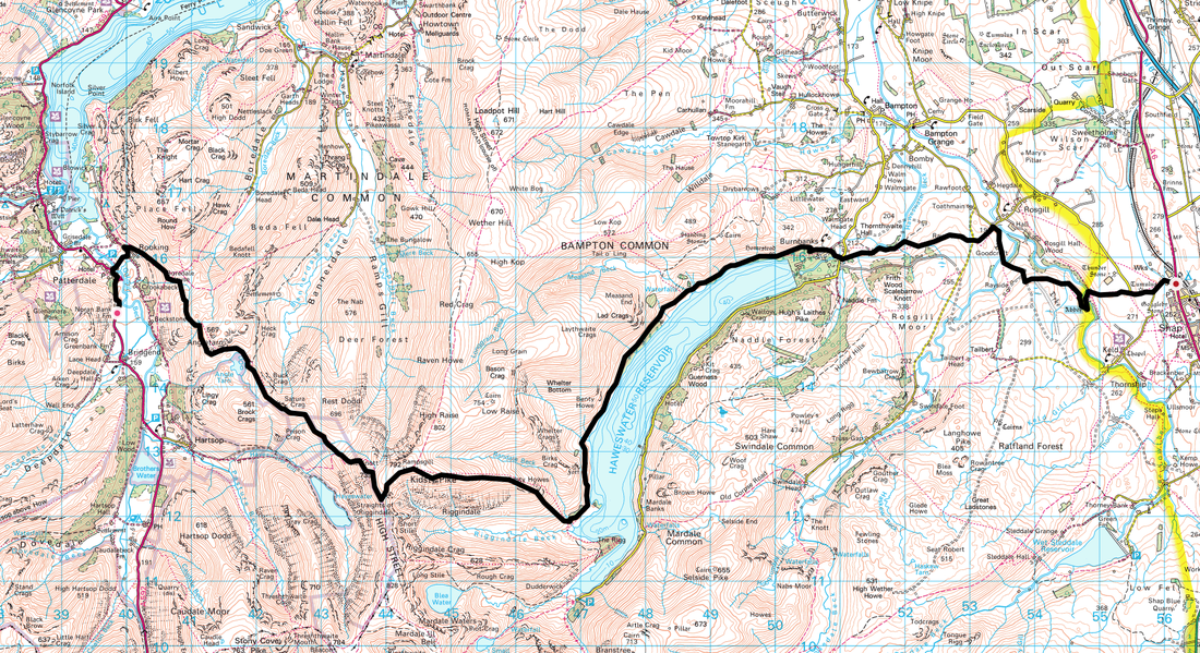
​After yesterday's deluge we awoke to sunshine and clear skies that remained constant for the rest of the day accompanied by very light breezes.  This was even better because the transit over to Shap is a delightful walk that takes in the idyllic Angle Tarn, The Knott, Kidsty Pike and the long but enjoyable amble along the western shore of Haweswater Reservoir.  After one of Heather's hearty farmhouse breakfasts we collected all our now thankfully dry kit, packed up and headed off on Day 4.
 
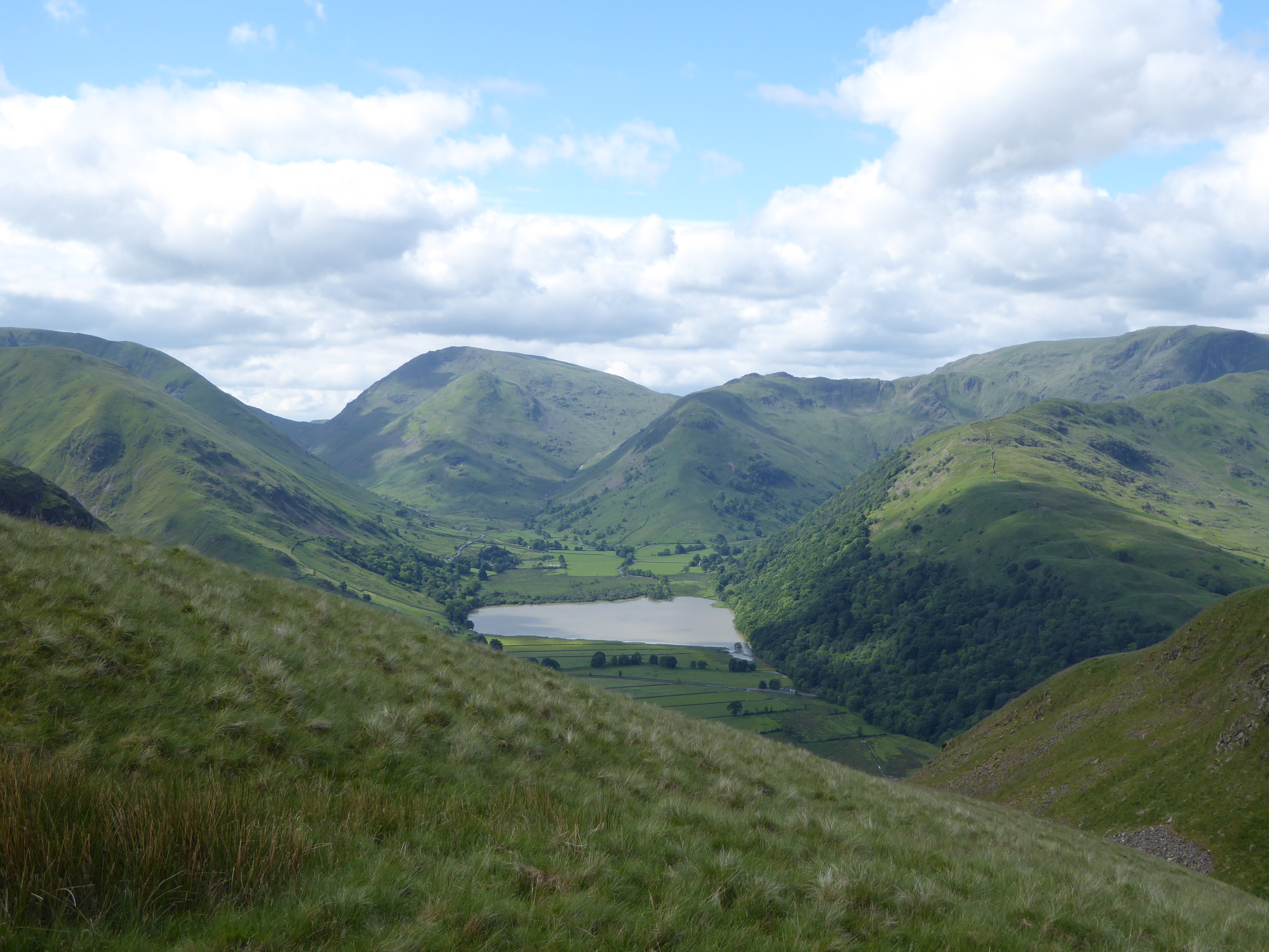
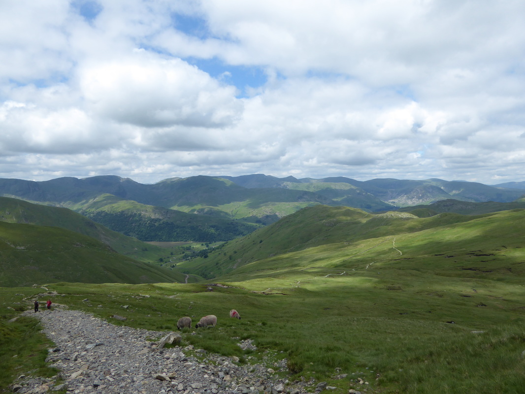
Our B&B in Patterdale was just outside the village therefore we headed back in and called at the Post Office for some snacks for the long trip over to Shap.  Whilst there we had a chat with the 4 Edinburgh chaps we met at Ennerdale Bridge before making our way to the Rooking turning which leads to the Boredale Hause path.  The ascent to Boredale Hause is one we have done many times and is on a steep but good path that eventually curved around to the east to arrive at the flat grassy area of the Hause.  There are a myriad of paths at the Hause which does catch people out - so much so we saw a couple of C2C walkers turning back down from the ascent of Place Fell.

Picture
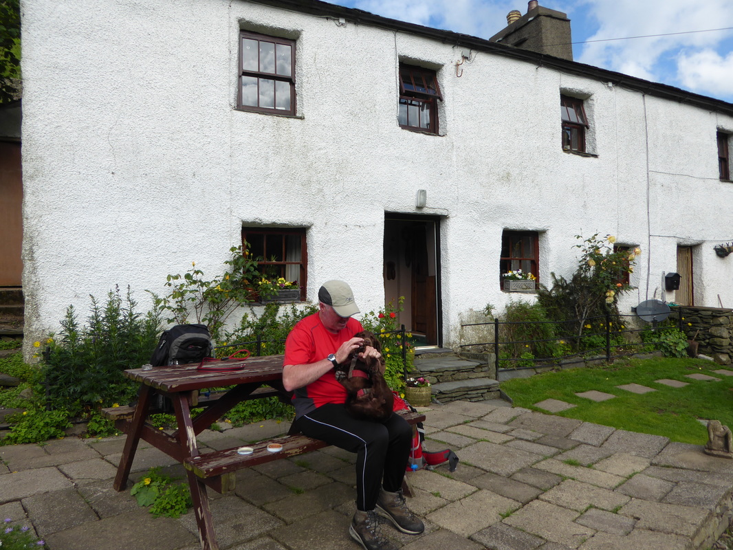
 Fudge going through his daily paw waxing routine outside Noran Bank - something he tolerates rather than enjoys!
Picture
The view from the door of our B&B at Noran Bank - Hartsop Dodd with Caudale Moor behind
Picture
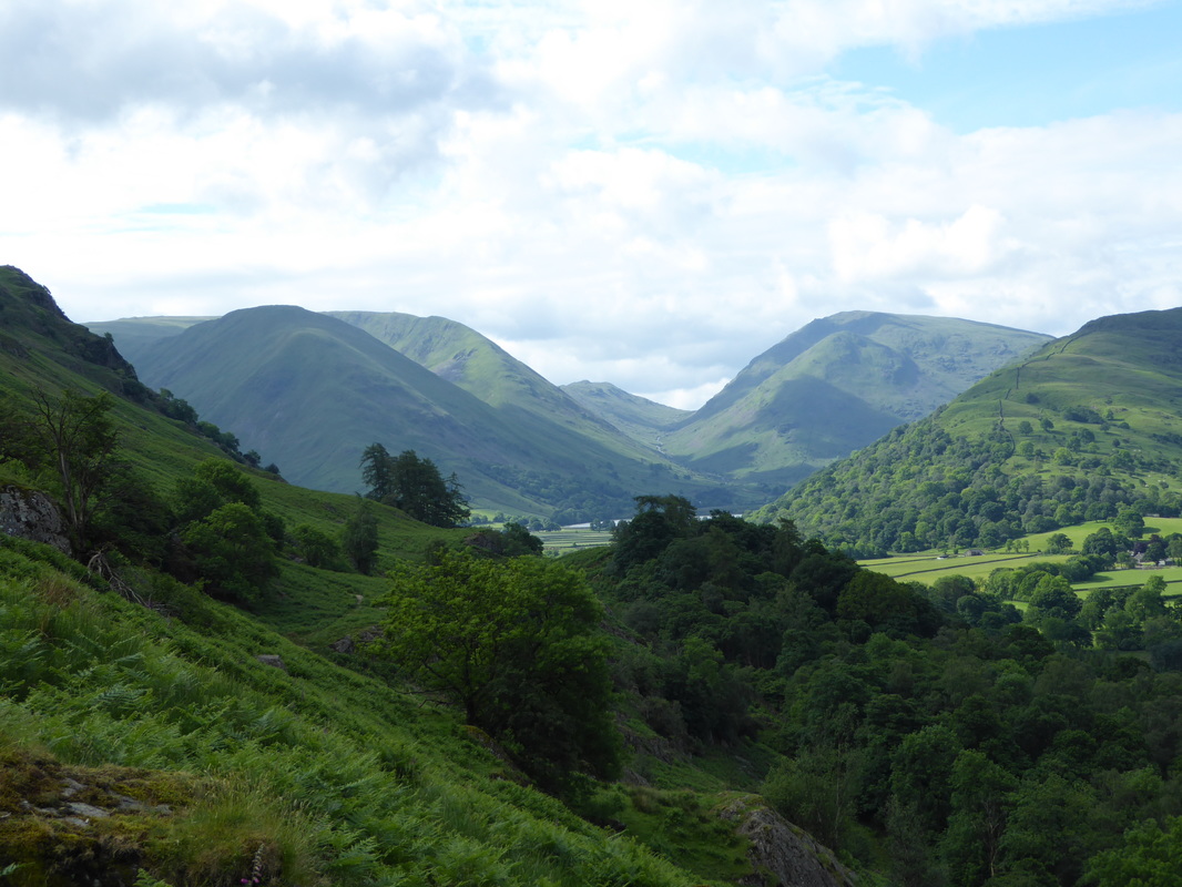
Looking to Boredale Hause
Picture
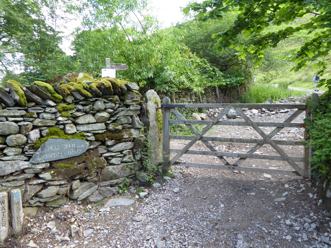
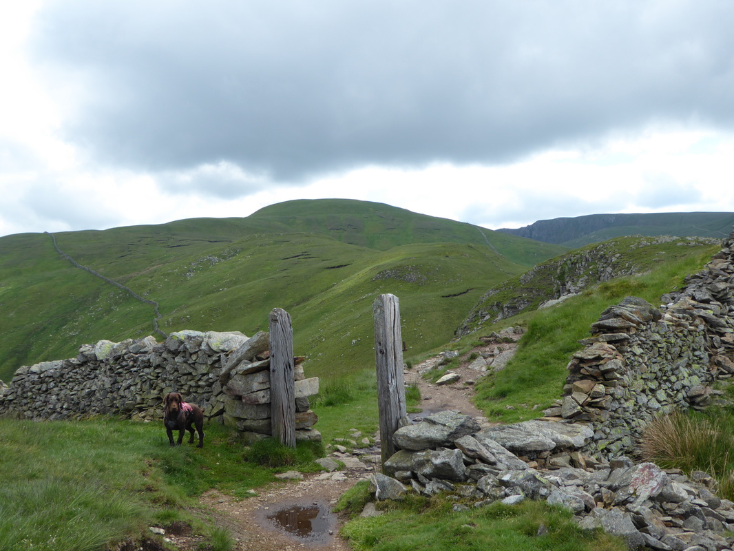
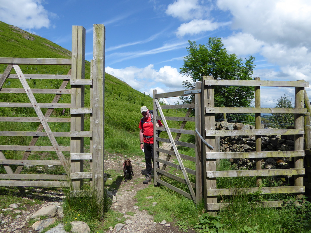
This gate gives access to the open fell side from Rooking
Picture
Arnison Crag & Birks
Picture
Looking down towards Brothers Water with Hartsop Dodd, Caudale Moor Red Screes & Middle Dodd
Picture
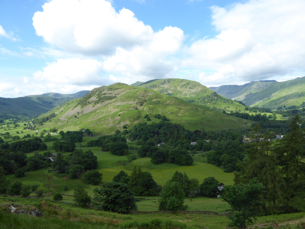
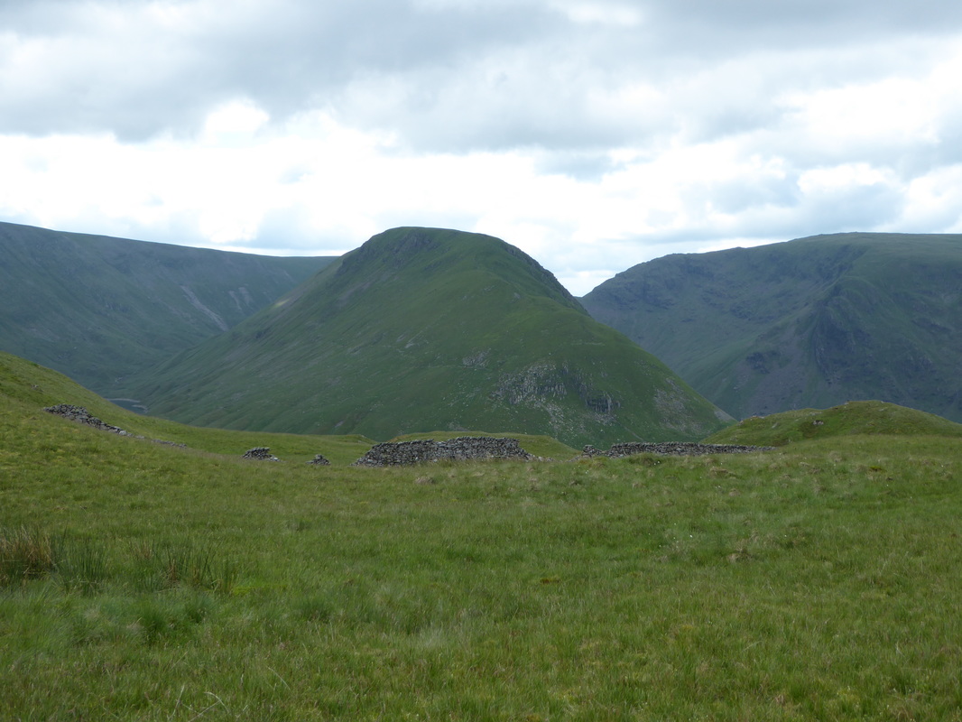
A lovely panorama from the ascent of Boredale Hause
Picture
3 out of the 4 lads from Edinburgh - we would not see them again after today
Picture
On the ascent of Boredale Hause with Ullswater, Sheffield Pike, Glenridding Dodd & The Dodds behind
Picture
Boredale Hause
Picture
Looking to the ascent of Place Fell - not for us today.  Sky looks promising
Picture
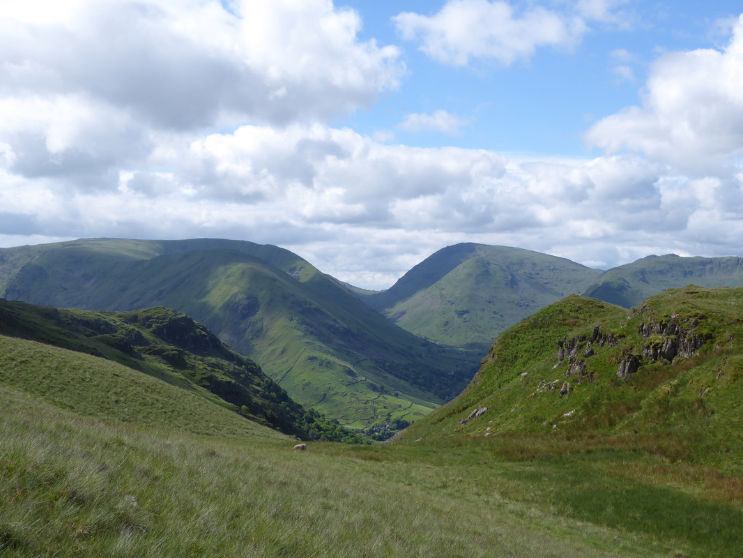
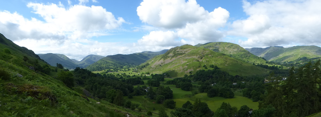
Never tire of the views on the ascent of Boredale House - Hartsop Dodd, Caudale Moor & Red Screes with the Kirkstone Pass centre
Picture
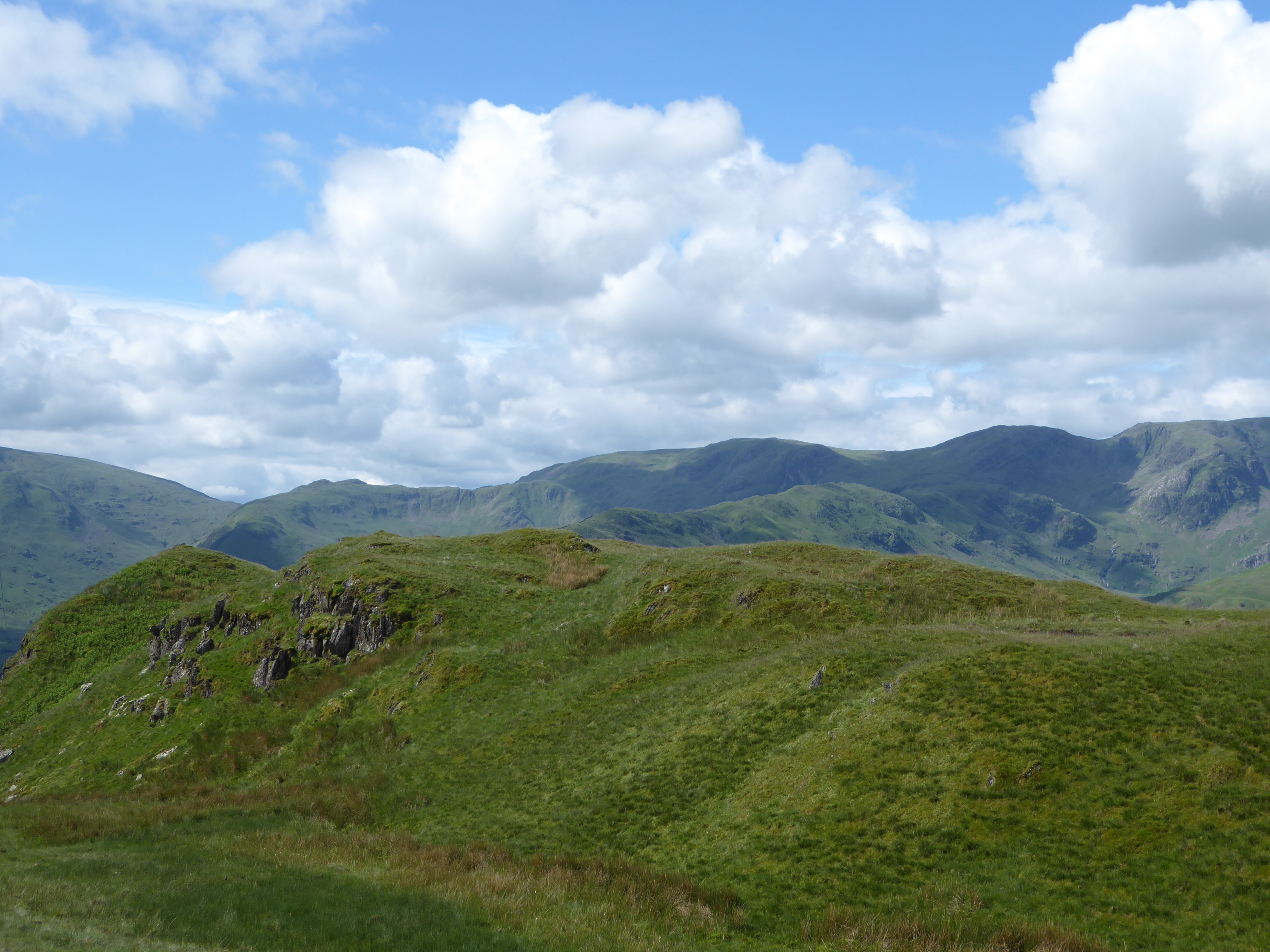
Looking to the western side of the Fairfield Horseshoe - Fairfield itself is to the right

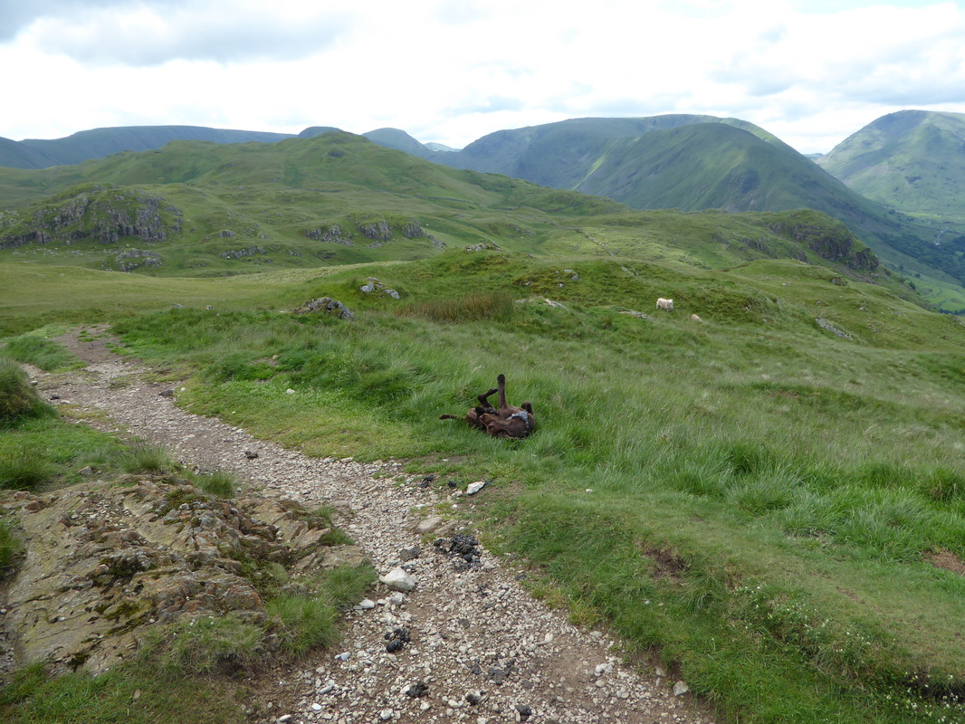
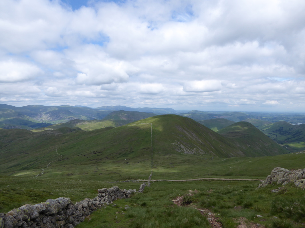
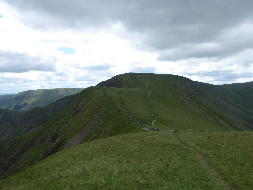
Leaving the Hause we headed off to Angle Tarn and on the way passed Andrew & Michelle, thankfully looking a lot drier then when we last met them in the pub the previous evening.  One of two Angle Tarns in the Lake District (the other is in Langdale), it is an idyllic and serene place and worth spending a few minutes to explore or simply sit and enjoy it.  Leaving the tarn we headed first to the east before arriving at the gateway that leads to the path to Rest Dodd.  After following this path for a while we branched off to the right to make the long transit over to The Knott.  Just before the ascent of The Knott steepened we stopped to chat with Nicole & Karen before heading up the steep path to gain the summit.  Dropping down off The Knott we met Nicole & Karen again and walked with them, firstly along the Straits of Riggindale before turning sharp left to make our way over to the conical summit of Kidsty Pike which was in full view and had many people up on the top (the HF group as it happens).  Reaching the summit ourselves the cairn was unfortunately adorned with rainbow flags - therefore we bagged these up to later put in the bin in Shap.  
​
Picture
Hart Crag, Fairfield & St Sunday Crag
Picture
With Andrew & Michelle on the path to Angle Tarn
Picture
Brothers Water with Caudale Moor & Red Screes amongst others
Picture
Fudge having "a moment"
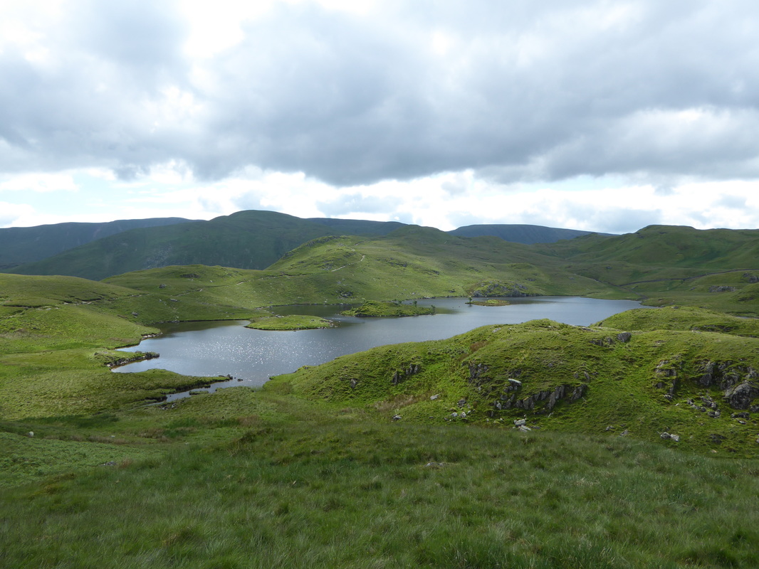
Picture
Angle Tarn
Picture
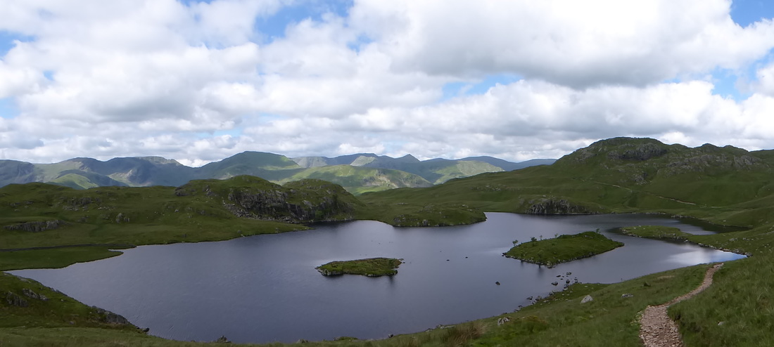
A panorama from Angle Tarn looking to the Fairfield & Helvellyn ranges
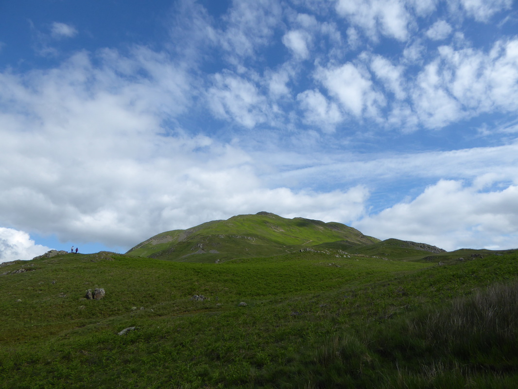
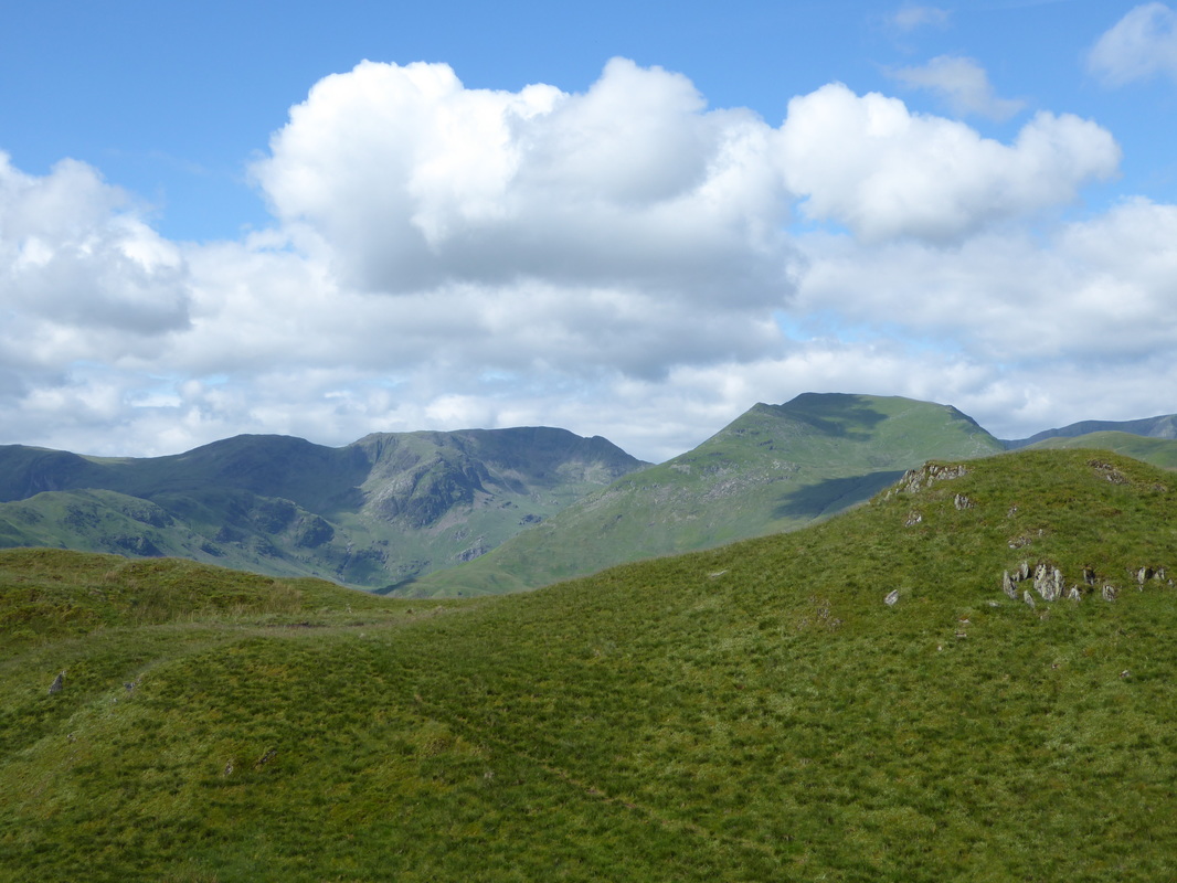
Picture
Gray Crag
Picture
Rest Dodd - the C2C path goes through the gate and follows the wall to the right
Picture
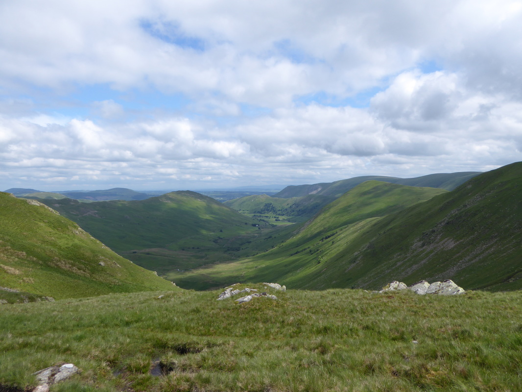
Looking North into Bannerdale
Picture
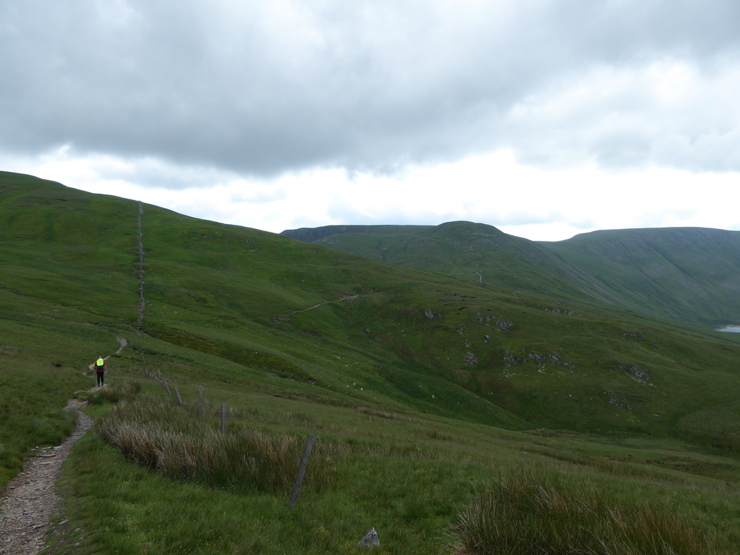
Heading for The Knott - the path can be seen in the distance heading up the fell
Picture
Looking back towards Patterdale from the ascent of The Knott
Picture
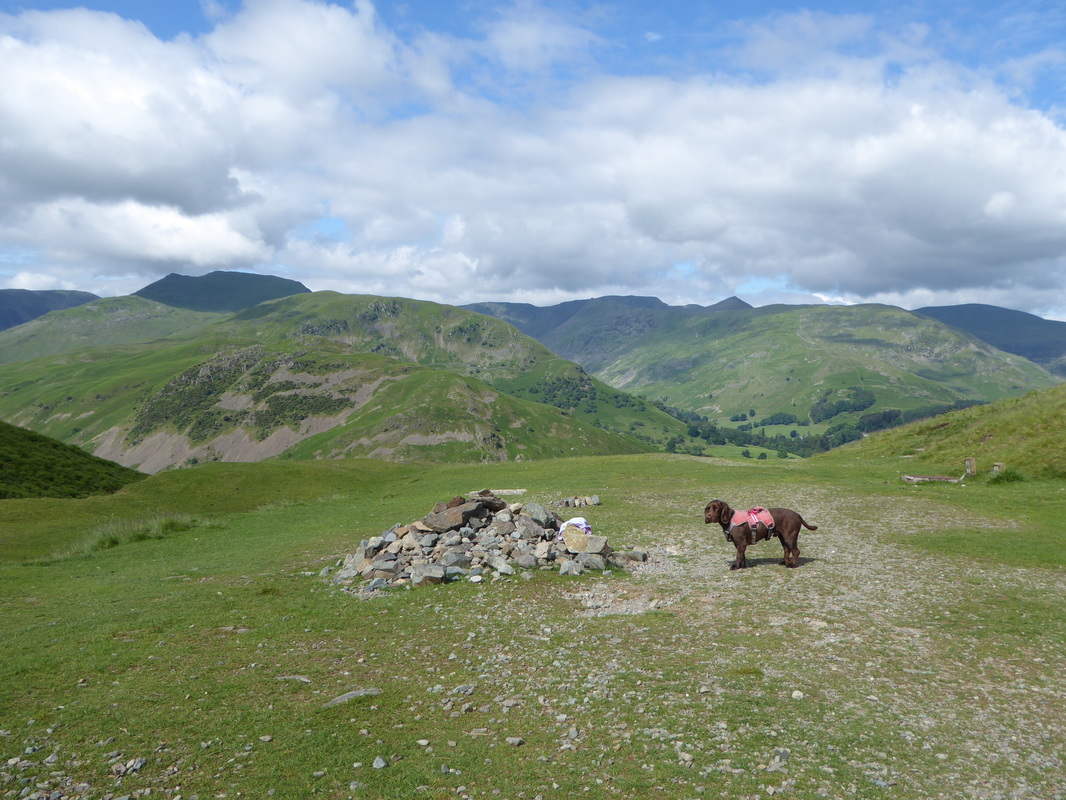
Rest Dodd with The Nab to the right
Picture
The summit of The Knott - just look at all those fells
Picture
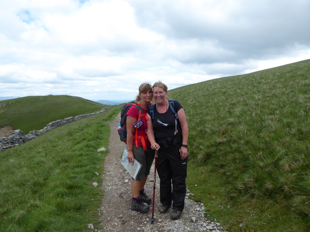
The lovely Nicole & Karen - walking in aid of Edale Mountain Rescue
Picture
A helpful sign at the left turn on the Straits of Riggindale - miss the turn and you are on the way to High Street rather than Kidsty Pike
Picture
High Street
Picture
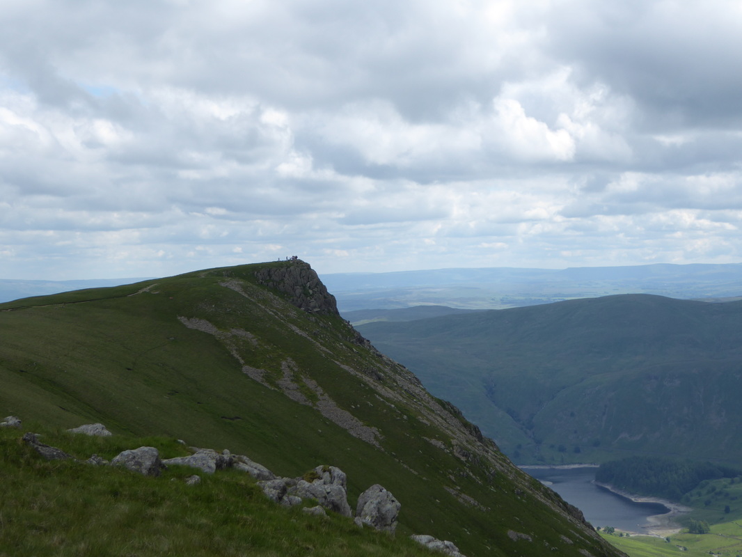
Kidsty Pike with the HF group in residence
Picture
A Kidsty Pike panorama
Picture
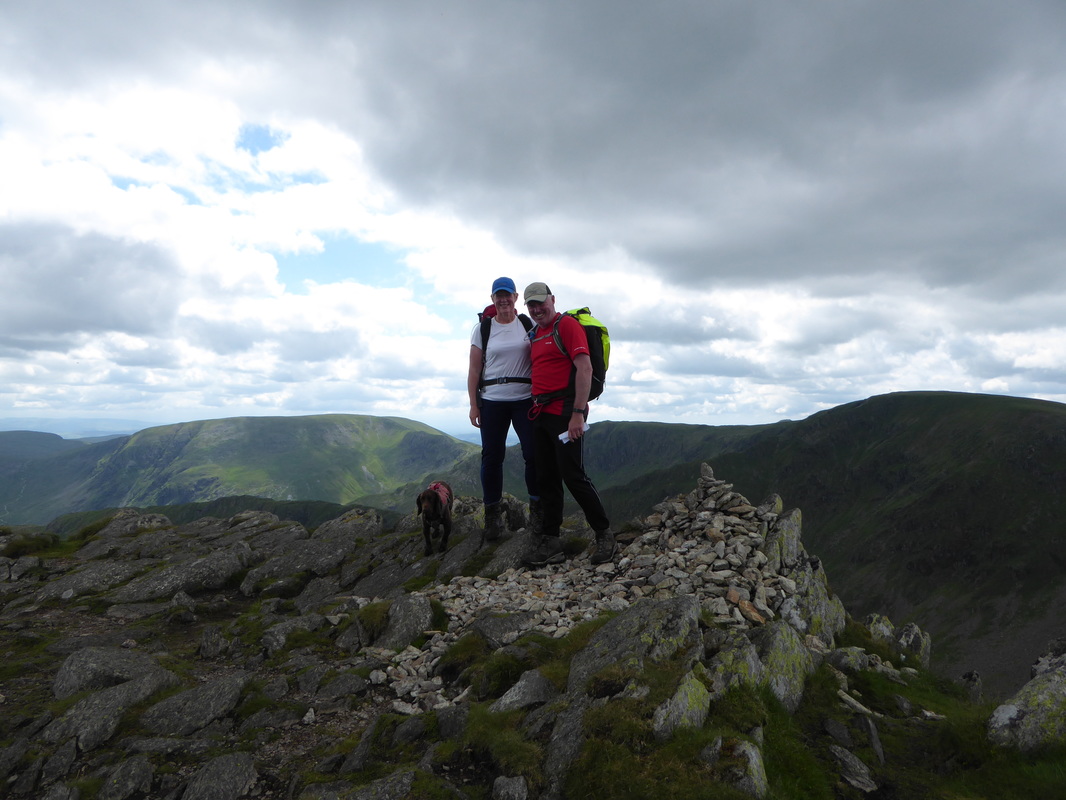
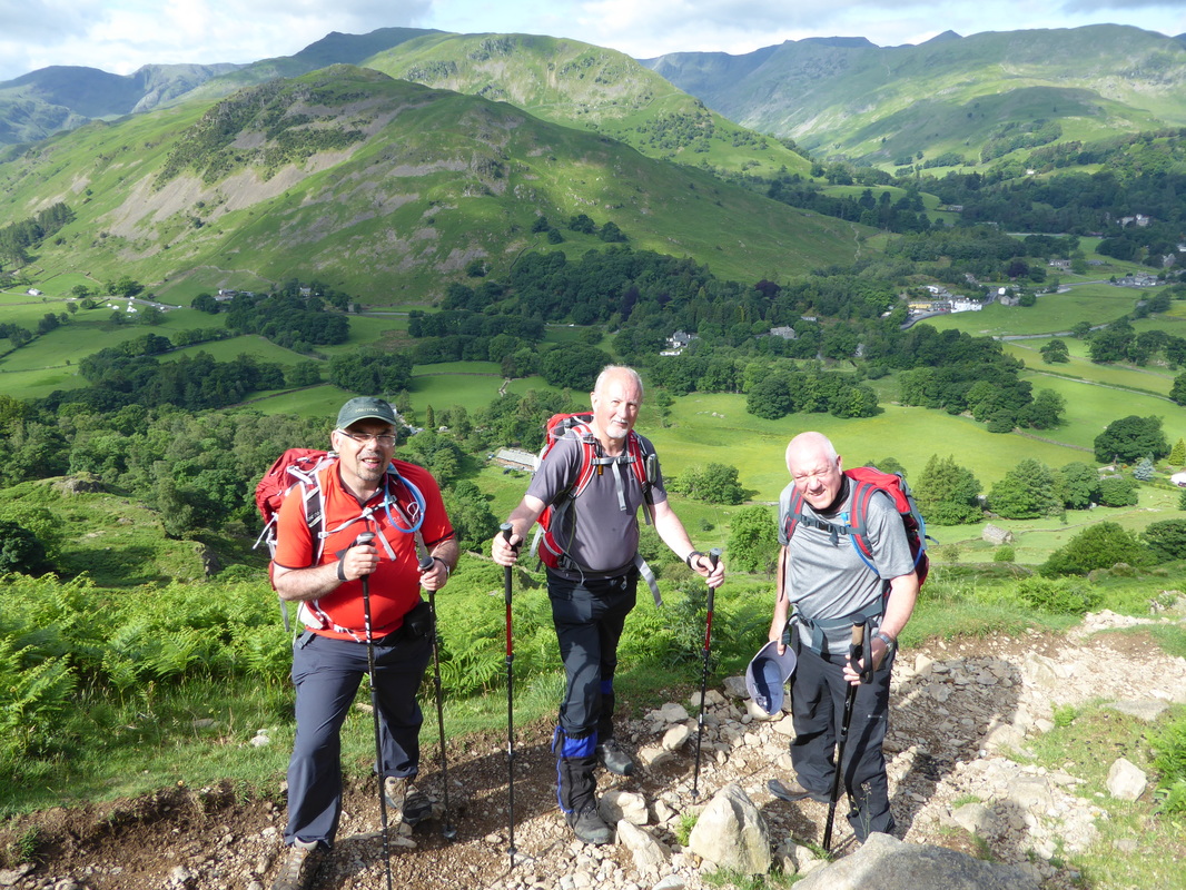
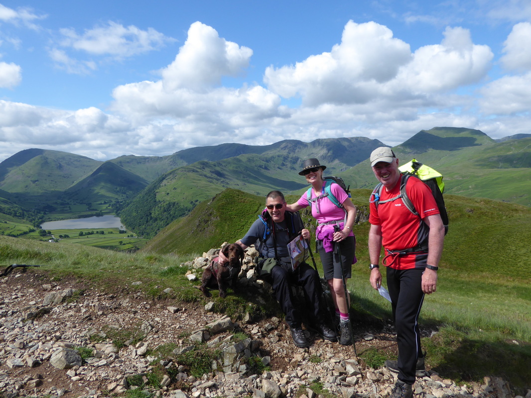
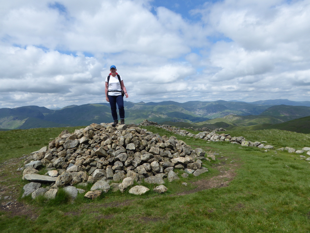
A team photo on the summit of Kidsty Pike
Picture
The summit of Kidsty Pike

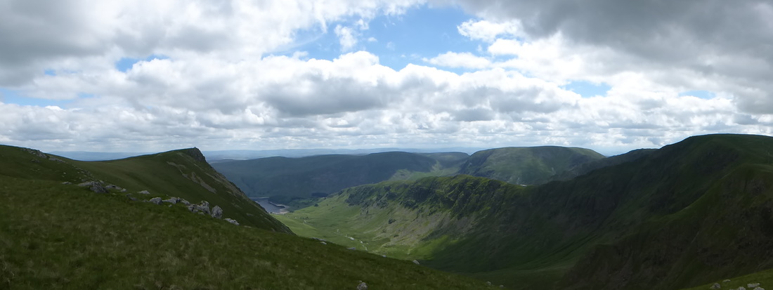
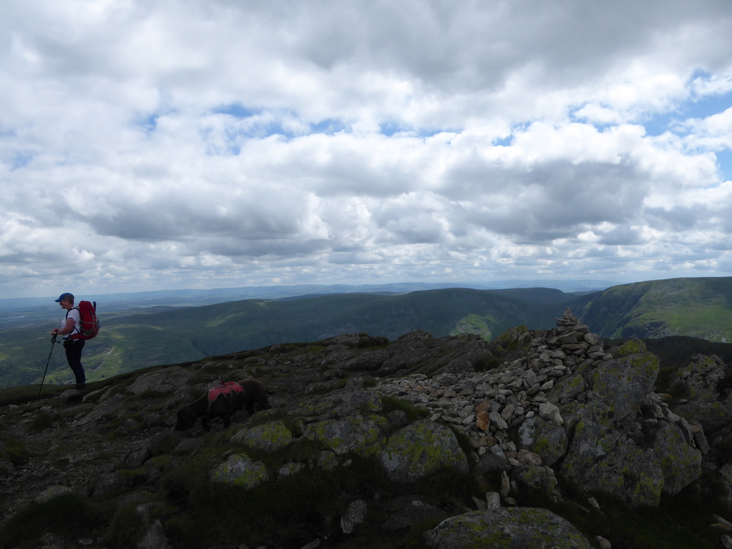
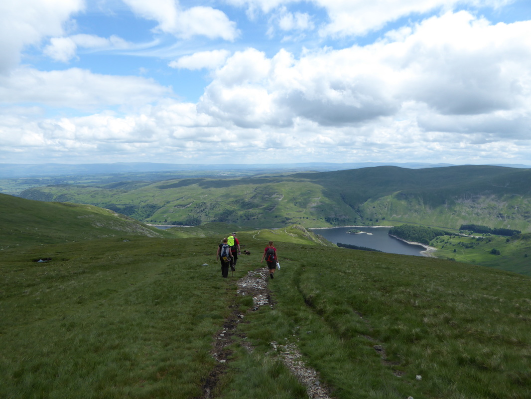
Leaving Kidsty Pike it was now time to descend to Haweswater via Kidsty Howes.  Many people comment on how steep this descent is and to be fair the gradient does drop sharply in places, particularly as Haweswater nears.  However on a clear day with Haweswater in full view for the most part it is a delightful descent and we were soon at the bottom where a large group of walkers were having lunch. Chatting to them, we found out this was a guided Holiday Fellowship (HF) group and the walkers were from all over the globe - we would see quite a lot of them over the remainder of the walk.  Crossing the bridge we then headed along the path to reach Speaking Crag where we stopped for our own lunch - a delightful spot therefore it was off with the boots and an airing of the feet.  Many of our fellow walkers passed as we ate and soon it was time to put the boots back on and crack on with the long, long transit along the western shore of Haweswater.
​

Picture
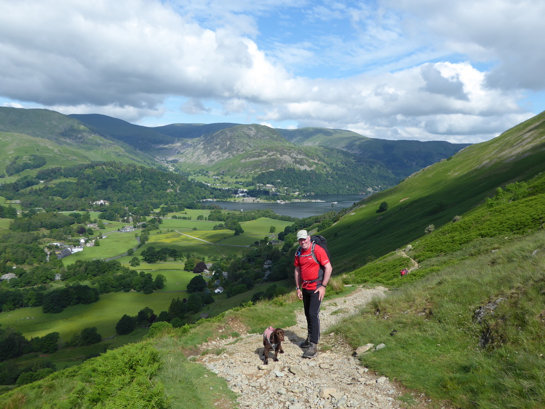
Descending off Kidsty Pike to Haweswater with Nicole & Karen.
​Much is made of the descent to Haweswater from Kidsty Pike - it's not that bad really, just a bit steep in parts
Picture
This is about as steep as it gets on the descent to Haweswater
Picture
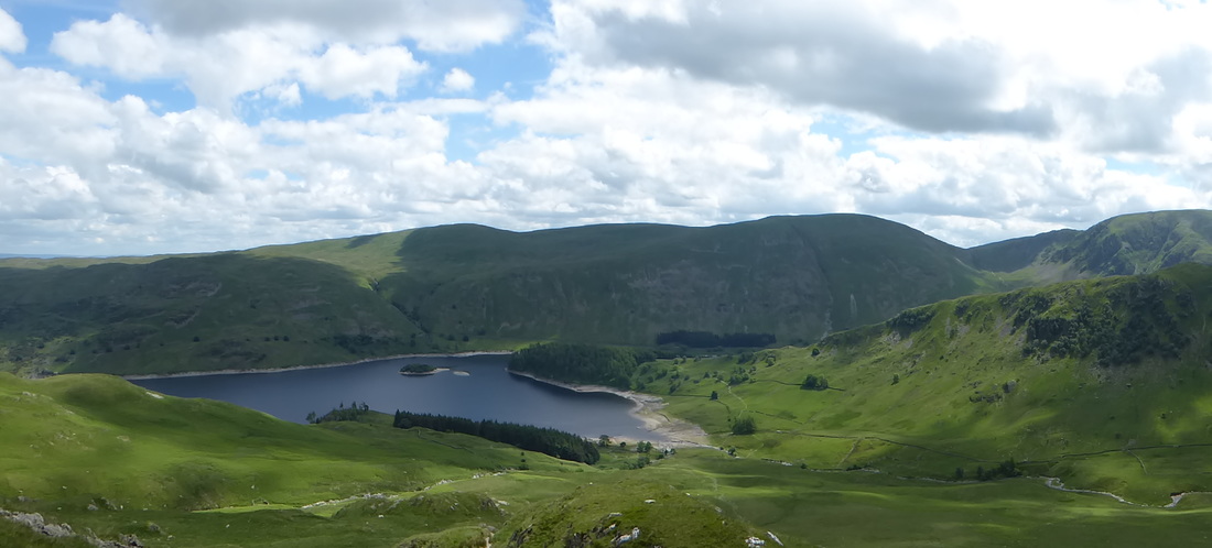
A Haweswater panorama
Picture
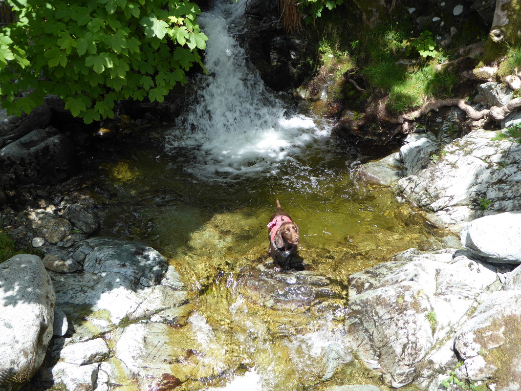
On reaching Haweswater Fudge found a lovely doggy plunge pool

For the most part the path along the reservoir is above the shoreline and relatively flat but there are a couple of sections that undulate. After a few miles along the edge of the reservoir the route left the view of the shoreline, passed the dam to enter a small section of forest before arriving at Burnbanks.  This small and pretty hamlet originally contained cottages which housed workers and their families that were involved in the building of the dam in the 1930s.  From Burnbanks we crossed Naddle Bridge and were delighted to find a well-stocked honesty box which we purchased a few items from before heading over fields and meadows to pass the lovely farm at Rawhead to reach Rosgill Bridge.
​
Picture
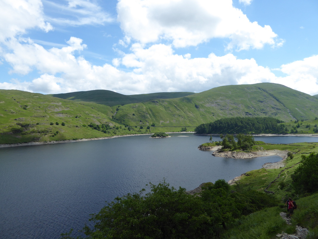
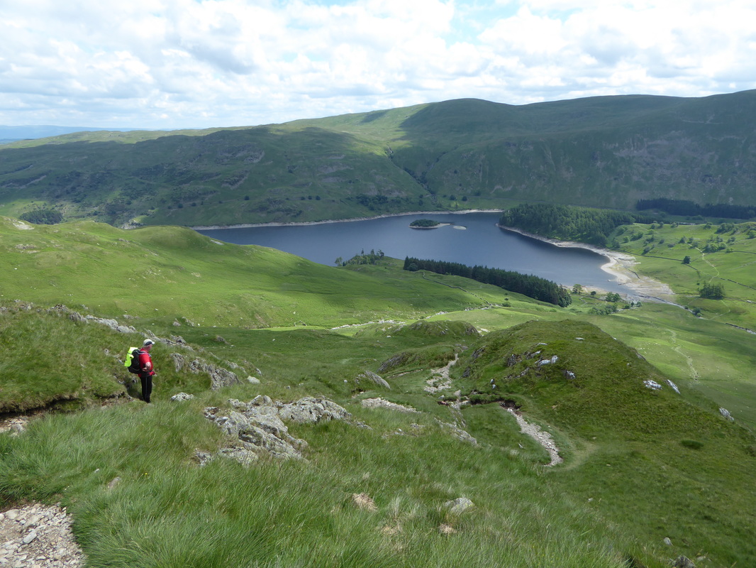
Haweswater - to the right is Branstree
Picture
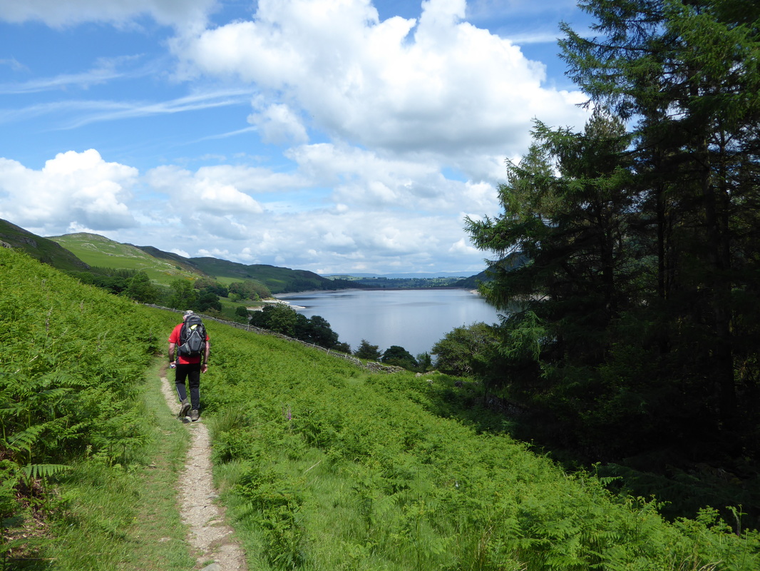
There is no disputing the fact that the walk along Haweswater is a long one - but a lovely amble all the same
Picture
Have come across a couple of these massive gates in the Lake District
Picture
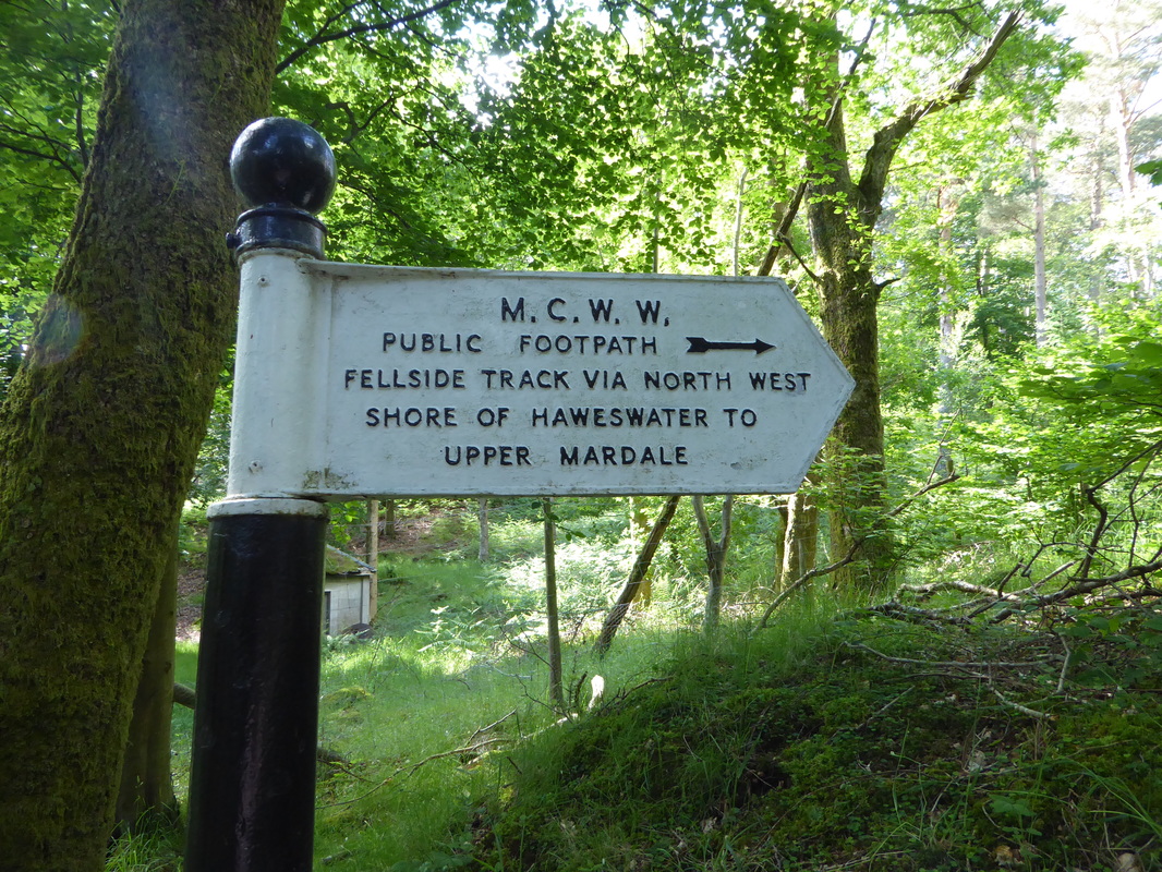
An old Manchester Corporation Water Works sign at the Northern End of Haweswater. 
MCWW started the controversial construction of the Reservoir in 1929 resulting in the loss of the tiny villages of Measand & Mardale Green

Picture
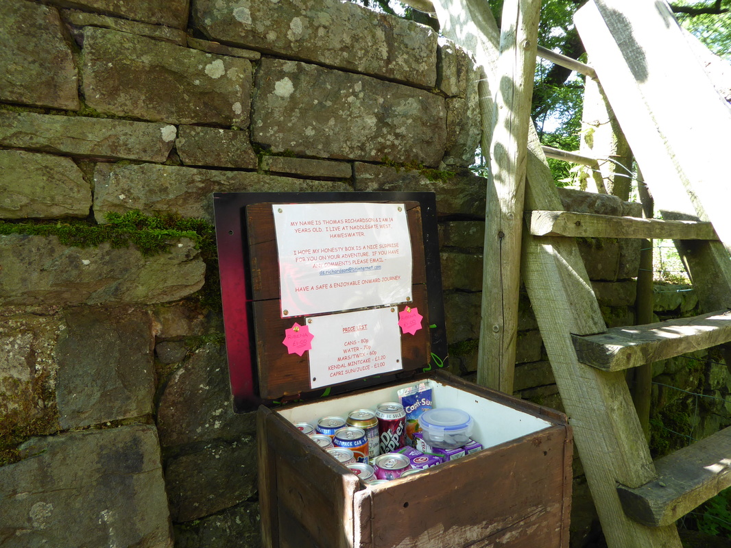
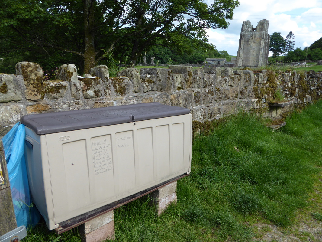
A welcome catering enterprise at Naddle Bridge near Burnbanks
Picture
Picture
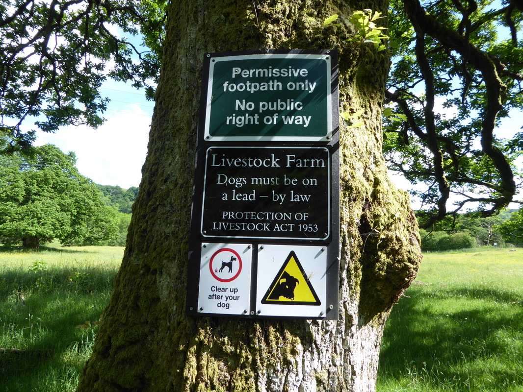
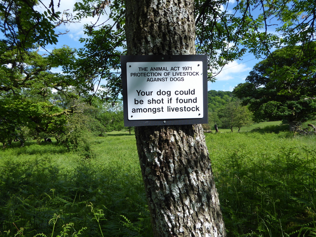
I think we get the message 
Picture
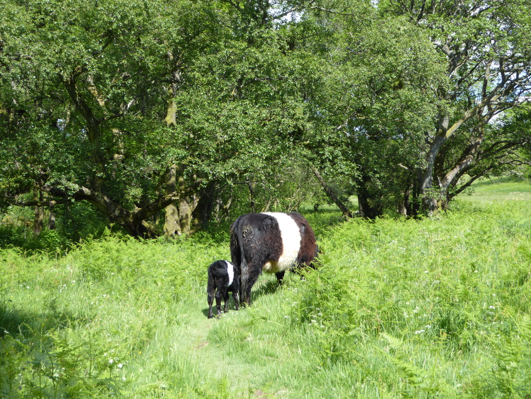
That face looks familiar - Belted Galloways near Naddle Bridge
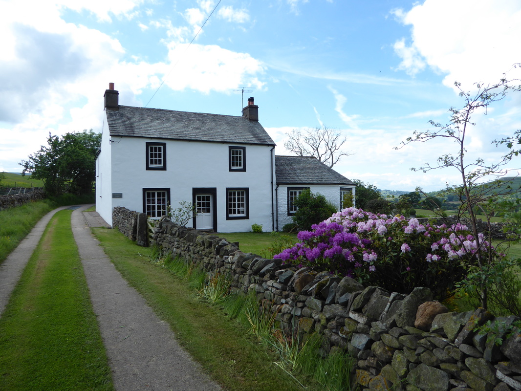
Picture
The farm at Rawhead

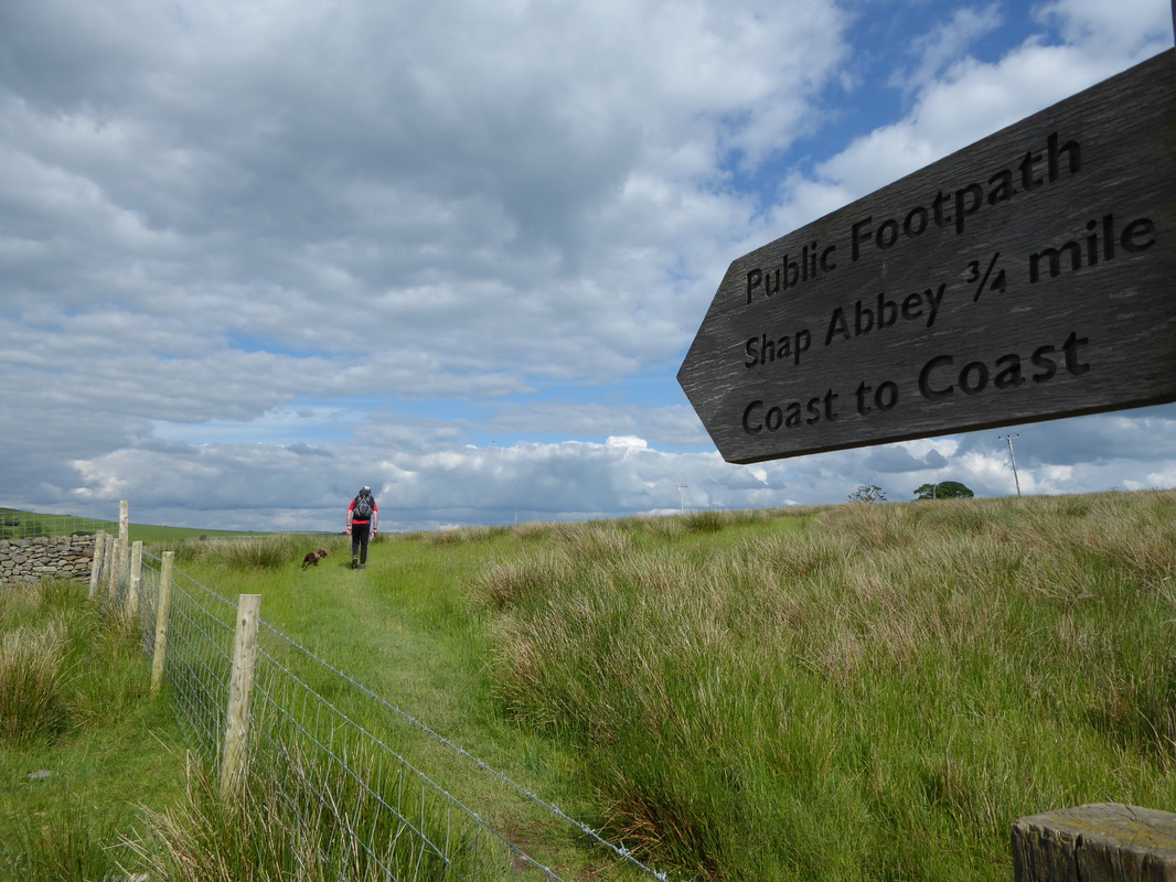
From Rosgill Bridge the route meanders very pleasantly along field paths to arrive at the 12th Century monastic religious house of Shap Abbey.  Considering the fact that much of the Abbey's stone has in the past been pilfered to build other buildings nearby, it is still an impressive sight.  Leaving the Abbey, the route headed up the hill to reach a lane which took us into Shap and our digs for the night, New Ing Lodge.  The bar was open therefore it would have been rude not to partake of a couple of cold ones (repeated for posterity) and we had a chat with some C2C cyclists as another batch of walkers arrived.  Amongst the walkers was Keith who we had met at Naddle Bridge - Keith had his own Taekwondo teaching business (not a bloke to mess with) and we would walk with him part of the next day.  After sorting ourselves out and with the B&B kindly doing a washing load for us, we dined well at New Ing that night before popping out to Shap Co-op to top up on supplies.
​

Picture
Picture
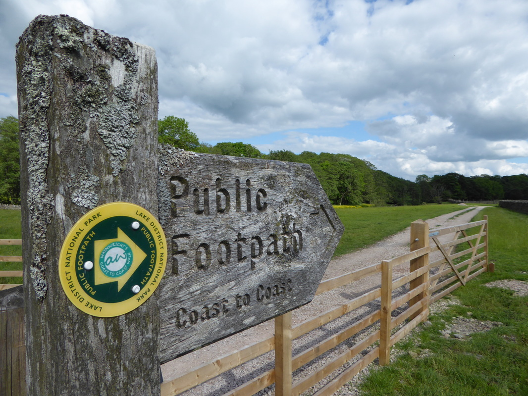
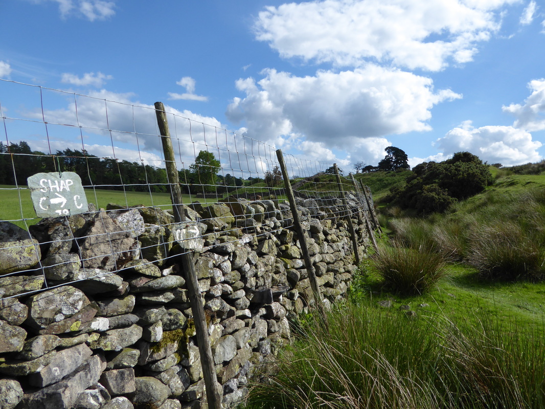
Coast to Coast signs aplenty now we have left the National Park
Picture
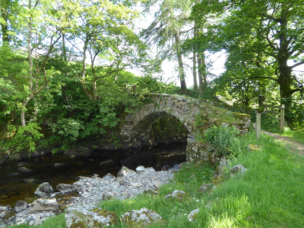
The lovely Packhorse Bridge near Shap Abbey
Picture
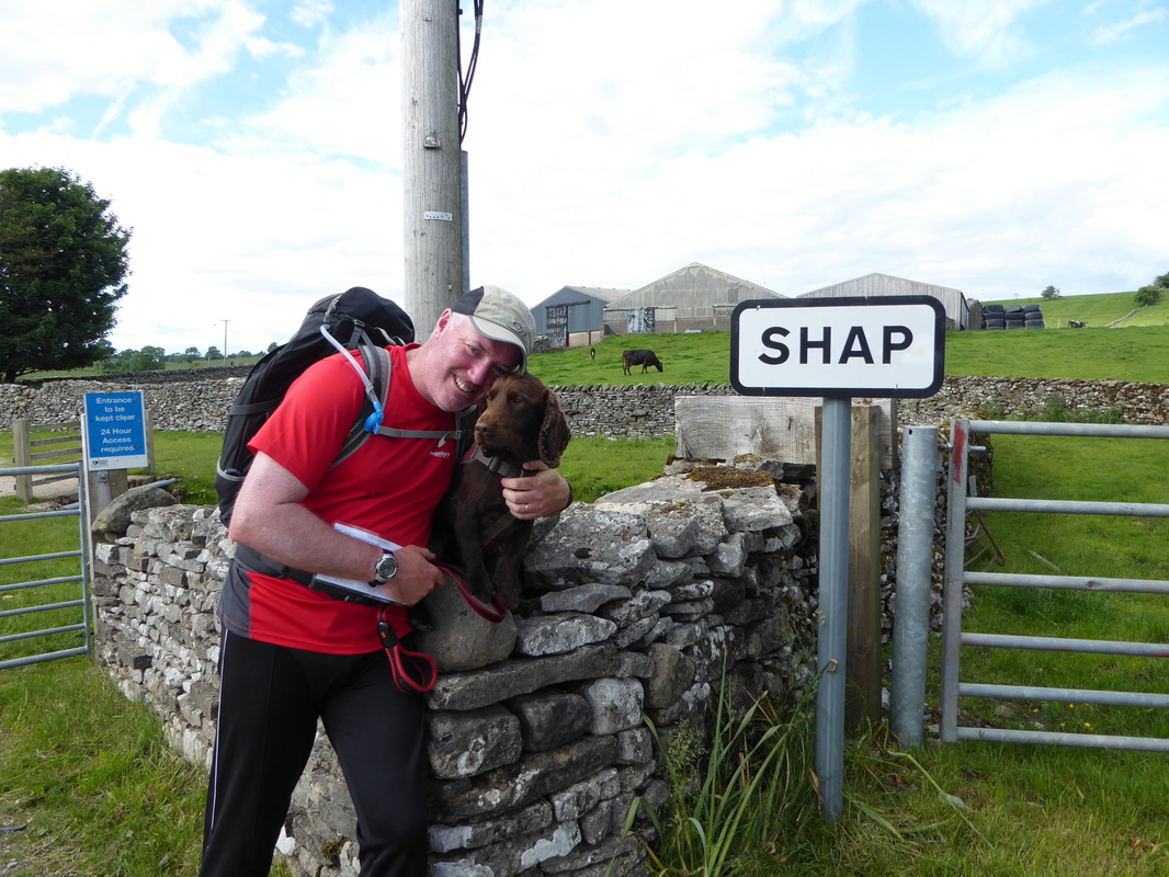
Not far now - soon be beer o'clock
Picture
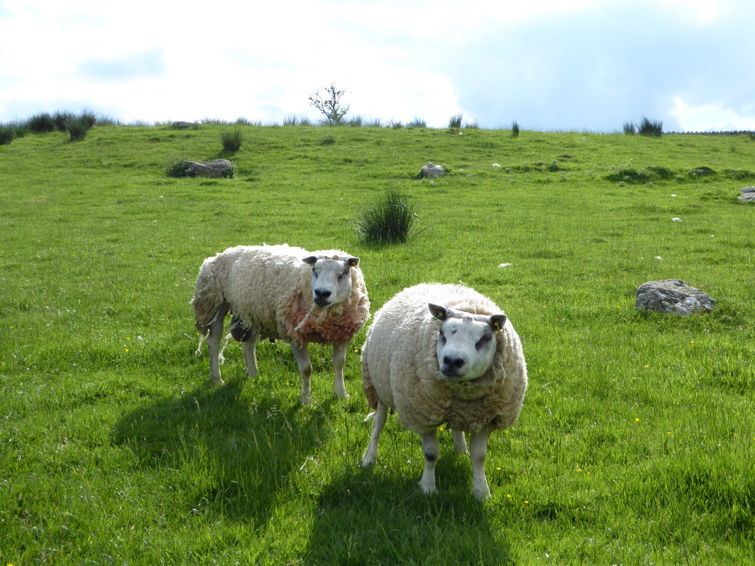
Fuggly Sheep at Shap
Picture
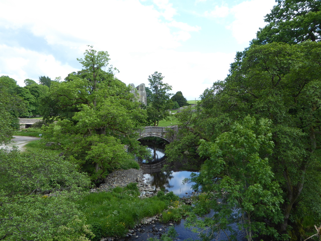
The River Lowther & Shap Abbey
Picture
Last time we were here the drinks were in a big bucket of ice - business has clearly improved in the intervening 4 years.
Just a shame everything was warm!
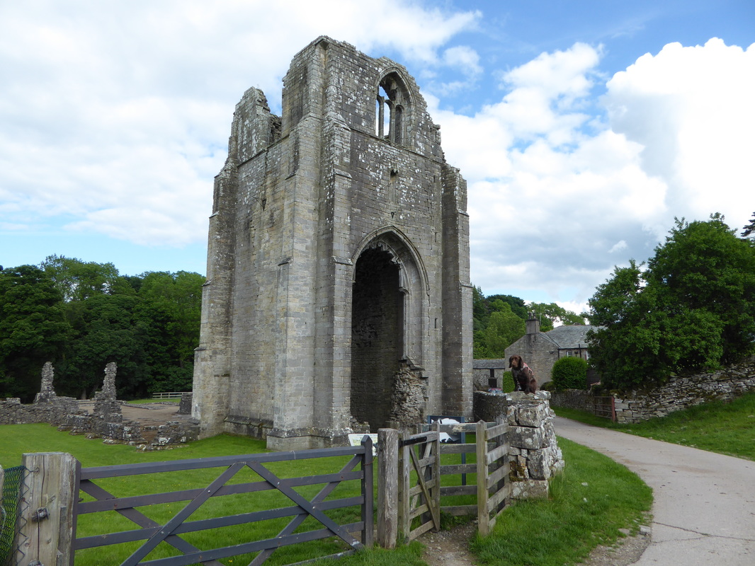
Picture
Shap Abbey
Picture
Come on Fudge - let's go & have a drink

​Overnight Accommodation
      
   
Picture

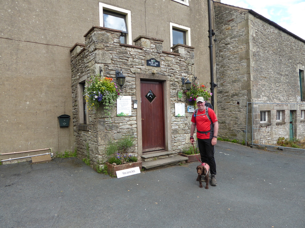
​New Ing Lodge, Shap - 
www.newinglodge.co.uk
     

We stayed here in 2012 and the place has not changed a bit.  Good food, fab beer and very friendly staff. New Ing is extremely well run by Scott & Jamie.
​
Day 4 Data
Mileage 

Cumulative Mileage

Time

Cumulative Time

Maximum Ascent

Total Ascent

Cumulative Ascent
16.7 miles

61.7 miles

8 hrs 42 min

31 hrs 34 min

2595 feet

4622 feet

16084 feet
Day 3
Day 5
© Copyright Dave Walsh 2013 - 2018 All Rights Reserved
Powered by Create your own unique website with customizable templates.